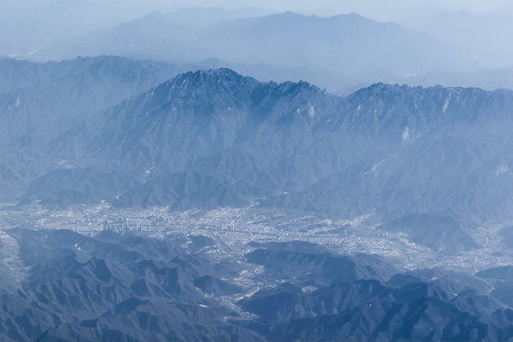
Regional overview
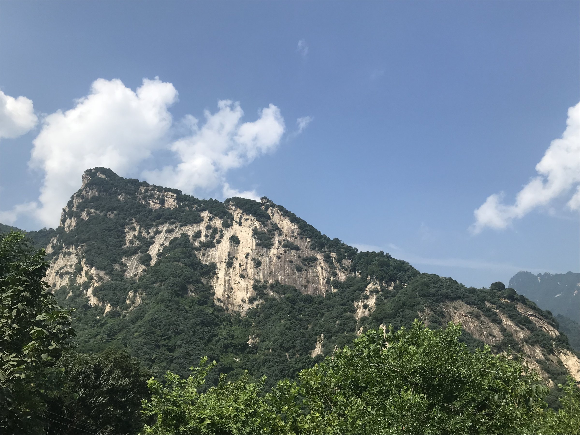
The Micang-Daba transition region links the southern Qinling, Micang Mountains and northern Daba Mountains across southern Shaanxi, northeastern Sichuan and the Chongqing borderlands. It is a humid, forested mountain zone of red-leaf beech forests, karst gorges, waterfalls, cliff plank roads, ancient Shu-road history and broad ecological transition between north and south China.
Walking is mostly in large managed scenic areas such as Guangwu Mountain, Micang Mountain National Forest Park, Nuoshuihe and Hanzhong-area parks. Distances can be long between scenic sectors, so individual day hikes are often selected sections reached by shuttle bus rather than continuous wild trails.
Autumn is the famous season, especially for Guangwu / Micang red leaves. Summer can be hot, wet and stormy; winter can bring snow and ice to higher forest roads and plank walks.
Selection rationale
The five hikes below cover the region’s best-supported day-walk types: Guangwu Mountain’s Taiji Tiankeng and cliff plank road, Swallow Ridge / Yanyan Stone Forest, Micang Mountain’s Xianglu high viewpoint, Shibayue Tan’s waterfall-pool valley, and a Daba-side Nuoshuihe karst gorge/cave walk.
Summary table
| # | Hike | Country | Route type | Distance | Gain | Max elevation | Difficulty |
|---|---|---|---|---|---|---|---|
| 1 | Guangwu Mountain Taiji Tiankeng and Feiyun Plank Road | China | Scenic-area loop | Approx. 4-8 km walked | Moderate | ||
| 2 | Guangwu Mountain Swallow Ridge and Yanyan Stone Forest | China | Shuttle-assisted ridge / viewpoint walk | Approx. 5-8 km walked | Moderate-hard | ||
| 3 | Micang Mountain Xianglu Mountain red-leaf viewpoint | China | Shuttle/lift-assisted out-and-back | Approx. 4-8 km walked | 2,331 m cited by travel source | Moderate | |
| 4 | Shibayue Tan waterfall-pool valley | China | Valley out-and-back | Approx. 5-8 km | Minor-moderate | Moderate | |
| 5 | Nuoshuihe karst gorge and cave walk | China | Gorge / cave scenic walk | Approx. 4-7 km selected walk | 2,088.6 m region high point; route lower | Moderate |
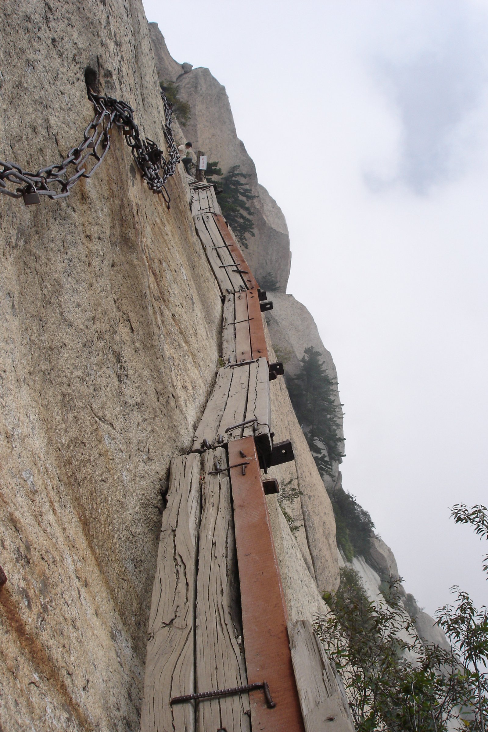
1. Guangwu Mountain Taiji Tiankeng and Feiyun Plank Road
Snapshot
Itinerary
The route links the Taiji Tiankeng river bend, Feiyun Plank Road and Ganling Temple area. LoongWander describes Feiyun Plank Road as a circular tourist route that can ascend from Taiji Tiankeng and descend from Ganling Temple.
Why it is essential
This is the clearest short Guangwu Mountain hike, combining karst gorge landform, cliff plank road and managed scenic access in a feasible day format.
Equipment
Standard hiking equipment, grippy shoes, rain shell, sun protection, water and warm layer outside summer.
Hazards and notes
Do not climb into unopened areas. Plank roads and steps can be slippery in rain, frost or autumn leaf litter.
GPX / KML links
| Source | URL | Format / access | Reuse status |
|---|---|---|---|
| OpenStreetMap search: Guangwu Mountain Taiji Tiankeng | openstreetmap.org | Map/search | OSM data is ODbL; geometry cross-check only |
External links
2. Guangwu Mountain Swallow Ridge and Yanyan Stone Forest
Snapshot
Itinerary
This selected day follows the managed Guangwu route through Longjia Yanyun, Nantianmen, Qinu Peak, Swallow Ridge, Wanhu Chaosheng and Yanyan Stone Forest where shuttle logistics allow. The walking sections focus on stone-forest viewpoints and cliff-and-forest scenery.
Why it is essential
Swallow Ridge and Yanyan Stone Forest are among Guangwu Mountain’s signature viewpoints and give the entry its peak-cluster and cliff scenery.
Equipment
Standard hiking equipment, water, food, rain shell, warm layer and poles.
Hazards and notes
The full sightseeing route is long; select a walkable section rather than trying to walk the entire road-linked circuit. Fog and rain reduce visibility on viewpoints.
GPX / KML links
| Source | URL | Format / access | Reuse status |
|---|---|---|---|
| OpenStreetMap search: Guangwu Mountain Swallow Ridge | openstreetmap.org | Map/search | OSM data is ODbL; geometry cross-check only |
External links
3. Micang Mountain Xianglu Mountain Red-Leaf Viewpoint
Snapshot
Itinerary
The route focuses on the Xianglu Mountain high viewpoint in Micang Mountain National Forest Park, usually visited as part of the red-leaf scenic-area system. Walking distance depends on the current shuttle, road and viewpoint access.
Why it is essential
Xianglu Mountain is one of the main high viewpoints over the Micang red-leaf forest and the Qinling-Daba transition landscape.
Equipment
Standard hiking equipment, warm layer, rain shell, water, food and grippy shoes.
Hazards and notes
Route statistics and official walking-line details were not verified. Autumn traffic control and shuttle rules can strongly affect access.
GPX / KML links
| Source | URL | Format / access | Reuse status |
|---|---|---|---|
| OpenStreetMap search: Micang Mountain Xianglu Mountain | openstreetmap.org | Map/search | OSM data is ODbL; geometry cross-check only |
External links
- Trip.com — Micang Mountain travel note citing Xianglu Mountain elevation
- LoongWander — Guangwushan / Micang access context
4. Shibayue Tan Waterfall-Pool Valley
Snapshot
Itinerary
The route follows Pearl Gully upstream through the sequence of named pools and waterfalls known collectively as Shibayue Tan, then returns by the same valley path or scenic transport where available.
Why it is essential
Shibayue Tan is the region’s classic red-leaf water walk, with pools, cascades and forest colour rather than high-summit views.
Equipment
Standard hiking equipment, rain shell, grippy shoes and water.
Hazards and notes
Wet paths and leaf-covered steps can be slippery. Avoid the valley in heavy rain or flood warnings.
GPX / KML links
| Source | URL | Format / access | Reuse status |
|---|---|---|---|
| OpenStreetMap search: Shibayue Tan Guangwu Mountain | openstreetmap.org | Map/search | OSM data is ODbL; geometry cross-check only |
External links
- Chengdu local travel article — Shibayue Tan route and named pools
- China Daily — Guangwu Mountain regional context
5. Nuoshuihe Karst Gorge and Cave Walk
Snapshot
Itinerary
The day selects an open Nuoshuihe scenic route through karst gorge, cave entrances and river scenery. The exact line should be chosen from current geopark/scenic-area maps because caves, gorge paths and shuttle operations vary.
Why it is essential
Nuoshuihe adds the Daba karst side of the transition region: caves, gorges, cliffs and river landscapes within the same UNESCO Global Geopark system as Guangwu Mountain.
Equipment
Standard hiking equipment, grippy shoes, rain shell and warm layer for caves.
Hazards and notes
Do not enter undeveloped caves or closed gorge sections. Rain can raise river levels and make cave/gorge access unsafe.
GPX / KML links
| Source | URL | Format / access | Reuse status |
|---|---|---|---|
| OpenStreetMap search: Nuoshuihe Tongjiang | openstreetmap.org | Map/search | OSM data is ODbL; geometry cross-check only |
External links
- Guangwu Mountain-Nuoshuihe UNESCO Global Geopark — heritage page
- Bang.cn — Nuoshuihe scenic-area summary
- Guangwu-Nuoshuihe geopark — geological heritage list
External links
| Source | URL |
|---|---|
| LoongWander — Guangwushan Scenic Area | loongwander.com |
| China Daily — Guangwu Mountain | govt.chinadaily.com.cn |
| Guangwu Mountain-Nuoshuihe UNESCO Global Geopark | gws-nshdzgy.demo.cnbz.sc.cn |
| Guangwu-Nuoshuihe geopark — geological heritage list | gws-nshdzgy.demo.cnbz.sc.cn |
| Trip.com — Micang Mountain travel note | trip.com |
| Chengdu local — Shibayue Tan route | m.cd.bendibao.com |
| Bang.cn — Nuoshuihe scenic-area summary | bang.cn |