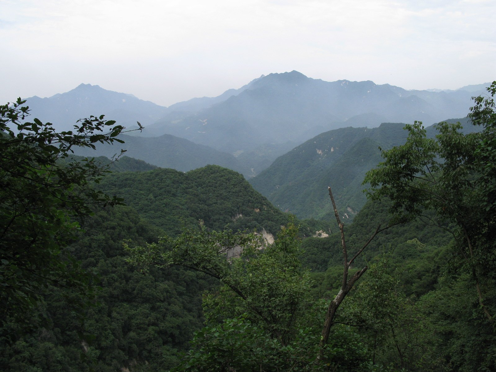
Regional overview
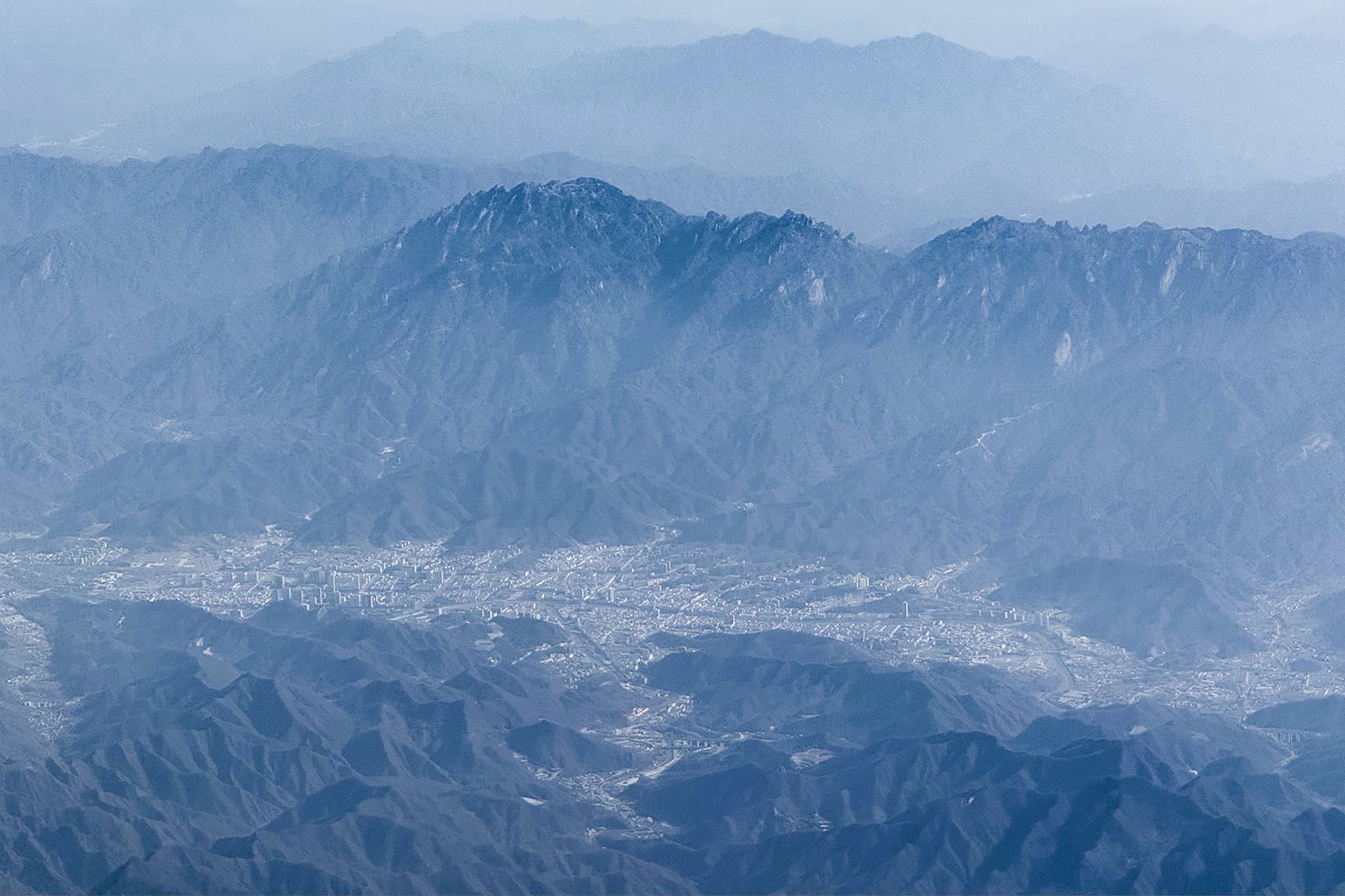
The Cuihua-Zhongnan Shan region forms the mountain wall immediately south of Xi’an. It includes landslide lakes and boulder fields at Cuihua Mountain, Buddhist pilgrimage terrain at Nanwutai, forest parks at Zhuque and Taiping, and lower Taoist/Buddhist cultural landscapes around Louguantai and the Zhongnan foothills.
The walking character is mostly managed scenic-area hiking: stairways, forest paths, plank roads, cable cars, internal shuttles, temple approaches and short gorge walks. The terrain is less extreme than Mount Hua but still steep, humid in summer and icy in winter. Thunderstorms, wet stone, crowding and changing scenic-area transport rules are the main planning issues.
Spring blossom, summer shade and autumn colour are the main seasons. Winter routes should be treated cautiously because steps, boardwalks and upper forest paths can ice over.
Selection rationale
These five hikes cover the region’s core walking types: Cuihua’s landslide geology, Nanwutai’s Buddhist five-terrace ascent, Zhuque’s high Qinling ridge, Taiping’s waterfall gorge, and Louguantai’s cultural forest foothills.
Summary table
| # | Hike | Country | Route type | Distance | Gain | Max elevation | Difficulty |
|---|---|---|---|---|---|---|---|
| 1 | Cuihua Mountain Tianchi and landslide maze | China | Scenic-area loop / out-and-back | 2.1 km AllTrails short route; 4-7 km with Tianchi and caves | 225 m short route; more with variants | 1,414 m Cuihua Peak; Zhongnan high point 2,604 m in park | Moderate |
| 2 | Nanwutai Bamboo Valley to Five Terraces | China | Out-and-back / traverse | 12.5 km cited by Shaanxi government | 1,688 m | Hard | |
| 3 | Zhuque National Forest Park to Bingjing Peak area | China | Lift-assisted out-and-back | Approx. 6-10 km | 3,015 m | Hard | |
| 4 | Taiping National Forest Park Rainbow Waterfall route | China | Gorge out-and-back / lift-assisted variant | Approx. 5-7 km | Up to 3,015 m park high point; route lower | Moderate | |
| 5 | Louguantai / Zhongnan foothill cultural forest walk | China | Foothill loop / out-and-back | Approx. 5-8 km | Easy-moderate |
1. Cuihua Mountain Tianchi and Landslide Maze
Snapshot
Itinerary
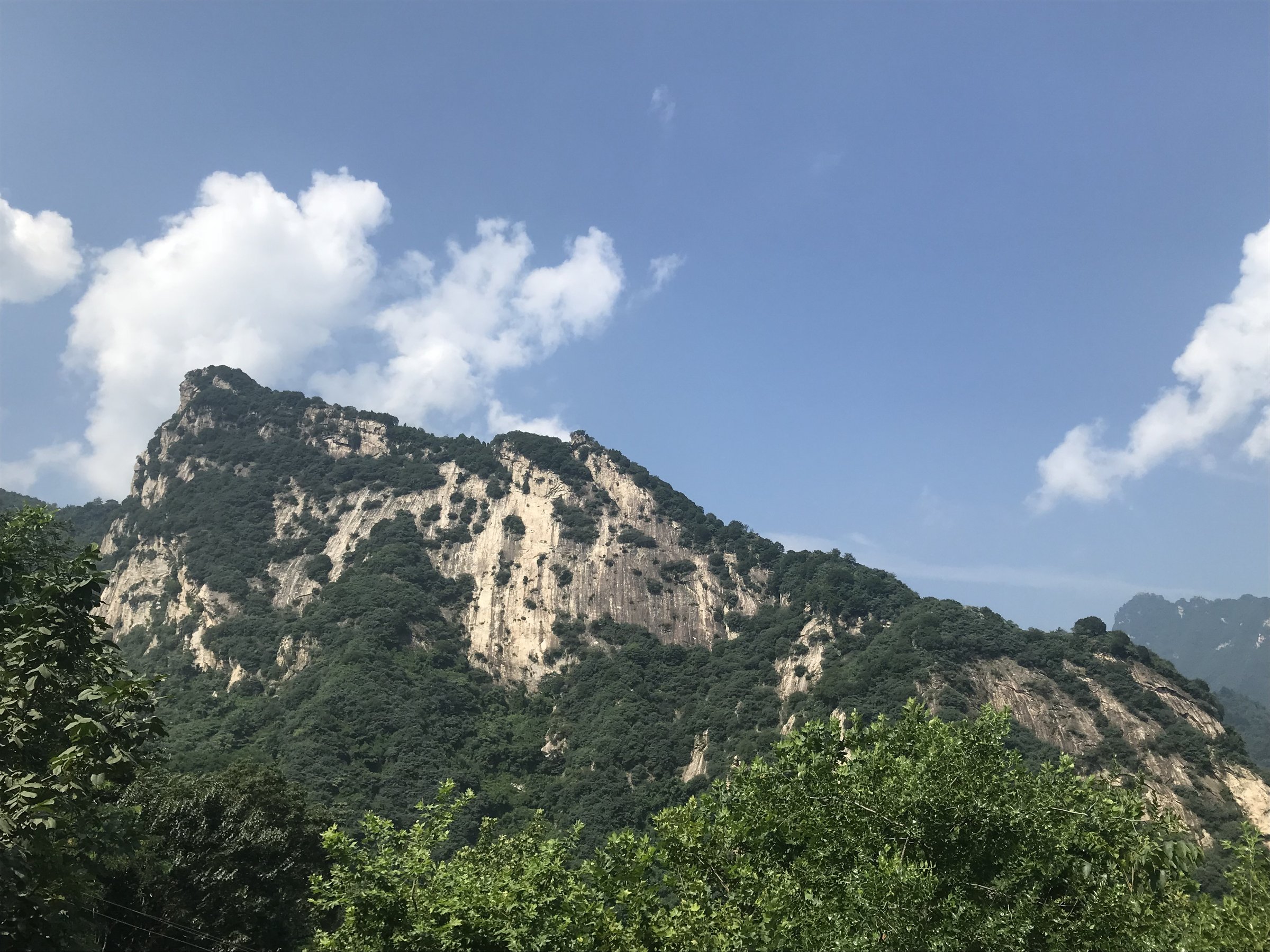
The classic walk links Heavenly Lake, the landslide boulder maze, Wind Cave, Ice Cave and nearby waterfall paths where open. The core of the route is the earthquake-triggered landslide landscape, with dammed lake scenery and collapsed-rock passages.
Why it is essential
Cuihua Mountain is the signature geological walk of the Xi’an-side Qinling and one of the most accessible ways to see the Zhongnan landslide landscape.
Equipment
Standard hiking equipment, grippy shoes, rain shell, water and sun protection. Carry a warm layer for caves and cold seasons.
Hazards and notes
The boulder passages can be slippery and awkward. Stay out of closed caves or damaged lake paths. Scenic-area shuttles change the amount of walking.
GPX / KML links
| Source | URL | Format / access | Reuse status |
|---|---|---|---|
| AllTrails: Cuihua Mountain | alltrails.com | Route page / app map | AllTrails terms apply; source geometry found; route-file reuse not confirmed |
| OpenStreetMap search: Cuihua Mountain | openstreetmap.org | Map/search | OSM data is ODbL; geometry cross-check only |
External links
- Shaanxi provincial government — Cuihua Mountains Landslide Scenery National Geopark
- TravelChinaGuide — Cuihua Mountain
- AllTrails — Cuihua Mountain
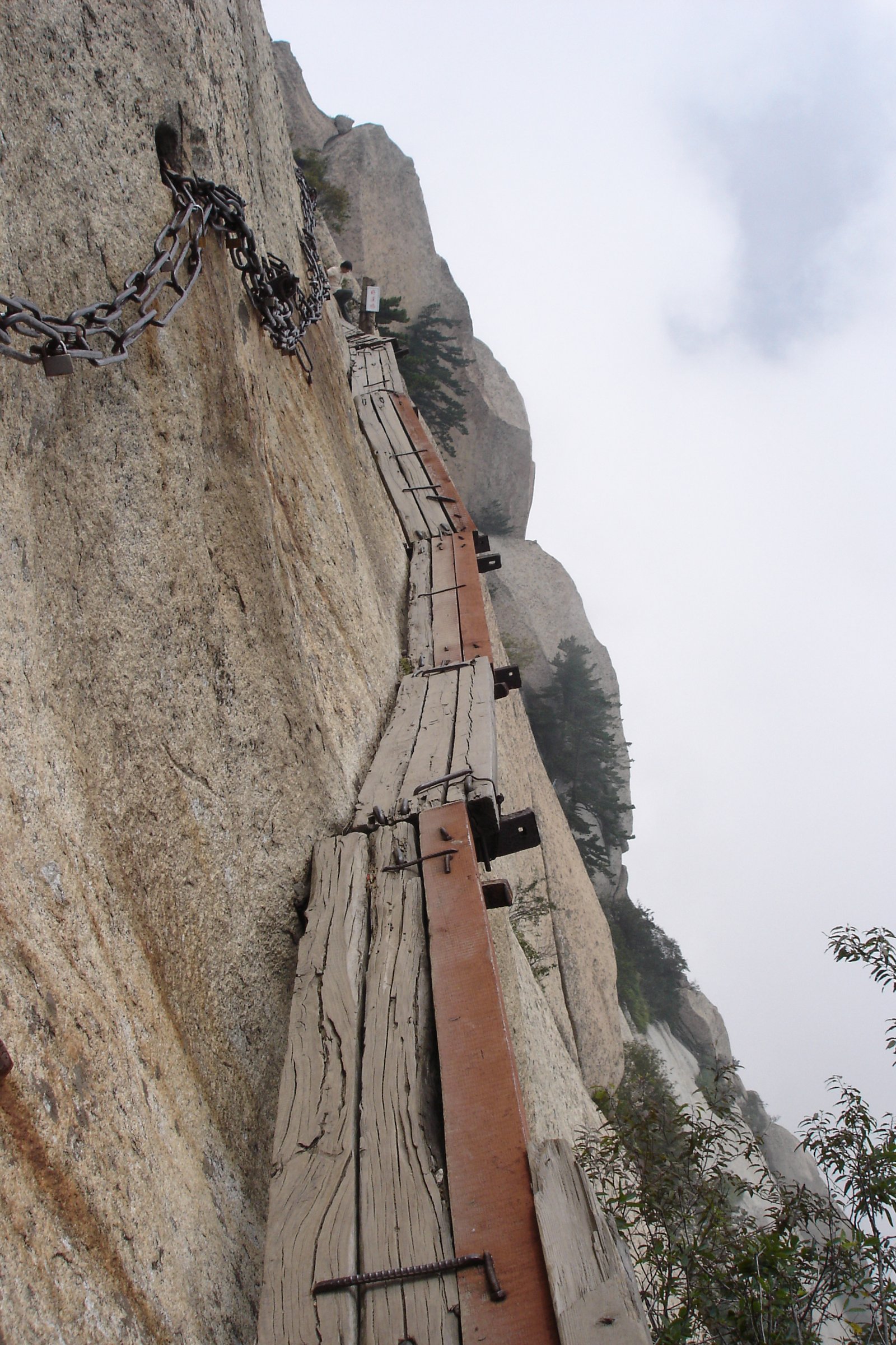
2. Nanwutai Bamboo Valley to Five Terraces
Snapshot
Itinerary
The route begins in Bamboo Valley and climbs through forest, stream gullies and temple terrain towards Nanwutai’s five terraces: Guanyin, Wenshu, Qingliang, Lingying and Sheshen. The route can be shortened depending current scenic-area transport.
Why it is essential
Nanwutai is one of the key Buddhist mountain walks in the Zhongnan range and gives the catalogue a cultural ascent rather than another purely geological or waterfall route.
Equipment
Standard hiking equipment, water, rain shell, sun protection and trekking poles for the descent.
Hazards and notes
Steps and stone paths are slippery in rain or ice. Temple and protected-area rules should be respected; stay on open paths.
GPX / KML links
| Source | URL | Format / access | Reuse status |
|---|---|---|---|
| OpenStreetMap search: Nanwutai Mountain | openstreetmap.org | Map/search | OSM data is ODbL; geometry cross-check only |
External links
3. Zhuque National Forest Park to Bingjing Peak Area
Snapshot
Itinerary
The route uses Zhuque National Forest Park’s internal access and, where operating, cable-car support to reach the Qinling Ridge / Glacier and Greens high area. Walks continue to open viewpoints around Bingjing Peak and return by the same system.
Why it is essential
Zhuque gives the Zhongnan entry its highest ridge environment, with north-south Qinling views and a colder alpine-forest character than Cuihua or Nanwutai.
Equipment
Mountain hiking equipment, warm layer, waterproofs, water, food, poles and headtorch for a long day.
Hazards and notes
Upper routes are weather-sensitive. Thunderstorms, fog and cold wind are serious issues above the forest. Confirm cable-car operation and closures before starting.
GPX / KML links
| Source | URL | Format / access | Reuse status |
|---|---|---|---|
| OpenStreetMap search: Zhuque National Forest Park | openstreetmap.org | Map/search | OSM data is ODbL; geometry cross-check only |
External links
- TravelChinaGuide — Zhuque National Forest Park
- Shaanxi provincial government — Xinhua photo note on Bingjing Peak
4. Taiping National Forest Park Rainbow Waterfall Route
Snapshot
Itinerary
The walk follows Taiping Valley’s waterfall corridor towards Longkou and Rainbow Waterfalls, using the cable car between Longkou and Rainbow Waterfall where helpful. The park contains a dense waterfall-and-pond landscape within a compact gorge.
Why it is essential
Taiping is the region’s classic waterfall forest walk and provides a humid, shaded Qinling valley contrast to the exposed high-ridge routes.
Equipment
Standard hiking equipment, grippy shoes, rain shell, water and sun protection.
Hazards and notes
Wet steps and boardwalks can be slippery. Avoid the gorge during heavy rain or thunderstorm periods because flash flooding and rockfall risk increase.
GPX / KML links
| Source | URL | Format / access | Reuse status |
|---|---|---|---|
| OpenStreetMap search: Taiping National Forest Park Xi’an | openstreetmap.org | Map/search | OSM data is ODbL; geometry cross-check only |
External links
- TravelChinaGuide — Taiping National Forest Park
- Shaanxi provincial government — seasonal hiking note
5. Louguantai / Zhongnan Foothill Cultural Forest Walk
Snapshot
Itinerary
The hike uses the open Louguantai / Zhongnan foothill paths to combine forest walking with Taoist and historical sites associated with Laozi traditions. The exact loop should be selected from the current scenic-area map.
Why it is essential
Louguantai represents the cultural foothill side of Zhongnan Shan and balances the geological, Buddhist and waterfall routes elsewhere in the entry.
Equipment
Standard hiking equipment, water, sun protection and rain shell.
Hazards and notes
Route statistics and a publishable GPX were not verified. Use official scenic-area maps and avoid closed religious or forest-management areas.
GPX / KML links
| Source | URL | Format / access | Reuse status |
|---|---|---|---|
| OpenStreetMap search: Louguantai | openstreetmap.org | Map/search | OSM data is ODbL; geometry cross-check only |
External links
- Wikipedia — Zhongnan Mountains
- TravelChinaGuide — Taibai Mountain (lists Louguantai as nearby attraction)
External links
| Source | URL |
|---|---|
| Shaanxi provincial government — Cuihua Mountain | en.shaanxi.gov.cn |
| Shaanxi provincial government — South Wutai Mountain | en.shaanxi.gov.cn |
| Shaanxi provincial government — Bingjing Peak photo note | en.shaanxi.gov.cn |
| Shaanxi provincial government — seasonal hiking note | en.shaanxi.gov.cn |
| TravelChinaGuide — Cuihua Mountain | travelchinaguide.com |
| TravelChinaGuide — Zhuque National Forest Park | travelchinaguide.com |
| TravelChinaGuide — Taiping National Forest Park | travelchinaguide.com |
| TravelChinaGuide — Taibai Mountain | travelchinaguide.com |
| AllTrails — Cuihua Mountain | alltrails.com |
| Wikipedia — Zhongnan Mountains | en.wikipedia.org |