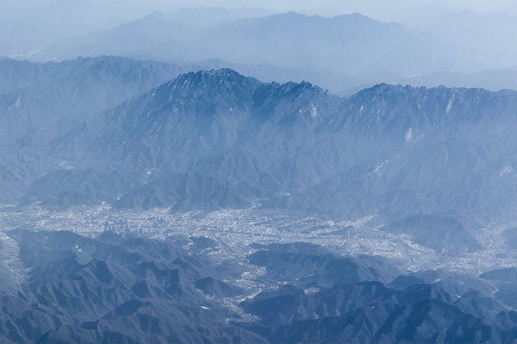
Regional overview
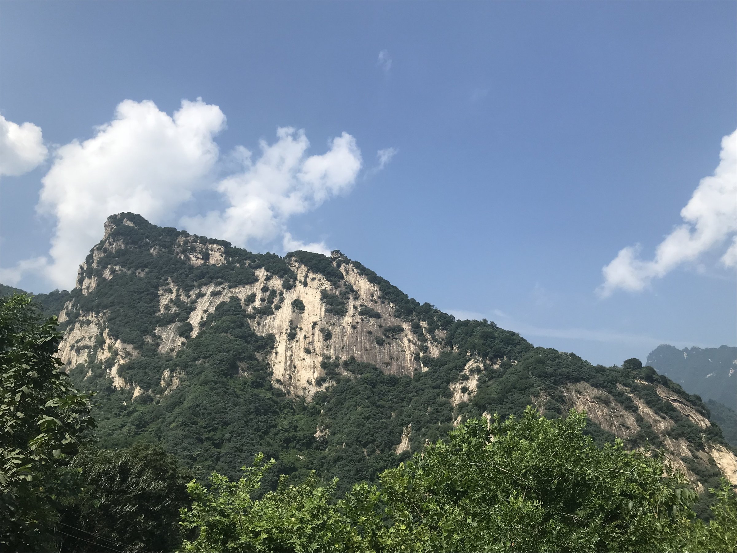
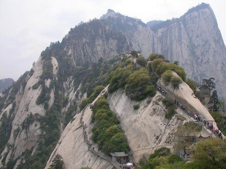
The Hua Shan / eastern Qinling region is dominated by the granite massif of Mount Hua above Huayin and by the lower forested ridges around Shaohua Mountain. The walking character is steep, engineered and highly exposed: stone stairways, chains, cliff paths, cable cars, shuttle buses, temples, narrow ridges and managed scenic-area corridors replace the open mountain paths found in less-developed ranges.
Mount Hua is the western sacred mountain of China and the defining hike of the region. It is compact but intense: the five main peaks are close together, yet the approaches and ridge links involve long flights of steps, ladders, narrow ledges and queue-prone bottlenecks. Shaohua Mountain adds a lower forest-and-gorge counterpart with Qianlong Temple, Shimen Gorge and a ropeway-supported day route.
The normal walking season is spring to autumn. Winter visits are possible in the managed scenic areas but snow, ice, wind and closed cliff-side features make the routes more serious. Current scenic-area notices, cable-car schedules and reservation rules should be checked before departure.
Selection rationale
The five hikes below cover the essential eastern Qinling experience: the classic five-peak Mount Hua traverse, the traditional foot ascent from Jade Spring Temple, the shorter North Peak approach, the technical-feeling South Peak plank-road option, and a lower Shaohua Mountain forest-and-gorge day.
Summary table
| # | Hike | Country | Route type | Distance | Gain | Max elevation | Difficulty |
|---|---|---|---|---|---|---|---|
| 1 | Mount Hua five peaks: West-up / North-down traverse | China | Lift-assisted traverse | Approx. 5-8 km walked | Approx. 500-700 m walked | 2,154.9 m | Hard |
| 2 | Mount Hua traditional ascent from Jade Spring Temple | China | Point-to-point / out-and-back variant | 8.5-17.5 km depending descent | 1,260-1,890 m | 2,154.9 m if full peaks included | Very hard |
| 3 | Mount Hua North Peak and Canglong Ridge | China | Lift-assisted out-and-back / partial traverse | Approx. 4-7 km walked | Approx. 400-700 m walked | 1,614-1,900 m depending turn-around | Hard |
| 4 | South Peak, Changkong Plank Road and West Peak | China | Lift-assisted high circuit | Approx. 4.7 km loop by AllTrails variant | Approx. 590 m | 2,154.9 m | Very hard / exposed |
| 5 | Shaohua Mountain: Qianlong Temple, Shaohua Peak and Shimen Gorge | China | Ropeway-assisted traverse / loop | Approx. 6-10 km | Moderate-hard |
1. Mount Hua Five Peaks - West-up / North-down Traverse

Snapshot
Itinerary
The standard one-day traverse uses the West Peak cable car to reach the high peak group, then walks West Peak, South Peak, East Peak, Middle Peak and the descending route towards North Peak. The route passes steep stairways, exposed viewpoints, temple terraces and the Canglong Ridge / Golden Lock Pass area before leaving by the North Peak cable car.
Why it is essential
This is the most efficient way to see the full Mount Hua summit landscape in one day: the lotus-shaped West Peak, the highest South Peak, the sunrise-oriented East Peak, the central temple peak and the classic North Peak exit.
Equipment
Mountain hiking equipment: grippy shoes or boots, gloves for chains, warm layer, rain shell, water, food, sun protection and headtorch if there is any risk of a late finish. Microspikes are appropriate in winter ice.
Hazards and notes
The route uses steep stairs, chains and cliff-edge paths. Canglong Ridge and upper viewpoints are weather-sensitive. Plank Walk and Hawk Turn-over side features require separate reservation and should be treated as exposed protected scrambling, not ordinary walking.
GPX / KML links
| Source | URL | Format / access | Reuse status |
|---|---|---|---|
| AllTrails: Mount Hua and Plank Walk | alltrails.com | Route page / app map | AllTrails terms apply; source geometry only |
| Wikiloc Huashan trail index | wikiloc.com | Route pages / GPS tracks | Wikiloc terms apply; source geometry only |
| OpenStreetMap search: Mount Hua | openstreetmap.org | Map/search | OSM data is ODbL; geometry cross-check only |
External links
- Shaanxi provincial government — Hiking of Mt. Huashan
- TravelChinaGuide — 6 Classical Routes for Mount Huashan Hike
- AllTrails — Mount Hua and Plank Walk
- Wikiloc — Huashan trails
2. Mount Hua Traditional Ascent from Jade Spring Temple

Snapshot
Itinerary
The traditional ascent starts at Jade Spring Temple, passes Wulong Bridge and climbs the old Huashan gorge route through Huixin Rock, Thousand-Foot Precipice and Hundred-Foot Gorge towards North Peak. Strong parties continue over Golden Lock Pass to the main summit group, then descend by West or North Peak cable car.
Why it is essential
This is the historic “one road to Hua Shan” ascent and the route that gives Mount Hua its reputation for arduous stone stairways and chain-protected cliff passages.
Equipment
Mountain hiking equipment, gloves for chains, headtorch for early starts, extra water and food, warm layer, rain shell and knee protection if descending on foot.
Hazards and notes
The ascent is long and steep. The full up-and-down route is hard on knees and should not be attempted late in the day. Night hiking is common for sunrise but removes visual route judgment and increases cold-weather risk.
GPX / KML links
| Source | URL | Format / access | Reuse status |
|---|---|---|---|
| AllTrails: Mount Hua | alltrails.com | Route page / app map | AllTrails terms apply; source geometry only |
| AllTrails: Mount Hua North Peak via Plank Walk | alltrails.com | Route page / app map | AllTrails terms apply; source geometry only |
| Wikiloc: Huashan from below, North-East-South-West | wikiloc.com | GPS track page | Wikiloc terms apply; source geometry only |
External links
- Shaanxi provincial government — Hiking of Mt. Huashan
- TravelChinaGuide — Mount Huashan hiking routes
- AllTrails — Mount Hua
- AllTrails — Mount Hua North Peak via Plank Walk
- Wikiloc — Huashan from below traverse
3. Mount Hua North Peak and Canglong Ridge
Snapshot
Itinerary
This shorter day starts with the North Peak cable car, visits the North Peak viewpoint and then climbs the famous ridge and stair sections towards Golden Lock Pass. It can be used as a there-and-back ridge walk or as the first part of a longer five-peak traverse.
Why it is essential
North Peak is the classic entry point to the Mount Hua summit system and gives a direct view of the ridge architecture without committing to the whole mountain.
Equipment
Standard to mountain hiking equipment, gloves for chains, water, windproof layer and sun protection.
Hazards and notes
Black Dragon Ridge / Canglong Ridge is narrow and exposed in places. The route can be congested; descend before cable-car closing times.
GPX / KML links
| Source | URL | Format / access | Reuse status |
|---|---|---|---|
| OpenStreetMap search: Huashan North Peak | openstreetmap.org | Map/search | OSM data is ODbL; geometry cross-check only |
| Waymarked Trails hiking map: Mount Hua area | hiking.waymarkedtrails.org | OSM-derived map | OSM/Waymarked terms apply; source-map only |
External links
- Shaanxi provincial government — Hiking of Mt. Huashan
- TravelChinaGuide — Mount Huashan hiking routes
- Waymarked Trails — Mount Hua hiking map
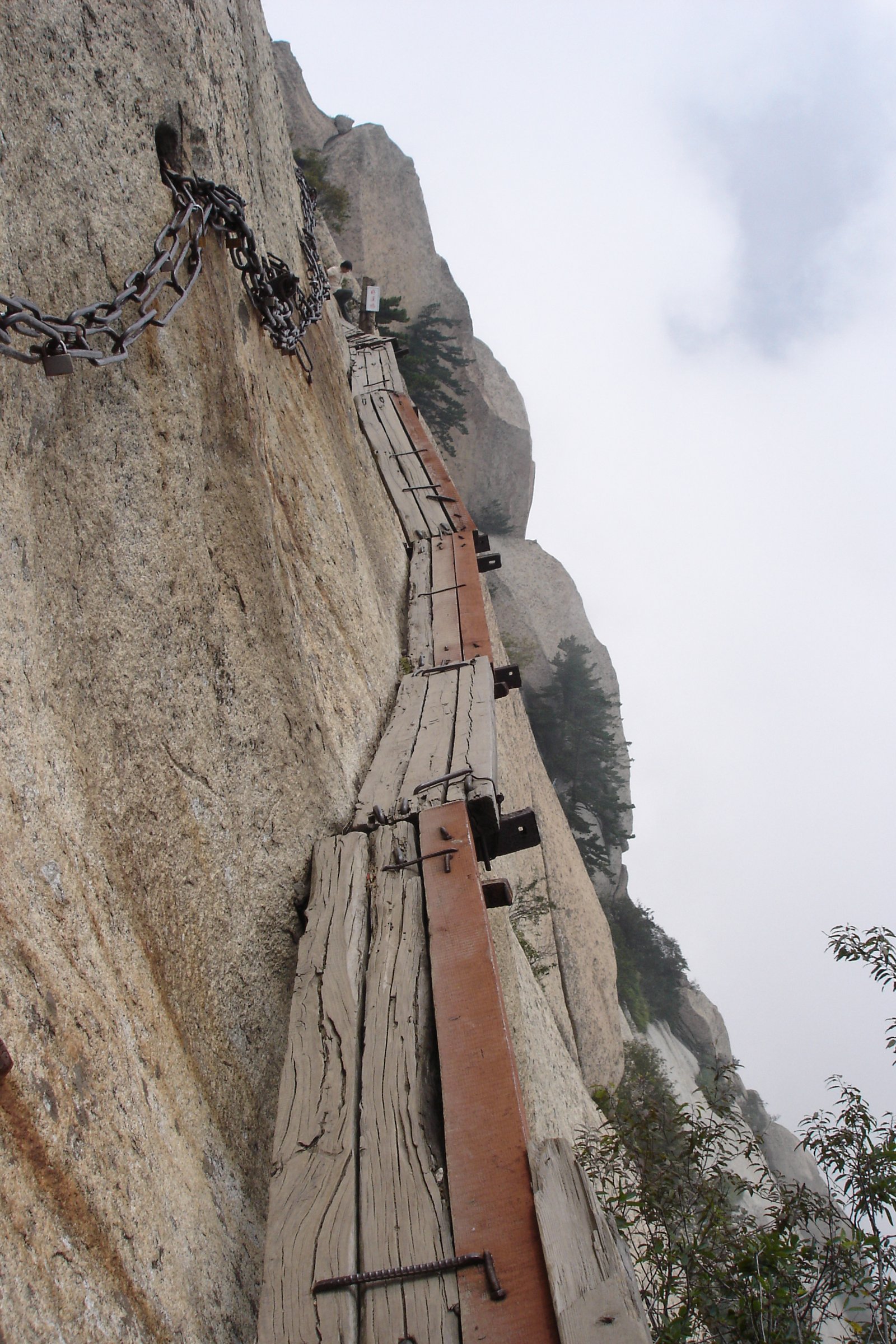
4. South Peak, Changkong Plank Road and West Peak

Snapshot
Itinerary
From the West Peak cable-car station, climb to West Peak and continue towards South Peak, the highest point of Mount Hua. The Changkong Plank Road is a side feature near South Peak and is optional. Return by the high paths to West Peak for cable-car descent, or continue towards East and North Peak if time allows.
Why it is essential
This compact route concentrates Mount Hua’s highest summit, famous cliff-side features and dramatic West Peak scenery into a shorter but still serious day.
Equipment
Mountain hiking equipment. A harness/lanyard system is normally controlled by the scenic area for the plank road; do not attempt the feature without official equipment and current permission.
Hazards and notes
The plank road and Hawk Turn-over are not ordinary hiking paths. They involve exposure, queues, weather restrictions and separate reservation rules. Bypass them if there is rain, ice, high wind, crowd pressure or discomfort with exposure.
GPX / KML links
| Source | URL | Format / access | Reuse status |
|---|---|---|---|
| AllTrails: Mount Hua and Plank Walk | alltrails.com | Route page / app map | AllTrails terms apply; source geometry only |
| OpenStreetMap search: South Peak Mount Hua | openstreetmap.org | Map/search | OSM data is ODbL; geometry cross-check only |
External links
- TravelChinaGuide — Mount Huashan hiking routes
- Shaanxi provincial government — Hiking of Mt. Huashan
- AllTrails — Mount Hua and Plank Walk
5. Shaohua Mountain - Qianlong Temple, Shaohua Peak and Shimen Gorge
Snapshot
Itinerary
The fuller Shaohua day uses the scenic-area ropeway to reach the Qianlong Temple / high path area, visits the glass walkway and Shaohua Peak viewpoints if open, then descends or transfers towards Hongya Lake and Shimen Gorge. Shimen Gorge provides the main water-and-forest walking section, with pools, cliffs and waterfalls.
Why it is essential
Shaohua Mountain gives the eastern Qinling entry a lower forested counterpart to Mount Hua: temple history, gorge scenery and a one-day mountain park route close to Huayin and Weinan.
Equipment
Standard hiking equipment, grippy shoes, water, rain shell, sun protection and warm layer outside midsummer.
Hazards and notes
Exact walking distance and elevation gain were not verified from an official route file. Use the scenic-area map and current staff advice. Do not enter unofficial wild paths beyond the managed scenic area.
GPX / KML links
| Source | URL | Format / access | Reuse status |
|---|---|---|---|
| OpenStreetMap search: Shaohua Mountain National Forest Park | openstreetmap.org | Map/search | OSM data is ODbL; geometry cross-check only |
| ENFI Shaohua Mountain ropeway project page | enfi.com.cn | Source page | No route-file licence found; confirms ropeway linking Hongya Lake, Shimen Canyon and Qianlong Temple |
External links
External links
| Source | URL |
|---|---|
| Shaanxi provincial government — Hiking of Mt. Huashan | en.shaanxi.gov.cn |
| TravelChinaGuide — Mount Huashan hiking routes | travelchinaguide.com |
| AllTrails — Mount Hua | alltrails.com |
| AllTrails — Mount Hua and Plank Walk | alltrails.com |
| AllTrails — Mount Hua North Peak via Plank Walk | alltrails.com |
| Wikiloc — Huashan trails | wikiloc.com |
| Wikiloc — Huashan from below traverse | wikiloc.com |
| Waymarked Trails — Mount Hua hiking map | hiking.waymarkedtrails.org |
| ENFI — Shaohua Mountain ropeway project | enfi.com.cn |
| China Daily — Shaohua Mountain photo story | chinadaily.com.cn |