Regional overview
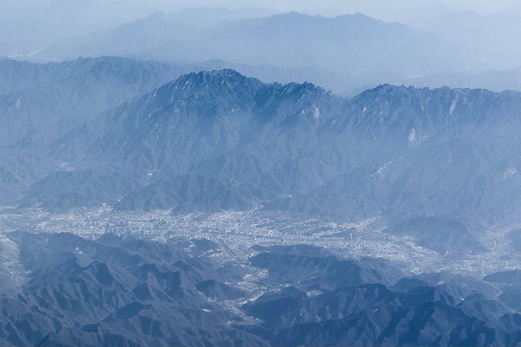
The Funiu Mountains form the eastern extension of the Qinling system across western Henan, spanning Luoyang, Nanyang and Pingdingshan. The region mixes granite peak forests, Taoist summit temples, high forest reserves, waterfall gorges, karst caves and north-south watershed ridges.
Most day walking takes place inside managed 5A scenic areas with cable cars, internal shuttles, boardwalks and stairways. This improves access but makes route distances variable: a “hike” can range from a short high-level circuit to a full stair-and-gorge walking day depending transport choices.
Spring rhododendron, summer shade and autumn colour are the main seasons. Winter snow and ice can be photogenic but make summit paths and plank roads slippery.
Selection rationale
The five hikes represent the Funiu core: Laojun Mountain’s Golden Top and Ten-Mile Gallery, Baiyun Mountain’s Yuhuangding and Jiulong Grand Canyon, Yaoshan’s granite ridge route, Laojieling’s watershed summit, and Baotianman’s protected forest-and-pool landscape.
Summary table
| # | Hike | Country | Route type | Distance | Gain | Max elevation | Difficulty | Photo status |
|---|---|---|---|---|---|---|---|---|
| 1 | Laojun Mountain Ten-Mile Gallery and Golden Top | China | Lift-assisted high circuit | Approx. 6-10 km walked | 2,217 m / 2,200 m depending source | Moderate-hard | Commons image verified | |
| 2 | Baiyun Mountain Yuhuangding and Jiulong Grand Canyon | China | Shuttle-assisted summit and gorge day | Approx. 8-12 km walked | 2,216 m | Hard | No licence-compatible image found | |
| 3 | Yaoshan Qinglongbei, Shiren Peak and Yuhuangding | China | Lift-assisted traverse | 8 km cited route | 2,153.3 m | Hard | No licence-compatible image found | |
| 4 | Laojieling Continental Divide and Jijiaojian | China | Lift-assisted out-and-back / loop | Approx. 4-8 km | 2,212.5 m | Moderate-hard | No licence-compatible image found | |
| 5 | Baotianman Qixing Pool and forest route | China | Forest / canyon out-and-back | Approx. 5-8 km | 1,830 m at Muhu Peak | Moderate | No licence-compatible image found |
1. Laojun Mountain Ten-Mile Gallery and Golden Top
Snapshot
Itinerary
The classic day uses the Zhongling cable car, then walks through Dream Valley, glass viewpoints, the Ten-Mile Gallery granite-peak scenery and the Golden Top Taoist Complex. Descent is normally by Yunjing or other scenic cable-car route.
Why it is essential
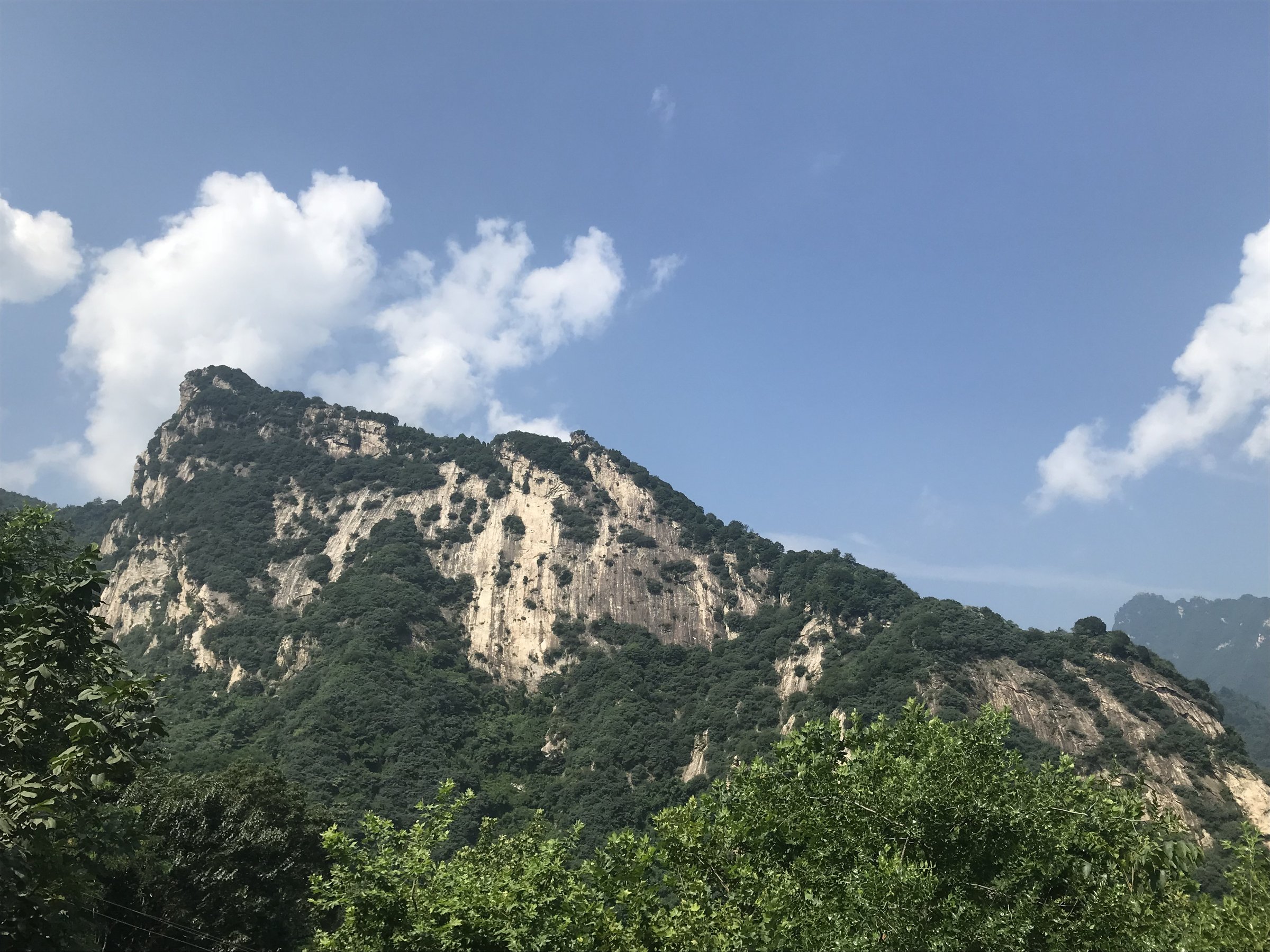
Laojun Mountain is the best-known Funiu summit walk, combining Taoist architecture above 2,000 m with granite peak forest scenery.
Equipment
Standard to mountain hiking equipment, warm layer for the summit, rain shell, water, snacks and grippy shoes. Winter visitors may need traction.
Hazards and notes
Henan government notes cold mountain climate, rain gear, no smoking and no entry into undeveloped areas. Cable-car operation and possible access restrictions should be checked before travel.
Photos
| Image | Source | Author | Licence | Reuse notes | Attribution |
|---|---|---|---|---|---|
| Aerial photo of Luanchuan County and Laojun Mountain | commons.wikimedia.org | Windmemories | CC BY-SA 4.0 | Commercial reuse and modification appear allowed with attribution and share-alike | “Aerial photo of Luanchuan County and Laojun Mountain” by Windmemories, CC BY-SA 4.0, via Wikimedia Commons |
GPX / KML links
| Source | URL | Format | Licence / terms | Reuse status |
|---|---|---|---|---|
| Wikiloc Luoyang mountaineering index, “Climbing Lao Jun Mountain” | wikiloc.com | Route index / GPS tracks | Wikiloc terms apply | Source geometry found; route-file reuse not confirmed |
| OpenStreetMap search: Laojun Mountain Luoyang | openstreetmap.org | Map/search | OSM data is ODbL | Geometry cross-check only |
External links
2. Baiyun Mountain Yuhuangding and Jiulong Grand Canyon
Snapshot
Itinerary
The full day combines two Baiyun Mountain essentials: the Jiulong Grand Canyon waterfall walk and the Yuhuangding summit route. Sightseeing buses link the sectors. The canyon walk visits Jiulong Waterfall and pools, while the summit route climbs to the high Taoist viewpoint over the Funiu ridges.
Why it is essential
Baiyun Mountain gives the Funiu entry a high forest-and-waterfall route and one of the region’s main 2,200 m viewpoints.
Equipment
Mountain hiking equipment, water, food, waterproof layer, warm layer for Yuhuangding and grippy shoes for steps.
Hazards and notes
The scenic area is large and buses are required. The summit is 8-10 C colder than the foot of the mountain. Canyons should be avoided during heavy rain; winter closures can affect high sections.
Photos
Photo status: No licence-compatible Baiyun Mountain image verified in this pass.
| Image | Source | Author | Licence | Reuse notes | Attribution |
|---|---|---|---|---|---|
| Unresolved | Unresolved | Unresolved | Unresolved | Follow-up needed | Unresolved |
GPX / KML links
| Source | URL | Format | Licence / terms | Reuse status |
|---|---|---|---|---|
| OpenStreetMap search: Baiyun Mountain Luoyang | openstreetmap.org | Map/search | OSM data is ODbL | Geometry cross-check only |
External links
3. Yaoshan Qinglongbei, Shiren Peak and Yuhuangding
Snapshot
Itinerary
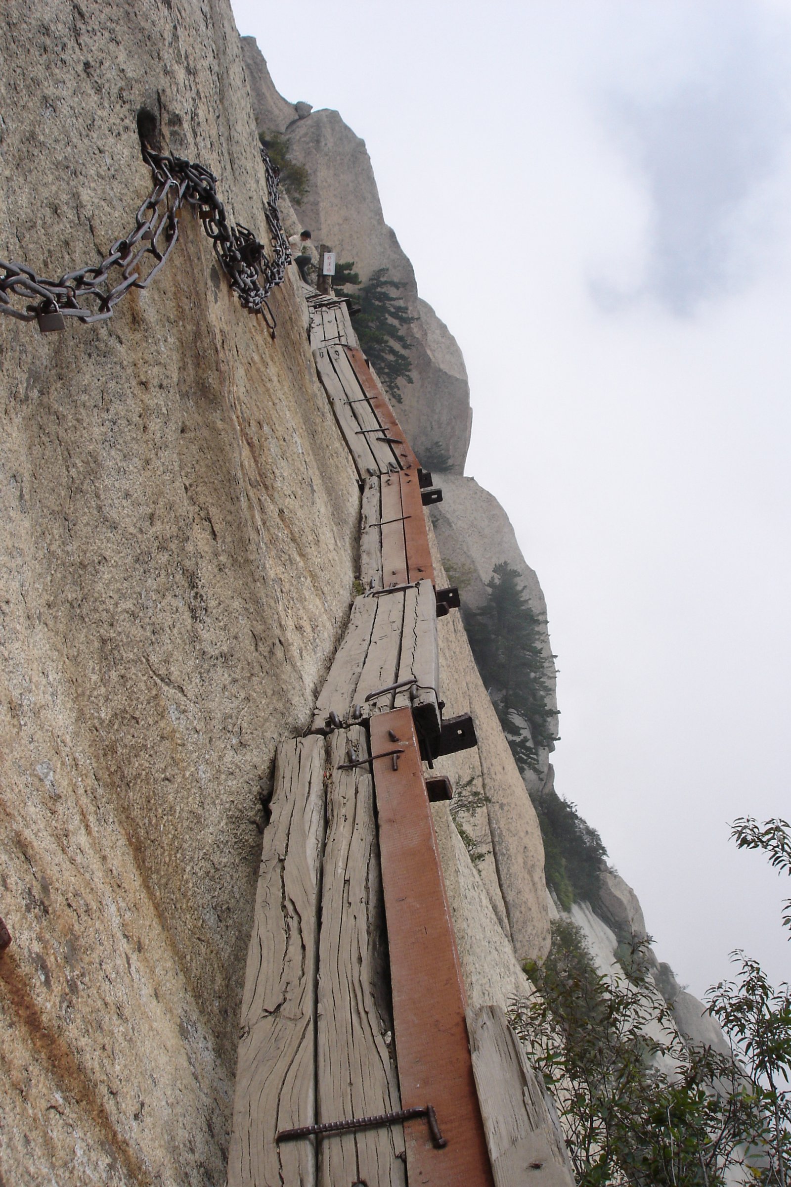
The cited one-day route runs from the gate to the Yaoshan cable car, then Qinglongbei, Shiren Peak, Yuhuangding, Jiuqu Waterfall, Tongtianmen and the scenic exit. It is a rugged granite ridge-and-waterfall day with exposed sections around Qinglongbei and Shiren Peak.
Why it is essential
Yaoshan is one of the main eastern Funiu mountain landscapes, known for granite peak forest, cloud views, forest and waterfall scenery.
Equipment
Mountain hiking equipment, grippy shoes, water, rain shell, warm layer and poles.
Hazards and notes
Qinglongbei is described as a narrow ridge only 2-3 m wide with steep drops; stay on the managed path. The scenic area prohibits fire and off-route climbing.
Photos
Photo status: No licence-compatible Yaoshan image verified in this pass.
| Image | Source | Author | Licence | Reuse notes | Attribution |
|---|---|---|---|---|---|
| Unresolved | Unresolved | Unresolved | Unresolved | Follow-up needed | Unresolved |
GPX / KML links
| Source | URL | Format | Licence / terms | Reuse status |
|---|---|---|---|---|
| OpenStreetMap search: Yaoshan Henan | openstreetmap.org | Map/search | OSM data is ODbL | Geometry cross-check only |
External links
4. Laojieling Continental Divide and Jijiaojian
Snapshot
Itinerary
The route follows the main scenic access to the cable station, then walks the Continental Divide, Immortal Peaks, Jijiaojian summit viewpoint and Virgin Forest sections before returning by the same system.
Why it is essential
Laojieling is a watershed summit between the Yellow River and Yangtze basins and is described as the highest point of the Funiu range by the consulted scenic source.
Equipment
Mountain hiking equipment, anti-slip shoes, poles, rain gear and warm layer.
Hazards and notes
Stay away from cliffs and suspend the route during thunderstorms. Mobile signal may be weak.
Photos
Photo status: No licence-compatible Laojieling image verified in this pass.
| Image | Source | Author | Licence | Reuse notes | Attribution |
|---|---|---|---|---|---|
| Unresolved | Unresolved | Unresolved | Unresolved | Follow-up needed | Unresolved |
GPX / KML links
| Source | URL | Format | Licence / terms | Reuse status |
|---|---|---|---|---|
| OpenStreetMap search: Laojieling | openstreetmap.org | Map/search | OSM data is ODbL | Geometry cross-check only |
External links
5. Baotianman Qixing Pool and Forest Route
Snapshot
Itinerary
The day uses open Baotianman scenic-area paths through protected forest and the Qixing Pool canyon system. Longer routes towards Muhu Peak or geological sections should only be used if open and permitted.
Why it is essential
Baotianman represents the protected-forest side of the Funiu Mountains and balances the more developed summit-temple scenic areas.
Equipment
Standard hiking equipment, rain shell, grippy shoes, water, food and insect/tick protection in warm months.
Hazards and notes
Smoking, littering and picking wild plants are prohibited. Rainy-season paths may close because of flood or landslide risk.
Photos
Photo status: No licence-compatible Baotianman image verified in this pass.
| Image | Source | Author | Licence | Reuse notes | Attribution |
|---|---|---|---|---|---|
| Unresolved | Unresolved | Unresolved | Unresolved | Follow-up needed | Unresolved |
GPX / KML links
| Source | URL | Format | Licence / terms | Reuse status |
|---|---|---|---|---|
| OpenStreetMap search: Baotianman | openstreetmap.org | Map/search | OSM data is ODbL | Geometry cross-check only |
External links
External links
| Source | URL |
|---|---|
| Henan provincial government — Laojun Mountain | english.henan.gov.cn |
| Henan Culture and Tourism — Baiyun Mountain | hct.henan.gov.cn |
| LoongWander — Funiu Mountain Scenic Area | loongwander.com |
| LoongWander — Baiyun Mountain Scenic Area | loongwander.com |
| LoongWander — Yaoshan Scenic Area (Chinese) | loongwander.com |
| LoongWander — Laojieling Scenic Area | loongwander.com |
| Wikiloc — Luoyang mountaineering index | wikiloc.com |