Regional overview
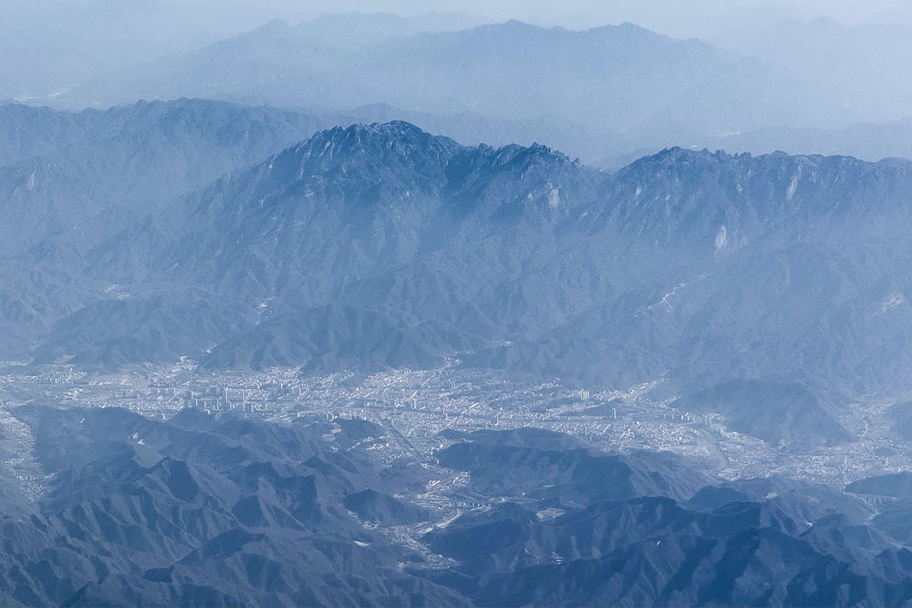
The Qinling are China’s central east-west mountain divide, separating the Wei River basin and the loess country to the north from the Han River and subtropical slopes to the south. Day hiking here is split between highly managed scenic mountains, sacred peaks, forest parks, temples, landslide lakes and high alpine routes around Taibai Shan.
The selection below avoids making this a Mount Hua-only entry. It covers the sacred granite stairways of Huashan, the high Qinling summit world of Taibai Shan, landslide-lake scenery at Cuihua, temple forest on South Wutai, and a forest-ridge reserve route at Niubeiliang. Scenic-area rules, shuttle buses, cable-car operating times and weather closures can change, so local notices remain essential.
Selection rationale
These five hikes were selected to represent the main accessible day-hiking characters of the Qinling: famous sacred-mountain stairways, the highest Qinling summit area, a geological park, a cultural temple mountain and a wilder forest-ridge reserve. Several long Aotai/Taibai traverses were excluded because they are not normal non-technical day hikes.
Summary table
| # | Hike | Country | Route type | Distance | Gain | Max elevation | Difficulty |
|---|---|---|---|---|---|---|---|
| 1 | Mount Hua / Huashan full summit route | China | Out-and-back / scenic-area variants | 17.5 km source route | 1,893 m | ca. 2,155 m | Very hard |
| 2 | Taibai Shan: Tianyuan Difang to Daye Hai / Baxiantai | China | High out-and-back candidate | ca. 16-18 km return | Unresolved | 3,767 m | Hard / high altitude |
| 3 | Cuihua Mountain landslide lake route | China | Out-and-back core route | 2.1 km core route | 225 m | 1,398 m | Moderate |
| 4 | South Wutai / Zhongnan Mountain temple ridge | China | Out-and-back | 6.1 km | 624 m | 1,645 m | Hard |
| 5 | Niubeiliang forest-ridge route | China | Out-and-back | 6.4 km | 959 m | 2,405 m | Hard |
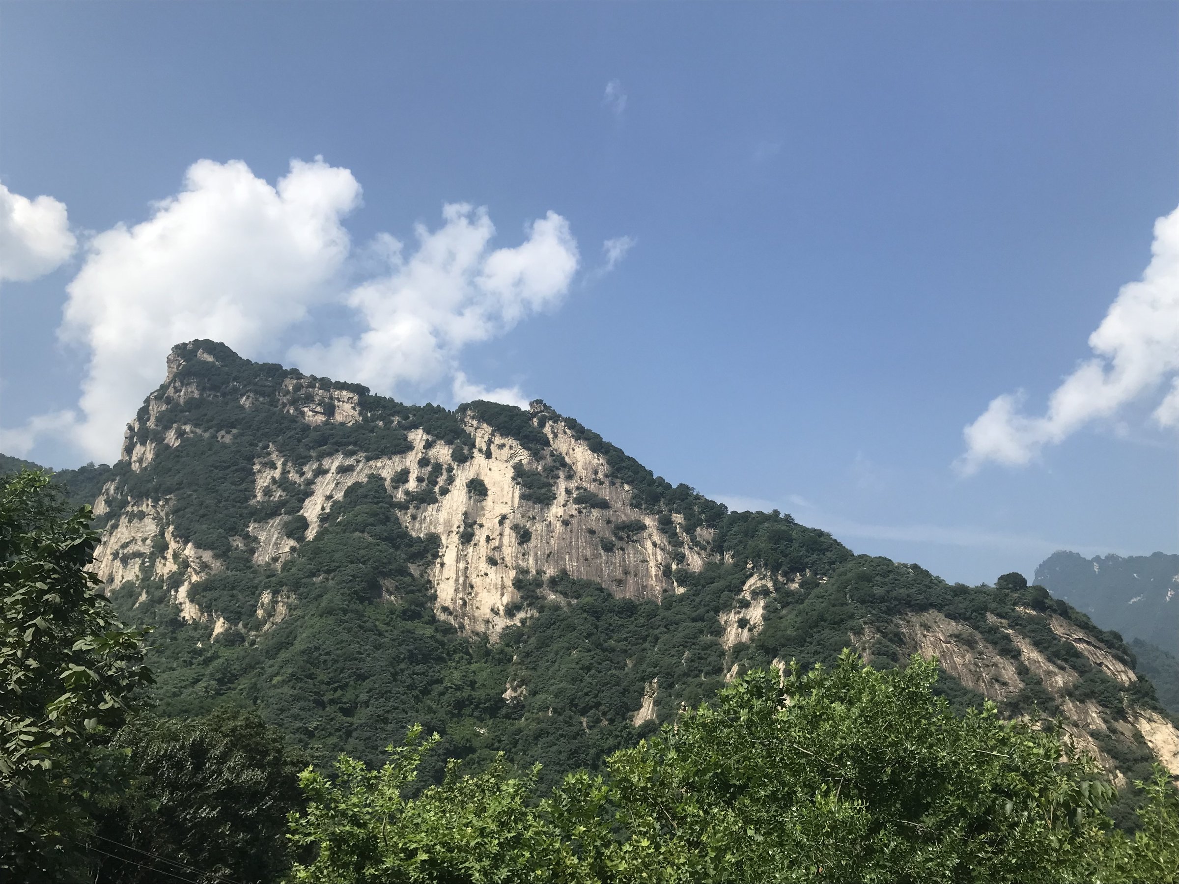
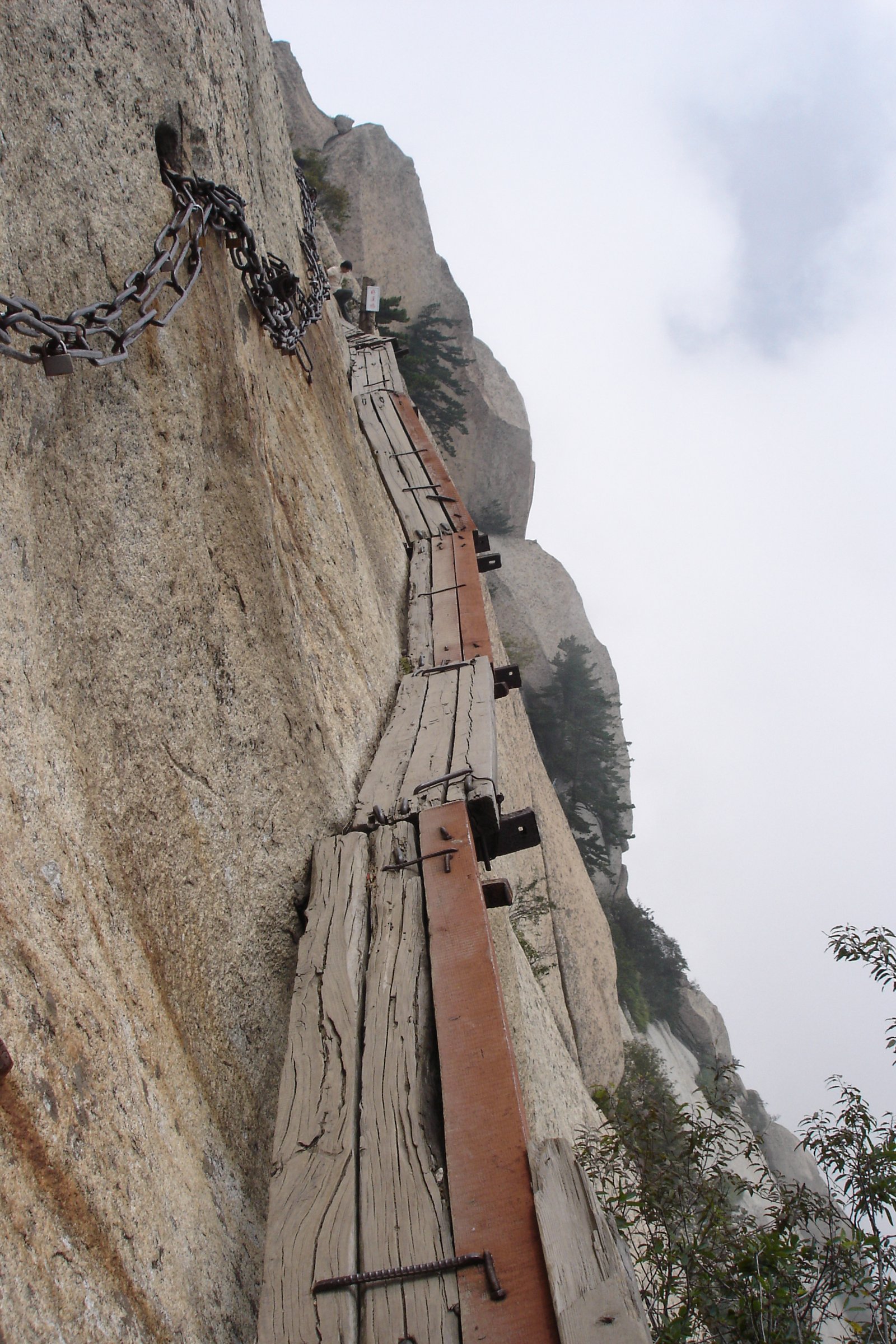
1. Mount Hua / Huashan Full Summit Route

Snapshot
Itinerary
The full route climbs from the lower Huashan access area toward North Peak, then continues through the engineered stairways and ridge links to the main peak group. Fit walkers can visit West Peak, South Peak, East Peak, Middle Peak and North Peak in one long day, using cable cars to shorten the route if required.
Why it is essential
Huashan is one of China’s five sacred mountains and the Qinling’s most internationally recognised day-hiking objective. It combines temples, cliff stairways, chains, granite towers and famous exposed ridge sections in a compact scenic area.
Equipment
Mountain hiking shoes, gloves for chains, warm layer, rain shell, sun protection, water, food and headtorch for early starts or late finishes. In winter, microspikes may be necessary.
Hazards and notes
Steep stone stairways, chain-protected drops, crowding and weather exposure are the main issues. Plank Walk and other side features are exposed paid/managed attractions and should not be treated as normal walking paths.
GPX / KML links
| Source | URL | Format / access | Reuse status |
|---|---|---|---|
| AllTrails: Mount Hua | alltrails.com | Source route page / app map | AllTrails terms apply; source geometry found; route-file reuse not confirmed |
| OpenStreetMap search: Mount Hua | openstreetmap.org | Map/search | OSM data is ODbL; geometry cross-check target |
External links
- Shaanxi provincial tourism — Hiking of Mt. Huashan
- TravelChinaGuide — Mount Huashan hiking routes
- AllTrails — Mount Hua
2. Taibai Shan: Tianyuan Difang to Daye Hai / Baxiantai

Snapshot
Itinerary
The intended day route uses the highest legal scenic-area access available, then follows the high Qinling route toward Daye Hai and Baxiantai. It crosses open, exposed alpine terrain above the forest belt and returns by the same line. The exact legal start point and walking distance require confirmation from current park operations.
Why it is essential
Taibai Shan is the highest mountain in the Qinling and one of the range’s defining landscapes. It adds the high, cold, alpine Qinling character that is absent from the lower managed temple and geopark walks.
Equipment
Full mountain day kit: waterproofs, warm layers, gloves/hat, sun protection, food, water, offline map/GPS and headtorch. Snow gear may be needed outside summer.
Hazards and notes
Altitude, fast weather change, snow/ice, exposed high ground and park-closure rules are the main concerns. Do not treat the multi-day Aotai traverse as part of this day-hike recommendation.
GPX / KML links
| Source | URL | Format / access | Reuse status |
|---|---|---|---|
| OpenStreetMap search: Taibai Mountain National Forest Park | openstreetmap.org | Map/search | OSM data is ODbL; geometry cross-check only; no route relation selected |
| TravelChinaGuide Taibai Mountain page | travelchinaguide.com | Visitor information page | Website terms apply; route-file not available |
External links
- TravelChinaGuide — Taibai Mountain
- Wikipedia — Mount Taibai
- Wikipedia — Aotai trail (safety context only)
3. Cuihua Mountain Landslide Lake Route

Snapshot
Itinerary
The source route makes a short out-and-back through the Cuihua Mountain scenic area, known for landslide geology, rock walls and lake scenery. It can be lengthened inside the geopark, but the exact statistics for those longer variants were not verified in this pass.
Why it is essential
Cuihua provides a lower, accessible Qinling geology walk close to Xi’an, contrasting with Huashan’s sacred stairways and Taibai’s high alpine terrain.
Equipment
Walking shoes, rain shell, water, sun protection and traction in wet weather.
Hazards and notes
The verified source route is short. If a guidebook-length entry needs a longer day, a future pass should source a full geopark loop or lake-and-ridge combination from official mapping.
GPX / KML links
| Source | URL | Format / access | Reuse status |
|---|---|---|---|
| AllTrails: Cuihua Mountain | alltrails.com | Source route page / app map | AllTrails terms apply; source geometry found; route-file reuse not confirmed |
| OpenStreetMap search: Cuihua Mountain | openstreetmap.org | Map/search | OSM data is ODbL; geometry cross-check target |
External links
4. South Wutai / Zhongnan Mountain Temple Ridge
Snapshot
Itinerary
The out-and-back climbs forested slopes and temple-linked paths in the South Wutai / Zhongnan Mountain area. It is a compact but steep cultural mountain route, with summit-area viewpoints and religious sites depending on the exact current open path.
Why it is essential
South Wutai gives the catalogue a Buddhist/Daoist Qinling temple mountain that is less internationally famous than Huashan but central to the Xi’an-side hiking landscape.
Equipment
Hiking shoes, water, rain layer, sun protection and warm layer outside summer.
Hazards and notes
Steep steps, wet stone, winter ice and scenic-area access rules are the practical concerns. Exact licence-compatible route-specific photography was not found in this pass.
GPX / KML links
| Source | URL | Format / access | Reuse status |
|---|---|---|---|
| AllTrails: South Wutai Trail | alltrails.com | Source route page / app map | AllTrails terms apply; source geometry found; route-file reuse not confirmed |
| OpenStreetMap search: South Wutai Shaanxi | openstreetmap.org | Map/search | OSM data is ODbL; geometry cross-check target |
External links
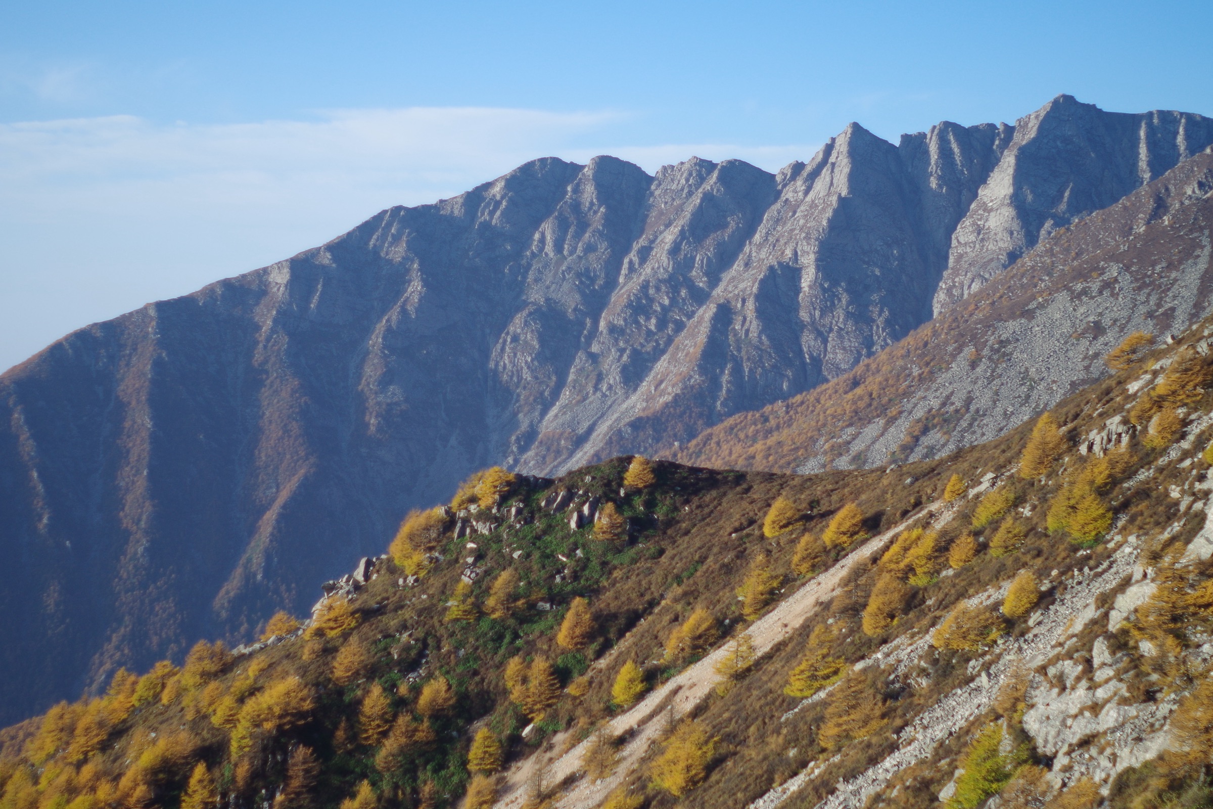
5. Niubeiliang Forest-Ridge Route

Snapshot
Itinerary
The route climbs through forested Qinling terrain toward the Niubeiliang high ridge. The source route is a steep out-and-back; a longer Shibianyu-Niubeiliang variant also exists but is significantly more committing.
Why it is essential
Niubeiliang adds a wilder forest-and-ridge objective to a set otherwise dominated by managed scenic areas. It represents the Qinling’s reserve and watershed character.
Equipment
Mountain shoes, rain shell, warm layer, water, food, offline map/GPS and headtorch.
Hazards and notes
The grade is steep for the distance. Weather, forest navigation and transport logistics should be confirmed locally. Longer variants can exceed normal day-hike effort.
GPX / KML links
| Source | URL | Format / access | Reuse status |
|---|---|---|---|
| AllTrails: Niubeiliang | alltrails.com | Source route page / app map | AllTrails terms apply; source geometry found; route-file reuse not confirmed |
| OpenStreetMap search: Niubeiliang Shaanxi | openstreetmap.org | Map/search | OSM data is ODbL; geometry cross-check target |
External links
External links
| Source | URL |
|---|---|
| Shaanxi provincial tourism — Hiking of Mt. Huashan | en.shaanxi.gov.cn |
| TravelChinaGuide — Huashan hiking routes | travelchinaguide.com |
| TravelChinaGuide — Taibai Mountain | travelchinaguide.com |
| AllTrails — Mount Hua | alltrails.com |
| AllTrails — Cuihua Mountain | alltrails.com |
| AllTrails — South Wutai Trail | alltrails.com |
| AllTrails — Niubeiliang | alltrails.com |
| Wikipedia — Mount Taibai | en.wikipedia.org |
| Wikipedia — Aotai trail | en.wikipedia.org |