Regional overview
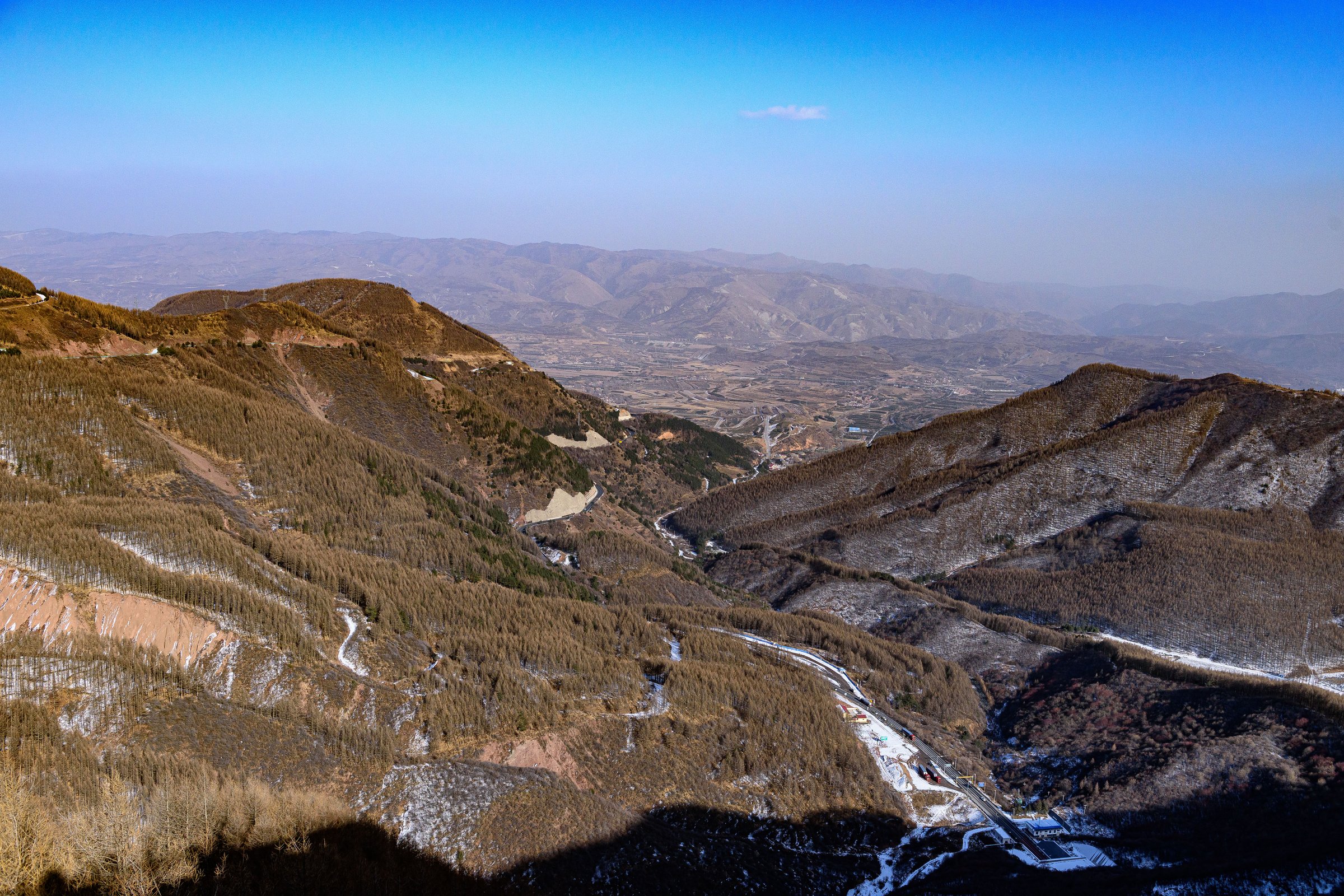
The Liupan Mountains form the greener, wetter southern Ningxia mountain block on the western Loess Plateau, extending toward Gansu and Shaanxi. Official Ningxia sources describe Liupan Mountain National Forest Park as covering 67,800 ha, with a main peak of 2,942 m and high forest cover. The area is a water-conservation forest base and source area for the Jing and Qingshui rivers.
Hiking character is forested gorge walking, stream valleys, waterfalls, cool summer ravines, red Danxia landforms at Huoshizhai and historical Long March/Genghis Khan associations. Compared with Helan, this region is less desert-like and more wooded.
Season is late spring to autumn. Snow, ice, fog, storms and wet slippery paths are important hazards. Some routes are inside scenic areas or protected forest/nature-reserve land.
Selection rationale
The selection follows the most repeatedly documented Liupan scenic walking areas: Xiaonanchuan, Liangdianxia, Laolongtan, Yehe Valley and Huoshizhai. Route stats are poor; all require follow-up mapping.
Summary table
| # | Hike | Country | Route type | Distance | Gain | Max elevation | Difficulty |
|---|---|---|---|---|---|---|---|
| 1 | Xiaonanchuan stream-and-waterfall trail | China | Out-and-back / valley | official itinerary gives 2 h | Easy-moderate | ||
| 2 | Liangdianxia gorge trail | China | Out-and-back / valley | itinerary gives 1.5 h | Easy-moderate | ||
| 3 | Laolongtan four-pools route | China | Out-and-back | Easy-moderate | |||
| 4 | Yehe Valley gorge walk | China | Out-and-back | Easy-moderate | |||
| 5 | Huoshizhai Danxia ridge / scenic path | China | Loop / out-and-back | 2,650 m area high point | Moderate |
1. Xiaonanchuan Stream-and-Waterfall Trail
Snapshot
Itinerary
The route follows the Xiaonanchuan stream valley through forest, flowing water and waterfall scenery inside the Liupan Mountain National Forest Park visitor area.
Why it is essential
Xiaonanchuan is part of the standard one-day Liupan scenic itinerary and represents the region’s forest-stream hiking character.
Equipment
Standard hiking equipment; waterproof footwear helpful after rain.
Hazards and notes
Wet boardwalks or stones may be slippery. Check scenic-area opening and shuttle arrangements.
GPX / KML links
| Source | URL | Format / access | Reuse status |
|---|---|---|---|
| Official route | Not found | - | Unresolved |
External links
- Liupan Mountain official overview — China Daily
- Lvyounk — Ningxia one-day itinerary reference
- Sina Travel — Xiaonanchuan scenic description
2. Liangdianxia Gorge Trail
Snapshot
Itinerary
The route explores the Liangdianxia gorge, a cool ravine associated in local sources with historical summering and Genghis Khan traditions.
Why it is essential
Liangdianxia is one of the named core Liupan Mountain scenic gorges and adds historical context to the forest-park walks.
Equipment
Standard hiking equipment, rain layer, grippy shoes.
Hazards and notes
Rockfall, wet surfaces and shuttle/ticket logistics need current confirmation.
GPX / KML links
| Source | URL | Format / access | Reuse status |
|---|---|---|---|
| Official route | Not found | - | Unresolved |
External links
3. Laolongtan Four-Pools Route
Snapshot
Itinerary
The walk follows the Laolongtan scenic route along the Jing River source area, linking the named pools and waterfall features.
Why it is essential
Official sources identify Laolongtan as the origin of the Jing River and describe one river, four pools and ten scenic spots, making it one of the defining water landscapes of Liupan Mountain.
Equipment
Standard hiking equipment.
Hazards and notes
Wet rock and streamside exposure require caution. Current scenic-area restrictions need confirmation.
GPX / KML links
| Source | URL | Format / access | Reuse status |
|---|---|---|---|
| Official route | Not found | - | Unresolved |
External links
4. Yehe Valley Gorge Walk
Snapshot
Itinerary
The route follows Yehe Valley, a north-south gorge with streamside vegetation and Huashan pine habitat, using official visitor paths where available.
Why it is essential
Yehe Valley adds a quieter gorge and habitat-focused walk to the Liupan set.
Equipment
Standard hiking equipment, insect/tick awareness in warm months.
Hazards and notes
Public route alignment and access controls need confirmation.
GPX / KML links
| Source | URL | Format / access | Reuse status |
|---|---|---|---|
| Official route | Not found | - | Unresolved |
External links
5. Huoshizhai Danxia Ridge / Scenic Path
Snapshot
Itinerary
The walk should use the official Huoshizhai scenic paths through red Danxia cliffs, ridges and forested viewpoints. Exact trail alignment and distance need current park-map verification.
Why it is essential
Huoshizhai is the most distinctive Danxia landscape in the Liupan region and broadens the selection beyond forest-waterfall routes.
Equipment
Standard hiking equipment, sun protection, wind layer.
Hazards and notes
Cliff edges, stairs and wet rock require caution. Stay within marked scenic-area routes.
GPX / KML links
| Source | URL | Format / access | Reuse status |
|---|---|---|---|
| Official route | Not found | - | Unresolved |
External links
- China Daily — Guyuan green treasures
- China.org — Huoshizhai overview
- China Daily — Huoshizhai Danxia article
- Xinhua — Huoshizhai images
External links
| Source | URL |
|---|---|
| Liupan Mountain official overview — China Daily | chinadaily.com.cn |
| Lvyounk — Ningxia one-day itinerary reference | lvyounk.com |
| Sina Travel — Xiaonanchuan scenic description | travel.sina.com.cn |
| Meet99 — Liangdianxia scenic listing | meet99.com |
| Gansu News — Liangdianxia report | gansu.gscn.com.cn |
| China Daily — Guyuan green treasures | chinadaily.com.cn |
| China.org — Huoshizhai overview | china.org.cn |
| China Daily — Huoshizhai Danxia article | chinadaily.com.cn |
| Xinhua — Huoshizhai images | xinhuanet.com |