Regional overview
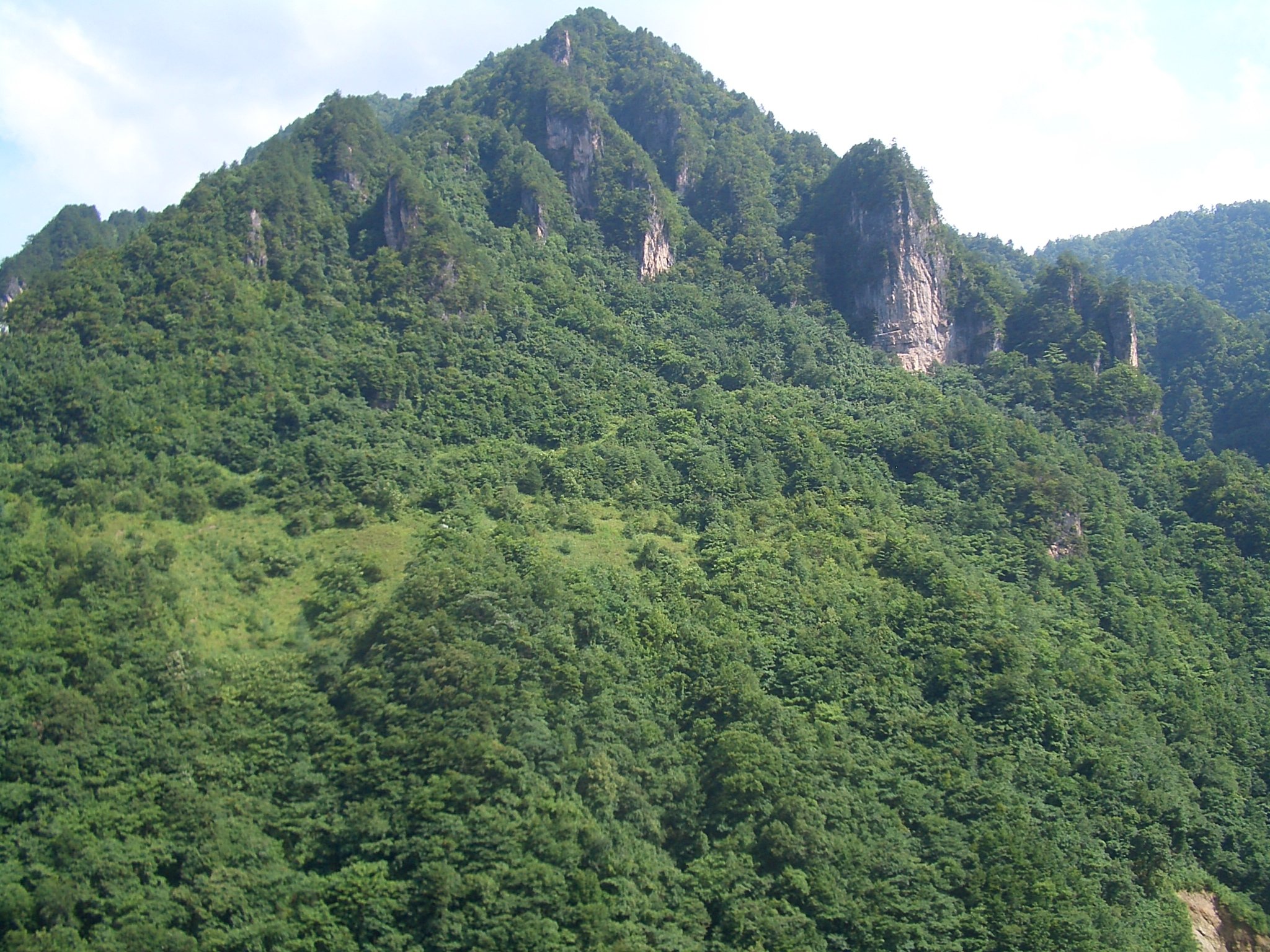
The Wudang Mountains form a compact, forested Taoist mountain region in northwestern Hubei, within the broader Daba / Qinba mountain system. The walking character is a mix of sacred-road stair ascents, cliff-temple approaches, forested stone paths, short temple walks, and shuttle- or cableway-assisted scenic-area traverses rather than open alpine trekking.
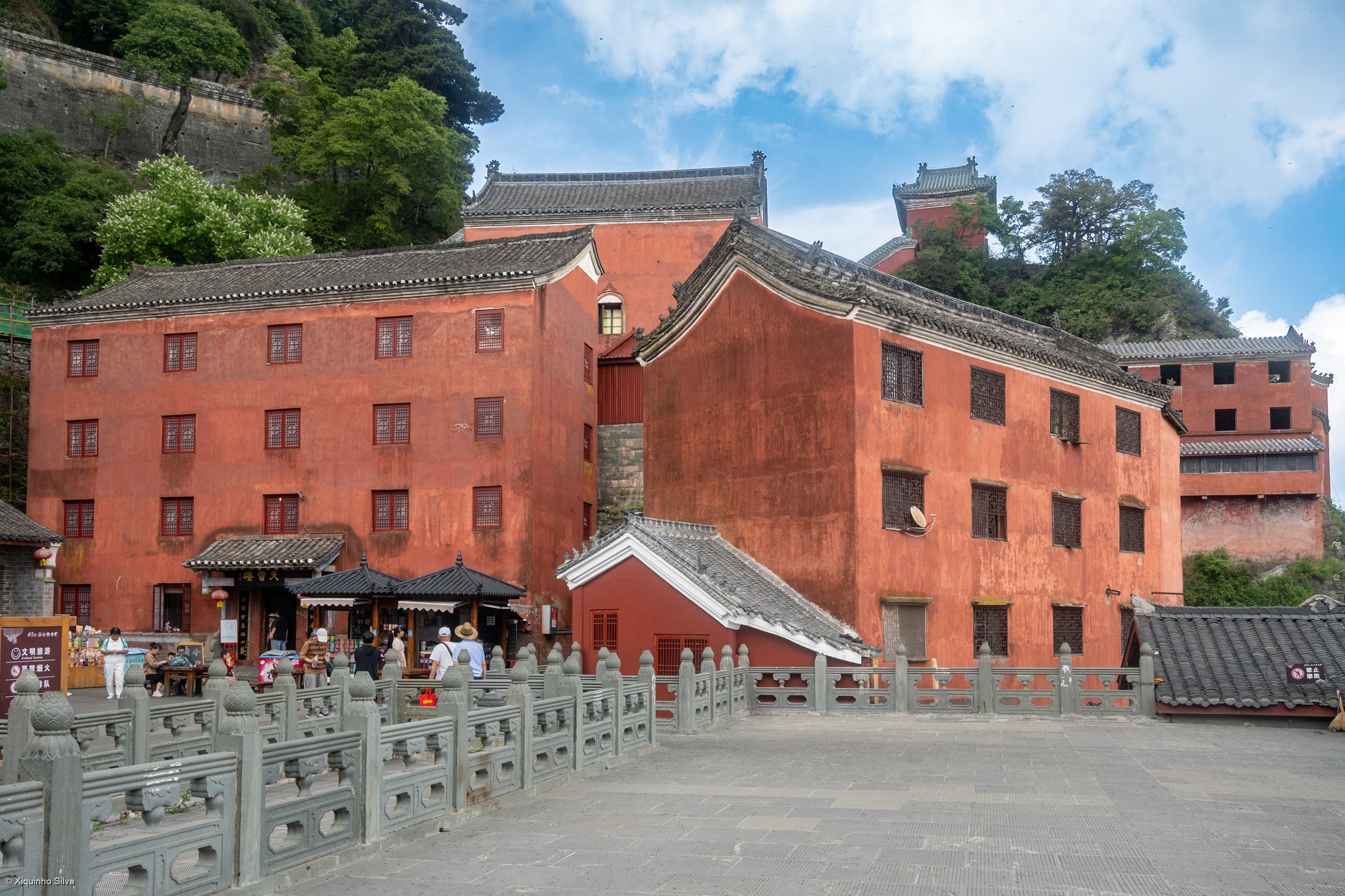
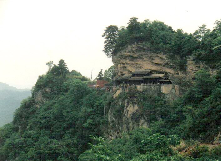
UNESCO lists the Ancient Building Complex in the Wudang Mountains as a World Heritage property, with surviving temples and palaces including the Golden Shrine / Golden Hall, Purple Heaven Palace, Nanyan Palace, Fuzhen Temple / Prince Slope, and other Yuan, Ming and Qing religious buildings embedded in the mountain landscape.
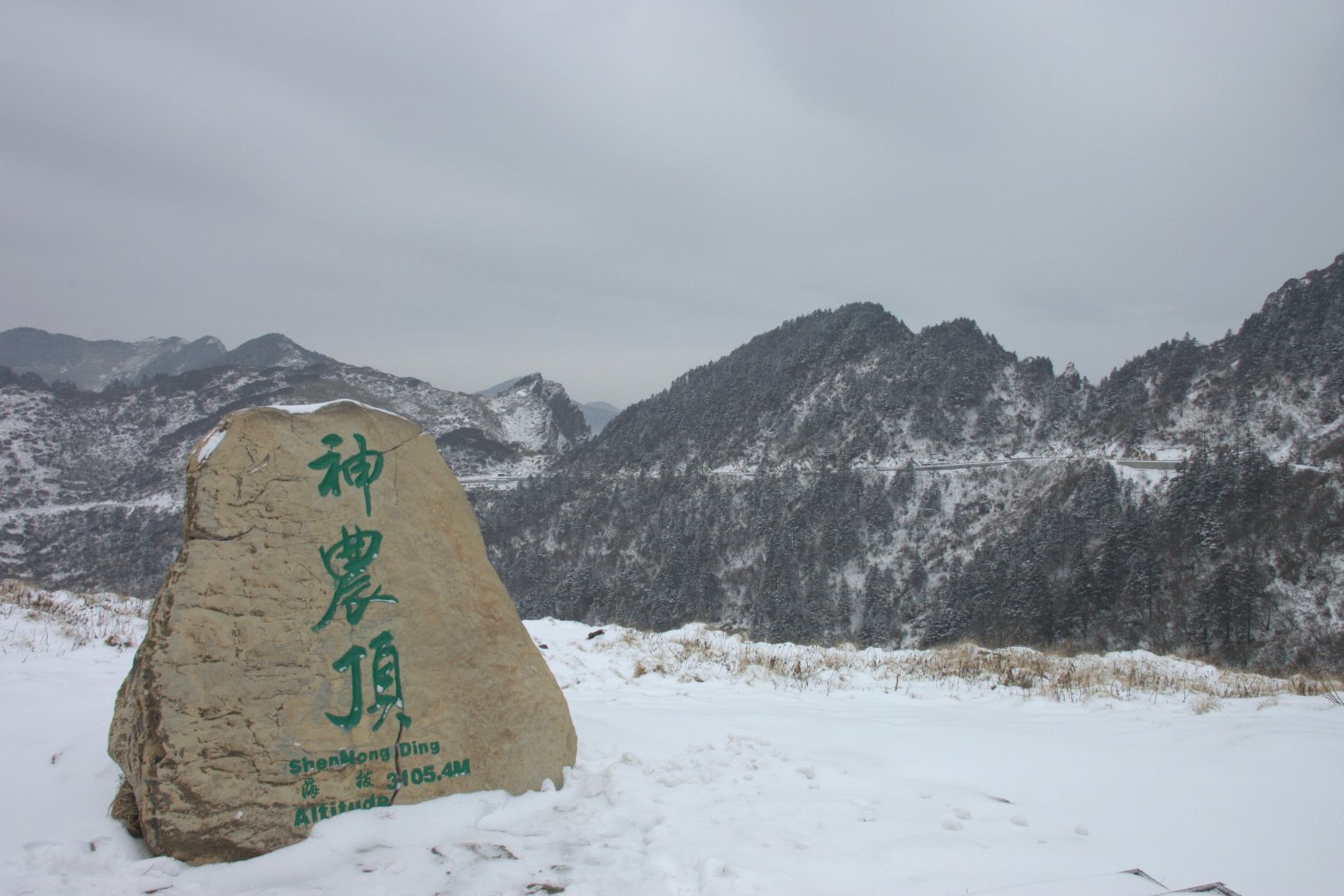
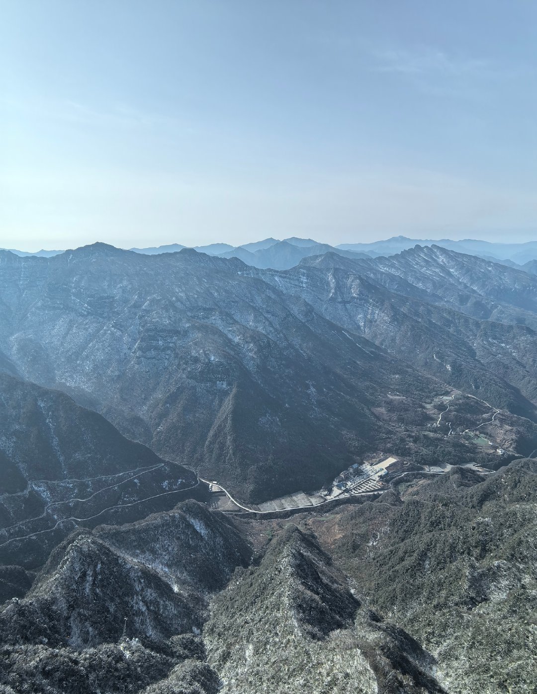
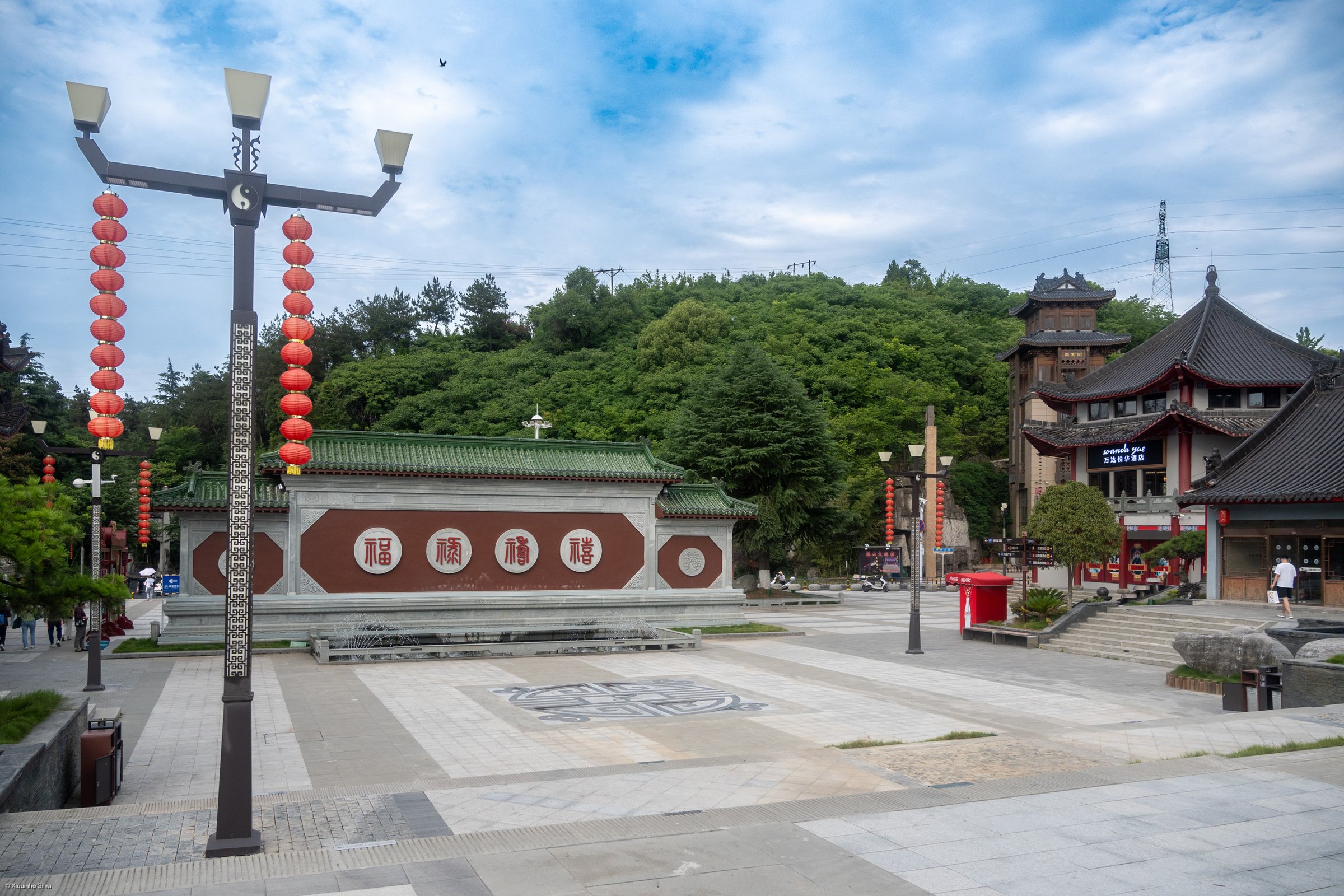
The main hiking season is spring to autumn. Winter can bring snow, ice, fog, and cableway or road closures. Most routes are inside the managed Wudangshan scenic area with tickets, buses, opening hours, crowd controls, temple access rules, and sometimes cableway dependencies.
Selection rationale
The five hikes balance the best-known Wudang summit ascent, the Nanyan-Golden Summit heritage traverse, a lower temple-and-forest walk linking Prince Slope / Xiaoyao Valley / Purple Heaven Palace, the Qiongtai-side Golden Summit approach, and a longer, less central Five Dragons Temple ancient-path route. AllTrails provides current source-map statistics for several routes; other route geometry remains source-map only and should be checked against the current scenic-area map before publication.
Summary table
| # | Hike | Country | Route type | Distance | Gain | Max elevation | Difficulty | Photo status |
|---|---|---|---|---|---|---|---|---|
| 1 | Nanyan Palace to Golden Summit via the sacred stairs | China | Point-to-point stair ascent | 3.1 km by AllTrails | 660 m by AllTrails | Approx. 1,509 m by AllTrails app metadata; Golden Summit high point needs official cross-check | Hard | Commons image verified |
| 2 | Golden Summit to Nanyan heritage traverse | China | Point-to-point | 4.3 km by AllTrails | 133 m by AllTrails | Approx. 1,539 m by AllTrails app metadata | Moderate | Commons image verified |
| 3 | Prince Slope, Xiaoyao Valley and Purple Heaven Palace walk | China | Shuttle-assisted linked short walks | Approx. 4-7 km linked day; exact total unresolved | Easy-moderate | Commons image verified | ||
| 4 | Qiongtai to Golden Summit stair and cableway-parallel route | China | Point-to-point / lift-assisted option | Approx. 2-4 km walking | Approx. 500-700 m if climbed on foot | Golden Summit / Tianzhu Peak area; exact route high point unresolved | Moderate-hard | Commons image verified |
| 5 | Five Dragons Temple via Wu Long Path | China | Out-and-back | 13.4 km by AllTrails | 1,014 m by AllTrails | Hard | Commons image verified |
1. Nanyan Palace to Golden Summit via the Sacred Stairs

Snapshot
Itinerary
From the Nanyan / South Cliff area, follow the signed sacred-road stair route toward Chaotian Palace, the gate sections below the summit, Taihe Palace, and the Golden Hall / Golden Summit complex. The path is mainly paved stone stairs and temple approach paths, with vendors, rest points, and toilets reported on the busier scenic route.
AllTrails lists the route as 3.1 km with 660 m of ascent and 1.5-2 hours, which matches the steep stair-ascent character described in recent trail reviews. The public AllTrails page identifies the route as partially paved, with forests, views, historic sites, and Golden Summit top sights.
Why it is essential
This is the classic Wudang pilgrimage-style ascent: forested stone stairways, Taoist gates and palaces, cliff views, and the Golden Summit at the sacred centre of the mountain.
Equipment
Sturdy walking shoes with good grip, water, sun and rain protection, warm layer outside summer, and a small headlamp if starting early. Trekking poles help knees on the descent if permitted and not disruptive on crowded stairs.
Hazards and notes
The route is physically strenuous because of repeated steep stairs. Wet stone is slippery, and the summit area can be crowded. Fog can remove views, and winter ice can make the stairs unsafe. Keep to open scenic-area paths and observe temple rules.
GPX / KML links
| Source | URL | Format | Licence / terms | Reuse status |
|---|---|---|---|---|
| AllTrails: Wudang Mountains | alltrails.com | Source map / route page | AllTrails terms apply; OSM/Mapbox/Maxar map credits shown | Source-map only; no public GPX reuse confirmed |
| OpenStreetMap search: Wudang Golden Summit | openstreetmap.org | Map/search | OSM data is ODbL | Geometry cross-check only |
External links
- AllTrails — Wudang Mountains route
- UNESCO World Heritage Centre — Ancient Building Complex in the Wudang Mountains
- China Daily — Wudang scenic spot overview
2. Golden Summit to Nanyan Heritage Traverse
Snapshot
Itinerary
This route follows the high Wudang heritage path between the Golden Summit / Taihe Palace side and the Nanyan area. AllTrails records it as a 4.3 km point-to-point trail with 133 m of ascent and a 2-2.5 hour walking time. User reports on the page describe stone pathways, many stairs, temple gates, and the South Cliff / Nanyan village area as the practical end of the route.
Walkers can combine this route with the summit ascent or use scenic-area buses and cableway logistics to avoid a full out-and-back day.
Why it is essential
The route links Wudang’s most important summit temple complex with the dramatic Nanyan cliff-palace area, making it the most useful heritage traverse for visitors who want walking rather than only shuttle-bus sightseeing.
Equipment
Sturdy shoes, water, rain shell, warm layer, and knee-friendly descent support if you use poles. Carry cash or mobile payment access for water and food where vendors are open.
Hazards and notes
Expect repeated stair climbs and descents rather than a smooth contour path. Wet stone and autumn leaf litter can be slippery. The route depends on scenic-area opening hours and ticket controls.
GPX / KML links
| Source | URL | Format | Licence / terms | Reuse status |
|---|---|---|---|---|
| AllTrails: Wudang Mountains to Nanyan | alltrails.com | Source map / route page | AllTrails terms apply; OSM/Mapbox/Maxar map credits shown | Source-map only; no public GPX reuse confirmed |
| OpenStreetMap search: Wudang Nanyan | openstreetmap.org | Map/search | OSM data is ODbL | Geometry cross-check only |
External links
3. Prince Slope, Xiaoyao Valley and Purple Heaven Palace Walk
Snapshot
Itinerary
Use the scenic-area bus corridor to link the lower and mid-level heritage stops: Prince Slope / Fuzhen Temple, Xiaoyao Valley, and Purple Heaven Palace / Zixiao Palace. The walking is made of short temple approaches, forested paved paths, stairs, and valley-side paths rather than one single published long trail.
AllTrails verifies a short Purple Cloud Temple out-and-back at 0.3 mi / 0.5 km with 72 ft / 22 m gain and a 0.5-1 hour estimate. The rest of the linked day remains approximate until a current scenic-area walking map is obtained.
Why it is essential
This is the best lower-impact Wudang walking day for Taoist architecture, forest atmosphere, and valley scenery without requiring the full Golden Summit stair ascent.
Equipment
Comfortable walking shoes, rain protection, water, sun protection, and a layer for shaded temple courtyards in cool seasons.
Hazards and notes
This route has fewer mountain hazards than the summit stairs, but stone steps can still be slick after rain. Avoid treating closed side paths as public trails. Monkeys or other wildlife should not be fed.
GPX / KML links
| Source | URL | Format | Licence / terms | Reuse status |
|---|---|---|---|---|
| AllTrails: Purple Cloud Temple | alltrails.com | Source map / route page | AllTrails terms apply | Source-map only for the short Purple Heaven Palace component |
| OpenStreetMap search: Prince Slope Xiaoyao Valley Purple Heaven Palace | openstreetmap.org | Map/search | OSM data is ODbL | Geometry cross-check only |
External links
- AllTrails — Purple Cloud Temple
- UNESCO World Heritage Centre — Wudang Mountains
- China Daily — Wudang scenic spot overview
4. Qiongtai to Golden Summit Stair and Cableway-Parallel Route
Snapshot
Itinerary
The Qiongtai side gives an alternative approach to the Golden Summit, using the cableway corridor and stair paths around Qiongtai Palace and the upper Golden Summit zone. It can be walked as a climb if the pedestrian route is open, or used as a lift-assisted descent after the Nanyan-Golden Summit walk.
Current public route-file data was not found in this pass. Treat the numbers above as planning estimates until verified from the scenic-area map or a field-recorded GPX.
Why it is essential
Qiongtai is the practical second gateway to Wudang’s Golden Summit. Including it gives the catalogue a summit route that can be adapted for weather, time, knee strain, and one-way shuttle/cableway logistics.
Equipment
Sturdy shoes, water, rain shell, warm layer, and cash/mobile payment for cableway or shuttle needs.
Hazards and notes
Do not assume the walking route is open just because the cableway is operating. Stairs can be steep and crowded near the summit. Weather can close the cableway or make the high stairs unsafe.
GPX / KML links
| Source | URL | Format | Licence / terms | Reuse status |
|---|---|---|---|---|
| OpenStreetMap search: Qiongtai Golden Summit Wudang | openstreetmap.org | Map/search | OSM data is ODbL | Geometry cross-check only |
| Wudang Mountain travel guide route overview | chinamountaintravel.com | Guide/source page | No route-file licence found | Planning context only |
External links
- UNESCO World Heritage Centre — Wudang Mountains
- China Mountain Travel — Wudang Mountain route overview
5. Five Dragons Temple via Wu Long Path
Snapshot
Itinerary
The route follows the Wu Long Path toward the Five-Dragon Temple / Wulonggong ruins area, passing forest, river and historic-site features shown on the AllTrails source map. AllTrails lists 13.4 km, 1,014 m of gain, and 6-6.5 hours, making this the longest and most strenuous route in this Wudang set.
Because this route is less central than the main scenic-area stair circuits, check whether the access path, bridges and temple-ruin area are open before relying on it as a catalogue route.
Why it is essential
Five Dragons Temple adds a quieter ancient-route and forest-valley dimension to Wudang, balancing the more crowded Golden Summit and Nanyan walks.
Equipment
Full day-hike kit: sturdy shoes, rain shell, warm layer, 1.5-2 litres water, food, offline map, power bank, first-aid basics, and traction if cold-season ice is possible.
Hazards and notes
The main hazards are distance, cumulative ascent, possible low traffic, river/bridge conditions, and unclear current access. Do not enter closed heritage or conservation areas.
GPX / KML links
| Source | URL | Format | Licence / terms | Reuse status |
|---|---|---|---|---|
| AllTrails: Five Dragons Temple via Wu Long Path | alltrails.com | Source map / route page | AllTrails terms apply; OSM/Mapbox/Maxar map credits shown | Source-map only; no public GPX reuse confirmed |
| OpenStreetMap search: Five Dragons Temple Wudang | openstreetmap.org | Map/search | OSM data is ODbL | Geometry cross-check only |
External links
- AllTrails — Five Dragons Temple via Wu Long Path
- UNESCO World Heritage Centre — Wudang Mountains
- China Daily — Wudang scenic spot overview
External links
| Source | URL |
|---|---|
| UNESCO World Heritage Centre — Ancient Building Complex in the Wudang Mountains | whc.unesco.org |
| UNESCO State of Conservation page — Wudang Mountains | whc.unesco.org |
| China Daily — Travel in Wudang Mountains | chinadaily.com.cn |
| AllTrails — Wudang Mountains | alltrails.com |
| AllTrails — Wudang Mountains to Nanyan | alltrails.com |
| AllTrails — Purple Cloud Temple | alltrails.com |
| AllTrails — Five Dragons Temple via Wu Long Path | alltrails.com |