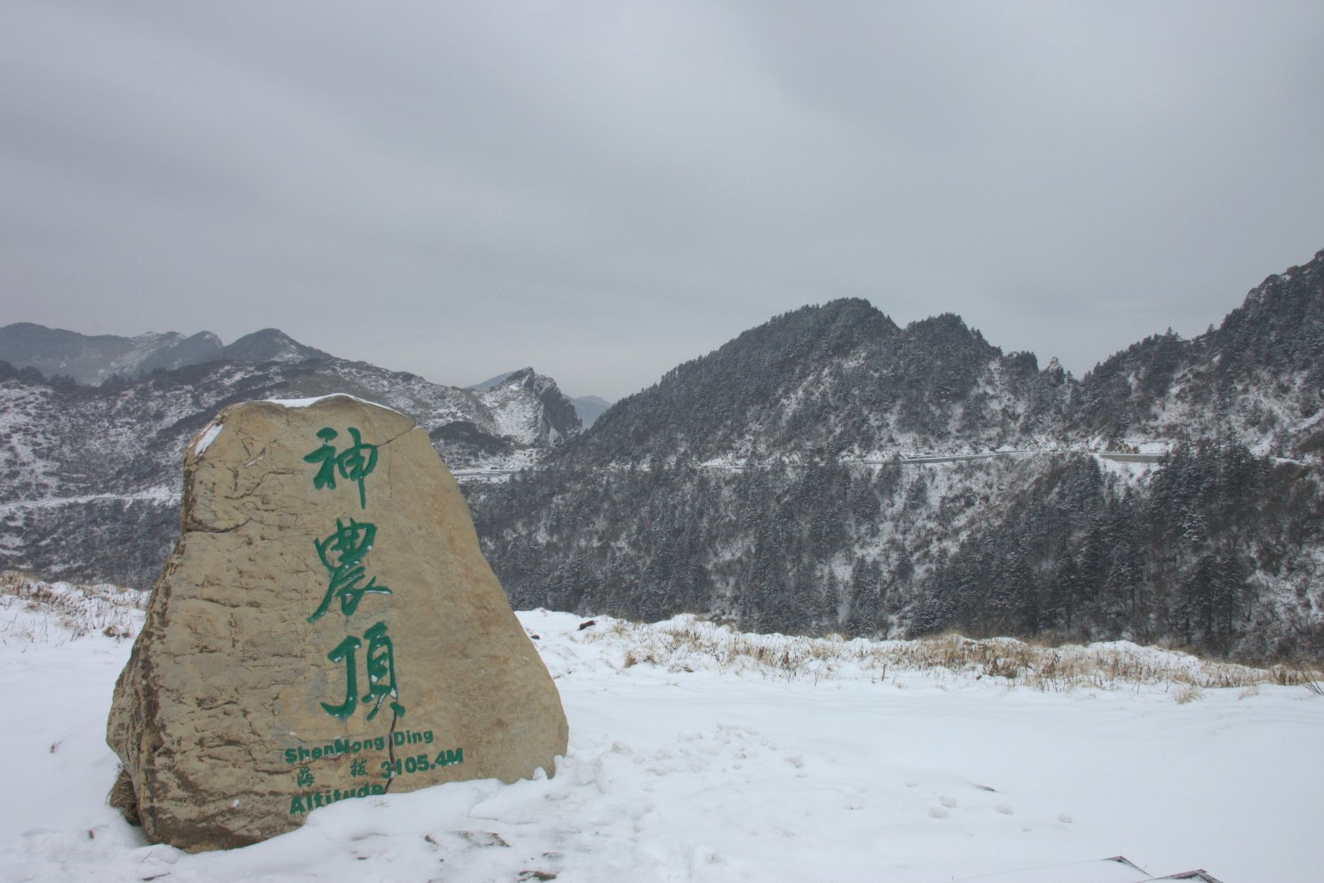
Regional overview
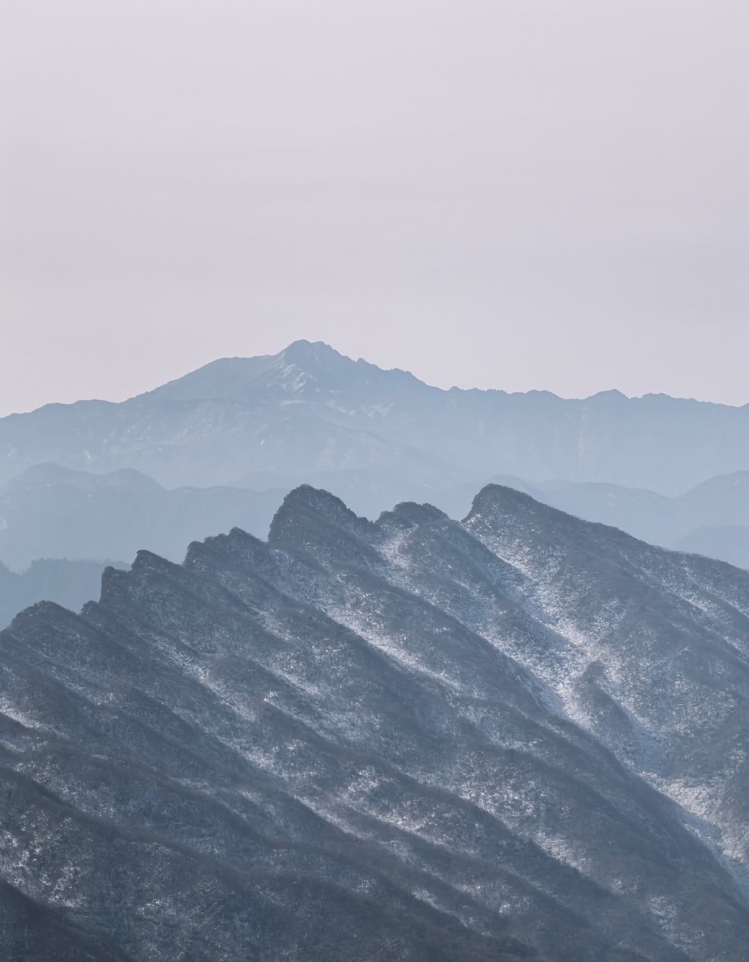
The Micang Shan region forms the western Daba Mountains along the Shaanxi-Sichuan divide, between the Hanzhong basin and the northern edge of the Sichuan Basin. The walking character is a mixture of managed scenic-area paths, forest-boardwalk circuits, waterfall gorges, high cliff walks, ancient-road fragments, and autumn foliage routes rather than open alpine trekking.
Guangwu Mountain / Micangshan, Eighteen Moon Lake, Liping National Forest Park, and Hanzhong Longtoushan are the strongest day-hiking anchors found in this pass. The region is notable for beech and mixed broadleaf forest, red-leaf tourism, granite and karst gorges, waterfalls, cliff plank roads, cloud-sea viewpoints, and the cultural layer of the Micang Ancient Road.
The main season is late spring to autumn, with October-November especially important for red leaves. Winter can bring snow, ice, closed plank roads, and ski-area operations at higher sites. Most routes are inside ticketed scenic areas with shuttle buses, cableways, opening hours, and seasonal controls; current scenic-area notices should be checked before travel.
Selection rationale
The five hikes balance the core Guangwu / Micangshan high viewpoint, an ancient-road and karst valley walk, the best-known waterfall-pool route, a Shaanxi-side forest-geology route at Liping, and a high cliff-boardwalk route at Longtoushan. Exact walking-only GPX data is scarce, so most route files are source-map links rather than reusable official downloads.
Summary table
| # | Hike | Country | Route type | Distance | Gain | Max elevation | Difficulty |
|---|---|---|---|---|---|---|---|
| 1 | Micangshan Xianglu Mountain, Natural Gallery and Black Bear Gully | China | Shuttle-assisted loop / out-and-back segments | Approx. 6-10 km walking; exact total unresolved | Main Guangwu summit area approx. 2,500 m; Xianglu high point unresolved | Moderate | |
| 2 | Guangwu Mountain Taoyuan and Micang Ancient Road | China | Scenic-area loop / ancient-road fragment | Approx. 4-8 km | Moderate | ||
| 3 | Eighteen Moon Lake / Shibayue Tan Waterfall Walk | China | Out-and-back / linear gorge walk | Approx. 3.5 km core gorge; longer with access | Easy-moderate | ||
| 4 | Liping National Forest Park: Jianxia, Yudai River, Fenglin Waterfall and Chinese Dragon Mountain | China | Shuttle-assisted scenic-area traverse | Approx. 6-12 km walking; exact total unresolved | Over 2,000 m park high points; route high point unresolved | Moderate | |
| 5 | Hanzhong Longtoushan Cloud Plank Road Loop | China | Lift-assisted high plank-road loop | 3.5 km core plank-road loop | Limited; lift removes most ascent | 2,336 m main peak; plank road around 2,200 m | Easy-moderate, exposed |
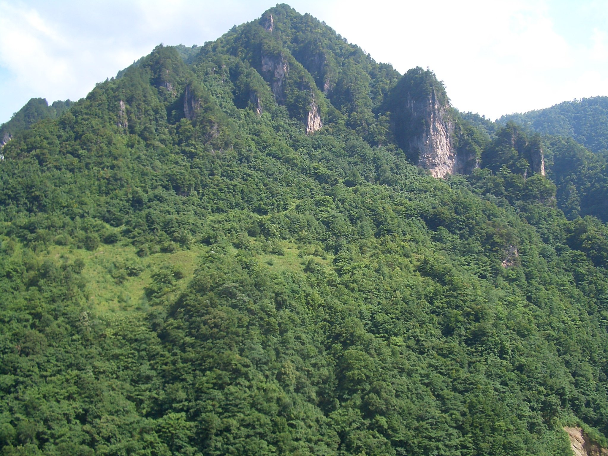
1. Micangshan Xianglu Mountain, Natural Gallery and Black Bear Gully
Snapshot
Itinerary
The route uses the Guangwu Mountain / Micangshan scenic-area transport system to link the Natural Gallery forest section, Black Bear Gully, and the Xianglu Mountain viewpoint area. The walking is primarily on managed paths, boardwalks, stone steps, and short gorge or forest sections rather than a continuous open mountain trail.
Black Bear Gully is listed by the Guangwu Mountain-Nuoshui River geopark as a structural gorge about 2 km long. Xianglu Mountain is repeatedly identified by regional travel sources as a key cloud-sea, red-leaf and rhododendron viewpoint within the Micangshan area.
Why it is essential
This is the strongest representative hike for the Micangshan red-leaf forest and high viewpoint character, combining forest, gorge, cloud-sea outlooks, and the main Guangwu / Micangshan scenic identity.
Equipment
Standard hiking equipment, with sturdy shoes for wet boardwalks and stone steps. Carry a warm layer for high viewpoints, rain protection, water, sun protection, and traction if winter ice is reported.
Hazards and notes
Red-leaf season is crowded and access may be controlled by shuttle queues. Stone and wooden paths can be slippery after rain. Fog can remove views from Xianglu Mountain. Check official scenic-area notices for winter, fire-prevention, and storm closures.
GPX / KML links
| Source | URL | Format / access | Reuse status |
|---|---|---|---|
| OpenStreetMap search: Micangshan Xianglu Mountain | openstreetmap.org | Map/search | OSM data is ODbL; geometry cross-check only |
| Guangwu Mountain-Nuoshui River geopark geological heritage page | gws-nshdzgy.demo.cnbz.sc.cn | Source page | No route-file licence found; scenic-feature verification only |
External links
- Guangwu Mountain Scenic Area overview — China Daily / government portal
- Sichuan Geological Society — Guangwu Mountain-Nuoshui River Geopark summary
- Guangwu Mountain-Nuoshui River geopark — geological heritage list
- BH2255 — Guangwu Mountain travel guide
2. Guangwu Mountain Taoyuan and Micang Ancient Road
Snapshot
Itinerary
The Taoyuan-side walk explores the Guangwu Mountain sector closest to Guangwushan Town, using scenic-area paths around karst and peak-cluster scenery and fragments associated with the Micang Ancient Road. Planning documents and regional sources identify the Micang Ancient Road as a cultural feature running through the Guangwu-Nuoshui geopark; Baidu Baike records a middle branch through Cherry Valley and Hanxi Gorge toward Shaanxi and Hanzhong.
The exact legal day-hike geometry varies by the currently open scenic-area paths, so this entry should be used as a Taoyuan / ancient-road walking day rather than a fixed GPX route until a current park map is obtained.
Why it is essential
This hike gives the Micang Shan entry its historical layer: the old route between Hanzhong, Ba-Shu, and the Sichuan Basin, alongside the region’s karst, gorge and forest scenery.
Equipment
Standard hiking equipment. Use grippy footwear for stone steps and wet rock, and carry water, rain protection, and a map or offline navigation.
Hazards and notes
Only use open scenic-area paths. Historic-road fragments can be discontinuous or reconstructed, and closed old paths should not be treated as public hiking routes. Summer storms and autumn crowds are common planning issues.
GPX / KML links
| Source | URL | Format / access | Reuse status |
|---|---|---|---|
| OpenStreetMap search: Guangwu Mountain Taoyuan | openstreetmap.org | Map/search | OSM data is ODbL; geometry cross-check only |
| Guangwu Mountain planning PDF | lcj.sc.gov.cn | Planning source | Government PDF; route-file reuse not stated; planning/context only |
External links
- Guangwu Mountain Scenic Area overview
- Sichuan Geological Society — geopark summary
- Baidu Baike — Longtoushan / Micang Ancient Road background
3. Eighteen Moon Lake / Shibayue Tan Waterfall Walk
Snapshot
Itinerary
The route follows the Pearl Gully / Shibayue Tan gorge, where local tourism information describes eighteen named pools distributed through a gorge about 3.5 km long. The usual walk links the pools and waterfalls on constructed paths, with red-leaf forest above the watercourse in autumn.
This is a compact scenic waterfall walk rather than a mountain summit route. Depending on traffic controls, visitors may have to use scenic buses or walk only the open pedestrian section.
Why it is essential
Eighteen Moon Lake is the clearest water-and-red-leaf walk in the Micang Shan region, balancing the high forest viewpoints of Xianglu Mountain with a lower gorge, pool and waterfall route.
Equipment
Walking shoes with wet-rock grip, rain layer, water, warm layer outside midsummer, and camera protection in wet conditions.
Hazards and notes
Wet stone, narrow boardwalks, crowding, and autumn traffic controls are the main issues. Heavy rain can make gorges more hazardous; check scenic-area status before departure.
GPX / KML links
| Source | URL | Format / access | Reuse status |
|---|---|---|---|
| OpenStreetMap search: Eighteen Moon Lake Guangwu Mountain | openstreetmap.org | Map/search | OSM data is ODbL; geometry cross-check only |
External links
- Sichuan Geological Society — Guangwu Mountain-Nuoshui River geopark summary
- Chengdu Bendibao — Eighteen Moon Lake route note (3.5 km Pearl Gully)
- Guangwu Mountain Scenic Area overview
4. Liping National Forest Park: Jianxia, Yudai River, Fenglin Waterfall and Chinese Dragon Mountain
Snapshot
Itinerary
The day links the main Liping scenic stops: Jianxia Gorge, Yudai River, Fenglin Waterfall, Chinese Dragon Mountain / Zhonghua Longshan, Haidi Shicheng and Hongchenxia-style gorge sections where open. Sources describe Liping as a high forest, meadow, stream and geological landscape area with shuttle-assisted sightseeing between the core sites.
The best publication-ready version needs a current park map because walking distances between shuttle stops and open paths are not consistently published in accessible sources.
Why it is essential
Liping represents the Shaanxi side of the Micang Shan: forested gorges, high meadows, waterfall walking, and unusual geologic formations reached from the Hanzhong side rather than the Sichuan side.
Equipment
Standard hiking equipment with grippy shoes, rain layer, water, sun protection, and a warm layer for higher forest areas.
Hazards and notes
Gorge paths can be slippery after rain. Verify shuttle schedules and open areas before committing to a full traverse. Some online route descriptions are tour itineraries rather than GPS-grade hiking data.
GPX / KML links
| Source | URL | Format / access | Reuse status |
|---|---|---|---|
| OpenStreetMap search: Liping National Forest Park Hanzhong | openstreetmap.org | Map/search | OSM data is ODbL; geometry cross-check only |
External links
- Lvyounk — Liping National Forest Park overview and suggested scenic sequence
- Youletour — Liping travel overview
- Tianya Outdoors — Guangwu / Liping itinerary source
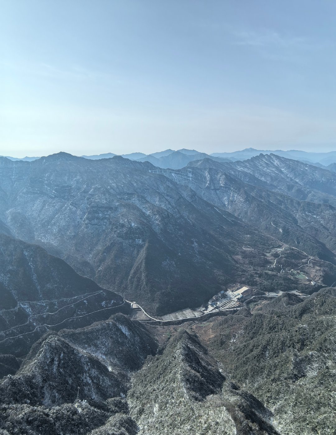
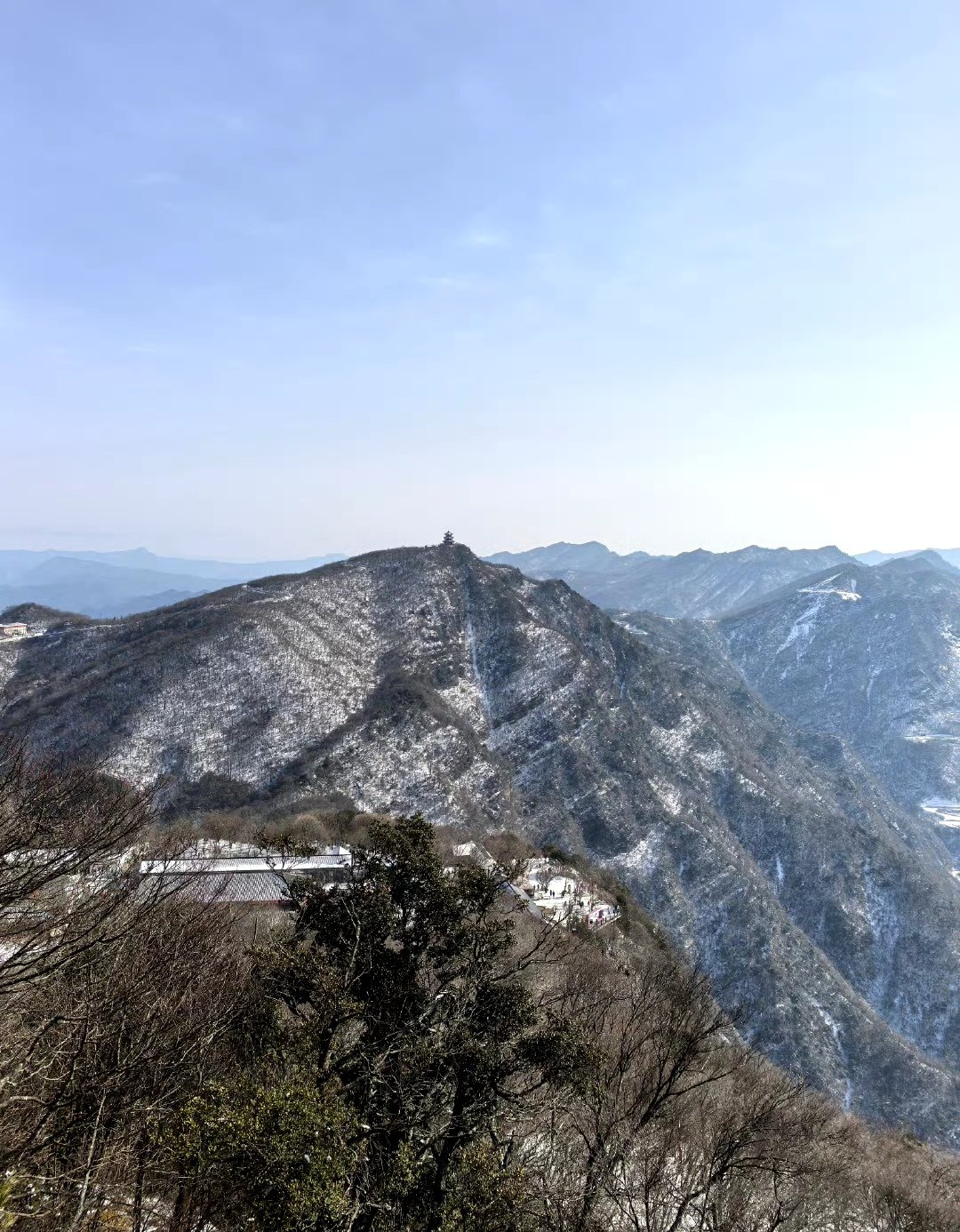
5. Hanzhong Longtoushan Cloud Plank Road Loop
Snapshot
Itinerary
Use the scenic-area cableway and mountain transport to reach the high Longtou Cloud Plank Road. The upgraded plank road is reported as a 3.5 km one-way loop with upper and lower levels, forest walking, cliff sections, sunrise/sunset viewpoints and high cloud-sea outlooks.
This is a high scenic-boardwalk day rather than a wilderness summit climb. The route can be extended within the scenic area, but only the 3.5 km cloud plank road is sufficiently clear from current sources.
Why it is essential
Longtoushan is one of the most accessible high Micang Shan cliff walks on the Shaanxi side, with a strong cloud-sea and high-boardwalk identity and a direct connection to the Micang Ancient Road landscape.
Equipment
Comfortable walking shoes with grip, windproof layer, warm layer, sun protection, water, and traction in winter if ice is reported.
Hazards and notes
Exposure is present on cliff and glass sections, though these are managed scenic-area structures. Cableway, escalator, glass walkway and winter snow operations can change with weather. Do not enter closed cliff paths.
GPX / KML links
| Source | URL | Format / access | Reuse status |
|---|---|---|---|
| OpenStreetMap search: Hanzhong Longtoushan | openstreetmap.org | Map/search | OSM data is ODbL; geometry cross-check only |
| Longtoushan official website | ltsdjq.com | Scenic-area source page | No route-file licence found; access/scenic context only |
External links
- Xixi News — Longtoushan source, 3.5 km Cloud Plank Road and 2,336 m peak
- Baidu Baike — Longtoushan overview, route infrastructure and Micang Ancient Road context
- Longtoushan official website
External links
| Source | URL |
|---|---|
| China Daily — Guangwu Mountain Scenic Area | govt.chinadaily.com.cn |
| Sichuan Geological Society — Guangwu Mountain-Nuoshui River Geopark | scdzxh.org.cn |
| Guangwu Mountain-Nuoshui River geopark — heritage list | gws-nshdzgy.demo.cnbz.sc.cn |
| Chengdu Bendibao — Eighteen Moon Lake | m.cd.bendibao.com |
| Lvyounk — Liping National Forest Park | lvyounk.com |
| Youletour — Liping | youletour.com |
| Xixi News — Longtoushan | xixinews.com |
| Baidu Baike — Longtoushan | bkso.baidu.com |