Regional overview
Shennongjia is the highest and most biodiverse part of the Daba Mountains, a forested massif in western Hubei with the “Roof of Central China” at Shennong Peak / Shennongding. UNESCO identifies the World Heritage property as including Shennongding / Badong and Laojunshan components, protecting the largest remaining primary forests in Central China and habitat for rare species including golden snub-nosed monkey and Chinese giant salamander.
The walking character is mostly managed scenic-area walking: high road access, boardwalk loops, stair climbs, gorge paths, cave loops, wetland boardwalks, and forest education trails. True backcountry traverses exist in hiking culture, but publication-ready day hikes should stay within legal public scenic areas unless current permits and local access rules are confirmed.
The main season is May-October. Weather changes quickly with altitude, and fog, rain, snow, ice, and road closures can affect even short scenic walks. The region has sensitive protected-area rules; do not enter unopened forest, research zones, or wildlife habitat beyond public paths.
Selection rationale
The five hikes represent the central Shennongjia walking spectrum: the high Shennongding / Shennong Valley core, monkey-habitat forest at Golden Monkey Ridge, Dajiuhu high wetland, Tianyan cave-and-forest walking, and lower Muyu-side water/forest walks. Several AllTrails source routes exist for short scenic loops; Shennongding itself is verified by official and UNESCO sources but current clean walking-only GPX remains unresolved.
Summary table
| # | Hike | Country | Route type | Distance | Gain | Max elevation | Difficulty |
|---|---|---|---|---|---|---|---|
| 1 | Shennongding and Shennong Valley High View Walk | China | Shuttle-assisted high scenic walk | Approx. 4.3 km for Shennong Valley source route; Shennongding stair variant unresolved | 3,106.2 m at Shennong Peak | Moderate-hard | |
| 2 | Golden Monkey Ridge Forest and Waterfall Walk | China | Out-and-back / short loop | Approx. 2-4 km; exact route unresolved | Golden Monkey Ridge reported up to 3,019 m | Moderate | |
| 3 | Dajiuhu Wetland Boardwalk Circuit | China | Wetland boardwalk / shuttle-assisted circuit | Approx. 5-10 km depending lakes visited | Low | Approx. 1,700 m | Easy-moderate |
| 4 | Tianyan: Wild Men Cave and Swallow Cave Loop | China | Loop | 2.3 km | 150 m | 2,209 m | Moderate |
| 5 | Xiangxiyuan, Guanmenshan and Shennong Altar Short Walks | China | Linked short walks | 1.0 km Xiangxiyuan loop; longer linked day unresolved | 69 m on Xiangxiyuan loop | 1,384 m on AllTrails Xiangxiyuan loop | Easy-moderate |
1. Shennongding and Shennong Valley High View Walk

Snapshot
Itinerary
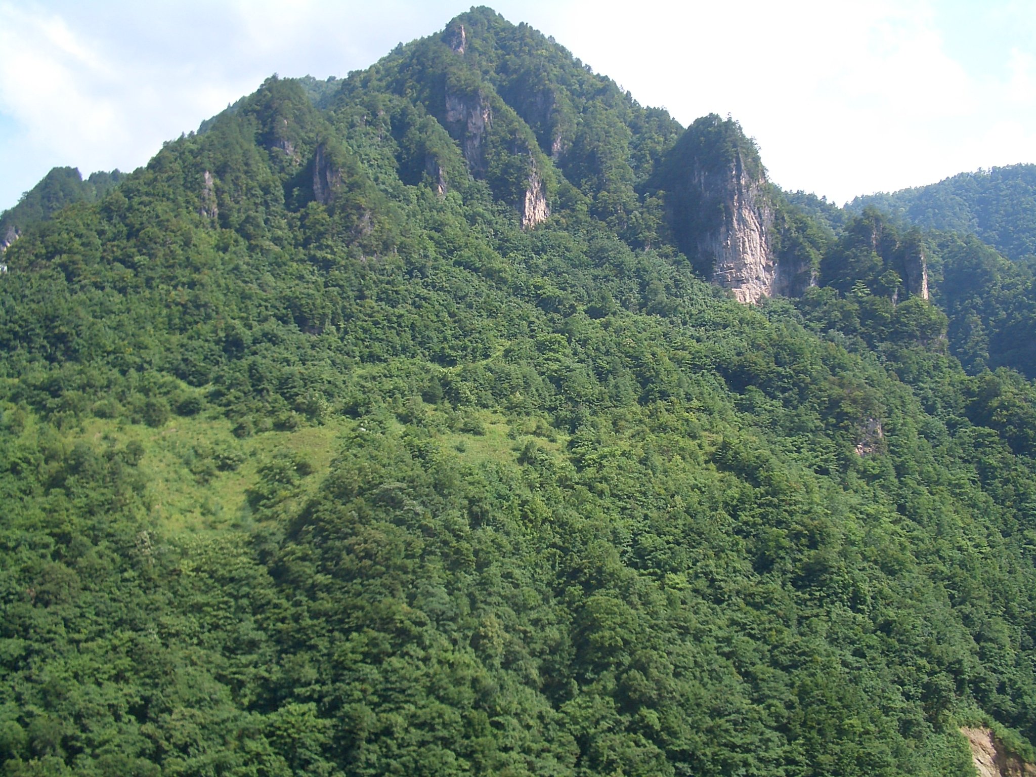
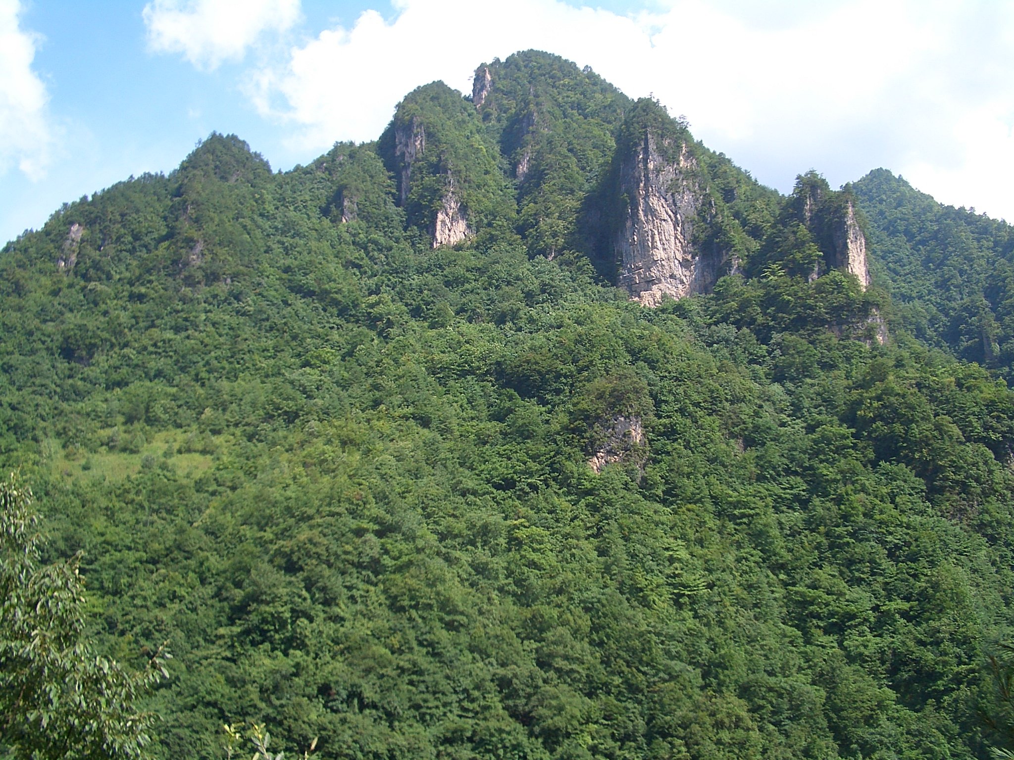
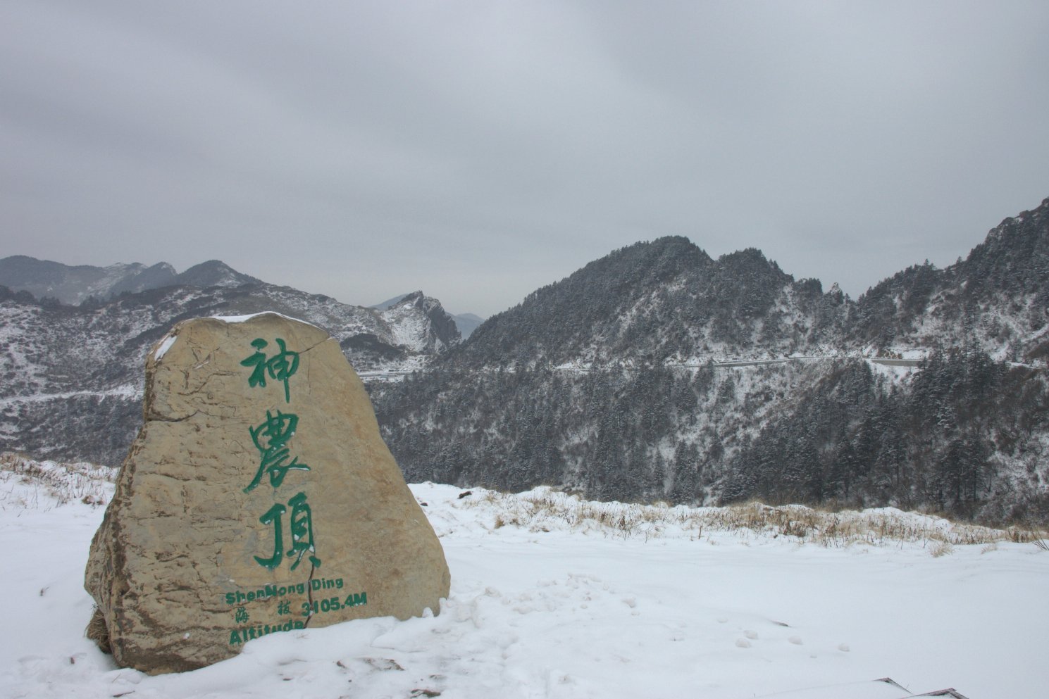
The route uses the Shennongding Scenic Area road system to reach the high mountain zone, then follows open public paths to Shennong Valley viewpoints, Banbi Rock / Banbiyan-style rock forest stops, and any currently open Shennongding summit or viewing-station stair section. UNESCO identifies Shennong Peak as 3,106.2 m, the highest peak in Central China.
Older Chinese reports describe a 2,999-step climb to Shennongding, but current hiking-tour sources indicate summit access has been restricted or changed in recent years. Treat the summit-stair component as unresolved until verified from the Shennongjia scenic-area operator.
Why it is essential
This is the defining high-elevation Shennongjia walk: Central China’s highest summit area, cloud forest, alpine meadow, limestone landforms, and the core landscape behind the region’s World Heritage status.
Equipment
Mountain hiking equipment: sturdy shoes, warm layer, waterproof/windproof shell, hat and gloves outside midsummer, water, snacks, sun protection, and traction if snow or ice is reported.
Hazards and notes
Fog, cold wind, thunderstorms, ice, road closures and restricted access are the main hazards. Stay within open scenic-area paths and do not enter research or wildlife protection zones.
GPX / KML links
| Source | URL | Format / access | Reuse status |
|---|---|---|---|
| OpenStreetMap search: Shennongding | openstreetmap.org | Map/search | OSM data is ODbL; geometry cross-check only |
| Wikiloc Shennongjia car/source route | wikiloc.com | Route page / GPS track | Wikiloc terms apply; source-map only; not a walking-only route |
External links
- UNESCO World Heritage — Hubei Shennongjia
- UNESCO Global Geopark — Shennongjia
- LoongWander — Shennongjia tourism overview
- Hubei media report on the 2,999 steps
2. Golden Monkey Ridge Forest and Waterfall Walk

Snapshot
Itinerary
The walk explores the Jinhouling forest and waterfall area, one of the best-known public stops associated with Shennongjia’s golden snub-nosed monkey habitat. The route follows managed forest paths rather than entering restricted habitat. Depending on opening rules, it can be paired with Shennong Valley and Banbiyan stops in the same day.
Why it is essential
Golden Monkey Ridge gives the catalogue a biodiversity-focused forest hike tied directly to Shennongjia’s protected-species reputation and World Heritage value.
Equipment
Standard to mountain hiking equipment: grippy shoes, rain layer, warm layer, water, and insect/tick protection in warm wet periods.
Hazards and notes
Do not approach, feed, or disturb wildlife. Paths can be wet and slippery. Access to sensitive monkey habitat may be controlled or redirected.
GPX / KML links
| Source | URL | Format / access | Reuse status |
|---|---|---|---|
| OpenStreetMap search: Golden Monkey Ridge Shennongjia | openstreetmap.org | Map/search | OSM data is ODbL; geometry cross-check only |
External links
- UNESCO World Heritage — Hubei Shennongjia
- Shennongjia National Park — Golden Monkey Ridge highlight page
- LoongWander — Shennongjia overview
3. Dajiuhu Wetland Boardwalk Circuit
Snapshot
Itinerary
The route follows the public Dajiuhu boardwalk and lake paths through the high wetland basin. LoongWander describes Dajiuhu as a nine-lake high mountain wetland at about 1,700 m and one of the core scenic areas included in the Shennongjia combined ticket.
The walking can be shortened to selected lakes or extended across multiple wetland stops, depending on current internal transport, boardwalk openings, and weather.
Why it is essential
Dajiuhu provides the wetland and meadow counterpart to Shennongjia’s forest and summit walks, representing one of the UNESCO Global Geopark subareas and a rare high wetland landscape in Central China.
Equipment
Standard hiking equipment, with windproof layer, sun protection, water, and warm clothing in shoulder seasons.
Hazards and notes
Stay on boardwalks to protect wetland vegetation. Fog, cold wind, thunderstorms, and icy boards can affect safety. Confirm internal transport and closing times.
GPX / KML links
| Source | URL | Format / access | Reuse status |
|---|---|---|---|
| OpenStreetMap search: Dajiuhu Wetland | openstreetmap.org | Map/search | OSM data is ODbL; geometry cross-check only |
External links
4. Tianyan: Wild Men Cave and Swallow Cave Loop

Snapshot
Itinerary
The loop passes through forest paths and boardwalks to Swallow Cave and Wild Men Cave, two Tianyan features tied to karst cave scenery and the region’s “Yeren” folklore. Visit Beijing’s Shennongjia Tianyan page describes Tianyan as a large scenic area themed around Shennong herb-gathering, wildlife, and wild-man research, with Yanziya and Tianmenya high passes around 2,200 m.
Why it is essential
This is the best sourced short cave-and-forest loop in Shennongjia, representing the Tianyan subarea and the folklore layer that has long shaped the region’s identity.
Equipment
Walking shoes with grip, rain layer, warm layer at altitude, water, and a headlamp only if entering any permitted dim cave sections where lighting is insufficient.
Hazards and notes
Cave entrances and wet boardwalks can be slippery. Do not enter closed cave areas. Fog and cold wind are common around high passes.
GPX / KML links
| Source | URL | Format / access | Reuse status |
|---|---|---|---|
| AllTrails: Wild Men Cave - Swallow Cave Loop | alltrails.com | Route page / source map | AllTrails terms apply; source geometry found; direct file reuse not confirmed |
| OpenStreetMap search: Tianyan Shennongjia | openstreetmap.org | Map/search | OSM data is ODbL; geometry cross-check only |
External links
- AllTrails — Wild Men Cave - Swallow Cave Loop
- Visit Beijing — Shennongjia Tianyan scenic area
- UNESCO Global Geopark — Tianyan subarea context
5. Xiangxiyuan, Guanmenshan and Shennong Altar Short Walks
Snapshot
Itinerary
Begin with the Xiangxiyuan Scenic Loop, a short forest-and-clear-water walk recorded by AllTrails. If time and access allow, link it with Guanmenshan, Shennong Altar and Tianshengqiao as a lower-elevation Muyu-area walking day. LoongWander identifies Guanmenshan, Shennong Altar and Tianshengqiao as core Shennongjia scenic areas included in the combined ticket.
Why it is essential
This hike gives the region a lower, accessible forest-water and cultural walking day, balancing the higher Shennongding and Dajiuhu routes.
Equipment
Standard hiking equipment: walking shoes, rain layer, water, sun protection, and insect protection in warm months.
Hazards and notes
Paths may be wet and slippery. The linked version depends on local vehicle transfers and scenic-area opening times. Protect aquatic habitats and do not enter closed research areas.
GPX / KML links
| Source | URL | Format / access | Reuse status |
|---|---|---|---|
| AllTrails: Xiangxiyuan Scenic Loop | alltrails.com | Route page / source map | AllTrails terms apply; source geometry found; direct file reuse not confirmed |
| OpenStreetMap search: Xiangxiyuan Shennongjia | openstreetmap.org | Map/search | OSM data is ODbL; geometry cross-check only |
External links
- AllTrails — Xiangxiyuan Scenic Loop
- LoongWander — Shennongjia tourism overview
- UNESCO World Heritage — Hubei Shennongjia
External links
| Source | URL |
|---|---|
| UNESCO World Heritage — Hubei Shennongjia | whc.unesco.org |
| UNESCO Global Geopark — Shennongjia | unesco.org |
| LoongWander — Shennongjia tourism overview | loongwander.com |
| Shennongjia National Park — Golden Monkey Ridge highlight | en.snjnationalpark.com |
| Visit Beijing — Shennongjia Tianyan scenic area | visitbeijing.com.cn |
| Hubei media report on the 2,999 steps | cnhubei.com |
| AllTrails — Wild Men Cave - Swallow Cave Loop | alltrails.com |
| AllTrails — Xiangxiyuan Scenic Loop | alltrails.com |
| AllTrails — Hongping Gallery Valley Loop | alltrails.com |
| Wikiloc — Shennongjia Dajiuhu to Shennongding source route | wikiloc.com |