


Regional overview
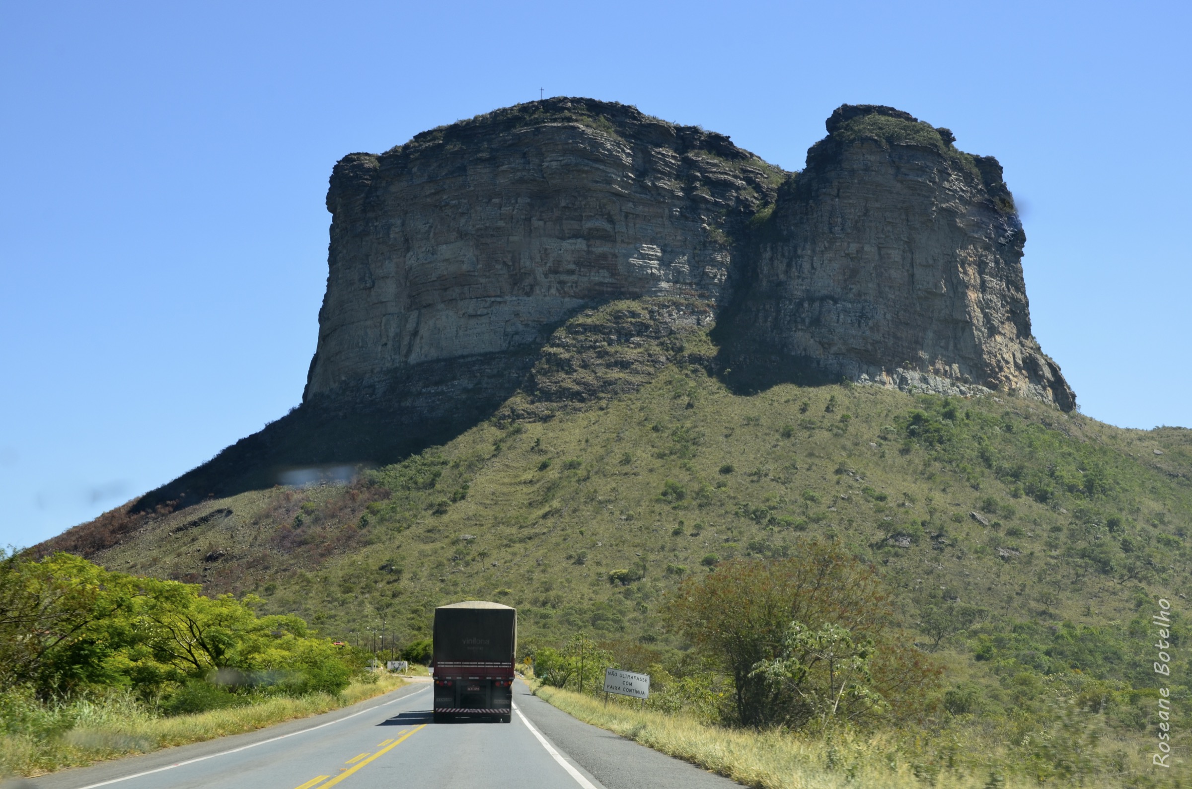
Chapada dos Veadeiros is a high Cerrado plateau in Goias, centred on Sao Jorge, Alto Paraiso de Goias and Cavalcante. The hiking character is dry-season waterfall walking over quartzite, open campo rupestre, gallery forest, rocky riverbeds and escarpment viewpoints. The national park is managed by ICMBio, with visitor services under concession, and the core park trail system starts from the Sao Jorge visitor centre on GO-239.
The best walking season is normally the dry season, roughly May to September, when river crossings and slippery rock slabs are less hazardous. The wet season brings stronger waterfalls but also flash-flood risk, muddy tracks, lightning and occasional temporary closures. Shade is limited on several routes; heat, sun exposure and water planning matter even on moderate distances.
Most access is by private vehicle, transfer or local tour from Alto Paraiso/Sao Jorge. Public transport exists to Alto Paraiso but is not a reliable trailhead solution for day planning. Several essential sights lie on private land outside the national park, so entry fees, access rules and opening hours should be checked locally.
Selection rationale
The selection combines the two flagship national-park waterfall trails, the classic Mirante da Janela view of the Rio Preto falls, the short but geologically distinctive Vale da Lua, and Catarata dos Couros as the major waterfall day outside the park. This gives waterfall, canyon, viewpoint, river-sculpted rock and off-park Cerrado coverage.
Summary table
| # | Hike | Country | Route type | Distance | Gain | Max elevation | Difficulty |
|---|---|---|---|---|---|---|---|
| 1 | Saltos, Carrossel and Corredeiras | Brazil | Out-and-back | 10.3–11 km | 373 m | 994 m | Moderate |
| 2 | Canions II and Cachoeira das Cariocas | Brazil | Out-and-back | 10.6–11 km | 225 m | 994 m | Moderate |
| 3 | Mirante da Janela and Cachoeira do Abismo | Brazil | Out-and-back | 12.2 km | 445 m | 1,088 m | Moderate |
| 4 | Vale da Lua | Brazil | Out-and-back | c. 1–2 km | Not verified | Not verified | Easy |
| 5 | Catarata dos Couros | Brazil | Out-and-back / informal circuit | c. 5–7 km walking component; sources vary | Not verified | Not verified | Moderate |
1. Saltos, Carrossel and Corredeiras

Snapshot
Itinerary
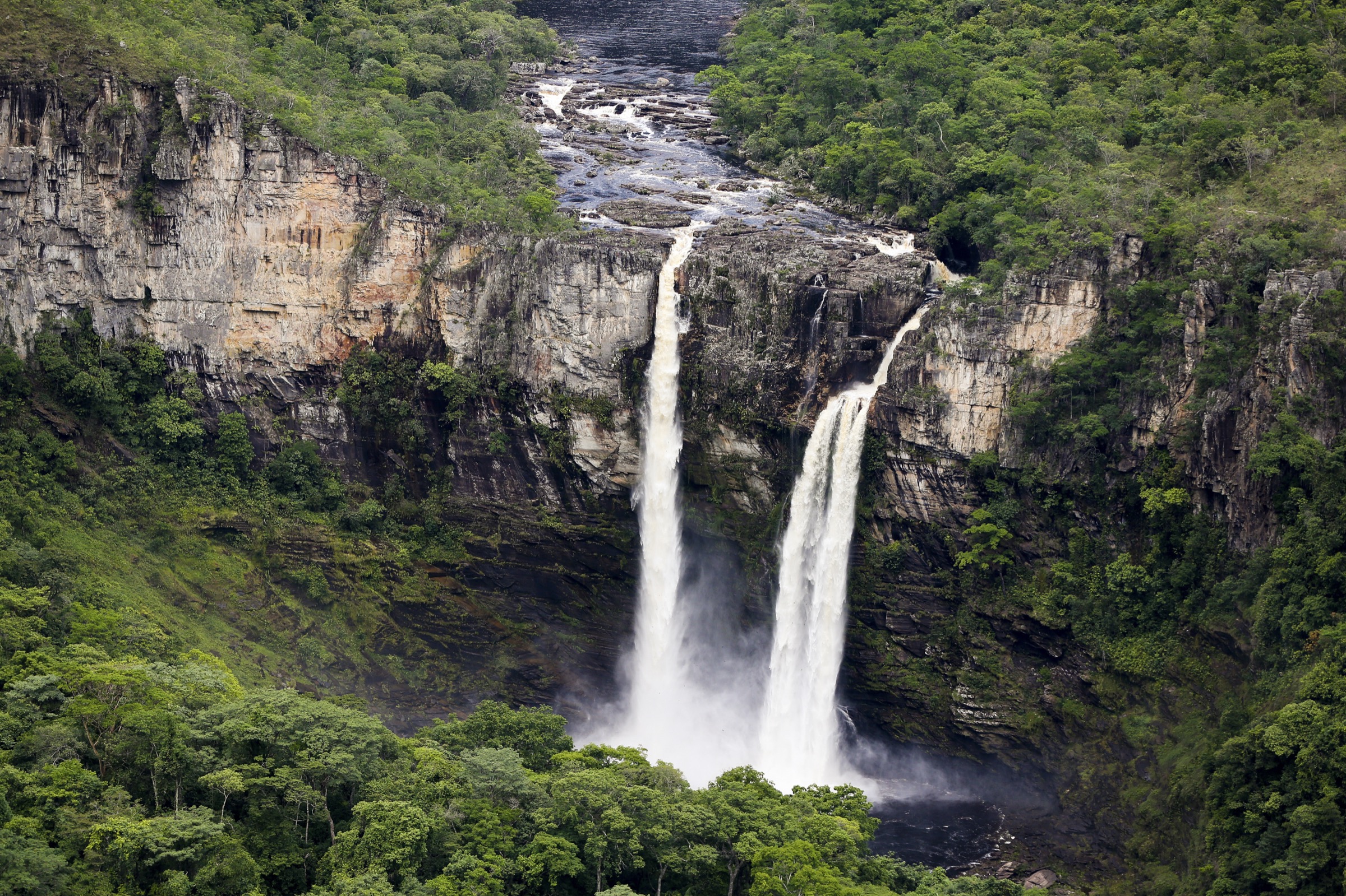
The route leaves the national-park visitor centre and follows the signed yellow/Saltos route through open Cerrado and rocky ground toward the Rio Preto escarpment. It reaches viewpoints over the 120 m and 80 m Rio Preto falls, then descends to bathing areas where permitted, before continuing or returning via the Corredeiras and Carrossel area depending on the current park route arrangement.
Why it is essential
This is the emblematic national-park hike of Chapada dos Veadeiros: it gives the classic Rio Preto waterfall views, open plateau terrain, river pools and the main Sao Jorge trail experience in one day.
Equipment
Standard hiking equipment plus closed footwear with grip, sun protection, at least 2 litres of water per person, swimwear where bathing is open, and a dry bag for electronics.
Hazards and notes
Heat and sun exposure are significant. Wet rocks around bathing areas can be slippery, and river levels can change quickly in the wet season. Stay on signed trails and follow park bathing/closure instructions. Dogs are not appropriate in the national park.
GPX / KML links
| Source | URL | Format / access | Reuse status |
|---|---|---|---|
| ICMBio “Trilhas abertas a visitacao Jan/2013” | gov.br/icmbio | KML link on official page | Official source-route found; reuse terms unresolved |
| AllTrails: Trilha dos Saltos – Corredeiras – Cachoeira do Carrossel | alltrails.com | Web route source | AllTrails terms; coordinate reuse not assessed; useful for verification only |
External links
- ICMBio — Parna da Chapada dos Veadeiros
- AllTrails — Trilha dos Saltos – Corredeiras – Cachoeira do Carrossel
- Wikimedia Commons — Chapada dos Veadeiros 18
2. Canions II and Cachoeira das Cariocas

Snapshot
Itinerary
The red-arrow route starts at the visitor centre and crosses open Cerrado toward the Rio Preto canyon system. It reaches Canion II, where access can depend on water level, then continues to the Cariocas/Carioquinhas pools and waterfall area before returning on the same general line.
Why it is essential
This hike represents the canyon side of the national park, with sculpted Rio Preto rock, swimming pools and a different feel from the high waterfall-view route.
Equipment
Standard hiking equipment, closed shoes for rock, sun protection, water, food, and a waterproof layer in the wet season.
Hazards and notes
The route can close after rain or high water. Slippery rock, heat and limited shade are the main issues. Do not enter canyon water if storms are possible upstream.
GPX / KML links
| Source | URL | Format / access | Reuse status |
|---|---|---|---|
| ICMBio “Trilhas abertas a visitacao Jan/2013” | gov.br/icmbio | KML link on official page | Official source-route found; reuse terms unresolved |
| AllTrails: Cariocas – Canion II | alltrails.com | Web route source | AllTrails terms; verification source only |
External links
- ICMBio — Parna da Chapada dos Veadeiros
- AllTrails — Cariocas – Canion II
- Wikimedia Commons — Cachoeira das Cariocas
3. Mirante da Janela and Cachoeira do Abismo

Snapshot
Itinerary
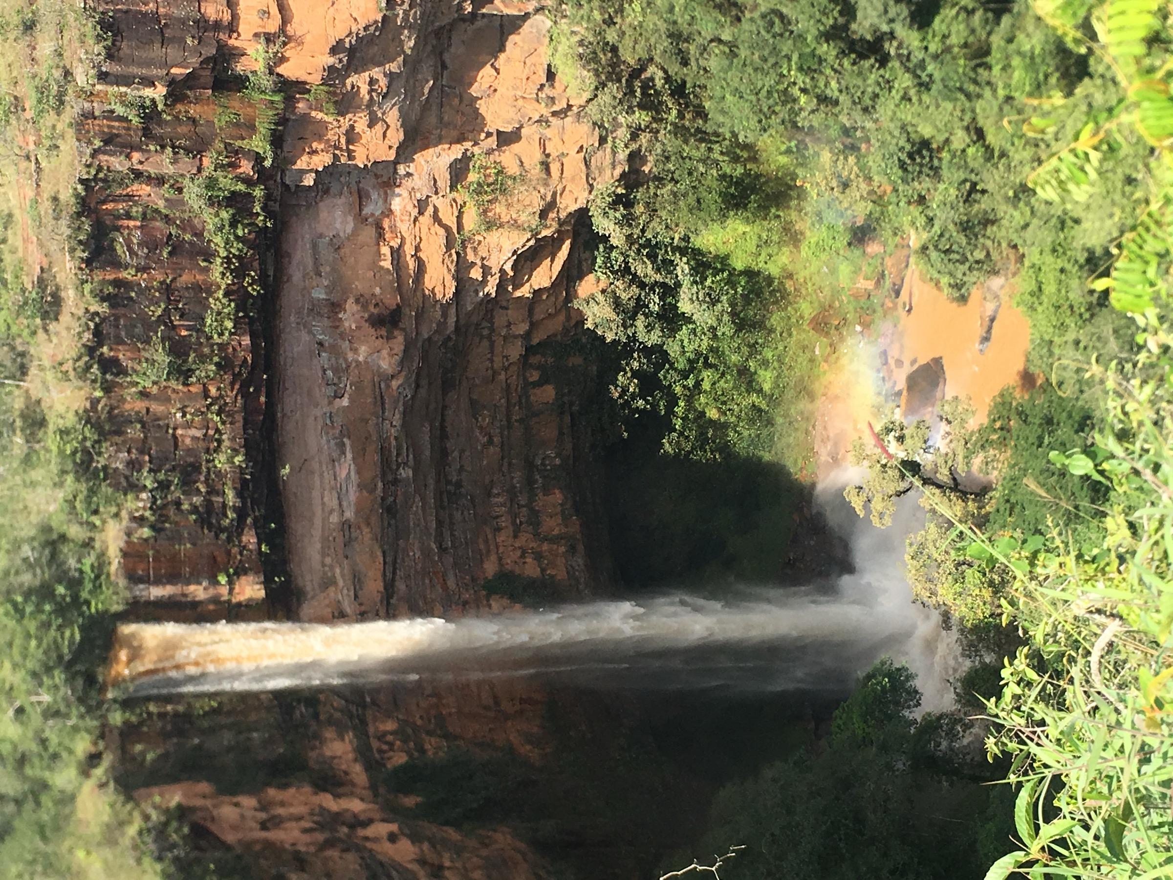
The trail climbs and undulates from the private trailhead through rocky Cerrado terrain, passing Mirante da Estrela and the seasonal Cachoeira do Abismo area. The final section climbs more steeply to the rock-window viewpoint over the Rio Preto falls and the national-park escarpment, then returns the same way.
Why it is essential
Mirante da Janela is the classic external viewpoint toward the Chapada dos Veadeiros waterfall amphitheatre and provides the most recognisable panorama of the Rio Preto falls.
Equipment
Standard hiking equipment, sturdy footwear, sun protection, water, snacks, and cash/card for private entry. Trekking poles are useful on rocky descents.
Hazards and notes
The trail has exposed rocky sections and limited shade. Local rules reported by route sources include guided access later in the day and a ban on climbing the top stone of the “window”; confirm current rules at the gate.
GPX / KML links
| Source | URL | Format / access | Reuse status |
|---|---|---|---|
| AllTrails: Mirante da Estrela – Mirante da Janela | alltrails.com | Web route source | AllTrails terms; verification source only; no official GPX found |
External links
- AllTrails — Mirante da Estrela – Mirante da Janela
- ICMBio — Parna da Chapada dos Veadeiros
- Wikimedia Commons — Mirante da Janela
4. Vale da Lua

Snapshot
Itinerary
The walk follows the managed access path to the Rio Sao Miguel rock formations. Visitors move through a compact area of grey, water-sculpted stone channels, potholes and pools, returning to the entrance on the same managed path or local loop as signed.
Why it is essential
Vale da Lua is one of the region’s most distinctive geological sights and balances the longer waterfall hikes with a short route through sculpted Cerrado river rock.
Equipment
Standard light hiking equipment, closed sandals or shoes with grip, sun protection and water.
Hazards and notes
The main hazard is slippery polished rock and sudden river rise after rain. This is a private attraction; opening, swimming zones and entry fees need current local confirmation.
GPX / KML links
| Source | URL | Format / access | Reuse status |
|---|---|---|---|
| No route file found in this pass | Unresolved | None | Manual GPX creation from field/mapping source recommended |
External links
5. Catarata dos Couros

Snapshot
Itinerary
After the rough road approach, the walking route visits the Rio dos Couros waterfall sequence, using local paths between viewpoints, river slabs and bathing areas. The route should be followed with current local guidance because paths, river crossings and permitted access may change.
Why it is essential
Catarata dos Couros is one of the major waterfall landscapes outside the national-park gate and broadens the selection beyond the Sao Jorge trailhead.
Equipment
Standard hiking equipment, sturdy shoes, sun protection, water, food, and dry storage. A local guide or reliable current track is recommended.
Hazards and notes
Rough road access, unsigned side paths, slippery river rock and flash-flood exposure are the main issues. Do not enter channels if rain is building upstream.
GPX / KML links
| Source | URL | Format / access | Reuse status |
|---|---|---|---|
| No official GPX/KML found in this pass | Unresolved | None | Manual GPX creation from reputable local map/field survey recommended |
External links
Missing data / follow-up work
- Official route statistics and route files were verified for the two national-park routes via ICMBio KML and trail-map links, but reuse terms for the KML are not stated.
- Vale da Lua and Catarata dos Couros need current private-access rules, fees, opening hours and authoritative distance/elevation data.
- Public transport to trailheads was not verified beyond regional town access.
External links
| Source | URL |
|---|---|
| ICMBio — Parna da Chapada dos Veadeiros | gov.br/icmbio |
| AllTrails — Trilha dos Saltos – Corredeiras – Cachoeira do Carrossel | alltrails.com |
| AllTrails — Cariocas – Canion II | alltrails.com |
| AllTrails — Mirante da Estrela – Mirante da Janela | alltrails.com |