Regional overview
Chapada dos Guimarães is a sandstone escarpment, waterfall and Cerrado plateau region in Mato Grosso, close to Cuiabá. The national park protects 32,769.55 ha and contains the best-known hiking sights: Véu de Noiva, Morro de São Jerônimo, Rio Claro, Cidade de Pedra and the Circuito das Cachoeiras.
The terrain is hot, exposed and often sandy or rocky, with gallery forest in watercourses and open plateau near viewpoints. The main hiking season is the drier part of the year, but waterfall flow and access rules vary. ICMBio states that some attractions are self-guided while others require authorised conductors, and that access is controlled by capacity and safety procedures.
Most visitors use private transport, local guides or organised day tours from Chapada dos Guimarães town or Cuiabá. The park warns visitors to arrive early during weekends, holidays and holiday periods.
Selection rationale
The five routes cover the main national-park hiking character: waterfall circuit, highest/major summit, cliff viewpoint at Cidade de Pedra, the iconic Véu de Noiva sector, and a shorter family-accessible waterfall walk.
Summary table
| # | Hike | Country | Route type | Distance | Gain | Max elevation | Difficulty |
|---|---|---|---|---|---|---|---|
| 1 | Circuito das Cachoeiras | Brazil | Loop | 9.2 km | 217 m | 694 m | Moderate |
| 2 | Morro de São Jerônimo | Brazil | Loop | 16.4 km | 421 m | 808 m | Moderate-hard |
| 3 | Cidade de Pedra | Brazil | Out-and-back | 1.9 km | 47 m | 684 m | Easy, guide/permit access |
| 4 | Véu de Noiva – Independência – Cachoeira do Degrau | Brazil | Out-and-back | 6.3 km | 222 m | 646 m | Moderate |
| 5 | Cachoeirinha and Cachoeira dos Namorados | Brazil | Out-and-back | 2.7 km | 58 m | 646 m | Easy |
1. Circuito das Cachoeiras
Snapshot
Itinerary
The circuit starts near the park access area and links several waterfalls and Cerrado/gallery-forest sections, with viewpoints including the Véu de Noiva area depending on the current signed route. ICMBio lists Circuito das Cachoeiras as an autoguided attraction with first-come access rather than advance reservation.
Why it is essential
This is the representative waterfall day in the national park and gives a concentrated sample of Chapada dos Guimarães watercourses, forest edges and sandstone scenery.
Equipment
- Standard hiking equipment
- Closed shoes
- Sun protection
- Water
- Swimwear where bathing is permitted
- Insect repellent
Hazards and notes
- Check current ICMBio access instructions.
- The park notes that some attractions require authorised conductors, while Circuito das Cachoeiras is listed among autoguided attractions.
- Heat, slippery rock and limited shade are the main risks.
GPX / KML links
| Source | URL | Format / access | Reuse status |
|---|---|---|---|
| AllTrails: Circuito das Cachoeiras | alltrails.com | Route page; AllTrails terms apply | Secondary route source only |
External links
- ICMBio — Parna da Chapada dos Guimarães
- ICMBio — Informações sobre visitação
- AllTrails — Circuito das Cachoeiras
2. Morro de São Jerônimo
Snapshot
Itinerary
The route crosses Cerrado and rock formations before climbing toward Morro de São Jerônimo, one of the prominent high points in the park. Near the summit, rock obstacles require more care. The route-source description states that access is only allowed with a guide.
Why it is essential
Morro de São Jerônimo provides the summit element for the region, with broad views over the Chapada, Cuiabá depression and surrounding sandstone relief.
Equipment
- Mountain hiking equipment for a hot day
- Sturdy footwear
- Sun protection
- At least 2 litres of water
- Food
- Navigation backup
- Headtorch for delays
Hazards and notes
- Guide requirement and access scheduling must be confirmed with ICMBio or authorised local conductors.
- Heat, exposed terrain, thunderstorms and rock obstacles are the main hazards.
GPX / KML links
| Source | URL | Format / access | Reuse status |
|---|---|---|---|
| AllTrails: Morro de São Jerônimo | alltrails.com | Route page; AllTrails terms apply | Secondary route source only |
External links
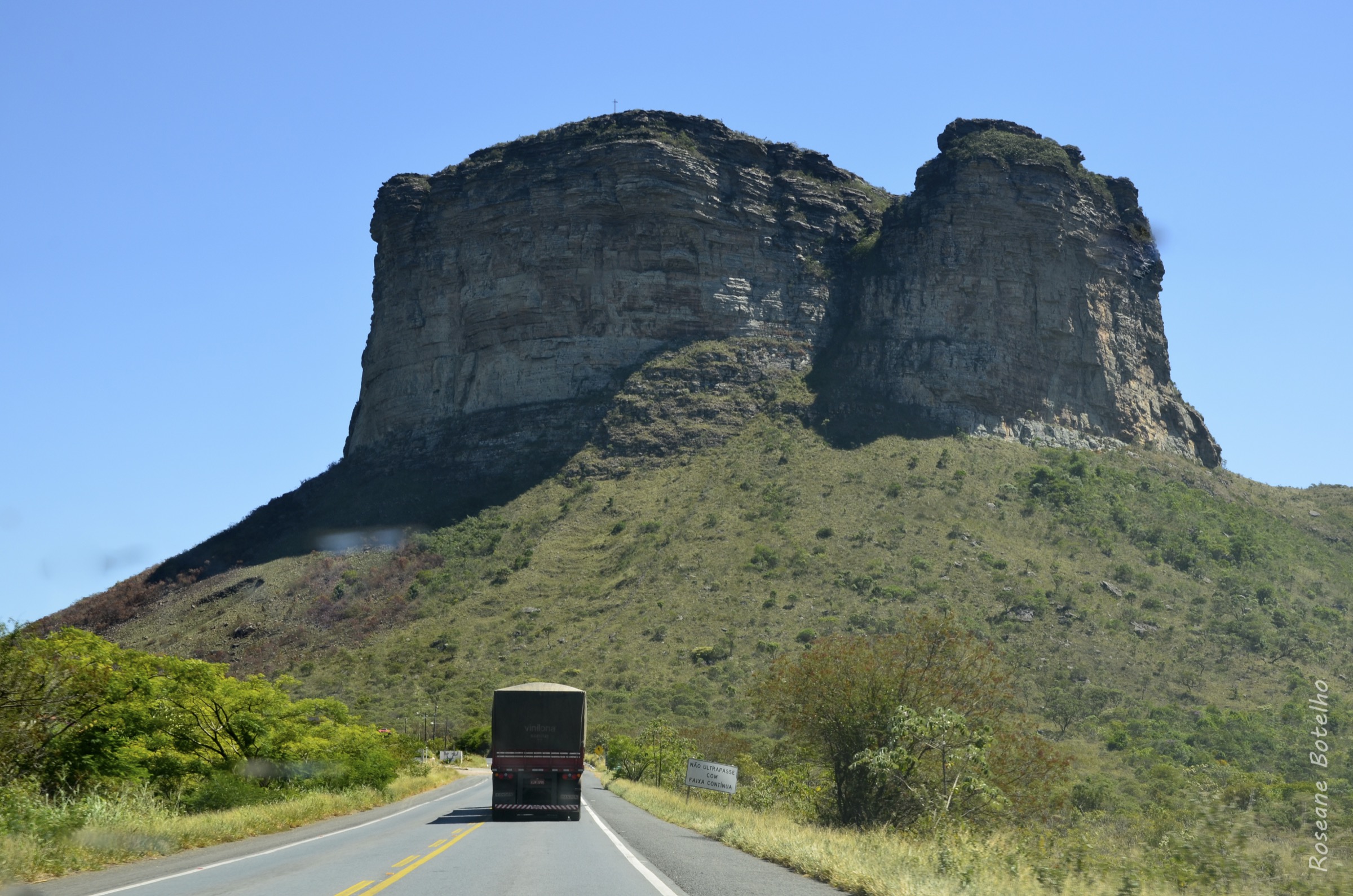
3. Cidade de Pedra
Snapshot
Itinerary
The short walking segment leads to the Cidade de Pedra cliff viewpoint, a sandstone escarpment landscape of walls, towers and rock “islands”. Route-source notes state that an authorised guide or prior permission is required.
Why it is essential
Cidade de Pedra is one of the park’s defining landscapes and represents the sandstone cliff and raptor/macaw-viewing side of Chapada dos Guimarães.
Equipment
- Standard hiking equipment
- Sun protection
- Water
- Guide/permit arrangement where required
Hazards and notes
- Cliff edges and heat are the key hazards.
- Do not approach exposed edges beyond signed or guide-approved limits.
GPX / KML links
| Source | URL | Format / access | Reuse status |
|---|---|---|---|
| AllTrails: Trilha Cidade de Pedra | alltrails.com | Route page; AllTrails terms apply | Secondary route source only |
External links
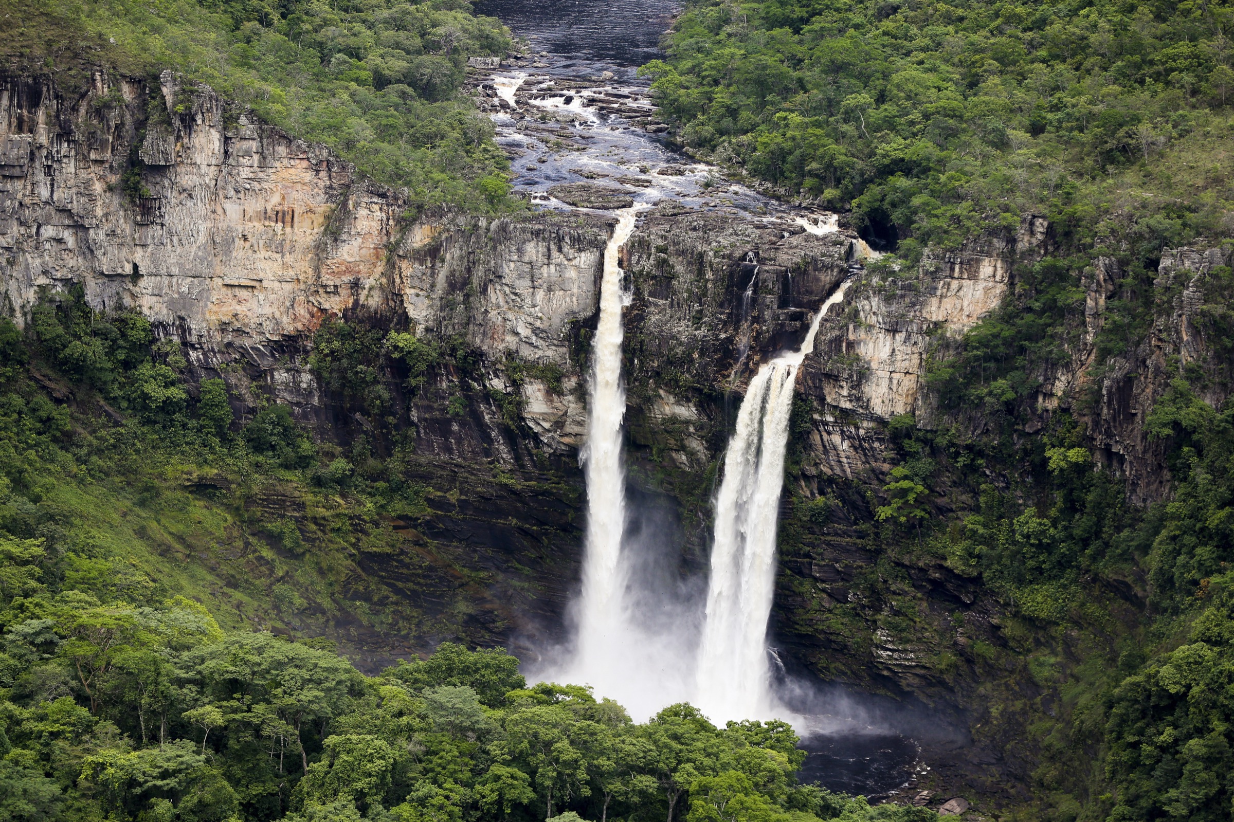
4. Véu de Noiva – Independência – Cachoeira do Degrau
Snapshot
Itinerary
The route links the iconic Véu de Noiva sector with additional waterfall viewpoints and river sections toward Independência and Cachoeira do Degrau, returning on the same general route.
Why it is essential
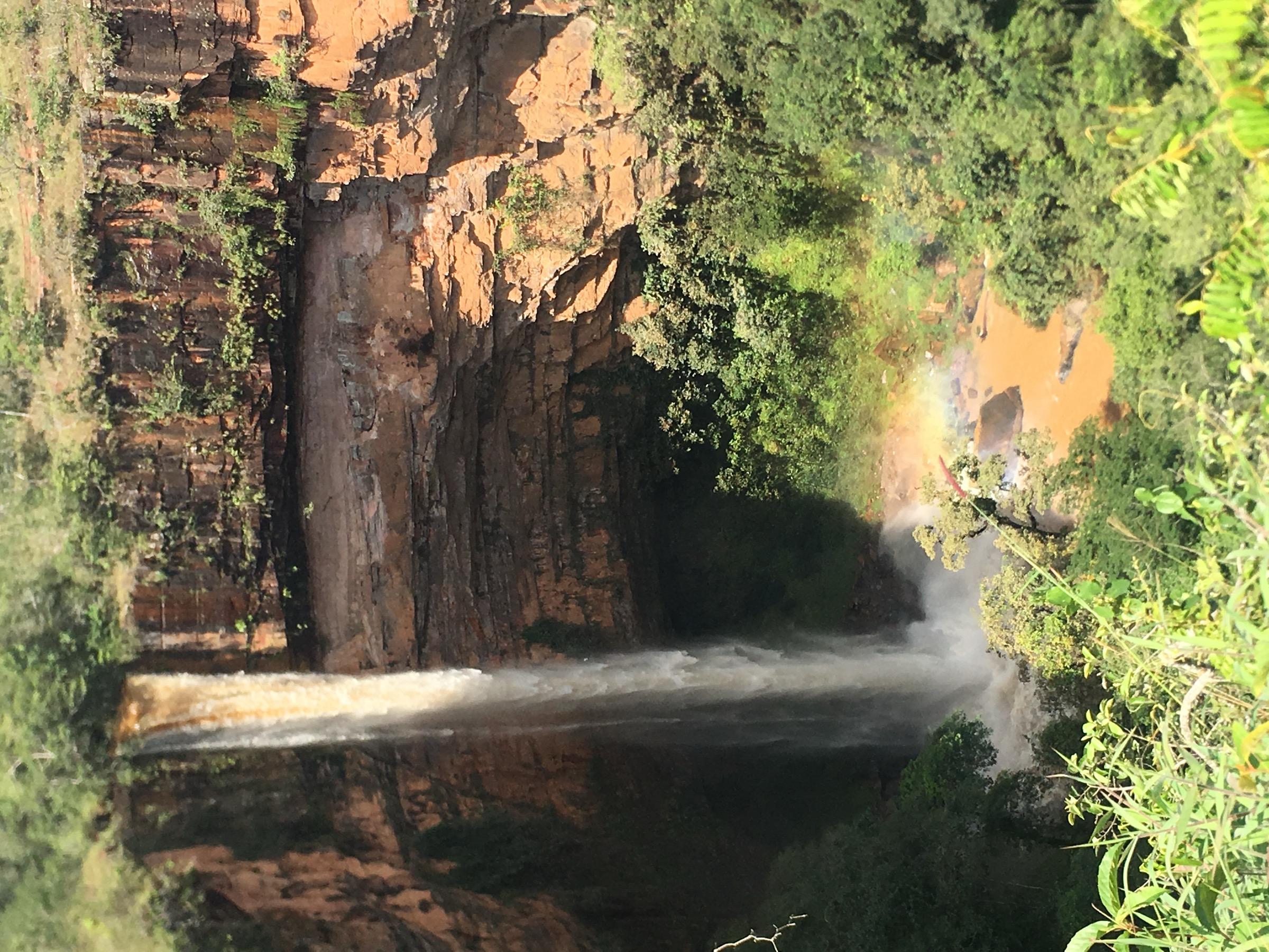
Véu de Noiva is the signature waterfall image of Chapada dos Guimarães, and this route turns the viewpoint sector into a fuller walking day.
Equipment
- Standard hiking equipment
- Closed shoes
- Sun protection
- Water
- Swimwear where bathing is allowed
Hazards and notes
- ICMBio access and closure notices should be checked before departure.
- Reviews and route-source notes mention closures; treat this as a route needing current confirmation.
GPX / KML links
| Source | URL | Format / access | Reuse status |
|---|---|---|---|
| AllTrails: Véu de Noiva – Independência – Cachoeira do Degrau | alltrails.com | Route page; AllTrails terms apply | Secondary route source only |
External links
- ICMBio — Parna da Chapada dos Guimarães
- AllTrails — Véu de Noiva – Independência – Cachoeira do Degrau
- Wikimedia Commons — Véu de Noiva photo
5. Cachoeirinha and Cachoeira dos Namorados
Snapshot
Itinerary
The short route follows a dirt track/path through Cerrado and gallery forest to Cachoeirinha, then continues a short distance to Cachoeira dos Namorados, before returning the same way.
Why it is essential
This route adds an accessible waterfall walk to the set and reflects the park’s shorter family-suitable hiking options.
Equipment
- Standard hiking equipment
- Closed shoes or sandals with grip
- Water
- Sun protection
Hazards and notes
- ICMBio lists Cachoeirinha and Cachoeira dos Namorados among self-guided attractions with first-come access.
- Wet rock around waterfalls remains slippery.
GPX / KML links
| Source | URL | Format / access | Reuse status |
|---|---|---|---|
| AllTrails: Cachoeira dos Namorados e Cachoeirinha | alltrails.com | Route page; AllTrails terms apply | Secondary route source only |
External links
External links
| Resource | Link |
|---|---|
| ICMBio — Parna da Chapada dos Guimarães | gov.br |
| ICMBio — Informações sobre visitação | gov.br |
| AllTrails — Circuito das Cachoeiras | alltrails.com |
| AllTrails — Morro de São Jerônimo | alltrails.com |
| AllTrails — Trilha Cidade de Pedra | alltrails.com |
| AllTrails — Véu de Noiva – Independência – Cachoeira do Degrau | alltrails.com |
| AllTrails — Cachoeira dos Namorados e Cachoeirinha | alltrails.com |