Regional overview
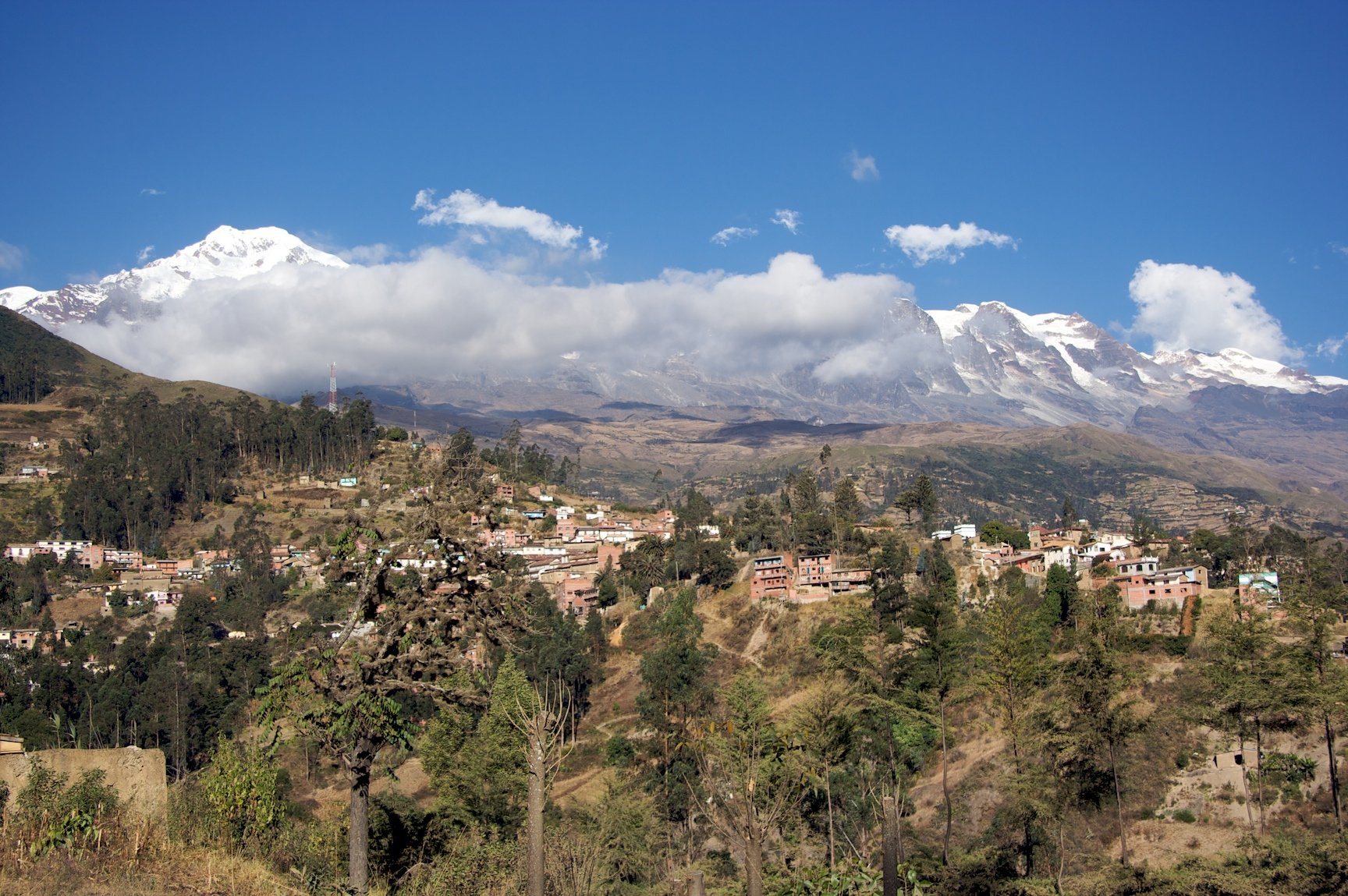
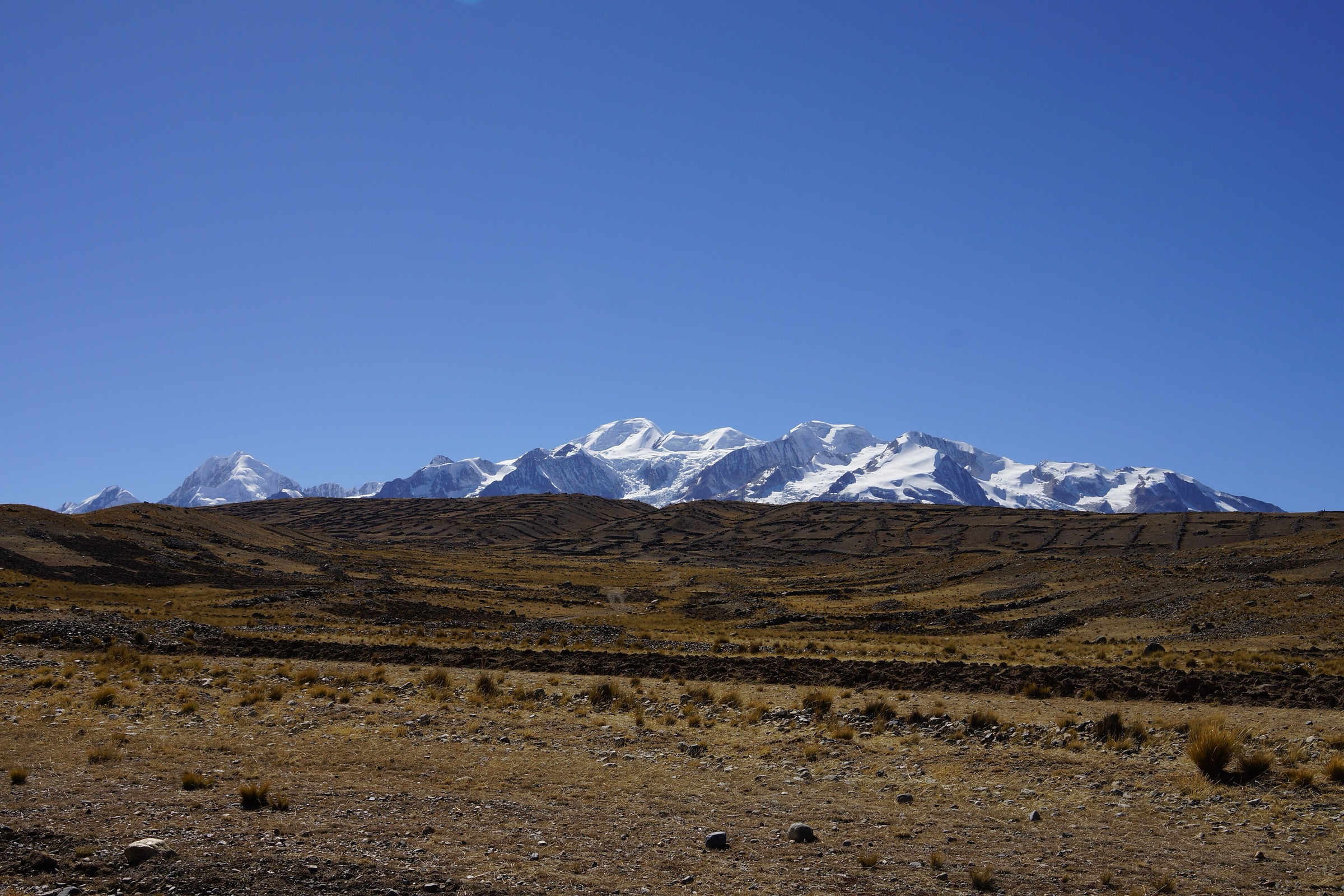
Sorata sits below the Illampu-Ancohuma massif in a warmer, greener valley than La Paz, with steep access to glacial lakes, viewpoints, caves and old village paths. The town is a historic trekking base for the Illampu Circuit and Laguna Glaciar approaches, but several routes can be treated as day hikes when transport and acclimatisation are arranged.
The walking character changes quickly: subtropical valley tracks around 2600-3000 m rise to high-Andean lakes above 4100 m and to the Laguna Glaciar basin above 5000 m. Views often include Illampu, Ancohuma, the Sorata valley and, from higher terrain, Lake Titicaca.
The most reliable hiking season is the dry season, roughly May to September. Sorata 360 recommends May to September for Laguna Chillata and advises local guide or community support for high-lake visits. Rain, fog, landslides, loose descents and routefinding are recurring issues.
Selection rationale
The selection combines the essential Sorata viewpoint, the classic cave walk, Laguna Chillata, the strenuous Laguna Glaciar objective and the Wila Kollo / Tutuacaja viewpoint ridge. Multi-day objectives such as the full Illampu Circuit, Mapiri Trail and Illampu / Ancohuma climbs are excluded.
Summary table
| # | Hike | Country | Route type | Distance | Gain | Max elevation | Difficulty |
|---|---|---|---|---|---|---|---|
| 1 | Sorata Main Viewpoint / Mirador Ulluntija | Bolivia | Out-and-back / loop candidate | 6.5 km | 429 m | Moderate | |
| 2 | Sorata to Gruta de San Pedro | Bolivia | Out-and-back / point-to-point variant | 8.3-16.9 km depending on route | 216-436 m | 2691 m | Moderate |
| 3 | Laguna Chillata | Bolivia | Out-and-back / taxi-assisted high route | 6.3 km one way from high start; longer from Sorata | 1014 m one way from Wikiloc high-start route | 4242 m | Hard |
| 4 | Laguna Glaciar from the Chillata Approach | Bolivia | Out-and-back / loop variant | 10.8-14.9 km depending on source | 876-1414 m | 4966-5053 m depending on source | Very hard |
| 5 | Mirador Wilakollo / Tutuacaja Wila Kollo | Bolivia | Out-and-back / ridge walk | 10.4 km | 608 m | Moderate-hard |
1. Sorata Main Viewpoint / Mirador Ulluntija
Snapshot
Itinerary
The route climbs from central Sorata toward the main viewpoint above town. Sorata 360 describes Mirador Ulluntija as about 20 minutes from the urban centre by local access and as a viewpoint over the Sorata valley, Rio San Cristobal and Illampu. A Wikiloc route named Sorata main viewpoint records 6.47 km and 429 m of gain from the main square area.
This is the best acclimatisation walk before committing to the high lakes.
Why it is essential
The viewpoint gives the classic overview of Sorata’s valley setting beneath Illampu and introduces the town’s steep topography without requiring a high-altitude transfer.
Equipment
- Walking shoes
- Sun protection
- Water
- Light weather layer
- Trekking poles for the descent
Hazards and notes
- Loose paths, sun, heat in the lower valley and informal side tracks are the main issues.
- Sorata 360 asks visitors to respect the environment and local identity.
GPX / KML links
| Source | URL | Format / access | Reuse status |
|---|---|---|---|
| Wikiloc: Sorata main viewpoint | wikiloc.com | Source map / GPX availability via Wikiloc; account may be required | Candidate route-file source; GPX not downloaded |
| Sorata 360: Mirador Ulluntija | 360.sorata.bo | Official attraction page; no route-file terms stated | Context only |
External links
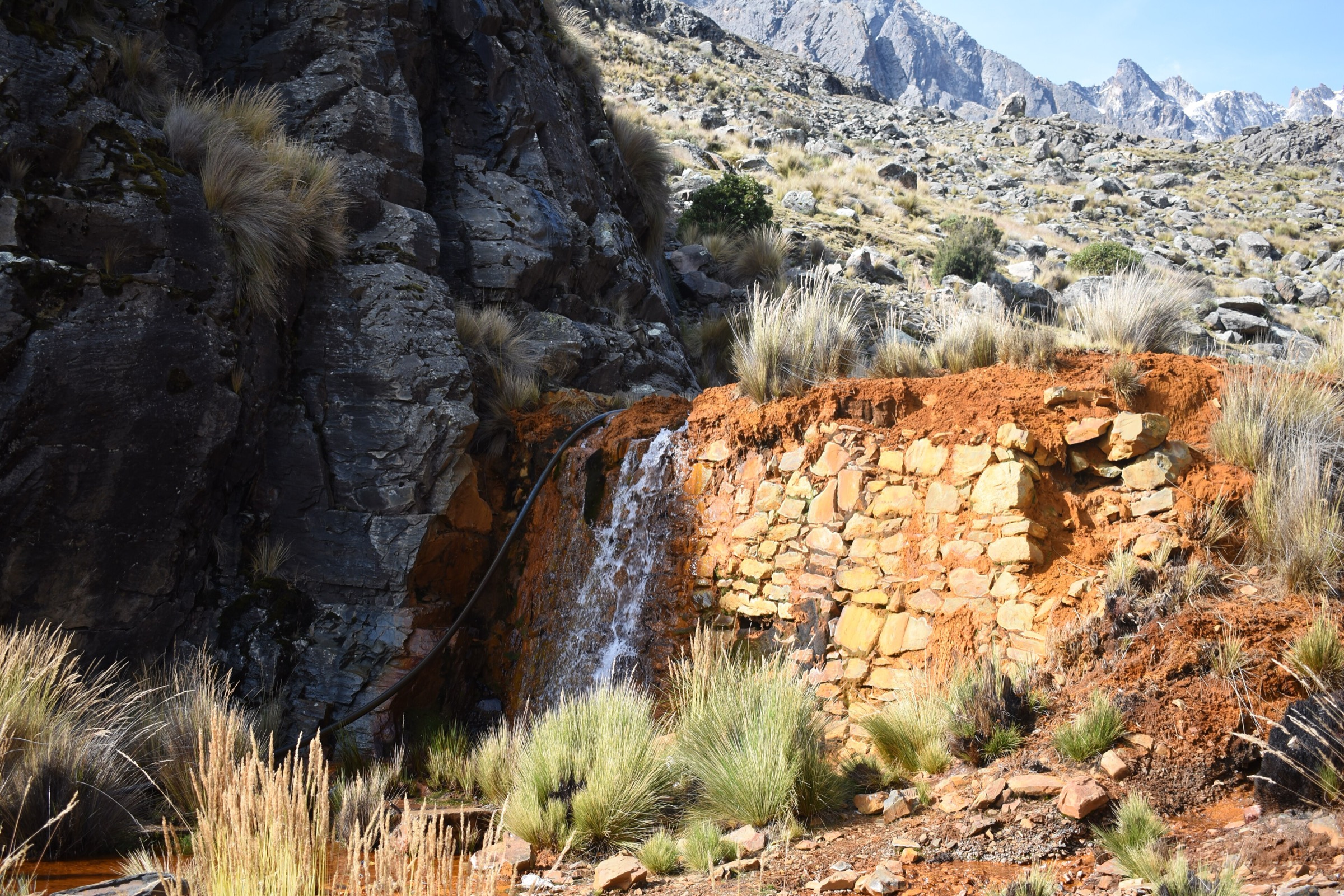
2. Sorata to Gruta de San Pedro
Snapshot
Itinerary
The route descends and traverses from Sorata toward San Pedro and the cave known as Gruta de San Pedro or Ch’usiq Uta. Sorata 360 describes it as an attraction with an internal lagoon and about 510 m of cave depth, reached in 30 minutes by vehicle or 2-3 hours on foot.
Wikiloc records vary: one Sorata - Gruta de San Pedro route gives 8.27 km and 216 m of ascent, while another Sorata - Gruta San Pedro route gives 16.88 km, 436 m of ascent and 477 m of descent. The production route should choose one geometry after local access confirmation.
Why it is essential
This is Sorata’s key lower-valley cultural and natural walk, contrasting with the high glacial lake routes and giving a feasible day objective in poorer high-mountain weather.
Equipment
- Standard hiking equipment
- Water
- Sun protection
- Headtorch if entering any cave area where permitted
- Footwear suitable for dusty paths and damp cave surfaces
Hazards and notes
- Confirm cave opening status, entry rules, boat availability and local fees.
- Do not enter unlit or restricted cave sections without local staff.
- The longer walking variants may involve road sections and heat.
GPX / KML links
| Source | URL | Format / access | Reuse status |
|---|---|---|---|
| Wikiloc: Sorata - Gruta San Pedro | wikiloc.com | Source map / GPX availability via Wikiloc; account may be required | Candidate route-file source; GPX not downloaded |
| Wikiloc: Sorata - Gruta de San Pedro | wikiloc.com | Source map / GPX availability via Wikiloc; account may be required | Alternate route source |
| Sorata 360: Gruta de San Pedro | 360.sorata.bo | Official attraction page; no route-file terms stated | Context only |
External links
3. Laguna Chillata
Snapshot
Itinerary
The hike climbs from the Sorata valley toward Laguna Chillata, a glacial lake formed by meltwater from Illampu. The lake sits above 4100 m and gives wide views over the Sorata valley and surrounding peaks.
Wikiloc records a high-start one-way route of 6.27 km, 1014 m of ascent and a maximum elevation of 4242 m. Sorata 360 lists the lake at approximately 4183 m and recommends the May-September season with local guide or community support.
Why it is essential
Laguna Chillata is the classic Sorata high-lake day objective and the normal stepping stone toward Laguna Glaciar and Ancohuma / Illampu approaches.
Equipment
- Boots
- Trekking poles
- Warm layer
- Waterproof/windproof shell
- Gloves/hat
- Sun protection
- Food
- Water treatment
- Navigation
Hazards and notes
- Altitude, steep ascent, weather, routefinding and transport reliability are the main hazards.
- The lake is often used as a camp on longer treks; unattended gear should not be left without local arrangements.
GPX / KML links
| Source | URL | Format / access | Reuse status |
|---|---|---|---|
| Wikiloc: Sorata - Laguna Chillata | wikiloc.com | Source map / GPX availability via Wikiloc; account may be required | Candidate route-file source; GPX not downloaded |
| Sorata 360: Laguna Chillata | 360.sorata.bo | Official attraction page; no route-file terms stated | Context only |
External links
- Sorata 360 — Laguna Chillata
- Wikiloc — Sorata - Laguna Chillata
- Bolivian Mountain Guides — Ancohuma itinerary context
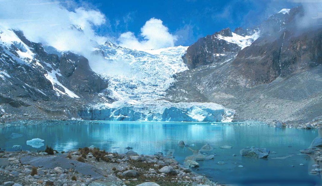
4. Laguna Glaciar from the Chillata Approach
Snapshot
Itinerary
Laguna Glaciar lies high below the Illampu-Ancohuma massif and is normally approached via the Chillata side. Sorata 360 describes it as a glacial lake at about 5053 m, associated with the high route toward Jankho-Uma. Wikiloc notes warn that the path can be easy to lose and that one-day completion requires strong fitness and acclimatisation.
AllTrails records a Glacier Lake Trail of 10.8 km with 876 m of ascent, while a Wikiloc Sorata - Laguna Glaciar - Laguna Chillata loop gives 14.9 km, 1414 m of ascent and 9 hr 9 min.
Why it is essential
Laguna Glaciar is the highest and most dramatic lake objective in the Sorata area, giving direct contact with the glacial landscape below Illampu and Ancohuma.
Equipment
- Mountain hiking equipment plus extra warm layers
- Gloves/hat
- Waterproofs
- Headtorch
- GPS/map
- Emergency insulation
- Food and water treatment
- Microspikes if snow or hard ice remains
Hazards and notes
- This is a serious high-altitude day.
- Hazards include altitude illness, route loss, steep loose descents, cold, storms, snow and remote rescue.
- Many sources recommend camping at Chillata rather than attempting the whole route in one day.
GPX / KML links
| Source | URL | Format / access | Reuse status |
|---|---|---|---|
| AllTrails: Glacier Lake Trail | alltrails.com | Source map; AllTrails terms apply | Direct GPX not retrieved; source-map reference only |
| Wikiloc: Sorata - Laguna Glaciar - Laguna Chillata | wikiloc.com | Source map / GPX availability via Wikiloc; account may be required | Candidate route-file source; GPX not downloaded |
| Sorata 360: Laguna Glaciar | 360.sorata.bo | Official attraction page; no route-file terms stated | Context only |
External links
- Sorata 360 — Laguna Glaciar
- AllTrails — Glacier Lake Trail
- Wikiloc — Sorata - Laguna Glaciar - Laguna Chillata
5. Mirador Wilakollo / Tutuacaja Wila Kollo
Snapshot
Itinerary
The route climbs toward the Wila Kollo viewpoint above Bella Vista / Tutuacaja. Sorata 360 describes Wila Kollo as a natural viewpoint with 360-degree views over Tutuacaja, Ulluntija, Corini, the Sorata valley, Rio San Cristobal and Nevado Illampu.
Wikiloc lists a Sorata - Tutuacaja Wila Kollo Take Kala hiking route of 10.44 km and 608 m of ascent. The official Sorata page warns that the access path is uneven.
Why it is essential
Wila Kollo is the best named Sorata ridge/viewpoint objective after the closer town miradors, giving a wider perspective over the valley and Illampu without requiring the much higher Laguna Chillata approach.
Equipment
- Grippy shoes or boots
- Sun protection
- Water and food
- Wind layer
- GPS/map
Hazards and notes
- Uneven tracks, loose ground, heat in the valley and limited signage are the main issues.
- Use a local guide if the route line is unclear.
GPX / KML links
| Source | URL | Format / access | Reuse status |
|---|---|---|---|
| Wikiloc Sorata hiking routes: Sorata - Tutuacaja Wila Kollo Take Kala | wikiloc.com | Source map listing / GPX availability via Wikiloc; account may be required | Candidate route-file source; exact route page should be opened before GPX creation |
| Sorata 360: Mirador Wilakollo | 360.sorata.bo | Official attraction page; no route-file terms stated | Context only |
| GAMS Sorata: Mirador Wilakollo | sorata.bo | Municipal attraction page; no route-file terms stated | Context only |
External links
External links
| Source | URL |
|---|---|
| Sorata 360 — Mirador Ulluntija | 360.sorata.bo |
| Sorata 360 — Mirador Wilakollo | 360.sorata.bo |
| Sorata 360 — Laguna Chillata | 360.sorata.bo |
| Sorata 360 — Laguna Glaciar | 360.sorata.bo |
| Sorata 360 — Gruta de San Pedro | 360.sorata.bo |
| GAMS Sorata — Mirador Wilakollo | sorata.bo |
| Wikiloc — Sorata main viewpoint | wikiloc.com |
| Wikiloc — Sorata - Gruta San Pedro | wikiloc.com |
| Wikiloc — Sorata - Gruta de San Pedro (alternate) | wikiloc.com |
| Wikiloc — Sorata - Laguna Chillata | wikiloc.com |
| Wikiloc — Sorata - Laguna Glaciar - Laguna Chillata | wikiloc.com |
| Wikiloc — Sorata route listing | wikiloc.com |
| AllTrails — Glacier Lake Trail | alltrails.com |
| Bolivian Mountain Guides — Ancohuma context | bolivianmountainguides.com |
| Show Caves — Gruta San Pedro | showcaves.com |