Regional overview
The La Paz / Illimani region combines high-altitude city-edge hiking, eroded badland valleys, pre-Columbian routes, and the southern Cordillera Real skyline dominated by Illimani. Most walks start between about 3200 m and 4800 m, so altitude affects even short routes.
The main hiking bases are La Paz’s Zona Sur neighbourhoods, El Alto / Milluni access roads, La Cumbre and the villages south-east of the city toward Illimani. The terrain ranges from dry gullies and volcanic rock towers to high puna, old Inca paving, moraine and glaciated-mountain approach valleys.
The most reliable hiking season is the dry season, roughly May to September, with April and October often usable depending on weather. Rainy-season storms can damage gullies and tracks, while snow, ice and high wind make the upper routes more serious. Current road conditions, community access and local security advice should be checked before departure.
Selection rationale
The selection balances the immediate La Paz classics, a high-altitude acclimatisation summit, a cultural Inca-road section and the essential non-technical approach to Illimani. Huayna Potosi and Condoriri routes are intentionally left to the separate Condoriri / Huayna Potosi region.
Summary table
| # | Hike | Country | Route type | Distance | Gain | Max elevation | Difficulty |
|---|---|---|---|---|---|---|---|
| 1 | Circuito del Valle de las Animas | Bolivia | Loop | 9.7 km | 643 m | 4368 m | Hard because of altitude and routefinding |
| 2 | Devil’s Molar / Muela del Diablo Trek | Bolivia | Loop | 9.2 km | 477 m | 3888 m | Moderate |
| 3 | Chacaltaya Summit from the Roadhead | Bolivia | Out-and-back / short loop | 2.4-3.8 km | 147-195 m | Track max 5350-5357 m; summit 5421 m | Moderate-hard altitude walk |
| 4 | Takesi Inca Trail: Mina San Francisco to Estancia Takesi | Bolivia | Point-to-point day section | Approx. 8-12 km; exact segment unresolved | Approx. 450 m gain, major descent | 4630-4800 m depending on source | Hard |
| 5 | Pinaya to Illimani Base Camp | Bolivia | Out-and-back / mountaineering approach day | Distance unresolved | Approx. 700-800 m | 4500-4600 m | Hard |
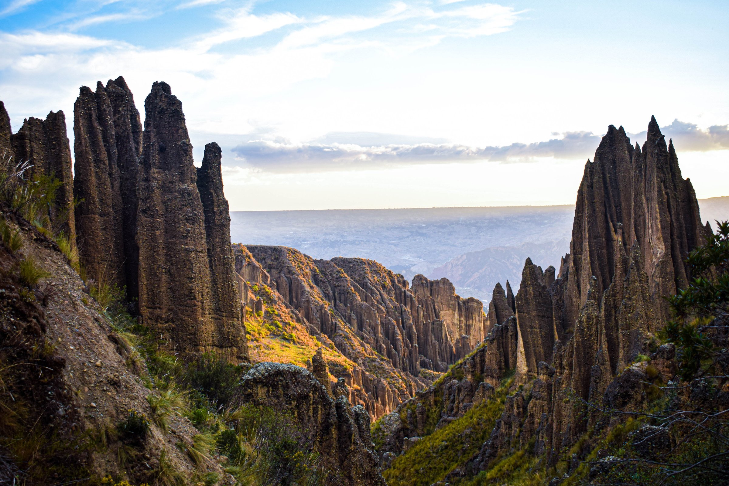
1. Circuito del Valle de las Animas
Snapshot
Itinerary
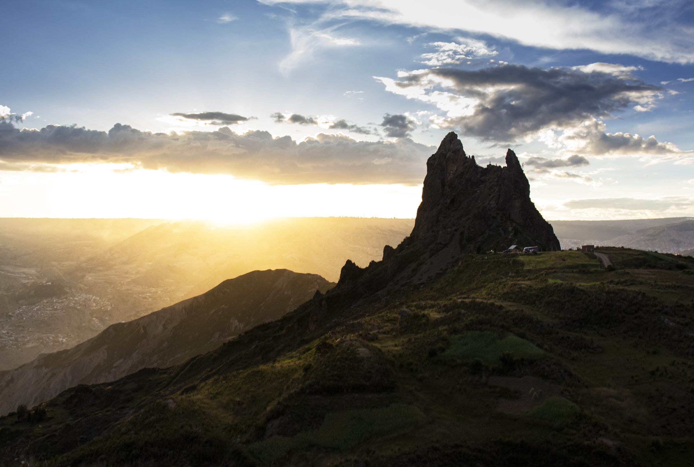
The route explores the eroded clay and conglomerate towers of Valle de las Animas on the south-eastern edge of La Paz. It climbs through gullies and open viewpoints above the formations, then loops back through high, exposed terrain with views toward La Paz, Illimani and Mururata in clear weather.
AllTrails records the circuit as a 9.7 km loop with 643 m of ascent and a maximum elevation of 4368 m. The return line can be affected by rain or informal closures, so an out-and-back retreat on the approach line may be necessary.
Why it is essential
Valle de las Animas is the defining geological hike of La Paz: close to the city but visually distinct from ordinary urban viewpoints, with spires, gullies and high-Andean light framed by the Illimani skyline.
Equipment
- Sturdy shoes
- Sun protection
- Water and food
- Wind layer
- GPS/map
- Trekking poles for loose descents
Hazards and notes
- Altitude, intense sun, eroded side slopes, barbed-wire obstacles and route ambiguity are the main issues.
- Avoid the gullies during heavy rain or immediately after storms.
- Entry fees may vary by access point.
GPX / KML links
| Source | URL | Format / access | Reuse status |
|---|---|---|---|
| AllTrails: Circuito del Valle de las Animas | alltrails.com | Source map; AllTrails terms apply | Direct GPX not retrieved; source-map reference only |
| OpenStreetMap search: Valle de las Animas | openstreetmap.org | OSM map data; ODbL | Geometry cross-check target |
External links
2. Devil’s Molar / Muela del Diablo Trek
Snapshot
Itinerary
The loop starts in the El Pedregal / Achumani area, climbs into eroded badland terrain and reaches the base and viewpoints around Muela del Diablo, the prominent volcanic-neck formation visible from much of southern La Paz. The Wikiloc route passes through Valle Escondido before reaching the Muela sector and returning by a loop line.
The route is non-technical in dry weather, but it crosses loose, dusty paths and informal tracks. The final rock tower itself is not treated as a climbing objective.
Why it is essential
Muela del Diablo is one of La Paz’s most recognisable natural landmarks and gives a compact half-day hike with city, valley and Illimani views.
Equipment
- Grippy shoes
- Sun protection
- Water and snacks
- Wind layer
- GPS track recommended because several informal tracks cross the area
Hazards and notes
- Loose slopes, strong sun, stray dogs near settlements and route ambiguity are the main concerns.
- The rock tower has steep drops and should not be scrambled without appropriate skill and conditions.
GPX / KML links
| Source | URL | Format / access | Reuse status |
|---|---|---|---|
| Wikiloc: Devil’s Molar Trek | wikiloc.com | Source map / GPX availability via Wikiloc; account may be required | Candidate route-file source; GPX not downloaded |
| AllTrails: Muela del Diablo Mountain | alltrails.com | Short source map; AllTrails terms apply | Secondary check only; spur route is too short for the full loop |
External links
3. Chacaltaya Summit from the Roadhead
Snapshot
Itinerary
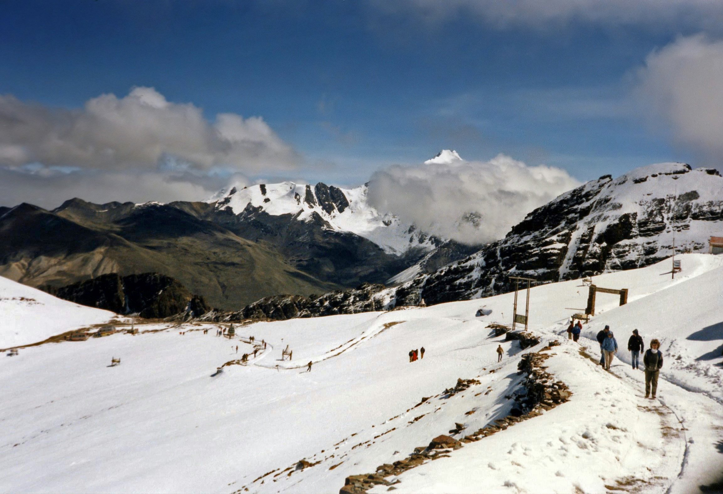
From the roadhead near the former Chacaltaya ski area, the path climbs the rocky ridge to the summit area and returns by the same line or a short loop. The route is short, but the trail starts above 5000 m, so the effort is disproportionate to the distance.
On clear days the route gives wide views to Huayna Potosi, Illimani, the Altiplano and Lake Titicaca. Snow or ice can change the character of the final ridge.
Why it is essential
Chacaltaya is the classic La Paz high-altitude acclimatisation walk: very short, historically important as a former ski area, and one of the easiest ways to stand above 5000 m without glacier travel.
Equipment
- Sturdy shoes
- Warm layer
- Windproof shell
- Gloves/hat
- Sunglasses and sunscreen
- Water and snacks
- Microspikes if snow or hard ice remains
Hazards and notes
- Altitude illness, wind, cold and rapid weather changes are the main hazards.
- The short distance should not be used to underestimate the route.
- Do not continue onto snow or glacier terrain without appropriate equipment and skills.
GPX / KML links
| Source | URL | Format / access | Reuse status |
|---|---|---|---|
| AllTrails: Mount Chacaltaya | alltrails.com | Source map; AllTrails terms apply | Direct GPX not retrieved; source-map reference only |
| Wikiloc: Chacaltaya Trail | wikiloc.com | Source map / GPX availability via Wikiloc; account may be required | Candidate route-file source; GPX not downloaded |
External links
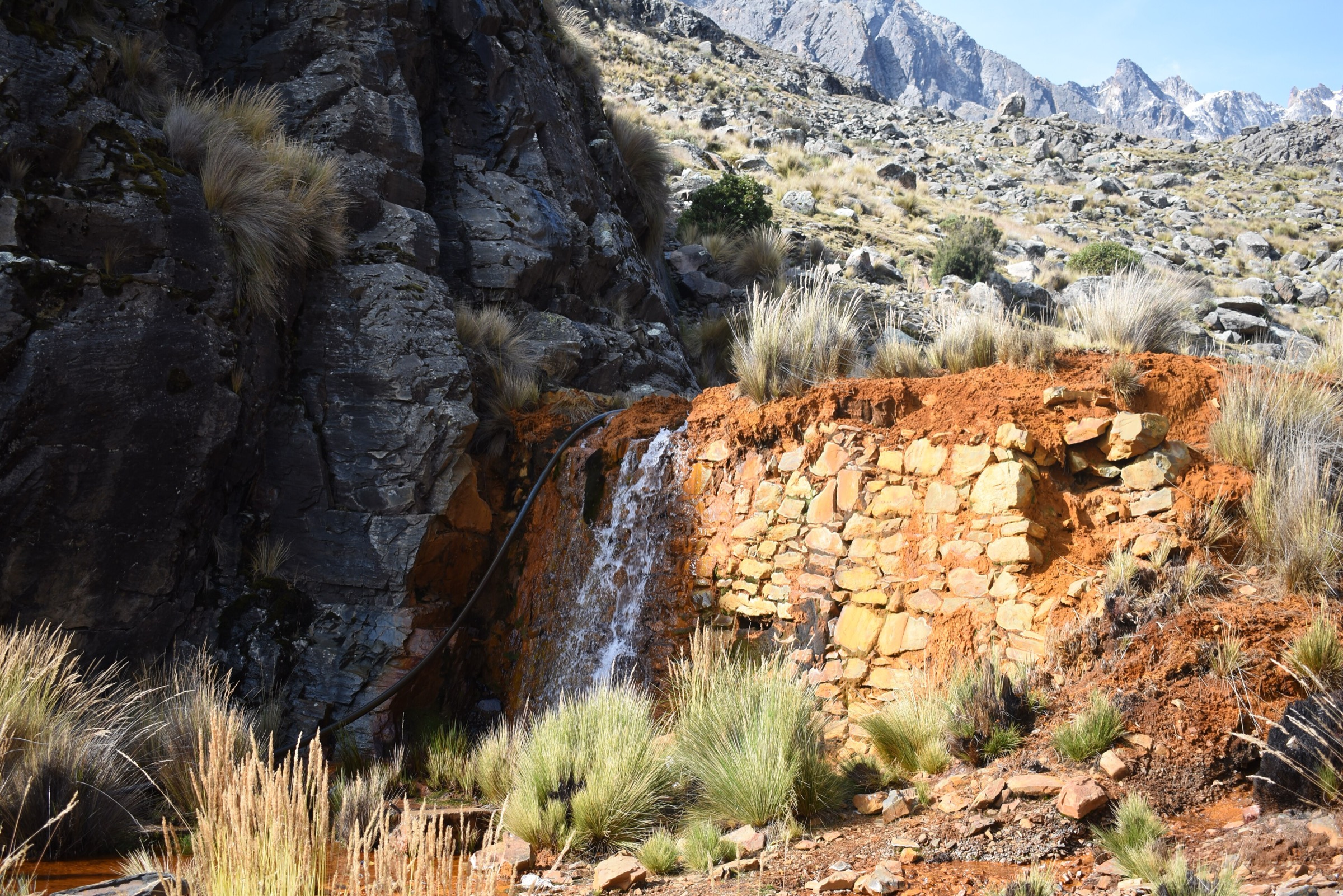
4. Takesi Inca Trail: Mina San Francisco to Estancia Takesi
Snapshot
Itinerary
This selected day section uses the upper pre-Columbian Takesi route rather than the full multi-day descent to Chojlla or Yanacachi. From Mina San Francisco, the old trail climbs toward the high apacheta, where Inca paving, retaining walls and drainage structures become prominent. It then descends toward Estancia Takesi through high puna and glacial-lake terrain.
The full Takesi is normally a 2-3 day trek. This entry treats only the high cultural section as a day-hike candidate because the full route is too long for an ordinary day catalogue entry.
Why it is essential
Takesi is one of the best-known surviving pre-Columbian roads near La Paz. The upper section gives the catalogue a culturally important hike in addition to geological and summit viewpoints.
Equipment
- Boots
- Weatherproof layer
- Warm layer
- Map/GPS
- Headtorch
- Sun protection
- Water treatment and food
- Trekking poles for the descent
Hazards and notes
- This entry remains candidate-only because a clean, legal one-day route file and exact segment statistics were not verified.
- The full route involves remote valleys, river crossings, mining settlements and transport complications.
- Local guide or community transport support is strongly recommended.
GPX / KML links
| Source | URL | Format / access | Reuse status |
|---|---|---|---|
| Wikiloc: Takesi Trail | wikiloc.com | Full-route source map / GPX availability via Wikiloc; account may be required | Full route only; selected day-section geometry unresolved |
| AllTrails: Takesi Trail Day 2 | alltrails.com | Stage source map; AllTrails terms apply | Secondary stage reference only |
External links
- Expedition Bolivia — Takesi Trail itinerary
- La Paz Life — Takesi Trail route description
- Wikiloc — Takesi Trail
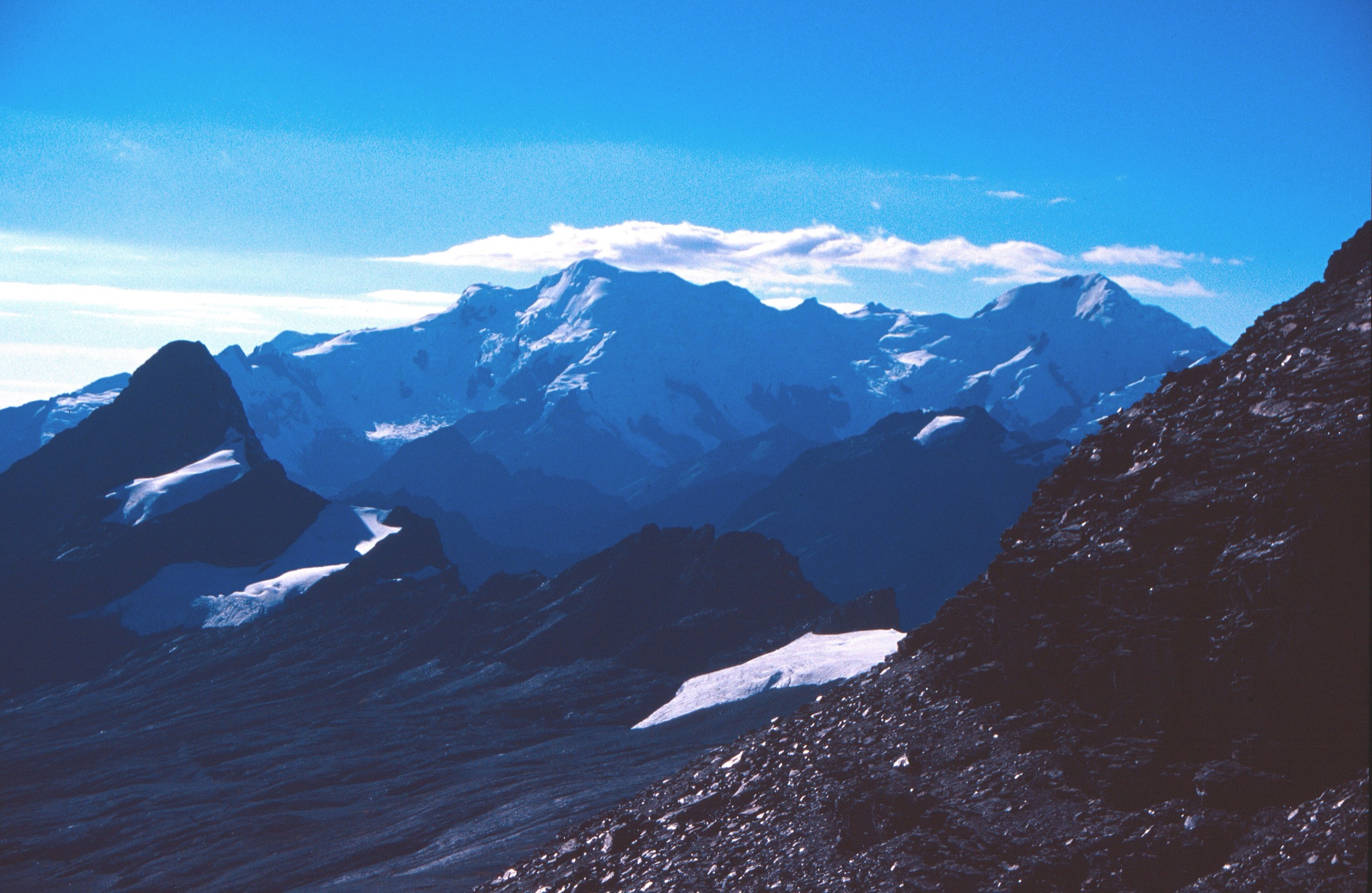
5. Pinaya to Illimani Base Camp
Snapshot
Itinerary
From Pinaya, the approach climbs toward the base-camp meadows below Illimani. Bolivian Mountaineering describes the approach from Pinaya at about 3800 m to base camp at 4600 m as a roughly 3-hour hike. Viacha Tours gives a similar simple-path approach of about 3.5 hours to a base camp around 4500 m.
The route stops at base camp and does not continue to Nido de Condores or onto snow/glacier terrain. The high camp and summit route are mountaineering objectives and are excluded from this day-hike entry.
Why it is essential
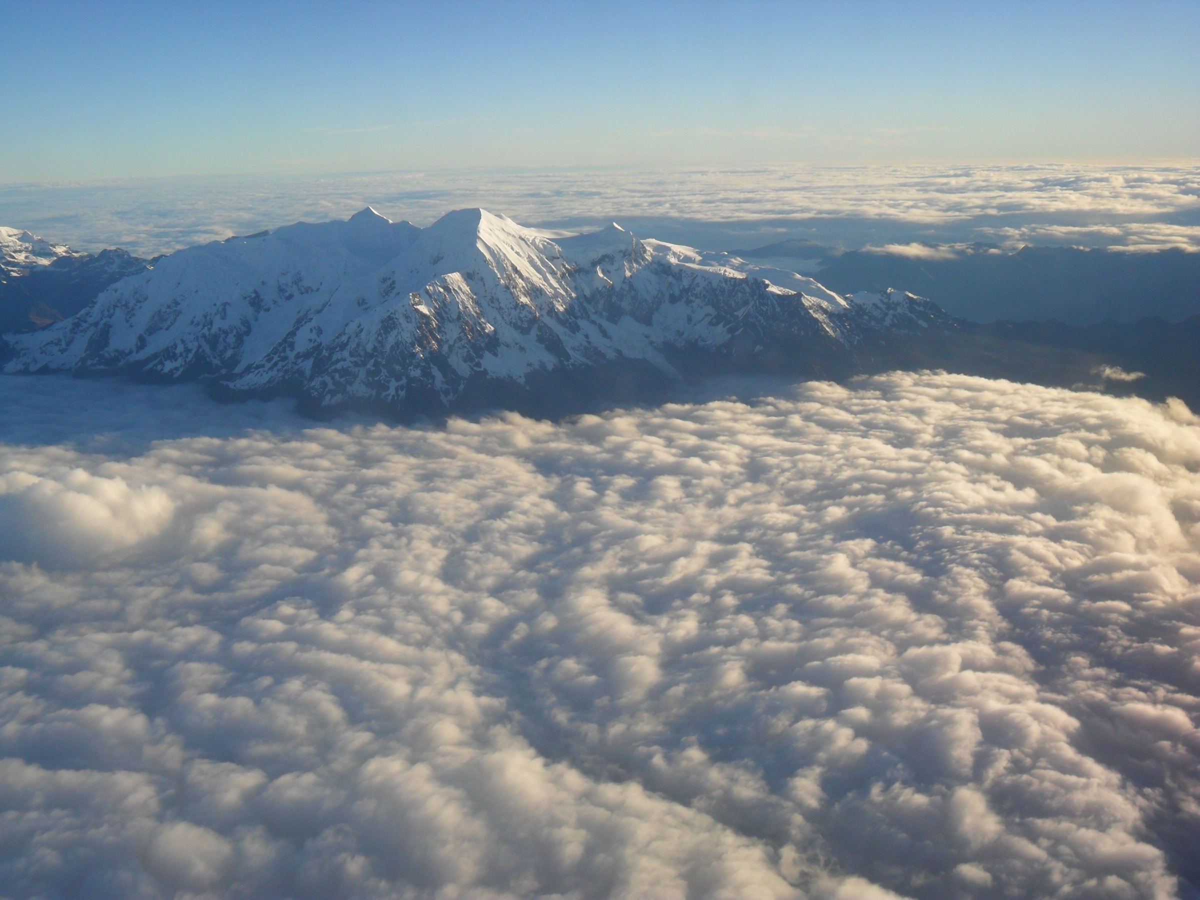
Illimani is the signature mountain of La Paz. The base-camp approach is the most direct non-technical way to experience the Illimani landscape without entering the roped glacier route.
Equipment
- Boots
- Trekking poles
- Warm layer
- Waterproof/windproof shell
- Gloves/hat
- Sun protection
- Food and 2-3 litres of water or treatment
- GPS/map
- Headtorch
Hazards and notes
- Altitude illness, remoteness, weather, route ambiguity and transport logistics are the major issues.
- This should be planned as a serious mountain day.
- Do not proceed above base camp without mountaineering equipment, glacier skills and a qualified local guide.
GPX / KML links
| Source | URL | Format / access | Reuse status |
|---|---|---|---|
| Wikiloc search: Pinaya / Illimani approach candidates | wikiloc.com | Source-map candidates; Wikiloc terms apply; account may be required | Candidate source only; clean base-camp day route not verified |
| Bolivian Mountaineering: Illimani | bolivianmountaineering.com | Itinerary source; no route-file terms stated | Context only |
External links
External links
| Source | URL |
|---|---|
| AllTrails — Circuito del Valle de las Animas | alltrails.com |
| AllTrails — Mount Chacaltaya | alltrails.com |
| AllTrails — Muela del Diablo Mountain | alltrails.com |
| AllTrails — Takesi Trail Day 2 | alltrails.com |
| Wikiloc — Devil’s Molar Trek | wikiloc.com |
| Wikiloc — Chacaltaya Trail | wikiloc.com |
| Wikiloc — Takesi Trail | wikiloc.com |
| Wikiloc search — Pinaya / Illimani approach | wikiloc.com |
| La Paz municipal tourism | lapaz.bo |
| Expedition Bolivia — Takesi Trail | expeditionbolivia.com |
| La Paz Life — Takesi Trail | lapazlife.com |
| CITUR — Muela del Diablo | citur-lilu.com |
| Bolivian Mountaineering — Illimani | bolivianmountaineering.com |
| Viacha Tours — Illimani | viacha-tours.com |