Regional overview
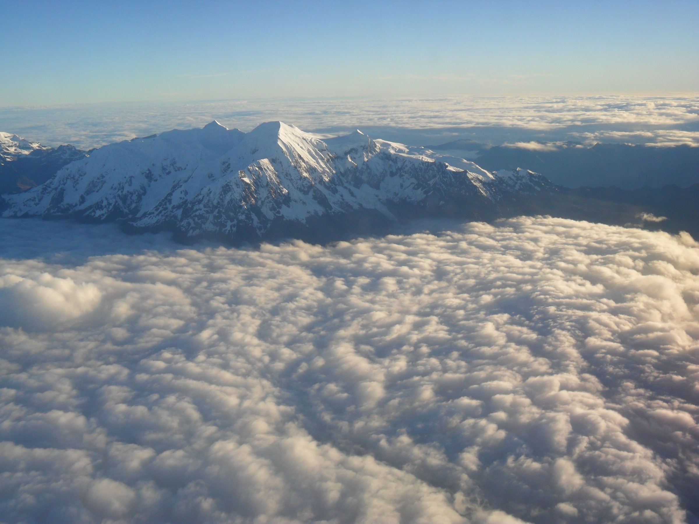
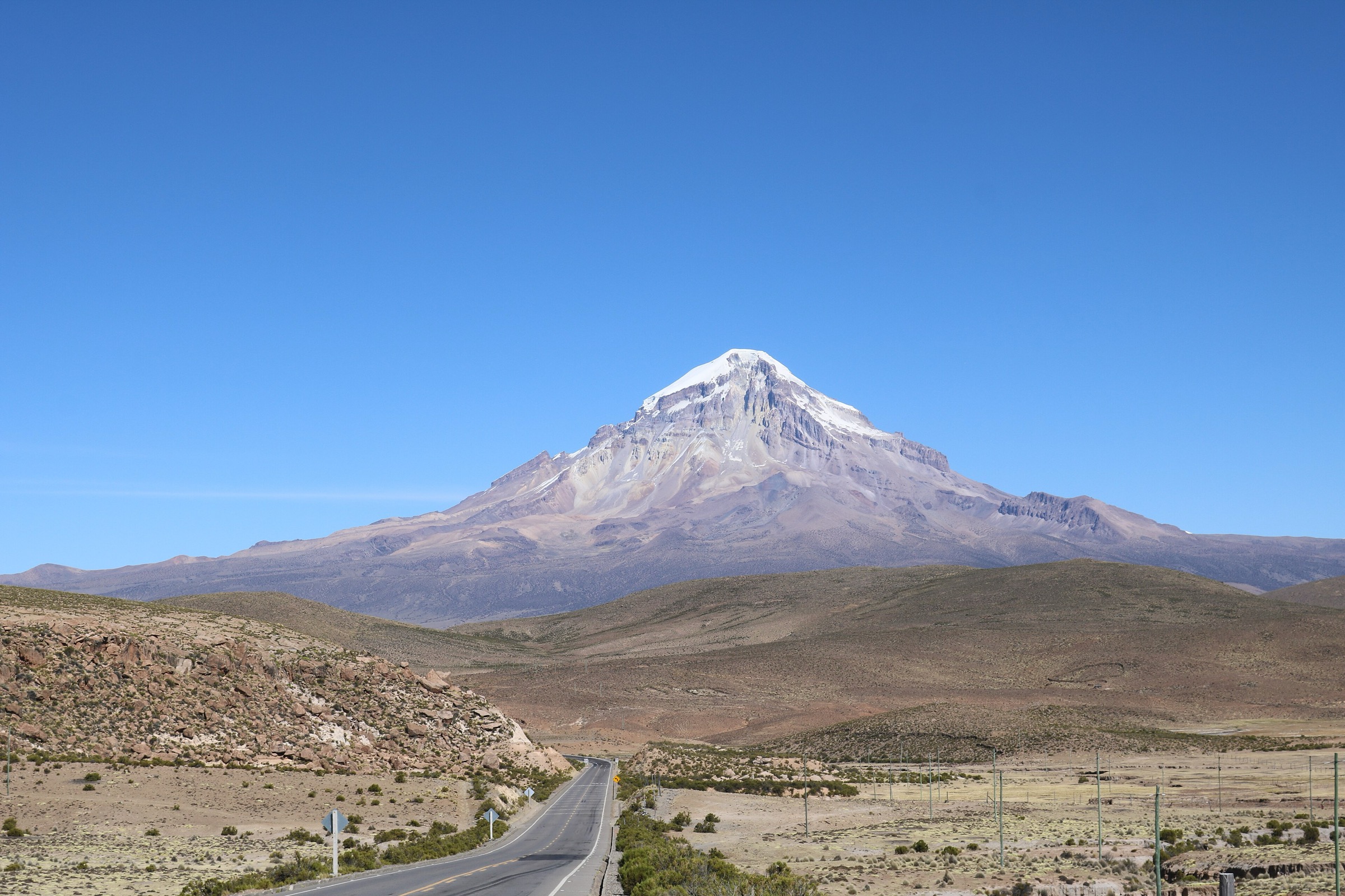
Parque Nacional Sajama is Bolivia’s classic western-volcano walking region: high puna, queñua woodland, geysers, hot springs, colonial villages, vicuña habitat, and the Payachata volcanoes. Most walking takes place above 4,000 m, with views toward Nevado Sajama, Parinacota, Pomerape, and the Altiplano.
Official SERNAP material is unusually useful here. The Sajama tourism regulation identifies authorised tourism routes and distinguishes short day walks from multi-day mountaineering objectives. That distinction matters: ascents of Sajama and Parinacota are not ordinary day hikes in the official framework, so this catalogue uses short official routes and a base-camp access walk rather than summit climbs.
Selection rationale
The five hikes are chosen from SERNAP-authorised visitor routes where possible: the Sajama-geysers walk, Monte Cielo, the queñua/hot-spring route, the Lagunas-Laguna Isla circuit, and the Parinacota base-camp access route. Together they cover geothermal activity, ritual/viewpoint terrain, high woodland, wetlands/lakes, and a volcano-base objective without turning the entry into a mountaineering list.
Summary table
| # | Hike | Country | Route type | Distance | Gain | Max elevation | Difficulty |
|---|---|---|---|---|---|---|---|
| 1 | Sajama village to geysers | Bolivia | Out-and-back / official route | ca. 4,300-4,500 m unresolved | Moderate | ||
| 2 | Sajama - Monte Cielo | Bolivia | Out-and-back / official route | Moderate-hard | |||
| 3 | Queñua forest and Manasaya hot springs | Bolivia | Short walk plus vehicle link | 20 min walk in official source | Easy | ||
| 4 | Lagunas - Laguna Isla circuit | Bolivia | Out-and-back / circuit variant | 1.3 km for Laguna Island source walk | 20 m | 4,157 m | Easy |
| 5 | Parinacota Volcano base-camp access | Bolivia | Point-to-point | 5.0 km | 399 m | 4,805 m | Hard |
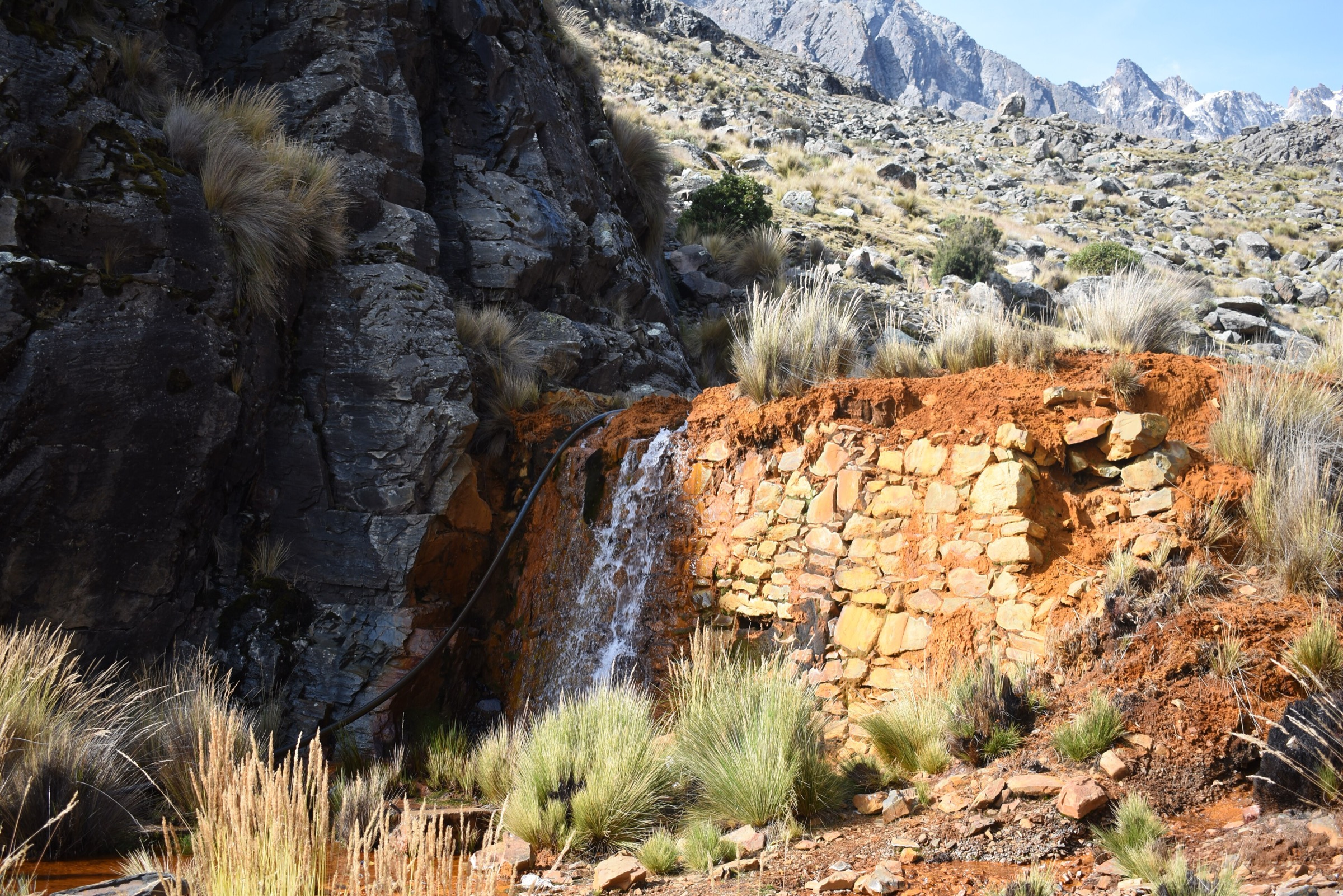
1. Sajama village to geysers
Snapshot
Itinerary
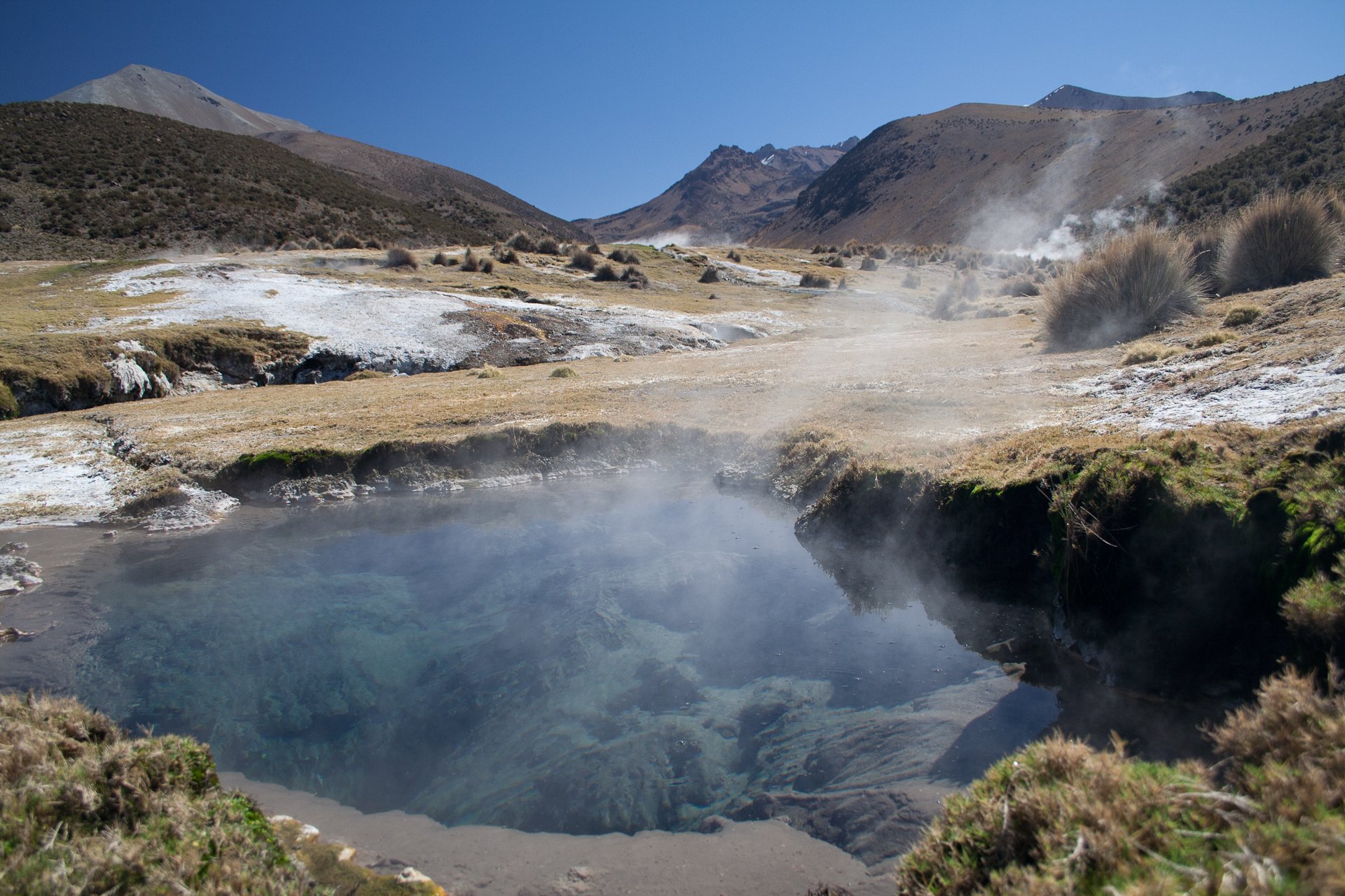
The route heads from Sajama toward the geothermal field identified by SERNAP as route R2, Sajama-geiseres. The walk crosses open high-Andean puna with views of Sajama and Payachata volcanoes before reaching steaming vents and hot-water features.
Why it is essential
The geysers are one of Sajama’s defining non-summit volcanic experiences and are explicitly named as an authorised tourism route by SERNAP.
Equipment
- High-altitude day-hike equipment: walking shoes/boots, warm layers, wind shell, sun protection, water, food, and navigation.
- Extra caution around geothermal ground; stay on established paths and firm surfaces.
Hazards and notes
- Do not approach unstable geothermal crust, boiling water, fumaroles, or mud pots.
- SERNAP rules require visitors to stay on authorised routes and respect park controls.
- Exact walking distance was not verified.
GPX / KML links
| Source | URL | Format / access | Reuse status |
|---|---|---|---|
| SERNAP ROTE Sajama, route R2 Sajama-geiseres | sernap.gob.bo | Official route listing; SERNAP PDF; reuse terms not assessed | Official route verified; GPX unavailable |
External links
2. Sajama - Monte Cielo
Snapshot
Itinerary
SERNAP route R3 climbs from Sajama to the hill known as Monte Cielo. The route is described as a three-hour walk with landscape views and a ritual site associated with the Carangas lordship.
Why it is essential
Monte Cielo is the official short viewpoint and cultural-landscape hike above Sajama village. It gives a day-walk alternative to the much more serious volcano ascents.
Equipment
- Standard mountain day equipment, including warm layers, wind shell, sun protection, water, and offline map.
- Cash and park ticket/route documentation if requested by guards.
Hazards and notes
- Route geometry and exact elevation were not verified in this pass.
- Confirm route line and access with park staff or local guides before setting out.
GPX / KML links
| Source | URL | Format / access | Reuse status |
|---|---|---|---|
| SERNAP ROTE Sajama, route R3 Sajama-Monte Cielo | sernap.gob.bo | Official route listing; SERNAP PDF; reuse terms not assessed | Official route verified; GPX unavailable |
External links
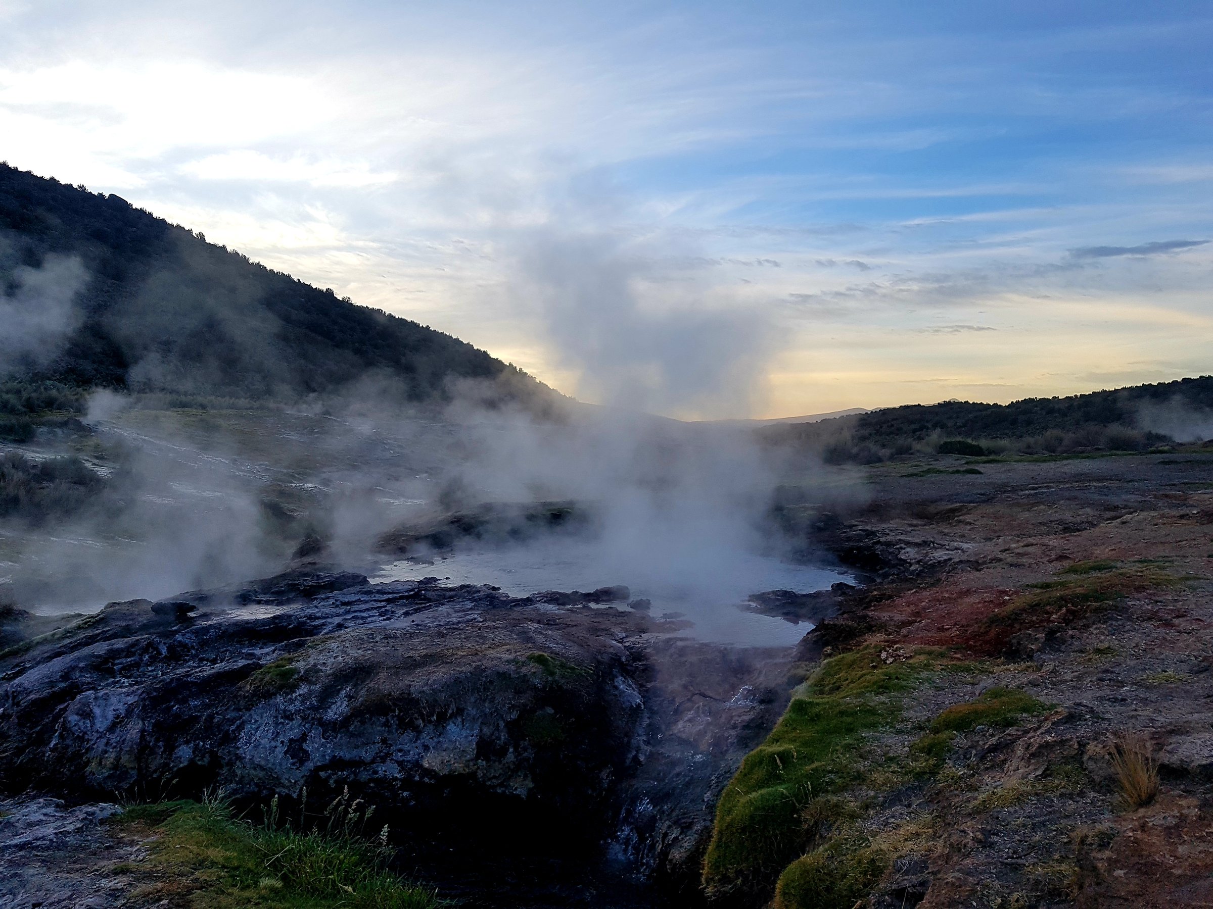
3. Queñua forest and Manasaya hot springs
Snapshot
Itinerary
SERNAP route R4 links Sajama with the high queñua woodland and the Manasaya hot springs. The walking component is short, but it highlights one of the park’s most distinctive habitats before the hot-spring stop.
Why it is essential
The queñua woodland is a defining Sajama ecosystem, and the hot springs are a classic non-technical volcano-country experience.
Equipment
- Light walking kit, wind layer, sun protection, water, and swimwear/towel only where bathing is currently allowed.
- Sandals are useful around hot-spring facilities but not for the walking section.
Hazards and notes
- Use only authorised paths and bathing areas.
- Fragile woodland, hot water, slippery surfaces, and park regulations are the main issues.
- Exact walking distance and current facility rules need local confirmation.
GPX / KML links
| Source | URL | Format / access | Reuse status |
|---|---|---|---|
| SERNAP ROTE Sajama, route R4 Sajama-Bosque de Queñuas-Aguas Termales | sernap.gob.bo | Official route listing; SERNAP PDF; reuse terms not assessed | Official route verified; GPX unavailable |
External links
4. Lagunas - Laguna Isla circuit
Snapshot
Itinerary
SERNAP route R6 begins in the community of Lagunas and links the interpretation centre, colonial churches, and Laguna Isla. The AllTrails source route isolates the short Laguna Island walk, which is useful as the walking-stat reference.
Why it is essential
Laguna Isla adds the park’s wetland and birdlife side to a set otherwise dominated by volcanoes, geothermal features, and viewpoints.
Equipment
- Light hiking equipment, wind layer, sun protection, binoculars, water, and camera.
- Warm clothing for wind exposure around the lake.
Hazards and notes
- Stay clear of wetland margins and do not disturb vicuñas or waterbirds.
- SERNAP rules prohibit disturbing or feeding wildlife and require travel on authorised routes.
GPX / KML links
| Source | URL | Format / access | Reuse status |
|---|---|---|---|
| SERNAP ROTE Sajama, route R6 Lagunas-Laguna Isla | sernap.gob.bo | Official route listing; SERNAP PDF; reuse terms not assessed | Official route verified; GPX unavailable |
| AllTrails: Lagoon Island | alltrails.com | Source map / route statistics; AllTrails terms apply | Stats verified; direct GPX reuse unresolved |
External links
5. Parinacota Volcano base-camp access
Snapshot
Itinerary
The route approaches the Parinacota base-camp area through high puna with views of Sajama, the Payachata volcanoes, vicuña habitat, and queñua woodland. This entry covers the access walk, not the Parinacota summit climb.
Why it is essential
Parinacota is one of the defining volcanoes of the Sajama skyline. A base-camp access day gives walkers a volcano-base experience while respecting the official framework that treats the summit ascent as a multi-day mountaineering route.
Equipment
- Full high-altitude day kit, warm layers, shell, gloves, hat, sun protection, water, food, and navigation.
- Mountaineering equipment is not listed here because the route is limited to base-camp access; summit attempts require a separate mountaineering plan.
Hazards and notes
- The official SERNAP route R9 describes Parinacota ascent logistics as normally two days.
- Do not treat this base-camp approach as a summit recommendation.
- Altitude, weather, volcanic scree, and remoteness are serious.
GPX / KML links
| Source | URL | Format / access | Reuse status |
|---|---|---|---|
| AllTrails: Access to Parinacota Volcano - Base Camp | alltrails.com | Source map / route statistics; AllTrails terms apply | Stats verified; direct GPX reuse unresolved |
| SERNAP ROTE Sajama, route R9 Payachatas-ascenso al Parinacota | sernap.gob.bo | Official route context; SERNAP PDF; reuse terms not assessed | Confirms Parinacota route context and multi-day nature |
External links
External links
| Source | URL |
|---|---|
| SERNAP — Reglamento de Operación Turística, Parque Nacional Sajama | sernap.gob.bo |
| AllTrails — Lagoon Island | alltrails.com |
| AllTrails — Parinacota base-camp access | alltrails.com |