Regional overview
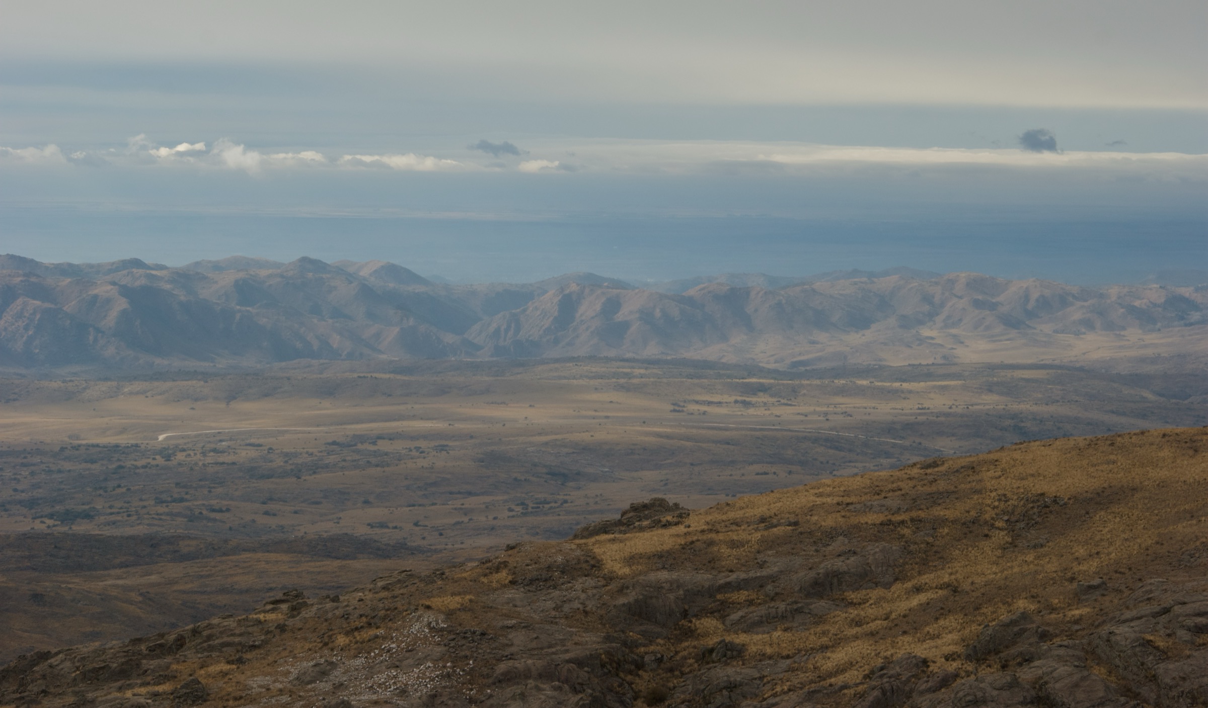
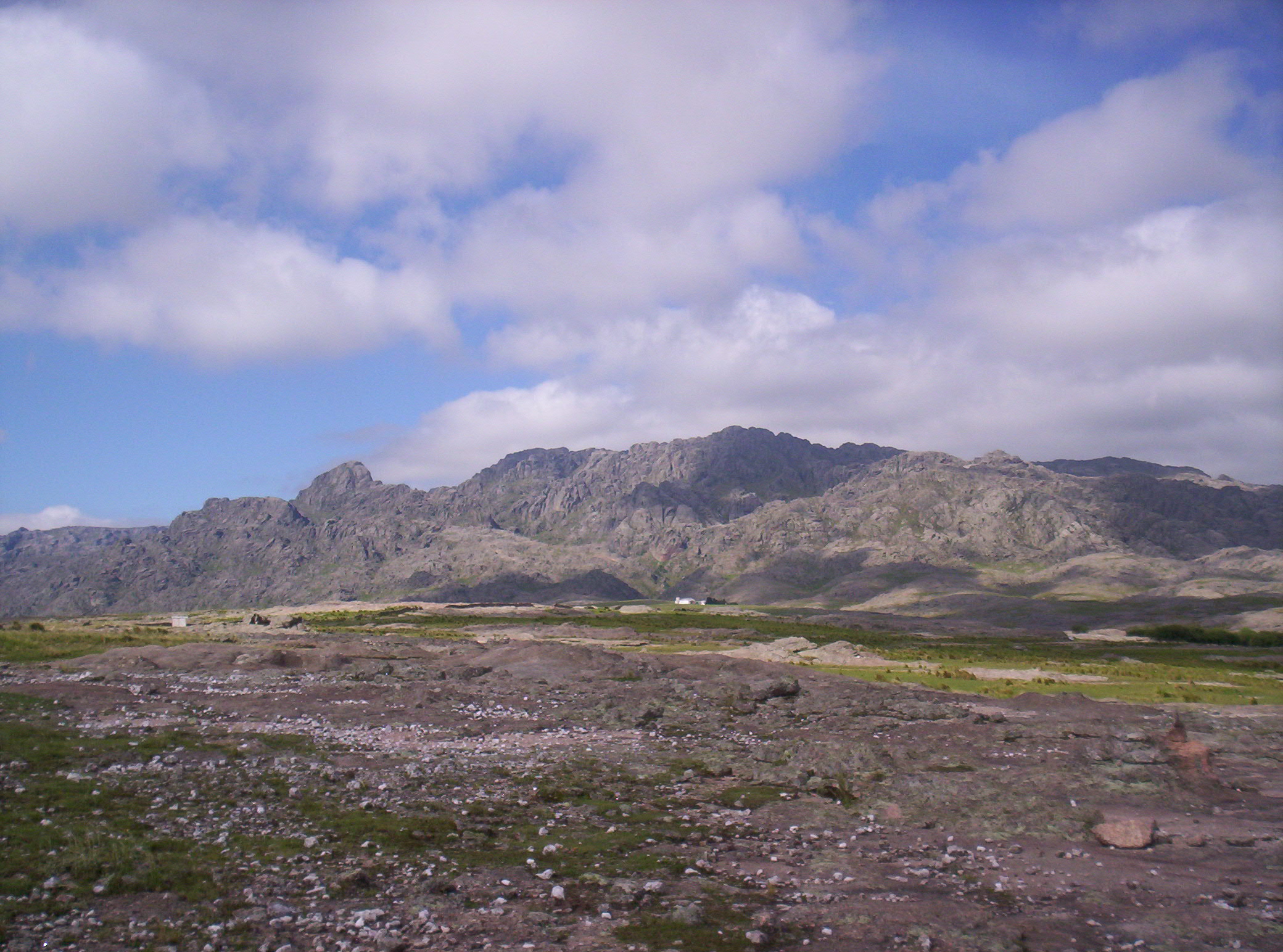
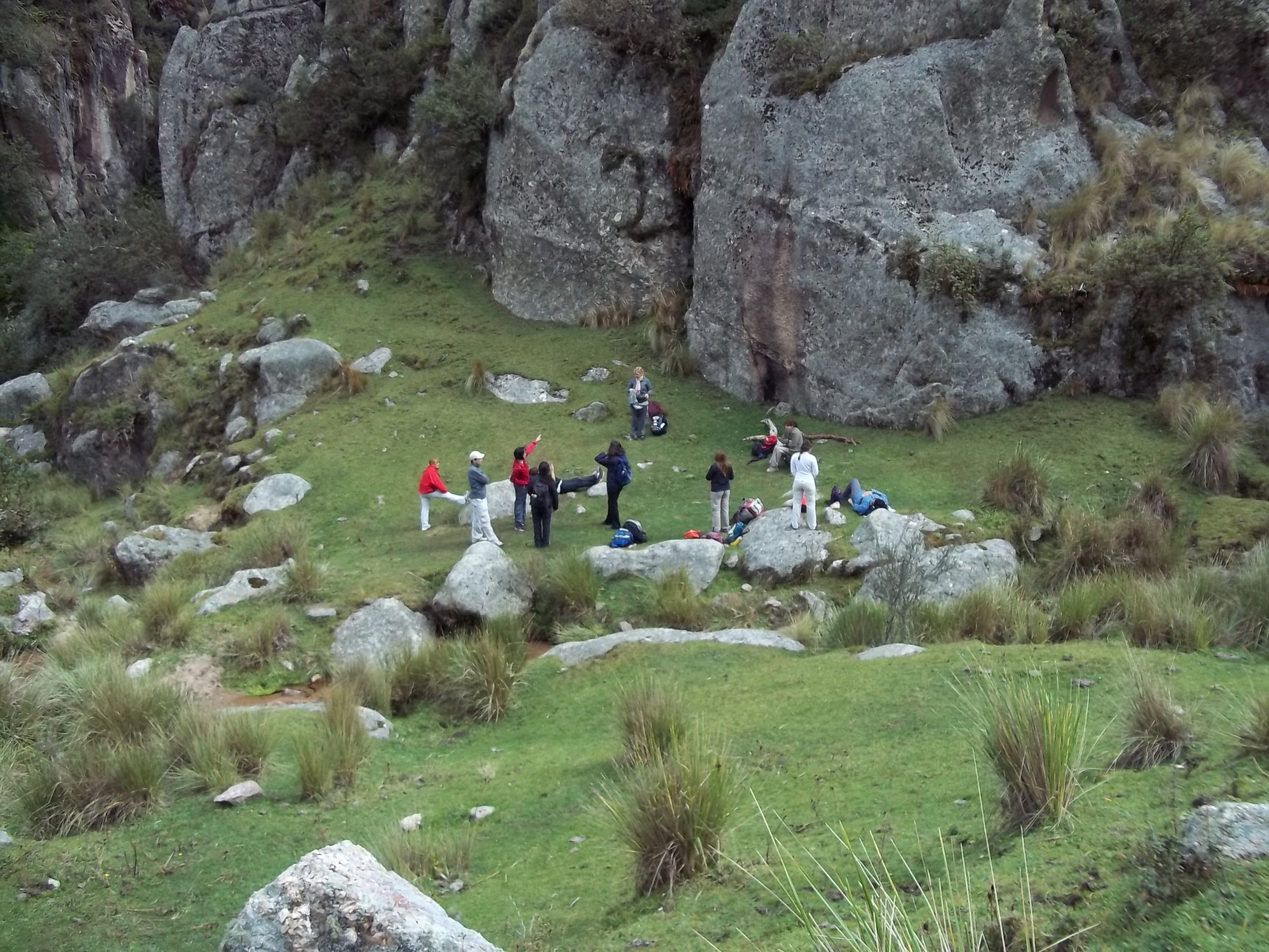
Los Gigantes is a granite massif at the northern end of the Sierras Grandes of Córdoba, within the broader Pampa de Achala highland system. Its hiking is rugged by Argentine-sierras standards: rock labyrinths, stream crossings, high grassland, short hand-use sections, and often poor visibility in mist.
The principal access points are Casas Nuevas / Doña Felipa for the Sendero Norte and La Rotonda for routes into Cerro de la Cruz, caves, and Valle de los Lisos. Córdoba Turismo classifies the Macizo Los Gigantes as a mountain-risk area and recommends access registration, local advice, correct equipment, and authorised guides for inexperienced walkers.
The normal season is year-round in stable weather, with autumn and spring often more comfortable than hot summer days. Fog, thunderstorms, slippery granite, wildfire closures, private access controls, and route-finding errors are the main issues. The final road access from Tanti includes about 27-30 km of gravel/ripio, and conditions should be checked after rain.
Selection rationale
The selection covers the main high summit, the classic Cerro de la Cruz sector, the private-reserve Valle de los Lisos landscape, the caves/río subterráneo route, and an official low-level viewpoint route facing the massif. The fifth route is an edge-area viewpoint rather than a summit route, included because it has official Córdoba Turismo statistics and offers a safer short Los Gigantes orientation walk.
Summary table
| # | Hike | Country | Route type | Distance | Gain | Max elevation | Difficulty |
|---|---|---|---|---|---|---|---|
| 1 | Cerro Mogote / Cerro Los Gigantes via Sendero Norte | Argentina | Loop / out-and-back variant | 11.7-15 km | 644 m secondary | 2,374 m official | Hard |
| 2 | Cerro de la Cruz from La Rotonda | Argentina | Loop | 9-10.74 km | 425 m secondary | 2,196 m secondary | Moderate-hard |
| 3 | Valle de los Lisos / Quebrada del Toro | Argentina | Out-and-back / guided circuit | 7.6-16 km | 412-576 m secondary | Moderate-hard | |
| 4 | Río Subterráneo, caves and Quebrada del Toro circuit | Argentina | Loop | 6.1-9 km depending on route | 259 m secondary; official gain unresolved | 2,194 m secondary | Moderate |
| 5 | Ventana a Los Gigantes, Santa Cruz del Lago | Argentina | Loop | 3.87 km | 94.1 m | 752.6 m | Easy-moderate |
1. Cerro Mogote / Cerro Los Gigantes via Sendero Norte
Snapshot
Itinerary
The usual route starts at Casas Nuevas, where access registration is handled locally, and follows the Sendero Norte into the granite massif. Cairns mark the way across slopes, streams, and rockier ground before the route reaches Cerro Mogote, the highest point of the massif.
Why it is essential
Cerro Mogote is the defining high point of Los Gigantes and gives the clearest day-hike expression of the massif’s granite domes, high grasslands, and broad Pampa de Achala views.
Equipment
- Mountain hiking equipment: sturdy boots, warm and waterproof layers, sun protection, 2+ litres of water, food, headtorch, map/GPS, and navigation backup
- Trekking poles useful on the long descent
- Gloves can help on rough granite in cold weather
Hazards and notes
- Córdoba Turismo describes strong slopes, arroyos, valleys, and short sections where hands are used.
- Fog can make the granite labyrinth difficult to navigate.
- Registration and current access / payment arrangements should be confirmed at Casas Nuevas before starting.
GPX / KML links
| Source | URL | Format / access | Reuse status |
|---|---|---|---|
| AllTrails: Cerro Los Gigantes | alltrails.com | Route page; AllTrails terms apply | Secondary route source only |
| Wikiloc: Cerro La Cruz y Cerro Mogote | wikiloc.com | Route page / GPX via platform; Wikiloc terms apply | Secondary route source only |
External links
- Córdoba Turismo — Los Gigantes
- AllTrails — Cerro Los Gigantes
- Wikiloc — Cerro La Cruz y Cerro Mogote
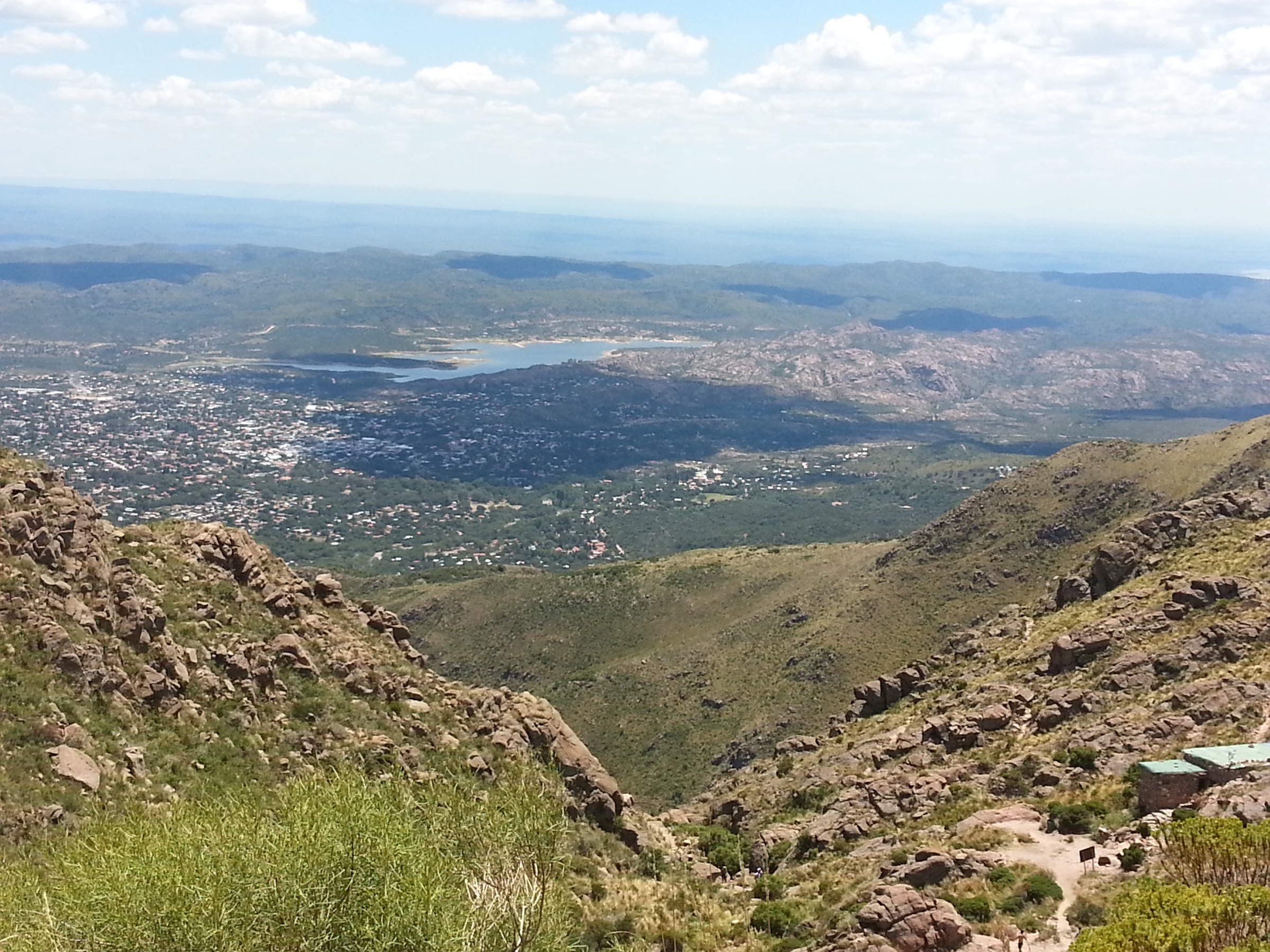
2. Cerro de la Cruz from La Rotonda
Snapshot
Itinerary
The route starts at La Rotonda and follows the normal Cerro de la Cruz approach. Official tourism material describes this as a classic Los Gigantes ascent, passing cave sectors such as Cueva del Pollito, Cueva de la Salamanca, Cueva de los Pájaros, and the Hornito / río subterráneo area depending on the guided variant.
Why it is essential
Cerro de la Cruz is a classic Los Gigantes objective, historically important for Córdoba mountaineering and rock-climbing culture, and gives a shorter alternative to Cerro Mogote while still entering the heart of the granite massif.
Equipment
- Mountain hiking equipment
- Navigation backup
- Headtorch
- For cave-focused variants, use a guide or a well-verified route and avoid entering tight or wet rock passages in poor conditions
Hazards and notes
- The route can include rough rock, hidden cave entrances, and confusing informal tracks.
- Some access crosses private or locally managed sectors; confirm permissions, fees, and whether a guide is required.
GPX / KML links
| Source | URL | Format / access | Reuse status |
|---|---|---|---|
| Wikiloc: Cerro de la Cruz — Los Gigantes | wikiloc.com | Route page / GPX via platform; Wikiloc terms apply | Secondary route source only |
| Córdoba Turismo: cave / Cerro de la Cruz experience | cordobaturismo.gov.ar | Source description; website terms not checked | No GPX found |
External links
- Córdoba Turismo — caves and Cerro de la Cruz
- Córdoba Turismo — viviendo Los Gigantes
- Wikiloc — Cerro de la Cruz, Los Gigantes
3. Valle de los Lisos / Quebrada del Toro
Snapshot
Itinerary
The route enters the eastern side of Los Gigantes and passes through cañadas, pajonales, old quarry areas, springs, quebradas, and polished rock valleys. Shorter public route pages link La Rotonda, Valle de los Lisos, and Quebrada del Toro.
Why it is essential
Valle de los Lisos represents the enclosed, sculpted-rock side of Los Gigantes and contrasts strongly with the summit-oriented Mogote and Cerro de la Cruz routes.
Equipment
- Mountain hiking equipment
- Water capacity
- Sun protection
- Headtorch
- Navigation backup
- Confirm reservation, entry, guide, group-size, and private-reserve rules before departure
Hazards and notes
- Córdoba Turismo describes an 8-hour, approximately 16 km experience and notes suspension in rain or fog.
- Several route pages refer to private-reserve access; current access rules need direct confirmation.
GPX / KML links
| Source | URL | Format / access | Reuse status |
|---|---|---|---|
| AllTrails: La Rotonda — Valle de los Lisos — Quebrada del Toro | alltrails.com | Route page; AllTrails terms apply | Secondary route source only |
| AllTrails: Reserva del Valle de los Lisos | alltrails.com | Route page; AllTrails terms apply | Secondary route source only |
| Wikiloc: Los Gigantes — Valle de los Lisos | wikiloc.com | Route page / GPX via platform; Wikiloc terms apply | Secondary route source only |
External links
- Córdoba Turismo — Los Gigantes / Valle de los Lisos
- AllTrails — La Rotonda / Valle de los Lisos / Quebrada del Toro
- AllTrails — Reserva del Valle de los Lisos
- Wikiloc — Los Gigantes / Valle de los Lisos
4. Río Subterráneo, caves and Quebrada del Toro circuit
Snapshot
Itinerary
The circuit links classic inner-massif features described by local and provincial sources: Río Subterráneo / Hornito, Cueva del Pollito, Cueva de la Salamanca, Cueva de los Pájaros, Valle de los Lisos, and Quebrada del Toro depending on variant. A source route lists Cerro de la Cruz, Valle de los Lisos, Río Subterráneo, Quebrada del Toro, and La Rotonda as waypoints.
Why it is essential
The cave and río subterráneo landscape is one of the distinctive features of Los Gigantes, showing the erosional granite character that separates the massif from ordinary hill walks.
Equipment
- Mountain hiking equipment
- Navigation backup
- Headtorch
- Weatherproof layer
- Enter cave passages only with local knowledge or a guide and never in heavy rain or poor visibility
Hazards and notes
- This route has the weakest publication-ready data in the Los Gigantes set.
- Cave entrances can be hidden, wet rock can be slippery, and informal variants may stray onto access-controlled land.
- Treat as a guided / candidate route until a clean GPS track and access permission are confirmed.
GPX / KML links
| Source | URL | Format / access | Reuse status |
|---|---|---|---|
| Wikiloc: Los Gigantes — Ruta 2 | wikiloc.com | Route page / GPX via platform; Wikiloc terms apply | Secondary route source only |
| Córdoba Turismo: cave / Cerro de la Cruz experience | cordobaturismo.gov.ar | Source description; website terms not checked | No GPX found |
External links
5. Ventana a Los Gigantes, Santa Cruz del Lago
Snapshot
Itinerary
The official route starts and ends at Monumento Indio Bamba and follows consolidated track to a natural balcony with the Los Gigantes massif as the main western feature. It is a short viewpoint walk rather than a high-massif route.
Why it is essential
This is the safer, lower-elevation orientation walk in the file: an official route with complete statistics that frames the massif for walkers not ready for the granite high routes.
Equipment
- Standard hiking equipment: hiking shoes, water, sun protection, and map/GPS
- The route is short but not a substitute for checking heat and storm forecasts
Hazards and notes
- This route is geographically outside the core Los Gigantes massif.
- It should be retained only if the catalogue permits edge-area viewpoint walks; otherwise replace with a locally guided route once official statistics are found.
GPX / KML links
| Source | URL | Format / access | Reuse status |
|---|---|---|---|
| Córdoba Turismo senderos PDF map link | google.com/maps/d | Google My Maps / source map; terms not checked | Official map source found; direct reuse unresolved |