Regional overview
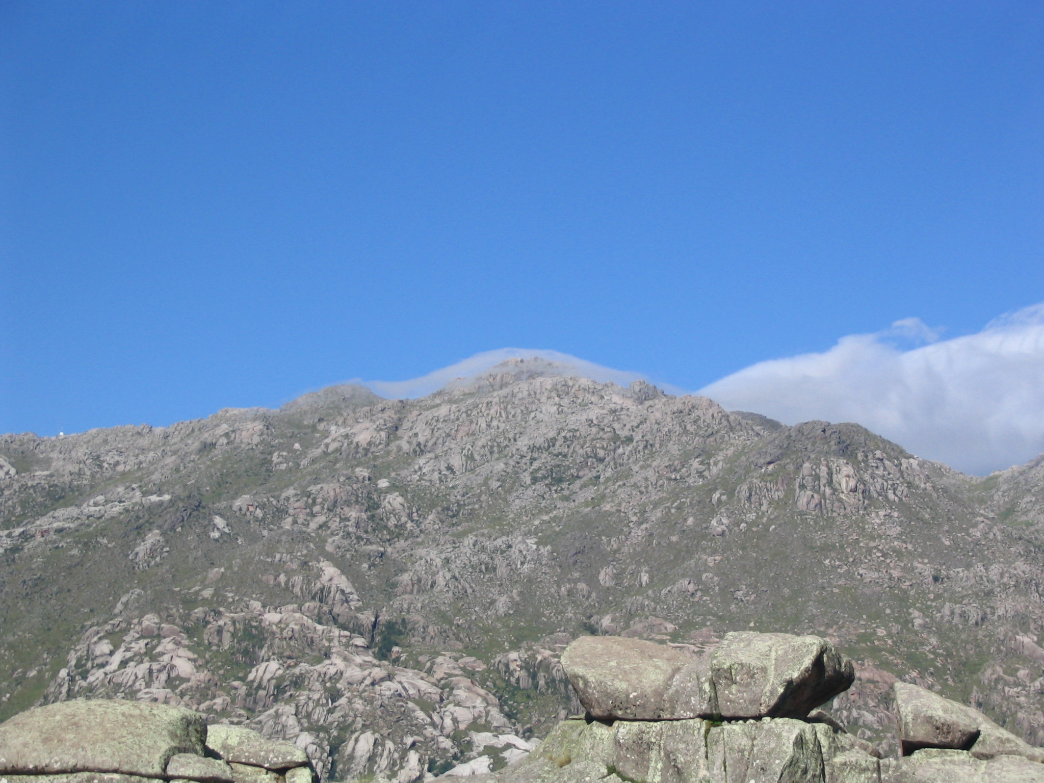
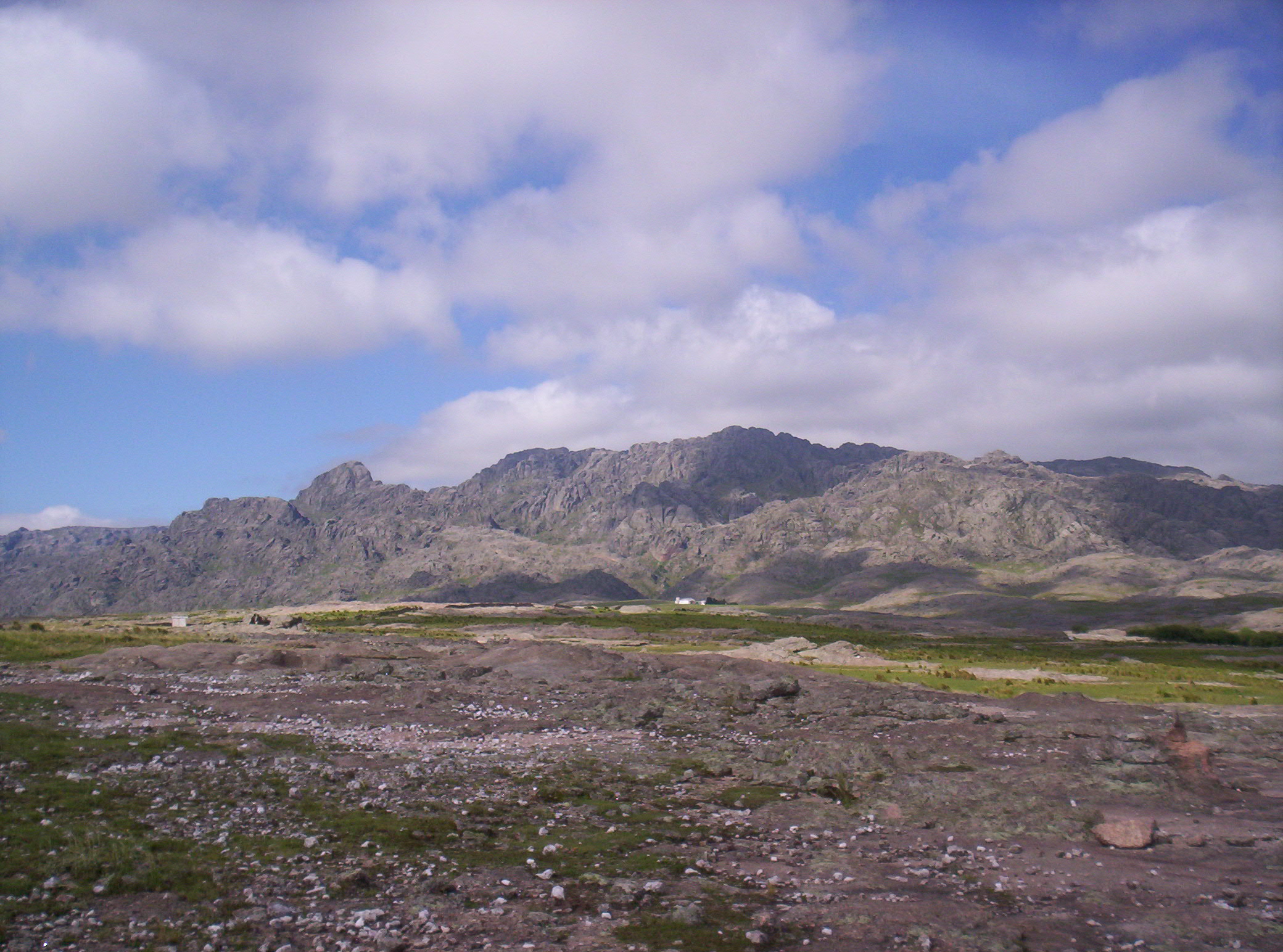
The Comechingones and San Luis highlands form part of the Sierras Pampeanas rather than the Andes. The walking character is dry, rocky and open, with high grassland, granite blocks, tabaquillo woodland pockets, ravines and waterfall gullies. The highest routes, especially around Champaqui and Pampa de Achala, feel like exposed upland plateau walks despite the relatively low absolute altitude.
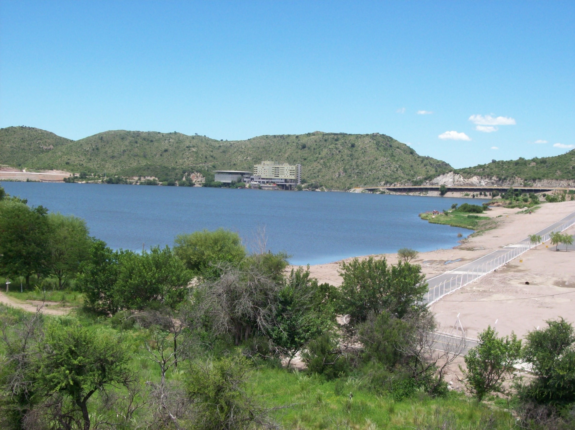
The main hiking bases are Villa de Merlo, Potrero de los Funes, Villa General Belgrano / Yacanto, Villa Alpina and the Altas Cumbres road. Public transport is limited outside the best-known access points. Many trailheads require a private vehicle, local transfer or guide.
Summer can be hot and stormy. Winter can bring frost, ice and occasional snow on the higher plateau. Navigation should not be underestimated: several routes cross open rock and grassland where side paths, informal tracks and fog can complicate route-finding.
Selection rationale
The five hikes below represent the high summit, national-park canyon, historic mining settlement, waterfall forest and San Luis summit sides of the region.
Summary table
| # | Hike | Country | Route type | Distance | Gain | Max elevation | Difficulty |
|---|---|---|---|---|---|---|---|
| 1 | Cerro Champaqui via Cerro Los Linderos | Argentina | Vehicle-assisted out-and-back | 2.4 km | 99 m | 2,782 m | Moderate |
| 2 | Quebrada del Condorito — Balcón Norte and río option | Argentina | Out-and-back | 10.0-11.9 km, plus river option | 395 m, plus river descent/ascent | 1,944 m | Moderate to hard |
| 3 | Sendero Tono to Pueblo Escondido / Cerro Áspero | Argentina | Out-and-back | 9.5 km | 441 m | 2,072 m | Moderate |
| 4 | Salto del Tabaquillo | Argentina | Out-and-back | 3.4 km | 271 m | 1,518 m | Moderate |
| 5 | Cerro Valle de Piedra via Los Molles | Argentina | Out-and-back | 13.8 km | 972 m | 1,949 m | Hard |
1. Cerro Champaqui via Cerro Los Linderos

Snapshot
Itinerary
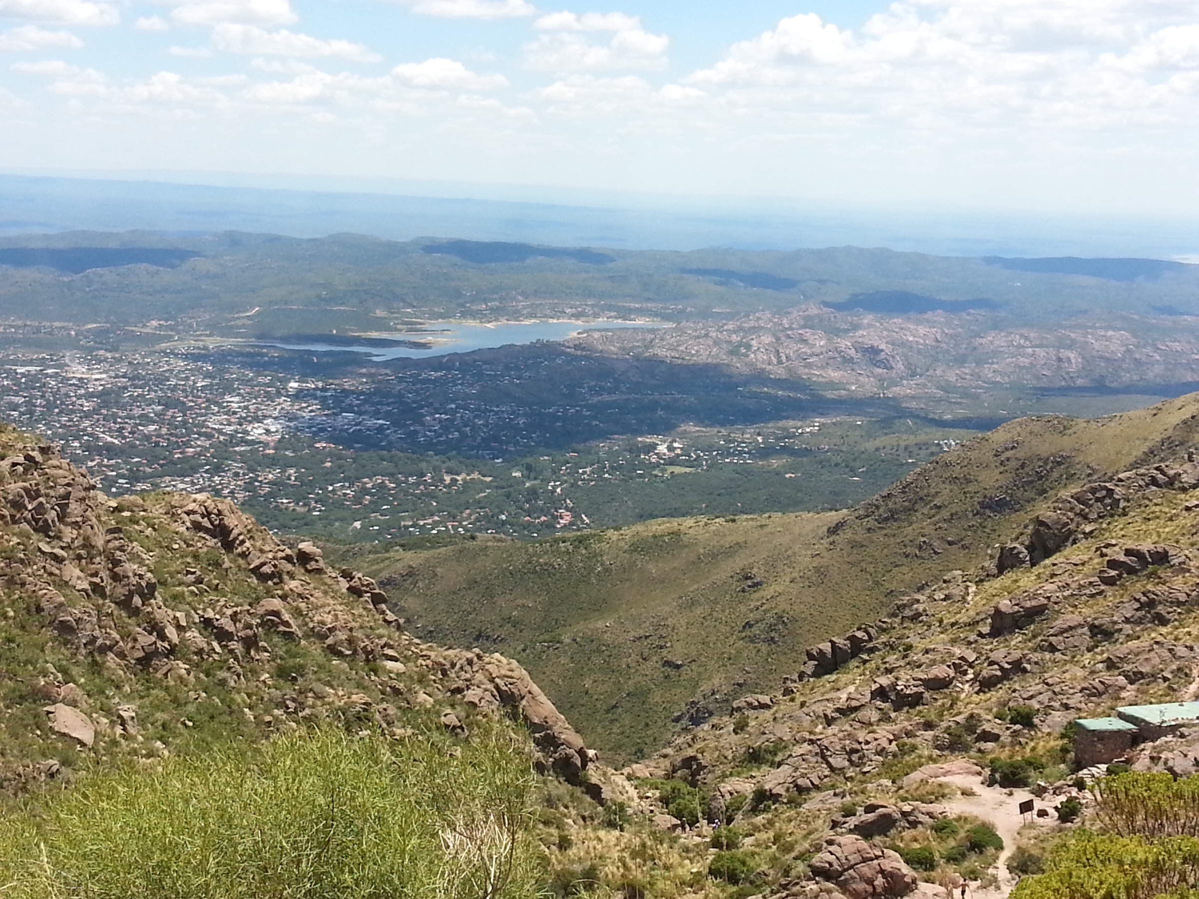
The route starts near Cerro Los Linderos and follows a short, rocky high-level path to the summit area of Cerro Champaqui, the landmark high point of the Córdoba sierras. The walking line is short, but the approach road is a major part of the day and conditions should be checked locally.
Why it is essential
Champaqui is the iconic high summit of the Comechingones / Sierras Grandes uplands and gives the broadest view over the Traslasierra and Calamuchita sides of the range.
Equipment
- Sturdy footwear
- Windproof / waterproof layer
- Warm layer
- Sun protection
- Water and food
- Map / GPS and navigation backup
Hazards and notes
- The high trail is exposed to sun, wind, storms and winter ice.
- The vehicle approach is long and road-condition dependent.
- The classic Villa Alpina route is much longer and is often done as a multi-day trip; it should not be substituted casually for this day variant.
GPX / KML links
| Source | URL | Format / access | Reuse status |
|---|---|---|---|
| AllTrails: Cerro Champaquí via Cerro Los Linderos | alltrails.com | Web map / source route; AllTrails terms apply | Reference only; recreate geometry independently |
External links
- AllTrails — Cerro Champaquí via Cerro Los Linderos
- Wikipedia — Cerro Champaquí
- Wikipedia — Sierras de Comechingones
2. Quebrada del Condorito — Balcón Norte and Río Option

Snapshot
Itinerary
The route follows the signed main trail across Pampa de Achala to Balcón Norte, the principal public viewpoint into the Condorito canyon. A steeper optional descent reaches Río de los Condoritos before climbing back to the main trail.
Why it is essential
This is the signature public walk in the national park, combining high-grassland scenery, condor habitat, canyon views and one of the best-managed protected-area trail systems in the region.
Equipment
- Standard to mountain hiking equipment
- Water, sun protection, warm layer and wind / rain shell
- Binoculars (useful for birdwatching)
Hazards and notes
- Online registration is required for unguided visits to Balcón Norte or Río de los Condoritos.
- APN states that the river descent is winter-sensitive because ice can make the path dangerous.
- Dogs are not allowed on the AllTrails-listed route.
- Fog, lightning and sudden weather shifts are plausible on the high plateau.
GPX / KML links
| Source | URL | Format / access | Reuse status |
|---|---|---|---|
| APN interactive protected-area map | argentina.gob.ar | Official source map; APN terms not checked for route-layer reuse | Source reference; downloadable layers mentioned by APN but not retrieved |
| AllTrails: Sendero Quebrada del Condorito | alltrails.com | Web map / source route; AllTrails terms apply | Reference only |
External links
- APN — Parque Nacional Quebrada del Condorito
- APN — Actividades / trail details
- APN — Access / registration
- AllTrails — Sendero Quebrada del Condorito
3. Sendero Tono to Pueblo Escondido / Cerro Áspero
Snapshot
Itinerary
The trail descends from the high road through open mountain terrain toward Pueblo Escondido and Arroyo del Tigre. The route passes the turn-off toward Salto del Tigre and reaches the historic mining settlement area before returning by the same track.
Why it is essential
Pueblo Escondido combines mountain scenery with the industrial remains of the Cerro Áspero mining district, giving the region a distinctive cultural and historical route rather than only a scenic summit or waterfall walk.
Equipment
- Mountain hiking equipment, with footwear with grip for rock
- Map / GPS and enough water
- Trekking poles are useful on the return climb
Hazards and notes
- AllTrails review summaries flag rocky sections and unclear paths; navigation should be treated seriously.
- Access status and any private-property conditions should be checked locally before departure.
GPX / KML links
| Source | URL | Format / access | Reuse status |
|---|---|---|---|
| AllTrails: Sendero Tono — Pueblo Escondido | alltrails.com | Web map / source route; AllTrails terms apply | Reference only |
External links
4. Salto del Tabaquillo

Snapshot
Itinerary
The route follows a rocky stream-side trail through the Mogote Bayo environment toward the 18 m Salto del Tabaquillo waterfall. The path includes boulder and stream-margin sections, so it is more than a simple promenade.
Why it is essential
This is one of Merlo’s classic mountain-waterfall walks, combining tabaquillo woodland, water, rock and close access from the Comechingones foothills.
Equipment
- Standard hiking equipment with grippy footwear
- Water, sun protection and a light shell
- Avoid sandals on wet rock
Hazards and notes
- Rock steps and wet stone can be slippery.
- AllTrails notes cortadera grasses along the route.
- Do not enter narrow stream sections in storms or after heavy rain.
GPX / KML links
| Source | URL | Format / access | Reuse status |
|---|---|---|---|
| AllTrails: Salto del Tabaquillo | alltrails.com | Web map / source route; AllTrails terms apply | Reference only |
External links
5. Cerro Valle de Piedra via Los Molles
Snapshot
Itinerary
The route climbs from the Los Molles side toward Cerro Valle de Piedra, one of the high points above Potrero de los Funes. It is a long out-and-back with river / stream scenery low down and increasingly open views higher on the mountain.
Why it is essential
This is the strongest summit-style day hike in the Potrero / San Luis highland section and balances the shorter waterfall and mirador routes in the broader region.
Equipment
- Mountain hiking equipment
- 2-3 litres of water
- Sun protection and wind layer
- Navigation backup and headtorch for a late return margin
Hazards and notes
- The main risk is effort: the route is long and nearly 1,000 m of ascent.
- Avoid hot afternoons, thunderstorms and poor visibility on the upper slopes.
GPX / KML links
| Source | URL | Format / access | Reuse status |
|---|---|---|---|
| AllTrails: Cerro Valle de Piedra via Los Molles | alltrails.com | Web map / source route; AllTrails terms apply | Reference only |
External links
External links
| Source | URL |
|---|---|
| APN — Parque Nacional Quebrada del Condorito | argentina.gob.ar |
| AllTrails — Cerro Champaquí via Cerro Los Linderos | alltrails.com |
| AllTrails — Sendero Quebrada del Condorito | alltrails.com |
| AllTrails — Sendero Tono — Pueblo Escondido | alltrails.com |
| AllTrails — Salto del Tabaquillo | alltrails.com |
| AllTrails — Cerro Valle de Piedra via Los Molles | alltrails.com |
| Wikipedia — Sierras de Comechingones | es.wikipedia.org |
| Wikipedia — Sierras de San Luis | es.wikipedia.org |
| Wikipedia — Reserva Provincial Natural Mogote Bayo | es.wikipedia.org |
| Wikipedia — Potrero de los Funes | es.wikipedia.org |
| Wikipedia — Mina de Cerro Áspero | es.wikipedia.org |
| Wikipedia — Cerro Champaquí | en.wikipedia.org |