Regional overview
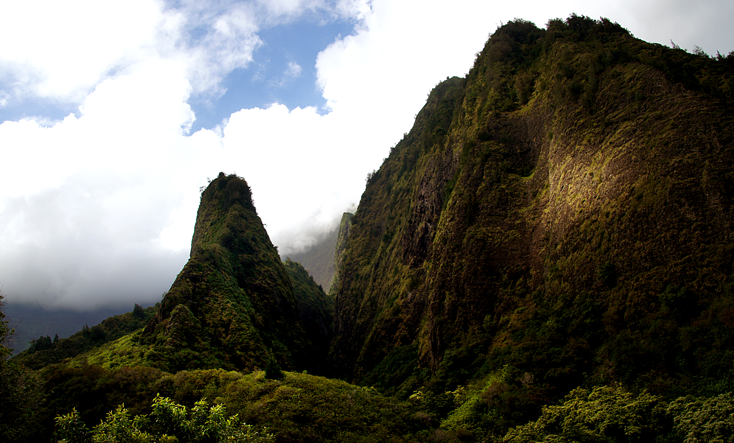
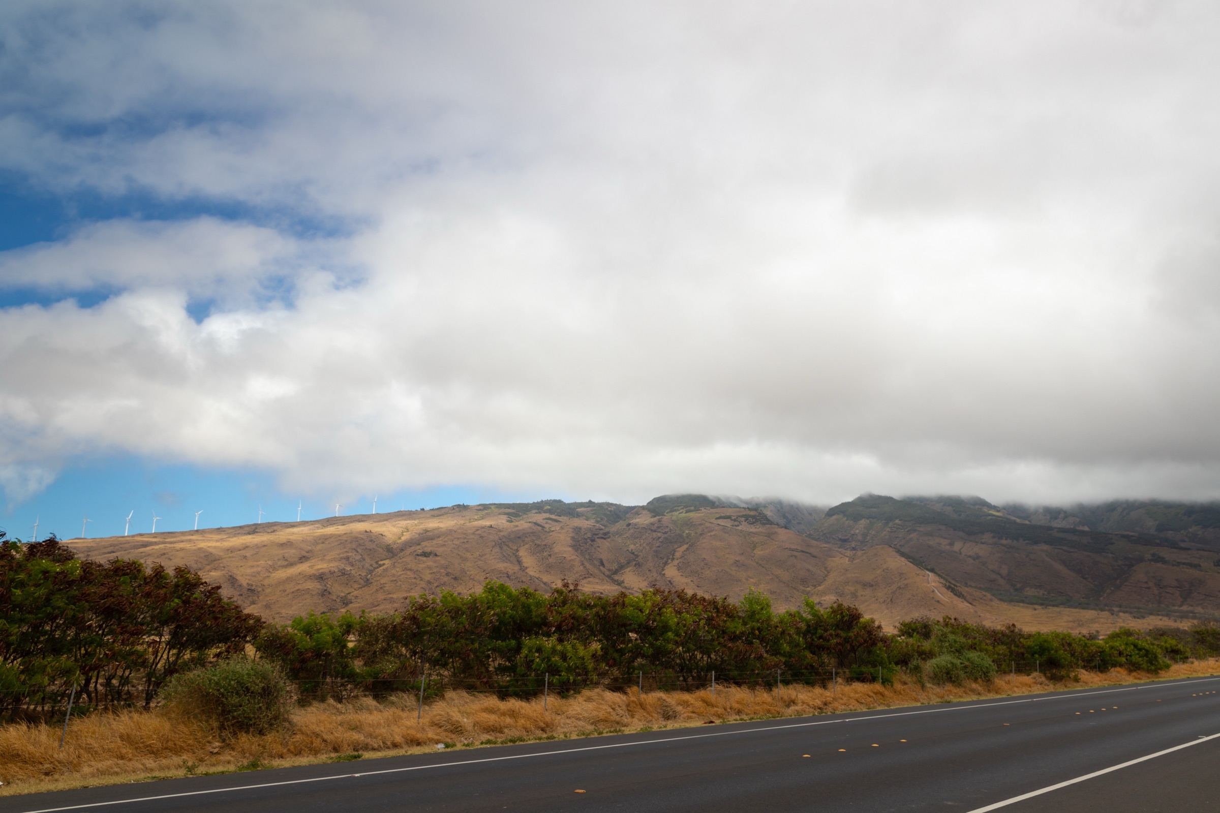
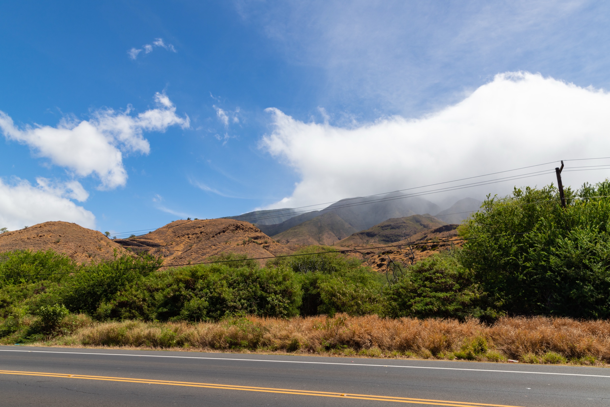
The West Maui Mountains are the older of the two shield volcanoes that built Maui — a deeply eroded basalt highland that rises to Puʻu Kukui at 1,764 m and falls away in radiating amphitheatre valleys: wet, windward Waiheʻe, Waiheʻe and ʻĪao to the east; dry, leeward Lāhainā and Ukumehame to the south; the long, low-angle Kapalua coast to the northwest. Hiking here is dictated by which side of the range a walk lies on. Windward routes climb into cloud forest under high rainfall; leeward routes cross dry, exposed pali and lava under strong trade winds; the northwest coastal walks are mild, paved or graded shoreline routes.
The legal day-hiking network is small. Most of the high interior is closed watershed reserve managed by the Maui County Department of Water Supply and the Puʻu Kukui Watershed Preserve, and the famous old Mauna Kahalāwai ridge crossings are not public day-hiking objects. The five essential walks below mix the small set of fully legal mountain trails — Waiheʻe Ridge in the West Maui Forest Reserve and the historic Lāhainā Pali Trail — with the short but region-defining coastal walks at the northwest end of the range. For the wet windward counterpart on the other side of the island, see the Kīpahulu and east Maui day-hikes.
Practical season runs year-round, with caveats. The windward ridges (Waiheʻe, Mahana) are slippery and cloud-bound year-round but worst from November to April; the leeward routes (Lāhainā Pali, ʻŌhai) bake under sun and trade wind from June to September. May–June and September–October give the most stable combinations. The August 2023 Lāhainā wildfire and subsequent recovery work continue to affect road access, parking and trailhead status across the southwest sector; check the Hawaiʻi Trails / Nā Ala Hele and Kapalua Resort sites before every trip.
Selection rationale
The five hikes were chosen to span the range’s defining contrasts in one catalogue:
- Waiheʻe Ridge — the headline windward cloud-forest ridge, the most representative mountain walk in the range.
- Lāhainā Pali — the historic dry-side crossing, the clearest contrast to Waiheʻe.
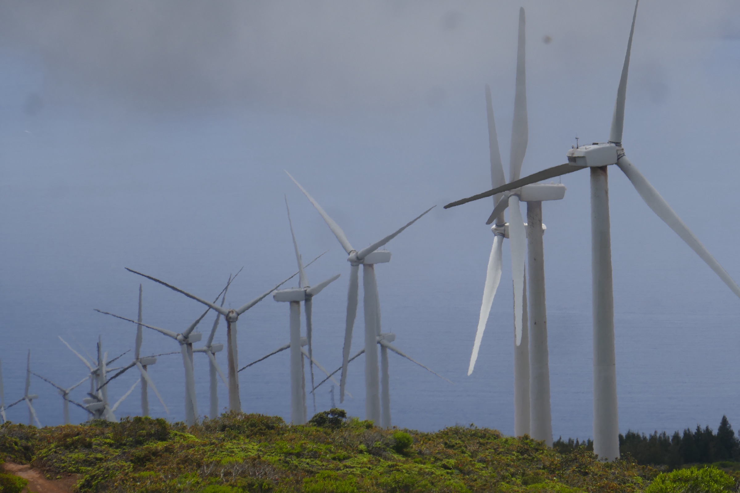
- Mahana Ridge — the long northwest ridge above Kapalua, the only walk that ties a resort-coast trailhead to true ridge terrain.
- ʻŌhai Trail — the short native-dryland coastal loop on the wild north-coast headland.
- Kapalua Coastal Trail — the sea-level counterpart to the ridges, the most accessible Hawaiian shoreline walk in West Maui.
Closed watershed traverses, the high Puʻu Kukui interior and any unofficial “back-way” ridge routes are deliberately excluded.
Summary table
| # | Hike | Country | Route type | Distance | Gain | Max elevation | Difficulty |
|---|---|---|---|---|---|---|---|
| 1 | Waiheʻe Ridge Trail | United States | Out-and-back ridge | 6.9 km | ~488 m | ~780 m | Moderate–hard |
| 2 | Lāhainā Pali Trail | United States | Point-to-point (often walked as halves) | 8.9 km one way | ~490 m | ~490 m | Hard |
| 3 | Mahana Ridge Trail | United States | Out-and-back ridge | 17.7 km | ~810 m | — | Hard |
| 4 | ʻŌhai Trail Loop | United States | Coastal loop | 2.0 km | ~60 m | Low coastal | Easy–moderate |
| 5 | Kapalua Coastal Trail | United States | Linear coastal path | 4.0 km out-and-back | ~60 m | Low coastal | Easy |
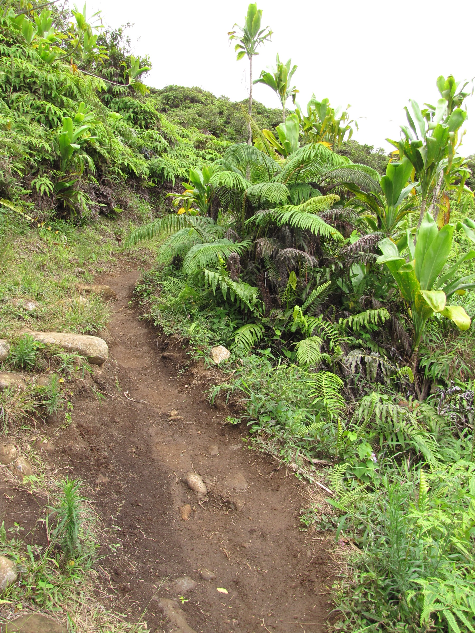
1. Waiheʻe Ridge Trail
Snapshot
Itinerary
From the Maluhia Road gate the trail climbs through pasture edge and planted forest onto the Waiheʻe ridge proper, then follows an increasingly open crest with views into the windward amphitheatre — Waiheʻe Valley to one side, the north coast to the other, and (in clear weather) the high Puʻu Kukui watershed reserve ahead. The standard turnaround is the upper viewpoint at roughly 780 m, beyond which the trail enters closed reserve and should not be pushed.
Why it is essential
Waiheʻe is the most representative legal mountain hike in the West Maui Mountains: a compact climb from lowland pasture into cloud-forest ridge terrain with the classic Waiheʻe Valley panorama, and the only public trail that gives a true high-ridge feel inside the range.
Equipment
- Boots or trail shoes with aggressive tread — the clay is unforgiving when wet
- Lightweight rain shell
- 1.5–2 L of water and food
- Sun protection for the open lower ridge
- Insect repellent for the lower planted forest
Hazards and notes
- The clay tread is the defining hazard; in heavy rain it becomes effectively unwalkable.
- Steep drop-offs on the upper ridge; stay on the centred tread when cloud cuts visibility.
- Hunting and forest-reserve activity is occasionally in progress — observe posted notices at the trailhead.
- No water on the route; carry it all.
Sources
- Hawaiʻi Trails — Waiheʻe Ridge Trail
- DLNR / Nā Ala Hele Maui trails map (PDF)
- AllTrails — Waiheʻe Ridge Trail
2. Lāhainā Pali Trail
Snapshot
Itinerary
The old Lāhainā Pali route climbs the dry southern flank of the range between the Māʻalaea and Ukumehame trailheads. The first kilometre on either side is the steep rocky climb; the central plateau crosses the Kaheawa wind-farm corridor at roughly 490 m with the trail’s defining view — Kahoʻolawe, Molokini and the leeward coast across the ʻAuʻau Channel. The far side descends back to highway level through dry scrubland. The common day-hike pattern is to walk one half as an out-and-back from the easier-parking Māʻalaea side; the full end-to-end version needs a confirmed shuttle.
Why it is essential
It is the classic historic crossing of the West Maui pali and the clearest dry-side contrast to the wet Waiheʻe ridge. The view from the Kaheawa high point is the single best leeward panorama in the range — no other public West Maui trail puts the South Maui islands directly under the walker’s feet.
Equipment
- Sturdy hiking shoes — the tread is rocky aʻā lava in places
- 2.5–3 L of water; there is no shade and no water on route
- Sun hat and sunscreen
- Wind layer; trade winds funnel hard across the high section
- Shuttle / pickup arrangement if traversing
Hazards and notes
- Heat and wind are the day’s real hazard; both halves cook by mid-morning in summer.
- No shade, no water; both trailheads sit on busy highways with limited shoulder parking.
- Wind-turbine traffic and access roads cross the route — observe posted closures.
- The tread is rough and easy to roll an ankle on; pace into the rocks.
Sources
- Hawaiʻi Trails — Lāhainā Pali Trail
- DLNR / Nā Ala Hele Maui trails map (PDF)
- AllTrails — Lāhainā Pali Trail
3. Mahana Ridge Trail
Snapshot
Itinerary
The Mahana Ridge route climbs from the Kapalua coast — typically the D.T. Fleming Beach access — into the ridge and arboretum country above the resort. The lower section runs through dry pasture and planted forest; the middle through the Maunalei Arboretum with its planted species and signage; the upper through native and naturalised vegetation on the open ridge. The catalogued turnaround is the ridge high point, then return the same way. The route can be linked with the shorter Maunalei Arboretum loop near the top for variety.
Why it is essential
It represents the long, vegetated northwest ridge side of West Maui, complementing both the dry Lāhainā Pali and the wet Waiheʻe ridge. It is also the only walk in the catalogue that ties a resort-coast trailhead to true ridge terrain rather than just shoreline.
Equipment
- Hiking shoes with grip
- Sun protection and a rain shell
- 2 L of water and food
- Navigation; the upper junctions are signed but easy to misread in cloud
- Insect repellent
- Charged phone — there is no reliable signal above the lower forest
Hazards and notes
- The lower approach is hot; start at first light in summer.
- Mud and overgrowth on the upper ridge after rain.
- Private / resort land interface at the lower trailhead — observe posted access rules.
- Routing and access here is more changeable than the DLNR trails; verify locally before publishing this as a guaranteed open route.
Sources
- Kapalua Resort — hiking trails
- Kapalua Resort Association — trail guide (PDF)
- AllTrails — Mahana Ridge Trail
4. ʻŌhai Trail Loop
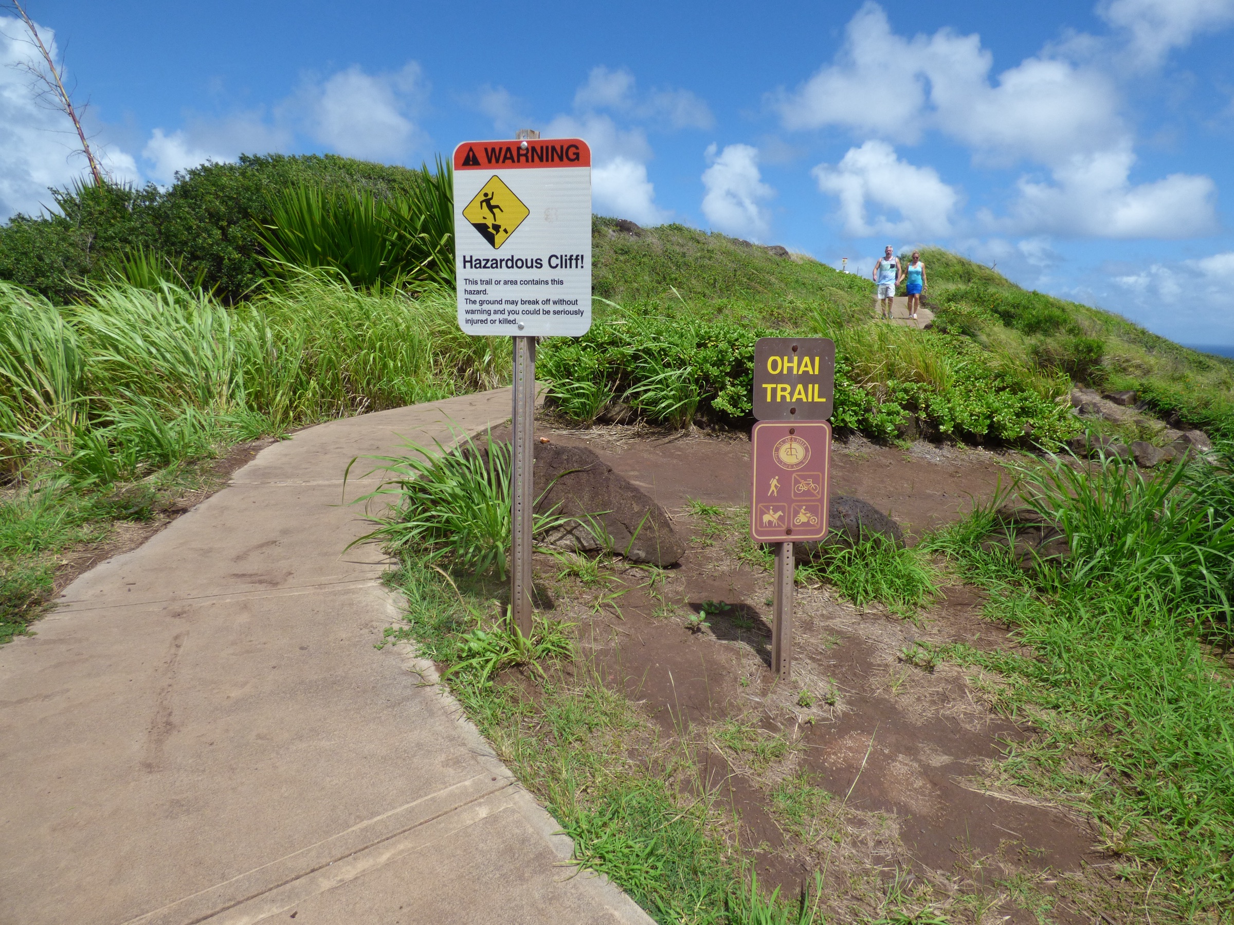
Snapshot
Itinerary
The signed loop drops onto an exposed headland above the Papanalahoa cliffs and circles a small dryland-restoration plot of native coastal plants — naio, ʻilima, ʻōhai (the trail’s namesake), and others — with interpretive signs and broad north-coast and ocean views. The loop is short but the cliff edges are unfenced and the trade winds at the headland are strong.
Why it is essential
Though short, it is the best compact West Maui walk for native coastal habitat, sea-cliff views and dryland-restoration interpretation, and the only essential walk in the catalogue that gets the visitor onto the wild north-coast headland.
Equipment
- Walking shoes
- Sun protection
- 0.5–1 L of water
- Wind layer if trades are strong
Hazards and notes
- Cliff edges are unfenced; keep children close and stay on the signed loop.
- Strong wind and hot sun — do not push the loop in midday heat.
- Fragile native vegetation; do not step off the marked tread.
- Kahekili Highway parking is on the shoulder; park carefully and watch traffic.
Sources
5. Kapalua Coastal Trail
Snapshot
Itinerary
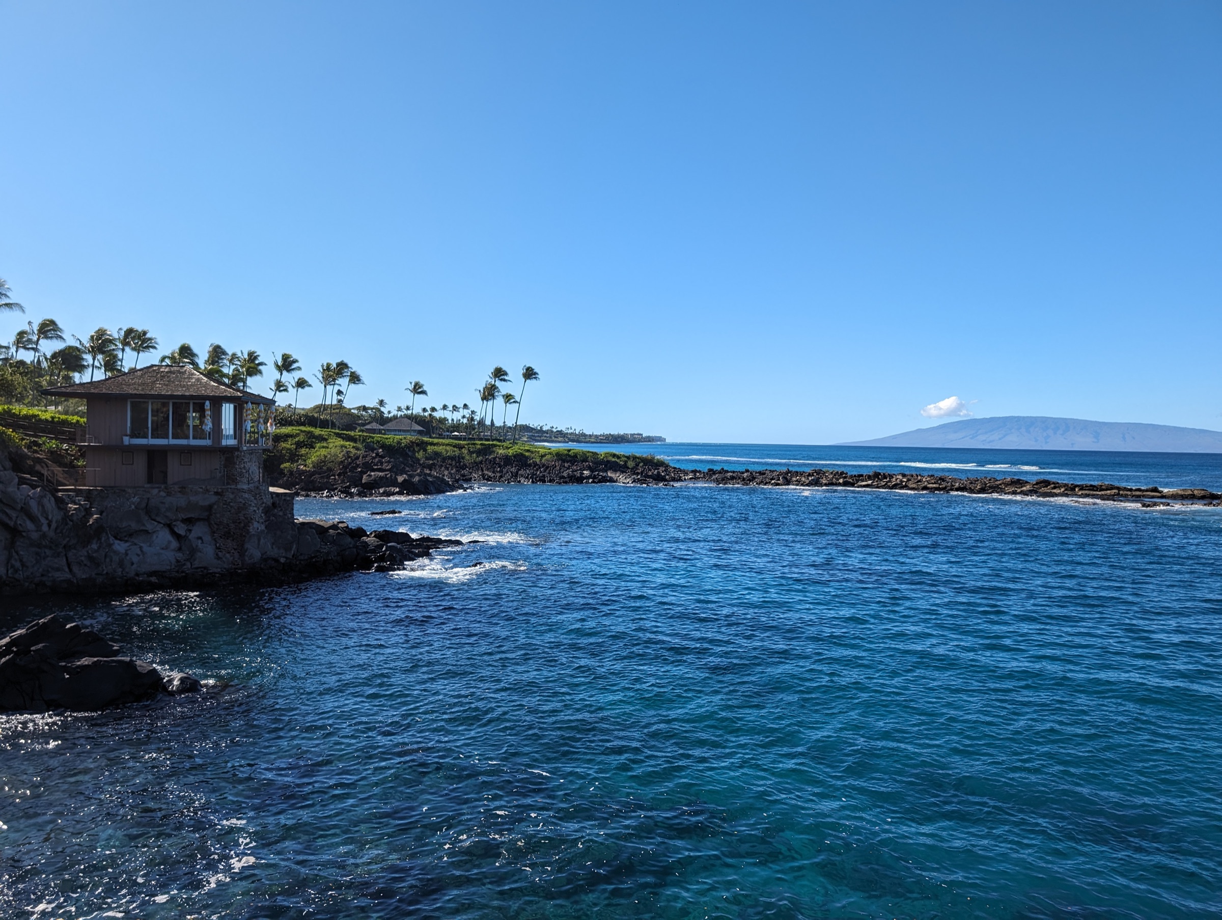
The Kapalua Coastal Trail links a sequence of bays, lava points and shoreline access paths along the resort coast: Kapalua Bay, Namalu Bay, Hawea Point, Oneloa Beach, and the Makaluapuna Point lava ridge — the Dragon’s Teeth formation — before reaching D.T. Fleming Beach. The route alternates between paved walking path and graded shoreline trail; the surface is benign, but the wind and sun on the open points are not. The standard outing is to walk the segment one way and return, or stop at any of the bays for a swim before turning back.
Why it is essential
It is the most accessible West Maui shoreline walk and gives the sea-level view of the same volcanic landscape explored by the ridge routes. Makaluapuna Point and the Dragon’s Teeth lava formation are the catalogue’s only direct contact with West Maui’s raw shoreline lava without resorting to the highway-side Lāhainā Pali corridor.
Equipment
- Walking shoes or sandals with grip
- Sun protection
- 0.5–1 L of water
- Swimsuit and towel if combining with a swim
Hazards and notes
- Surf at exposed points can be heavy; do not turn your back on the ocean at Makaluapuna.
- Cliff and lava-rock edges are unfenced.
- Resort / private-property boundaries cross the route; observe posted signs.
- Fragile coastal vegetation — stay on the marked tread.
Sources
- Kapalua Resort — hiking trails
- Kapalua Resort Association — trail guide (PDF)
- AllTrails — Kapalua Coastal Trail
Further reading
| Source | URL |
|---|---|
| Hawaiʻi Trails (Nā Ala Hele) | hawaiitrails.hawaii.gov |
| DLNR Division of Forestry and Wildlife | dlnr.hawaii.gov/dofaw |
| DLNR / Nā Ala Hele Maui trails maps | dlnr.hawaii.gov |
| Kapalua Resort — hiking trails | kapalua.com |
| Puʻu Kukui Watershed Preserve | maui.com |
| Maui County Department of Water Supply | mauicounty.gov |
| Wikipedia — West Maui Mountains | en.wikipedia.org |
| Wikipedia — Puʻu Kukui | en.wikipedia.org |
| Wikimedia Commons — Category: West Maui Mountains | commons.wikimedia.org |
| OpenStreetMap (ODbL 1.0) | openstreetmap.org |