Regional overview
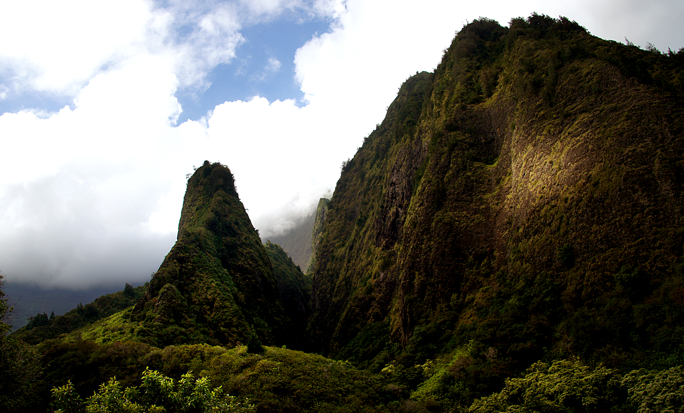
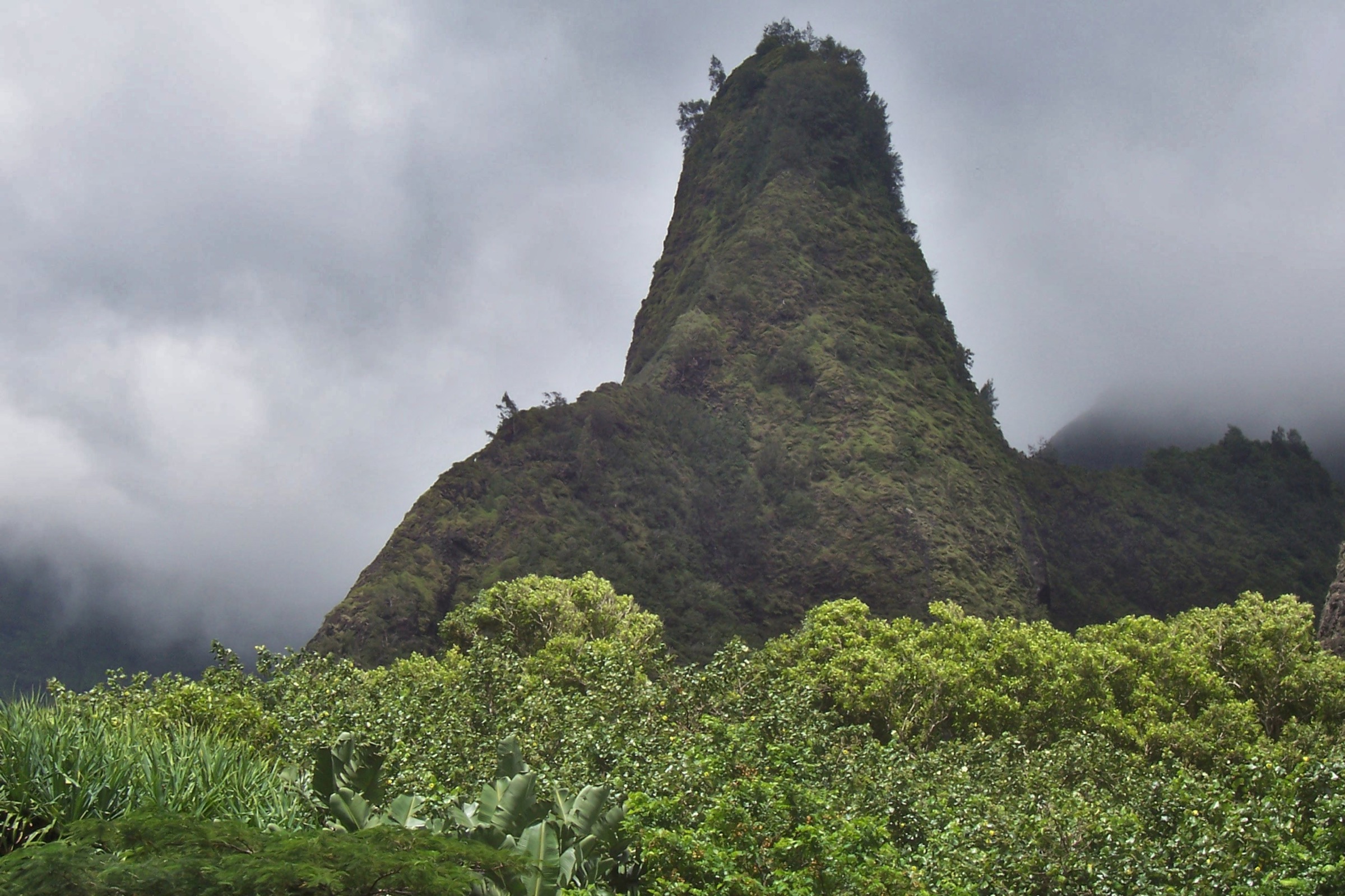
The ʻĪao Valley region is a steep, sacred, rain-fed cleft on the Wailuku side of the West Maui Mountains, centred on Kukaʻemoku — the green-spired ʻĪao Needle — and the wet valley floor above the town. It is the cultural and visual heart of West Maui, a registered National Natural Landmark and a site of the 1790 Battle of Kepaniwai, but it is also unusually constrained as a hiking unit: the official state-park walking trail is short, several tempting valley routes are closed or access-sensitive, and DLNR currently lists ʻĪao Valley State Monument as closed until 17 July 2026 for safety improvements.
The walking universe runs from a short paved lookout near the Needle, through the cultural gardens of Kepaniwai Park in lower ʻĪao Valley, up the Waiheʻe Ridge Trail into West Maui cloud forest, into the gulch crossings of Makamakaʻole Stream, and down to the dunes and wetlands of the Hawaiʻi Land Trust’s Waiheʻe Coastal Refuge at the mouth of the valley system. Only the ʻĪao Needle walk and Waiheʻe Ridge are anchored by full official state route data — Kepaniwai, Makamakaʻole and the Waiheʻe Refuge sit on a spectrum from cultural-garden walk to managed-preserve access.
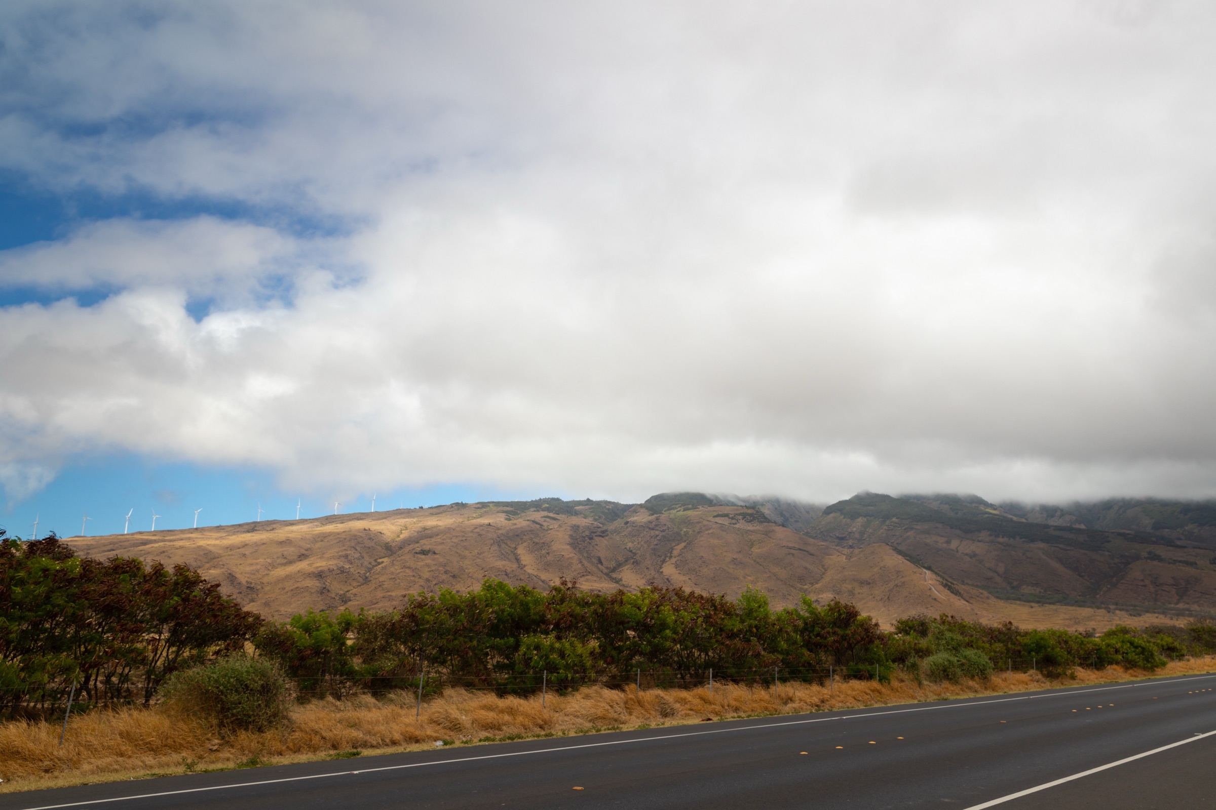
The valley climate is wet year-round. Stream and gulch routes are dangerous in heavy rain and after storms; the West Maui cloud forest above Waiheʻe builds cloud and mud through the day, so mornings give the best chance of clear ridge views. For the wider West Maui catalogue this region sits within, see the West Maui Mountains essentials; for the windward east-Maui counterpart, see the Kīpahulu and east Maui day-hikes.
Selection rationale
The five hikes cover the practical ʻĪao region walking spectrum: the official ʻĪao Needle Lookout and ethnobotanical loop in the state monument; the short Kepaniwai cultural garden walk in lower ʻĪao Valley; the Waiheʻe Ridge Trail into West Maui cloud forest as the strongest official mountain hike on the Wailuku side; the Makamakaʻole Stream “13 Crossings” gulch walk; and the Waiheʻe Coastal Dunes and Wetlands Refuge as the cultural and ecological mouth-of-valley counterpart. Only the ʻĪao Needle trail and Waiheʻe Ridge are anchored by full official state-trail data. Kepaniwai, Makamakaʻole and the Waiheʻe Refuge are retained as candidate or access-managed entries because current public-route legality or stable route geometry need stronger confirmation.
Summary table
| # | Hike | Country | Route type | Distance | Gain | Max elevation | Difficulty |
|---|---|---|---|---|---|---|---|
| 1 | ʻĪao Needle Lookout and Ethnobotanical Loop | USA | Short paved lookout walk and loop | 1.0 km | 61 m | Low valley floor | Easy |
| 2 | Kepaniwai Park / Heritage Gardens loop | USA | Cultural garden loop | ~0.6–0.7 km | ~33 m | Unresolved | Easy |
| 3 | Waiheʻe Ridge Trail | USA | Out-and-back ridge | 6.9 km | 476–488 m | ~780 m | Moderate–hard |
| 4 | Makamakaʻole Stream — 13 Crossings | USA | Out-and-back stream walk (candidate) | ~3.4 km | ~158 m | Unresolved | Moderate |
| 5 | Waiheʻe Coastal Dunes and Wetlands Refuge | USA | Managed preserve walk (access-managed) | Unresolved | Minimal | Low coastal | Easy |
1. ʻĪao Needle Lookout Trail and Ethnobotanical Loop
Snapshot
Itinerary
The paved trail starts beyond the restrooms and interpretive signs, crosses ʻĪao Stream and climbs to the lookout shelter facing Kukaʻemoku / ʻĪao Needle. A short ethnobotanical loop meanders beside the stream, identifying culturally important plants. Total walking time is 20–45 minutes including viewing.
Why it is essential
This is the official, iconic walk of the ʻĪao Valley region — the only straightforward public way to experience the famous Needle viewpoint at close range, and the cultural anchor of the entire ʻĪao landscape.
Equipment
Comfortable walking shoes, rain shell, water and a sun layer. The paving and accessibility profile can vary with closures and construction; expect a wet, slippery valley climate even on short walks.
Hazards and notes
Wet paving, stream and bridge crossings, falling-rock hazards during storms and a strict stay-on-trail requirement. Dogs are not permitted. Do not attempt unofficial valley routes — closures and access notices are enforced.
GPX / route file
| Source | URL | Format | Notes |
|---|---|---|---|
| Official DLNR — ʻĪao Needle Lookout Trail and Ethnobotanical Loop | dlnr.hawaii.gov | Official page | Route, stats, reservation note and current closure verified; no GPX/KML provided |
| ʻĪao Valley State Monument park page | dlnr.hawaii.gov | Official park page | Access and current closure context |
Further reading
2. Kepaniwai Park / Heritage Gardens loop
Snapshot
Itinerary
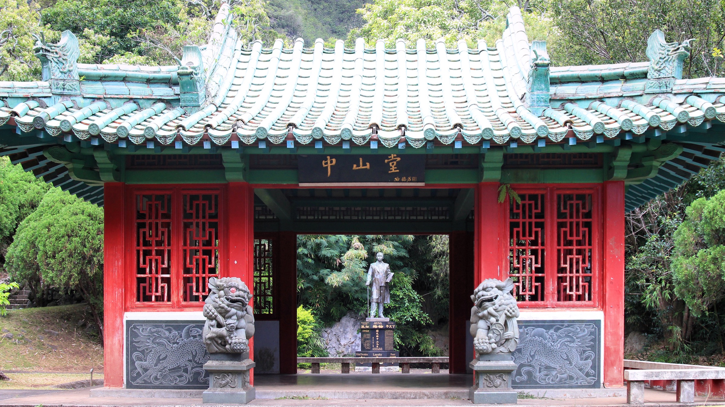
A compact walk through the cultural garden complex by ʻĪao Stream, linking garden structures from Hawaiian, Chinese, Japanese, Portuguese, Filipino and other communities that shaped Maui’s plantation-era history, with streamside lawns and commemorative features. The walking line follows the maintained paths between garden zones rather than a wilderness trail.
Why it is essential
Kepaniwai adds the human and cultural layer of lower ʻĪao Valley, which is inseparable from the region’s identity — it sits on the site of the 1790 Battle of Kepaniwai and is the most accessible cultural counterpart to the upper-valley state monument walk.
Equipment
Comfortable walking shoes and a rain shell. The paths are short but can be slick after rain.
Hazards and notes
Slippery paths, stream proximity, cultural-site respect and possible park-maintenance closures are the main issues. Treat the garden zones as cultural sites — do not climb structures or stray from maintained paths.
GPX / route file
| Source | URL | Format | Notes |
|---|---|---|---|
| AllTrails — Kepaniwai Park Loop | alltrails.com | Source map / app route | AllTrails terms apply; secondary stats only — do not reuse geometry directly |
Further reading
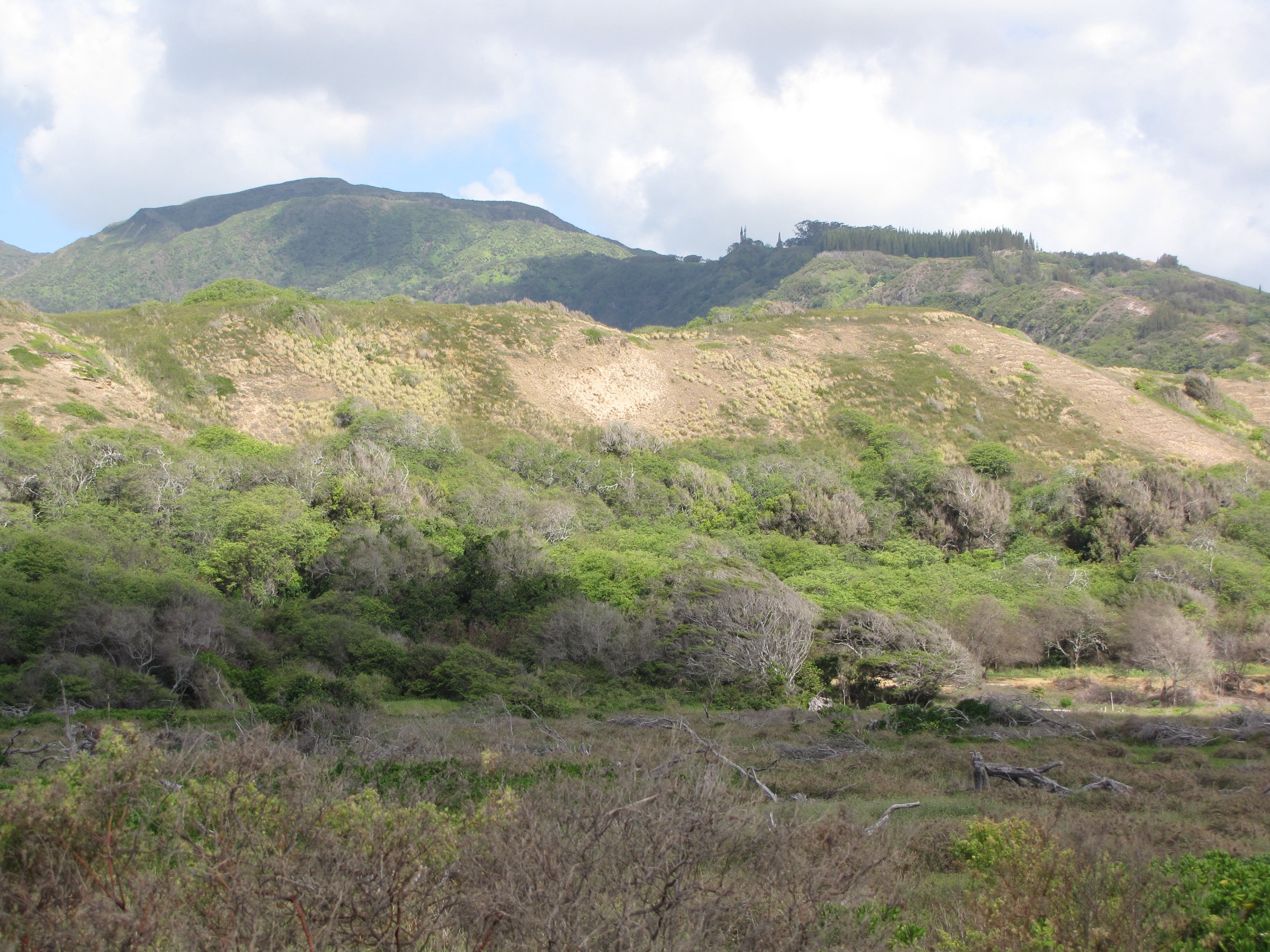
3. Waiheʻe Ridge Trail
Snapshot
Itinerary
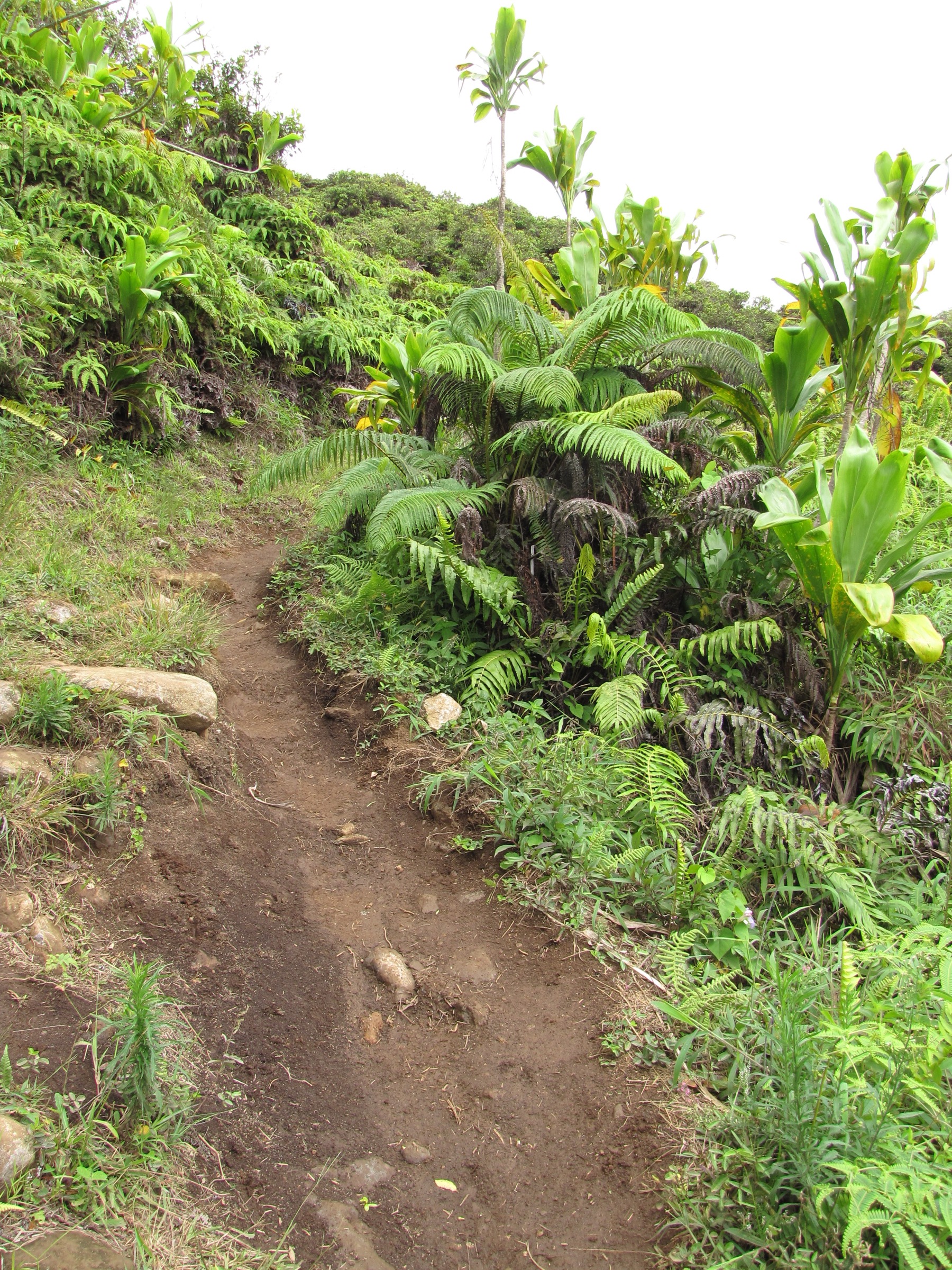
A steady ridge ascent from pasture and forest into high West Maui cloud-forest terrain, with views into Waiheʻe Valley and back toward Wailuku and the north coast. The trail climbs through the gate area, follows the ridge spine through native and recovering forest and ends at an upper viewpoint where cloud often closes the view by midday.
Why it is essential
Because the core ʻĪao monument has only a short official walk, this is the nearest robust public mountain hike that lets you experience the same wet West Maui massif at day-hike scale. It is the headline mountain walk for visitors based in Wailuku.
Equipment
Hiking shoes with grip, rain shell, sun protection, water and an offline map. Expect mud — gaiters or trail runners that drain well are useful in wet weather.
Hazards and notes
Slippery red dirt, drop-offs along the ridge spine, dense cloud blocking views, no water on the trail and limited parking are the main hazards. Start early to beat the cloud build-up and the parking pinch.
GPX / route file
| Source | URL | Format | Notes |
|---|---|---|---|
| Official DLNR / Nā Ala Hele Maui trails map | dlnr.hawaii.gov | Official PDF | Route and core stats verified; map artwork not reusable without permission |
| AllTrails — Waiheʻe Ridge Trail | alltrails.com | Source map / app route | AllTrails terms apply; secondary stats cross-check only |
Further reading
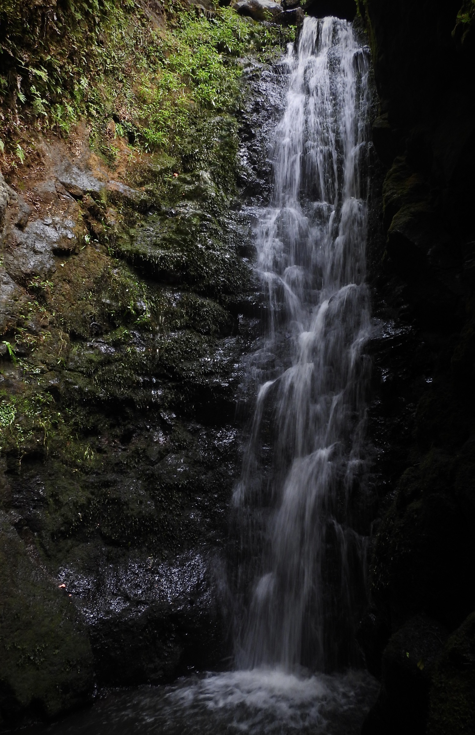
4. Makamakaʻole Stream — 13 Crossings
Snapshot
Itinerary
The popular route follows Makamakaʻole Stream through repeated crossings toward small cascades and rainforest sections. It is commonly referred to as “13 Crossings”, but the actual count and safe turnaround vary with conditions. Treat the route as condition-dependent — short and gentle in low water, dangerous in flash-flood conditions.
Why it is essential
It represents the lush gulch and stream side of the ʻĪao–Waiheʻe region, but the entry is not publication-ready because access authority and parking are unresolved. Listed here as a candidate that walkers should research locally before attempting.
Equipment
Wet-capable hiking shoes, dry bag, offline map, water and insect protection. A rain shell and a willingness to turn back are essential — this is not a route to push through.
Hazards and notes
Multiple stream crossings, flash floods, slick boulders, narrow roadside access and possible land or access sensitivity. Do not enter the gulch if rain is forecast or has fallen recently in the West Maui catchment.
GPX / route file
| Source | URL | Format | Notes |
|---|---|---|---|
| AllTrails — Makamakaʻole Stream / 13 Crossings | alltrails.com | Source map / app route | AllTrails terms apply; secondary stats only — do not reuse geometry directly |
Further reading
5. Waiheʻe Coastal Dunes and Wetlands Refuge
Snapshot
Itinerary
The Hawaiʻi Land Trust’s Waiheʻe Refuge protects roughly 277 acres of coastal dunes, wetlands, shoreline, reef, archaeological sites and native habitat. Walking access is tied to land-trust programming — volunteer days, free “Talk Story on the Land” guided tours, and reservation or camping rules — rather than a standard public trailhead. Choose a programme via the HILT pages and follow the route they run on the day.
Why it is essential
The refuge gives the cultural and ecological mouth-of-valley context for Waiheʻe and ʻĪao: dunes, wetlands, ancient village sites, heiau and endangered-species habitat in one accessible managed walk. It closes the picture that the upper valley monument and Waiheʻe Ridge open higher up.
Equipment
Sun protection, closed shoes, water, and whatever volunteer or guided-tour requirements HILT specifies for the chosen programme.
Hazards and notes
Sensitive cultural and wildlife habitat, access restrictions, heat, wind and shoreline hazards are the main issues. Respect monk seal and turtle protection zones, archaeological sites and any restricted-area signage.
GPX / route file
Further reading
Further reading
| Source | URL |
|---|---|
| ʻĪao Valley State Monument (DLNR) | dlnr.hawaii.gov |
| Official DLNR — ʻĪao Needle Lookout Trail and Ethnobotanical Loop | dlnr.hawaii.gov |
| Official DLNR / Nā Ala Hele Maui trails map | dlnr.hawaii.gov |
| Hawaiʻi Land Trust — Waiheʻe Refuge | hilt.org |
| Hawaiʻi Land Trust — Waiheʻe reservations | hilt.org |
| AllTrails — Kepaniwai Park Loop | alltrails.com |
| AllTrails — Waiheʻe Ridge Trail | alltrails.com |
| AllTrails — Makamakaʻole Stream / 13 Crossings | alltrails.com |
| Wikimedia Commons — ʻĪao Valley | commons.wikimedia.org |