Regional overview
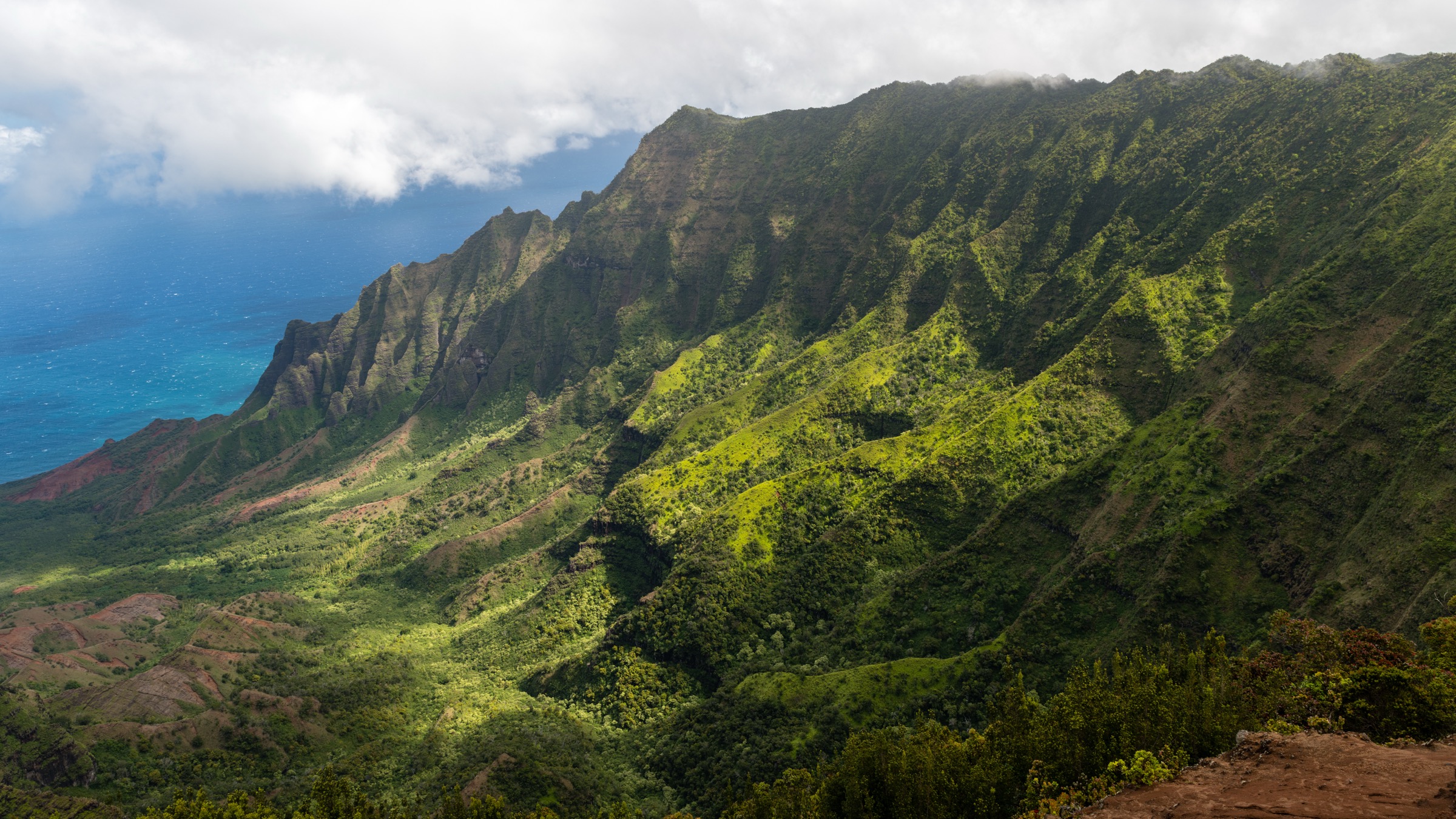
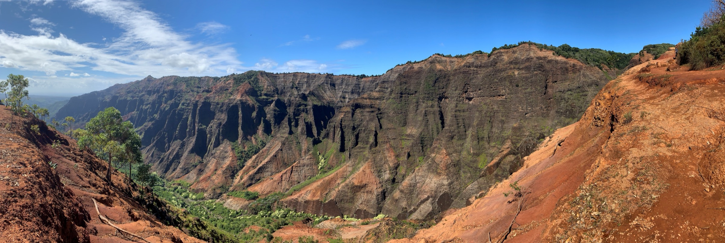
Waimea Canyon is the deep, red-walled gorge cut by the Waimea River into the western side of Kauaʻi’s central shield. It is roughly 22 km long and up to 900 m deep — the largest canyon in the Hawaiian Islands and the setting Mark Twain called “the Grand Canyon of the Pacific.” The canyon is managed by the Hawaiʻi Department of Land and Natural Resources (DLNR), Division of State Parks, as Waimea Canyon State Park. Its trail network is shared with the adjoining Kōkeʻe State Park and administered on the ground by the Nā Ala Hele trails programme of DLNR’s Division of Forestry and Wildlife.
Access is by Waimea Canyon Drive / Kōkeʻe Road (Highway 550), which climbs from the town of Waimea on the south coast to the rim near Puʻu Ka Pele (Iliau Nature Loop, mile marker 9), Puʻu Hinahina Lookout (mile marker 13), and the main Waimea Canyon Lookout. Two families of walks fit the canyon proper: the descent into the canyon interior on the Kukui Trail, and the rim-side falls / cliff-view walks that leave Halemanu Road. Halemanu Road is a rough 4WD track and starts just south of Kōkeʻe HQ; the trails it serves — Canyon Trail, Cliff Trail, Black Pipe — cross the administrative boundary between the two parks but focus entirely on the canyon rim, so they are treated here.
The canyon can be walked year-round, but the difference between wet and dry conditions is severe. The Waimea and Koaie rivers rise rapidly in the canyon floor after upland rain, and multiple flash-flood incidents make the descent trails serious commitments in wet weather. Rim heat and sun exposure are the other side of the coin in the June–September dry season. Check current DLNR announcements before every trip; the entrance and shuttle system for Waimea Canyon SP is being progressively expanded and paid parking now applies at the main lookout.
Related entries: Kōkeʻe highlands day-hikes covers the plateau trails above the canyon — Alakaʻi Swamp, Awaʻawapuhi, Nualolo — that share the same road access. Nā Pali Coast day-hikes covers the coast at the far north end of the same road.
Selection rationale
The Kukui Trail is the only walk that legally reaches the canyon floor; it is the canonical Waimea Canyon hike. The Iliau Nature Loop gives the short interpretive rim experience and the endemic ʻiliau plant. Canyon Trail to Waipoʻo Falls is the essential rim-to-falls walk and the closest most walkers get to the canyon floor by day. Cliff Trail is the short cliff-edge viewpoint from the same trailhead. The Canyon–Black Pipe Loop extends the rim walk into a half-day and is included with a maintenance caveat, since it is the closest thing to a “long” day-hike on the canyon side.
Summary table
| # | Hike | Country | Route type | Distance | Gain | Max elevation | Difficulty |
|---|---|---|---|---|---|---|---|
| 1 | Kukui Trail to Wiliwili Camp | USA | Out-and-back | ~ 8 km | ~ 610 m | ~ 900 m at trailhead | Strenuous |
| 2 | Iliau Nature Loop | USA | Loop | 0.5 km | ~ 15 m | ~ 950 m | Easy |
| 3 | Canyon Trail to Waipoʻo Falls | USA | Out-and-back | ~ 5.4 km | ~ 240 m | ~ 1,010 m at trailhead | Moderate |
| 4 | Cliff Trail | USA | Out-and-back | ~ 0.3 km | Negligible | ~ 1,010 m | Easy |
| 5 | Canyon and Black Pipe Loop | USA | Loop | ~ 6.4 km | ~ 400 m | ~ 1,010 m | Moderate to strenuous |
1. Kukui Trail to Wiliwili Camp
Snapshot
Itinerary
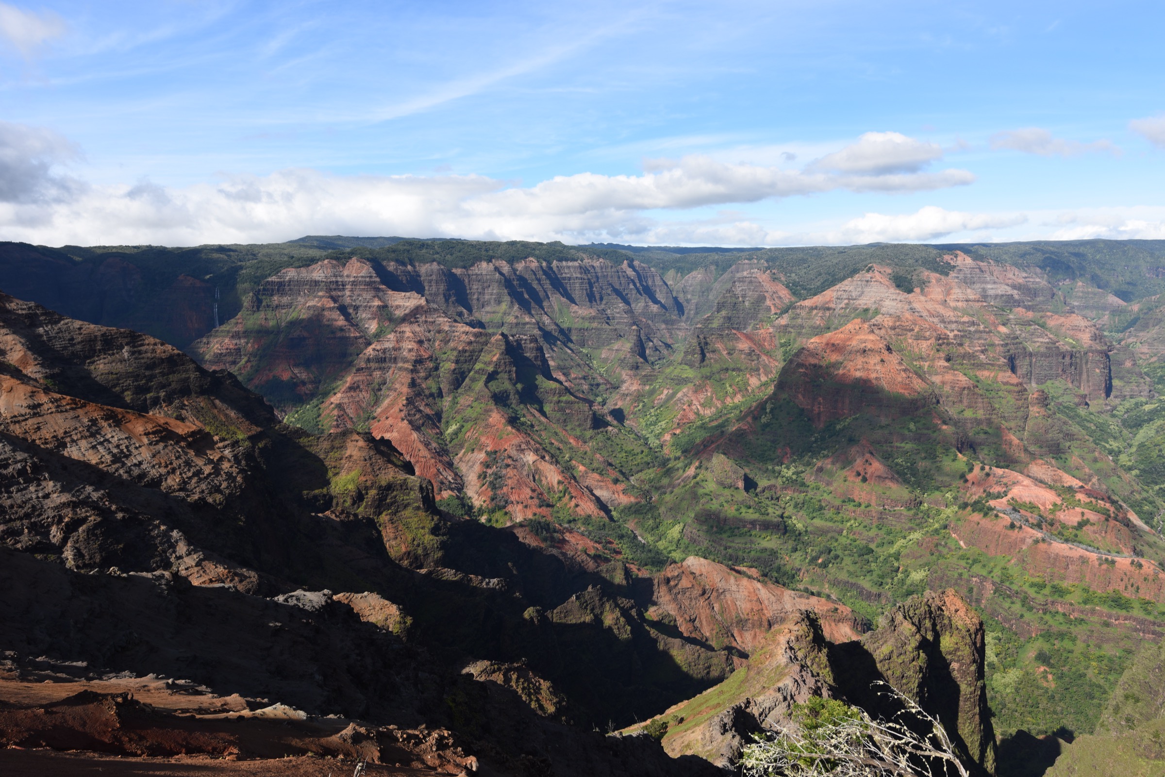
From the Iliau Nature Loop car park, the Kukui Trail leaves the loop and drops directly off the canyon rim in a long series of steep switchbacks through open ʻōhiʻa and koa. The trail loses height fast — nearly 600 m in the descent — and gives progressively larger canyon views as it drops. It ends at Wiliwili Camp on the Waimea River at the canyon floor, where a DLNR-issued permit is required to spend the night. Day-hikers turn around at the river and reclimb. Continuing across the river to Koaie Canyon or downstream on the Waimea Canyon Trail requires permits and is beyond a normal day hike from the top.
Why it is essential
Kukui is the only legal, waymarked descent into the canyon interior. It is the walk that turns Waimea Canyon from a viewpoint into a place, and the interior scale is not visible from the rim.
Equipment
Sturdy boots with grip, at least 3 litres of water, food, sun protection, rain shell, trekking poles for the descent and re-ascent, and headtorch. Waimea Canyon has almost no shade on the middle switchbacks.
Hazards and notes
Turn back promptly if rain begins upstream: the Waimea River rises quickly and canyon-floor flash floods have killed. The re-ascent is the crux; several hikers each year require rescue on the return climb during the hot afternoon window. Camping at Wiliwili is by DLNR permit only, and hunting occurs seasonally in the reserve — check status. Feral goats and pigs are widespread.
GPX / route file
| Source | URL | Format / access | Reuse status |
|---|---|---|---|
| DLNR — Kukui Trail | dlnr.hawaii.gov | Official route description | Public agency; no official GPX published |
| Nā Ala Hele | hawaiitrails.ehawaii.gov | Official trails portal | Public agency; interactive map |
Further reading
2. Iliau Nature Loop
Snapshot
Itinerary
Follow the marked interpretive loop through open shrubland on the canyon rim, past stands of the endemic ʻiliau (Wilkesia gymnoxiphium), a Kauaʻi-only relative of the silversword. The loop returns to the road pull-off; the Kukui Trail descends off the loop’s southern arc.
Why it is essential
The loop is the shortest, most accessible legal way to see the endemic ʻiliau plant on its Kauaʻi rim habitat, and gives a sample rim view without committing to Kukui.
Equipment
Comfortable footwear, sun protection, water.
Hazards and notes
Stay on the marked path — the surrounding shrubland contains fragile endemics. The plant flowers only once and dies afterwards; the mid-summer flowering is short.
GPX / route file
| Source | URL | Format / access | Reuse status |
|---|---|---|---|
| DLNR — Iliau Nature Loop | dlnr.hawaii.gov | Official route page | Public agency; no GPX published |
Further reading
3. Canyon Trail to Waipoʻo Falls
Snapshot
Itinerary
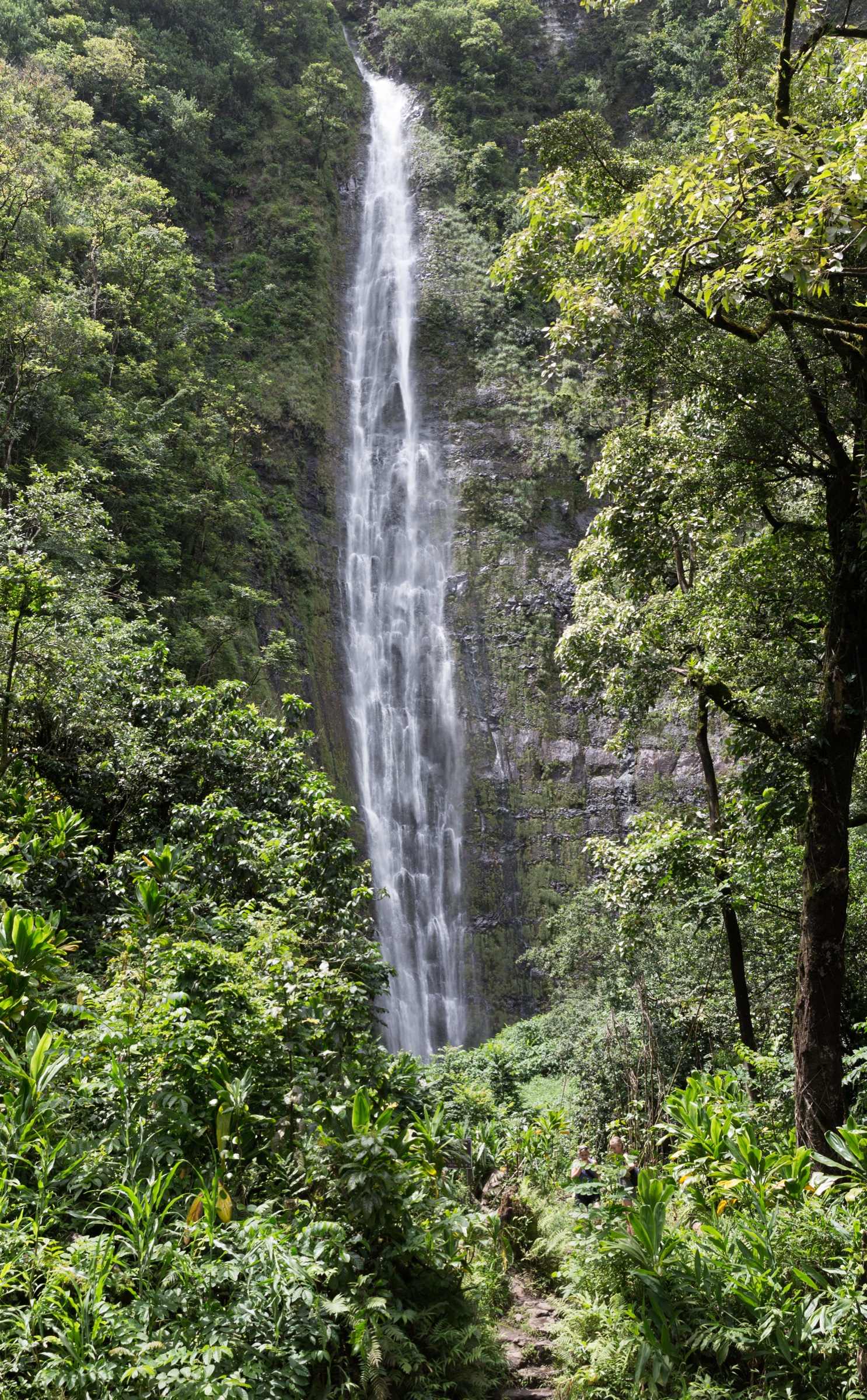
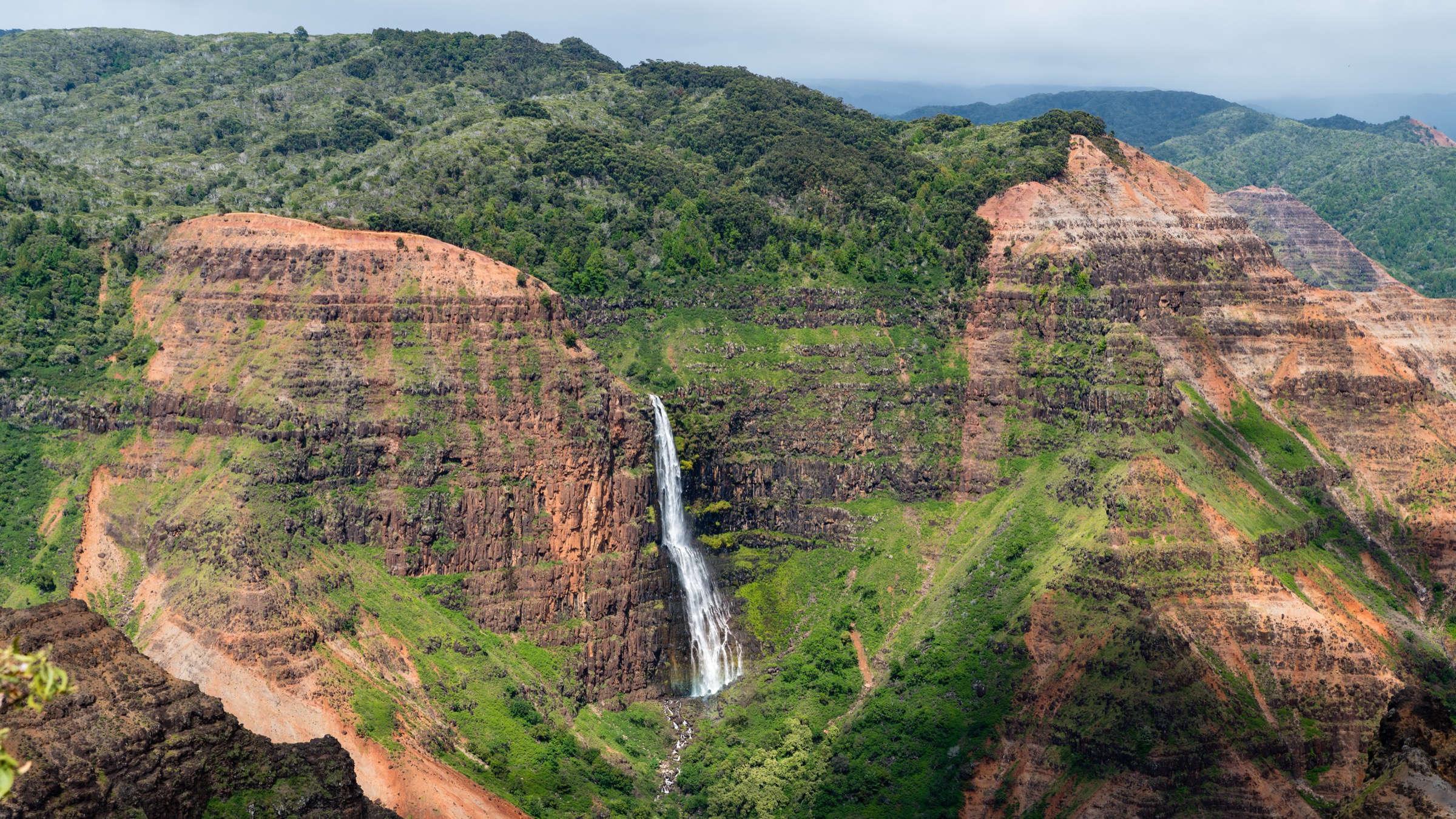
From Halemanu Road, take the Canyon Trail east through native koa and introduced softwoods. The path descends past a junction with the Cliff Trail (hike 4) and Black Pipe Trail (hike 5), crosses the small Kōkeʻe Stream, and drops to a viewpoint above and beside Waipoʻo Falls. Waipoʻo is a roughly 240 m two-tier plunge; the trail passes the upper pool but does not go over or below the fall. Return the same way, ideally after taking in the panoramic canyon views from the trail’s eastern shoulder.
Why it is essential
The Canyon Trail to Waipoʻo is the region’s canonical rim-to-falls walk and gives the deepest inward view of Waimea Canyon that is legally accessible without descending the Kukui switchbacks. The falls close the loop of “canyon from above” that begins at the roadside lookouts.
Equipment
Trail shoes with grip, water, sun protection, rain shell, and — after wet spells — footwear that tolerates mud.
Hazards and notes
The upper section of the falls is off-limits and unstable; do not scramble to the lip. The trail is exposed and hot in mid-afternoon. Halemanu Road is a 4WD track and often ruts after rain; when it is impassable, park at the top on the highway and add two kilometres of walking each way.
GPX / route file
| Source | URL | Format / access | Reuse status |
|---|---|---|---|
| DLNR — Canyon Trail | dlnr.hawaii.gov | Official route page | Public agency; no GPX published |
| Nā Ala Hele | hawaiitrails.ehawaii.gov | Official trails portal | Public agency; interactive map |
Further reading
4. Cliff Trail
Snapshot
Itinerary
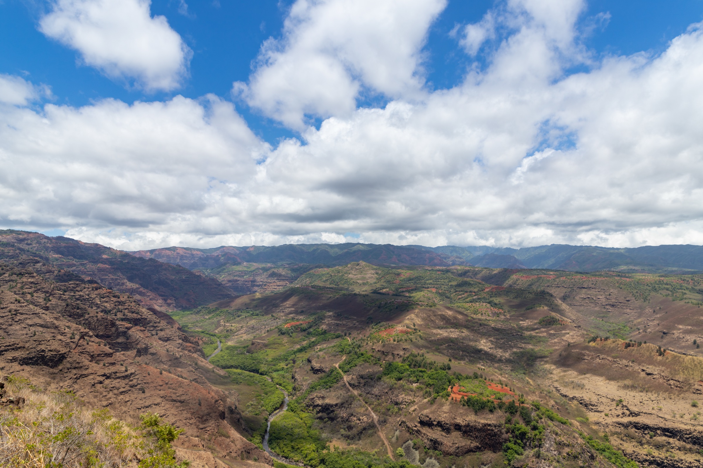
From the Canyon Trail junction near the top of Halemanu Road, follow the short marked spur to a railed cliff-edge belvedere directly above Waimea Canyon. Return the same way. Cliff Trail is commonly combined with hike 3.
Why it is essential
Cliff gives the canyon its most immediate rim panorama on a walk short enough to fit into a broken half day or an active viewpoint stop. It is also the natural add-on to any Canyon Trail hike.
Equipment
Standard walking shoes, sun protection, water.
Hazards and notes
Stay behind railings and off unmarked rock ledges; the drop is unbroken. Rockfall onto lower trails is a consideration when scrambling above the marked overlook.
GPX / route file
| Source | URL | Format / access | Reuse status |
|---|---|---|---|
| Nā Ala Hele | hawaiitrails.ehawaii.gov | Official trails portal | Public agency; interactive map |
Further reading
5. Canyon and Black Pipe Loop
Snapshot
Itinerary
Take the Canyon Trail from Halemanu Road as for hike 3. Instead of turning around at Waipoʻo, follow the marked descent past the falls to the Kaluahaulu connector, then loop back up the Black Pipe Trail through overgrown ʻōhiʻa and koa to rejoin the Canyon Trail near its western end. Return to Halemanu Road.
Why it is essential
The loop is the region’s longest legal single-day walk that stays on the canyon rim, and it links the falls viewpoint with the canyon’s less-visited east-flank forest.
Equipment
Sturdy trail shoes, water, food, GPS or paper map, long trousers for overgrowth, and a route-finding margin. Not recommended for walkers who want a well-graded trail.
Hazards and notes
The Black Pipe section has been widely reported as poorly maintained: overgrowth, fallen trees, and unclear marking. Skip the loop and return via the Canyon Trail if the connector is not obvious. Do not scramble around the top of Waipoʻo Falls.
GPX / route file
| Source | URL | Format / access | Reuse status |
|---|---|---|---|
| Nā Ala Hele | hawaiitrails.ehawaii.gov | Official trails portal | Public agency; interactive map |
Further reading
Notes and caveats
- Distances and elevation figures for Kukui, Canyon and the Black Pipe loop are rounded from a mix of DLNR trail pages and Nā Ala Hele mapping. DLNR’s Kukui page gives a one-way distance of about 4 km / 2.5 mi and 610 m / 2,000 ft of descent, but does not publish a canonical GPX. Some secondary sources give 5 mi / 8 km round-trip; others 4 mi / 6.4 km. The trailhead-to-Wiliwili return is treated here as about 8 km.
- Canyon Trail and Cliff Trail begin on Halemanu Road, which crosses the administrative boundary with Kōkeʻe State Park. They are placed here because their view corridor is Waimea Canyon.
- No official GPX or KML has been located for any hike. Nā Ala Hele’s interactive map is treated as the canonical route source; individual downloads were not found.
- The main Waimea Canyon Lookout parking has been switched to a paid, reserved system for out-of-state visitors during the 2023–2026 rollout. Check the current status before travel.
- Puʻu Hinahina Lookout striping and roadwork closed the lookout in mid-2026; verify before including it in a driving loop.
Further reading
| Resource | Link |
|---|---|
| DLNR — Waimea Canyon State Park | dlnr.hawaii.gov |
| DLNR — Kōkeʻe State Park | dlnr.hawaii.gov |
| DLNR — Kukui Trail | dlnr.hawaii.gov |
| DLNR — Iliau Nature Loop | dlnr.hawaii.gov |
| DLNR — Canyon Trail | dlnr.hawaii.gov |
| Nā Ala Hele trails portal | hawaiitrails.ehawaii.gov |
| Kōkeʻe & Waimea Canyon SP Master Plan | dlnr.hawaii.gov (PDF) |
| Kōkeʻe & Waimea Canyon trail poster | dlnr.hawaii.gov (PDF) |