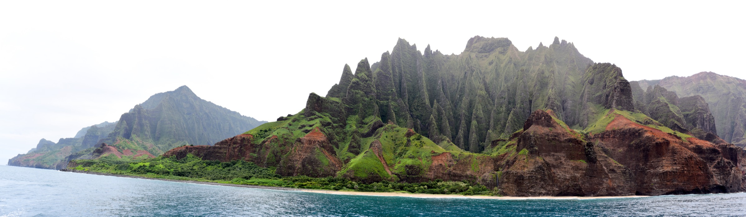
Regional overview
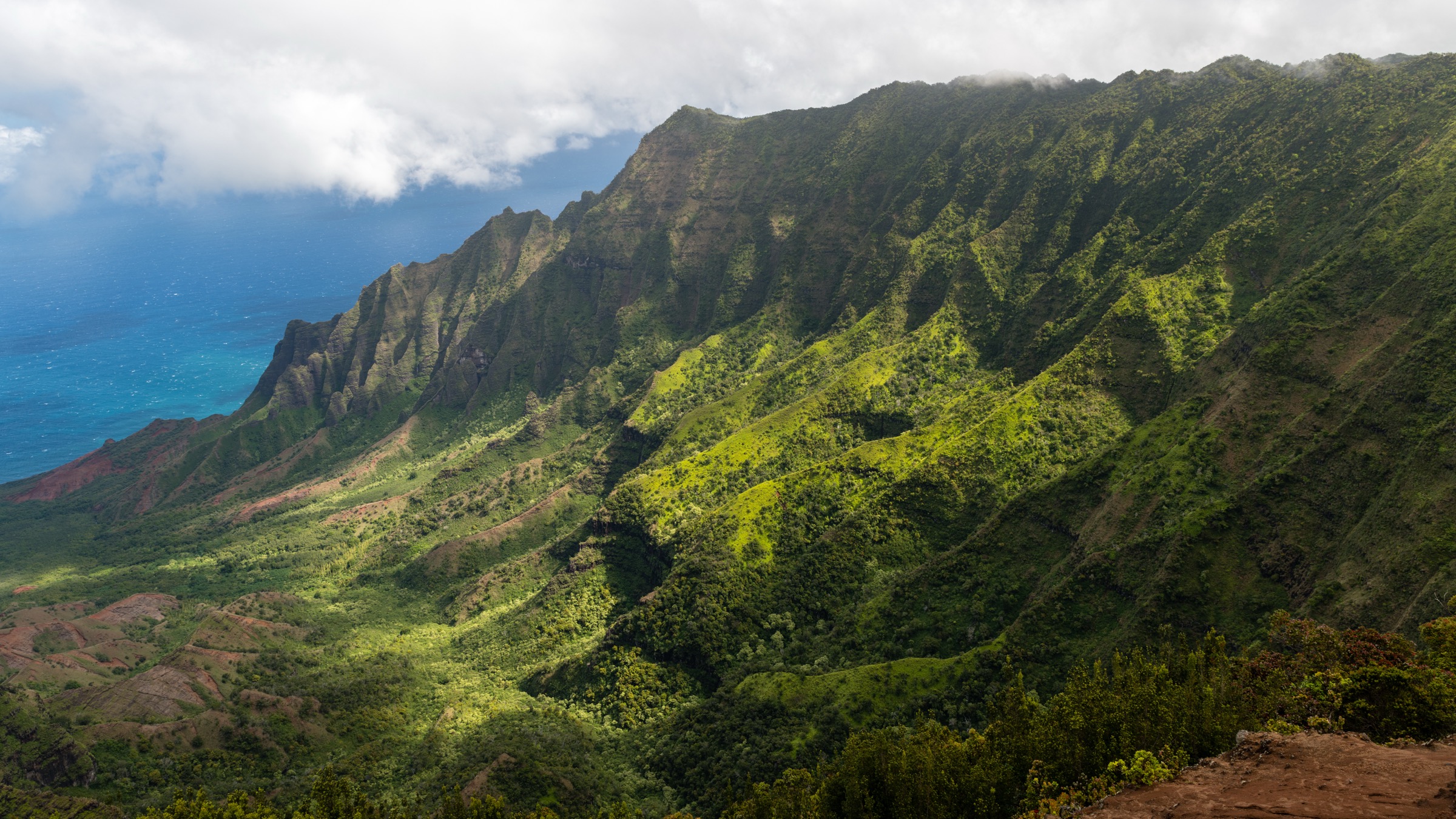
The Nā Pali Coast is the roadless northwest edge of Kauaʻi: fluted basalt palis rising 600–1,200 m from a narrow surf-cut shoreline, deep hanging valleys, and just one land trail — the Kalalau — that runs the full 18 km along the coast from Kēʻē Beach to Kalalau Beach. The region is managed as Nā Pali Coast State Wilderness Park by the Hawaiʻi Department of Land and Natural Resources (DLNR), Division of State Parks. Adjacent access at the east end is gated by Hāʻena State Park and its timed-entry system at gohaena.com.
The catalogue of “true” day hikes on the coastal side is short. Only the first four kilometres of the Kalalau Trail — to Hanakāpīʻai Beach — can be done as a day walk without a camping permit; the falls spur inland from that beach adds another four kilometres but stays inside the day-hike-legal zone. Everything past Hanakāpīʻai requires a permit issued in advance through camping.ehawaii.gov, is contested and quickly booked out, and is not treated here as day-hiking. The remaining “essential” land-based Nā Pali experiences are the two cliff-top lookouts at the end of Kōkeʻe Road — administratively in Kōkeʻe State Park but the only public vantage points that look down on the Kalalau valley from the west — plus the short cultural walk at the Kēʻē trailhead and the long beach walk at Polihale that closes the coast at its dry, western end.
Season matters. From about October to April the north-shore swell removes the sand at Hanakāpīʻai Beach, flash floods routinely close the Kalalau Trail, and cloud sits on the Kōkeʻe rim. May to September gives the most stable window. Whichever month is chosen, book the Hāʻena timed-entry parking or shuttle in advance for the two Kalalau day-hikes, and check DLNR status updates for closures.
Related entries: Waimea Canyon day-hikes covers the canyon-descent walks a short drive south; Kōkeʻe highlands day-hikes covers the plateau bog trails, forest loops, and the Awaʻawapuhi/Nualolo ridge descents that view the Nā Pali cliffs from above.
Selection rationale
The two Hanakāpīʻai walks are the only legally-permit-free coastal day-hikes on the Nā Pali. The Kalalau Lookout / Puʻu o Kila short walks give the essential land view of the Kalalau valley — the coast’s iconic amphitheatre — that no coastal hike can offer at ground level. The Kēʻē walk anchors the east trailhead and its cultural context, and Polihale closes the western end of the coast. Together the five cover the full coastal arc.
Summary table
| # | Hike | Country | Route type | Distance | Gain | Max elevation | Difficulty |
|---|---|---|---|---|---|---|---|
| 1 | Kalalau Trail to Hanakāpīʻai Beach | USA | Out-and-back | 6.4 km | ~ 240 m | ~ 200 m | Hard |
| 2 | Kalalau Trail to Hanakāpīʻai Falls | USA | Out-and-back | 12.9 km | ~ 500 m | ~ 250 m | Hard |
| 3 | Kalalau and Puʻu o Kila Lookouts | USA | Two short out-and-backs | ~ 1.5 km combined | ~ 30 m | ~ 1,270 m | Easy but high |
| 4 | Kēʻē Beach and Kaulu Paoa Heiau walk | USA | Loop / short out-and-back | ~ 1.2 km | Negligible | Sea level | Easy |
| 5 | Polihale State Park beach walk | USA | Out-and-back on sand | Up to ~ 8 km | Negligible | Sea level | Easy but exposed |
1. Kalalau Trail to Hanakāpīʻai Beach
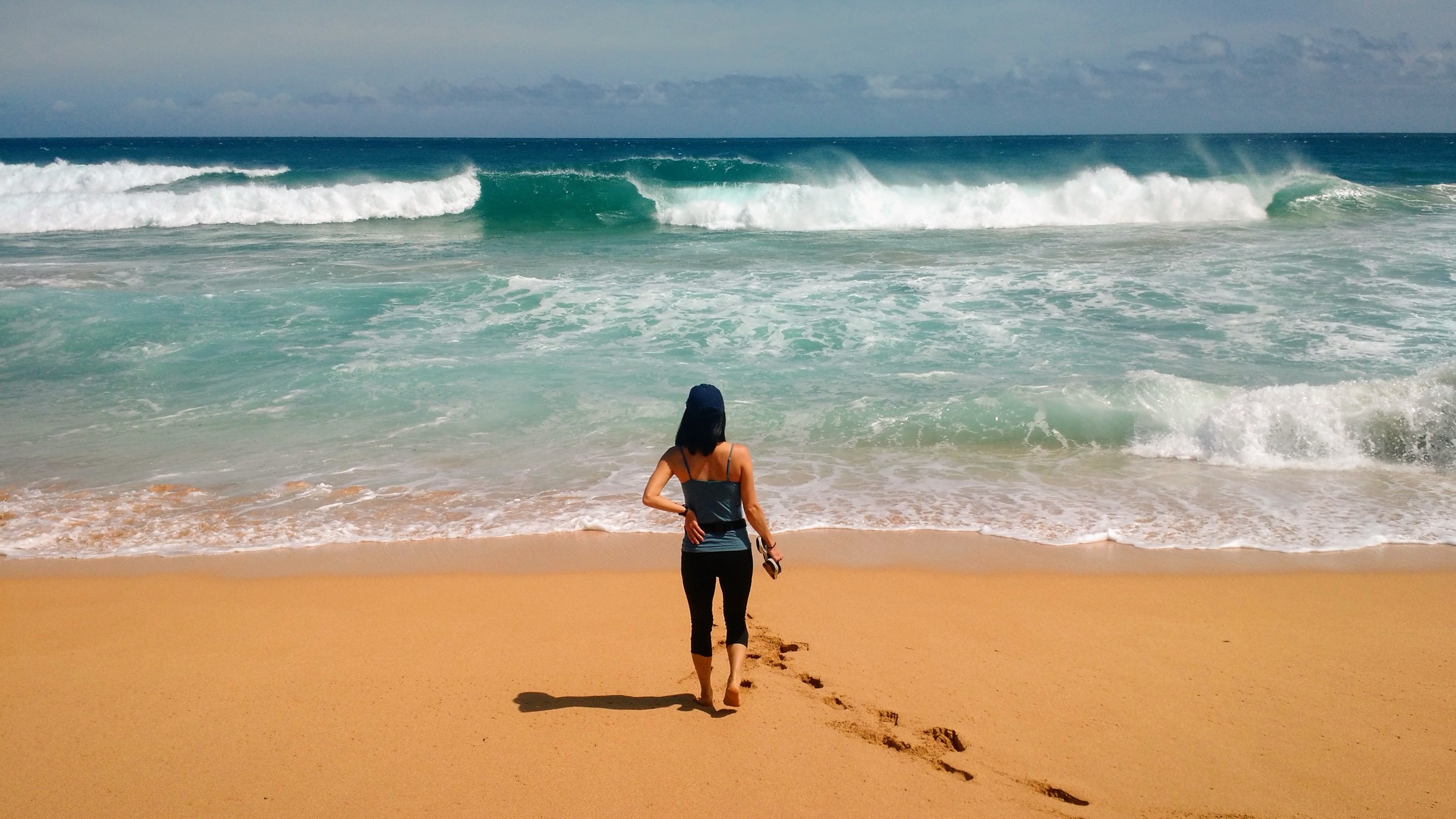
Snapshot
Itinerary
From the Kalalau Trailhead at the end of Kūhiō Highway, the trail climbs immediately over a rooted, rocky ridge above Kēʻē Beach and traverses west along the coastal palis. After the first kilometre the path opens to an ocean-side viewpoint used as the canonical Nā Pali photograph. The trail then drops in switchbacks to the beach at Hanakāpīʻai, meeting a stream that must be waded. Turn around at the beach: continuing inland reaches the falls (see hike 2); continuing coastwards requires a camping permit.
Why it is essential
This is the only Nā Pali coastal day-hike open to the general public without an advance camping permit, and it delivers the region’s defining view — the fluted palis running west from the ocean-side traverse. It is also the walk on which most first-time Kauaʻi hikers meet the coast.
Equipment
Trail shoes with grip, at least 2 litres of water, food, sun protection, rain shell, a dry bag for the stream crossing, and a headtorch in case of a slower return. Do not carry swimwear expecting to swim.
Hazards and notes
DLNR flags this stretch as one of the most dangerous state-park trails in Hawaiʻi. Rockfall, ocean-side drop-offs on wet trail, and flash flooding at Hanakāpīʻai Stream have all caused deaths; the beach itself has fatal rip currents that make it a “no-swim” location. Do not cross the stream if it is above the knees, do not proceed if rain is falling in the upper valley, and do not enter the surf. Access to the trailhead is gated by the Hāʻena State Park timed reservation system; permits and shuttle tickets are released 30 days ahead at 00:01 Hawaiʻi time on gohaena.com and sell out quickly.
GPX / route file
| Source | URL | Format / access | Reuse status |
|---|---|---|---|
| DLNR — Kalalau Trail | dlnr.hawaii.gov | Official route description | Public agency page; no official GPX published |
| Nā Pali Coast SP | dlnr.hawaii.gov | Official park page with map | Public agency page; no official GPX published |
Further reading
2. Kalalau Trail to Hanakāpīʻai Falls
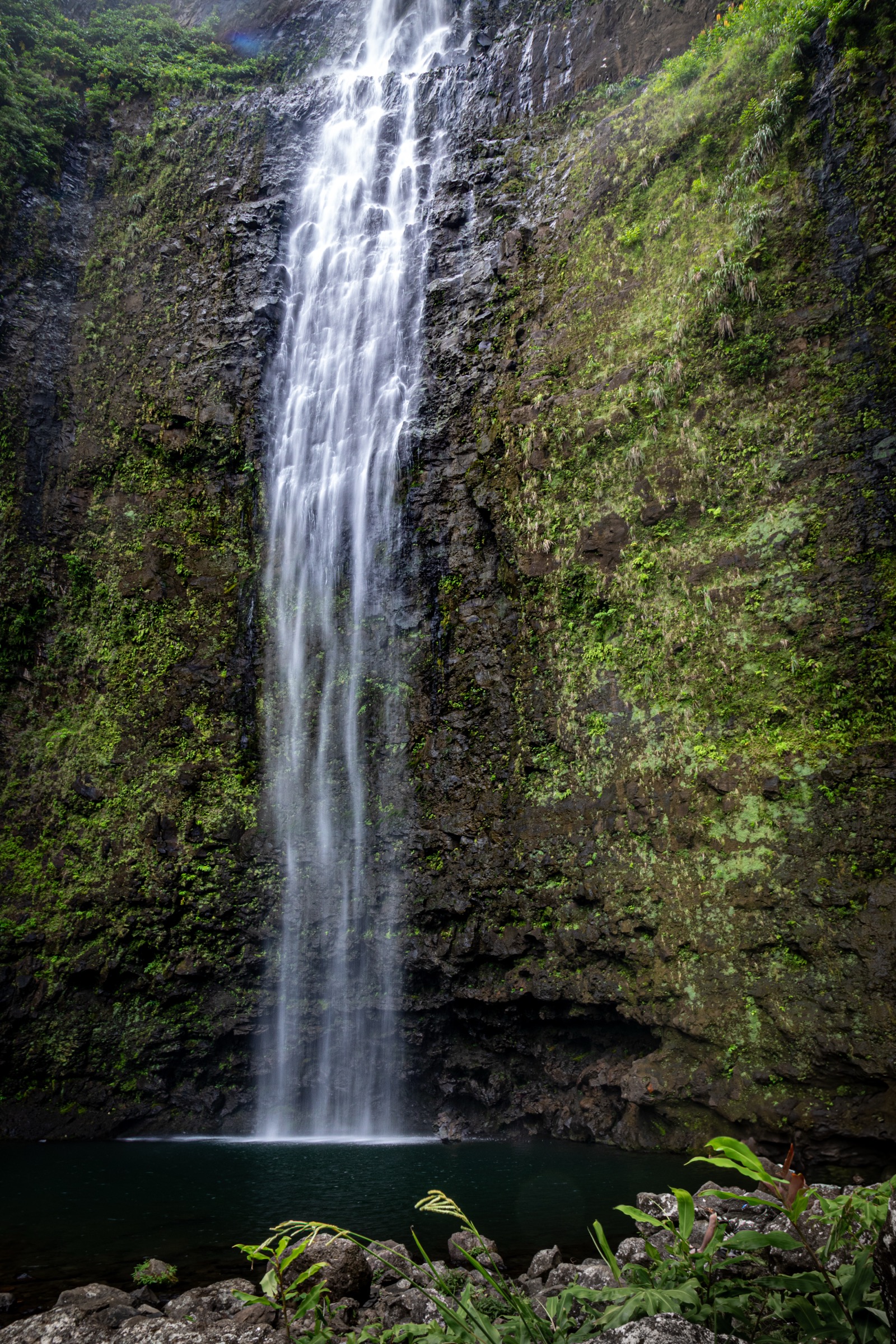
Snapshot
Itinerary
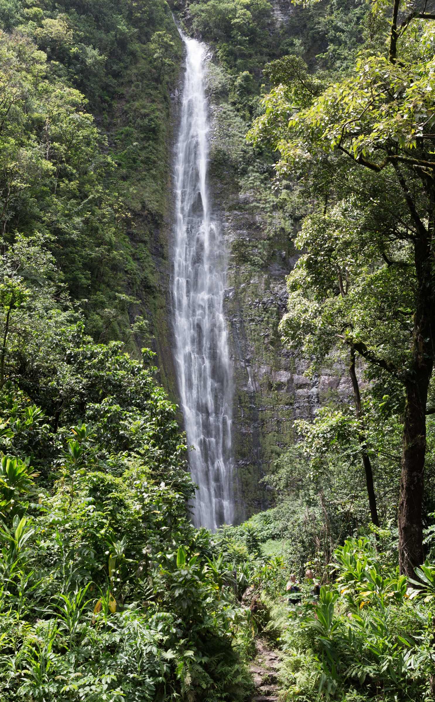
Follow hike 1 to Hanakāpīʻai Beach. From the beach, pick up the inland spur that follows Hanakāpīʻai Stream up-valley through hala and rainforest, crossing the stream several times on boulders. The trail passes an abandoned coffee-mill site, climbs over root steps, and ends at a plunge pool below the roughly 90-metre Hanakāpīʻai Falls. Return the same way.
Why it is essential
The falls spur is the longest walk on the coast that can be legally completed in a day, and it pairs the ocean-side traverse with a full inland rainforest section — the two ecologies of Nā Pali in one route.
Equipment
As for hike 1, plus footwear that can get wet, additional food and water for the longer day, and an honest weather margin. A dry bag for creek crossings is useful.
Hazards and notes
Both the ocean-side coastal trail and the inland stream are flash-flood zones; the stream crossings inside Hanakāpīʻai Valley are more sensitive than the one at the beach, and multiple deaths have occurred. Do not proceed past a rising stream. The route stays inside the day-use zone; going past the falls or continuing west from the beach requires a camping permit through camping.ehawaii.gov. Swimming in the falls pool carries falling-rock risk.
GPX / route file
| Source | URL | Format / access | Reuse status |
|---|---|---|---|
| DLNR — Kalalau Trail | dlnr.hawaii.gov | Official route description | Public agency page; no official GPX published |
Further reading
3. Kalalau and Puʻu o Kila Lookouts
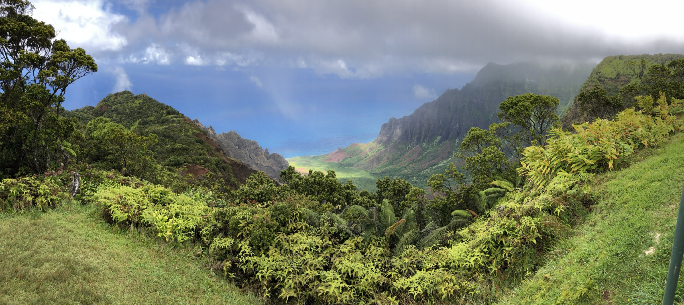
Snapshot
Itinerary
Drive Kōkeʻe Road (Highway 550) to the end. Two viewpoints look north over the Kalalau valley: the Kalalau Lookout at the marked pull-out near mile marker 18, and Puʻu o Kila Lookout at the terminus of the road. Each is a short paved or gravel walk from the car park to a railed cliff-top. Puʻu o Kila also marks the trailhead of the Pihea Trail (see the Kōkeʻe entry).
Why it is essential
These are the only land vantage points from which the Kalalau Valley — the coast’s iconic amphitheatre and the endpoint of the Kalalau Trail — can be seen from above. In clear weather they close the loop of the coastal experience.
Equipment
Warm layer and wind shell (the rim is 800–1,000 m above the coast and often cool), sun protection.
Hazards and notes
Cloud commonly sits on the rim from late morning; sunrise and early morning give the highest chance of a clear view. Stay behind railings — falls from the lookouts have been fatal. The last mile of road to Puʻu o Kila has been in poor condition and, when closed, adds a walk of a couple of kilometres from Kalalau Lookout. Confirm the current status with DLNR before the drive.
GPX / route file
| Source | URL | Format / access | Reuse status |
|---|---|---|---|
| DLNR — Kōkeʻe State Park | dlnr.hawaii.gov | Official park page | Public agency; no GPX published |
Further reading
4. Kēʻē Beach and Kaulu Paoa Heiau walk
Snapshot
Itinerary
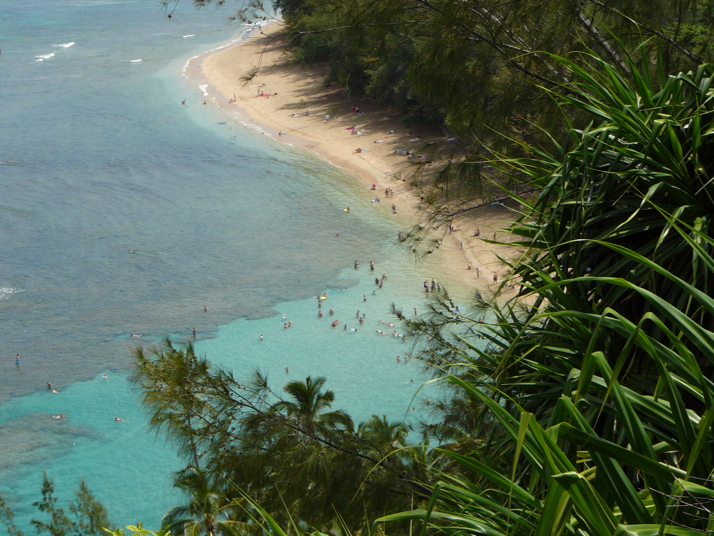
From the Hāʻena parking area, follow the shore path to Kēʻē Beach. A short marked spur to the west leads to the terraced platform of Kaulu Paoa Heiau, an important hula site with an interpretive sign. Return along the beach to the car park, or continue to the Kalalau Trailhead for the first-viewpoint pitch of hike 1.
Why it is essential
The walk pairs the Kalalau Trail’s east anchor with the cultural context — the heiau associated with Laka and hula lineage on the north shore — that gives the coast its Hawaiian meaning.
Equipment
Sun protection, water, reef-safe sunscreen. Sturdy footwear is not required but useful on the coral-rubble path.
Hazards and notes
Kēʻē has strong currents outside the fringing reef in winter; heed posted warnings. Stay on marked paths at the heiau and do not disturb offerings or stones. Access is gated by the Hāʻena timed reservation.
GPX / route file
| Source | URL | Format / access | Reuse status |
|---|---|---|---|
| DLNR — Hāʻena State Park | dlnr.hawaii.gov | Official park page | Public agency; no GPX published |
Further reading
5. Polihale State Park beach walk
Snapshot
Itinerary
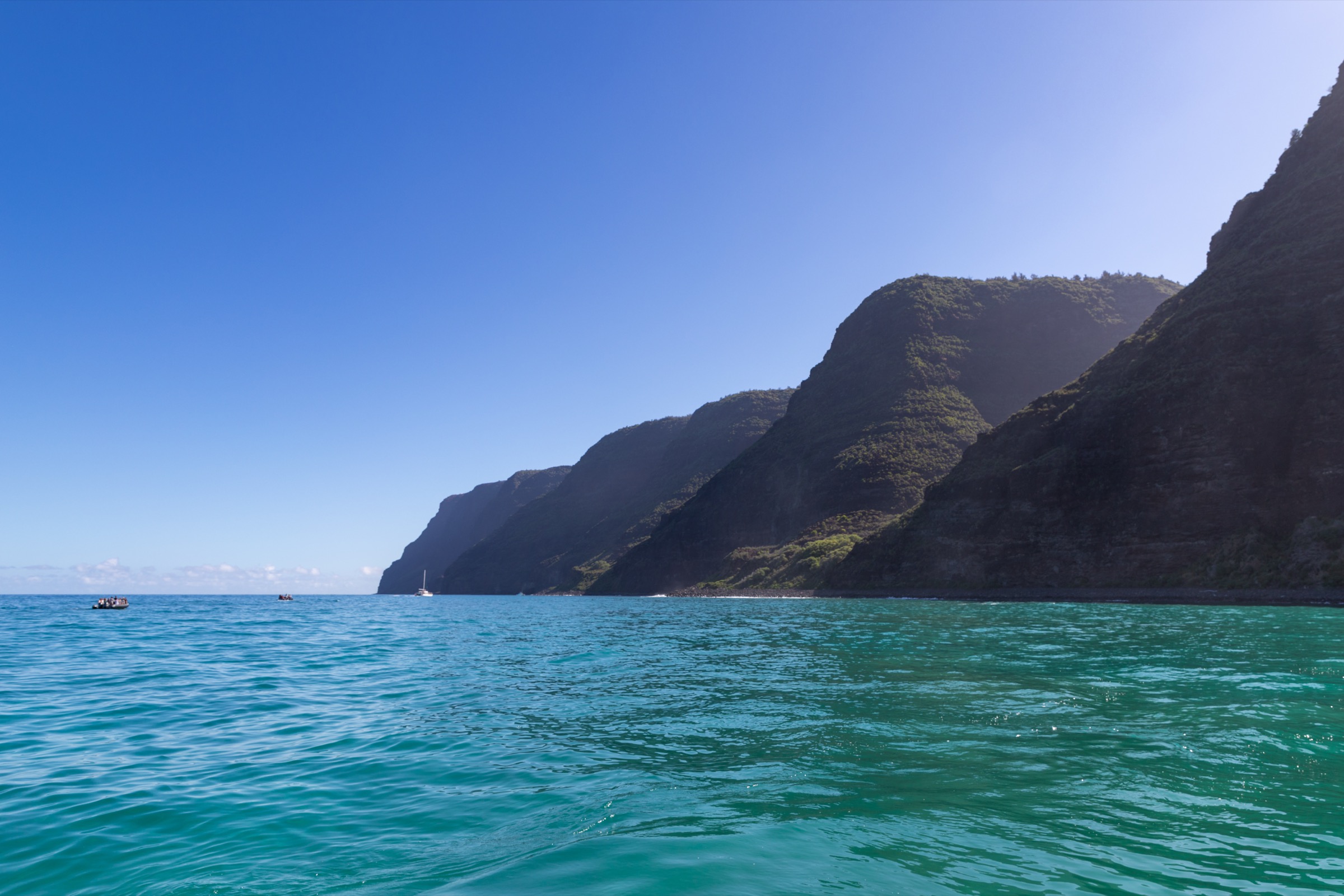
From the Polihale beach access, walk north along the sand. The palis of the western Nā Pali start immediately at the north end of the beach and rise to nearly 300 m directly out of the surf; walking as far as the cliff foot and back gives the essential experience. Return along the beach.
Why it is essential
Polihale is the only place on Kauaʻi where the Nā Pali Coast can be met at sea level by car and foot — the closure of the coastal arc that begins at Kēʻē Beach in the east. The scale of the cliffs at the north end of the beach is difficult to appreciate from any other vantage.
Equipment
Water — no supply on site — sun protection, footwear that tolerates sand (or none at all), a wind shell. A vehicle with adequate ground clearance is normally required for the access road.
Hazards and notes
The access road is unsealed, corrugated, and often rutted; local rental-car agreements sometimes prohibit its use. The surf on this coast has strong rip currents and shore breaks that regularly injure swimmers; ocean safety here is worse than on the north shore. There is no lifeguard on the beach. Bring more water than expected.
GPX / route file
| Source | URL | Format / access | Reuse status |
|---|---|---|---|
| DLNR — Polihale State Park | dlnr.hawaii.gov | Official park page | Public agency; no GPX published |
Further reading
Notes and caveats
- The Kalalau Trail west of Hanakāpīʻai Beach — Hanakoa (6 mi) and Kalalau Beach (11 mi) — is not treated here as a day-hike. Both require a state camping permit even for day use of the trail beyond the two-mile marker, and permits sell out rapidly.
- No official GPX or KML has been located for any of these routes. DLNR trail descriptions and the state-park maps are treated as the canonical source.
- Elevation figures for hikes 1 and 2 are typical values reported by DLNR-adjacent hiking sources; the official DLNR pages give distances and hazards but do not list elevation. The values are marked as approximate.
- Hāʻena reservations, weather forecasts, and any current trail closures should be checked immediately before travel.
Further reading
| Resource | Link |
|---|---|
| DLNR — Nā Pali Coast State Wilderness Park | dlnr.hawaii.gov |
| DLNR — Kalalau Trail | dlnr.hawaii.gov |
| DLNR — Kalalau Trail safety | dlnr.hawaii.gov |
| DLNR — Hāʻena State Park | dlnr.hawaii.gov |
| Hāʻena State Park reservations | gohaena.com |
| Nā Pali camping permits | camping.ehawaii.gov |
| DLNR — Polihale State Park | dlnr.hawaii.gov |