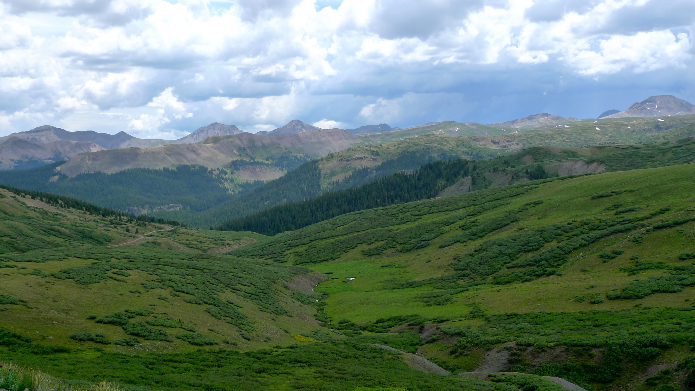
Regional overview
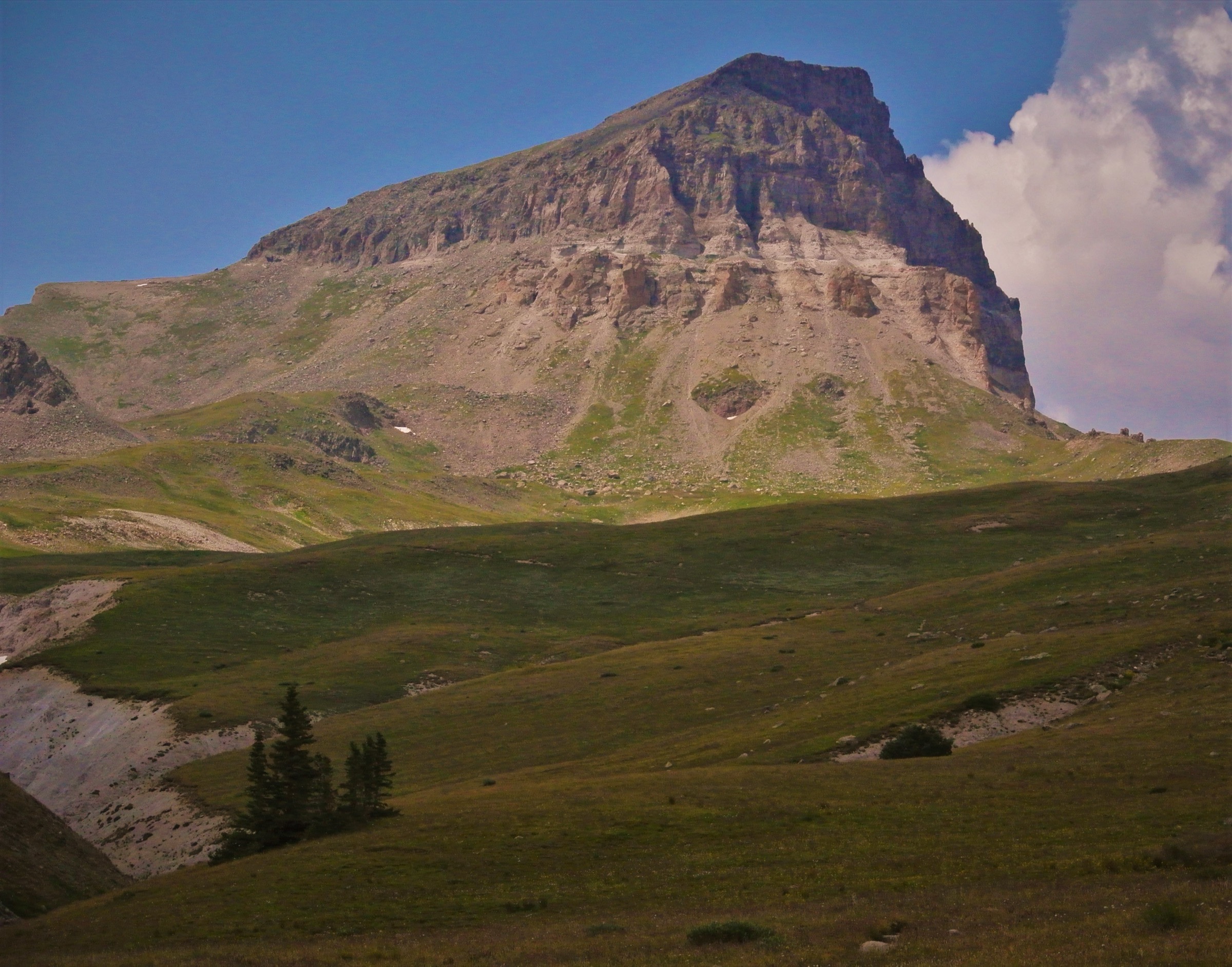
The Weminuche Wilderness covers roughly 499,771 acres (2,023 km²) of the high San Juan Mountains in south-western Colorado, making it the largest designated wilderness area in the state. It straddles the Continental Divide between the Rio Grande National Forest on the east and the San Juan National Forest on the west, taking in the headwaters of the Animas, Los Pinos, Piedra and San Juan rivers, the Needle and Grenadier mountains, and the upper Rio Grande. Three Fourteeners — Mount Eolus (4,318 m), Sunlight Peak (4,285 m) and Windom Peak (4,292 m) — sit deep in the Chicago Basin, and the great alpine spine of the Grenadiers holds Vestal, Arrow and the Trinity Peaks. Much of the interior is more than a day’s walk from any road.
That scale is what controls the day-hiking character. The named San Juan classics — Chicago Basin, the Vallecito approach to Trinity Lake, the Vestal Creek basin — are backpacking or Durango & Silverton Narrow Gauge Railroad objectives rather than clean single-day hikes; the San Juan Mountains Association describes the Needleton drop-off as a 5.5–6.5-mile, roughly 3,000 ft climb to Chicago Basin one-way, and road-based approaches are far longer. Realistic day-hike trailheads sit on the wilderness fringe: Cunningham Gulch and Stony Pass on the Silverton side, Andrews Lake at the top of Molas Pass on US 550, the Piedra and Fourmile drainages above Pagosa Springs, and the West Fork San Juan corridor off US 160 below Wolf Creek Pass.
The walking season is short and high. Snow on north aspects and at the cols can linger well into July in heavier years, and afternoon thunderstorms over the Divide are nearly daily in July and August — early starts and a hard turnaround time above treeline are standard practice. The high routes are usually safest from mid-July through September; lower forest and waterfall trails open earlier and close later, but mud, deadfall and road damage all push the calendar. Forest roads to the Silverton-side trailheads (FDR 589 toward Highland Mary, the upper Stony Pass road, Beartown) are rough enough that high-clearance, often four-wheel-drive, vehicles are normal.
Designated wilderness rules apply throughout. Mechanised travel — including bicycles, e-bikes and drones — is prohibited; party-size limits, dispersed-camping setbacks and stock regulations are posted at every major trailhead. The area is core habitat for black bear and the recently reintroduced Colorado wolf, and the upper basins are summer range for elk; food storage and trail-etiquette around large wildlife should be treated as the default. Mobile signal is absent across almost the entire wilderness, so a downloaded offline map, a paper backup and a hard plan with someone outside the area matter more than they do on the front-range Colorado classics. The more accessible San Juan basins on the Silverton-Telluride side of the range are covered separately in the companion Ouray, Silverton and Telluride day-hikes entry.
Selection rationale
Chicago Basin is deliberately excluded as a standard day-hike. The five routes below instead spread across the wilderness’s three usable approach corridors — Silverton / Molas Pass on the west, Pagosa Springs on the south, Wolf Creek Pass on the south-east — and cover its three signature day-hike landscapes: alpine lake basins, river-canyon waterfalls and hot springs, and a short open traverse on the Continental Divide Trail. The CDT segment between Beartown and Stony Pass is the only point-to-point in the list; the rest are out-and-back. Distances run from a 10 km waterfall walk to an 18 km lake approach, and elevation gains stay under 650 m, but maximum elevations push to 3,869 m on the CDT and 3,699 m at Highland Mary, so altitude is the controlling fitness factor on three of the five.
Summary table
| # | Hike | Country | Route type | Distance | Gain | Max elevation | Difficulty |
|---|---|---|---|---|---|---|---|
| 1 | Highland Mary Lakes | USA | Out-and-back | 8.4 km | 425 m | 3,699 m | Moderate |
| 2 | Crater Lake from Andrews Lake | USA | Out-and-back | 18.0 km | 615 m | 3,568 m | Hard |
| 3 | Fourmile Falls via Fourmile Trail | USA | Out-and-back | 10.0 km | 364 m | 3,022 m | Moderate |
| 4 | Rainbow Hot Springs via West Fork Trail | USA | Out-and-back | 16.3 km | 513 m | 2,771 m | Hard |
| 5 | CDT Section 40 — Beartown to Stony Pass | USA | Point-to-point | 12.6 km | 545 m | 3,869 m | Hard |
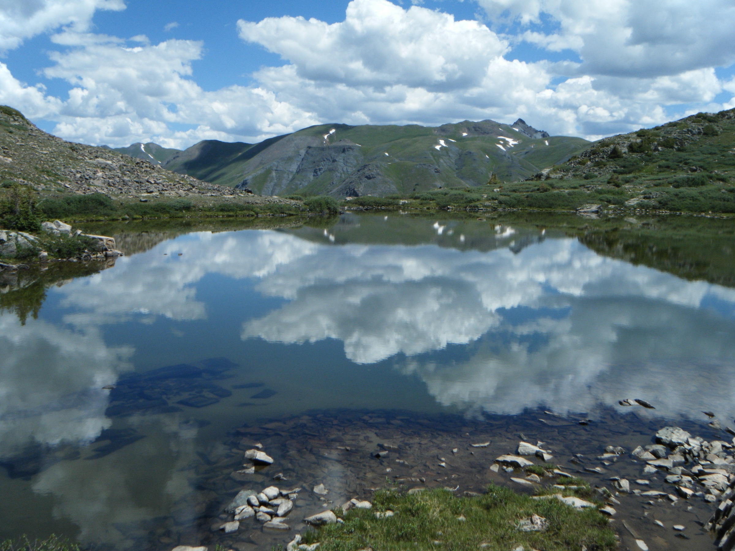
1. Highland Mary Lakes
Snapshot
Itinerary
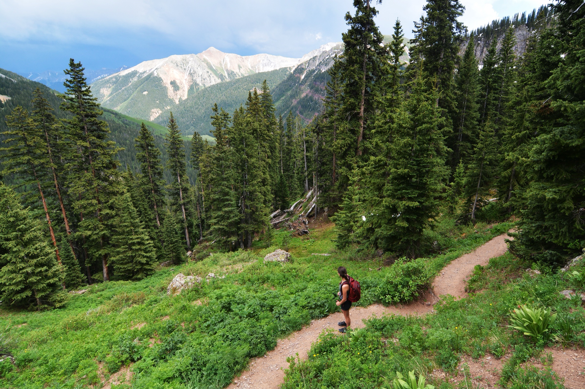
From the trailhead at the head of Cunningham Gulch, the path climbs steeply out of the gulch on a rocky alignment and pulls quickly above treeline into a broad, mostly open basin of meadows, creeks, small waterfalls and bedrock benches. The Forest Service lists this as Highland Mary Trail #606, a Weminuche route that links upward to Whitehead Peak Trail #674 and the Continental Divide Trail. The AllTrails track records 8.4 km out-and-back and 425 m of gain, finishing at the cluster of upper tarns that give the basin its name.
The standard day-hike objective is the main lakes basin rather than a longer CDT link-up. Walkers should stay on durable trail surfaces, ford streams at established crossings, and avoid lakeshore camping impacts if continuing overnight.
Why it is essential
Highland Mary is the most accessible alpine-lake classic on the Silverton side of the Weminuche. Within a few hours of walking it delivers a compressed sample of the wilderness’s high San Juan character — open tundra, tarns, wildflower meadows, small cascades and views toward the Continental Divide — without the road, mileage or altitude penalty of the deeper interior approaches.
Equipment
Sturdy waterproof boots, rain shell and warm insulated layer, hat and gloves for above-treeline weather, sun protection, 2 L water with a treatment method, food, trekking poles for the steep early section, and a downloaded offline map. Microspikes can help in early-season snowfields at the upper benches.
Hazards and notes
The basin is high enough for rapid afternoon storms, lightning and hail; an early start and a clear turnaround time are essential. Lingering snow can cover the trail into July, and stream crossings run high after warm afternoons. Dogs must be under control. No motorised or mechanised travel — including bicycles and drones — is allowed in designated wilderness. Mobile signal is absent in the basin.
GPX / route file
| Source | URL | Format / access | Reuse status |
|---|---|---|---|
| AllTrails — Highland Mary Lake Trail | alltrails.com | Source map / downloadable route via AllTrails account | AllTrails terms apply; direct GPX not retrieved; source-map reference only |
| USDA Forest Service — Highland Mary Lakes Trail | fs.usda.gov | Official trail page | No GPX published; access and trail context |
Further reading
2. Crater Lake from Andrews Lake
Snapshot
Itinerary
The trail leaves the south end of Andrews Lake on a short, signed connector, then settles into a long, undulating traverse south-east through spruce-fir forest and pocket meadows on the west side of Snowdon Peak. The grade is moderate but the line is rocky and rooted, with several short climbs that slow the pace. Approaching the head of the basin the trail breaks out into open subalpine country and pulls up to Crater Lake at 3,568 m, set under a cirque wall on the northern shoulder of North Twilight Peak. The Forest Service identifies this as Crater Lake Trail in the Columbine Ranger District, beginning at Andrews Lake near Molas Pass. AllTrails records 18.0 km out-and-back with 615 m of gain.
The route is longer and more committing than Highland Mary, with a wilder feel and a larger day-hike distance. Lingering snowfields, mud, deadfall or wet rock can slow the second half of the day considerably.
Why it is essential
This is the cleanest Molas Pass day route for entering the Weminuche edge on foot without committing to a backpacking itinerary. It combines lake scenery, deep San Juan forest, high meadows and the Twilight skyline in a single day from a paved trailhead.
Equipment
Full mountain day kit: rain shell, insulating layer, food, 2.5 L water with treatment, headlamp, offline map, and traction (microspikes) if early-season snow remains on the higher benches. Trekking poles help on the rocky descent.
Hazards and notes
Afternoon thunderstorms over the Divide are serious; turn back from the open upper basin before mid-afternoon if cells are building. Road access is easier than the deep 4WD trailheads on the Silverton side but is still weather-dependent — US 550 between Durango and Silverton is occasionally closed for slides. Bear awareness is the standard wilderness default.
GPX / route file
| Source | URL | Format / access | Reuse status |
|---|---|---|---|
| AllTrails — Crater Lake Trail | alltrails.com | Source map / downloadable route via AllTrails account | AllTrails terms apply; direct GPX not retrieved; source-map reference only |
| USDA Forest Service — Crater Lake Trail (Columbine RD) | fs.usda.gov | Official trail page | No GPX published; access and trail context |
Further reading
- USDA Forest Service — Crater Lake Trail
- Durango Trails — Crater Lake Trail
- AllTrails — Crater Lake Trail
3. Fourmile Falls via Fourmile Trail
Snapshot
Itinerary
Fourmile Trail (Forest Service #569) climbs north-east from the trailhead through mixed conifer forest and open meadows on the south side of the Fourmile Creek drainage, with a few open viewpoints north toward the Pagosa Peak skyline. The grade is steady rather than sustained. The day-hike turnaround is the Fourmile Falls viewpoint roughly 5 km in, where the trail emerges above a long-drop cascade fed by snowmelt from the upper basin. The AllTrails track records 10.0 km out-and-back with 364 m of gain. Continuing beyond the falls would push into deeper Weminuche backcountry and out of day-hike range; the standard plan is to return by the same path.
Why it is essential
Fourmile Falls is the Weminuche’s most approachable Pagosa-side waterfall day-hike. It rounds out a selection otherwise dominated by alpine lakes and Divide traverses with a lower, forested, water-focused route that opens earlier in the season and is friendlier to less experienced parties.
Equipment
Hiking shoes or boots with traction, waterproof layer, water with treatment, food, sun protection, and a downloaded offline map. Trekking poles help on the descent. Do not rely on phone service from the trailhead onward.
Hazards and notes
Creekside sections, muddy stretches, deadfall and wet rock near the falls can slow travel. Spring runoff makes the falls thunderous but the trail conditions worse — confirm with a current Pagosa Area Trails update before driving. Bear awareness is standard.
GPX / route file
| Source | URL | Format / access | Reuse status |
|---|---|---|---|
| AllTrails — Fourmile Falls via Fourmile Stock Drive Trail | alltrails.com | Source map / downloadable route via AllTrails account | AllTrails terms apply; direct GPX not retrieved; source-map reference only |
| USDA Forest Service — Fourmile Trail | fs.usda.gov | Official trail page | No GPX published; access and trail context |
Further reading
- USDA Forest Service — Fourmile Trail
- Pagosa Springs Area Trails — Fourmile Trail #569
- AllTrails — Fourmile Falls via Fourmile Stock Drive Trail
4. Rainbow Hot Springs via West Fork Trail
Snapshot
Itinerary
The route follows West Fork Trail #561 north and north-east up the canyon of the West Fork of the San Juan River, in and out of mature spruce-fir forest with frequent river contact. The grade is gentle for most of the approach, with a few rocky steps and small climbs over slide debris. AllTrails records a 16.3 km out-and-back with 513 m of gain. The main trail is straightforward to follow as far as the campsite area opposite the springs; from there the line down to the riverside hot pools is rougher, often steep and braided, and worth confirming against a current map before committing.
Why it is essential
Rainbow is the classic long day objective from the Pagosa and Wolf Creek side of the Weminuche. It shows the wilderness’s river-canyon and hot-spring character rather than the high Silverton lake basins, and pulls the catalogue down off the divide for one route.
Equipment
Full day kit: waterproof layer, food, 2.5 L water with treatment, headlamp, downloaded offline map, and footwear that handles mud and creekside travel. A small towel and swim layer for the springs.
Hazards and notes
Hot springs carry health risks. Avoid soaking with open cuts, keep your head above water (Naegleria fowleri has been associated with warm freshwater in the western US), and follow any posted Forest Service restrictions. Confirm Forest Service alerts for West Fork Road and the river-crossing bridges before driving — both have been damaged in past wildfire and storm cycles. The 2013 West Fork Complex fire scar still affects deadfall risk in parts of the corridor.
GPX / route file
| Source | URL | Format / access | Reuse status |
|---|---|---|---|
| AllTrails — Rainbow Hot Springs | alltrails.com | Source map / downloadable route via AllTrails account | AllTrails terms apply; direct GPX not retrieved; source-map reference only |
| USDA Forest Service — Rainbow Hot Springs | fs.usda.gov | Official recreation page | No GPX published; access context |
| USDA Forest Service — West Fork Trail | fs.usda.gov | Official trail page | No GPX published; route and access context |
Further reading
- USDA Forest Service — Rainbow Hot Springs
- USDA Forest Service — West Fork Trail
- AllTrails — Rainbow Hot Springs
5. CDT Section 40 — Beartown to Stony Pass
Snapshot
Itinerary
The day samples a short, high section of the Continental Divide Trail between the Beartown / Hunchback Pass area and Stony Pass on the boundary of the Weminuche. The line stays in open alpine tundra for nearly its entire length, traversing west and north-west across the Divide with the upper Animas, the Grenadier skyline and the Rio Grande headwaters in view. Shelter is minimal once on the ridge. AllTrails records 12.6 km with 545 m of gain; the Hiking Project entry covers the same CDT segment with a slightly different trailhead label.
This is a point-to-point hike, not a casual out-and-back. The road logistics are often harder than the trail: the Beartown end is reached by a long, rough four-wheel-drive track from Stony Pass Road, and the Stony Pass exit needs an arranged vehicle or shuttle. Bad weather can make the high traverse serious within minutes.
Why it is essential
This is the cleanest way to include a true Continental Divide Trail day on the Weminuche without asking the reader to commit to a multi-day section hike. It shows the open, high, through-hiking character of the range that the lake-basin and waterfall routes can only hint at.
Equipment
Full alpine day kit, headlamp, emergency insulation (a light puffy plus a wind shell at minimum), downloaded offline map, water with treatment, food for a long day, and a hard turnaround plan. Trekking poles help on the rocky descent toward Stony Pass.
Hazards and notes
Lightning exposure above 3,800 m is the headline hazard; an early start and a willingness to turn around mid-traverse are non-negotiable. Lingering snow on north aspects, navigation errors in fog, altitude, and the rough mountain road at both ends are the supporting risks. Do not start unless the shuttle or vehicle retrieval is secure — Stony Pass Road is regularly impassable to non-4WD vehicles.
GPX / route file
| Source | URL | Format / access | Reuse status |
|---|---|---|---|
| AllTrails — CDT Section 40: Beartown to Stony Pass | alltrails.com | Source map / downloadable route via AllTrails account | AllTrails terms apply; direct GPX not retrieved; source-map reference only |
| Hiking Project — CDT: Beartown to Stony Pass (CO Sec 9) | hikingproject.com | Source-map page; GPX availability per Hiking Project | Hiking Project / Adventure Projects terms apply; direct GPX not retrieved |
Further reading
- Continental Divide Trail Coalition
- Hiking Project — CDT: Beartown to Stony Pass
- AllTrails — CDT Section 40: Beartown to Stony Pass
Further reading
| Source | URL |
|---|---|
| USDA Forest Service — Weminuche Wilderness | fs.usda.gov |
| USDA Forest Service — Wilderness Rules and Regulations (San Juan NF) | fs.usda.gov |
| San Juan Mountains Association — Chicago Basin Trip Planning | sjma.org |
| Continental Divide Trail Coalition | continentaldividetrail.org |
| Pagosa Springs Area Trails | pagosatrails.org |
| Durango Trails | durangotrails.org |
| AllTrails — Weminuche Wilderness trails | alltrails.com |
| Wikimedia Commons — Category: Weminuche Wilderness | commons.wikimedia.org |
| Wikipedia — Weminuche Wilderness | en.wikipedia.org |