Regional overview
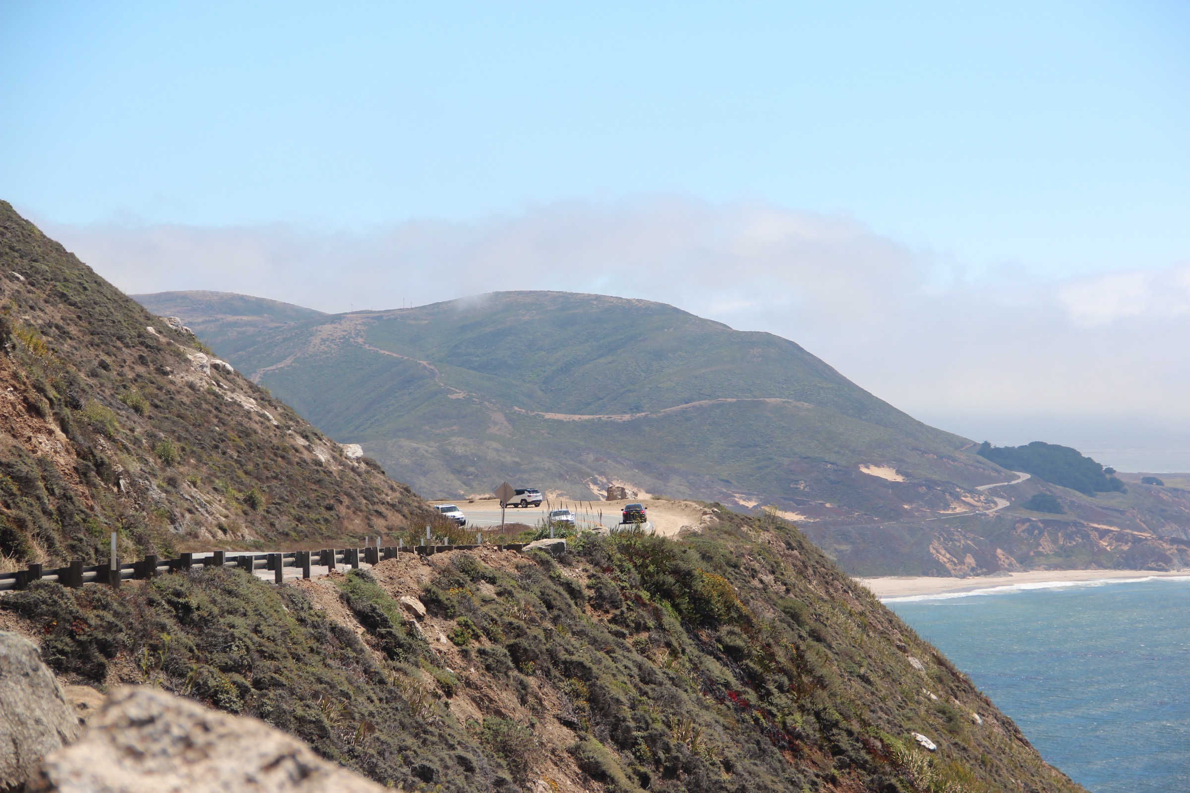
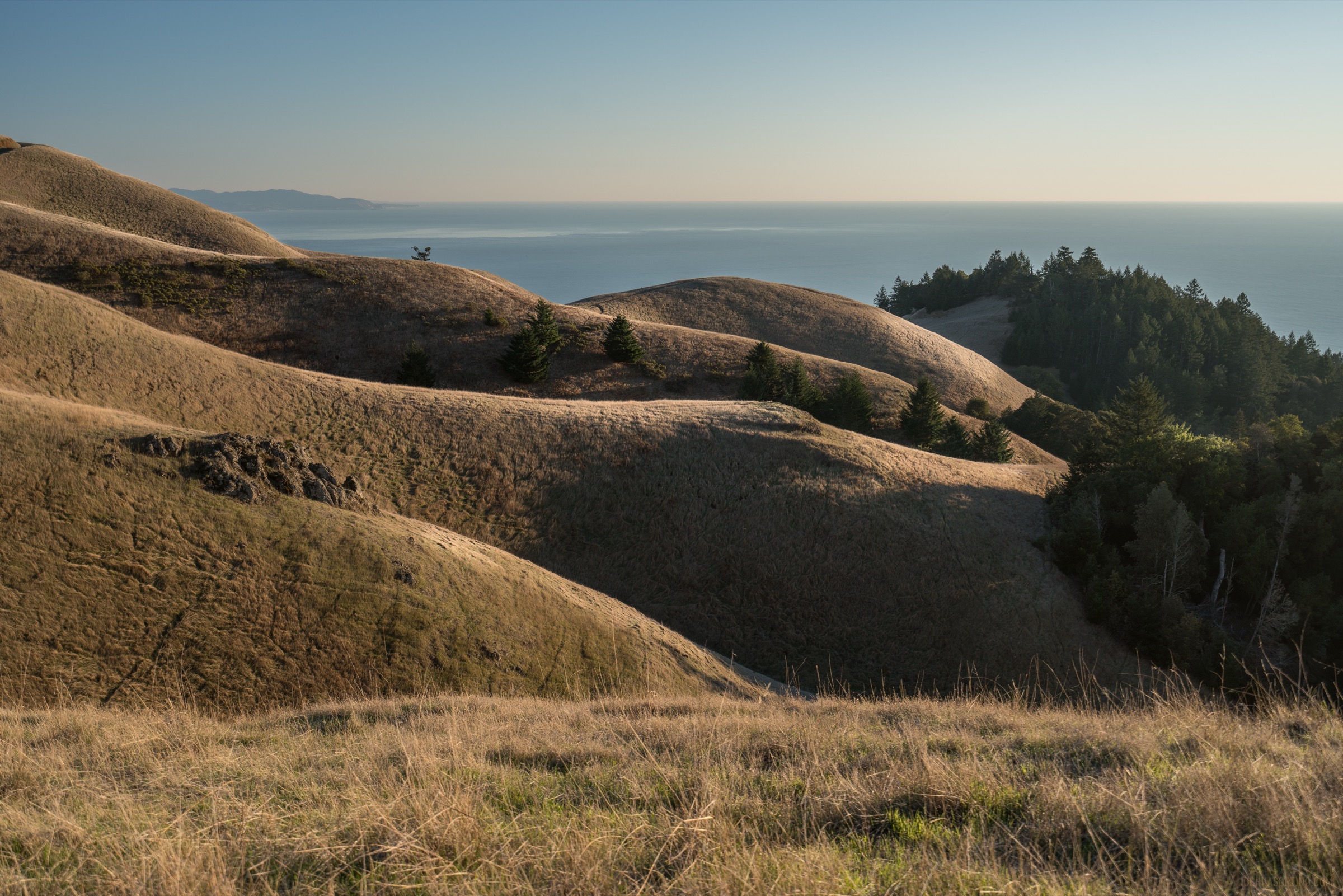
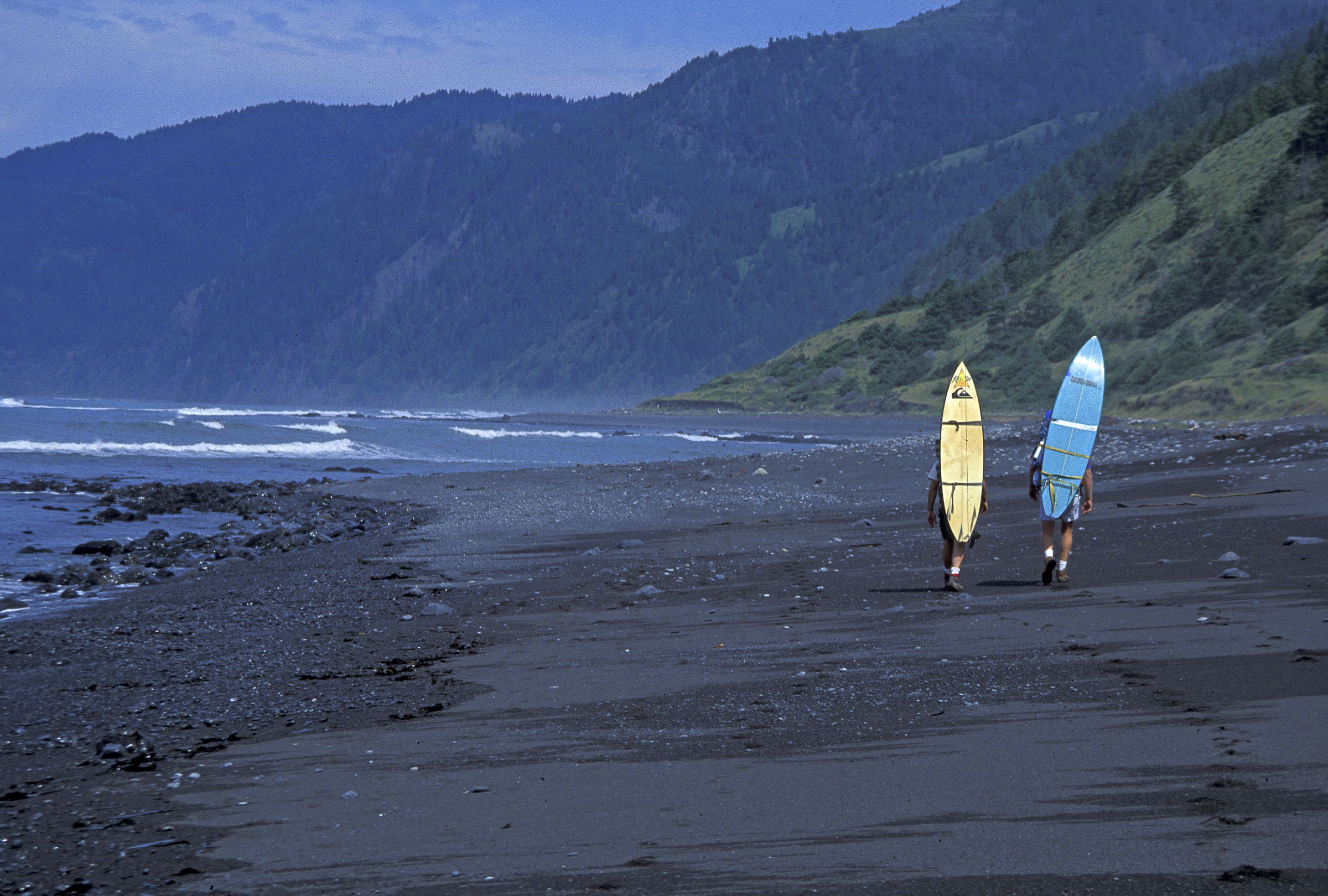
The Mendocino and King Range hiking area covers the Mendocino coast and its uplifted marine terraces, Sinkyone Wilderness State Park, and the King Range National Conservation Area on the Lost Coast. The defining character is coastal wilderness rather than high-alpine terrain: surf-battered beaches, dark coves, redwood-and-fern canyons, pygmy-forest terraces, rough coastal roads, and mountains that rise steeply from the Pacific. The BLM describes the King Range as mountains that thrust out of the surf, with 4,088 ft (1,246 m) King Peak only about three miles from the ocean — the greatest coastal relief on the California coast.
Conditions can be more consequential than the elevations suggest. Lost Coast beach walks require careful tide awareness: sneaker waves, cold water, bluff collapse, fog, winter storms, mud, ticks, poison oak, limited services, and weak phone coverage are all recurring issues. Several trailheads are reached by narrow, steep, unpaved roads that may be unsuitable for RVs or long trailers and can become impassable in wet weather. California State Parks explicitly warns that Sinkyone roads are steep, narrow, unpaved, and not recommended for RVs or trailers, and BLM’s King Range trip-planning guide flags tide-driven closures on the Lost Coast Trail.
The five hikes below therefore split cleanly between exposed Lost Coast objectives — Punta Gorda Lighthouse, King Peak and Bear Harbor — and the sheltered Mendocino state-park side, where Russian Gulch and Jug Handle give redwood-fern and marine-terrace walking at moderate distances from Highway 1. All five are documented against official BLM, California State Parks and Sinkyone Wilderness sources, cross-checked with AllTrails route stats.
Selection rationale
The five selections balance the sub-region’s essential experiences: Punta Gorda Lighthouse for the classic Lost Coast beach day, King Peak for the signature summit above the Pacific, Bear Harbor for Sinkyone Wilderness and the southern Lost Coast, Russian Gulch for Mendocino redwood-fern waterfall hiking, and the Ecological Staircase for the internationally notable marine-terrace and pygmy-forest sequence at Jug Handle State Natural Reserve. Distances run from an 8.4 km terrace out-and-back to a 10.5 km Lost Coast beach walk; total ascent stays under 600 m on every route.
The long backpacking traverses of the Lost Coast Trail and the Sinkyone through-route are excluded here to keep the entry to accessible, well-documented day-hikes.
Summary
| # | Hike | Country | Route type | Distance | Gain | Max elevation | Difficulty |
|---|---|---|---|---|---|---|---|
| 1 | Punta Gorda Lighthouse via Lost Coast Trail | USA | Out-and-back | 10.5 km | 117 m | 26 m | Moderate |
| 2 | King Peak Trail | USA | Loop | 8.5 km | 592 m | 1,245 m | Hard |
| 3 | Bear Harbor via Briceland Road / Needle Rock | USA | Out-and-back | 9.8 km | 274 m | 93 m | Moderate |
| 4 | Russian Gulch Fern Canyon and Waterfall Loop | USA | Loop | 10.0 km | 166 m | 158 m | Moderate |
| 5 | The Ecological Staircase, Jug Handle | USA | Out-and-back | 8.4 km | 101 m | 90 m | Moderate |
1. Punta Gorda Lighthouse via Lost Coast Trail
Snapshot
Itinerary
From Mattole Beach, the route follows the northern Lost Coast Trail south along beach, sand, cobble and low coastal benches to the restored Punta Gorda Lighthouse. The walk passes surf, dunes, driftwood, coastal bluffs and wildlife habitat; elephant seals are often present near the lighthouse area and must be given wide space. Return is by the same beach route. Day use does not require the overnight Lost Coast wilderness permit.
Why it is essential
This is the most accessible day-sized taste of the Lost Coast: wild beach walking, a historic lighthouse, marine wildlife, and the dramatic meeting of the King Range mountains and Pacific surf without committing to the multi-day backpacking route.
Equipment
- Layers, wind shell and rain protection
- 2 L water and food for a slow beach day
- Sun protection — the beach is fully exposed
- Sturdy footwear that can handle sand and cobble
- Headlamp for return if a tide-window forces a wait
- Offline navigation and a tide table for the day
Hazards and notes
- Tide awareness is essential — BLM warns hikers to check tide levels before walking any section of the Lost Coast Trail; sneaker waves and undertow are cold-water hazards.
- Cold water and wet creek crossings; hypothermia risk if wet through.
- Elephant seals and other marine wildlife near the lighthouse — stay at least 165 ft (50 m) away.
- Weak or absent phone coverage across the entire route.
- Confirm road conditions to Mattole Beach with the King Range NCA office before travel.
GPX / route file
| Source | URL | Format / access | Reuse status |
|---|---|---|---|
| AllTrails — Punta Gorda Lighthouse via Lost Coast Trail | alltrails.com | Source map / route page | AllTrails terms apply; source-map reference only |
| BLM — King Range map and guide (PDF) | blm.gov | Official PDF map / guide | Public-agency source; map reference only |
| BLM — King Range trip-planning and tide guide (PDF) | blm.gov | Official PDF safety guide | Tide and hazard reference |
Further reading
2. King Peak Trail
Snapshot
Itinerary
The route climbs from the King Peak trailhead area toward the summit of King Peak, the high point of the King Range. The trail gains quickly through forest and open slopes to the summit ridge, where the Pacific is only a few miles away horizontally but more than 1,200 m below. The loop return uses linked King Range trails back to the start. The summit view spans the Lost Coast, the Sinkyone side to the south and — on clear days — the King Range’s own long unbroken coastline.
Why it is essential
King Peak is the defining summit of the Lost Coast. The BLM describes the King Range as mountains thrusting out of the surf, with 4,088 ft King Peak only about three miles from the ocean; this hike is the most direct day-sized expression of that geography.
Equipment
- Full mountain day-kit: 2.5 L water, food for the ascent, and layers for the ridge
- Sun protection and wind shell — the summit ridge is fully exposed
- Sturdy hiking footwear for steep grades and possible loose tread
- Offline map / GPS — road access is complex and phone coverage is unreliable
- Headlamp and first-aid kit
- Poison-oak and tick awareness for lower elevations
Hazards and notes
- Rough approach roads — narrow, steep, and unpaved; high-clearance vehicles are recommended, and RVs / long trailers are not suitable.
- Fast-changing coastal weather — clear ridges can be fogged in within minutes.
- Poison oak and ticks on the lower slopes; long trousers recommended.
- Confirm current road and trail status with BLM before driving in — winter closures and storm damage are common.
- Steep summit exposure — keep a margin near the ridge edge.
GPX / route file
| Source | URL | Format / access | Reuse status |
|---|---|---|---|
| AllTrails — King Peak Trail | alltrails.com | Source map / route page | AllTrails terms apply; source-map reference only |
| BLM — King Range map and guide (PDF) | blm.gov | Official PDF map / guide | Public-agency source; map reference only |
Further reading
3. Bear Harbor via Briceland Road / Needle Rock
Snapshot
Itinerary
From the Needle Rock / Briceland Road side of Sinkyone Wilderness State Park, the route heads south toward Bear Harbor through forest, coastal meadows and rugged Lost Coast terrain. It reaches the sheltered cove and dark beach at Bear Harbor before returning the same way. The route is signed and reasonably followed, but expect blowdowns and mud after storm cycles.
Why it is essential
Bear Harbor is the day-hike gateway to Sinkyone Wilderness: a remote cove, steep green coastal slopes, dark sand, and the southern continuation of the Lost Coast atmosphere without needing a multi-day traverse.
Equipment
- Waterproof shoes with mud traction
- 2 L water and a lunch
- Rain and wind layers
- Offline navigation — trail junctions are lightly signed
- Tick and poison-oak awareness
- Bear-aware food storage if lingering at Bear Harbor
Hazards and notes
- California State Parks warns that Sinkyone roads are steep, narrow, unpaved and unsuitable for RVs or trailers.
- Potable water is not available in the park — carry all you need.
- Downed trees, mud, ticks, poison oak and slick trails are recurring conditions.
- Coastal fog and cold onshore wind at any season.
- Limited services and weak or absent phone coverage.
GPX / route file
| Source | URL | Format / access | Reuse status |
|---|---|---|---|
| AllTrails — Bear Harbor via Briceland Road | alltrails.com | Source map / route page | AllTrails terms apply; source-map reference only |
| California State Parks — Sinkyone Wilderness State Park | parks.ca.gov | Official park page / map source | Rule, access and map reference |
Further reading
4. Russian Gulch Fern Canyon and Waterfall Loop
Snapshot
Itinerary
The loop links Russian Gulch’s Fern Canyon Trail and Falls Loop Trail, following shaded creek-side forest toward the park’s 36 ft (11 m) waterfall before returning through redwood, fern and mixed coastal forest. The route is well suited to damp-season scenery but can be muddy after rain; slick roots and small stream crossings are the recurring characters underfoot.
Why it is essential
Russian Gulch is the classic Mendocino coast forest hike: coastal state-park access, fern canyon, redwoods, a real waterfall, and a moderate loop format that contrasts strongly with the exposed Lost Coast objectives further north.
Equipment
- Shoes with mud traction
- Rain layer in wet weather
- 1.5–2 L water and a snack
- Tick and poison-oak awareness
- Offline map — junctions are signed but not always obvious after rain
Hazards and notes
- Slick roots and mud, especially after storms.
- Possible trail washouts and downed trees after winter storms.
- Dogs are not permitted on the trail per the current AllTrails route record — confirm state-park pet rules before travel.
- State-park day-use fees apply — confirm current fee and closure status.
- Ticks and poison oak in the shoulder seasons.
GPX / route file
| Source | URL | Format / access | Reuse status |
|---|---|---|---|
| AllTrails — Russian Gulch Fern Canyon and Waterfall Loop | alltrails.com | Source map / route page | AllTrails terms apply; source-map reference only |
| California State Parks — Russian Gulch State Park | parks.ca.gov | Official park page / map source | Rule, access and map reference |
Further reading
5. The Ecological Staircase, Jug Handle
Snapshot
Itinerary
The trail starts near the coast and crosses a sequence of uplifted marine terraces, moving from coastal bluff and forest into older, increasingly nutrient-poor soils. The route’s inland objective is the Pygmy Forest, where stunted pines and cypress reflect the severe soil conditions. Return is by the same trail; interpretive signage and the state-park trail guide match key features on the ground.
Why it is essential
The Ecological Staircase is one of the most distinctive short hikes on the California coast. California State Parks describes the marine-terrace sequence as an ecological and landscape-evolution story unparalleled elsewhere in California — a scientific and scenic essential rather than just another coastal forest walk.
Equipment
- Comfortable trail shoes with mud traction
- Light rain layer in wet weather
- 1 L water and a snack
- Sun protection for the exposed bluff section
- Bug awareness in warmer months
Hazards and notes
- Stay on the trail and boardwalks where provided — the Pygmy Forest soils and plant communities are fragile.
- Dog access is restricted: the AllTrails route notes dogs only west of Highway 1 and not on the trail east of the highway.
- Expect mud in wet periods; the underlying podzol soils drain slowly.
- Highway 1 traffic and parking at the trailhead can be busy on weekends.
GPX / route file
| Source | URL | Format / access | Reuse status |
|---|---|---|---|
| AllTrails — The Ecological Staircase | alltrails.com | Source map / route page | AllTrails terms apply; source-map reference only |
| California State Parks — Jug Handle State Natural Reserve | parks.ca.gov | Official park page with brochure and trail-guide links | Rule, access and route context |