Regional overview
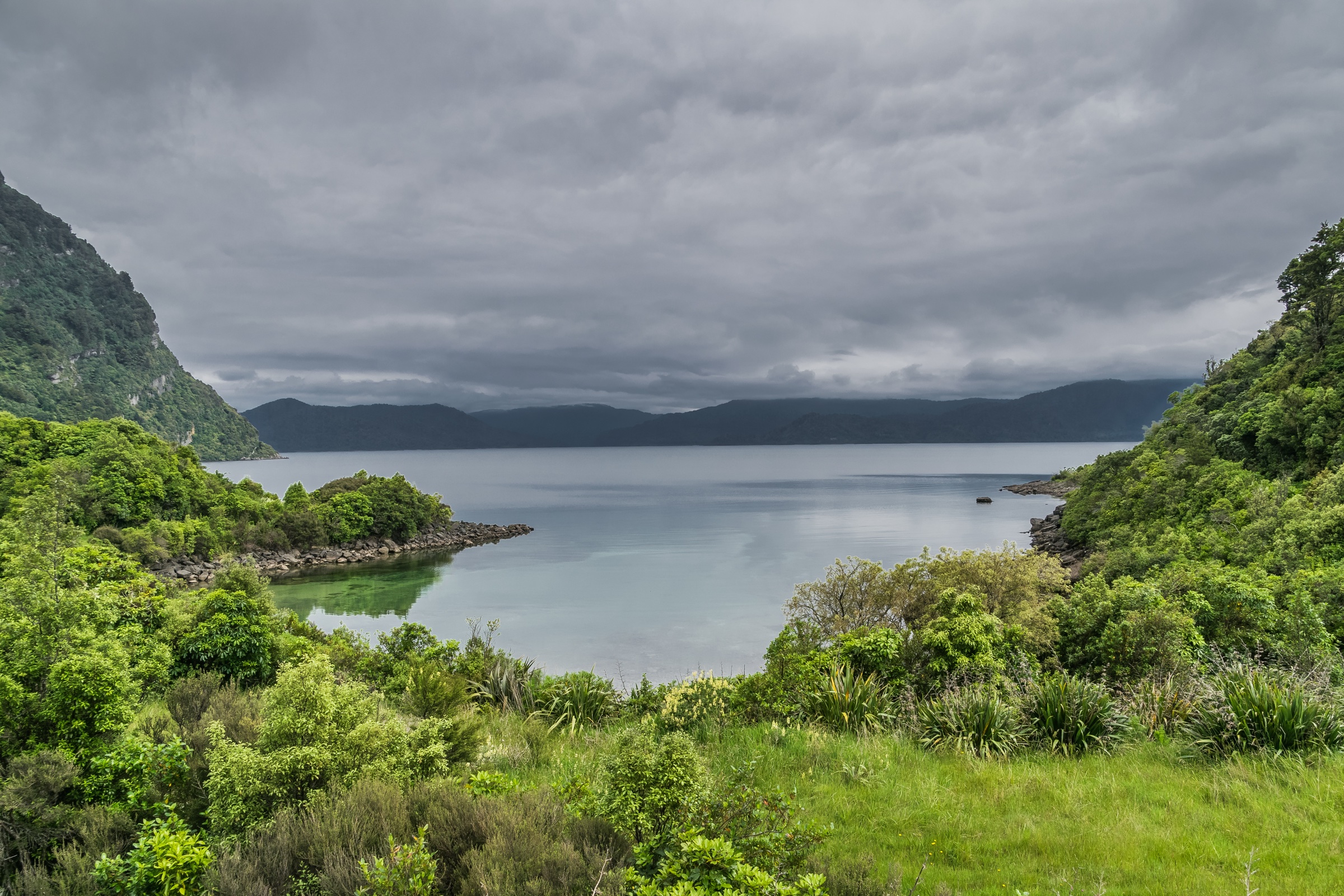
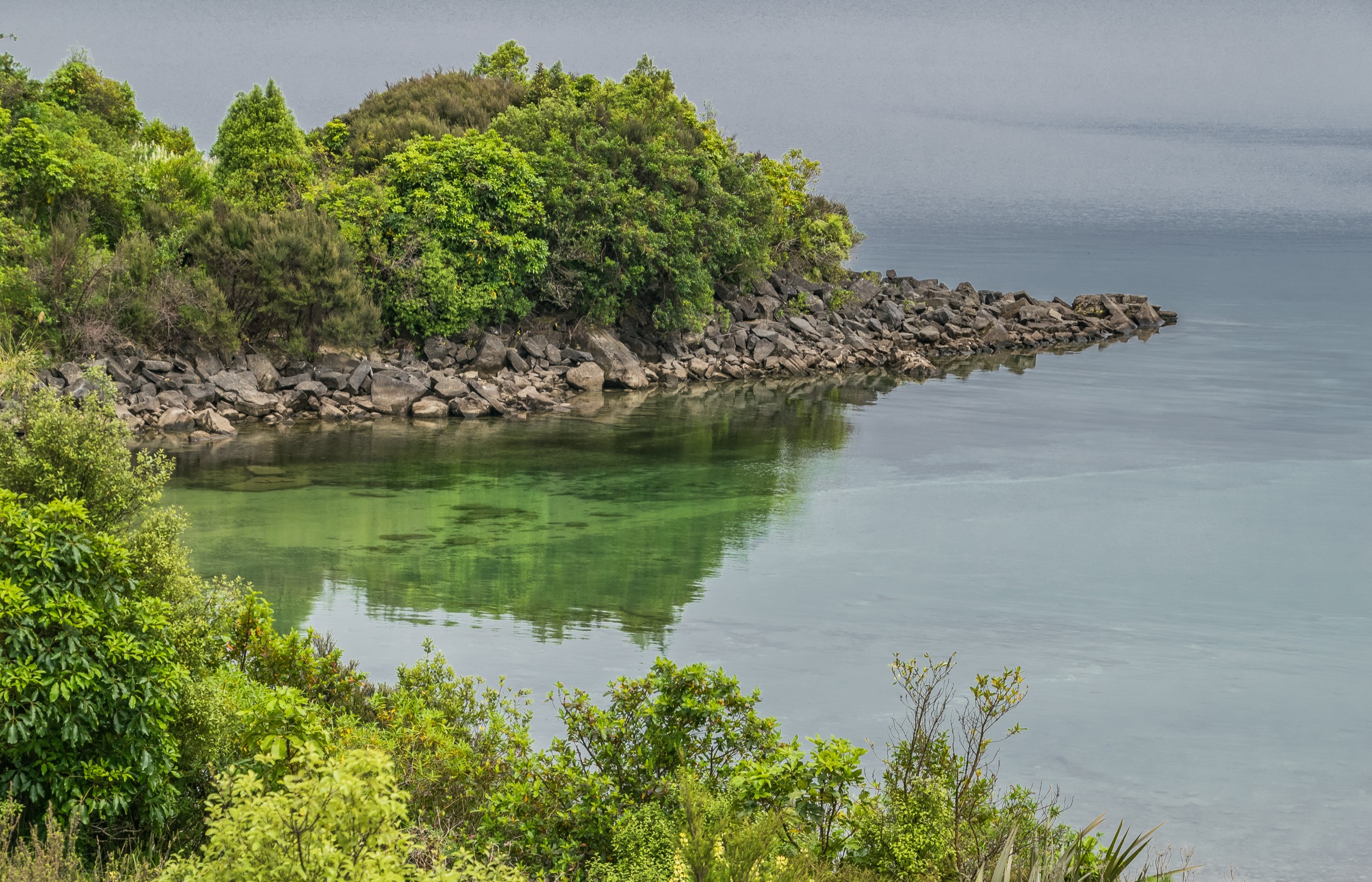
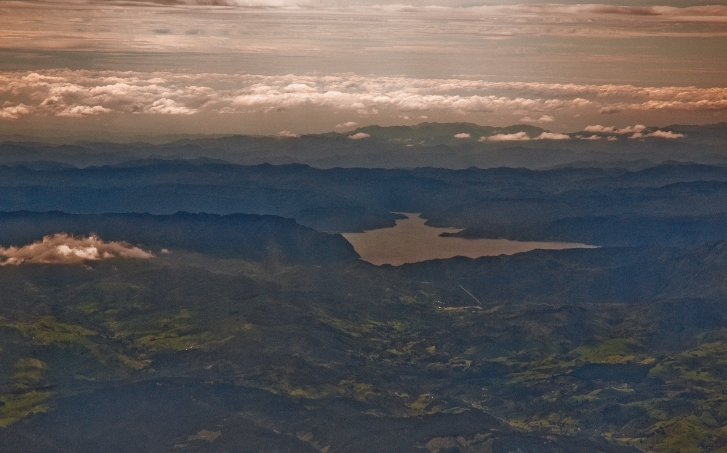
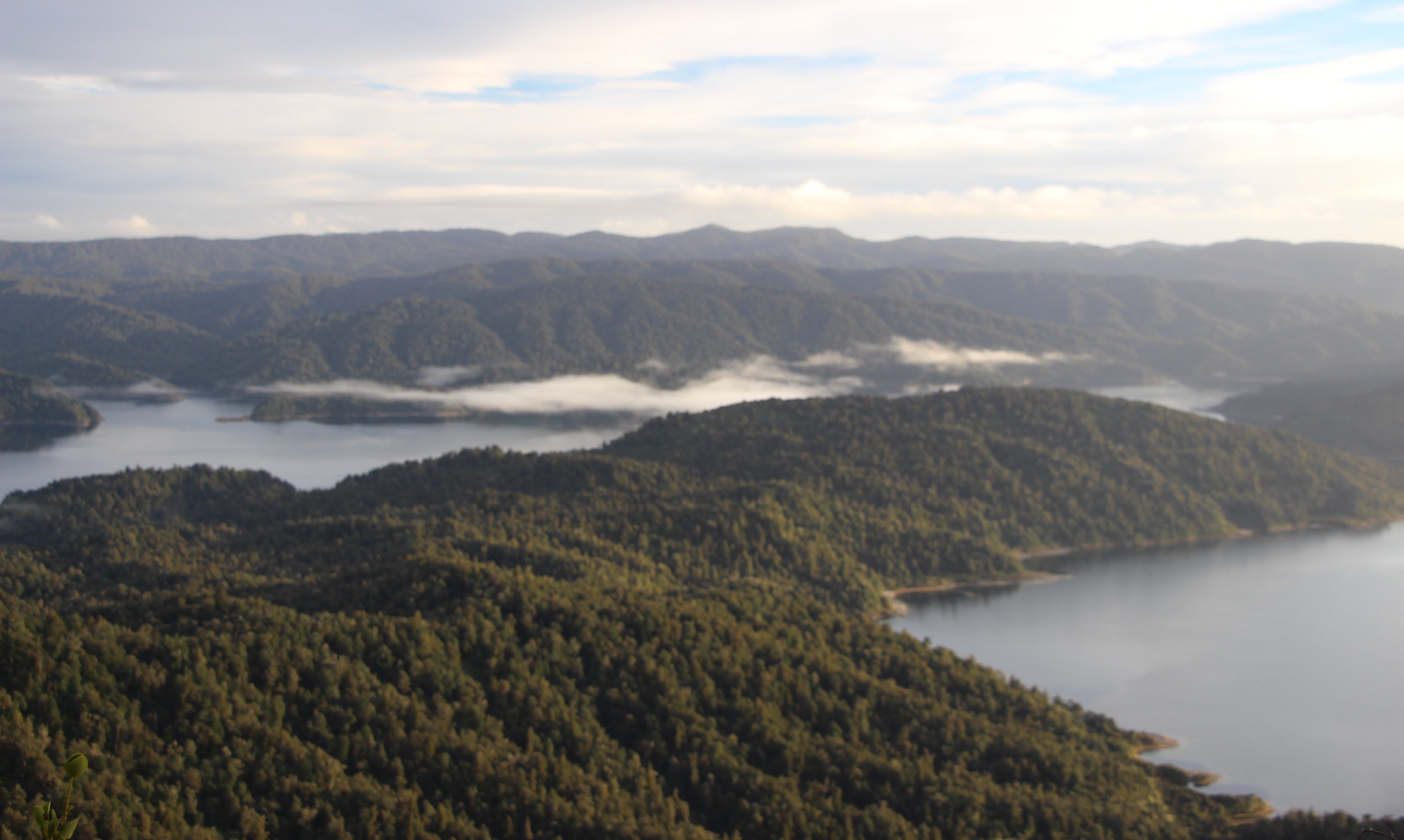
Lake Waikaremoana (“sea of rippling waters”) sits at around 585 m in the central Huiarau Range of Te Urewera in the eastern North Island of New Zealand. The lake is a landslide-dammed body of water roughly 54 km² in surface area, formed about 2,200 years ago when a sandstone-mudstone block detached from the Ngāmoko Range and blocked the Waikaretaheke River — the origin event still legible in the steep, irregular shoreline and in the higher Lake Waikareiti basin 350 m above the main lake, which is the largest of several minor landslide-dammed lakes scattered across the surrounding plateau. The Huiarau Range itself runs roughly north-east to south-west through Te Urewera, a 2,127 km² protected area of indigenous beech-podocarp rainforest, sandstone bluffs, deep gorges and wetland basins that is one of the largest tracts of unbroken native forest left on the North Island.
The legal status of Te Urewera is unusual and shapes the practical management of every walk in this article. Under the Te Urewera Act 2014, the former Te Urewera National Park was dis-established and Te Urewera was granted legal personhood as a “legal entity with all the rights, powers, duties, and liabilities of a legal person” — the first natural area in the world to be granted that status. Day-to-day governance is shared between the Crown and Ngāi Tūhoe, the iwi (tribe) whose ancestral homeland the area is, and operational responsibility for tracks, huts and visitor services moves between the New Zealand Department of Conservation (DOC) and Te Uru Taumatua, the Tūhoe Tribal Authority. DOC remains the primary published source for track descriptions and times for the routes below, but no-dog rules, hunting regulations, and the conduct expected of visitors are framed around Tūhoe guardianship of the area, and visitors should expect a different signage and management style from a conventional national park.
The Lake Waikaremoana sector — covering the lake itself, the Panekire Bluffs above the southern shore, the Lake Waikareiti basin to the north, the Ruapani wetlands, the Ngāmoko Range above the eastern shore and the lake-shore sections of the Lake Waikaremoana Great Walk — is the most walkable part of Te Urewera, holding the only Great Walk in the region and the densest cluster of marked day-walks. The terrain is beech-podocarp rainforest, sandstone slips, ridge bluffs, landslide-dammed lakes and wetland basins; the highest point reachable on a single-day walk in this article is the Puketapu trig at 1,180 m on the Panekire ridge. The Great Walk runs around 46 km on the lake’s western and southern shores and is the principal multi-day tramp; the five hikes below are designed to substitute for or complement it without requiring a full multi-day hut or campsite booking.
Access is by SH38, the only sealed-then-gravel road through Te Urewera, which leaves SH2 at Wairoa in the south or SH5 at Murupara in the north and meets at the Te Urewera Visitor Centre / Te Kura Whenua at Āniwaniwa near the eastern lake shore. The southern section from Wairoa is sealed; the northern section through Te Urewera is unsealed gravel for around 90 km and is slow, narrow and frequently potholed — allow 3 hours from Murupara and 1.5 hours from Wairoa even in good conditions. Mobile coverage is very limited inside Te Urewera and unreliable everywhere east of Murupara; parties should plan for no signal at the trailheads. Closest fuel is Wairoa or Murupara. There is no DOC campground at the Visitor Centre but several roadside campsites, a Waiopaoa Hut, and Tūhoe Tourism’s water-taxi service support day visits on the lake-shore. For broader context on North Island volcanic-range day walking, see the Tongariro Volcanic Centre and Taranaki Volcanic Centre entries where present; the Huiarau Range sits between those two and gives the closest equivalent of South Island beech-forest tramping that the North Island offers.
Selection rationale
The five hikes below cover the essential public walking character of the Lake Waikaremoana sector without requiring a Great Walk hut or campsite booking. The selection is structured around the four useful trailhead clusters — Onepoto at the southern end of the lake (Panekire), the Visitor Centre at Āniwaniwa (Waikareiti, Ruapani, Ngāmoko), Whaitiri Point on the eastern shore (Ngāmoko start) and the water-taxi drop at Waiopaoa on the western shore (Korokoro Falls) — and is deliberately split between forest, ridge, wetland and lake-shore environments so that a two- or three-day visit can cover the full range.
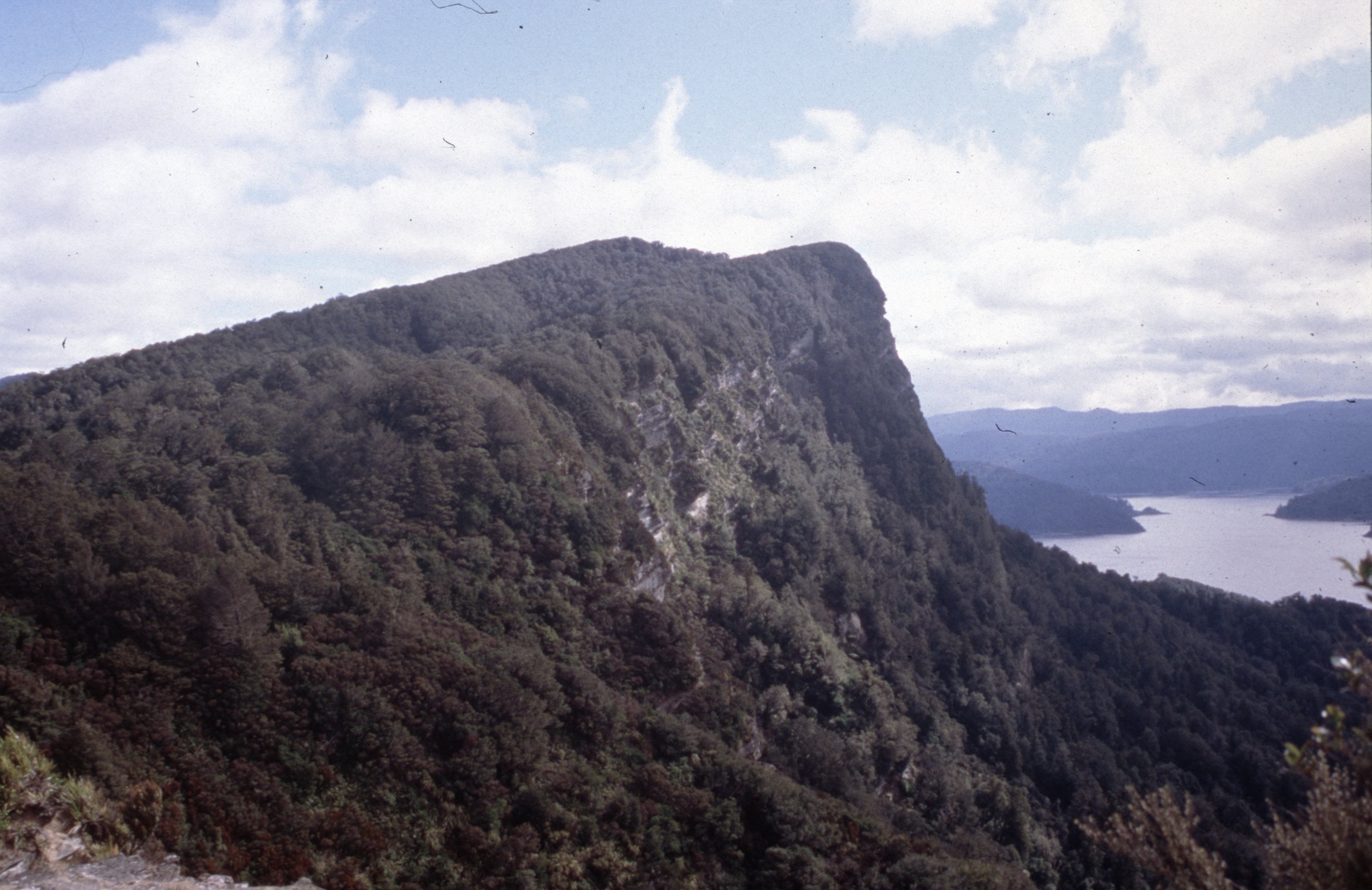
Panekire Bluffs is the iconic high viewpoint of the Great Walk’s first day and the only hike here that gives a sustained ridge above the lake. Lake Waikareiti is the cleanest short introduction to the higher landslide-lake landscape and the shortest walk in the selection. The Ruapani Circuit is the sector’s signature wetland-and-tarn day and the only walk in this group that crosses the high-altitude bog country between Waikareiti and the main lake. The Ngāmoko Track to the 1,099 m summit is the most direct verified forest-to-ridge climb above the eastern lake shore. The Waiopaoa–Korokoro Falls day section is the only useful Great Walk day-section reachable by water taxi as a one- or two-water-taxi-leg day from the Visitor Centre, and covers the lake-shore Great Walk character that the Panekire ridge alone does not.
The Lake Waikaremoana Track itself — the 46 km, 3–4 day Great Walk between Onepoto and Hopuruahine — is deliberately not split into a five-day-hike series here; it is a hut- or campsite-booked multi-day tramp and should be planned as such. Panekire (Day 1) and Korokoro Falls (Day 2 side-trip) are the two components of the Great Walk that work as day-walks without huts; the rest of the Great Walk is included only as continuation context.
DOC remains the primary published source for track descriptions, times, distances and access notes for all five routes; AllTrails is referenced only where the route clearly matches a named Great Walk section. Several official DOC pages publish walking time but not distance, total ascent or maximum elevation, and no DOC GPX or KML is published for any of the routes below — the Sources tables note where each statistic is verified, derived, or unresolved.
Summary table
| # | Hike | Country | Route type | Distance | Gain | Max elevation | Difficulty |
|---|---|---|---|---|---|---|---|
| 1 | Panekire Bluffs / Bald Knob from Onepoto | New Zealand | Out-and-back day variant | 8.8 km one-way to Panekire Hut (DOC); Bald Knob day return unresolved | ~951 m to Panekire Hut | 1,180 m at Puketapu trig; Bald Knob 1,155 m | Hard |
| 2 | Lake Waikareiti Walk | New Zealand | Out-and-back | 3.3 km return | 300 m altitude rise | ~880–892 m at Lake Waikareiti | Easy–moderate |
| 3 | Ruapani Circuit Track | New Zealand | Loop via Lake Waikareiti Track | Distance unresolved; DOC publishes time only | Unresolved | Unresolved | Hard |
| 4 | Ngāmoko Track to summit | New Zealand | Out-and-back summit climb | Distance unresolved; DOC publishes time only | Unresolved | 1,099 m at summit | Hard |
| 5 | Waiopaoa – Korokoro Falls Great Walk day section | New Zealand | Water-taxi-assisted out-and-back | 3.6 km one-way to Korokoro Campsite + 1 h falls side trip | Unresolved | Unresolved | Moderate tramping |
1. Panekire Bluffs / Bald Knob from Onepoto
Snapshot
Itinerary
From the Onepoto Shelter at the southern end of Lake Waikaremoana the Lake Waikaremoana Great Walk leaves SH38, passes the remains of the 1869 Onepoto Armed Constabulary Redoubt and climbs steadily north-east into beech-podocarp forest on the southern flank of the Panekire ridge. The first marked viewpoint is the first trig at around 1 h from the trailhead — a forested top that gives a partial Lake Waikaremoana view and is a useful turnaround for a short half-day visit. Above the first trig the track continues along the ridgeline in beech forest with intermittent sandstone-bluff edges and arrives at Bald Knob (1,155 m) at around 3 h, the strongest single-day viewpoint on the ridge with a near-continuous view of Lake Waikaremoana from the southern bluffs to the Te Puna inlets. Onward to the Panekire Hut at 1,180 m, the track keeps to the upper ridge for a further 2–3 h. The standard Great Walk Day 1 finishes at the hut; for a day-only return, Bald Knob is the standard objective and Panekire Hut is reachable only by a fit early party prepared for a 12–14 h return day. The descent is the same path. There is no water source on the ridge — carry everything from the trailhead.
Why it is essential
Panekire is the iconic Waikaremoana view and the only ridge walk in this article that gives a sustained lake-and-bush panorama from above. The bluff line is the recognised skyline silhouette of the southern Huiarau Range and is the signature image of the Great Walk; the Bald Knob day-return is the single best way to access it without committing to the hut booking and continuation on Day 2.
Equipment
- Tramping boots; ridge tread is muddy in beech-leaf litter and slick on sandstone steps
- Full mountain-day kit — rain shell, warm layer and hat — for the exposed bluff sections
- Sun protection on the upper ridge
- Water (2 L minimum); no water on the ridge
- Headtorch; sunset on a long day is the standard reason for being out late
- Personal locator beacon recommended for the Panekire Hut return variant
Hazards and notes
DOC notes there is no water on the Panekire Bluffs trip; the ridge is dry from the first trig onward. Take care near cliff edges — the bluffs are exposed and several short cliff-top sections have no railing. The Lake Waikaremoana Great Walk is not recommended for children under 10 because of exposed mountainous terrain and adverse weather. Te Urewera is no-dog and no-pet country under the Te Urewera Act and Tūhoe management; pets are not permitted on any track in this article. Mobile signal is unreliable to non-existent across the Panekire ridge.
GPX / KML links
| Source | URL | Format | Notes |
|---|---|---|---|
| DOC — Lake Waikaremoana: Panekire Bluffs | doc.govt.nz | Official route page | DOC site terms; no standalone GPX / KML published |
| DOC — Lake Waikaremoana Great Walk | doc.govt.nz | Official route page | DOC site terms |
| OpenStreetMap — Lake Waikaremoana Great Walk relation | openstreetmap.org | OSM relation | ODbL 1.0 |
| AllTrails — Onepoto to Panekire Hut | alltrails.com | Route page | AllTrails terms; secondary distance / gain reference only |
Sources
- DOC — Lake Waikaremoana: Panekire Bluffs
- DOC — Lake Waikaremoana Great Walk
- AllTrails — Onepoto to Panekire Hut
2. Lake Waikareiti Walk
Snapshot
Itinerary
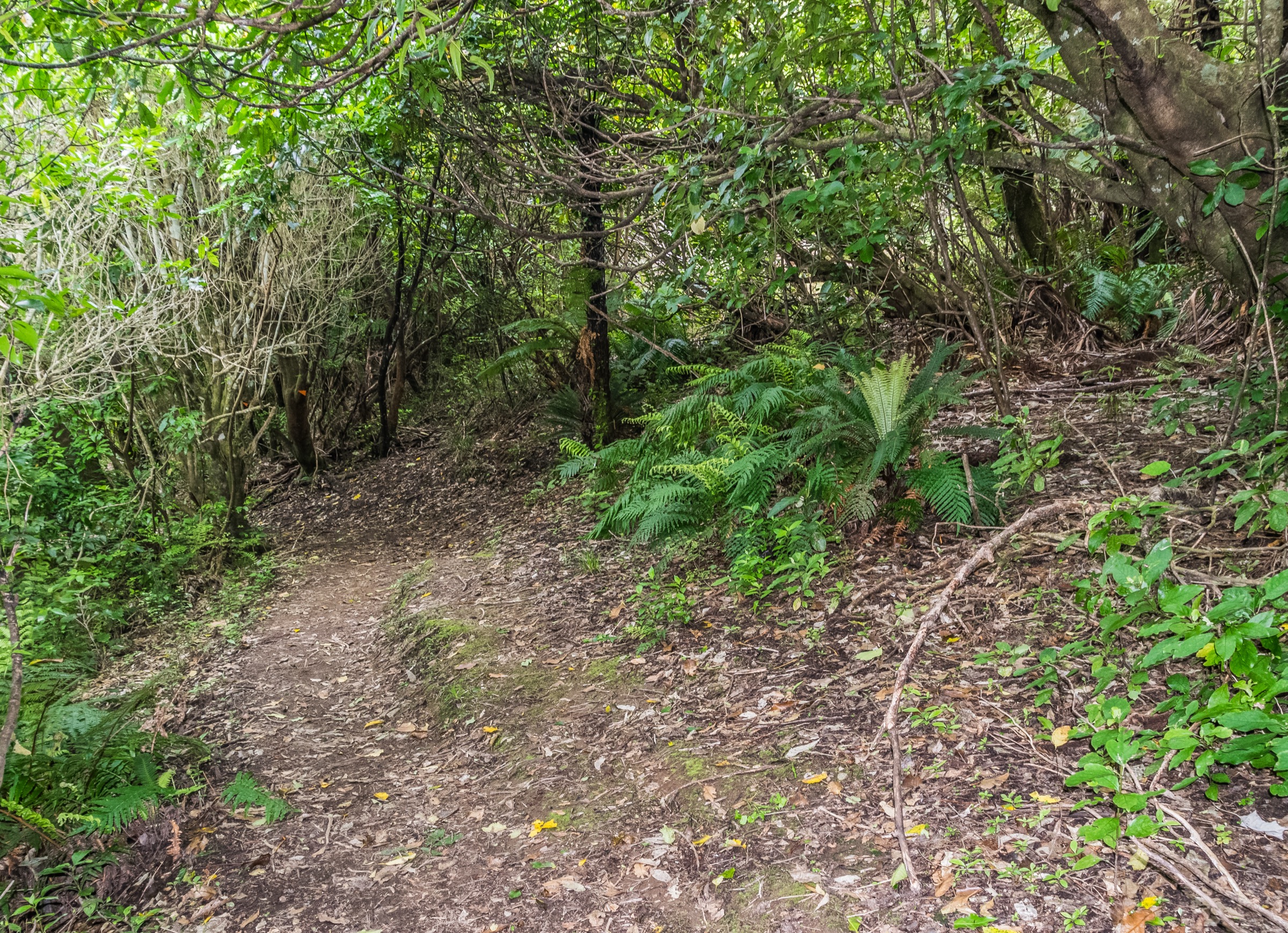
From the Lake Waikareiti track start 200 m north of the Te Urewera Visitor Centre on SH38, the well-graded path climbs steadily through a red beech and silver beech forest with emergent rimu and miro to the day shelter on the south-eastern shore of Lake Waikareiti. Lake Waikareiti sits at around 885 m altitude — 300 m above the main Lake Waikaremoana — and is itself a landslide-dammed lake, with several small bush-covered islands and a quieter character than the main lake. The day shelter is the standard turnaround for a short walk; from there the Sandy Bay Hut continuation breaks north-west around the lake shore but is a tramping-track day-return of its own and should not be drifted into without time and equipment. Return is on the same path. Total round trip is 3.3 km with 300 m of altitude rise.
Why it is essential
Waikareiti is the sector’s quieter and higher landslide-dammed lake, and this short climb is the cleanest way to experience the upper Waikaremoana landscape without committing to a full day’s tramping. It is the only walk in this article that can be done in two hours and gives the canonical introduction to the beech-podocarp forest type that characterises the rest of Te Urewera.
Equipment
- Walking shoes or low boots; the track is well-formed but the upper section can be muddy after rain
- Rain jacket and a warm layer; weather in the basin can switch within an hour
- Sun protection at the lake shelter
- Water (1 L) and a snack
- Light gloves and a hat in shoulder season
Hazards and notes
The track continues beyond the day shelter as a tramping route to Sandy Bay Hut on the lake’s north-eastern shore — do not drift onto the continuation without the equipment, time and party for a tramping day. Te Urewera is no-dog and no-pet country; pets are not permitted on this track. Cell signal at the lake shelter is unreliable.
GPX / KML links
| Source | URL | Format | Notes |
|---|---|---|---|
| DOC — Lake Waikareiti Walk | doc.govt.nz | Official route page | DOC site terms; no standalone GPX / KML published |
| OpenStreetMap — Te Urewera | openstreetmap.org | OSM | ODbL 1.0; track coverage partial |
Sources
3. Ruapani Circuit Track
Snapshot
Itinerary
From the Lake Waikareiti day shelter, continue along the lake’s south-eastern shore for around half an hour, then take the signed left fork onto the Ruapani Circuit. The track crosses the Ruapani plateau through a sequence of seven landslide-dammed tarns and wetland basins set in red and silver beech forest, with characteristic boggy patches and short boardwalks across the worst of the wetland. The high point of the circuit is on the bench between Lake Waikareiti and Lake Ruapani; from above Lake Ruapani the track turns south-east and descends through forest with intermittent views toward Lake Waikaremoana, the Panekire Bluffs and the Hawke’s Bay coast on a clear day. The descent rejoins the Lake Waikareiti Track close to the SH38 trailhead, completing the circuit at the Visitor Centre. Total walking time, per DOC, is 6 h for the circuit itself plus access time on the Waikareiti Track. Distance, total ascent and maximum elevation are not published by DOC.
Why it is essential
Ruapani is the Waikaremoana sector’s signature wetland walk: a sequence of high-altitude landslide-dammed tarns and bogs in a beech-forest landscape that the Panekire ridge and the lake-shore Great Walk both miss. It is the only walk in this article that crosses the upper Te Urewera bog country and shows the geological aftermath of the broader landslide events that dam the main lake.
Equipment
- Tramping boots; the wetland sections are persistently wet and the forest tread can be muddy year-round
- Full rain shell and a warm layer; the plateau is more exposed than the forest below
- Sun protection in summer
- Water (2 L) and snacks; no reliable refill points
- Map / GPS and headtorch; the time budget is the main reason for being out late
- Personal locator beacon recommended
Hazards and notes
DOC classifies the Ruapani Circuit as an advanced tramping track. Limited views, wet ground and poor weather can make navigation and timing significantly harder than the moderate stated distance might suggest; allow the full DOC time plus a buffer. The route is no-dog and no-pet country. Mobile signal is unreliable to non-existent.
GPX / KML links
| Source | URL | Format | Notes |
|---|---|---|---|
| DOC — Ruapani Circuit Track | doc.govt.nz | Official route page | DOC site terms; no standalone GPX / KML published |
| DOC — Lake Waikareiti Walk | doc.govt.nz | Official route page | Access leg only |
| OpenStreetMap — Te Urewera | openstreetmap.org | OSM | ODbL 1.0; circuit coverage partial |
Sources
4. Ngāmoko Track to summit
Snapshot
Itinerary
From the roadside start opposite Whaitiri Point on SH38, the Ngāmoko Track climbs steeply north-east through dense lowland forest of tawa, red and silver beech, rimu and large northern rātā. The lower forest gives way to a series of sandstone-bluff sections at around 800 m where the gradient eases briefly before resuming the climb to the upper silver-beech belt just below the summit. The summit at 1,099 m is a forested ridge top with several open gaps to the south giving the only views on the route — south-west along Lake Waikaremoana toward the Panekire Bluffs, south-east toward the Wairoa lowlands and the Hawke’s Bay coast, and east toward the Gisborne hill country. The Ngāmoko Track continues from the summit along the Ngāmoko Range and descends north to Lake Kaitawa on SH38 — a one-way 8 h day requiring transport at the far end. The summit-only return is the standard day-walk and the variant covered here. Distance and total ascent are not published by DOC.
Why it is essential
Ngāmoko is the sector’s best verified non-Great-Walk summit day-tramp and the only forest-to-ridge climb in this article that gives a true Huiarau ridge summit above Lake Waikaremoana from a single-vehicle start. The summit panorama covers the lake, the Panekire Bluffs and the Hawke’s Bay coast in one direction and the Wairoa and Gisborne lowlands in the other — the broadest single viewpoint reachable on a day-walk in the sector.
Equipment
- Tramping boots; the forest tread is steep, slick on roots, and muddy in wet weather
- Full rain shell, warm layer and hat; the summit and upper sandstone-bluff sections can be windy and cold even on a fine day at the lake
- Sun protection in the open summit gaps
- Water (2 L) and snacks; no refill points
- Map / GPS and headtorch
- Personal locator beacon recommended
Hazards and notes
DOC classifies the Ngāmoko Track as an advanced tramping track. The longer continuation along the Ngāmoko Range to Lake Kaitawa makes a one-way 8 h day and requires arranged transport at the far end — do not drift past the summit without that logistics chain in place. Mobile signal is unreliable to non-existent. Te Urewera is no-dog and no-pet country.
GPX / KML links
| Source | URL | Format | Notes |
|---|---|---|---|
| DOC — Ngāmoko Track | doc.govt.nz | Official route page | DOC site terms; no standalone GPX / KML published |
| OpenStreetMap — Te Urewera | openstreetmap.org | OSM | ODbL 1.0; track coverage partial |
Sources
5. Waiopaoa – Korokoro Falls Great Walk day section
Snapshot
Itinerary
From the Waiopaoa Hut and Campsite on the western Lake Waikaremoana shore — reached by Tūhoe Tourism water taxi from the Visitor Centre area in around 30 minutes — the Lake Waikaremoana Great Walk follows grassy flats, kānuka and beech forest along the lake shore north-west toward the Korokoro Stream. At 3.6 km from Waiopaoa the track reaches the Korokoro Campsite at the Korokoro Stream’s outlet into the lake. From the campsite a signed side trip climbs ~1 h return along the Korokoro Stream gorge to the Korokoro Falls platform — a 22 m two-stage fall set in a small forested bowl that is the recognised waterfall highlight of the Great Walk. Return to Waiopaoa is on the same lake-shore path and adds a further 1 h 30 min for the second leg of the round trip, or — if a continuation has been arranged — the Great Walk continues a further 5 h on the Day 3 leg to Marauiti Hut on the lake’s northern shore. Total walking time for the day-section return to Waiopaoa is around 4 h.
Why it is essential
Korokoro Falls is the named waterfall highlight of the Lake Waikaremoana Track and is the only way to sample the lake-shore Great Walk character on a day visit without taking the Panekire ridge instead. The water-taxi-supported variant is also the only practical way to experience the western lake shore at all without booking the Great Walk huts; the lake-side approach from Waiopaoa is otherwise three days of tramping from Onepoto.
Equipment
- Trail shoes or low tramping boots; the Great Walk tread is well-formed but can be muddy after rain
- Light rain jacket and warm layer
- Sun protection on the lake-shore sections
- Water (1.5 L); the Korokoro Stream is the only refill point
- Confirmed water-taxi booking with Tūhoe Tourism, with both legs scheduled
- Headtorch as a buffer for a late return
Hazards and notes
Water-taxi logistics control the day. Check current weather, lake conditions and the Tūhoe Tourism water-taxi timetable before committing; the lake can build a short steep chop in southerly winds and water-taxi operations can suspend on safety grounds. The Korokoro Falls side trip includes a short stream crossing that can be impassable in heavy rain. The Lake Waikaremoana Great Walk is not recommended for children under 10 because of exposed terrain elsewhere on the route. Te Urewera is no-dog and no-pet country.
GPX / KML links
| Source | URL | Format | Notes |
|---|---|---|---|
| DOC — Lake Waikaremoana Great Walk | doc.govt.nz | Official route page | DOC site terms; no standalone GPX / KML published |
| OpenStreetMap — Lake Waikaremoana Great Walk relation | openstreetmap.org | OSM relation | ODbL 1.0 |
Sources
Missing data / follow-up work
- DOC publishes walking time but not distance, total ascent, total descent or maximum elevation for the Ruapani Circuit and the Ngāmoko Track; the snapshot panels reflect that gap. Replace with surveyed values when they become available.
- Panekire Bluffs distance, ascent and time figures above use the published DOC values for Onepoto to Panekire Hut; the Bald Knob-only day return is not published by DOC and is described above by reference to the DOC time-budget for Bald Knob rather than from a surveyed figure.
- Lake Waikareiti maximum elevation above is taken from secondary geographic sources giving the lake-level altitude (~880–892 m); the exact maximum elevation reached on the track itself was not located in this pass.
- Korokoro Falls side trip elevation gain and maximum elevation are not published by DOC; the description above is qualitative.
- The Tūhoe Tourism water-taxi timetable for the Lake Waikaremoana Track is seasonal and operator-managed; confirm the current 2026–27 schedule and pricing before booking a Waiopaoa transfer.
- SH38 road conditions through the central Te Urewera gravel section change with weather and slip activity; verify current road status with the local DOC office or NZTA before travel.
Further reading
| Source | URL |
|---|---|
| DOC — Te Urewera | doc.govt.nz |
| DOC — Lake Waikaremoana Great Walk | doc.govt.nz |
| DOC — Panekire Bluffs | doc.govt.nz |
| DOC — Lake Waikareiti Walk | doc.govt.nz |
| DOC — Ruapani Circuit Track | doc.govt.nz |
| DOC — Ngāmoko Track | doc.govt.nz |
| Tūhoe Tourism | ngaituhoe.iwi.nz |
| Wikipedia — Lake Waikaremoana | en.wikipedia.org |
| Wikipedia — Te Urewera | en.wikipedia.org |
| Wikipedia — Huiarau Range | en.wikipedia.org |
| Wikimedia Commons — Category:Lake Waikaremoana | commons.wikimedia.org |
| OpenStreetMap — Lake Waikaremoana Great Walk relation | openstreetmap.org |