Regional overview
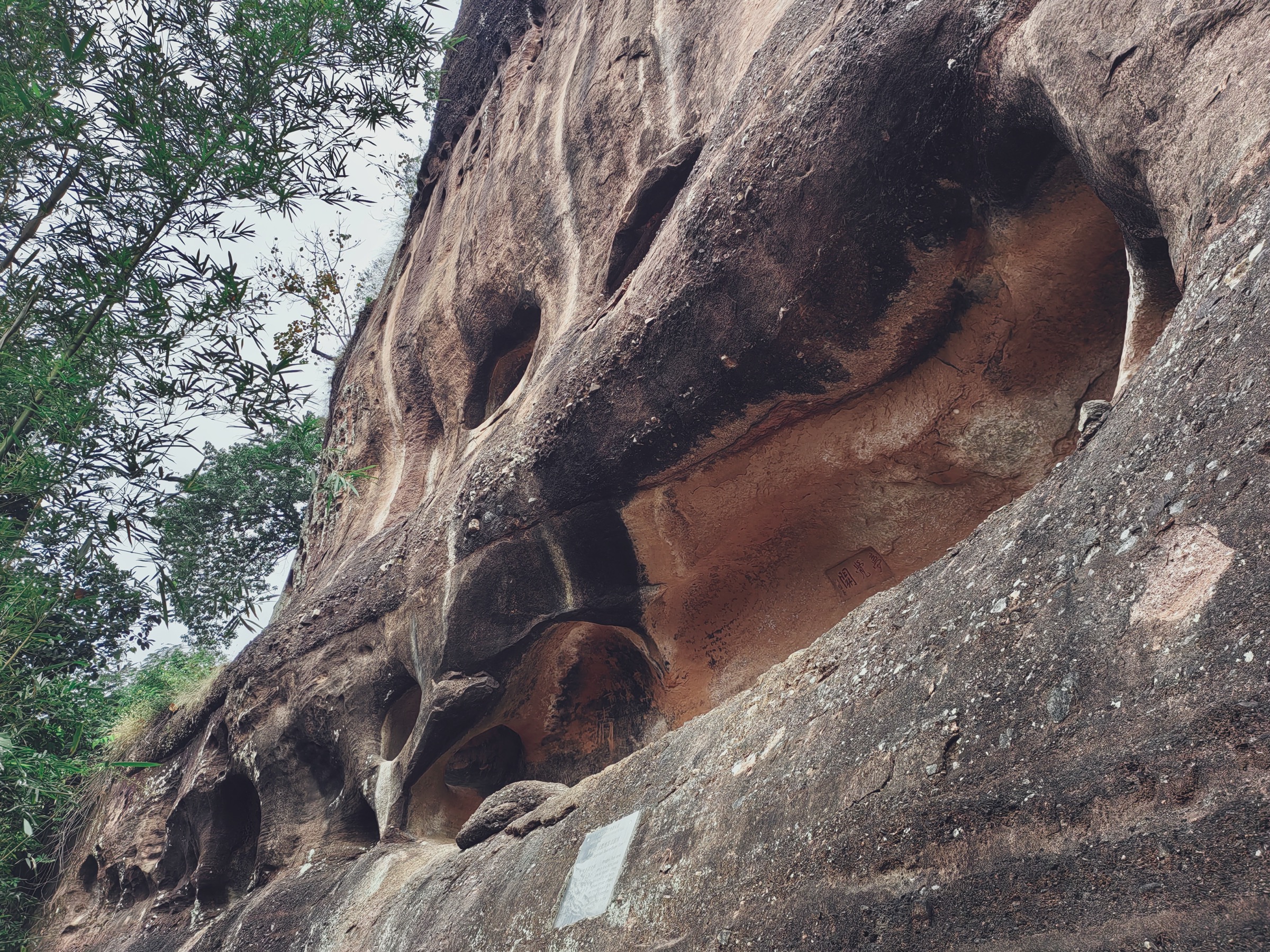
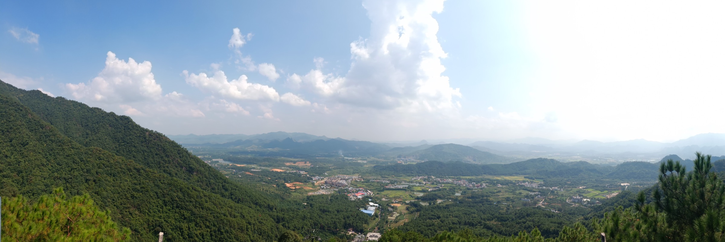
Northern Guangdong’s Nanling uplands stack four contrasting rock types into one walking region: red Danxia sandstone at Danxia Shan near Renhua, quartz-sandstone canyon walls at the Guangdong Grand Canyon near Ruyuan, tower karst limestone at Yingxi Peak Forest near Yingde, and granite and metamorphic high-forest around the Nanling National Forest Park and Shikengkong on the Guangdong–Hunan border. All of it sits in the subtropical monsoon belt, so the walking calendar and the hazard profile are much closer to a coastal Chinese range than to the temperate mid-latitude ranges further north.
The walking character across the region is a mix of managed scenic-area stair paths at Danxia, Yingxi and Ruyuan, gorge-floor and stair routes in the Guangdong Grand Canyon, and short forest and waterfall walks inside the Nanling National Forest Park with a serious summit objective at Shikengkong (1,902 m), the highest point in Guangdong. Scenic-area ticketing, opening hours, cableway status and occasional route or park closures shape the practical hiking universe. Danxia Shan’s administration published a January 2024 notice prohibiting unauthorised entry into core and buffer zones, and the Nanling National Forest Park was reported closed for rectification from 2018 — current access status for both should be checked before travel.
Best walking seasons run October to April for cool, dry weather. Summer brings heat, humidity, afternoon thunderstorms, and typhoon-tail rain that can flood valley paths and close scenic areas at short notice. Spring mist softens the red rock and karst but leaves stairs slick, and winter is mild but early starts for sunrise routes can still be cold. Standard equipment is walking boots with grip for wet steps, waterproof shell, sun protection, water and food, headtorch and a way of navigating that does not rely on scenic-area waymarks — several of the sub-regions in this article are still short on well-audited public route files.
Selection rationale
Five day-scale routes are presented across the four northern Guangdong rock types. The Danxia Shan Changlaofeng cultural ridge is the region’s signature managed walk and is presented here at survey level — the dedicated Danxia Shan guide covers Danxia’s five deepest routes. The Guangdong Grand Canyon rim-to-floor / Tongtian Ladder route carries the region’s biggest single stair objective; the Yingxi Peak Forest karst walk near Yingde carries the tower-karst landscape; the Nanling National Forest Park Waterfall Cluster is the short forest-and-water objective inside the granite / high-forest zone; and Shikengkong from the Ruyuan side is the Guangdong-side approach to the province’s highest peak. Shikengkong’s Hunan-side approach and the fuller Nanling boundary summit context sit in the Mangshan guide. Longer through-trips, cableway-only itineraries and unaudited backcountry variants sit outside this catalogue.
Summary
| # | Hike | Sub-region | Route type | Distance | Gain | Max elevation | Difficulty |
|---|---|---|---|---|---|---|---|
| 1 | Danxia Shan — Changlaofeng cultural ridge | Renhua / Danxia Shan | Out-and-back | 5.95 km | 395 m | Unresolved | Hard |
| 2 | Guangdong Grand Canyon rim-to-floor / Tongtian Ladder | Ruyuan / Dabu | Out-and-back candidate | Unresolved | Unresolved | Unresolved | Hard |
| 3 | Yingxi Peak Forest karst walk | Yingde / Huanghua | Loop or point-to-point candidate | Unresolved | Unresolved | Unresolved | Easy–moderate |
| 4 | Nanling National Forest Park Waterfall Cluster | Ruyuan / Nanling park | Out-and-back short walk | 2.2 km | Unresolved | Unresolved | Moderate |
| 5 | Shikengkong / Guangdong First Peak — Ruyuan-side | Ruyuan / Nanling park | Summit out-and-back candidate | Unresolved | Unresolved | 1,902 m | Hard |
1. Danxia Shan — Changlaofeng cultural ridge
Snapshot
Itinerary
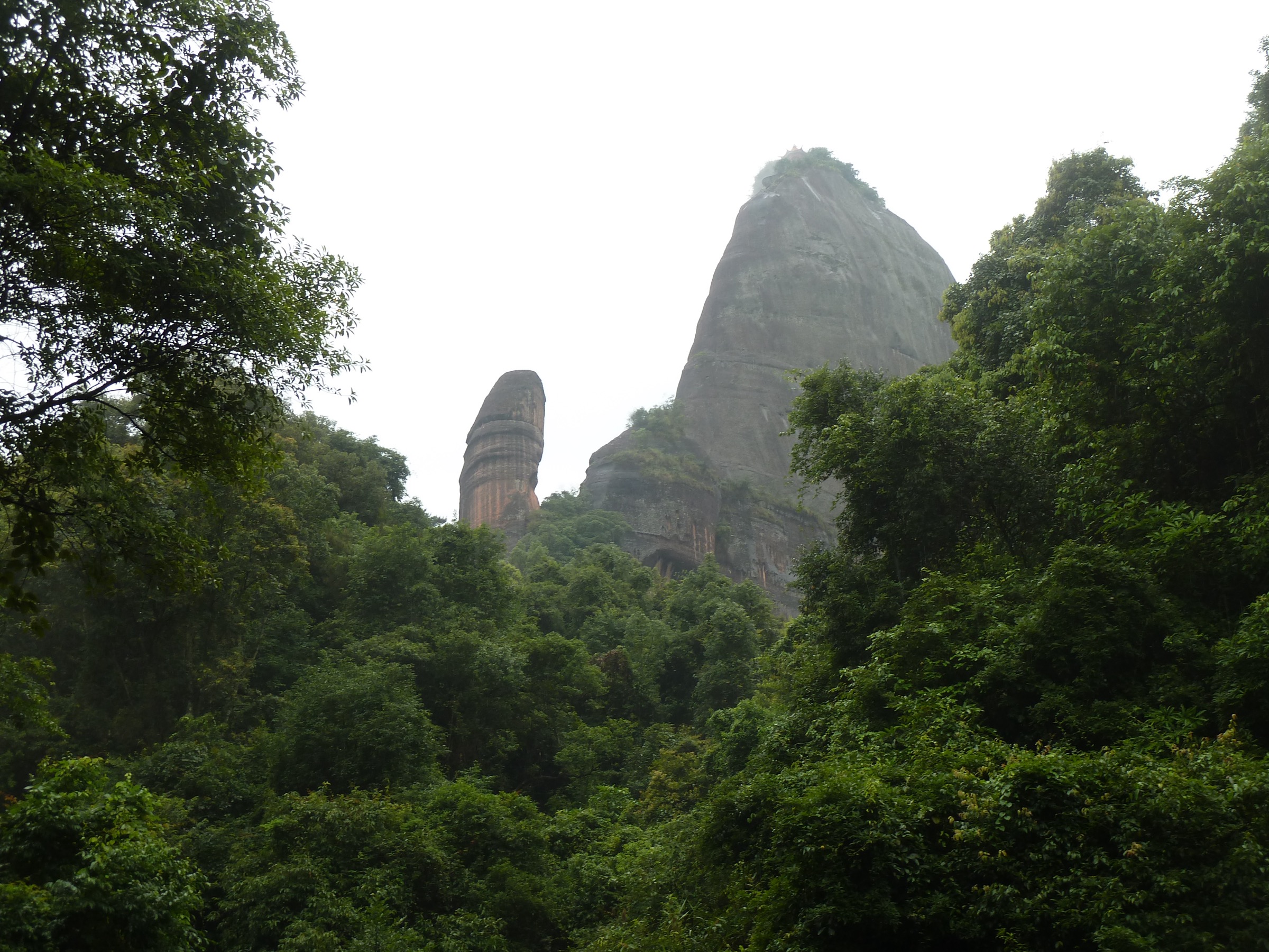
From the Changlaofeng checkpoint, follow the stone-step route through the cultural ridge: Jinshiyan Temple, Biechuan Zen Temple, cliff inscriptions and the Shaoyin Pavilion summit area on Baozhu Peak. Descend either on foot by the same track or by cableway from the pavilion area. The Yangyuan Mountain / Ximei Fortress loop is a shorter Danxia option and can be done as a second half-day; both routes are treated in more depth in the dedicated Danxia Shan guide.
Why it is essential
Danxia Shan is the type locality of the Danxia landform, a UNESCO Global Geopark and one of six components of the UNESCO China Danxia World Heritage serial property. The Changlaofeng cultural ridge threads the scenic area’s most concentrated stack of temples, cliff inscriptions and red-rock viewpoints and is the signature northern Guangdong scenic-area walk — the sandstone contrast to the karst, canyon and granite country that fills the rest of this article.
Equipment
- Grippy walking shoes for wet stone steps
- Waterproof shell and warm mid-layer for early starts
- Sun protection and 1.5–2 L water
- Small daypack, food and headlamp for full-day plans
Hazards and notes
- Steep engineered stone steps with cliff-edge sections — slippery when wet
- Summer thunderstorms and flash-flood risk on the lower corridors
- Scenic-area ticketing and opening hours shape the day; check the official Danxiashan site before travel
- January 2024 protected-area notice — unauthorised entry into the reserve’s core and buffer zones is prohibited; keep to signed public routes
- For deeper Danxia route detail (Rudder Stone, Yangyuan / Ximei loop, Xianglong Lake and the Shaoshi historic walk), see the dedicated Danxia Shan guide
2. Guangdong Grand Canyon rim-to-floor / Tongtian Ladder route
Snapshot
Itinerary
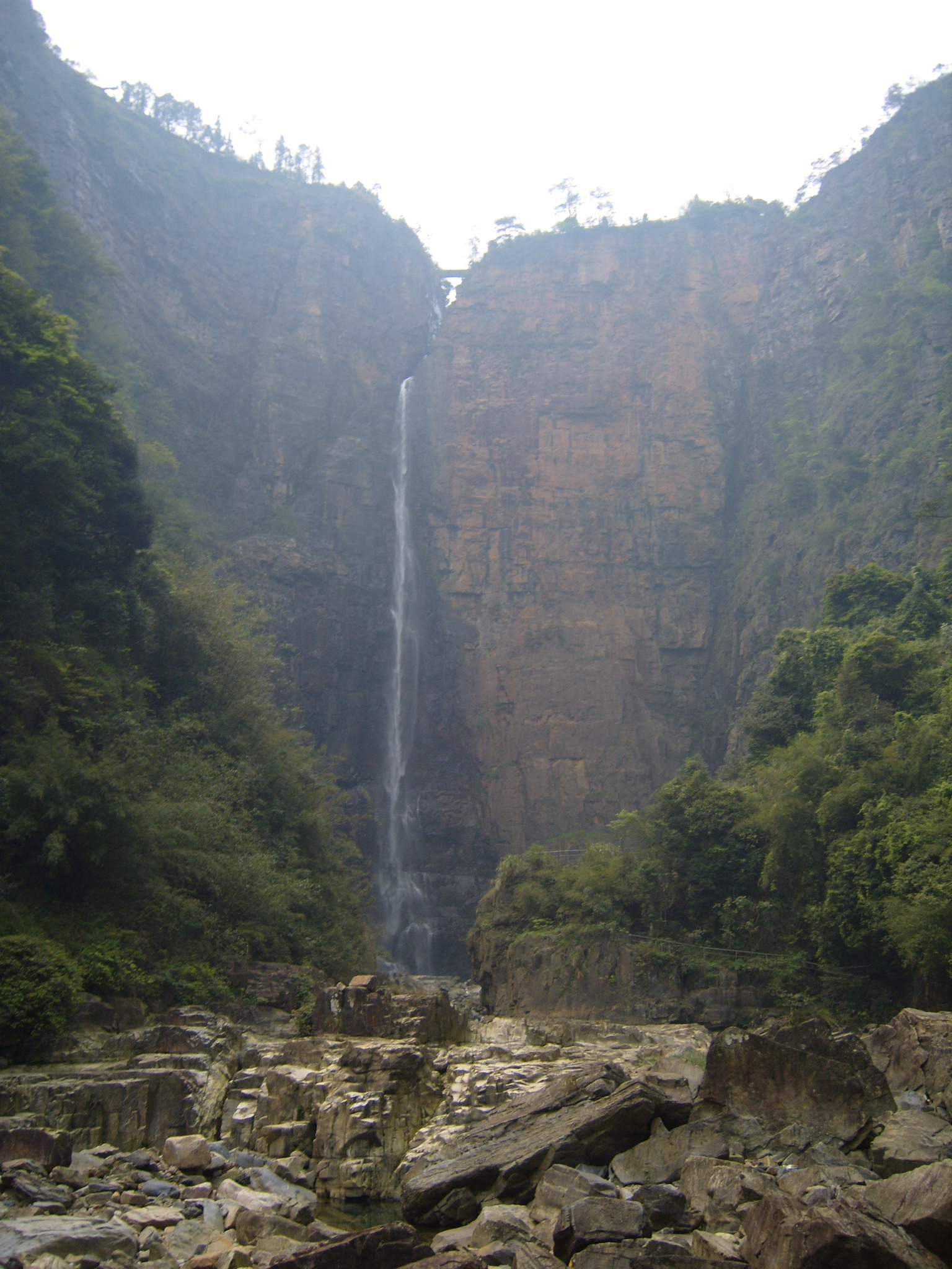
From the Guangdong Grand Canyon scenic-area gate near Dabu, follow the rim path to the Tongtian Ladder and descend the 1,386-step stairway to the gorge floor. Return by the same route unless a current loop variant is confirmed in-park. The published cableway that once served the canyon has been reported as inactive in older sources, so a walking descent and ascent should be the default plan.
Why it is essential
The Guangdong Grand Canyon is northern Guangdong’s headline gorge landscape — deep quartz-sandstone walls, a long linear canyon and the province’s most-cited engineered stair descent. It carries the vertical drama that the Danxia scenic area doesn’t and is the natural balance between Danxia sandstone and the Yingxi karst further west.
Equipment
- Grippy walking shoes or boots for wet stone stairs
- Trekking poles for the stair descent and re-ascent
- Waterproof shell and warm mid-layer for the gorge floor
- 2 L water and food for a full day
- Sun protection and headlamp
Hazards and notes
- The Tongtian Ladder stair section is steep, wet and long — treat the ascent, not the descent, as the crux
- Flash-flood and heavy-rain risk on the gorge floor
- Cableway status is not guaranteed — plan for a walking descent and ascent
- Scenic-area opening hours and current ticket policy should be checked before travel
- Distance, gain and one-way time were not resolved from official sources in this pass; the route entry is still a candidate
3. Yingxi Peak Forest karst walk
Snapshot
Itinerary
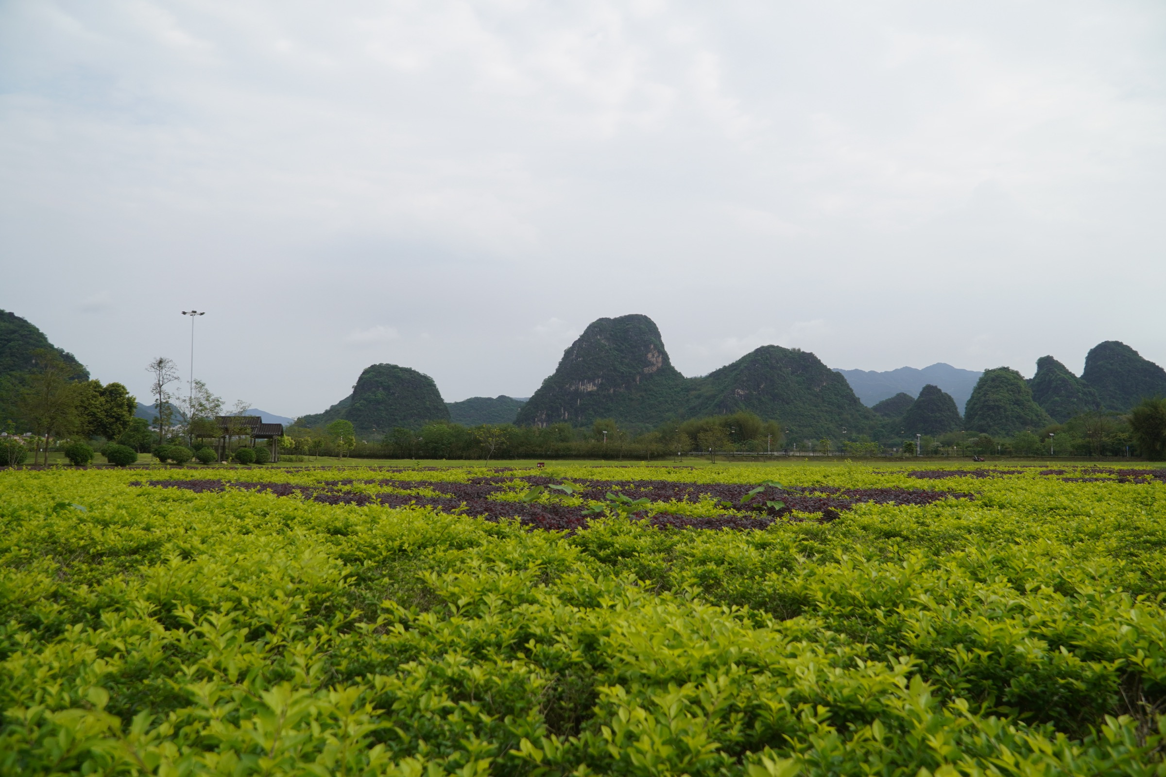
From the Huanghua / Yingxi Peak Forest access village, follow village lanes and farm tracks through the tower-karst landscape, linking viewpoints, paddies and scenic stops around Pengjiaci and Gongzheng-Xicun. The exact walking geometry should be confirmed from a local map or official scenic-area material before travel; several private-land sections and unofficial viewpoints are woven into the on-the-ground network.
Why it is essential
Yingxi Peak Forest is the clearest karst-hiking landscape in Guangdong — a low-elevation tower-karst basin that gives the northern Guangdong catalogue its limestone contrast to Danxia sandstone and the granite / high-forest terrain further east. The walking is village-scale rather than mountain-scale, which makes it a good pairing day with a bigger objective at Danxia or Nanling.
Equipment
- Walking shoes or light hikers for lane-and-paddy walking
- Sun protection and 1.5 L water minimum
- Rain shell for storm season
- Small daypack, snacks and a way of navigating that doesn’t depend on scenic-area waymarks
Hazards and notes
- Route continuity is not certain — the walking network mixes public lanes, farm tracks and unofficial connectors
- Private land and paddy edges should be treated with care; do not enter fenced or crop areas
- Heat and thunderstorms are the main summer risk
- Distance, gain, time and legal access boundaries were not fully resolved from official sources in this pass — the entry remains a candidate
4. Nanling National Forest Park Waterfall Cluster
Snapshot
Itinerary
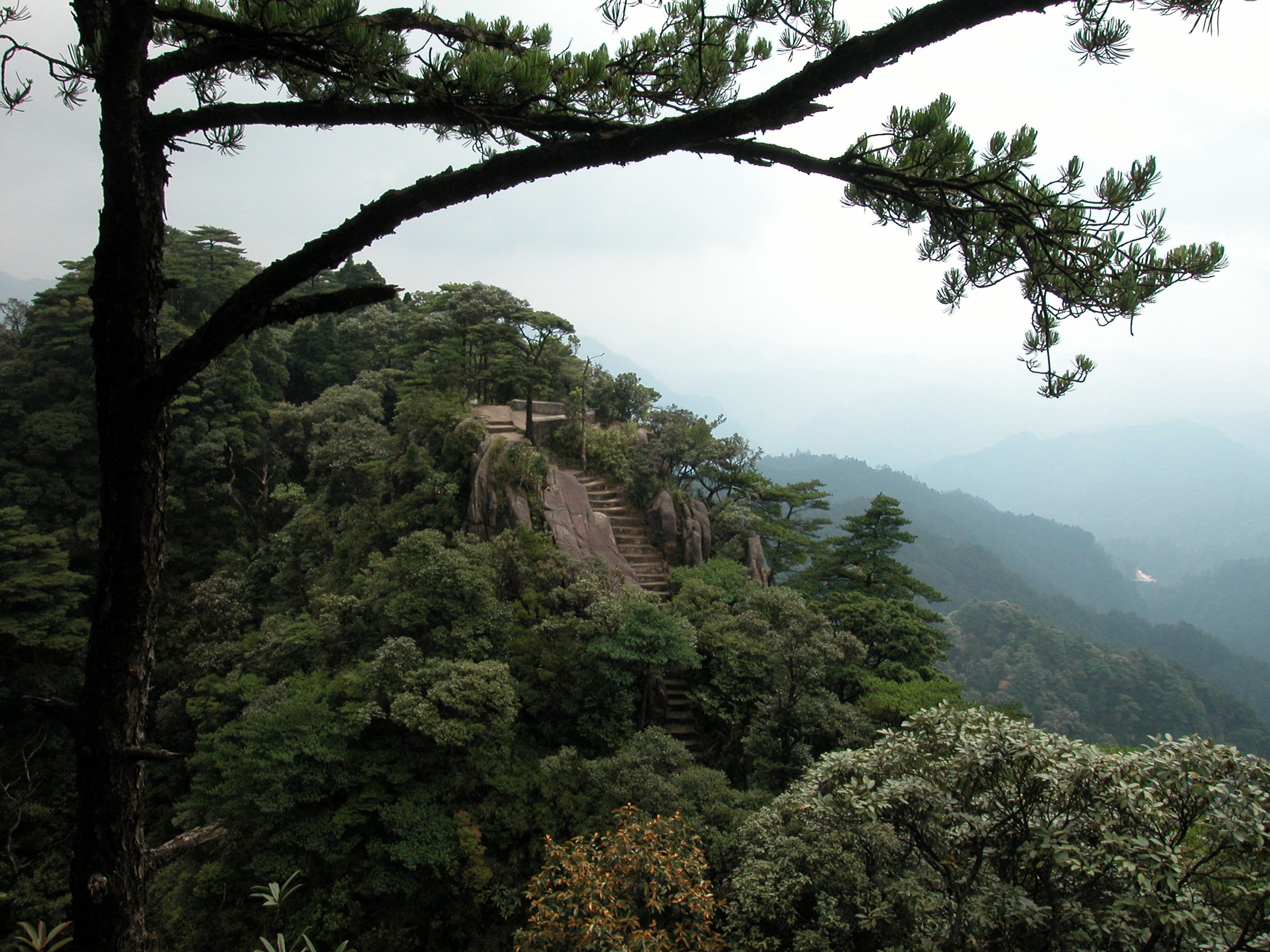
From the Waterfall Cluster access point inside the Nanling National Forest Park, follow the short path through the waterfall chain and return by the same route. The path is the park’s compact forest-and-water objective and is separate from the harder Shikengkong summit route in the next entry.
Why it is essential
The Nanling National Forest Park protects one of the southern Chinese mainland’s most important subtropical broadleaf and mixed-forest blocks, and the Waterfall Cluster path is its most approachable published walk. It gives the granite / high-forest zone of northern Guangdong a short catalogue objective before or after the bigger Shikengkong day.
Equipment
- Grippy walking shoes for wet stone steps
- Rain shell and warm mid-layer
- Sun protection, 1 L water and snacks
- Small daypack, headlamp
Hazards and notes
- Park access status — the Nanling National Forest Park was reported closed for rectification from 2018; confirm current opening before travel
- Wet stone steps and slippery ground around the waterfall chain
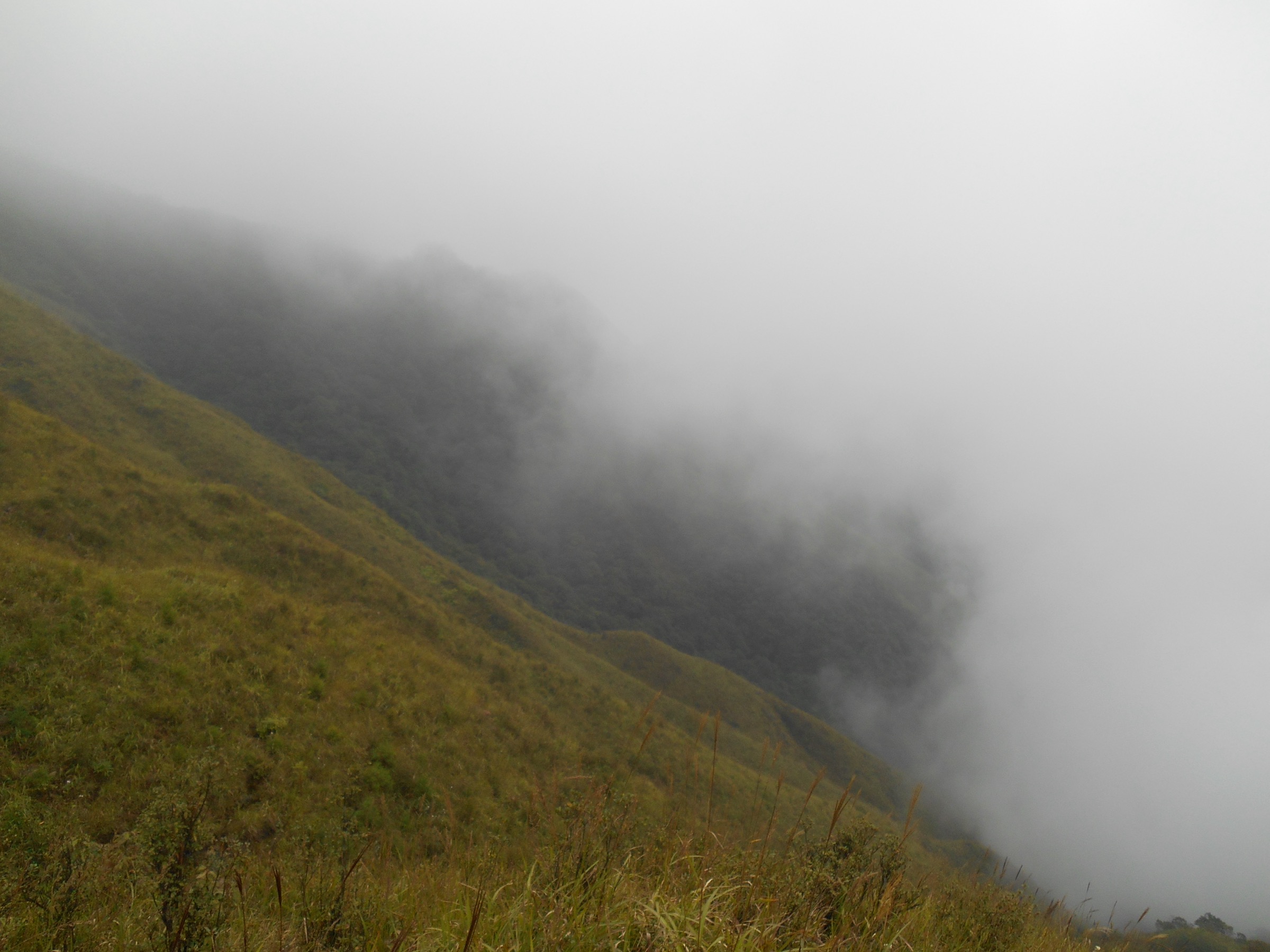
- Fog and rapid weather change are common in the high-forest zone
- Route audit is thin — the 2.2 km figure is the strongest number found in this pass; elevation gain and one-way time were not resolved from official sources
5. Shikengkong / Guangdong First Peak — Ruyuan-side approach
Snapshot
Itinerary
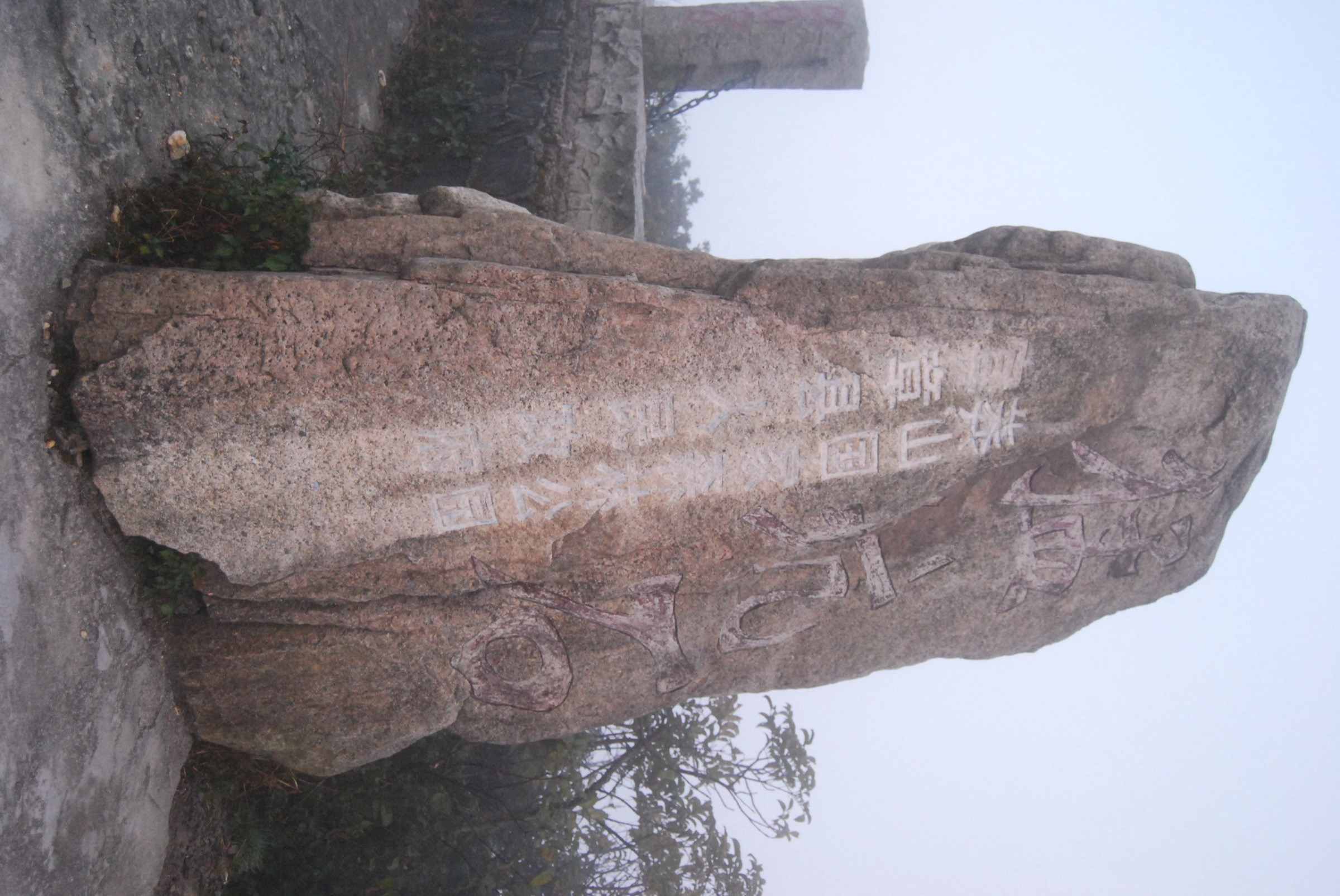
Use only an officially open route from the Nanling National Forest Park / Guangdong side to the Shikengkong / Mengkengshi summit at 1,902 m, and return by the same track. The Hunan-side approach and boundary-summit context are covered in the Mangshan guide; this entry stays on the Ruyuan side. Because current legal access, exact trailhead, distance and time were not resolved from open sources in this pass, treat the entry as a candidate until in-park sign posting confirms an open route.
Why it is essential
Shikengkong is the highest point in Guangdong and the defining Nanling boundary summit. It gives the northern Guangdong catalogue its serious mountain objective and contrasts the granite / high-forest zone with the scenic-area walking at Danxia, the canyon walking at Ruyuan and the karst walking at Yingxi.
Equipment
- Mountain hiking equipment: sturdy boots, waterproof shell, warm layers, warm hat and gloves
- Map, compass and offline GPS — do not rely on scenic-area waymarks near the border
- Headlamp with spare batteries
- 2 L water and food for a long day
- Personal Locator Beacon or equivalent communication device where legal
Hazards and notes
- Legal access status is the primary issue — Nanling National Forest Park’s 2018 rectification closure and any current reserve access rules must be confirmed before any summit attempt
- Cold, fog and rapid weather change on the summit ridge, including in summer
- Route-finding beyond marked ground — the Guangdong-side approach is not as consistently signed as the managed scenic-area routes elsewhere in this article
- Boundary-area sensitivity — treat the Hunan-Guangdong administrative crossing conservatively
- For the Hunan-side approach and fuller Nanling boundary summit context, see the Mangshan guide
Further reading
| Resource | Link |
|---|---|
| Danxia Shan — dedicated day-hikes guide | /articles/china-nanling-danxia-shan-guangdong-essential-day-hikes/ |
| Mangshan — Hunan-side Shikengkong day-hikes guide | /articles/china-nanling-mountains-mangshan-southern-hunan-essential-day-hikes/ |
| Wuyi / Nanling regional overview | /articles/china-south-china-ranges-wuyi-nanling-essential-day-hikes/ |
| Danxia Shan official scenic-area site | dxs.sg.gov.cn |
| Danxia Shan January 2024 protected-area notice | dxs.sg.gov.cn |
| UNESCO World Heritage Centre — China Danxia | whc.unesco.org |
| UNESCO Global Geoparks — Danxiashan | unesco.org |
| Wikipedia — Mount Danxia | en.wikipedia.org |
| Wikipedia — Guangdong Grand Canyon (Chinese) | zh.wikipedia.org |
| Wikipedia — Yingde National Forest Park (Chinese) | zh.wikipedia.org |
| Wikipedia — Nanling National Forest Park | en.wikipedia.org |
| Wikipedia — Shikengkong / Mengkengshi (Chinese) | zh.wikipedia.org |
| Wikimedia Commons — Mount Danxia | commons.wikimedia.org |