Regional overview
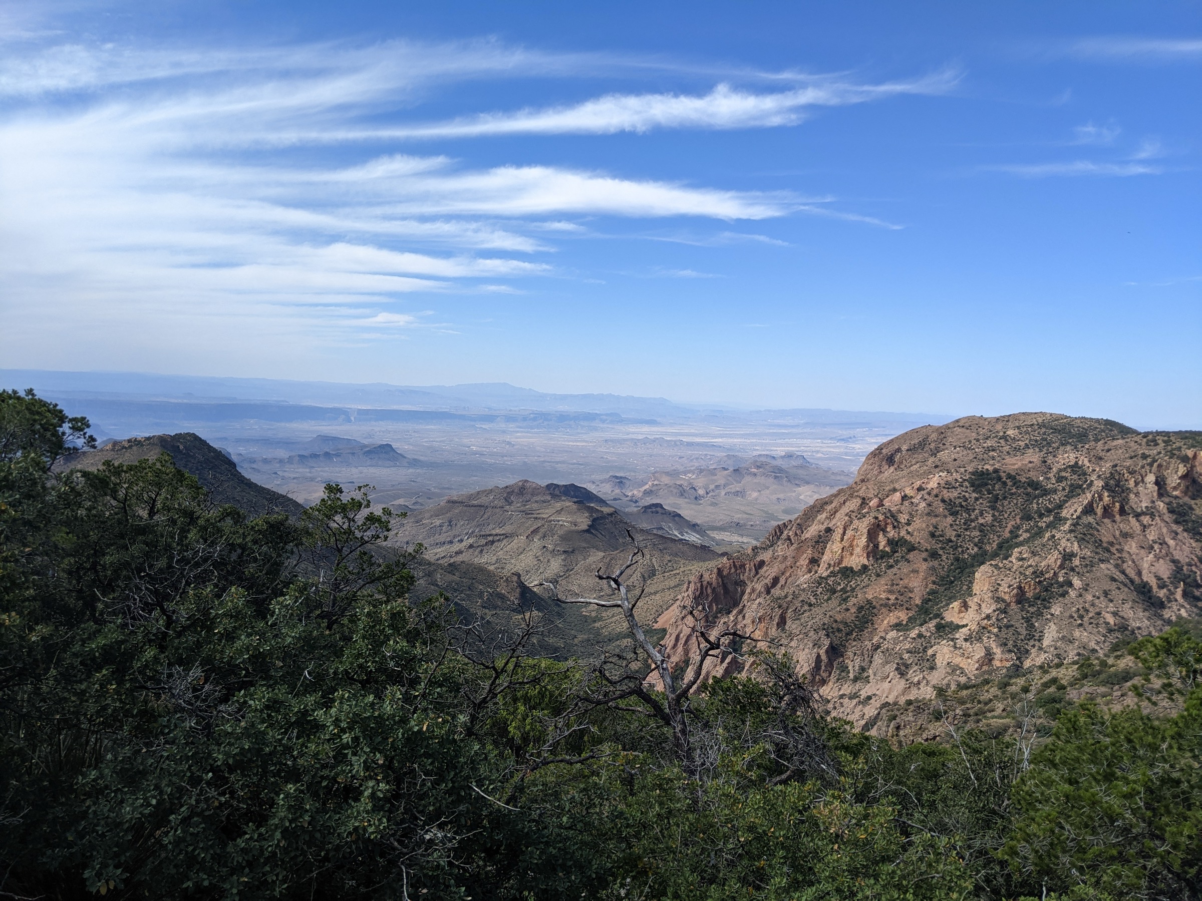
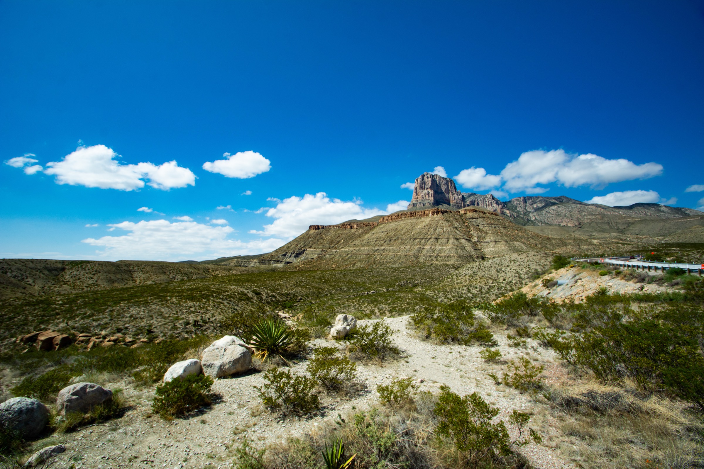
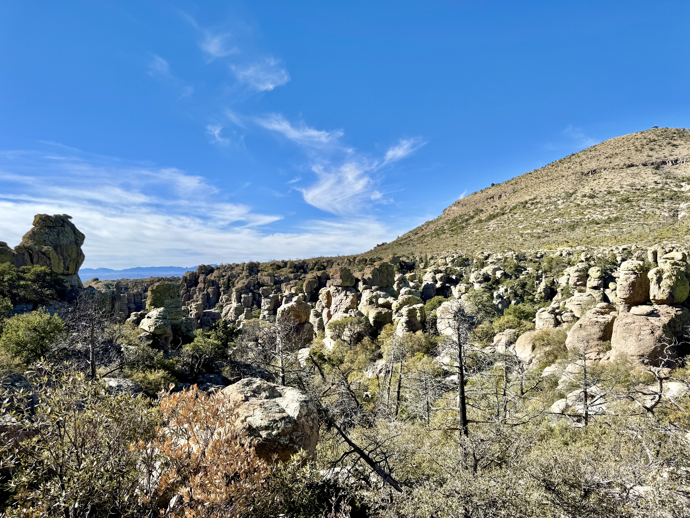
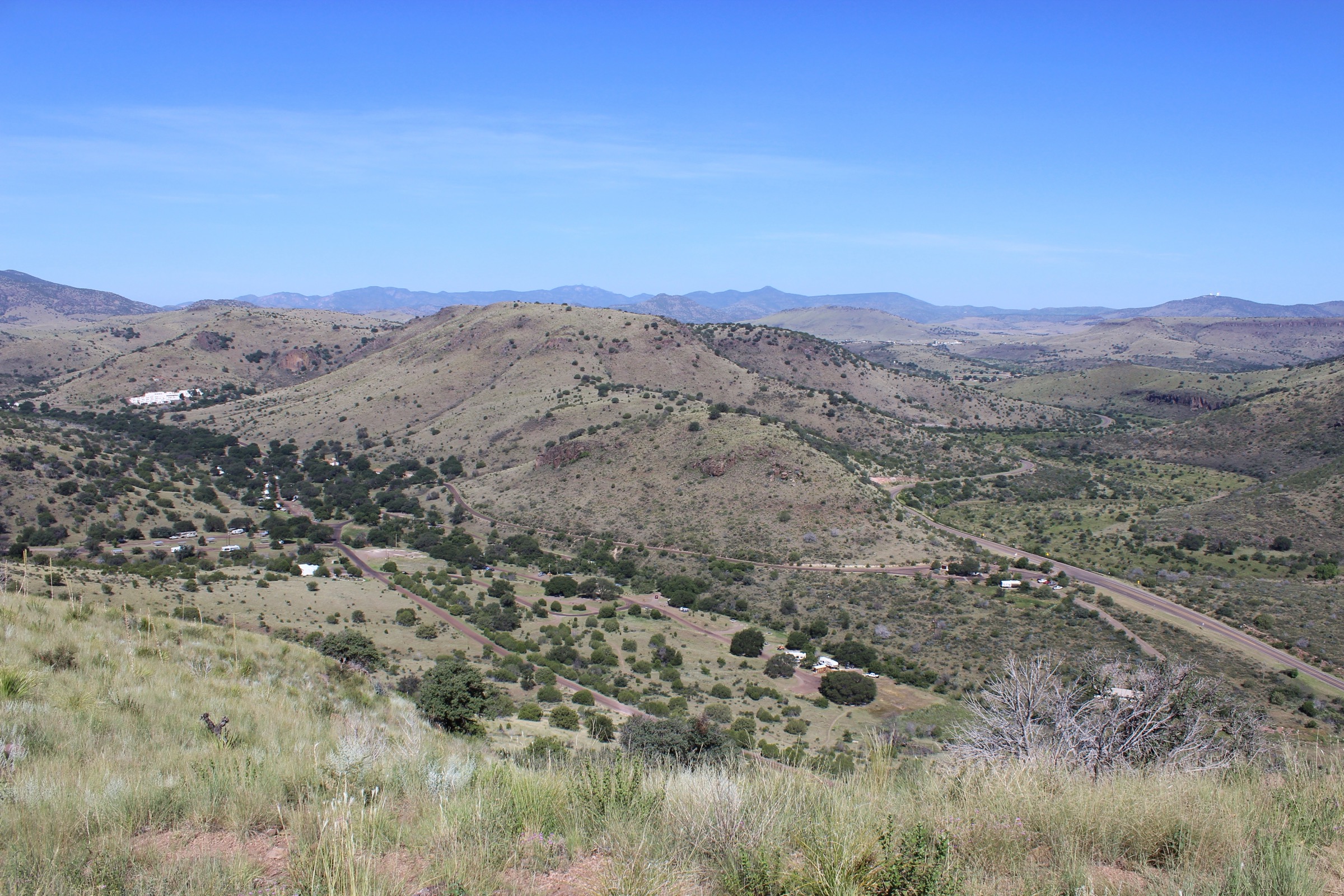
The Davis Mountains are a high Chihuahuan Desert sky-island range around Fort Davis, Texas. Public day hiking is concentrated in three areas: Davis Mountains State Park (managed by Texas Parks and Wildlife), Fort Davis National Historic Site (NPS), and The Nature Conservancy’s Madera Canyon Trail on the edge of the Davis Mountains Preserve. The range is drier and more open than most forested mountain regions, with oak–juniper slopes, grassland plateaus, volcanic rock, canyon viewpoints, historic frontier trails and wide desert-basin views toward Mount Livermore.
The walking character is exposed, rocky and often hot, but well marked on the state-park and national-park trails. Davis Mountains State Park routes range from short lodge and overlook paths to longer combinations using Limpia Creek and Sheep Pen Canyon. Fort Davis adds short but steep historic-ridge hikes above the preserved 19th-century frontier fort. Madera Canyon provides a year-round public loop next to the Davis Mountains Preserve — the preserve itself has only limited public access via reserved open days and guided tours, which is why full preserve routes such as Mount Livermore / Baldy are outside this catalogue.
The reliable walking season is autumn through spring. Summer hiking must be early, shaded where possible and conservative in distance. Water is limited or unavailable at trailheads away from developed areas, and TPWD warns that mobile connectivity in the park can be poor. Access is by private vehicle; no reliable public transport to the selected trailheads was verified.
See also: Guadalupe Mountains, Texas · Franklin Mountains, Texas.
Selection rationale
The five walks below cover the public day-hike range of the Davis Mountains. Skyline Drive Trail is the state park’s compact balcony route linking a canyon overlook with the historic CCC landscape. Indian Lodge + Montezuma Quail Trail is the lodge-to-ridge traverse that connects the historic Indian Lodge with the park’s best short high-desert viewpoint. Limpia Creek + Sheep Pen Canyon Loop is the park’s long backcountry-style day, and the most complete public route in the range. Fort Davis North Ridge Loop adds the range’s essential cultural-history hike, climbing directly above the frontier fort. Madera Canyon Trail closes the set with the most important publicly accessible non-state-park Davis Mountains walk. Official TPWD, NPS and TNC sources were prioritised; no downloadable GPX or KML was found for any route, so route-file status rests on official maps and route pages.
Summary table
| # | Hike | Country | Route type | Distance | Gain / change | Max elevation | Difficulty |
|---|---|---|---|---|---|---|---|
| 1 | Skyline Drive Trail | USA | Point-to-point | 4.2 km | 166 m ascent | Not published | Moderate–challenging |
| 2 | Indian Lodge + Montezuma Quail | USA | Point-to-point | 3.9 km | ≥67 m (Quail); combined unpublished | Not published | Challenging |
| 3 | Limpia Creek + Sheep Pen Canyon Loop | USA | Loop with access legs | ~16.7 km | ≥168–213 m per TPWD notes | Not published | Moderate, long and remote |
| 4 | Fort Davis North Ridge Loop | USA | Loop / lollipop | ~2.6 km | ~100 m | 1,592 m | Strenuous (short) |
| 5 | Madera Canyon Trail | USA | Loop | 3.9 km | 53 m change | 1,844 m | Moderate |
1. Skyline Drive Trail
Snapshot
Itinerary
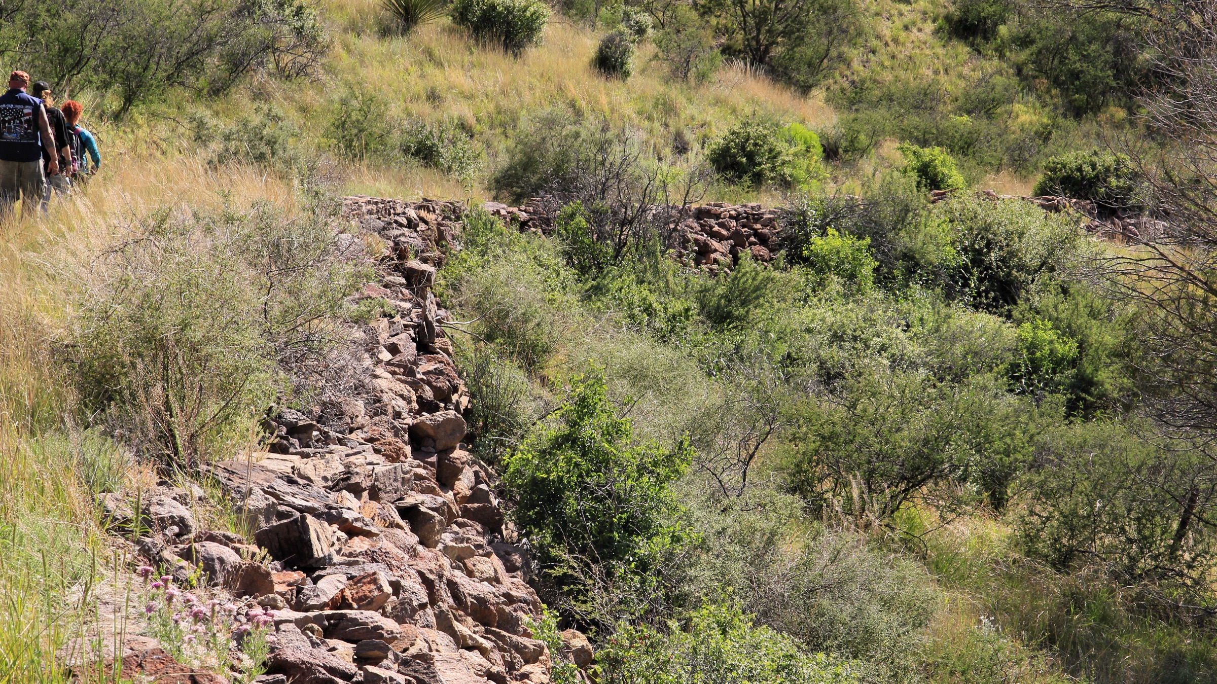
From the Interpretive Center area, the trail climbs toward Keesey Canyon Overlook, then follows the Skyline Drive corridor toward the park’s historic Civilian Conservation Corps structures and the CCC trailhead. It can be walked as a point-to-point with a shuttle or folded into a longer state-park loop using adjacent trails and park roads.
Why it is essential
Skyline Drive Trail is the state park’s compact balcony route: a canyon overlook, historic CCC landscape and wide Davis Mountains views in a single walkable line.
Equipment
- Sturdy hiking shoes
- 2 L water minimum
- Sun hat, high-SPF sunscreen and sunglasses
- Food and a wind or weather layer
- Offline map and GPS
- Trekking poles for the climb and descent
Hazards and notes
- Ridge is exposed to sun, wind and storms.
- TPWD emphasises water, heat awareness and staying on trails; mobile connectivity is limited.
- Check park alerts and day-use access before travel.
GPX / route file
| Source | URL | Format | Notes |
|---|---|---|---|
| TPWD — Davis Mountains trails information | tpwd.texas.gov | Web page | Official route description; no GPX exposed |
| TPWD — Davis Mountains park map | tpwd.texas.gov | Source map only |
Sources
2. Indian Lodge Trail + Montezuma Quail Trail
Snapshot
Itinerary
Begin behind Indian Lodge and climb the Indian Lodge Trail toward open Davis Mountains views. Continue via Montezuma Quail Trail, which TPWD describes as climbing from the wildlife-viewing area and giving canyon and Indian Lodge views before descending toward the campground or headquarters side of the park.
Why it is essential
This is the state park’s classic lodge-to-ridge walk: it links the historic Indian Lodge setting with one of the park’s best short high-desert viewpoints and a practical cross-park trail connection.
Equipment
- Sturdy hiking shoes
- 2 L water minimum
- Sun hat, sunscreen and sunglasses
- Food and a wind or weather layer
- Offline map and GPS
Hazards and notes
- Short but steep and exposed — heat, loose footing and route logistics are the main issues.
- Point-to-point returns require a shuttle or a road walk; plan accordingly.
- Avoid walking road sections in poor visibility.
GPX / route file
| Source | URL | Format | Notes |
|---|---|---|---|
| TPWD — Davis Mountains trails information | tpwd.texas.gov | Web page | Official segment descriptions and times |
| TPWD — Davis Mountains park map | tpwd.texas.gov | Source map only |
Sources
3. Limpia Creek + Sheep Pen Canyon Loop
Snapshot
Itinerary
Follow Limpia Creek Trail through Limpia Canyon — TPWD describes an initially flat route that then climbs to the Sheep Pen Canyon Loop junction. Continue around Sheep Pen Canyon Loop across oak–juniper woodland, grassland plateau and viewpoint terrain, with optional spurs depending on conditions and daylight. Return to the start by Limpia Creek Trail.
Why it is essential
This is the most complete long public day hike in Davis Mountains State Park: canyon walking, plateau terrain, remote-feeling high desert and the park’s most spacious backcountry character.
Equipment
- Sturdy footwear and trekking poles
- 3–4 L water — no reliable drinking water on the loop
- Full food for a 7–8 hour day
- Sun protection and warm/wind layers
- Weatherproof shell
- Offline map and GPS
- Headtorch for a late return
Hazards and notes
- Long for the region with limited shade and no reliable water.
- Mobile connectivity is limited — carry navigation backup.
- TPWD recommends telling others your plan, staying on trails and checking burn bans or park restrictions.
- Heat and dehydration are the dominant risks; start at dawn in warm weather.
GPX / route file
| Source | URL | Format | Notes |
|---|---|---|---|
| TPWD — Davis Mountains trails information | tpwd.texas.gov | Web page | Official segment descriptions and times |
| TPWD — Davis Mountains park map | tpwd.texas.gov | Source map only |
Sources
4. Fort Davis North Ridge Loop
Snapshot

Itinerary
From the historic post area, climb Hospital Canyon Trail to the ridge system, continue along North Ridge Trail, and descend by the Scenic Overlook Trail. The loop gives views over the preserved 19th-century frontier fort, the surrounding volcanic hills and the wider Davis Mountains.
Why it is essential
This is the best short combination of Davis Mountains hiking and cultural history in the range: steep ridge walking directly above one of west Texas’s key historic sites.
Equipment
- Sturdy hiking shoes
- 1.5–2 L water even for the short loop
- Sun hat, sunscreen and sunglasses
- Light weather layer
- Site map from the NPS visitor centre
Hazards and notes
- NPS describes several Fort Davis trails as steep and strenuous with switchbacks, stairs, rails and little or no shade.
- Trails and the front gate close at 5 p.m. — plan the descent accordingly.
- Children under 16 must be with an adult on the trails, per the NPS hiking map.
- Rock and metalwork can be slick after precipitation.
GPX / route file
Sources
- NPS Fort Davis — hiking
- NPS Fort Davis — hiking map (PDF)
- NPS Fort Davis — plan your visit
- NPS Fort Davis — maps
5. Madera Canyon Trail
Snapshot
Itinerary
From the Lawrence E. Wood Picnic Area, follow the signed Madera Canyon Trail loop through pinyon–oak–juniper woodland, across Madera Creek, and to a canyon overlook with views toward Mount Livermore. Return on the loop, staying on the marked trail because the surrounding land is private.
Why it is essential
Madera Canyon is the most important publicly accessible non-state-park Davis Mountains walk. It gives a compact taste of the higher, wooded Davis Mountains and views toward Mount Livermore without depending on the preserve’s limited open-day access.
Equipment
- Sturdy hiking shoes
- 2 L water — no water at the trail
- Sun hat, sunscreen and sunglasses
- Food and a light weather layer
- Offline map
Hazards and notes
- TNC notes loose gravel, uneven terrain, a creek crossing, drop-offs and cliff-face hazards.
- Do not cross Madera Creek at flood stage.
- The trail is on private property with public access limited to the marked trail — off-trail travel is trespass.
- No bikes, ATVs, off-leash pets or camping.
- No restrooms or drinking water at the trail.
GPX / route file
| Source | URL | Format | Notes |
|---|---|---|---|
| TNC — Davis Mountains Preserve | nature.org | Web page | Official access page |
| TNC — Madera Canyon visitor map | nature.org | Source map only |
Sources
Routes excluded as out of scope
- Mount Livermore / Baldy — the range’s highest summit, but reserved for Davis Mountains Preserve open days or guided tours rather than normal day-hike public access.
- McDonald Observatory nature walks — short interpretive routes best treated with astronomy-site visits rather than a mountain-hike catalogue.
- Wider ranch and preserve interior traverses — private land or permit-only, and outside the “publicly accessible day-hike” scope of this article.
Further reading
- TPWD — Davis Mountains State Park
- TPWD — Davis Mountains trails information
- NPS Fort Davis National Historic Site
- TNC — Davis Mountains Preserve
- Sister catalogue: USA — Chisos Mountains, Big Bend, Texas: essential day-hikes
Missing data / follow-up work
- No official GPX or KML downloads were retrieved for any of the five routes; route-file status rests on the TPWD, NPS and TNC route pages and map PDFs.
- Davis Mountains State Park maximum elevations and exact gain / loss figures need GIS or topographic backfill.
- The Fort Davis North Ridge Loop distance is an assembled estimate from official NPS segment lengths and should be GIS-checked before publication.
- Madera Canyon Trail has no licence-compatible route photograph yet. The TNC page carries copyrighted images; a first-party photograph or a permission-cleared open-licence image is needed.
- Indian Lodge Trail and the Limpia Creek + Sheep Pen Canyon Loop currently rely on lower-resolution open-licence photographs that sit below the site’s 2000 px floor (Robert Hensley’s Indian Lodge view at 1600 px; wadelane’s Limpia Creek Valley at 640 px). Larger open-licence replacements should be sought.
- Mount Livermore / Baldy may be added if a stable and publicly documented access route via the Davis Mountains Preserve becomes available.