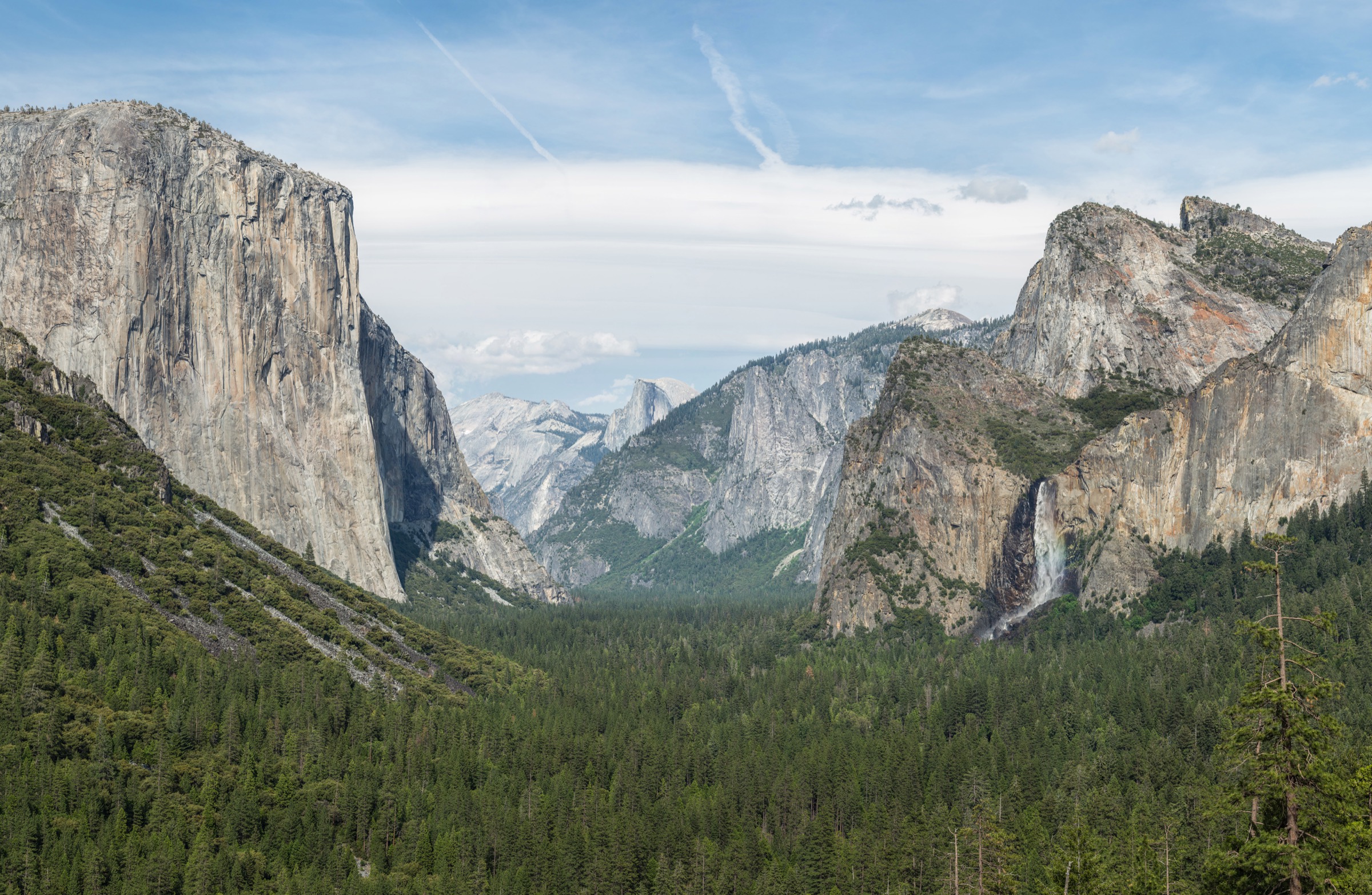
Regional overview
Yosemite and the central Sierra Nevada combine glacier-shaped granite walls, long waterfalls, alpine lake basins, giant sequoia groves and one of the densest sets of historic, well-engineered mountain trails in North America. Yosemite Valley routes are logistically straightforward but heavily crowded in summer, while the high country along Tioga Road and Tuolumne Meadows depends on seasonal road opening — typically late May or June through October.
The recurring hazards are heat and dehydration on long Valley climbs, thunderstorms on exposed granite ridges, icy winter trails, high altitude on Tioga-side routes, full parking lots and shuttle queues, bears, and strict permit rules. Half Dome is a special case: it is a strenuous day hike with a regulated summit-cable section and should be treated as a serious objective, not a casual viewpoint walk. For the lake-and-granite catalogue immediately to the north, see the Tahoe and Northern Sierra essentials.
Selection rationale
The five hikes represent the core Yosemite and central Sierra experiences: Half Dome for the iconic regulated summit, Upper Yosemite Falls for the historic Valley waterfall climb, Clouds Rest for the exposed high-granite viewpoint, Cathedral Lakes for Tuolumne alpine lake terrain, and Mariposa Grove for giant sequoia history and ecology. Multi-day Yosemite wilderness routes, technical climbs and long trans-Sierra objectives are excluded.
Summary table
| # | Hike | Route type | Distance | Gain | Max elevation | Difficulty |
|---|---|---|---|---|---|---|
| 1 | Half Dome via the John Muir Trail | Out-and-back | 27.7 km | 1,617 m | 2,684 m | Strenuous |
| 2 | Upper Yosemite Falls Trail | Out-and-back | 10.8 km | 987 m | 2,043 m | Hard |
| 3 | Clouds Rest from Sunrise Lakes Trailhead | Out-and-back | 20.3 km | 950 m | 3,027 m | Hard |
| 4 | Cathedral Lakes Trail | Out-and-back | 15.4 km | 505 m | 2,933 m | Moderate |
| 5 | Mariposa Grove of Giant Sequoias Trail | Out-and-back | 10.9 km | 372 m | 2,077 m | Moderate |
1. Half Dome via the John Muir Trail
Snapshot
Itinerary
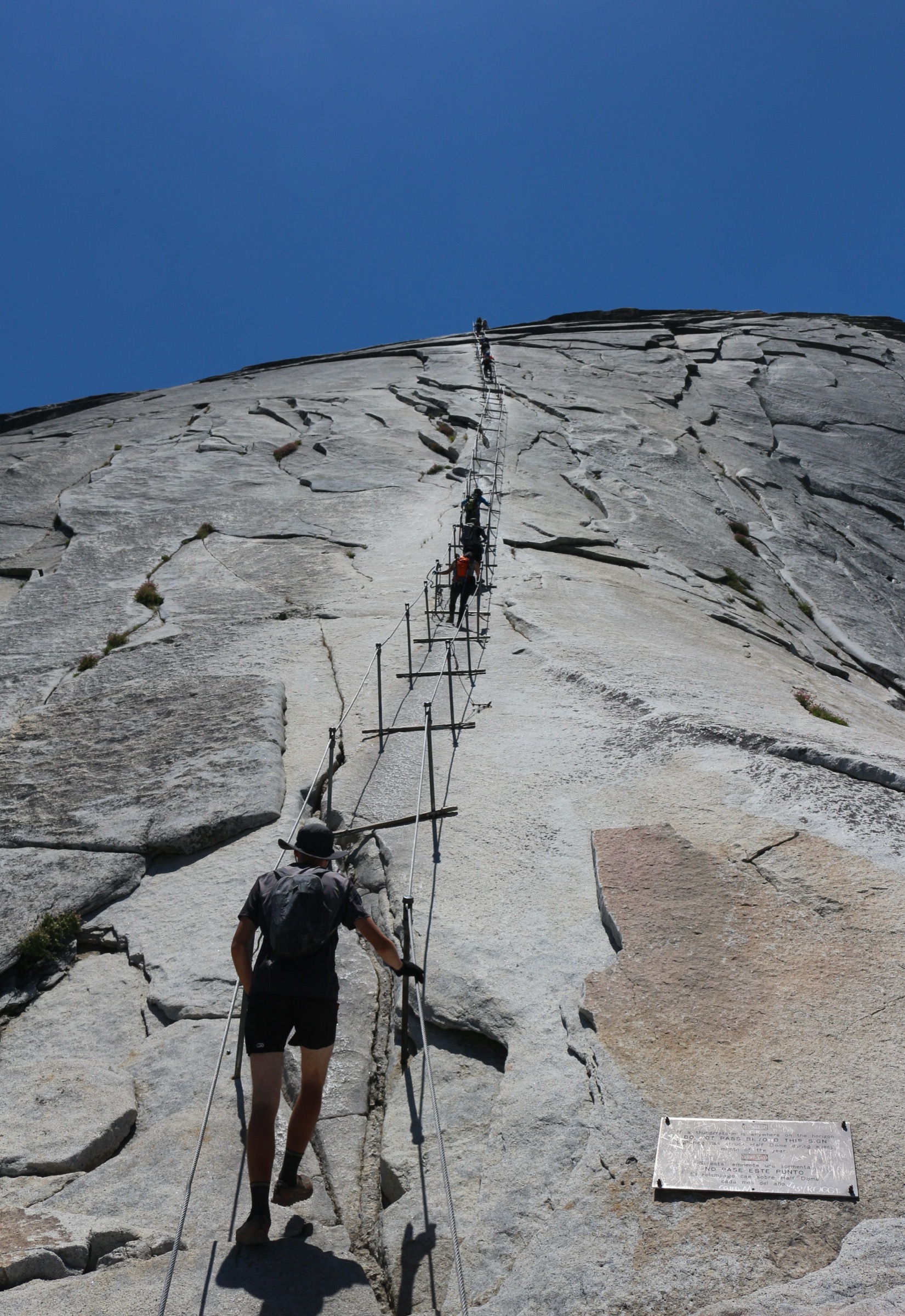
From Happy Isles the route climbs past Vernal and Nevada Falls, reaches Little Yosemite Valley, and then continues through forest and granite steps to Sub Dome and the cable route. The final 400 ft to the summit uses the famous Half Dome cables when installed. The summit gives panoramic views over Yosemite Valley and the High Sierra before the long return.
Why it is essential
Half Dome is Yosemite’s regulated icon: physically demanding, historically famous and unlike any ordinary Sierra day hike because the summit requires permits, cables, and conservative weather judgment.
Equipment, hazards and notes
Carry broken-in boots, headlamp with spare batteries, map / GPS, warm and waterproof layers, sun protection, food, and enough water or treatment capacity. NPS recommends one gallon (4 litres) of water for hikers going to the top. Gloves are strongly useful on the cables; pack them out. Do not attempt the cables when wet or during thunderstorms. A permit is required to hike Half Dome when the cables are up.
GPX / route file
| Source | URL | Format | Reuse status |
|---|---|---|---|
| AllTrails — Half Dome via the John Muir Trail | alltrails.com | Source map / route page | AllTrails terms; geometry not reused |
| NPS — Half Dome Day Hike | nps.gov | Page | Rule / route source |
| NPS — Half Dome permits | nps.gov | Page | Permit source |
| OpenStreetMap — search “Half Dome Trail Yosemite” | openstreetmap.org | OSM | Cross-check only |
Further reading
- NPS — Half Dome Day Hike
- NPS — Half Dome permits
- AllTrails — Half Dome via the John Muir Trail
- Wikipedia — Half Dome
2. Upper Yosemite Falls Trail
Snapshot
Itinerary
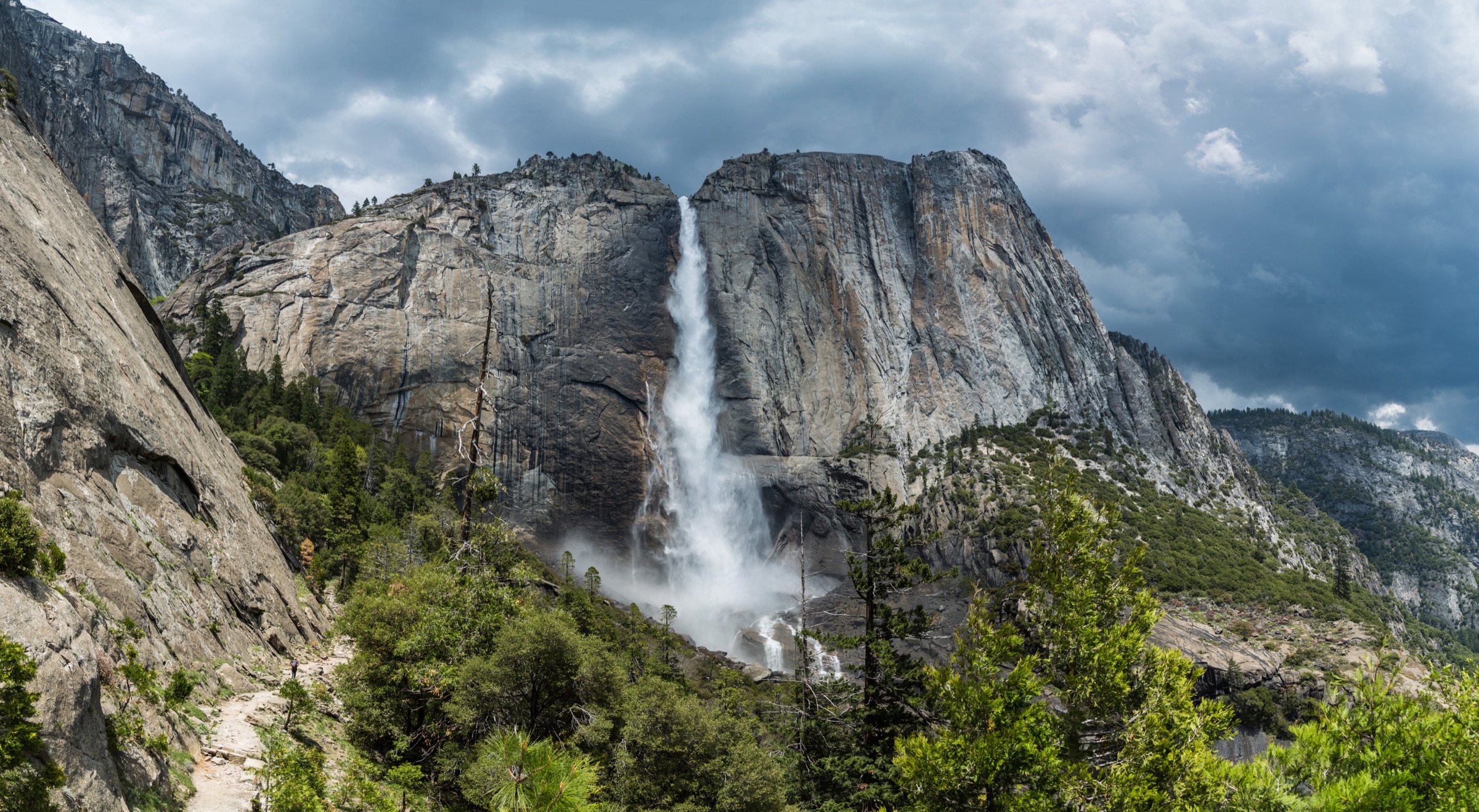
The trail starts near Camp 4 and climbs steep switchbacks above Yosemite Valley. Columbia Rock gives an early viewpoint over Half Dome and the Valley; continuing farther brings a close view of Upper Yosemite Fall before the longer climb reaches the top of the falls. Optional extensions to Yosemite Point or Eagle Peak add distance beyond this entry.
Why it is essential
This is Yosemite Valley’s great historic waterfall climb: steep, direct, and closely tied to one of North America’s tallest waterfalls.
Equipment, hazards and notes
Carry plenty of water, sun protection, layers and traction in icy conditions. NPS warns of steep drops near the trail, loose decomposed granite in summer, and icy or slippery upper sections in winter. Waterfall flow can be very low by late summer.
GPX / route file
| Source | URL | Format | Reuse status |
|---|---|---|---|
| AllTrails — Upper Yosemite Falls Trail | alltrails.com | Source map / route page | AllTrails terms; geometry not reused |
| NPS — Yosemite Falls Trail | nps.gov | Page | Rule / route source |
| OpenStreetMap — search “Upper Yosemite Falls Trail” | openstreetmap.org | OSM | Cross-check only |
Further reading
3. Clouds Rest from Sunrise Lakes Trailhead
Snapshot
Itinerary
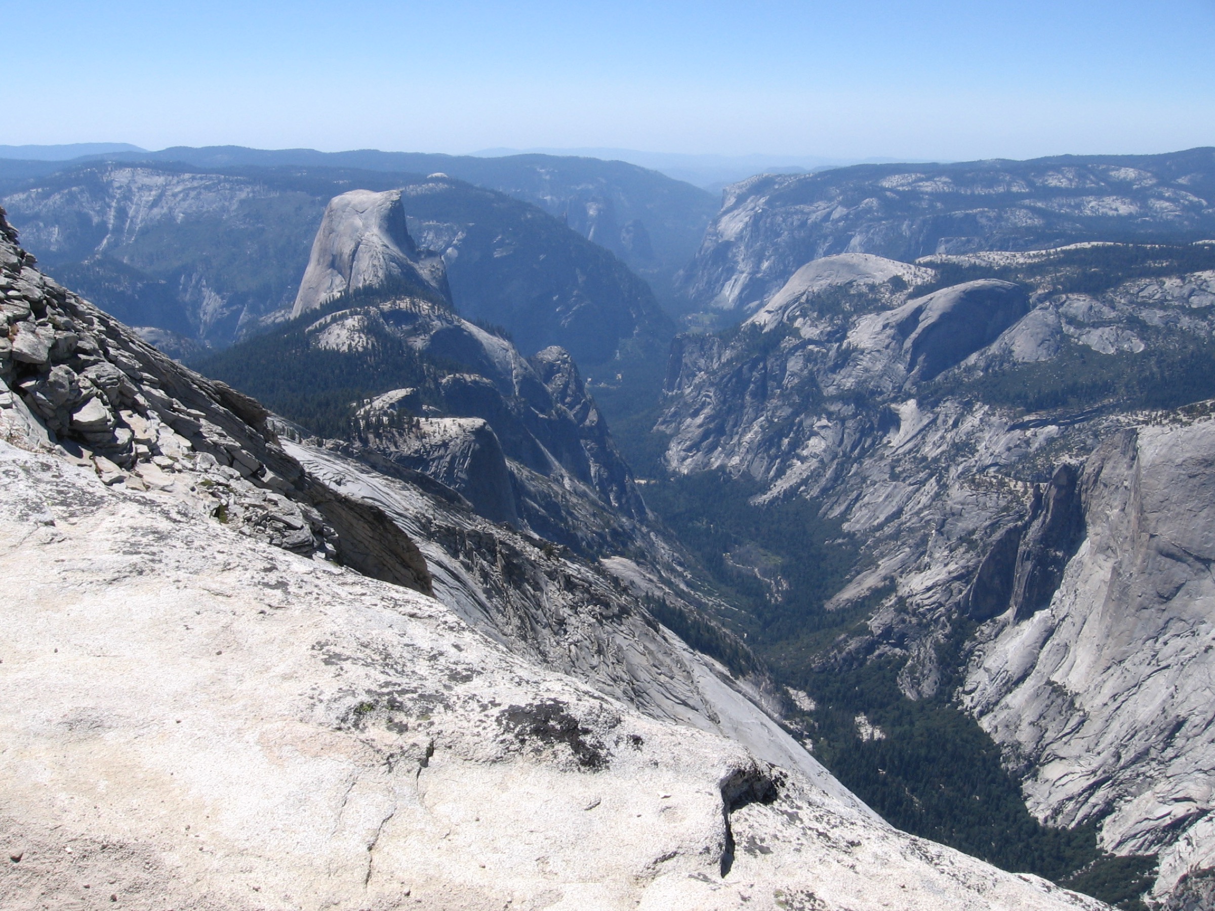
From the Sunrise Lakes Trailhead the route climbs from the Tenaya Lake area toward the Sunrise junction, then follows the Clouds Rest line through forest and granite terrain. The final approach uses a narrow high ridge to reach the summit, with views down Tenaya Canyon, toward Half Dome, and across the High Sierra.
Why it is essential
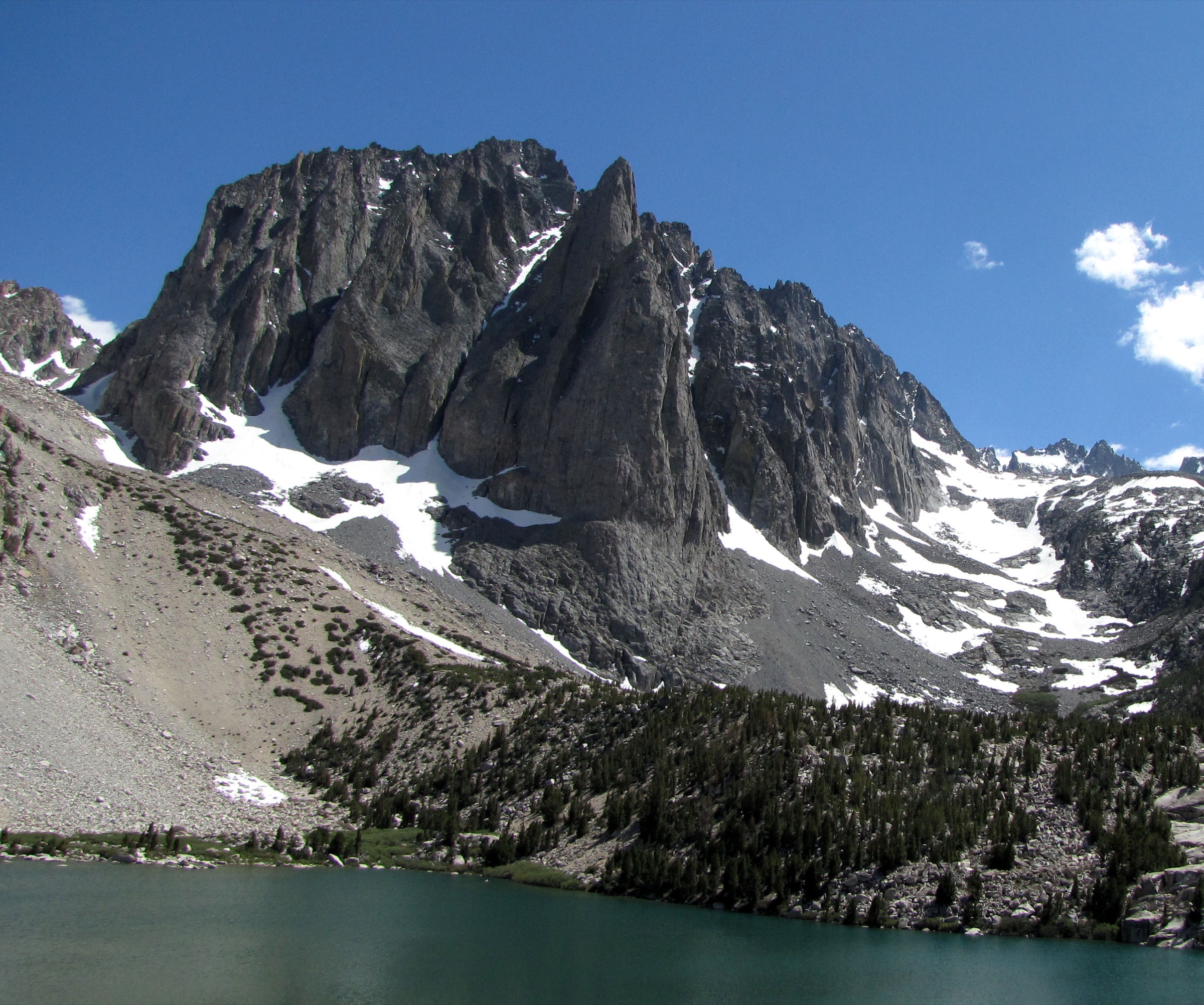
Clouds Rest is the non-permit alternative to Half Dome for many strong hikers, but it is not second-best: the summit ridge and high viewpoint give one of Yosemite’s finest granite panoramas.
Equipment, hazards and notes
Carry high-country day kit, warm and waterproof layers, sun protection, water treatment, food, navigation and a headlamp. The summit ridge has real exposure and should be avoided in storms, high wind or icy conditions. Mosquitoes can be intense early season; Tioga Road is seasonal.
GPX / route file
| Source | URL | Format | Reuse status |
|---|---|---|---|
| AllTrails — Clouds Rest Trail | alltrails.com | Source map / route page | AllTrails terms; geometry not reused |
| NPS — Day Hikes in Tuolumne Meadows | nps.gov | Page | Access / seasonal context |
| NPS — Current conditions | nps.gov | Page | Conditions source |
| OpenStreetMap — search “Clouds Rest Trail Yosemite” | openstreetmap.org | OSM | Cross-check only |
Further reading
- AllTrails — Clouds Rest Trail
- NPS — Day Hikes in Tuolumne Meadows
- NPS — Current Conditions
- Wikipedia — Clouds Rest
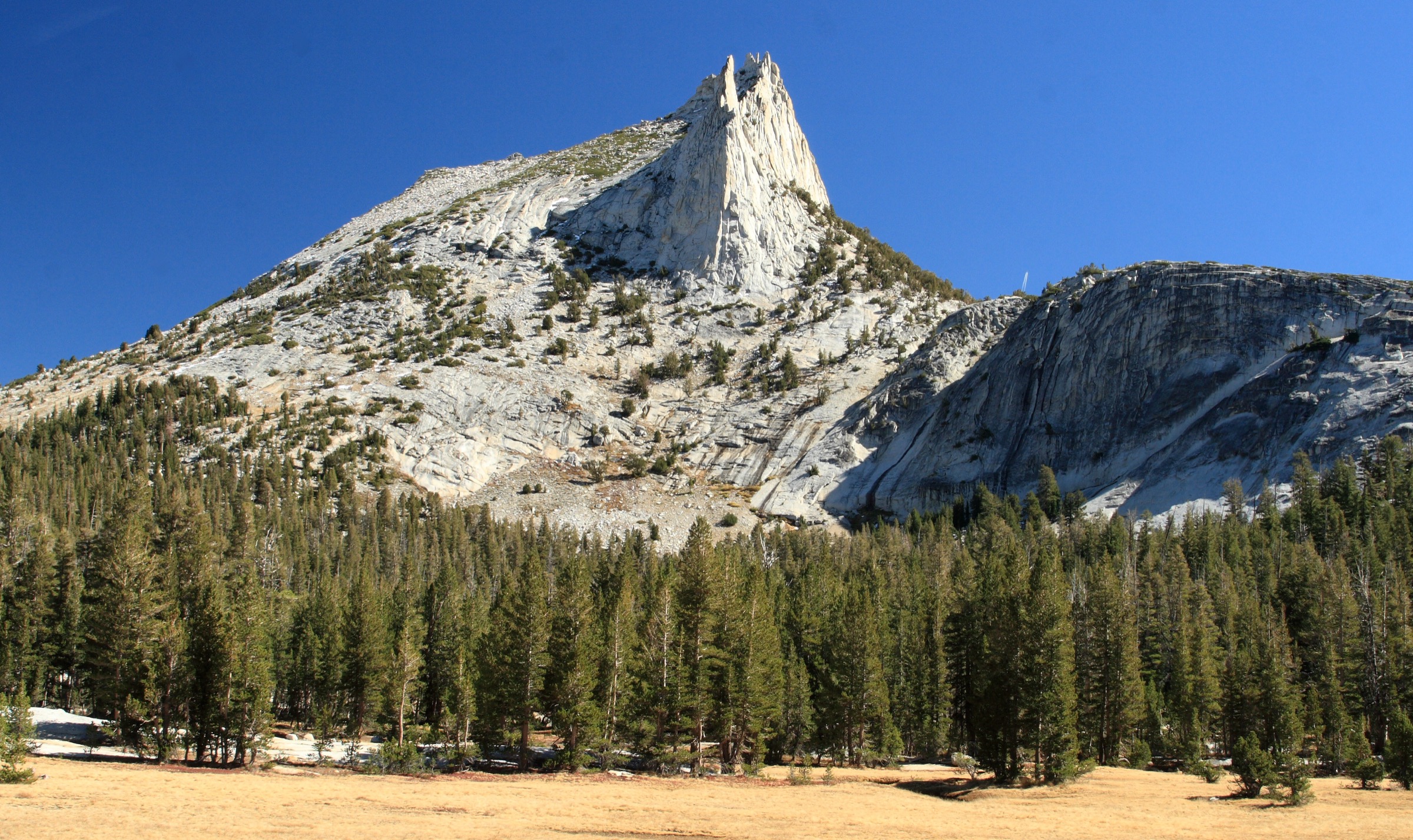
4. Cathedral Lakes Trail
Snapshot
Itinerary
The trail follows the John Muir Trail corridor from Tuolumne Meadows, climbing steadily toward Cathedral Pass and Upper Cathedral Lake. Near the upper section, a spur leads to Lower Cathedral Lake. Cathedral Peak and the surrounding alpine meadows make this one of the best introductory high-country hikes in Yosemite.
Why it is essential
Cathedral Lakes is the central Yosemite high-country lake hike: accessible from Tioga Road, tied to the John Muir Trail, and representative of Tuolumne’s granite-and-meadow landscape.
Equipment, hazards and notes
Carry layers, sun protection, bug protection, water treatment and navigation. The trail is high enough for altitude fatigue, snow patches, mud and mosquitoes early in the season. Overnight stays require wilderness permits; this entry is for the day hike only.
GPX / route file
| Source | URL | Format | Reuse status |
|---|---|---|---|
| AllTrails — Cathedral Lakes Trail | alltrails.com | Source map / route page | AllTrails terms; geometry not reused |
| NPS — Day Hikes in Tuolumne Meadows | nps.gov | Page | Route / access source |
| OpenStreetMap — search “Cathedral Lakes Trail Yosemite” | openstreetmap.org | OSM | Cross-check only |
Further reading
- NPS — Day Hikes in Tuolumne Meadows
- AllTrails — Cathedral Lakes Trail
- Wikipedia — Cathedral Peak (Sierra Nevada)
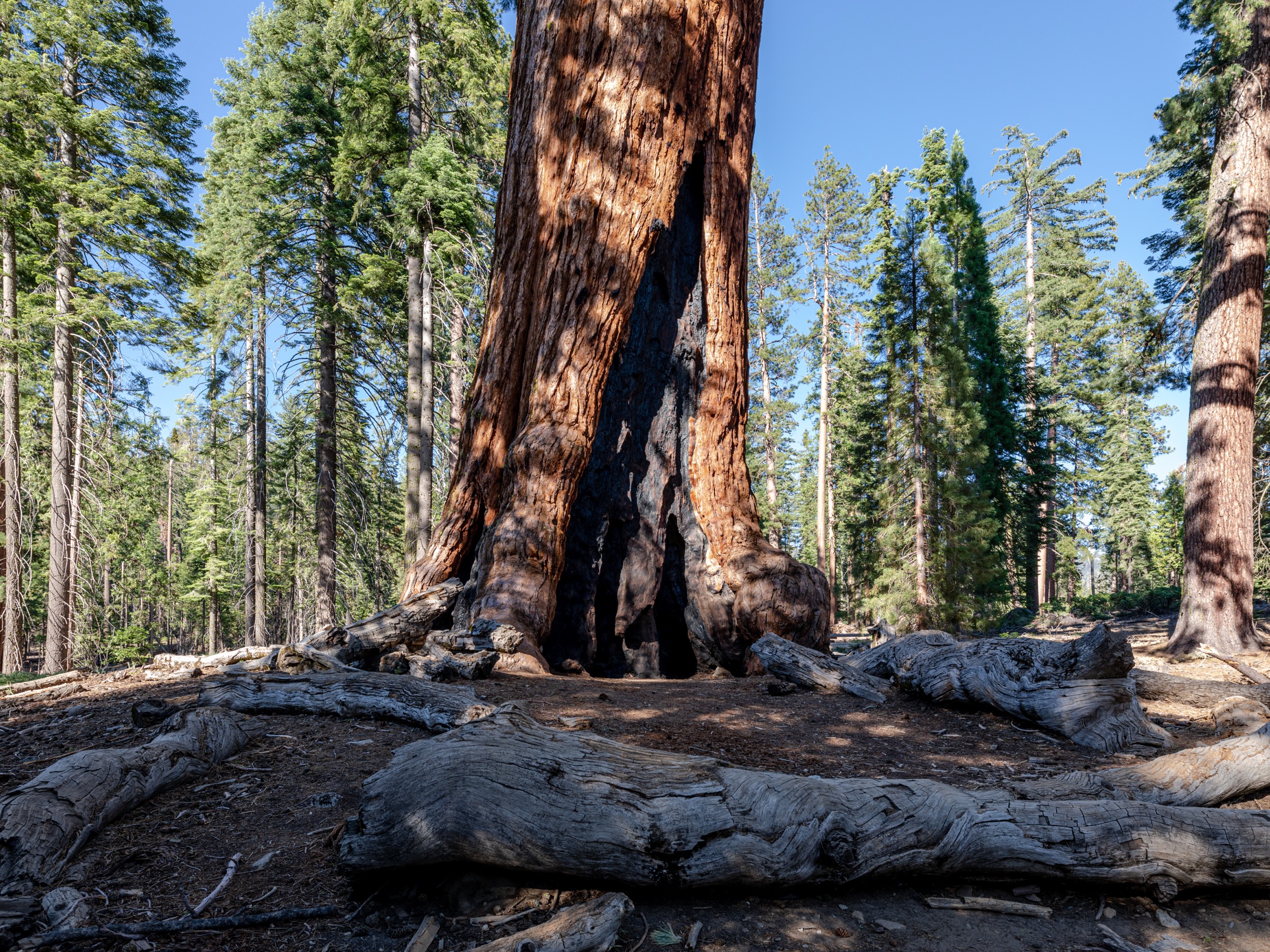
5. Mariposa Grove of Giant Sequoias Trail
Snapshot
Itinerary
From the Mariposa Grove Arrival Area the route passes the lower-grove sequoias, including the Bachelor and Three Graces, the Grizzly Giant and the California Tunnel Tree, then continues toward the upper grove and Wawona Point. NPS identifies the grove as Yosemite’s largest sequoia grove, with over 500 mature giant sequoias.
Why it is essential
Mariposa Grove is the cultural and ecological counterweight to Yosemite’s granite routes: giant sequoias, the roots of the national-park idea, and a historically significant protected landscape.
Equipment, hazards and notes
Carry water, layers, sun protection and traction in winter. Pets are not allowed on Mariposa Grove trails, roads, shuttles or within the grove. The Welcome Plaza can fill by late morning. Food services are not available in the grove.
GPX / route file
| Source | URL | Format | Reuse status |
|---|---|---|---|
| AllTrails — Mariposa Grove of Giant Sequoias Trail | alltrails.com | Source map / route page | AllTrails terms; geometry not reused |
| NPS — Mariposa Grove of Giant Sequoias | nps.gov | Page | Route / shuttle / rule source |
| OpenStreetMap — search “Mariposa Grove Trail Yosemite” | openstreetmap.org | OSM | Cross-check only |
Further reading
- NPS — Mariposa Grove of Giant Sequoias
- AllTrails — Mariposa Grove of Giant Sequoias Trail
- Wikipedia — Mariposa Grove