Regional overview
The Mammoth and Eastern Sierra hiking region covers the steep east side of the Sierra Nevada from Mammoth Lakes and Rock Creek south through Big Pine, Bishop, and Lone Pine. Its day-hikes start high, climb fast, and reach granite basins, glacial lakes, high passes, and the highest summit in the contiguous United States.
The walking character is more alpine than the mileage alone suggests. Trailheads often sit near or above 3,000 m, summer thunderstorms are common, snow can linger on passes into early summer, and desert-to-alpine temperature swings are severe. Most trailheads are managed by Inyo National Forest, with seasonal road closures and separate wilderness-permit rules for overnight use. The Mount Whitney Trail has its own day-use permit quota system in the Mount Whitney Zone.
For the granite-lake-and-rim country at the northern end of the range, see the companion Tahoe and Northern Sierra day-hikes entry.
Selection rationale
The five hikes cover the Eastern Sierra’s essential day-hike spectrum: Duck Pass for the Mammoth Lakes Basin, Little Lakes Valley for accessible high alpine lake scenery, Big Pine Lakes to Third Lake for Palisade and Temple Crag views, Bishop Pass for the classic high pass from South Lake, and the Mount Whitney Trail for the nationally iconic strenuous summit. Technical Palisades objectives, glacier routes, and multi-day trans-Sierra passes are excluded.
Summary table
| # | Hike | Country | Route type | Distance | Gain | Max elevation | Difficulty |
|---|---|---|---|---|---|---|---|
| 1 | Duck Pass and Pika Lake Trail | USA | Out-and-back | 16.7 km | 657 m | 3,295 m | Hard |
| 2 | Little Lakes Valley to Gem Lakes | USA | Out-and-back | 11.7 km | 325 m | 3,336 m | Moderate |
| 3 | Big Pine Creek to Third Lake | USA | Out-and-back | 18.0 km | 830 m | 3,139 m | Hard |
| 4 | Bishop Pass Trail | USA | Out-and-back | 17.9 km | 715 m | 3,651 m | Hard |
| 5 | Mount Whitney Trail | USA | Out-and-back | 34.9 km | 2,031 m | 4,413 m | Strenuous |
1. Duck Pass and Pika Lake Trail
Snapshot
Itinerary
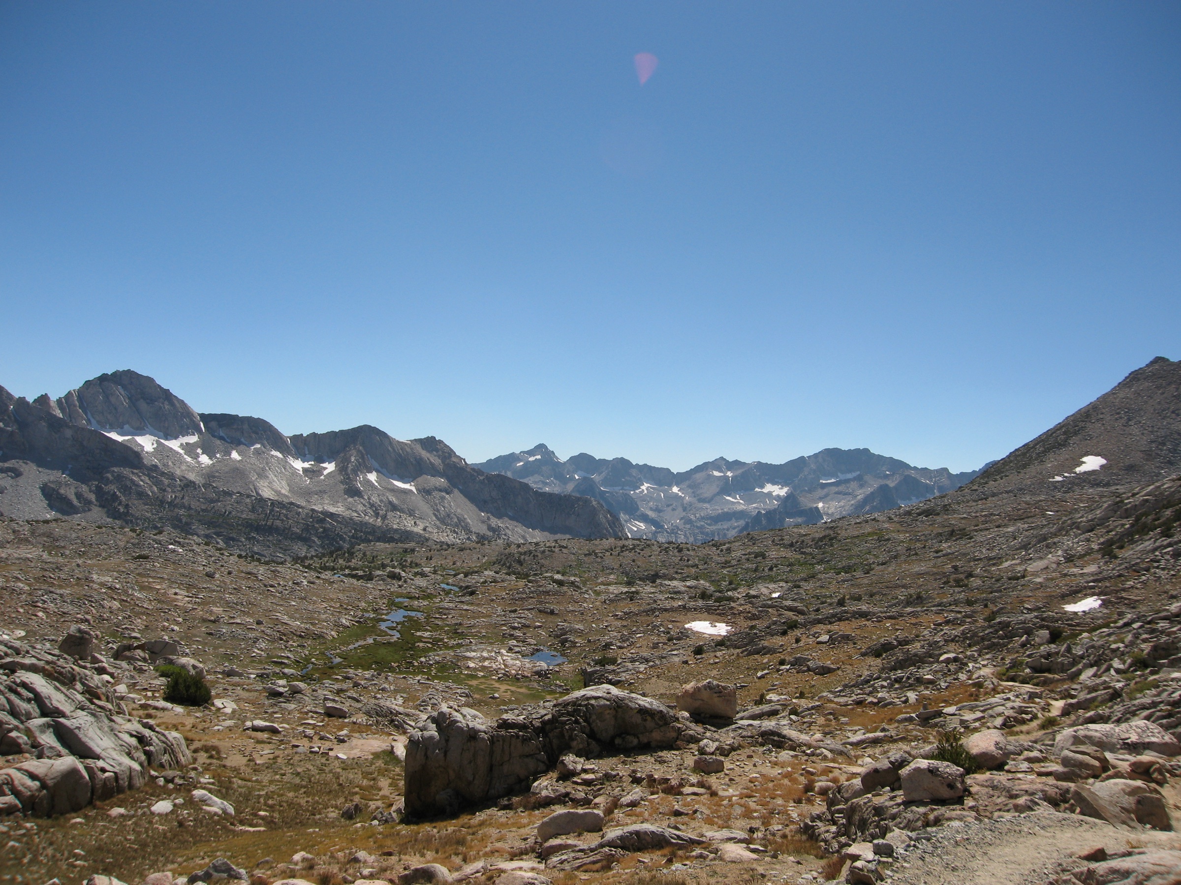
The trail begins behind Coldwater Campground in the Mammoth Lakes Basin, then climbs through forest and lake basins toward Duck Pass. Side routes reach Arrowhead, Skelton, and Barney Lakes; the selected route continues over the pass toward Pika Lake and views into the John Muir Wilderness.
Why it is essential
Duck Pass is the Mammoth Lakes Basin’s classic high pass: close to town but quickly alpine, with a string of lakes and a gateway feeling into the deeper John Muir Wilderness.
Equipment
Mountain day kit, sun protection, insect repellent, water treatment, warm and waterproof layers, and navigation backup.
Hazards and notes
Snow patches, icy sections, mosquitoes, and altitude fatigue are common early in the season. Seasonal road closures affect access; check current conditions before driving in.
GPX / KML links
| Source | URL | Format / access | Reuse status |
|---|---|---|---|
| AllTrails — Duck Pass and Pika Lake Trail | alltrails.com | Interactive route map | AllTrails terms; GPX reuse not verified; source/check only |
| Inyo National Forest — alerts and notices | fs.usda.gov | Official conditions / road-closure page | Official access source; no GPX |
Further reading
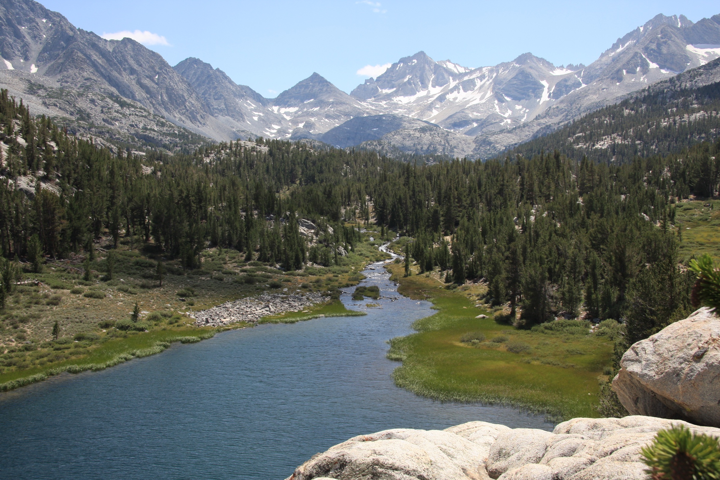
2. Little Lakes Valley to Gem Lakes
Snapshot
Itinerary
From the high Mosquito Flat trailhead, the route follows Little Lakes Valley through a chain of lakes and meadows below the high crest — Mack, Heart, Long, and the Chickenfoot–Gem area, depending on the exact turnaround. The grade is relatively gentle for the scenery, but the trailhead is already above 3,000 m.
Why it is essential
Little Lakes Valley is one of the Eastern Sierra’s best effort-to-reward lake walks: huge alpine scenery, many lakes, and relatively moderate terrain from one of the highest road-access trailheads in the range.
Equipment
Warm and waterproof layers, sun protection, insect repellent, water treatment, food, and navigation backup. There is no drinking water at the trailhead.
Hazards and notes
Altitude, mosquitoes, mud, and lingering snow patches can affect an otherwise moderate route. The trailhead fills early on summer weekends.
GPX / KML links
| Source | URL | Format / access | Reuse status |
|---|---|---|---|
| AllTrails — Little Lakes Valley to Gem Lakes | alltrails.com | Interactive route map | AllTrails terms; GPX reuse not verified; source/check only |
| Inyo National Forest — alerts and notices | fs.usda.gov | Official conditions / road-closure page | Official access source; no GPX |
Further reading
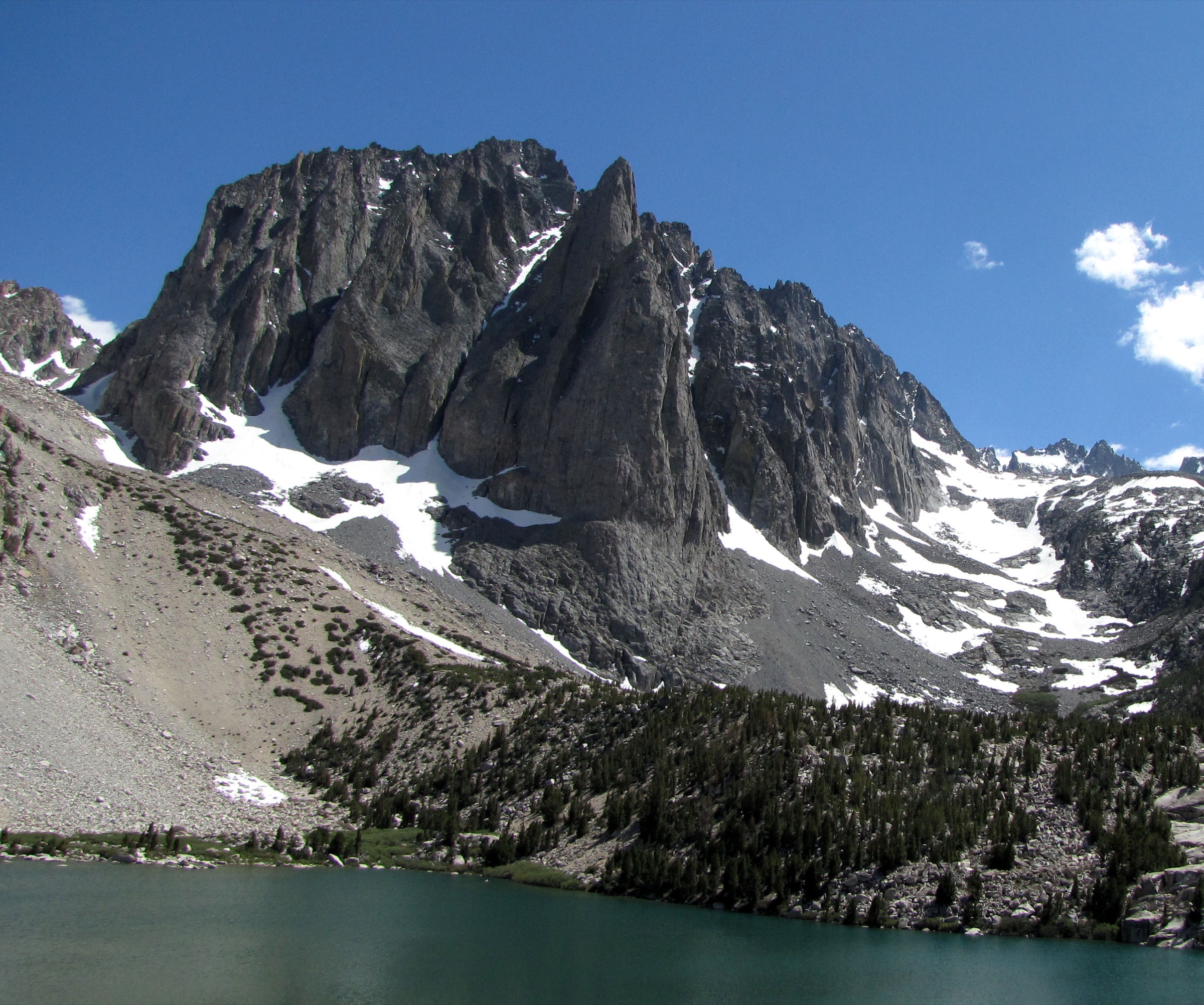
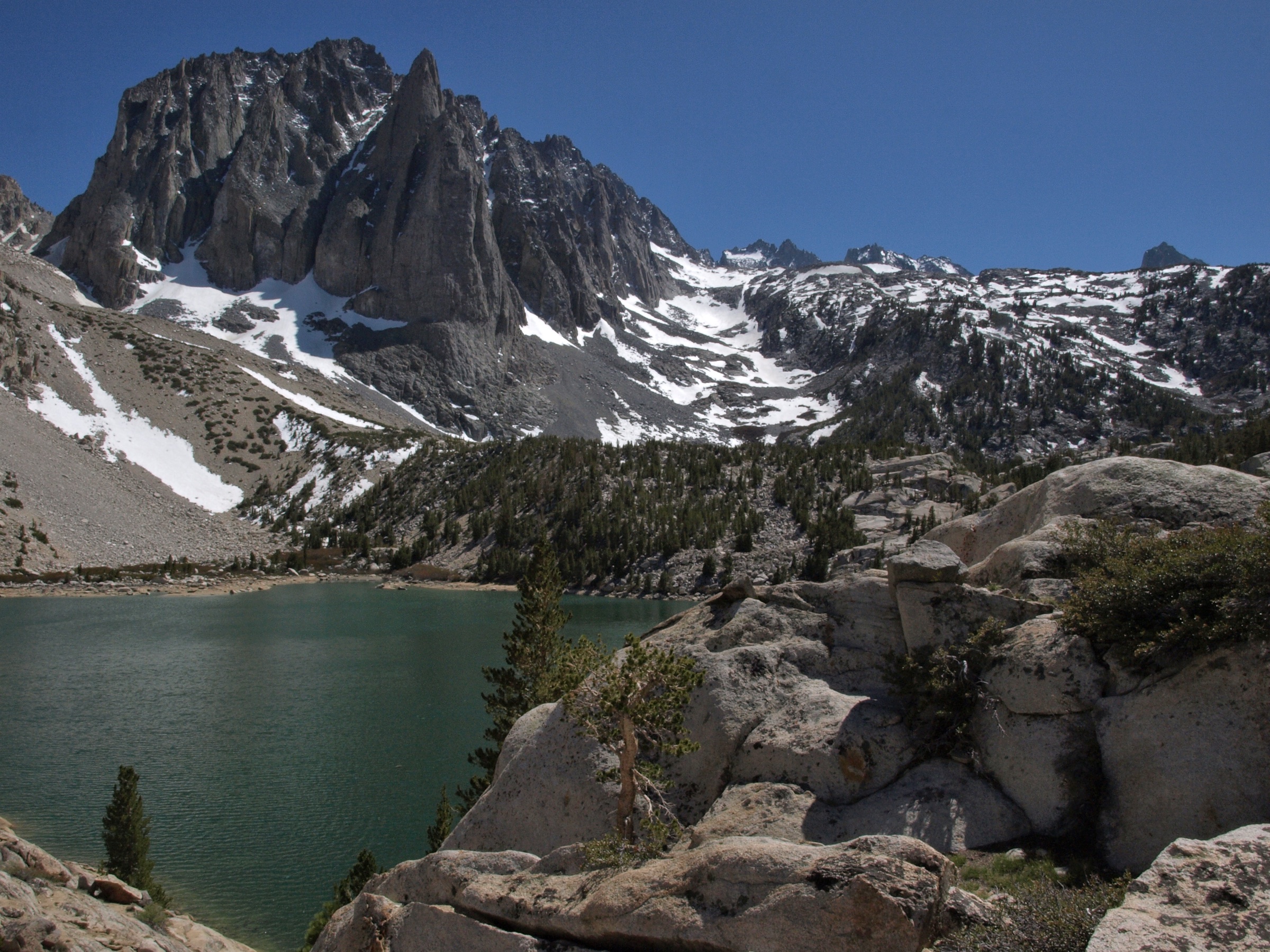
3. Big Pine Creek to Third Lake
Snapshot
Itinerary
From the Glacier Lodge / First Falls area, the trail climbs Big Pine Creek past forest, sage, and manzanita slopes into the North Fork basin. It passes First and Second Falls, then reaches the glacially carved Big Pine Lakes chain with views of Temple Crag and the Palisade Glacier area. This entry turns around at Third Lake.
Why it is essential
Big Pine Lakes is the Eastern Sierra’s classic turquoise-lake-and-granite-spire day hike, with Temple Crag as one of the most dramatic non-technical views in the range.
Equipment
Full mountain day kit, sun protection, water treatment, food, map/GPS, and a headlamp as early-start backup.
Hazards and notes
The route is long, sunny in sections, and popular. No fee or permit is needed for day hiking, but overnight camping requires a permit via Recreation.gov.
GPX / KML links
| Source | URL | Format / access | Reuse status |
|---|---|---|---|
| AllTrails — First Falls and Second Falls Trail to Third Lake | alltrails.com | Interactive route map | AllTrails terms; GPX reuse not verified; source/check only |
| Recreation.gov — wilderness permits | recreation.gov | Permit portal | Site terms; overnight permit reference only |
| Inyo National Forest — alerts and notices | fs.usda.gov | Official conditions / road-closure page | Official access source; no GPX |
Further reading
- AllTrails — First Falls and Second Falls Trail to Third Lake
- Recreation.gov — wilderness permits
- Inyo National Forest — alerts and notices
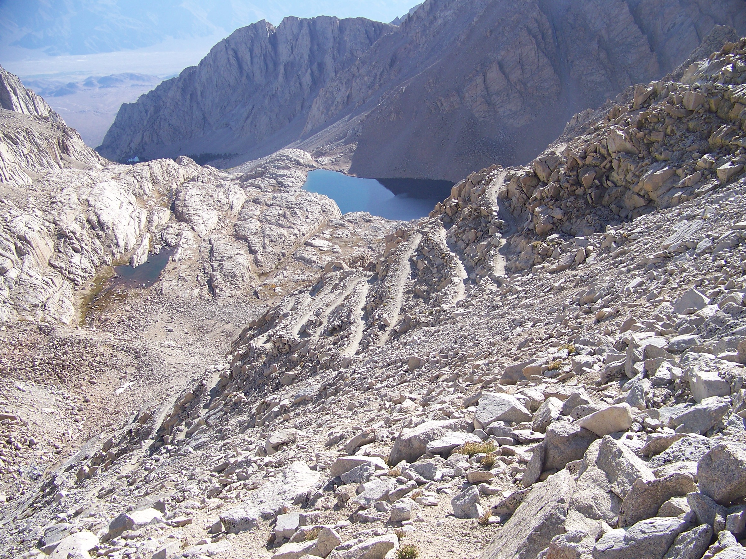
4. Bishop Pass Trail
Snapshot
Itinerary
From South Lake, the trail climbs the valley between the Inconsolable Range and Hurd Peak, reaches Long Lake, then ascends granite benches and high lakes below Mount Thompson and Mount Goode. The day-hike objective is Bishop Pass, where the route looks into Dusy Basin and toward the deeper Sierra.
Why it is essential
Bishop Pass is a classic Eastern Sierra pass hike: high lakes, granite benches, a major trans-Sierra threshold, and huge scenery without a technical summit.
Equipment
Full high-altitude day kit, navigation backup, water treatment, warm and waterproof layers, and sun protection.
Hazards and notes
Snow can linger into early summer. Lightning, cold, altitude, and bears are recurring concerns. Dogs are not allowed past Bishop Pass where the route enters Sequoia and Kings Canyon National Park.
GPX / KML links
| Source | URL | Format / access | Reuse status |
|---|---|---|---|
| AllTrails — Bishop Pass Trail | alltrails.com | Interactive route map | AllTrails terms; GPX reuse not verified; source/check only |
| Recreation.gov — Inyo National Forest wilderness permits | recreation.gov | Permit page | Site terms; permit reference only |
| Inyo National Forest — alerts and notices | fs.usda.gov | Official conditions / road-closure page | Official access source; no GPX |
Further reading
- AllTrails — Bishop Pass Trail
- Recreation.gov — Inyo National Forest wilderness permits
- Inyo National Forest — alerts and notices
5. Mount Whitney Trail
Snapshot
Itinerary
From Whitney Portal, the trail climbs past Lone Pine Lake, Mirror Lake, Outpost Camp, Consultation Lake, and Trail Camp, then ascends the famous 99 switchbacks to Trail Crest. From there it joins the John Muir Trail corridor along the ridge to the summit hut and the highest point in the contiguous United States.
Why it is essential
Mount Whitney is the Eastern Sierra’s nationally iconic endurance day hike: the high point of the contiguous United States, a demanding altitude objective, and the major permit-managed Sierra route.
Equipment
Full high-altitude mountain kit, headlamp, emergency layers, rain and wind shell, water treatment, food, map/GPS, and strong fitness and acclimatisation. Spring and early-summer snow or ice may require microspikes, crampons, ice axe, and snow-travel competence.
Hazards and notes
This is outside the normal day-hike envelope but included because of its iconic status. Dogs are not allowed. Permits are required to day-hike or backpack in the Mount Whitney Zone; quotas apply from May 1 to November 1.
GPX / KML links
| Source | URL | Format / access | Reuse status |
|---|---|---|---|
| AllTrails — Mount Whitney Trail | alltrails.com | Interactive route map | AllTrails terms; GPX reuse not verified; source/check only |
| Recreation.gov — Mount Whitney Zone permits | recreation.gov | Official permit page | Site terms; permit source only |
| NPS — Mount Whitney | nps.gov | Official park route / access page | Official context source |
| Inyo National Forest — alerts and notices | fs.usda.gov | Official conditions / road-closure page | Official access source; no GPX |
Further reading
- AllTrails — Mount Whitney Trail
- Recreation.gov — Mount Whitney Zone permits
- NPS — Mount Whitney
- Inyo SAR — Mount Whitney preparation (PDF)
Missing data / follow-up work
- No directly reusable GPX/KML files were verified. AllTrails route pages are included as source-map references only.
- OpenStreetMap route relations were not confirmed for any of the five routes.
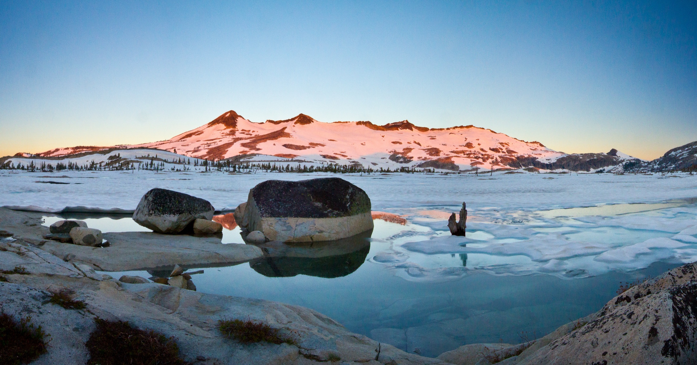
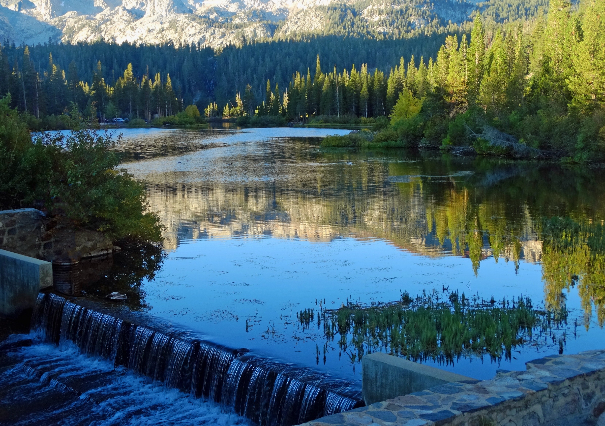
- Duck Pass and Bishop Pass have only contextual licence-compatible imagery (Mammoth Basin sunrise and Dusy Basin from the pass); route-specific open photos remain a gap.
Further reading
| Resource | Link |
|---|---|
| Inyo National Forest | fs.usda.gov |
| Inyo National Forest — alerts and notices | fs.usda.gov |
| Recreation.gov — Mount Whitney Zone permits | recreation.gov |
| Recreation.gov — Inyo wilderness permits | recreation.gov |
| NPS — Mount Whitney | nps.gov |
| AllTrails — Duck Pass and Pika Lake Trail | alltrails.com |
| AllTrails — Little Lakes Valley to Gem Lakes | alltrails.com |
| AllTrails — First Falls and Second Falls Trail to Third Lake | alltrails.com |
| AllTrails — Bishop Pass Trail | alltrails.com |
| AllTrails — Mount Whitney Trail | alltrails.com |