Regional overview
The Tahoe and Northern Sierra hiking area spans Lake Tahoe’s granite shoreline and rim, the lake-and-meadow country of Desolation Wilderness, the Donner Pass and Castle Peak crest, and the northern Sierra high country around Sierra City. Its essential day-hikes combine lake-basin routes, volcanic and granite summits, historic fire lookouts and shoreline traverses, with the Tahoe Rim Trail and the Pacific Crest Trail threading through several of them as the long-distance backbone.
The walking character is seasonal and mountain-serious. Lower lakeshore routes around the state parks can open in late spring, but high routes commonly hold snow into June or July. July through October is the normal summer hiking window; thunderstorms, wildfire smoke, mosquitoes, sun exposure, limited water on the ridge routes, and rapidly changing road and trailhead access are recurring issues. Desolation Wilderness requires entry permits for both day and overnight use, and state-park trailheads on the west shore can have parking fees, full lots, or seasonal road closures.
There is no reliable public transport to any of the trailheads. Access is by private vehicle from South Lake Tahoe, Truckee or the I-80 / Highway 89 corridor, and several of the gravel and mountain-road approaches are open only from late spring through October.
Selection rationale
The five hikes below balance the region’s defining experiences rather than cluster on Desolation Wilderness, which dominates almost every other “best of” list for the area:
- Mount Tallac Trail — the iconic South Lake Tahoe summit hike, strenuous and visually definitive.
- D.L. Bliss to Emerald Bay via the Rubicon Trail — the essential lakeshore traverse on Tahoe’s west shore, lower than the summit routes but packed with granite, forest and Emerald Bay scenery.
- Lake Aloha from Echo Lakes — the representative Desolation Wilderness day-hike, with granite basins and lake-studded terrain on the PCT corridor.
- Sierra Buttes Trail — the signature northern-Sierra lookout summit, with a historic fire-lookout finish and wide Lakes Basin views.
- Castle Peak Trail — the defining Donner Pass day summit, linked to the PCT and visually distinct from the Tahoe Basin routes.
Long Tahoe Rim Trail sections, overnight Desolation loops and technical winter or mountaineering variants are excluded.
Summary table
| # | Hike | Country | Route type | Distance | Gain | Max elevation | Difficulty |
|---|---|---|---|---|---|---|---|
| 1 | Mount Tallac Trail | United States | Out-and-back | 15.3 km | 1,001 m | 2,964 m | Strenuous |
| 2 | D.L. Bliss to Emerald Bay via Rubicon Trail | United States | Out-and-back / shuttleable | 12.4 km | 324 m | 2,014 m | Moderate |
| 3 | Lake Aloha Trail from Echo Lakes | United States | Out-and-back | 20.3 km | 568 m | 2,563 m | Hard |
| 4 | Sierra Buttes Trail | United States | Out-and-back | 8.2 km | 479 m | 2,614 m | Hard |
| 5 | Castle Peak Trail | United States | Out-and-back | 8.9 km | 531 m | 2,765 m | Hard |
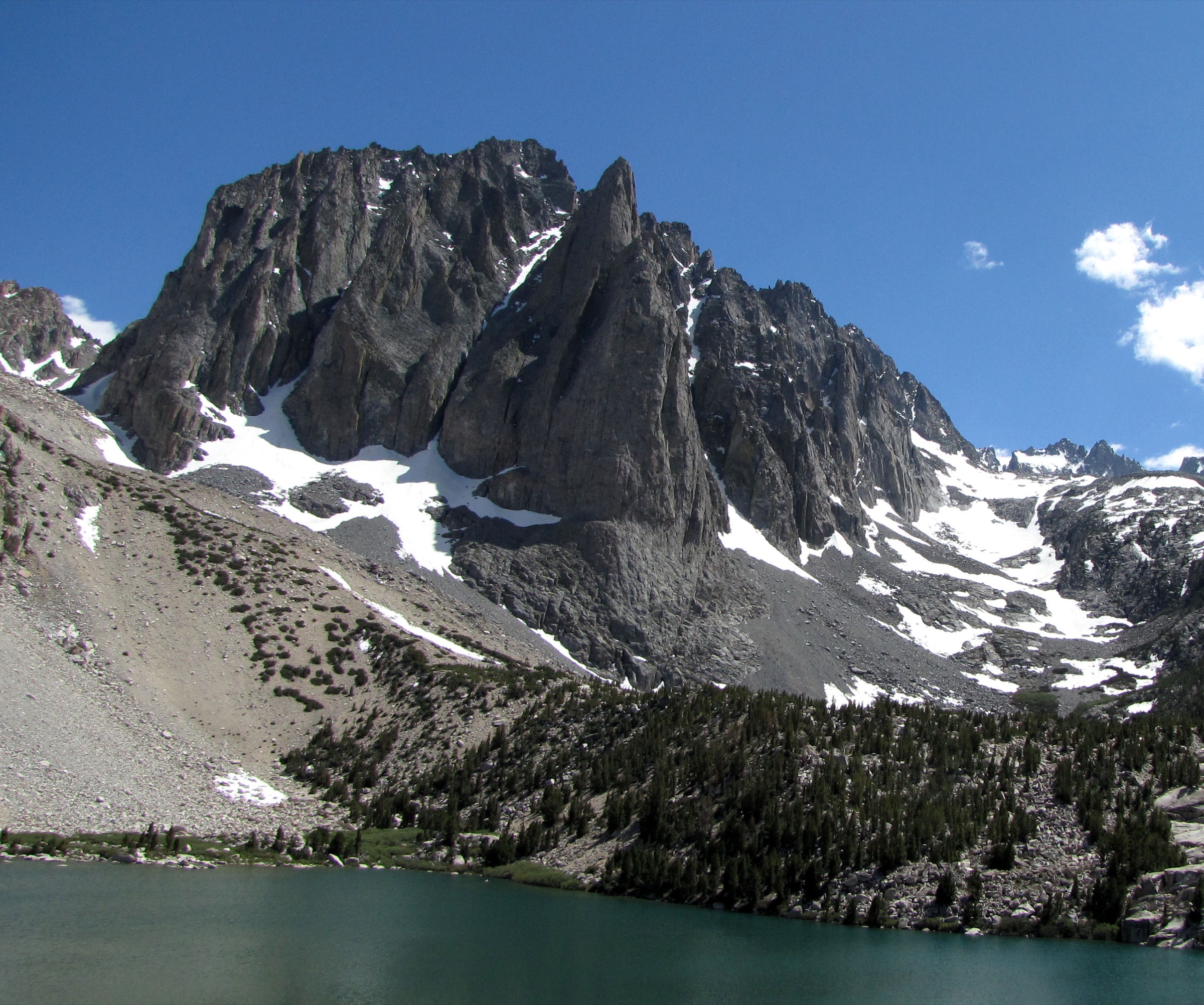
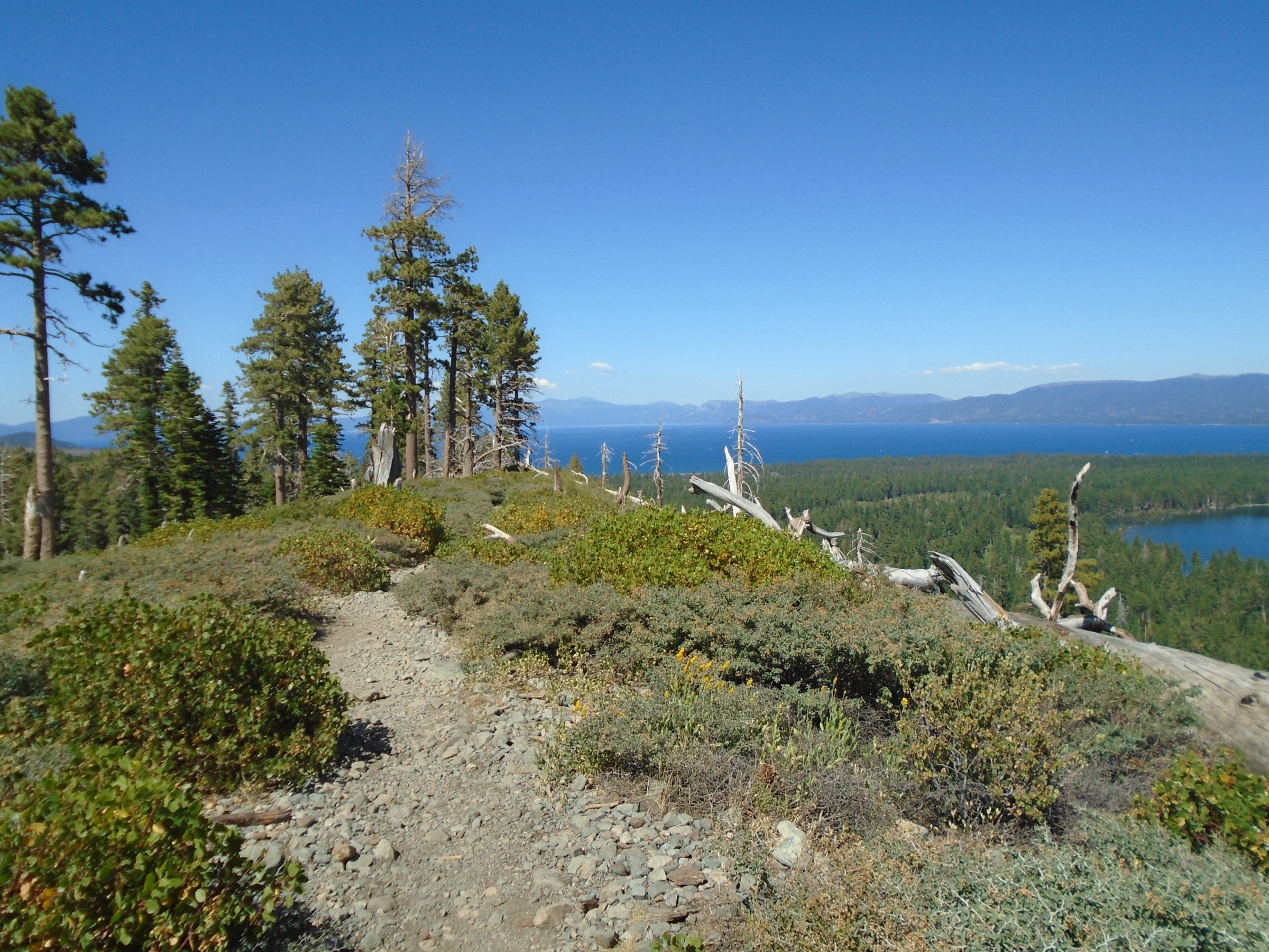
1. Mount Tallac Trail
Snapshot
Itinerary
From the Mount Tallac Trailhead the route climbs above Fallen Leaf Lake toward Floating Island Lake and Cathedral Lake, then steepens through forest and rocky open slopes. Higher on the ridge it gives views toward Gilmore Lake before the final climb to Tallac’s summit panorama over Emerald Bay, South Lake Tahoe and the Desolation Wilderness.
Why it is essential
Tallac is the classic South Lake Tahoe summit hike — strenuous, popular and visually definitive, with lakes on the ascent and a summit view that makes the lake-basin geography of Tahoe immediately legible.
Equipment
- Sturdy boots, waterproof shell, warm layer
- Sun protection — exposure is full on the upper ridge
- 3-4 L of water in heat, food
- Offline map / GPS; cell coverage is unreliable
- Headlamp and trekking poles
Hazards and notes
- Early starts are advisable to avoid heat and afternoon thunderstorms.
- In winter or spring, avalanche terrain, ice and deep snow change the route into a backcountry-snow objective.
- Desolation Wilderness entry permits are required year-round; overnight quotas and fees are separate from day-use.
GPX / KML links
| Source | URL | Format | Reuse status |
|---|---|---|---|
| AllTrails — Mt Tallac Trail | alltrails.com | Source map / route page | AllTrails terms; geometry not reused |
| USDA Forest Service — Desolation Wilderness | fs.usda.gov | Page | Rule / access source |
| OpenStreetMap — search “Mount Tallac Trail” | openstreetmap.org | OSM | Cross-check only |
Further reading
- AllTrails — Mt Tallac Trail
- USDA Forest Service — Desolation Wilderness
- USDA Forest Service — Lake Tahoe Basin recreation
- Wikipedia — Mount Tallac
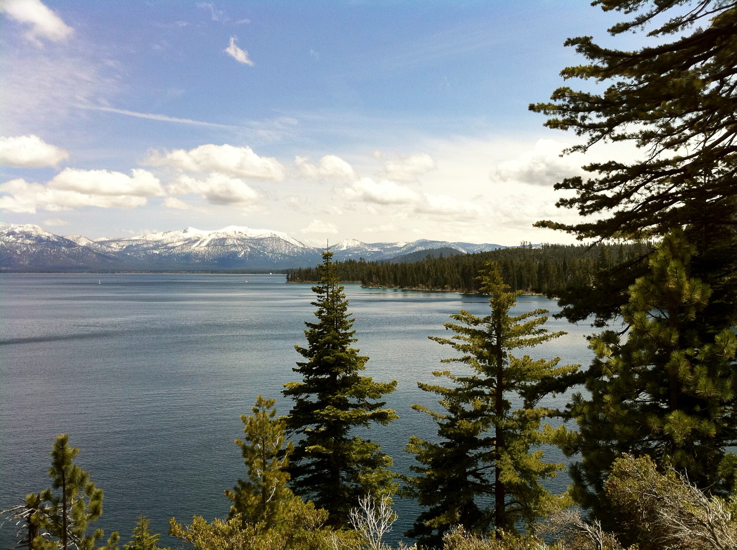
2. D.L. Bliss State Park to Emerald Bay State Park via Rubicon Trail
Snapshot
Itinerary
The Rubicon Trail follows Lake Tahoe’s west shore between D.L. Bliss and Emerald Bay State Parks. It traverses granite shoreline, cliffy viewpoints, Jeffrey pine and incense cedar forest, and views across turquoise water toward Fannette Island and Vikingsholm. Some sections have steep drops or rocky footing, but the route is primarily a constructed hiking trail rather than a technical scramble.
Why it is essential
The essential Tahoe shoreline hike — lower than the summit routes, but packed with classic lake, granite, forest and Emerald Bay scenery.
Equipment
- Water and sun protection
- Layers for exposed and shaded sections
- Shoes with good traction for the granite slabs
Hazards and notes
- Exposed drop-offs and hot sunny sections, with limited escape points along the shore.
- Dogs are not allowed on this AllTrails route record.
- Confirm current state-park road, parking and fee status before driving in.
GPX / KML links
| Source | URL | Format | Reuse status |
|---|---|---|---|
| AllTrails — D.L. Bliss to Emerald Bay via Rubicon Trail | alltrails.com | Source map / route page | AllTrails terms; geometry not reused |
| California State Parks — D.L. Bliss | parks.ca.gov | Page | Rule / access source |
| California State Parks — Emerald Bay | parks.ca.gov | Page | Rule / access source |
| OpenStreetMap — search “Rubicon Trail Lake Tahoe” | openstreetmap.org | OSM | Cross-check only |
Further reading
- AllTrails — D.L. Bliss to Emerald Bay via Rubicon Trail
- California State Parks — D.L. Bliss
- California State Parks — Emerald Bay
- Wikipedia — Emerald Bay State Park
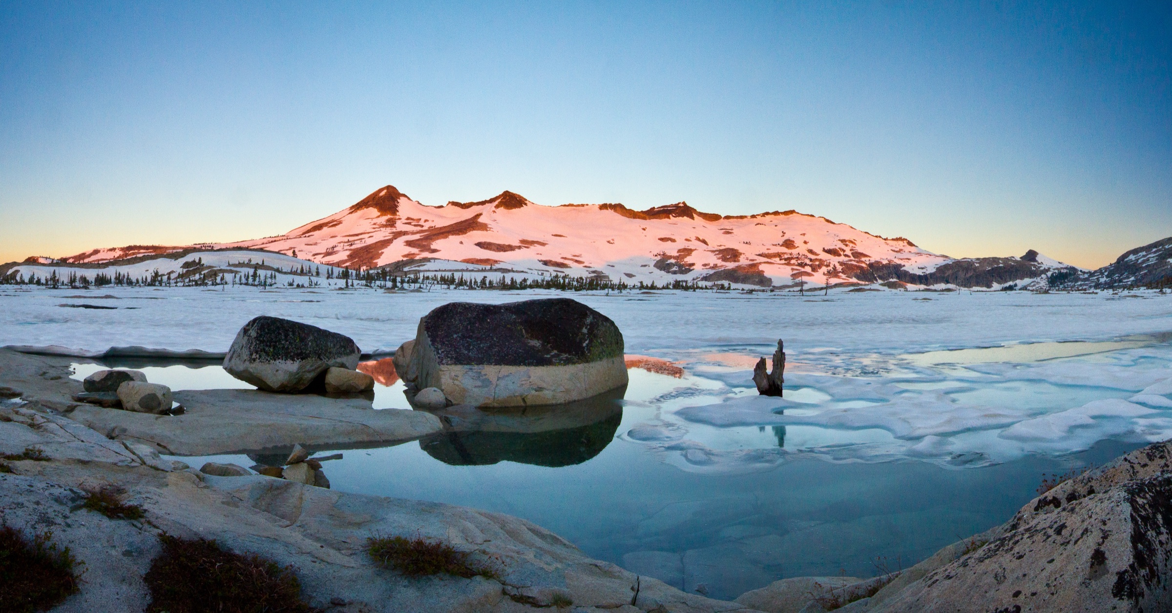
3. Lake Aloha Trail from Echo Lakes
Snapshot
Itinerary
From Echo Lakes the route follows the Pacific Crest Trail and Tahoe Rim Trail corridor into Desolation Wilderness, passing granite slabs, forest and smaller alpine lakes before reaching the island-dotted basin of Lake Aloha. Walk the full route, or when available use the Echo Chalet water taxi across Echo Lakes to shorten the approach.
Why it is essential
The representative Desolation Wilderness day hike — granite basins, open sky, lake-studded terrain and a major Sierra trail corridor in one long but non-technical day.
Equipment
- Full mountain day kit; waterproof and warm layers
- Sun and bug protection
- Water treatment
- Map / GPS and headlamp
Hazards and notes
- No water fountain at the trailhead per AllTrails — carry from the start.
- Desolation Wilderness permits are required; overnight camping has separate fees and quotas.
- Confirm Echo Chalet water-taxi schedule before relying on it.
GPX / KML links
| Source | URL | Format | Reuse status |
|---|---|---|---|
| AllTrails — Lake Aloha Trail | alltrails.com | Source map / route page | AllTrails terms; geometry not reused |
| USDA Forest Service — Desolation Wilderness | fs.usda.gov | Page | Rule / access source |
| Echo Chalet — water taxi | echochalet.com | Page | Operator schedule |
| OpenStreetMap — search “Lake Aloha Trail” | openstreetmap.org | OSM | Cross-check only |
Further reading
- AllTrails — Lake Aloha Trail
- USDA Forest Service — Desolation Wilderness
- Echo Chalet
- Wikipedia — Lake Aloha
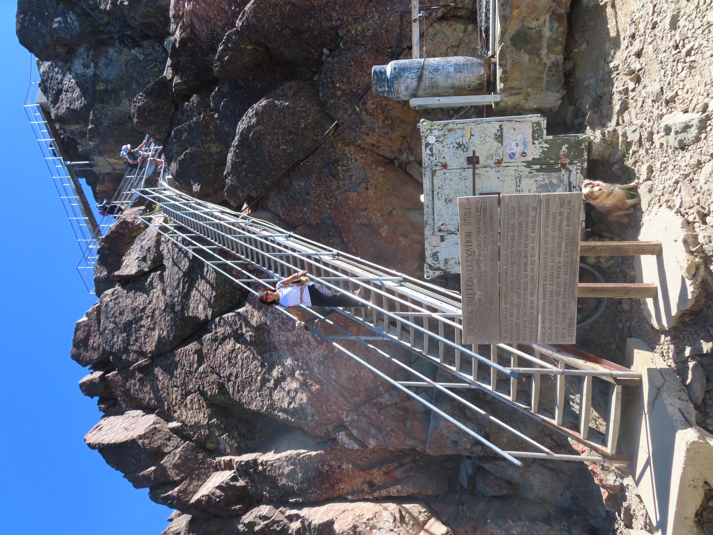
4. Sierra Buttes Trail
Snapshot
Itinerary
From Monarch Road the trail climbs steeply toward the Sierra Buttes Lookout. It gives views over Tamarack, Sardine and Young America Lakes, then finishes with the exposed stairway and lookout structure on the summit rocks.
Why it is essential
The signature northern-Sierra lookout hike — steep, memorable, and visually distinct from the Tahoe Basin routes, with a historic fire-lookout finish and wide views across the Lakes Basin and northern Sierra.
Equipment
- Water, layers and sun protection
- Shoes with good traction for the upper stairs and rock
- Light insulation for the exposed summit
Hazards and notes
- The upper stairs and lookout area are exposed and unsuitable for hikers uncomfortable with heights.
- Lightning, wind and smoke can make the summit unsafe or unrewarding — turn back if cells build.
GPX / KML links
| Source | URL | Format | Reuse status |
|---|---|---|---|
| AllTrails — Sierra Buttes Lookout Trail | alltrails.com | Source map / route page | AllTrails terms; geometry not reused |
| Tahoe National Forest — alerts and notices | fs.usda.gov | Page | Rule / access source |
| OpenStreetMap — search “Sierra Buttes Lookout Trail” | openstreetmap.org | OSM | Cross-check only |
Further reading
- AllTrails — Sierra Buttes Lookout Trail
- Tahoe National Forest — alerts and notices
- Wikipedia — Sierra Buttes
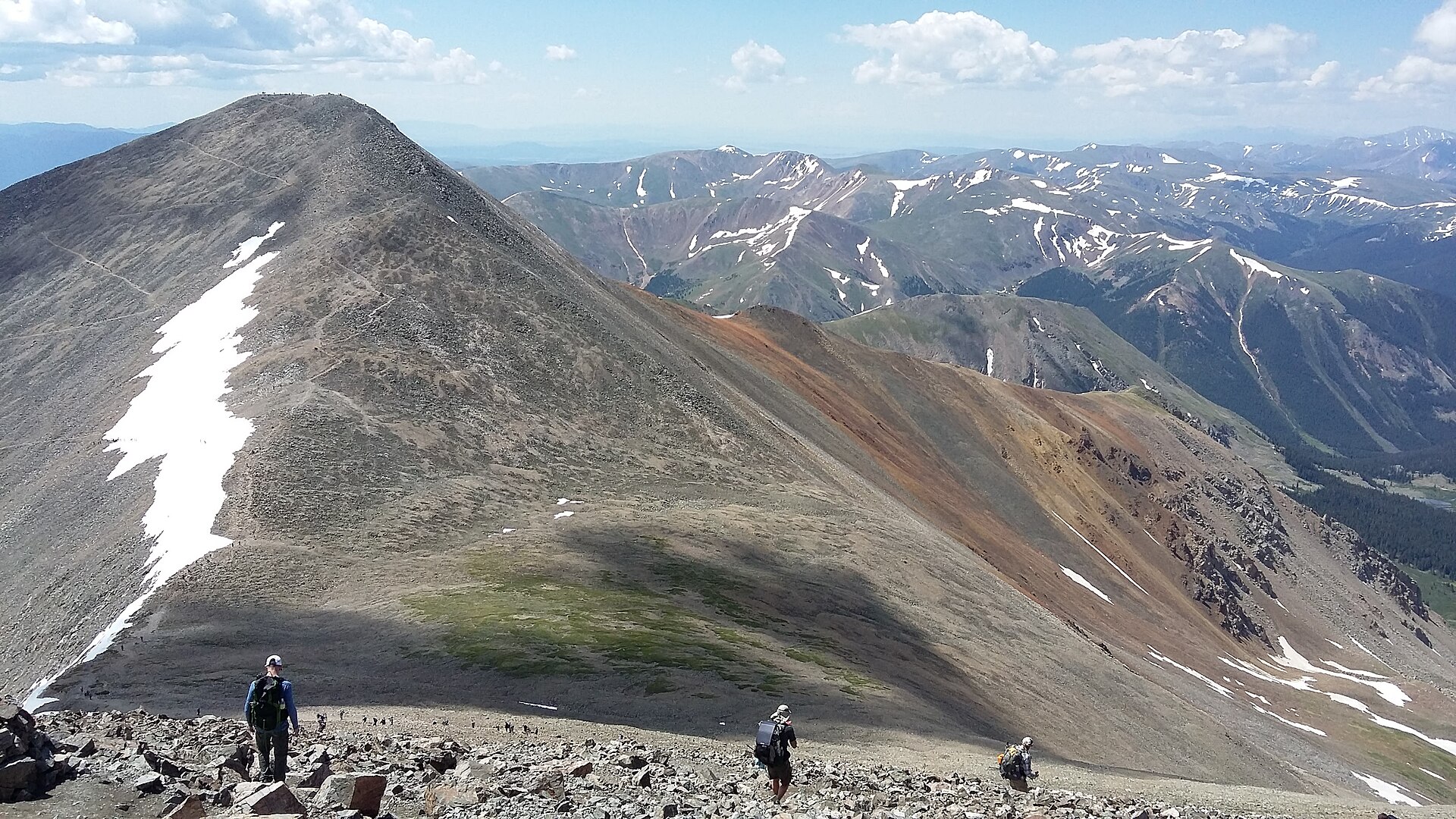
5. Castle Peak Trail
Snapshot
Itinerary
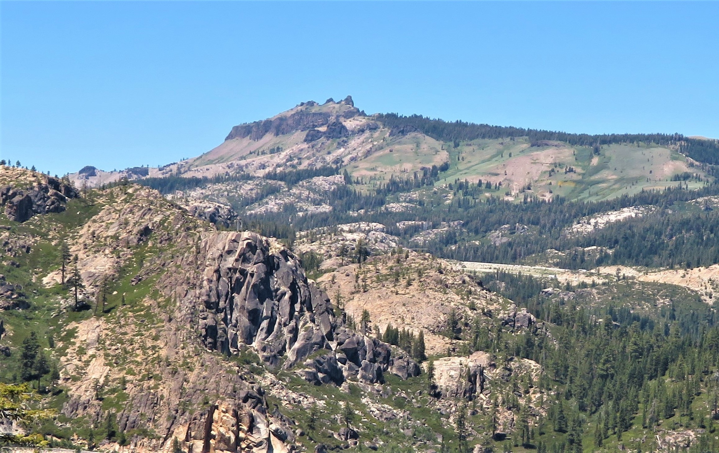
From the Boreal / Castle Valley Road approach the route follows the road and trail toward Castle Pass, where it intersects the Pacific Crest Trail, then climbs the ridge toward Castle Peak. The true summit requires a steep, exposed scramble; hikers who do not want scrambling should stop short of the summit block or use the route as a high viewpoint walk.
Why it is essential
The defining Donner Pass day summit — a prominent volcanic-looking crest beside I-80, linked to the PCT corridor, with a clear progression from forest road to pass, ridge and summit views.
Equipment
- Full mountain day kit
- Map / GPS, layers, water
- Trekking poles for the upper ridge
Hazards and notes
- The final summit block has loose, exposed scrambling — assess before committing.
- In snow or ice this becomes a mountaineering / snowshoe objective requiring avalanche awareness, winter navigation and appropriate equipment.
GPX / KML links
| Source | URL | Format | Reuse status |
|---|---|---|---|
| AllTrails — Castle Peak | alltrails.com | Source map / route page | AllTrails terms; geometry not reused |
| Tahoe National Forest — alerts and notices | fs.usda.gov | Page | Rule / access source |
| OpenStreetMap — search “Castle Peak Donner Pass” | openstreetmap.org | OSM | Cross-check only |
Further reading
- AllTrails — Castle Peak
- Tahoe National Forest — alerts and notices
- Wikipedia — Castle Peak (Nevada County, California)
Missing data / follow-up
- No direct GPX or KML files were downloaded; AllTrails route pages are included as source-map references only.
- OpenStreetMap route relations were not confirmed; OSM links are search and geometry cross-check starting points.
- Echo Chalet water taxi: confirm operating status and current schedule before publication.
Further reading
| Source | URL |
|---|---|
| AllTrails — Mt Tallac Trail | alltrails.com |
| AllTrails — D.L. Bliss to Emerald Bay via Rubicon Trail | alltrails.com |
| AllTrails — Lake Aloha Trail | alltrails.com |
| AllTrails — Sierra Buttes Lookout Trail | alltrails.com |
| AllTrails — Castle Peak | alltrails.com |
| USDA Forest Service — Desolation Wilderness | fs.usda.gov |
| USDA Forest Service — Lake Tahoe Basin recreation | fs.usda.gov |
| California State Parks — D.L. Bliss | parks.ca.gov |
| California State Parks — Emerald Bay | parks.ca.gov |
| Echo Chalet — water taxi | echochalet.com |
| Tahoe National Forest — alerts and notices | fs.usda.gov |
| Wikipedia — Mount Tallac | en.wikipedia.org |
| Wikipedia — Emerald Bay State Park | en.wikipedia.org |
| Wikipedia — Lake Aloha | en.wikipedia.org |
| Wikipedia — Sierra Buttes | en.wikipedia.org |
| Wikipedia — Castle Peak (Nevada County, California) | en.wikipedia.org |
| Wikipedia — Desolation Wilderness | en.wikipedia.org |
| Wikipedia — Donner Pass | en.wikipedia.org |
| OpenStreetMap (ODbL 1.0) | openstreetmap.org |