Regional overview
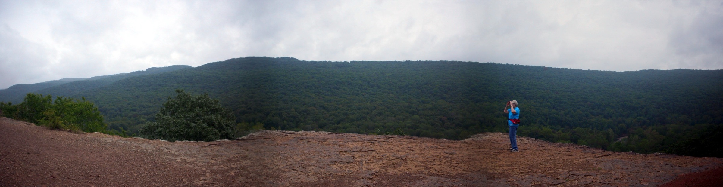
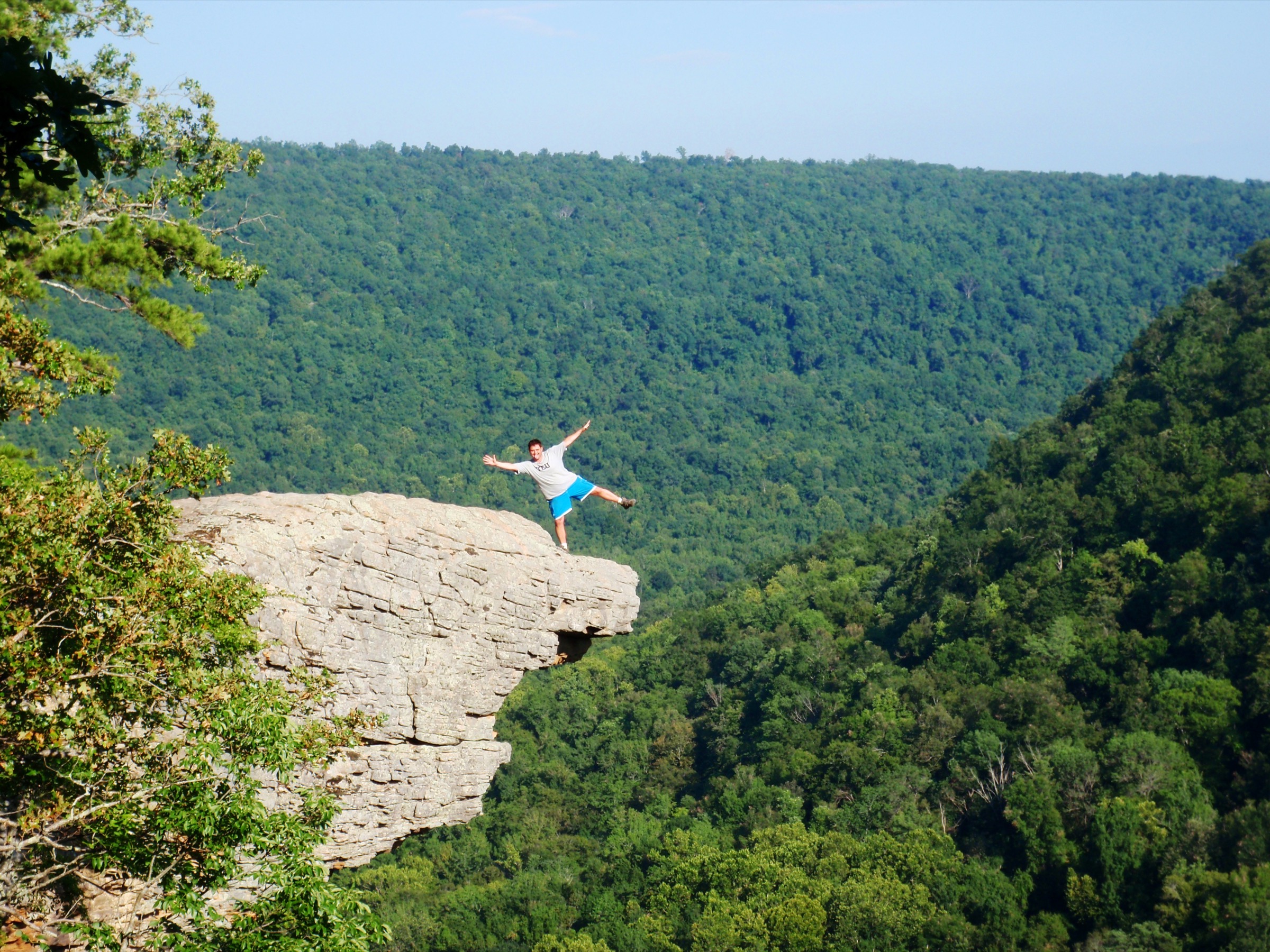
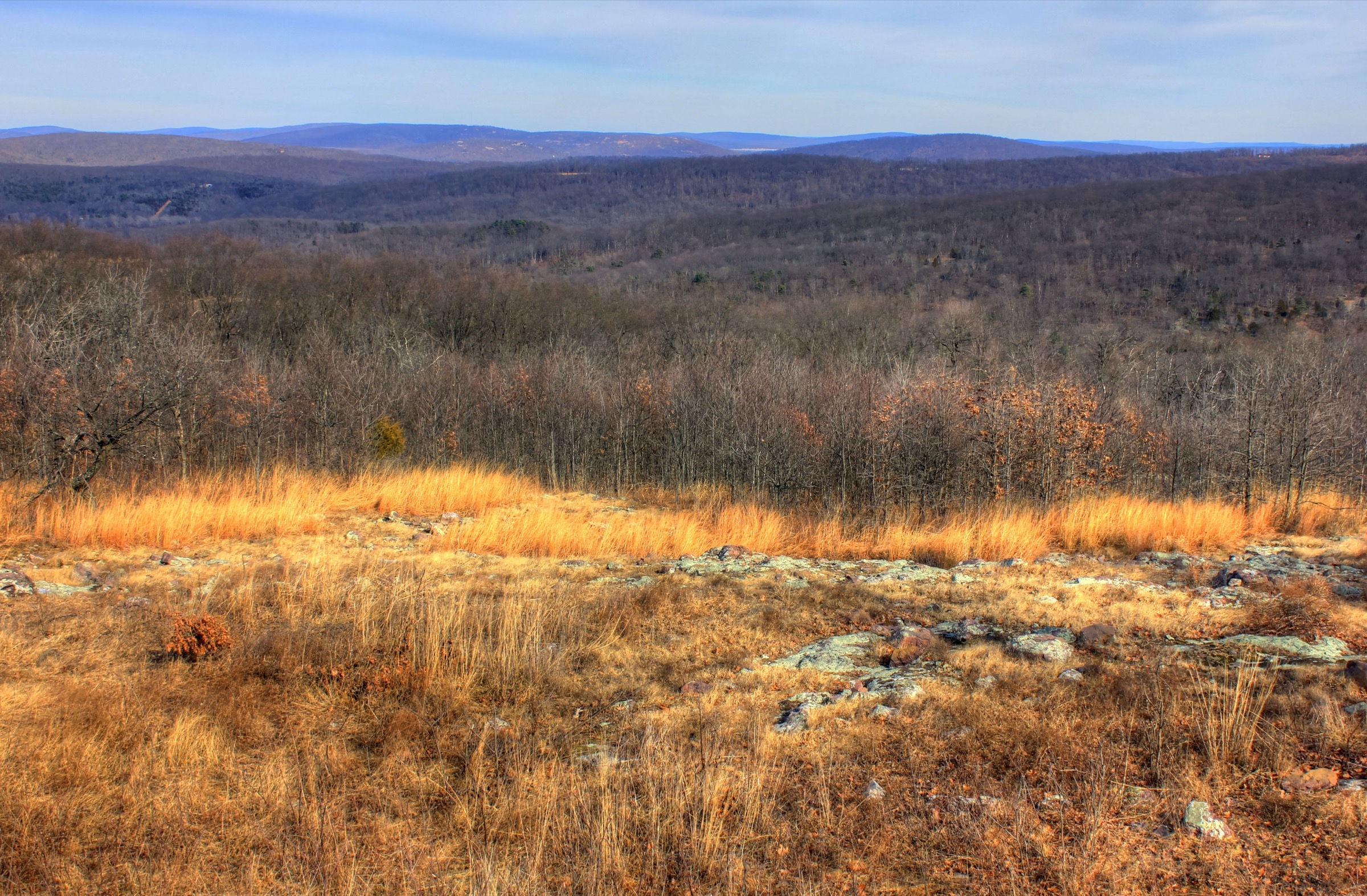
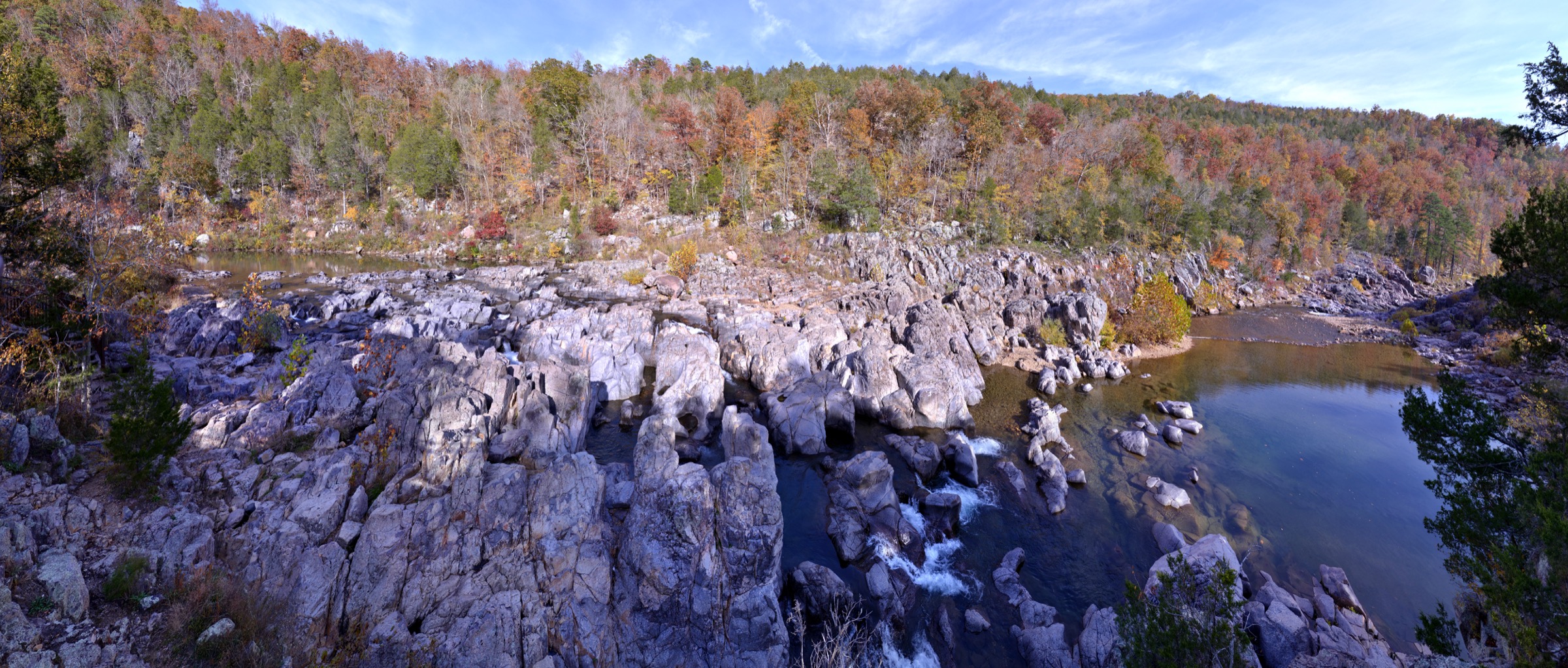
The St Francois Mountains are a compact upland of Precambrian igneous rock in south-east Missouri, rising as a geological island out of the sedimentary Ozark Plateau that surrounds them. The bedrock — rhyolite, granite and porphyry, laid down as a chain of collapsed calderas roughly 1.4 to 1.5 billion years ago — is some of the oldest exposed rock in the central United States, and gives the range a character entirely distinct from the sandstone canyons of the Boston Mountains to the south-west or the layered limestone bluffs along the Buffalo National River in Arkansas. Relief is modest — Taum Sauk Mountain at 540 m (1,772 ft) is the highest natural point in Missouri, and no summit in the range exceeds it by more than a few tens of metres — but the walking is characterised less by summit height than by rocky knobs, open glade-topped balds, columnar-jointed rhyolite, rounded granite tors and the region’s signature “shut-ins,” where rivers cut narrow flumes through resistant volcanic bedrock.
The best-known landforms are clustered within an hour’s drive of one another. Taum Sauk Mountain State Park holds Missouri’s high point and, on the same trail loop, the state’s tallest waterfall at Mina Sauk Falls, which drops roughly 40 m in stages across a wet-season stairway of rhyolite ledges. Johnson’s Shut-Ins State Park, on the East Fork Black River, preserves the classic shut-ins landscape — bedrock potholes, chutes and plunge pools carved into 1.4-billion-year-old rock — alongside the modern Scour Trail, which climbs the 1.5-mile corridor stripped to bedrock by the December 2005 upper Taum Sauk Reservoir breach. Hughes Mountain State Natural Area hosts the Devil’s Honeycomb, a summit plateau of polygonal rhyolite columns comparable in origin (if not scale) to the Giant’s Causeway or Devils Tower. Elephant Rocks State Park, a short granite-tor loop near Graniteville, is small enough to be treated as a regional add-on rather than a full day-hike entry, but it is worth an afternoon on any trip through the range.
Public land in the range is a mosaic of Missouri State Parks (Taum Sauk Mountain, Johnson’s Shut-Ins, Elephant Rocks), the Missouri Department of Conservation (Hughes Mountain Natural Area, Amidon Memorial Conservation Area) and the federal Mark Twain National Forest, whose Bell Mountain Wilderness provides the closest thing the range offers to a full day of wilderness ridge walking. Threading them all is the Ozark Trail, whose Taum Sauk Section runs roughly 56 km (35 mi) end to end and links Taum Sauk Mountain, Devil’s Toll Gate, the interior ridges around Proffit Mountain and Johnson’s Shut-Ins. The Ozark Trail Association maintains and blazes the trail; Missouri State Parks and the US Forest Service manage its trailheads.
Terrain is rugged but not alpine. Trails are rocky, root-laced and slow underfoot, and the Ozark Trail Association explicitly notes that hikers should expect their normal pace to drop by roughly one mile per hour on long sections. Vertical relief on any single climb rarely exceeds 250 m. The walking season runs from March to early December; April and May bring wildflower colour and the strongest waterfall flow, October delivers the cleanest autumn light on the glades, and midsummer is dominated by heat, humidity and afternoon thunderstorms. Ticks (lone star, American dog and blacklegged deer ticks) and chiggers are severe from April through October across the entire region, and copperheads and timber rattlesnakes are both present but rarely aggressive. Winter walking is straightforward on cold dry days, but ice on rhyolite ledges — particularly the Mina Sauk Falls stairway and the Devil’s Honeycomb columns — makes those features genuinely treacherous when wet or frozen.
Access is by private vehicle. The nearest major airport is St Louis Lambert International, roughly two hours’ drive north via Interstate 55 and Missouri Highways 21 or 67. There is no public transport to any trailhead in this catalogue. Missouri State Parks charge no day-use fee, and no permit is required for any of the routes below, but the Johnson’s Shut-Ins swimming area has operated a capacity-limited, reservation-based summer access system in recent years — hikers using the Scour Trail on a summer weekend should check current park advisories before arrival. Taum Sauk Mountain and Johnson’s Shut-Ins both have small campgrounds; primitive camping is permitted in the Bell Mountain Wilderness and along most of the Ozark Trail outside a two-mile buffer of the Johnson’s Shut-Ins day-use area.
See also: Missouri Ozarks · Buffalo National River, Arkansas day-hikes.
Selection rationale
Five day-hikes are presented across the geological and land-management range of the St Francois Mountains: the loop over Missouri’s high point and its tallest waterfall (Mina Sauk Falls Trail), the classic point-to-point ridge day on the Ozark Trail linking the range’s two flagship state parks (Taum Sauk to Johnson’s Shut-Ins), the short but geologically indispensable columnar-rhyolite summit at Devil’s Honeycomb, a full wilderness loop over the range’s most exposed summit glade (Bell Mountain Wilderness Loop), and the walk through the 2005 dam-breach corridor at Johnson’s Shut-Ins Scour Trail. The set is built around landform and land status rather than length: two moderate state-park loops, one strenuous point-to-point, one strenuous wilderness loop, and one short but historically singular scour walk. The mix is deliberately broad because the range’s headline features — high point, waterfall, columnar rhyolite, shut-ins and wilderness — are compact enough that all five entries fit inside a single long weekend.
Elephant Rocks and its short Braille Trail granite-tor loop are noted in the regional overview but excluded from the top five as too short (~1.6 km) for a full day-hike entry. The shorter Shut-Ins Trail into the plunge pools at Johnson’s Shut-Ins is treated as duplicative of the Scour Trail entry — the two loops share a trailhead and are best combined on the same visit — and the Silver Mines / Millstream Gardens corridor on the St Francis River, Amidon Memorial Conservation Area and Buford Mountain are all listed with the excluded routes at the foot of the article.
Summary
| # | Hike | Trailhead | Route type | Distance | Gain | Max elevation | Difficulty |
|---|---|---|---|---|---|---|---|
| 1 | Mina Sauk Falls Trail (with optional Devil’s Toll Gate spur) | Taum Sauk Mountain SP summit parking | Loop | ~4.8 km (7.7 km with spur) | ~130 m (~220 m with spur) | 540 m | Moderate |
| 2 | Ozark Trail — Taum Sauk to Johnson’s Shut-Ins | Taum Sauk Mountain SP → Johnson’s Shut-Ins SP | Point-to-point | ~20–22 km | ~500–600 m | 540 m | Strenuous |
| 3 | Devil’s Honeycomb — Hughes Mountain | Hughes Mountain Natural Area, Route M | Out-and-back with summit loop | ~2.3 km | ~120 m | ~370 m | Easy–moderate |
| 4 | Bell Mountain Wilderness Loop | Highway A trailhead, Mark Twain NF | Loop | ~17–19 km | ~360–520 m | 519 m | Strenuous |
| 5 | Scour Trail — Johnson’s Shut-Ins | Johnson’s Shut-Ins SP day-use pavilion | Loop | ~2.3–3.6 km | ~55 m | ~330 m | Moderate |
1. Mina Sauk Falls Trail
Snapshot
Itinerary
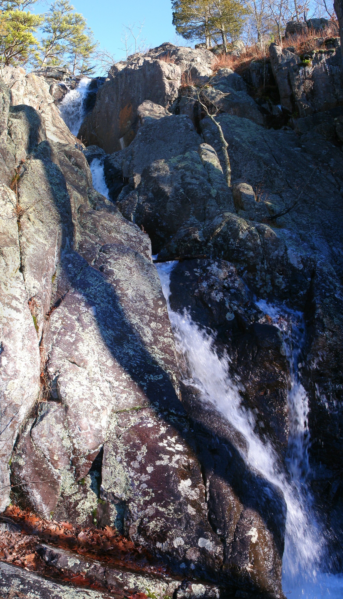
From the parking area at the end of Highway CC a short paved apron climbs a few metres to the state high-point marker at 540 m — the highest natural point in Missouri. Beyond the marker the surfaced trail ends and the Mina Sauk Falls Loop drops through oak-hickory forest across rhyolite bedrock, swinging roughly north-west and then west onto open glade. Stone steps lead down through a run of volcanic ledges to the head of Mina Sauk Falls, where the water breaks over a stairway of rhyolite in a total drop of about 40 m during wet weather. The falls are strongly seasonal and reduce to a trickle or dry out entirely in high summer.
At the base of the falls the loop meets the Ozark Trail — Taum Sauk Section. The standard optional extension turns left (south-west) along the Ozark Trail for roughly 1.6 km down to Devil’s Toll Gate, an eight-foot-wide passage cleft through a 15 m wall of volcanic rhyolite that is one of the range’s most photographed geological features. Returning to the falls, the loop climbs steadily back through sheltered forest and glade to the summit area and finishes on the paved apron.
Why it is essential
Missouri’s high point, the state’s tallest waterfall and one of the St Francois Mountains’ signature volcanic landforms sit on a single moderate outing that never leaves state-park land. No other day route in the range concentrates as many headline features at this level of effort, which is why the Mina Sauk Falls Trail is the single most representative hike in the catalogue.
Equipment
- Sturdy hiking shoes or light boots with grippy soles — rhyolite ledges around the falls are slick when wet
- Trekking poles helpful on the steep steps below the summit
- 1.5–2 L water in cool weather, 2.5–3 L in summer — no potable water on route
- Sun protection for the exposed glades
- Tick protection April through October
- Traction devices (microspikes) if ice is reported around the falls in winter
Hazards and notes
- The upper paved apron is wheelchair-accessible; the loop itself is not.
- The falls are strongly seasonal — plan around recent rainfall if the waterfall is the objective.
- Rock ledges above and below the falls are dangerous when wet or icy.
- No potable water on route.
- Dogs permitted on lead. No permit or fee.
- The park has a small basic campground at the trailhead — first-come, first-served outside the reservation season.
2. Ozark Trail — Taum Sauk to Johnson’s Shut-Ins
Snapshot
Itinerary
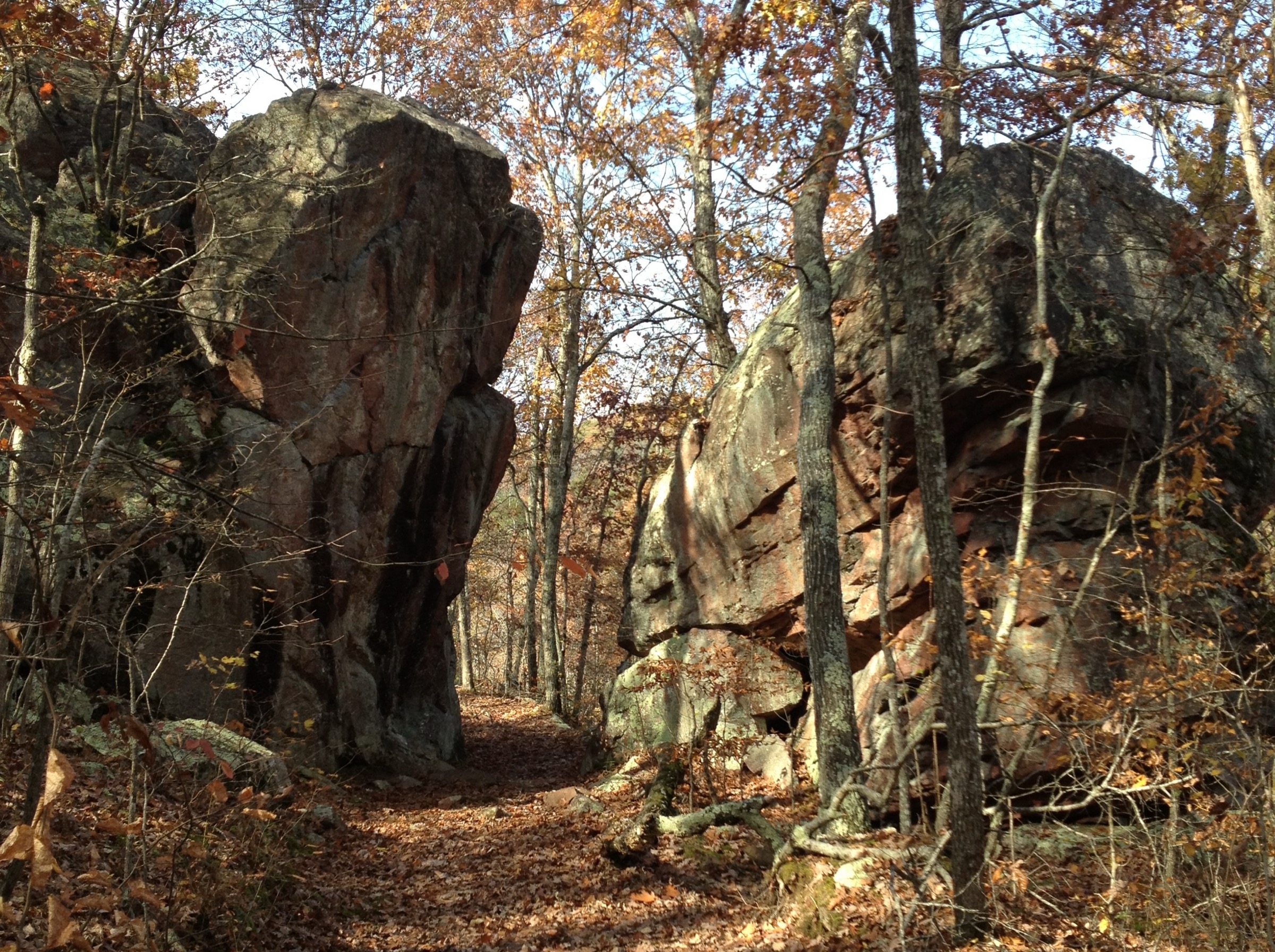
The day begins at the Taum Sauk Mountain summit parking area and descends via the Mina Sauk Falls Loop to the head of the falls. At the base of the falls the route joins the Ozark Trail south-westbound, passes Devil’s Toll Gate at roughly 1.6 km beyond the falls, and continues through oak-hickory forest and rhyolite glades over a succession of low ridges — the country around Wildcat Mountain and south of Proffit Mountain — before dropping into the East Fork Black River drainage. The trail approaches Johnson’s Shut-Ins from the west, meets the park’s own trail network near the Scour Trail viewpoint and finishes at the day-use area or the Highway N trailhead.
Tread is continuously rocky. Blazing is consistent along the Ozark Trail proper, but glade sections rely on cairn navigation, and the Ozark Trail Association explicitly warns that average pace on this section drops by roughly one mile per hour relative to normal walking. Distances published by Missouri State Parks (12.8 mi ≈ 20.6 km) and the Ozark Trail Association (12.5 mi ≈ 20 km) sit at the shorter end; third-party trackers on AllTrails, Gaia GPS and Trailforks report up to 13.9 mi (~22 km) depending on where the route begins and ends inside each park.
Why it is essential
This is the signature Ozark Trail day-section in the St Francois Mountains. It threads Devil’s Toll Gate and Mina Sauk Falls, traverses the range’s most rugged interior country, and links the two flagship state parks in a single push. It is the range’s standard entry on published lists of Missouri’s classic long day-hikes and unrivalled as an introduction to the interior of the Taum Sauk Section.
Equipment
- Sturdy hiking boots with good ankle support
- Trekking poles for the long rocky descent to the East Fork Black River
- 2.5–3 L water — no reliable potable sources on route
- High-energy food for a 7–10 h day
- Navigation backup: paper Ozark Trail Association map and GPS with downloaded track
- Headtorch — slower parties finish in dusk in shoulder seasons
- Tick protection April through October
- Two vehicles pre-positioned for the shuttle, or a shuttle service arranged in advance
Hazards and notes
- Long, rocky and slow — do not underestimate the pace penalty on cairn-marked glade sections.
- Cell coverage is patchy along the route; carry offline maps.
- Water crossings on the East Fork Black River can be impassable after heavy rain.
- Ticks and chiggers are severe from April through October — treat clothing with permethrin and check thoroughly after the walk.
- Copperheads and timber rattlesnakes are present but rarely aggressive.
- Camping is allowed on the Ozark Trail outside a two-mile buffer of the Johnson’s Shut-Ins main parking area; check current rules with Missouri State Parks and the Mark Twain National Forest before overnight plans.
- Dogs permitted on lead.
3. Devil’s Honeycomb — Hughes Mountain
Snapshot
Itinerary
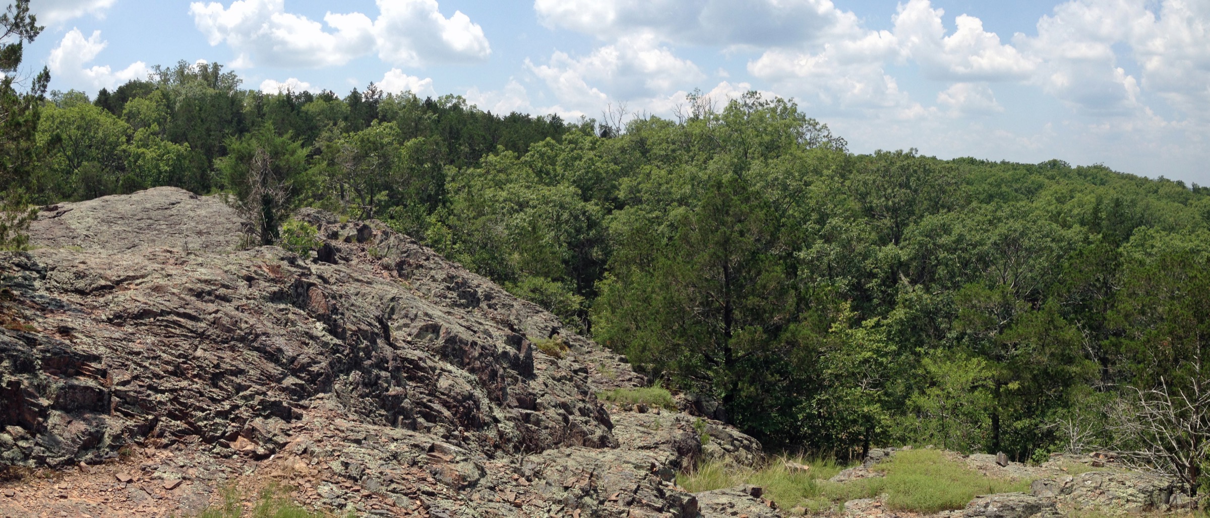
From the small gravel car park on Route M, the trail climbs through oak-hickory-cedar forest on rocky tread, gaining most of its elevation in the first 800 m before emerging onto a broad summit glade of Precambrian rhyolite at roughly 370 m. The summit glade forms the Devil’s Honeycomb: a plateau of columnar-jointed volcanic rock in polygonal columns four to six sides across, up to about a metre tall, formed as the rhyolite cooled and contracted roughly 1.485 billion years ago. The columnar jointing is comparable in origin — if not in scale — to Devils Tower in Wyoming and the Giant’s Causeway on the Antrim coast. A short summit circuit takes in the westward views across Washington County toward the wider St Francois Mountains; return is by the same trail.
Why it is essential
The Devil’s Honeycomb is one of Missouri’s signature geological features and among the oldest exposed rock surfaces anywhere in the interior United States. The route is short, but the summit glade is geologically indispensable to any serious St Francois Mountains itinerary and is the range’s clearest illustration of its Precambrian volcanic origin.
Equipment
- Sturdy hiking shoes with good grip — the summit rhyolite is uneven and slick when wet or icy
- 1 L water
- Sun protection on the exposed summit
- Tick protection April through October
- Traction devices if ice is present on the columnar summit in winter
Hazards and notes
- Icy rhyolite in winter is a genuine slip hazard on the columnar summit — the polygonal cracks concentrate meltwater and refreeze quickly.
- The area is a designated Missouri State Natural Area under Missouri Department of Conservation management: stay on rock rather than vegetation on the glades, no camping, no collecting.
- Dogs on lead. No fees or permits.
- The trailhead has no facilities beyond a small gravel car park; there is no potable water on route.
4. Bell Mountain Wilderness Loop
Snapshot
Itinerary
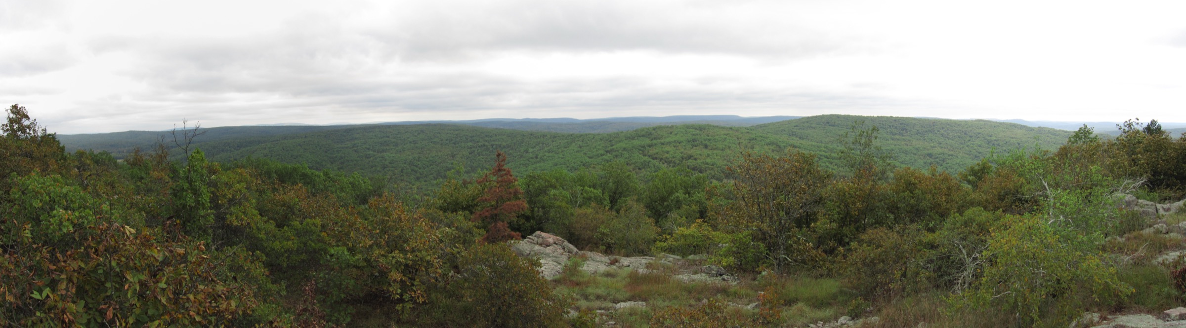
From the Highway A south trailhead the Bell Mountain Trail climbs steadily through mixed oak-pine-hickory forest and open rhyolite glades toward the ridge crest. Roughly 4–5 km in, a short spur leads to the summit of Bell Mountain at 519 m, a large open rhyolite glade with long eastward views to Lindsey Mountain (506 m) across the wilderness interior. The route then descends the north-west flank into the Joes Creek drainage, where the Bell Mountain Trail meets the Ozark Trail Middle Fork Section. The loop closes by following the Ozark Trail southbound along Shut-in Creek and back over the ridge to the trailhead.
Blazing is intentionally minimal — the Bell Mountain Wilderness was designated by Congress in 1980 under a “primitive character” mandate — and glade sections rely on cairn navigation. Distances published by the US Forest Service report roughly 11.9 mi (~19 km) of trail across the wilderness; a shorter 10.6 mi (~17 km) variant is possible from the north trailhead.
Why it is essential
Bell Mountain provides the largest wilderness experience in the St Francois range and the closest thing Missouri offers to a full-day wilderness ridge loop. The summit glade is one of the finest viewpoints in the range, and the fact that the route is minimally blazed keeps traffic manageable even on autumn weekends.
Equipment
- Sturdy hiking boots with good ankle support
- Trekking poles for the long rocky descent and re-ascent
- 2.5–3 L water — no reliable potable sources on route in dry summers
- High-energy food for a 5–7 h day
- Navigation backup: paper map (USFS Bell Mountain Wilderness map, available in Avenza format) and GPS with a downloaded track
- Headtorch
- Tick protection April through October
- Basic first-aid kit including snakebite guidance
Hazards and notes
- Sparse blazing is a deliberate wilderness feature — carry paper map and GPS, and treat cairn navigation across the glades as required rather than optional.
- Water in Joes Creek and Shut-in Creek is not reliable in dry summers.
- Ticks and chiggers are severe from May through September.
- Copperheads and timber rattlesnakes are present.
- Standard US Forest Service wilderness rules apply: no mechanised transport, no bicycles, no groups over ten people.
- Camping is permitted; primitive-only, no fixed sites.
- Fire restrictions vary seasonally — confirm with the Potosi-Fredericktown Ranger District of Mark Twain National Forest before setting one.
5. Scour Trail — Johnson’s Shut-Ins
Snapshot
Itinerary
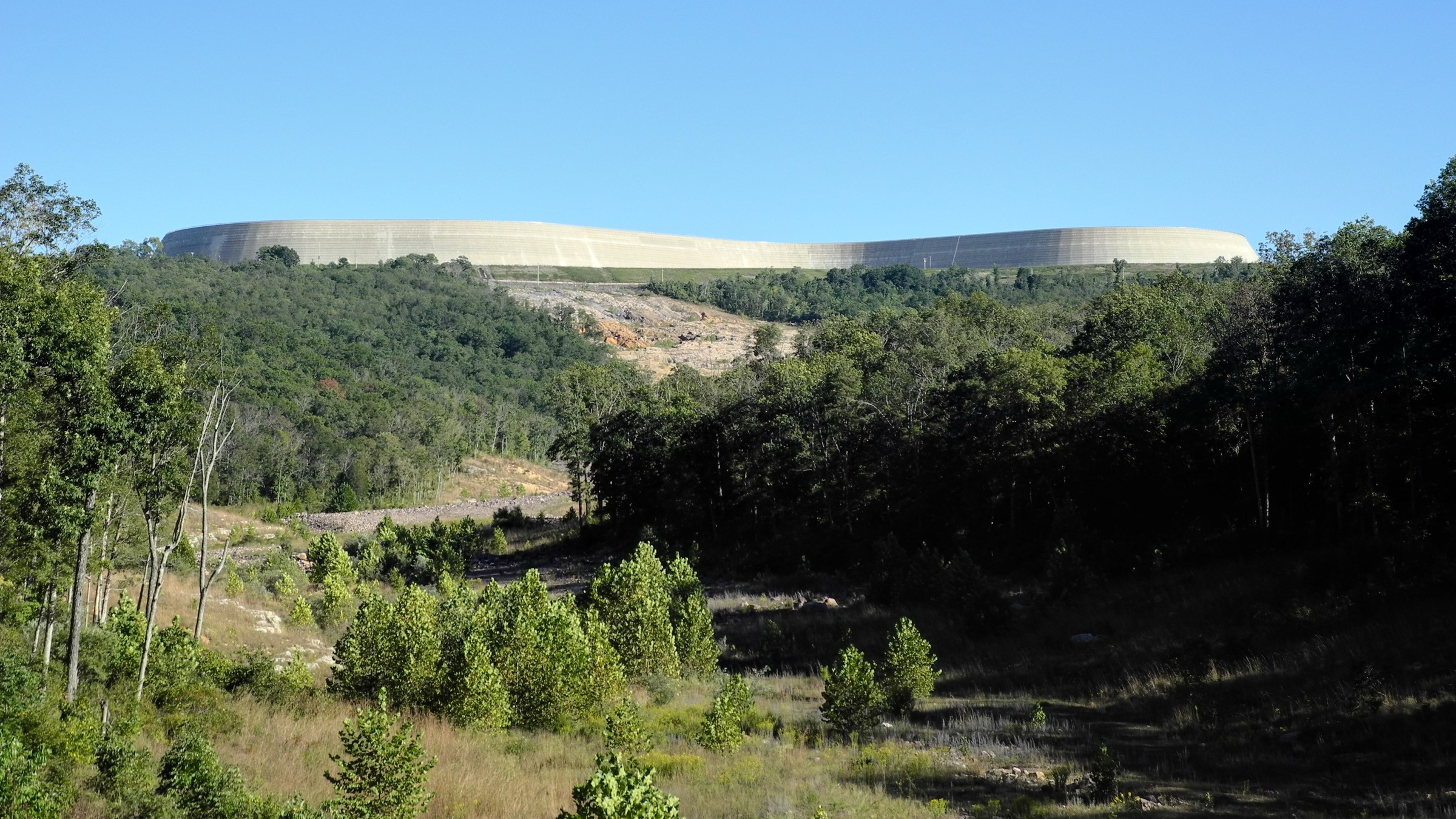
The Scour Trail follows the path of the 14 December 2005 upper Taum Sauk Reservoir breach, when roughly 1.3 billion gallons of water descended the flank of Proffit Mountain in twelve minutes, stripping a 1.5-mile corridor of trees and soil to bedrock and reworking the East Fork Black River channel. From the interpretive pavilion at the day-use area, the trail climbs the scour channel across exposed Precambrian rhyolite, boulder fields and glacial-scale erosion features toward an upper overlook that looks up the flank of Proffit Mountain to the reservoir site, then loops back through a forested corridor to the pavilion. Interpretive panels along the route explain the geology, hydrology and dam-failure sequence in detail.
Water crossings and slick rock are the main technical elements. The exposed scour surface is highly reflective; sun exposure is intense in midsummer. Missouri State Parks routing gives the loop as roughly 1.5 mi (~2.4 km); AllTrails and other third-party trackers report up to 2.0 mi (~3.2 km) or 2.25 mi (~3.6 km) depending on where the loop is closed.
Why it is essential
The Scour Trail is unlike any other walk in North America: a legally accessible route through a catastrophic modern dam-breach flood zone that, in stripping the corridor to bedrock, laid bare a natural cross-section of some of the oldest rock on the continent. It is essential context for anything else in the range, and the natural add-on to the classic Shut-Ins Trail into the plunge pools that gave the park its name.
Equipment
- Sturdy hiking shoes with good grip — algae-slick rhyolite is a serious slip hazard
- Water shoes if wading the East Fork Black River is part of the plan
- 1–1.5 L water
- Sun protection — the scour surface is highly reflective
- Tick protection April through October
Hazards and notes
- Slippery rhyolite is the principal hazard, particularly when wet or algae-covered.
- The trail may be closed after heavy rain due to flood risk in the scour channel.
- The park’s shut-ins swimming area has operated a timed-entry, capacity-managed access system in recent summers — check current park advisories before a summer visit.
- Dogs on lead. No permit or fee for the trail itself.
- The trailhead area is busy on summer weekends — arrive early.
Routes excluded as out of scope
The following sit inside or immediately adjacent to the St Francois Mountains but fall outside a day-hike entry, are editorially duplicative of the five above, or are better treated as short add-ons than as standalone routes.
- Elephant Rocks State Park — Braille Trail. The 1.6 km granite-tor loop near Graniteville is one of the range’s signature geological experiences and mentioned in the regional overview, but is too short and too self-contained to justify a top-five day-hike entry.
- Shut-Ins Trail (Johnson’s Shut-Ins). The shorter loop from the day-use area into the plunge pools that give the park its name is the natural companion to the Scour Trail entry and is best walked on the same visit rather than as a separate day.
- Silver Mines and Millstream Gardens (St Francis River). A pair of shorter walks along the St Francis River corridor south of Fredericktown; whitewater country in high spring, better as a half-day add-on than a standalone entry.
- Amidon Memorial Conservation Area. A short loop through the pink-granite shut-ins of the Castor River, managed by the Missouri Department of Conservation. Beautiful, but shorter in character than any of the five entries above.
- Buford Mountain State Forest. A rugged loop over one of the range’s higher summits — a strong secondary objective, but the trail is intermittently maintained and the loop is more suited to a shoulder-season overnight than a reliably signposted day-hike.
- Ozark Trail Middle Fork and Karkaghne Sections. Excellent long walks north-west and south of Bell Mountain, but with no logical single-day loop from a paved road head accessible in this catalogue.
Further reading
| Source | URL |
|---|---|
| Missouri State Parks — Taum Sauk Mountain State Park | mostateparks.com |
| Missouri State Parks — Taum Sauk Mountain general information | mostateparks.com |
| Missouri State Parks — Johnson’s Shut-Ins State Park trails | mostateparks.com |
| Missouri State Parks — Elephant Rocks State Park | mostateparks.com |
| Missouri Department of Conservation — Hughes Mountain Natural Area | mdc.mo.gov |
| USDA Forest Service — Mark Twain National Forest, Bell Mountain Wilderness | fs.usda.gov |
| USDA Forest Service — Ozark Trail Taum Sauk Section | fs.usda.gov |
| Ozark Trail Association | ozarktrail.com |
| Ozark Trail Association — Taum Sauk Section | ozarktrail.com |
| Wilderness.net — Bell Mountain Wilderness | wilderness.net |
| Wikipedia — Taum Sauk Mountain | en.wikipedia.org |
| Wikipedia — Hughes Mountain | en.wikipedia.org |
| Wikipedia — Bell Mountain Wilderness | en.wikipedia.org |
| Wikipedia — Johnson’s Shut-Ins State Park | en.wikipedia.org |
| Wikipedia — Elephant Rocks State Park | en.wikipedia.org |
| Wikimedia Commons — Taum Sauk Mountain State Park | commons.wikimedia.org |
| OpenStreetMap (ODbL 1.0) | openstreetmap.org |