Regional overview
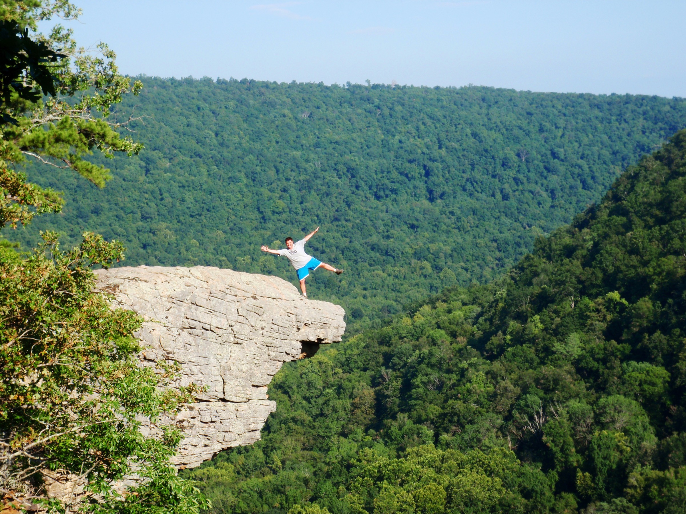
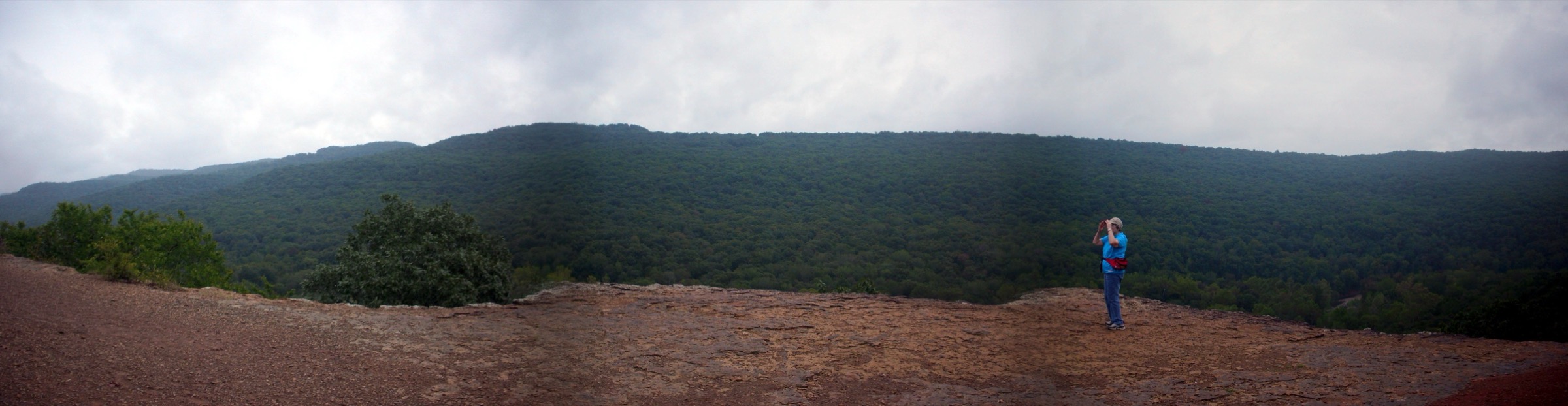
The Boston Mountains form the highest and most deeply dissected part of the Ozark Plateau, a broad canvas of Pennsylvanian sandstone and shale extending roughly 30–55 km wide and about 320 km long across north-central Arkansas and a narrow strip of eastern Oklahoma. Summits reach a little over 780 m — Wahzhazhe Summit, the former Buffalo Lookout at 781 m, is the highest point anywhere in the Ozarks — while the valleys below run 150–470 m lower. The bedrock is dominated by the Atoka Formation, a resistant Pennsylvanian sandstone that weathers into the range’s signature landforms: sheer bluff-lined rims, mushroom-shaped hoodoo columns, natural arches, “glory-hole” waterfalls where creeks drop through the roof of an overhang, and sheltered box canyons known locally as hollows. The result is dendritic canyon country hidden beneath a nearly continuous oak-hickory forest, easy to miss from a road and unmistakable from a rim.
The main hiking centres cluster along the western and central Boston Mountains within the Ozark–St. Francis National Forest, split administratively between the Boston Mountain, Pleasant Hill and Big Piney ranger districts, and at Devil’s Den State Park west of Fayetteville. Devil’s Den is one of the most complete surviving landscapes of the Civilian Conservation Corps anywhere in the American South: Company 797 built its stone cabins, arched dam, rim overlooks and pavilion between 1933 and 1942, and the park’s trails still trace the network they laid out. The Ozark Highlands Trail (OHT), a 260–290 km long-distance route managed by the Ozark Highlands Trail Association, runs the length of the range from Lake Fort Smith east to the Buffalo River area and is the region’s signature backpacking corridor. The Shores Lake to White Rock loop covered in this entry is its most-walked day section.
Access is straightforward from Fayetteville in the north-west or Ozark on the Arkansas River in the south: paved state highways lead within a few kilometres of every trailhead here, and the final sections of gravel Forest Service road are normally passable in a passenger car outside heavy rain and winter ice. The exceptions are the upper approach to White Rock Mountain, where a historic CCC-built rim road typically opens May to October, and the unpaved Forest Service tracks to Alum Cove and Glory Hole, which can rut badly after storms. Current road status is worth confirming with the relevant ranger district before travel.
The typical hiking season is October to May. Autumn from mid-October to mid-November delivers vivid hardwood colour across the whole range; winter offers leaf-off long views and the strongest waterfall flow; spring brings wildflowers, brimming falls at Kings Bluff and Glory Hole, and the year’s first tick pressure. Midsummer is hot and humid, the understory closes in, biting insects are intense, and the smaller waterfalls drop to a trickle. The principal hazards are unfenced sandstone rim edges — fatal falls have occurred at Pedestal Rocks, Whitaker Point and Yellow Rock — together with ticks and chiggers from April through October, venomous snakes (timber rattlesnake and copperhead), slick sandstone after rain, a growing but rarely encountered black bear population, and flash-flood risk in the narrow hollows during storms. Cell coverage is patchy across the ranger districts.
This entry covers the Boston Mountains uplands of the Ozark National Forest and Devil’s Den State Park. It deliberately excludes routes inside the Buffalo National River corridor and the Upper Buffalo Wilderness — Whitaker Point (Hawksbill Crag), Lost Valley, Hemmed-in Hollow, Indian Rockhouse and the Goat Trail at Big Bluff — which sit in a distinct protected-area system and belong in a separate Buffalo National River article.
Selection rationale
Five day-hikes are presented across the geological and cultural range of the Boston Mountains, chosen to avoid duplicating the Buffalo River corridor: two combined bluff-and-waterfall loops from the same trailhead (Pedestal Rocks & Kings Bluff), a short but iconic hollow waterfall (Glory Hole Falls), a CCC-heritage rim trail (Yellow Rock at Devil’s Den), the range’s classic long day-loop on the Ozark Highlands Trail (Shores Lake — White Rock Mountain), and a family-friendly natural arch (Alum Cove). The set is built around landform rather than length: hoodoo columns and a rim-plunge waterfall on the first entry, a roof-of-a-cave waterfall on the second, a sandstone rim viewpoint on the third, a sustained OHT ridge day on the fourth, and one of the largest natural arches in the southeastern United States on the fifth. The mix gives a working catalogue that does not require all five days to be sustained efforts and preserves the CCC heritage layer that is unique to Devil’s Den.
Sam’s Throne, the sandstone amphitheatre north of Mount Judea, is excluded because it is a climbing venue rather than a hiking destination. The Butterfield Trail at Devil’s Den is excluded as duplicative of the Yellow Rock rim experience for a day-walking party. Routes inside the Buffalo National River corridor — Whitaker Point (Hawksbill Crag), Lost Valley, Hemmed-in Hollow, Indian Rockhouse and the Goat Trail — belong in a separate entry.
Summary
| # | Hike | Trailhead | Route type | Distance | Gain | Max elevation | Difficulty |
|---|---|---|---|---|---|---|---|
| 1 | Pedestal Rocks & Kings Bluff combined loop | Pedestal Rocks Scenic Area, AR-16 | Two connected loops | ~6.4 km | ~160 m | ~640 m | Easy–moderate |
| 2 | Glory Hole Falls | AR-16/AR-21 pull-off north of Fallsville | Out-and-back | ~3.2 km | ~120 m | ~640 m | Easy–moderate |
| 3 | Yellow Rock Trail (Devil’s Den SP) | Campground A, Devil’s Den State Park | Lollipop loop | ~4.2–5.0 km | ~120 m | ~490 m | Moderate |
| 4 | Shores Lake — White Rock Mountain OHT loop | Shores Lake Recreation Area | Loop | ~20.9–23.2 km | ~700 m | ~698 m | Strenuous |
| 5 | Alum Cove Natural Bridge Trail | Alum Cove Recreation Area | Loop | ~1.9 km | ~80 m | ~490 m | Easy |
1. Pedestal Rocks & Kings Bluff combined loop
Snapshot
Itinerary
The two loops leave from opposite ends of the shared parking area on the south side of AR-16, roughly 10 km east of Pelsor. Signage directs walkers to either the Pedestal Rocks loop (east) or the Kings Bluff loop (west); combining them makes a natural three-hour circuit.
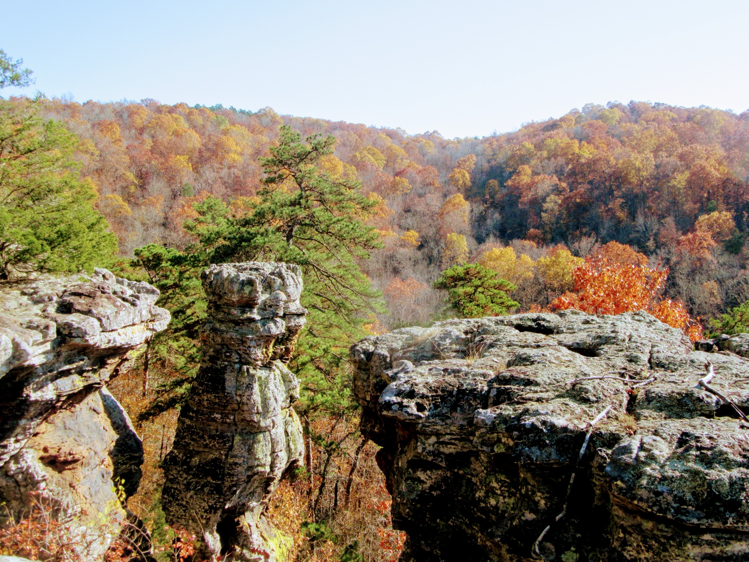
The Pedestal Rocks loop drops gently through oak-hickory forest for roughly 800 m before reaching the rim of a long sandstone bluff. From here the trail follows the rim eastward, with short spurs leading to a series of mushroom-shaped freestanding pedestal columns, small caves, natural windows and needle-eye passages carved into the bluff line. The formations are the product of differential weathering of the Pennsylvanian sandstone — softer strata below cut back faster than the resistant caprock — and they include some of the most concentrated hoodoo topography anywhere in the Ozarks. Multiple viewpoints look out over the Illinois Bayou and the Big Piney valley. The trail returns through upland forest.
The Kings Bluff loop follows a similar pattern: a gentle descent to the rim, then a rim traverse to the head of a horseshoe amphitheatre where Kings Bluff Falls plunges an estimated 34–35 m (114 ft) — one of the tallest single-drop waterfalls in the Ozarks. A short spur leads to the falls overlook. The loop closes through the upper woodland back to the shared trailhead.
There are no guardrails at most of the rim viewpoints and the bluff drops are of the order of 30 m or more.
Why it is essential
The Pedestal Rocks Scenic Area contains the most concentrated set of freestanding sandstone hoodoo columns in Arkansas — a formation type essentially absent from the Buffalo River corridor and rare elsewhere in the Ozarks. Kings Bluff Falls is one of the tallest single-drop waterfalls in the range. Combining the two loops delivers the two archetypal Boston Mountains landforms, hoodoo and rim-plunge waterfall, in a single moderate day.
Equipment
- Sturdy trail shoes or light boots
- Weatherproof outer layer and a warm mid-layer
- 1.5–2 L water and food
- Offline map or GPS
- Sun protection
- Tick and chigger repellent from April to October
- Microspikes in occasional January or February ice storms
- Headtorch if aiming for a winter sunset visit
Hazards and notes
- Unfenced sandstone rim edges are the primary hazard; fatal falls have been recorded in the Scenic Area.
- Wet or icy sandstone is slick; keep well back from the edge in rain or after ice.
- Keep dogs on a short leash near the rim.
- Waterfall flow is unreliable outside winter and spring.
- Day-use only; no permit or fee. Vault toilet and picnic sites at the trailhead.
- Timber rattlesnakes and copperheads are present April to October.
2. Glory Hole Falls
Snapshot
Itinerary
The trail leaves the unmarked highway pull-off on the west side of AR-16/AR-21 along an old logging road that descends steadily through mixed hardwood forest. After about 800 m the track drops more steeply, following the drainage. The route crosses the small creek that feeds Glory Hole and reaches the top of a low bluff line, where the stream disappears through a roughly 2.5 m circular hole worn through the sandstone overhang and drops into a bowl-shaped alcove below.
A short scramble leads to the base of the falls, where hikers can stand behind and beneath the plunge and look up through the “glory hole” to the sky. The trail is retraced to the trailhead; the entire return climb is uphill.
Why it is essential
Glory Hole Falls is arguably the most photographed waterfall in the Boston Mountains and one of the most geomorphically unusual in eastern North America. The feature — a perennial stream that has cut a circular vertical shaft through the roof of a sandstone bluff overhang — is the archetypal Boston Mountains “roof-of-a-cave” waterfall and is short enough to combine with any of the other hikes in this entry as a half-day.
Equipment
- Sturdy trail shoes or light boots
- Weatherproof outer layer
- 1–1.5 L water and food
- Tick repellent April to October
- Waterproof footwear after rain for the creek crossing
- Microspikes if visiting after a winter ice storm; the alcove holds ice
Hazards and notes
- The descent to the base of the falls involves scrambling on slick sandstone; injuries are recorded here each year.
- The trailhead is unmarked and parking is limited to a handful of cars on the highway shoulder.
- Flash-flood risk in the drainage during and immediately after storms.
- Day-use only; no permit, fee or facilities at the trailhead.
- Ticks and copperheads present in warm months.
3. Yellow Rock Trail, Devil’s Den State Park
Snapshot
Itinerary
From the Campground A trailhead the route climbs immediately through mature oak-hickory-pine forest, gaining most of its elevation in the first kilometre on a well-graded but rocky path. At the top of the climb the trail reaches the western edge of a sandstone bluff and turns to follow the rim eastward.
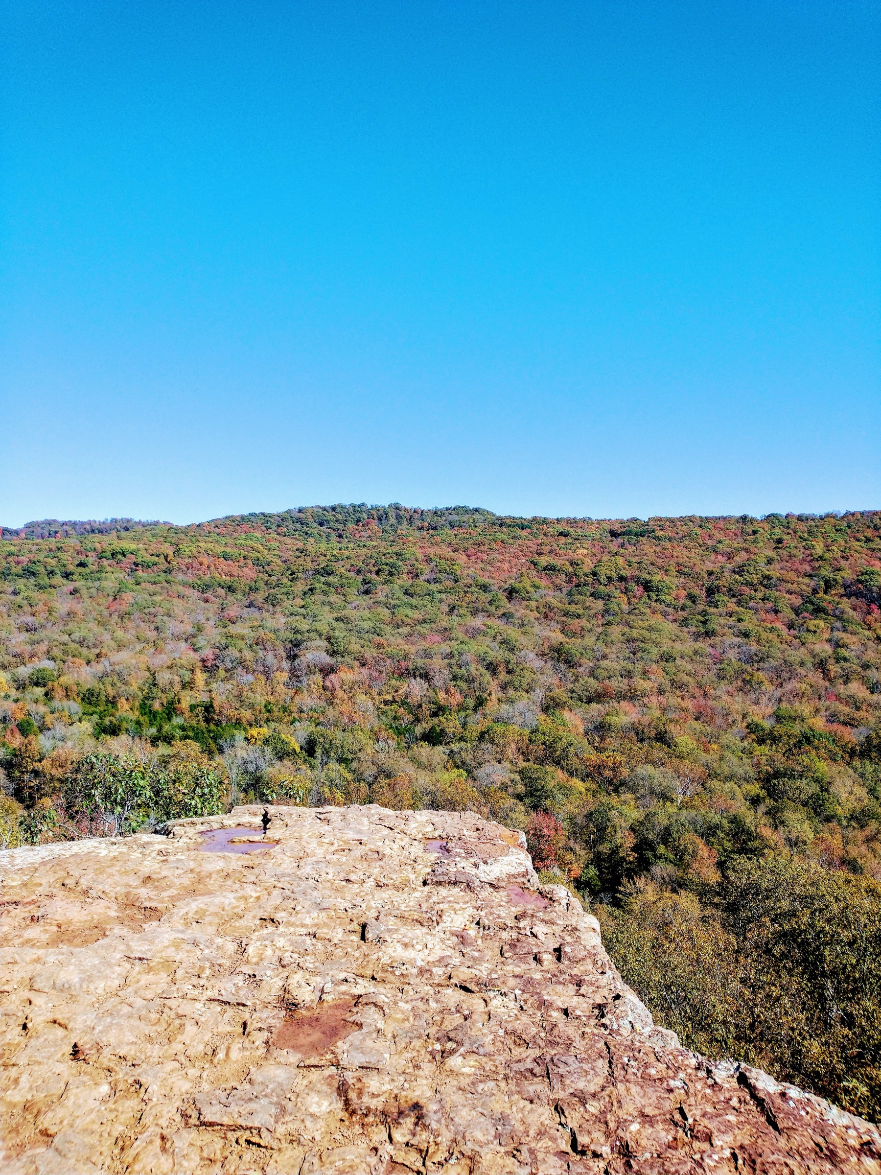
Yellow Rock itself, the trail’s namesake, is a large sandstone slab perched roughly 90 m above the Lee Creek valley. From the flat rock the view opens west across the CCC-era park infrastructure, the Lee Creek dam and the wooded ridges of the western Boston Mountains. The main loop continues to the CCC overlook, a stone-built viewing point constructed by Company 797 of the Civilian Conservation Corps in the mid-1930s.
The loop closes by descending through the upper forest on a slightly gentler grade and returning to the campground. Combining both rim spurs adds roughly 800 m.
Why it is essential
Devil’s Den is one of the most complete surviving Civilian Conservation Corps landscapes in the United States, with 1930s cabins, stone bridges, dam and pavilion still in daily park use. Yellow Rock is both the park’s signature scenic viewpoint and one of the first structures the CCC built here in 1933. The trail combines the classic Boston Mountains bluff-rim experience with a heritage layer that no route in the Ozark National Forest can match.
Equipment
- Sturdy trail shoes or light boots
- Weatherproof outer layer and a warm mid-layer
- 1.5 L water and food
- Sun protection
- Tick and chigger repellent from April to October
- Headtorch for late-autumn afternoons; sunset falls before 17:30
- Microspikes for occasional January ice
Hazards and notes
- Yellow Rock itself and several rim points are unfenced; falls from the bluff have been fatal.
- Slick sandstone in wet weather.
- Arkansas state park rules apply — dogs allowed on a hand-held leash, no gathering plants or removal of natural material.
- Standard state park day-use is free, but overnight backpacking on the connecting Butterfield Trail requires a permit from the visitor centre.
- Trails may close after heavy rain; check current park status.
- Timber rattlesnakes and copperheads present in warm months.
4. Shores Lake — White Rock Mountain OHT loop
Snapshot
Itinerary
The loop is normally walked clockwise from Shores Lake. The trail leaves the day-use parking, crosses the outlet dam and follows the north shore for roughly 800 m before turning north up Hurricane Creek. For the next 6–7 km the route climbs steadily along the well-watered west drainage, crossing the creek repeatedly and passing several small cascades and slide waterfalls. This section coincides with the Ozark Highlands Trail west of White Rock Mountain and is generally shaded and reliably flowing.
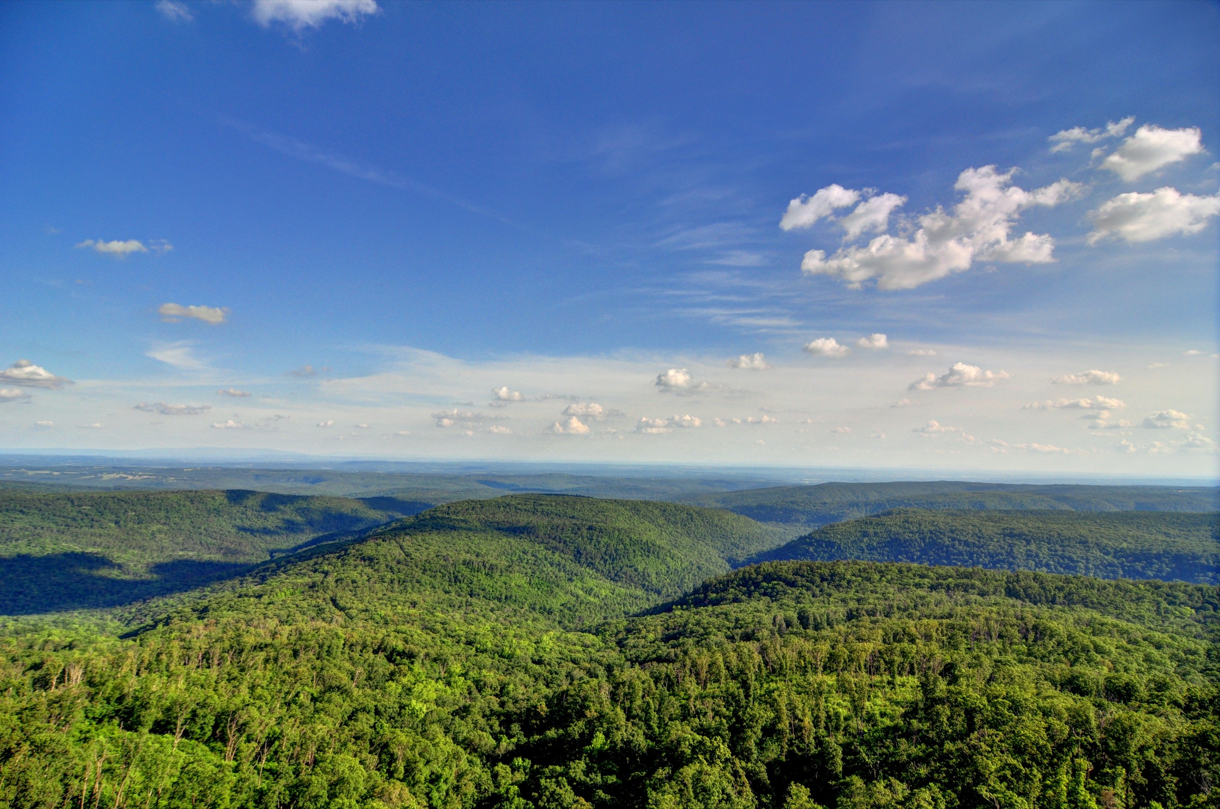
At the head of Hurricane Creek the trail joins the White Rock spur and climbs the last ~150 m to the summit plateau of White Rock Mountain. The plateau rim is ringed by lichen-whitened sandstone bluffs, and four stone shelters — Sunset, West, North and South — built by the Civilian Conservation Corps in the 1930s sit around the edge. The Rim Trail loop around the summit (~3 km) can be added for panoramic Boston Mountains views; the Sunset Shelter is the classic viewpoint. The historic CCC-built rim road to the summit typically opens May to October and is worth verifying seasonally with the Boston Mountain Ranger District.
The descent follows the east side of the loop back to Shores Lake through a drier ridge and drainage system. Water is scarce on this side outside spring. The final section descends steeply to the lake and closes the circuit.
Source distances vary by 15–20 % for this loop — from 12.2 mi through 14.4 mi to the 17.5 mi two-loop network on the White Rock Mountain Recreation Area’s own map — so the range in the snapshot above should be read as a planning window rather than a single verified figure.
Why it is essential
The Ozark Highlands Trail is the signature long-distance route of the region, and the Shores Lake — White Rock loop is the most-walked day-loop section of the OHT within the Boston Mountains. The route delivers the range’s largest sustained ascent, its highest fully accessible summit outside the Buffalo watershed, a rim of CCC-era stone shelters and a spectrum of Boston Mountains landscape types — hollow drainage, hardwood ridge, sandstone rim — in a single continuous walk.
Equipment
- Mountain hiking boots with edging support
- Trekking poles for the sustained descent
- Weatherproof outer layer, insulated mid-layer, hat and gloves
- 2.5–3.5 L water or a filter
- Food, offline map and GPS
- Headtorch for short winter days
- Sun protection
- Tick and chigger protection April to October
- Extra bottles or a filter for the dry east side outside spring
- Microspikes after winter ice events
- Whistle
- Tent, or a reservation at a White Rock cabin, for overnight variants
Hazards and notes
- Rocky, ankle-turning footing on parts of both loops.
- The east side is largely waterless — plan carefully.
- Rim edges at White Rock Mountain are unfenced, with drops of 30 m or more; keep well back in wet or icy conditions.
- Creek crossings can become impassable after heavy rain.
- Signage on the OHT is intermittent (white blazes); route-finding attention is needed at the White Rock spur and east loop junctions.
- Bears are present but rarely seen; standard bear-country food storage is prudent for overnight use.
- No permit required for day use; White Rock Mountain cabins and campsites are reservable.
- The upper Forest Service road can be impassable after ice storms or in winter mud; confirm status with the Boston Mountain Ranger District before travel.
5. Alum Cove Natural Bridge Trail
Snapshot
Itinerary
The trail leaves the picnic area and descends approximately 400 m through hardwood forest to the top of the Alum Cove Natural Bridge. The bridge is a quartz-sandstone arch spanning roughly 40 m (130 ft), around 6–8 m (20 ft) wide, all that remains of the roof of a former rock shelter. Steps and a short path lead down beneath the arch, where the underside can be inspected close up.
From below the bridge the loop continues northward, crossing a small perennial stream and turning to follow a bluff line dotted with small rock shelters, overhangs and shallow caves — the same overhang morphology that produces the range’s glory-hole waterfalls, here left dry. Several short spurs lead into recesses in the bluff. The trail eventually climbs back to the rim and returns to the picnic area through mature forest.
The access road is unpaved Forest Service track; current status is worth checking with the Big Piney Ranger District before travel, particularly after storms and in winter.
Why it is essential
Alum Cove Natural Bridge is one of the largest natural arches in the southeastern United States and the single most distinctive geological feature in the central Boston Mountains outside the Buffalo watershed. The site is a designated Forest Service Geologic Area and a National Recreation Trail. Its short length and gentle grade make it the natural complement to the strenuous Shores Lake — White Rock loop for a two-hike itinerary.
Equipment
- Sturdy trail shoes or light boots
- Weatherproof outer layer
- 1 L water and snacks
- Tick and chigger repellent from April to October
- Waterproof footwear after rain for the small stream crossing
Hazards and notes
- Wet sandstone and mossy rock are slick; falls from above onto the arch have occurred and visitors should avoid walking on the arch itself.
- Drops beside the bluff line are 10–15 m.
- Poison ivy and stinging nettle are present.
- Day-use only; no permit or fee. Seasonal water at the picnic area, typically April to September.
- Camping is prohibited in the recreation area; the nearest camping is at Fairview Campground on AR-7.
Routes excluded as out of scope
The following sit inside or adjacent to the Boston Mountains but fall outside this day-hike entry, are duplicative of the five above, or belong in a separate protected-area article.
- Whitaker Point (Hawksbill Crag), Lost Valley, Hemmed-in Hollow, Indian Rockhouse and the Goat Trail at Big Bluff. All sit inside the Buffalo National River corridor or the Upper Buffalo Wilderness and belong in a separate Buffalo National River article rather than an Ozark National Forest entry.
- Sam’s Throne. The sandstone amphitheatre north of Mount Judea is one of the premier sport-climbing venues in the American mid-South, but the surrounding walks are short approach paths rather than a hiking destination in their own right.
- Butterfield Trail (Devil’s Den State Park). A longer backpacking loop out of the same park as Yellow Rock; editorially duplicative of Yellow Rock for a day-walking party and better treated as an overnight.
- North side Ozark Highlands Trail sections beyond White Rock. Strong long-distance walking, but not a realistic day-hike from any road head accessible in this catalogue.
Further reading
| Source | URL |
|---|---|
| USDA Forest Service — Ozark–St. Francis National Forest | fs.usda.gov |
| USDA Forest Service — Pedestal Rock Scenic Area | fs.usda.gov |
| USDA Forest Service — Ozark Highlands Trail | fs.usda.gov |
| USDA Forest Service — Alum Cove Natural Bridge Recreation Area | fs.usda.gov |
| Ozark Highlands Trail Association | ozarkhighlandstrail.com |
| Arkansas Department of Parks, Heritage and Tourism — Devil’s Den State Park | arkansas.com |
| Arkansas Department of Parks, Heritage and Tourism — Glory Hole Falls | arkansas.com |
| White Rock Mountain Recreation Area | whiterockmountain.com |
| National Recreation Trails — Yellow Rock Trail | nrtapplication.org |
| National Recreation Trails — Alum Cove Natural Bridge Trail | nrtapplication.org |
| Encyclopedia of Arkansas — Boston Mountains | encyclopediaofarkansas.net |
| Encyclopedia of Arkansas — Ozark Mountains | encyclopediaofarkansas.net |
| Encyclopedia of Arkansas — Devil’s Den State Park | encyclopediaofarkansas.net |
| Encyclopedia of Arkansas — Civilian Conservation Corps | encyclopediaofarkansas.net |
| Wikipedia — Boston Mountains | en.wikipedia.org |
| Wikipedia — Devil’s Den State Park | en.wikipedia.org |
| ouachitamaps — White Rock–Shores Lake Loop | ouachitamaps.com |
| Backpacker — White Rock–Shores Lake Loop | backpacker.com |
| OpenStreetMap (ODbL 1.0) | openstreetmap.org |