Regional overview
The Buffalo National River rises in the Boston Mountains — the highest and most dissected sub-range of the Ozark Highlands — and runs 246 km (153 miles) east across northern Arkansas to its confluence with the White River. Congress designated the lower 217 km of the river as America’s first National River in 1972, ending a long fight against two proposed federal dams and placing the corridor under National Park Service management. Much of the river is also classified under the National Wild and Scenic Rivers system, and the surrounding uplands sit within a mosaic of NPS wilderness (the Ponca Wilderness and Lower Buffalo Wilderness) and USDA Forest Service wilderness (the Upper Buffalo Wilderness in the Ozark–St. Francis National Forest). No entrance fee is charged; no permit is required for day walking.
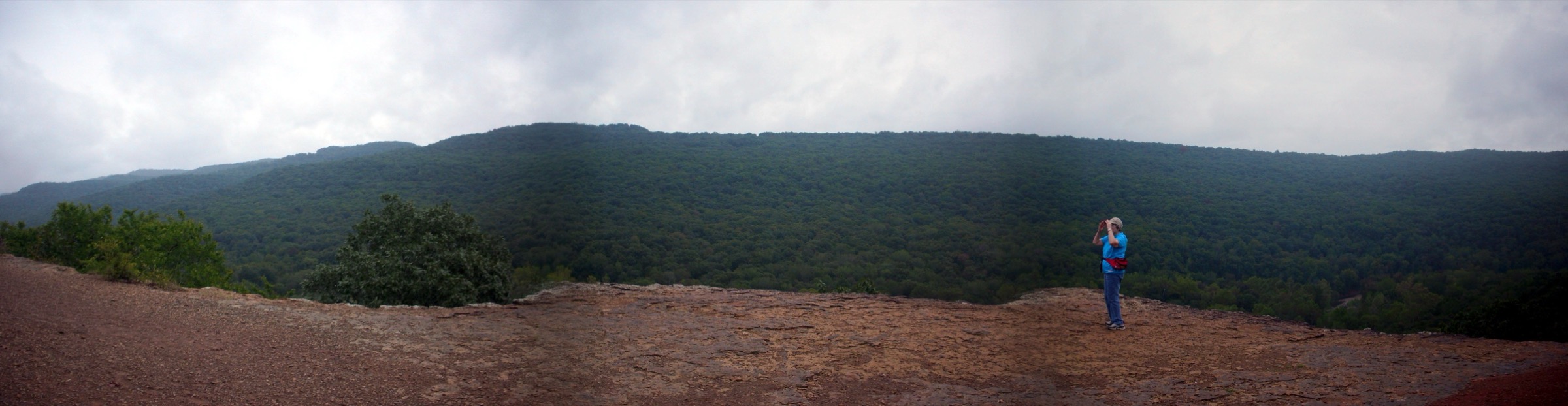
Geologically the corridor is a Palaeozoic layer-cake of Ordovician and Mississippian sandstones and limestones, tilted very gently and then dissected by a single river system with unusual vertical energy for its latitude. The river cuts through three plateau divisions on its way east — the Boston Mountains in the west, the Springfield Plateau through the middle course, and the Salem Plateau in the lower gorge — and it exposes bluff faces that regularly exceed 150 m and, on the Upper District, reach 168 m (550 ft) at Big Bluff, the tallest sheer cliff in the interior United States between the Rockies and the Appalachians. The plateau surface above the bluffs is karst country: sinkholes, seeps, dry valleys, sandstone bluff shelters (“rockhouses”), natural bridges and dozens of named waterfalls, most of them ephemeral and driven by winter and spring rain. Regional elevations sit between 200 and 700 m; almost every hike involves 300–450 m of climb on its return leg from the river back to the plateau rim.
The Park Service divides its 217 km of river into three management districts. The Upper District around Ponca and Boxley Valley contains the Ponca Wilderness, the Old River Trail out of Steel Creek, and access to Hemmed-in Hollow Falls (64 m / 209 ft) and the Goat Trail on Big Bluff. The adjoining Upper Buffalo Wilderness, administered by the Forest Service rather than the NPS, contains Whitaker Point (Hawksbill Crag) — the region’s most photographed viewpoint — and is culturally inseparable from the National River even though it sits outside the park boundary. The Middle District centres on Tyler Bend and the middle-course bluff line, and the Lower District, anchored at Buffalo Point near Yellville, contains the Indian Rockhouse bluff shelter and the Rush historic mining district. The long-distance Ozark Highlands Trail runs above the western headwaters, and the shorter Buffalo River Trail (BRT) — laid out on the plateau above the north bank — links most of the Upper District trailheads and provides a canonical multi-day traverse.
The main walking season runs from late September to early May. Autumn colour peaks in the second half of October; spring flow on the waterfalls is best from mid-March to late April, when redbud, dogwood and Ozark wildflowers are also in bloom. Ozark summers are hot and humid, with dew points routinely above 20 °C, and heat-related exhaustion on the Compton and Centerpoint climbs is the single most common cause of NPS Search and Rescue callouts. Winter hiking is entirely feasible — daytime highs are often mild — but occasional ice storms can render bluff-edge routes hazardous for several days at a time. Ticks and chiggers are active from spring through autumn, and two venomous snakes (copperhead and timber rattlesnake) are present but rarely aggressive; standard Ozark black bear food-storage practice applies at trailheads and picnic areas.
Access is by private vehicle. Public transport does not effectively serve any Buffalo National River trailhead; Harrison, about 30 km north of Ponca, is the nearest regional town with commercial services, and Little Rock (250 km south-east) and Springfield, Missouri (200 km north) are the nearest airports. Cell coverage in the river gorge is limited to non-existent. NPS trails within the Ponca Wilderness prohibit dogs (documented service animals excepted); the Whitaker Point Trail on Forest Service land does allow leashed dogs. Sister catalogues covering the neighbouring Boston Mountains uplands (Pedestal Rocks, Glory Hole, Yellow Rock and the Ozark Highlands Trail day sections) and the Ouachita Mountains further south are treated in separate entries.
See also: St Francois Mountains, Missouri day-hikes · Missouri Ozarks.
Selection rationale
Five day-hikes are presented across the Buffalo corridor’s principal scenic archetypes with minimum overlap. The set gives one iconic bluff-edge viewpoint (Whitaker Point / Hawksbill Crag), one short waterfall-and-karst introduction (Lost Valley to Eden Falls), the tallest waterfall between the Rockies and the Appalachians (Hemmed-in Hollow Falls from Compton), a strenuous bluff-face ledge traverse (Centerpoint to the Goat Trail on Big Bluff), and a cultural-and-karst loop to a nationally significant prehistoric bluff shelter (Indian Rockhouse). Four of the five sit within Buffalo National River proper; Whitaker Point sits just outside the park boundary within the Forest Service’s Upper Buffalo Wilderness but is universally listed with the Buffalo corridor and cannot be omitted from any honest regional catalogue. The set spans both the Upper and Lower Districts and deliberately avoids selecting multiple near-duplicate routes from the same Compton trailhead.
Summary
| # | Hike | Trailhead | Route type | Distance | Gain | Max elevation | Difficulty |
|---|---|---|---|---|---|---|---|
| 1 | Whitaker Point (Hawksbill Crag) | Whitaker Point (Cave Mountain Rd) | Out-and-back | 4.5 km | 125 m | 640 m | Easy–moderate |
| 2 | Lost Valley to Eden Falls | Lost Valley (Hwy 43) | Out-and-back | 3.9 km | 75 m | 370 m | Easy–moderate |
| 3 | Hemmed-in Hollow Falls | Compton Trailhead (CR 19) | Out-and-back | 9.2 km | 425 m | 640 m | Strenuous |
| 4 | Centerpoint to Goat Trail (Big Bluff) | Centerpoint (Hwy 43) | Out-and-back | 9.7 km | 320 m | 665 m | Strenuous, exposed |
| 5 | Indian Rockhouse Loop | Buffalo Point (Lower District) | Loop | 5.6 km | 140 m | 245 m | Moderate–strenuous |
1. Whitaker Point (Hawksbill Crag)
Snapshot
Itinerary
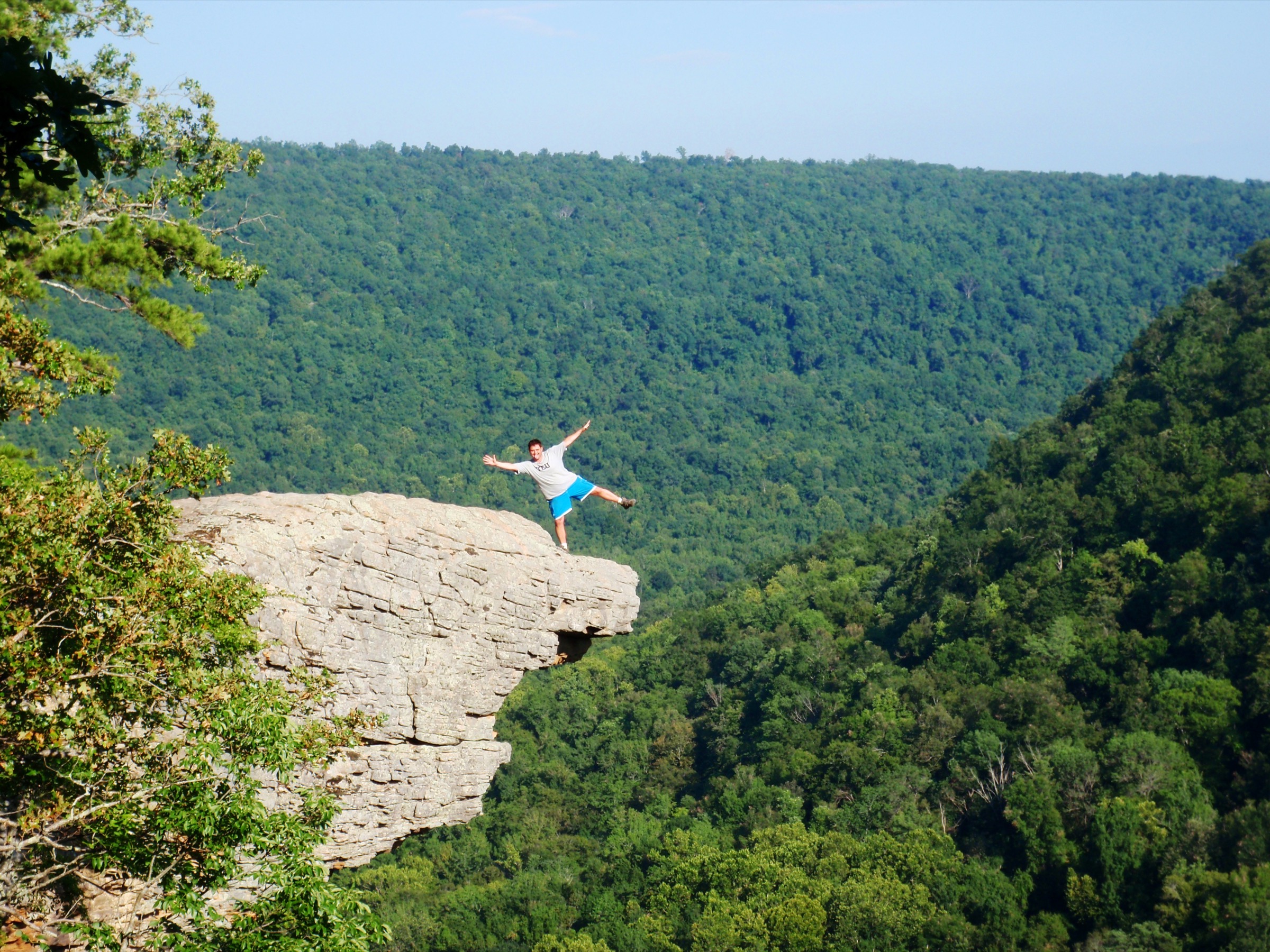
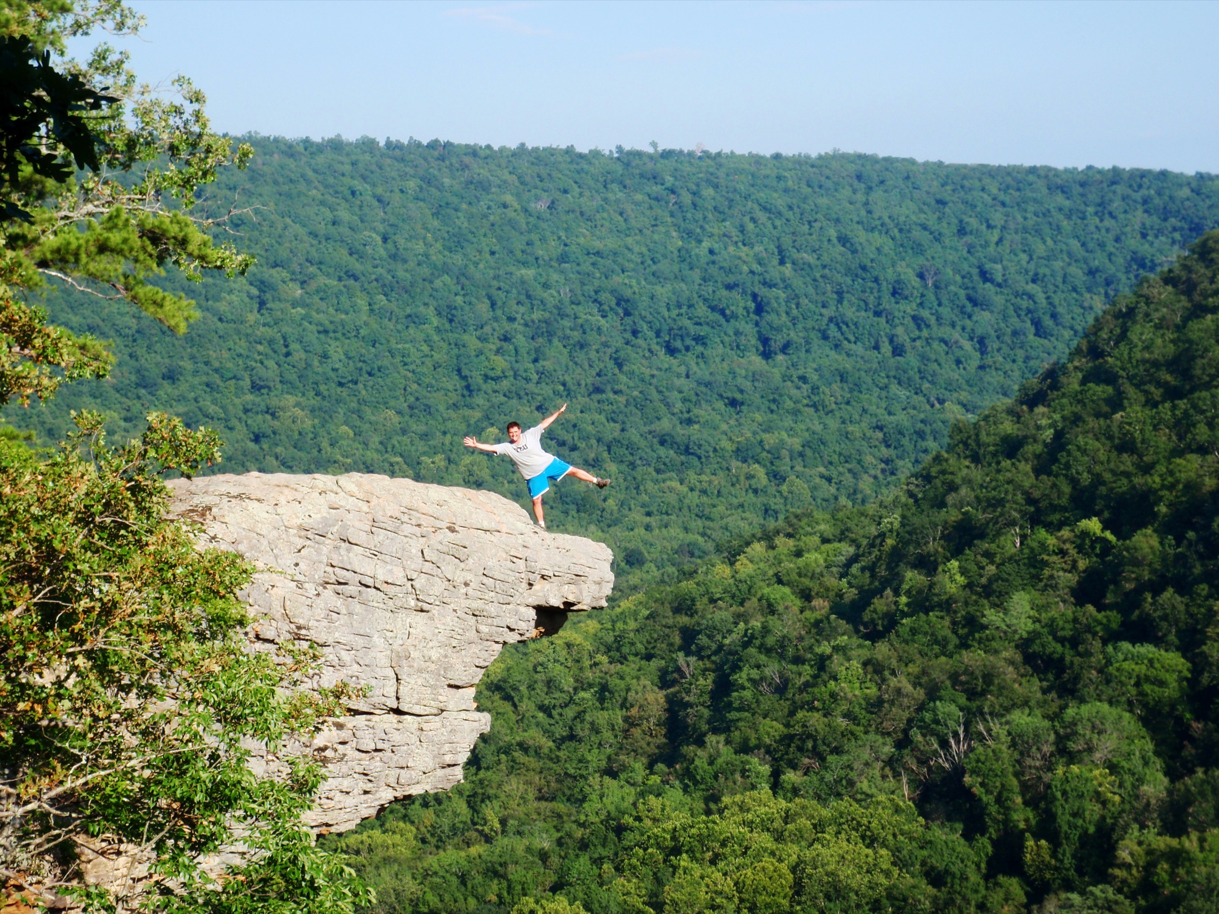
From the small roadside pull-off on County Road 5, the trail descends gently through mixed oak-hickory forest for about 400 m to reach the head of a shallow drainage. It then continues south-east along the west rim of Whitaker Creek Hollow, crossing several minor drainages on stepping stones. The forest opens periodically to reveal glimpses of the opposite bluff-line. After roughly 2 km the path exits onto open sandstone slabs at the head of Whitaker Point itself, where a narrow sandstone overhang, informally known as Hawksbill Crag for its raptor-beak profile, projects some 60 m over the valley floor below. Multiple secondary user paths follow the rim; the main trail is generally well-signed and heavily worn. Return is by the same route.
Why it is essential
Whitaker Point is the most reproduced landscape image of the Arkansas Ozarks and the region’s benchmark viewpoint. It is short enough for casual visitors yet sits within a designated wilderness that preserves representative Boston Mountains bluff country. Any regional catalogue that omits it is incomplete.
Equipment
- Sturdy footwear — the final sandstone slabs are slippery when wet or icy
- Sun protection for the exposed slabs at the crag
- 1 L water in summer; the trail has no reliable source
- Wind layer in shoulder seasons — the crag is exposed
- Headtorch for sunrise or sunset visits
- Offline map — cell coverage on Cave Mountain Road is minimal
Hazards and notes
- The crag is unfenced and several fatal falls have occurred over the years; children must be kept close and the slab is not the place for photographic risk-taking.
- Sandstone becomes very slippery when wet, iced, or coated with autumn leaves.
- The access road (Cave Mountain Road / CR 5) is unpaved and can be rutted or muddy after heavy rain.
- Dogs on leash are permitted under Forest Service rules, unlike the NPS Ponca Wilderness trails immediately to the north.
- No permit required; Leave No Trace principles apply. As a designated wilderness, no bicycles or motorised use.
- Parking is limited; on autumn colour and spring bloom weekends, arrival before 09:00 is advisable.
2. Lost Valley to Eden Falls
Snapshot
Itinerary
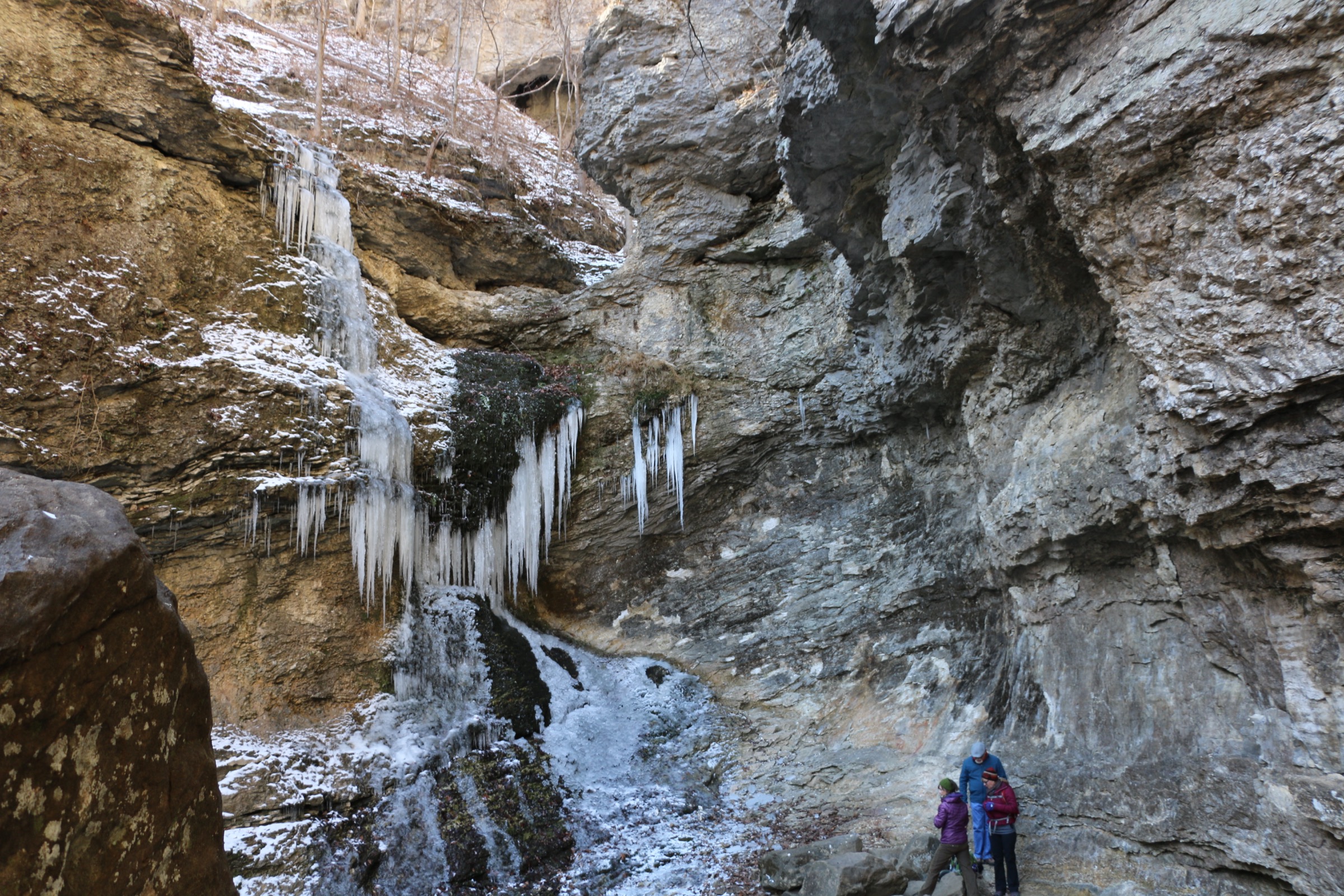
The trail leaves the parking area and follows the floor of Clark Creek’s flat, forested box canyon on a wide, gently graded path suitable for a range of abilities, with occasional benches. After roughly 1.2 km it passes a small emerald plunge pool beneath the Natural Bridge, an eroded creek-bed feature with a small waterfall. The route then climbs stone steps along the north bank of Clark Creek, entering the head of the canyon beneath Cob Cave, a 60 m-long sandstone bluff shelter (rockhouse). A short scramble up steep, uneven stone steps reaches the base of Lower Eden Falls, a multi-tiered fall dropping roughly 16 m (53 ft) into a shaded amphitheatre. A narrow, wet passage continues into Eden Falls Cave above the falls, where an internal cascade can be viewed with a headtorch; this section is optional and can be slippery.
Why it is essential
Lost Valley concentrates most of the Ozark karst repertoire — box canyon, bluff shelter, plunge-pool waterfall, and a cave waterfall — in under 4 km of easy trail. It is the single most visited route in the National River and is the standard introduction to Buffalo geomorphology.
Equipment
- Sturdy footwear with grip for the upper stone-step section, which is often wet
- Headtorch for the small cave above Eden Falls (mandatory for anyone entering)
- 1 L water is usually sufficient
- Insect repellent from spring through autumn
- Warm layer and traction in winter — the upper steps hold ice for days after a freeze
Hazards and notes
- The NPS lists Lost Valley among the most frequent SAR locations in the park; slips on wet stone steps and falls from small cliff bands are the main causes.
- The Eden Falls Cave section has low ceilings and can flood after heavy rain; do not enter during storms.
- Pets are prohibited on the Lost Valley Trail (documented service animals excepted).
- Day use only; no backcountry camping.
- Parking fills on spring and autumn weekends.
- Flash flooding is possible in Clark Creek after heavy rain.
3. Hemmed-in Hollow Falls (from Compton)
Snapshot
Itinerary
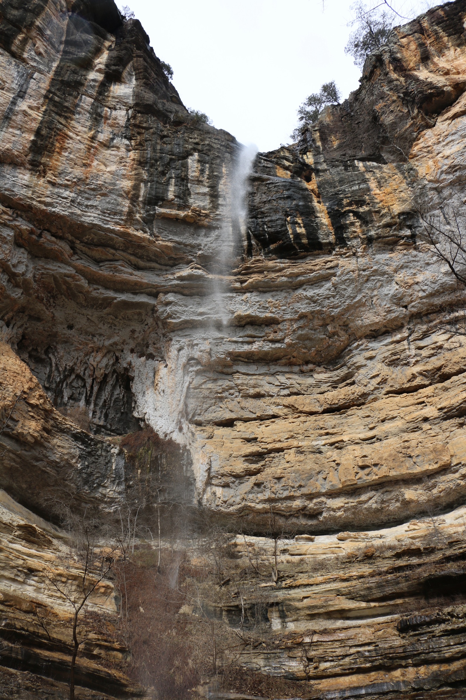
From the Compton Trailhead the route drops steadily north into the Ponca Wilderness on an old road grade, losing altitude quickly through mature hardwood forest. After roughly 2 km the trail junctions; the signed spur to Hemmed-in Hollow bears left. Grade steepens as the path descends through hemlock and hardwood benches into the head of a broad amphitheatre. A final scramble on rooted, uneven ground brings the trail into the amphitheatre floor at the base of the fall. Hemmed-in Hollow drops a single unbroken plume of approximately 64 m (209 ft) — the tallest waterfall between the Rockies and the Appalachians, per NPS — into a shallow pool. Return by the same route requires steady, sustained climbing back to the plateau rim; the descent is deceptive, and it is the ascent that drives the route’s difficulty rating.
Why it is essential
Hemmed-in Hollow is the region’s headline waterfall and the tallest fall of any type between the Rockies and the Appalachians. The amphitheatre setting, and the descent through Ponca Wilderness bluff country, make this the definitive strenuous half-day hike of the Buffalo corridor.
Equipment
- Boots with proper grip and ankle support — the descent is rooted and uneven
- Trekking poles recommended for the ~2,000 ft (~610 m) round-trip climb
- 2 L water per person minimum (NPS figure); double this in summer
- Layered clothing for the temperature drop between the rim and the shaded amphitheatre
- Headtorch — slower parties finish in dusk
- No cave gear needed
Hazards and notes
- NPS lists this trail among the most frequent SAR callouts, driven by heat exhaustion, dehydration and overexertion on the return climb from the falls to the rim.
- Pets are prohibited within the Ponca Wilderness (documented service animals excepted).
- No permits required for day hikes.
- Water sources en route are unreliable and must be treated before drinking.
- The waterfall may reduce to a trickle after prolonged dry weather; check recent rainfall before travelling.
- Cell coverage in the hollow is essentially nil.
4. Centerpoint to Goat Trail (Big Bluff)
Snapshot
Itinerary
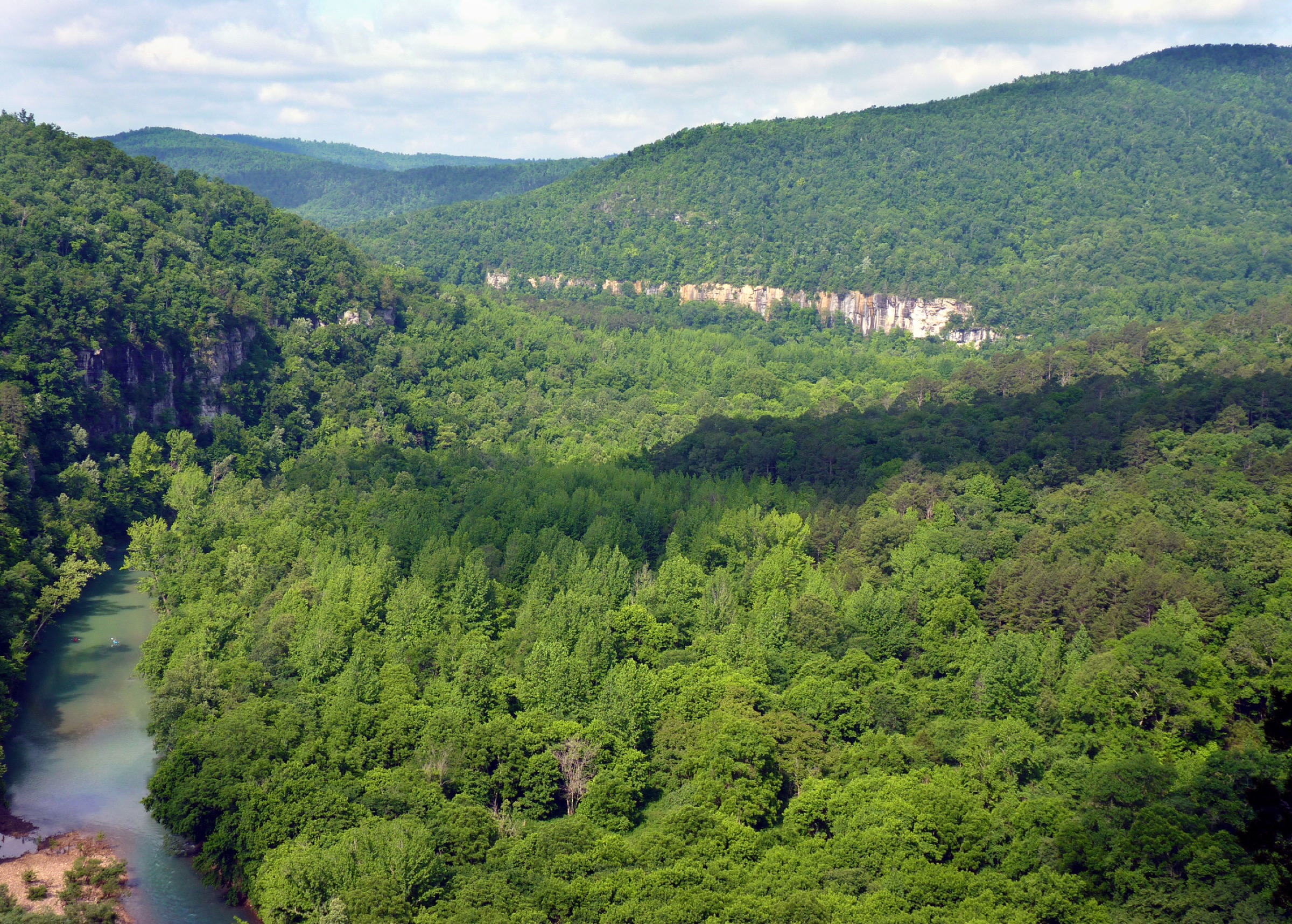
The Centerpoint Trail descends south from Hwy 43 on the graded bed of an old wagon road, dropping through hardwood forest for approximately 4 km. At the signed intersection with the Goat Trail, the route bears right onto a narrow footpath that traverses the face of Big Bluff. The Goat Trail — about 0.5 mile (800 m) long — runs across a natural rock ledge on the cliff face itself; in places the ledge is under 1 m wide, with a sheer drop of around 100 m to the Buffalo River below. Big Bluff itself is roughly 168 m (550 ft) high, the tallest sheer cliff face between the Rockies and the Appalachians. The ledge ends at an open sandstone terrace with a panorama over the river bend at Jim Bluff. Return is by the same route with a sustained climb back to the trailhead; the ledge should be reversed with the same care as its outbound crossing.
Why it is essential
Big Bluff is the tallest sheer cliff of the Ozarks and the Goat Trail is one of the very few unprotected bluff-face ledges in the eastern United States open to walkers. The route is the defining bluff-edge experience of the Buffalo corridor.
Equipment
- Sturdy boots with genuine grip; smooth soles are dangerous on the ledge
- Trekking poles for the ascent, but stow them for the Goat Trail traverse
- 2 L water minimum
- Windproof shell — the ledge is exposed and gusts can be strong
- Small pack only — a large or top-heavy pack unbalances you on the narrow section
- Offline map; cell coverage is nil in the gorge
Hazards and notes
- The Goat Trail is a narrow, unfenced ledge above a 100 m drop with a long history of fatal falls; the NPS explicitly states it is not recommended for children or those with a fear of heights.
- Do not attempt in ice, high wind or wet conditions — the sandstone is treacherous when damp and the ledge holds ice for days after a freeze.
- The route is among the park’s most frequent SAR callouts; heat exhaustion on the ascent and cliff-edge falls on the ledge dominate.
- Pets are prohibited within the Ponca Wilderness (documented service animals excepted).
- No permits required for day hikes; backcountry camping is permitted in the Ponca Wilderness but not on Big Bluff itself.
- Turn back if the ledge is wet, iced, or if wind at the top of the descent is strong enough to unbalance a walker on flat ground.
5. Indian Rockhouse Loop
Snapshot
Itinerary
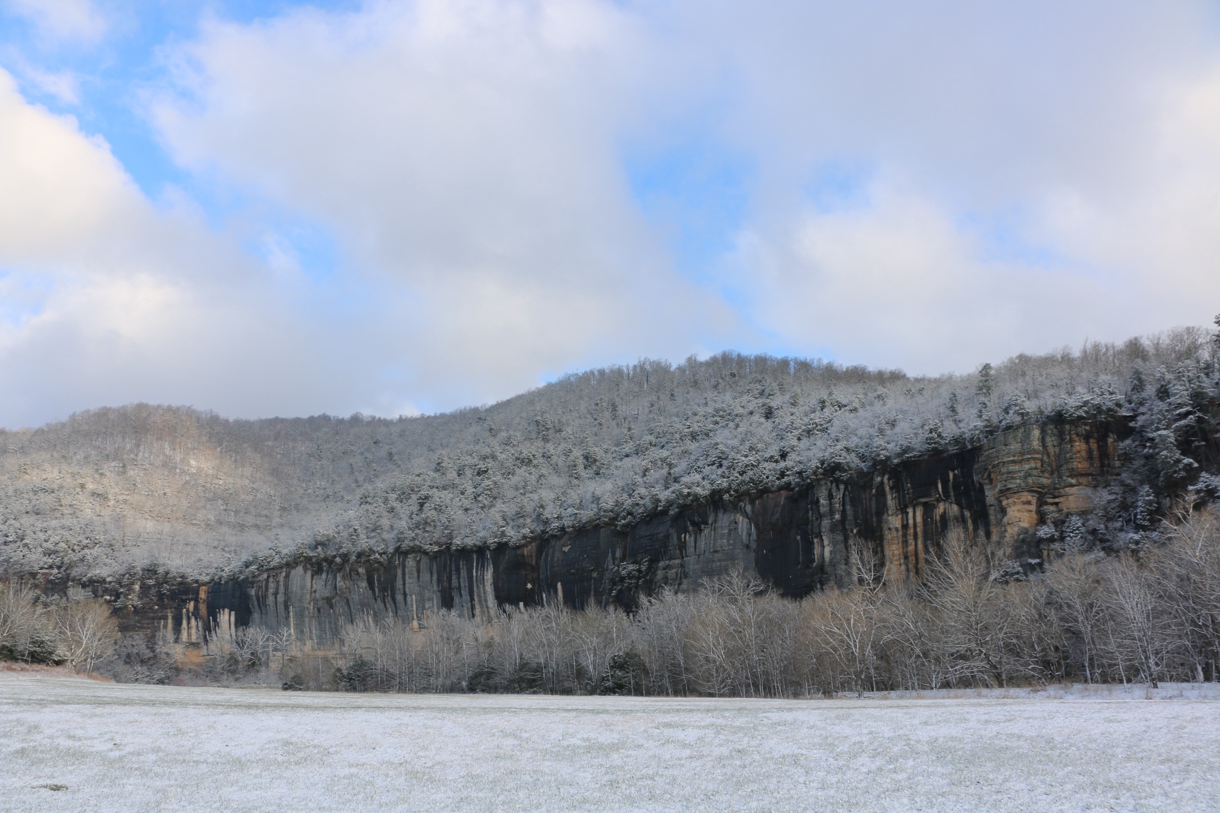
The Indian Rockhouse Trail leaves Buffalo Point and drops off the plateau rim through mature hardwoods, passing a series of interpretive features that make up a compact tour of Ozark karst: a small sinkhole, a seasonal waterfall over a bluff step, a mine prospect from short-lived nineteenth-century workings, sculpted bedrock formations along Panther Creek, and a small sandstone quarry from the CCC era. A short spur leads to the Indian Rockhouse itself: a large sandstone bluff shelter with a natural skylight and a spring emerging briefly at one end. The shelter has archaeological evidence of human use from at least 7,000 BC; excavations in the 1930s by the Carnegie Institute recovered stone tools, basketry and food remains, and the site remains one of the most significant bluff shelters in the University of Arkansas Ozark bluff-shelter inventory. The return climb regains the plateau on a series of switchbacks.
Why it is essential
Indian Rockhouse is the definitive cultural and karst route of the Buffalo corridor. It combines a nationally significant prehistoric bluff shelter with an interpretive walk through a compact selection of Ozark geological features, and is the anchor day-hike of the Lower District. Its inclusion ensures the catalogue is not weighted only towards the iconic scenery of the Upper District.
Equipment
- Sturdy footwear for uneven, rocky ground
- Trekking poles helpful on the return climb
- 1–2 L water depending on season
- Headtorch — useful for exploring inside the shelter and its overhang
- Insect repellent from spring through autumn
- Warm layer and traction if walking in a cold snap
Hazards and notes
- The trail is narrow, steep, and rocky in places; slips are common on wet stone.
- Pets are prohibited on this NPS trail (documented service animals excepted).
- No permits required.
- The Rockhouse is a federally protected archaeological site; collection or disturbance of artefacts is a criminal offence under the Archaeological Resources Protection Act.
- The seasonal waterfall runs mainly in winter and spring; the shelter’s spring is present year-round.
- Standard Ozark black bear food-storage practice applies at the Buffalo Point trailhead and campground.
Routes excluded as out of scope
The following sit within or immediately adjacent to the Buffalo corridor but fall outside a day-hike entry, are duplicative of the five above, or are covered by a sister catalogue.
- Buffalo River Trail (BRT). The 60 km plateau-side traverse along the north bank is a canonical multi-day route rather than a single day-hike, and its shorter day-sections largely duplicate the trailheads already used above (Ponca, Steel Creek, Kyle’s Landing).
- Old River Trail from Steel Creek. A pleasant riverside stroll from the Steel Creek campground but editorially thin against the five selected routes and better read as an add-on to a Ponca base.
- Rush Ghost Town and the Rush Historic District. A short historic walk through the best-preserved zinc-mining ghost town in the Ozarks; a strong candidate that was excluded to keep the catalogue balanced between scenery and culture, since the Indian Rockhouse entry already covers the cultural archetype.
- Compton to Sneeds Creek and Granny Henderson’s Cabin. A parallel Compton descent that lands in the same category as Hemmed-in Hollow and does not add a new archetype.
- Boston Mountains uplands. Pedestal Rocks, Kings Bluff, Glory Hole and Yellow Rock, together with the Ozark Highlands Trail day sections above the Buffalo headwaters, sit outside the National River proper and are covered in the sister Boston Mountains entry.
- Ouachita Mountains routes. The Ouachitas south of the Arkansas River — an entirely different, east–west-trending range — are covered separately from the Ozark entries.
Further reading
| Source | URL |
|---|---|
| NPS — Buffalo National River (park index) | nps.gov/buff |
| NPS — Hike the Lost Valley Trail | nps.gov |
| NPS — Hike to Hemmed-in Hollow | nps.gov |
| NPS — Hike to Big Bluff | nps.gov |
| NPS — Upper District Hiking | nps.gov |
| NPS — Hiking in the Lower District | nps.gov |
| NPS — Hike the Indian Rockhouse Trail | nps.gov |
| NPS — Current park conditions and alerts | nps.gov |
| USDA Forest Service — Ozark–St. Francis National Forest | fs.usda.gov |
| University of Arkansas — Indian Rockhouse Cave on Panther Creek | archeology.uark.edu |
| Wikipedia — Buffalo National River | en.wikipedia.org |
| Wikipedia — Hemmed-In-Hollow Falls | en.wikipedia.org |
| Wikimedia Commons — Buffalo National River category | commons.wikimedia.org |
| OpenStreetMap (ODbL 1.0) | openstreetmap.org |