Regional overview
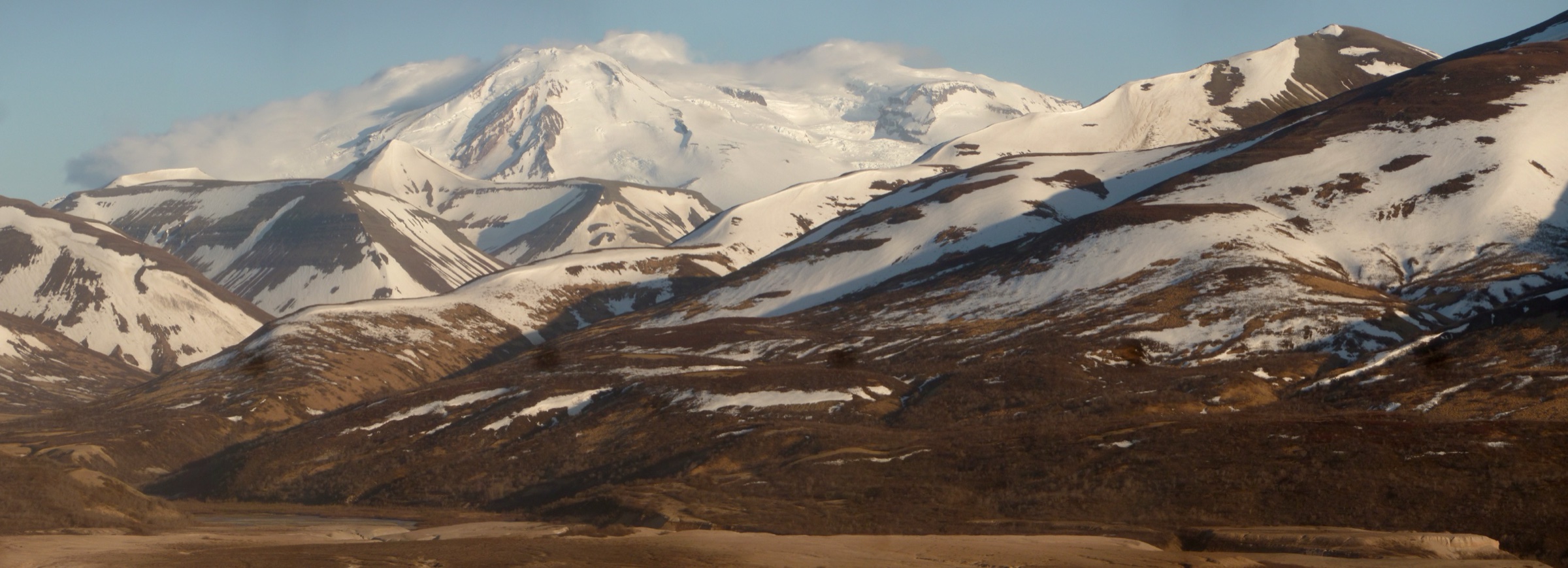
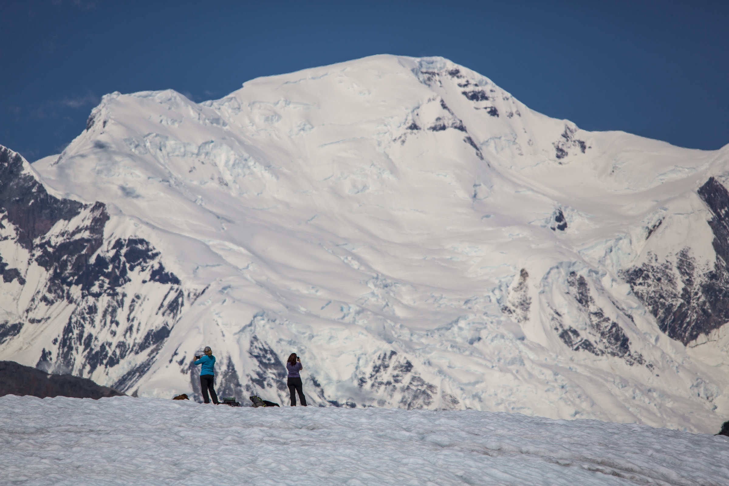
The Wrangell Mountains rise on the north-west edge of Wrangell–St Elias National Park & Preserve — the largest US national park at over 13 million acres — bounded by the Copper River to the south-west, the Nabesna and Chisana drainages to the north, and the St Elias block to the south-east. They are a young volcanic and glaciated range: Mount Wrangell, Mount Blackburn and Mount Sanford exceed 4,900 m (16,000 ft), and the range’s active and dormant volcanic centres (Wrangell, Drum, Sanford, Blackburn) sit on ice-mantled bases fed by some of the largest glaciers in the sub-Arctic. Day-hiking access is concentrated in two corridors: the Kennecott / McCarthy area at the end of the McCarthy Road on the south-western flank, and the Nabesna Road on the north-western flank, running east from the Richardson Highway at Slana.
The park service is explicit that most Wrangell–St Elias hiking trails are maintained only for the first few miles and then become routes, and that even named day-hikes can involve rough tread, creek crossings, rapidly changing conditions, bears, insects and limited rescue options. Cell coverage is essentially absent inside the park, and neither the McCarthy nor the Nabesna corridor carries reliable emergency services once past the ranger stations at Kennecott / McCarthy (south side) and Slana (north side). Both roads are seasonal: the McCarthy Road is unpaved and generally usable May to October but slow and vehicle-dependent, and the Nabesna Road runs east from Slana with the maintained section ending at approximately mile 42 (Rambler Mine trailhead) beyond which the road becomes rough and creek-forded.
The reliable hiking season is late June to mid-September on the high routes; lower valley trails open earlier and close later. Afternoon weather changes are common in the volcanic country around Skookum, and lingering snow can persist on the higher passes into July. Grizzly and black bears are present throughout — standard practice is to carry spray, hike in groups where possible, make noise, and follow food-storage requirements. Historic mining infrastructure at Kennecott, Bonanza Mine, Rambler Mine and elsewhere is unstable — the NPS warns against entering any mine building or opening, and abandoned explosives have been documented at some sites.
This catalogue uses NPS pages and route PDFs as the primary source wherever possible. No legal GPX/KML files were located in this pass, so each hike is anchored to the NPS route PDF or trail page and downloadable route-file status is marked unresolved. For the coastal side of the wider block, see the sister catalogue on the St Elias Mountains.
Selection rationale
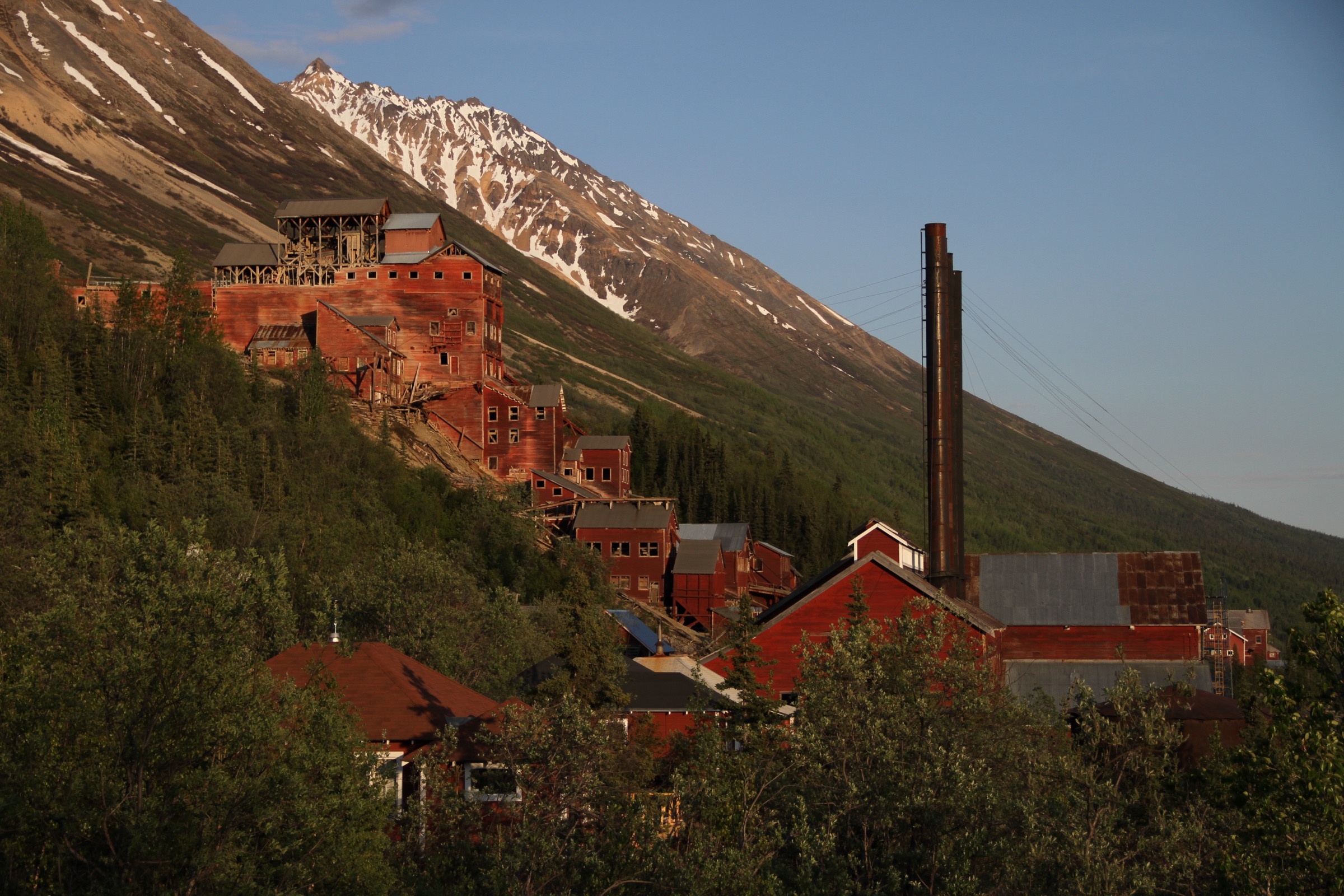
The five walks represent the essential day-walking identities of the Wrangell Mountains: Root Glacier for direct glacier access on the McCarthy side, Bonanza Mine for the iconic Kennecott mining panorama, Skookum Volcano for Nabesna geology and high-country views, Caribou Creek for a moderate Nabesna valley route, and Rambler Mine for a short historic-mine objective at the end of the Nabesna Road. The set spreads the catalogue across both principal park corridors and combines glacier, alpine, geological and mining-heritage character in a single entry. Longer routes into the range interior — the Erie Mine, Donoho Basin, and multi-day traverses beyond the maintained tread — sit outside a day-hike bracket and are noted at the end.
Summary table
| # | Hike | Country | Route type | Distance | Gain | Max elevation | Difficulty |
|---|---|---|---|---|---|---|---|
| 1 | Root Glacier Trail | USA | Out-and-back with glacier spur | ~4.8–7.1 km | not officially resolved | not officially resolved | Easy–moderate (trail); glacier travel technical |
| 2 | Bonanza Mine Trail | USA | Out-and-back | 14.5 km | 1,158 m | not officially resolved | Strenuous |
| 3 | Skookum Volcano Trail | USA | Out-and-back or loop | 8 km (loop +4.8 km) | ~853 m | ~1,768 m | Moderately strenuous |
| 4 | Caribou Creek Trail | USA | Out-and-back | 9.7 km | 244 m | not officially resolved | Easy–moderate |
| 5 | Rambler Mine Trail | USA | Out-and-back | 2.4 km | 122 m | not officially resolved | Moderate (short and steep) |
1. Root Glacier Trail
Snapshot
Itinerary
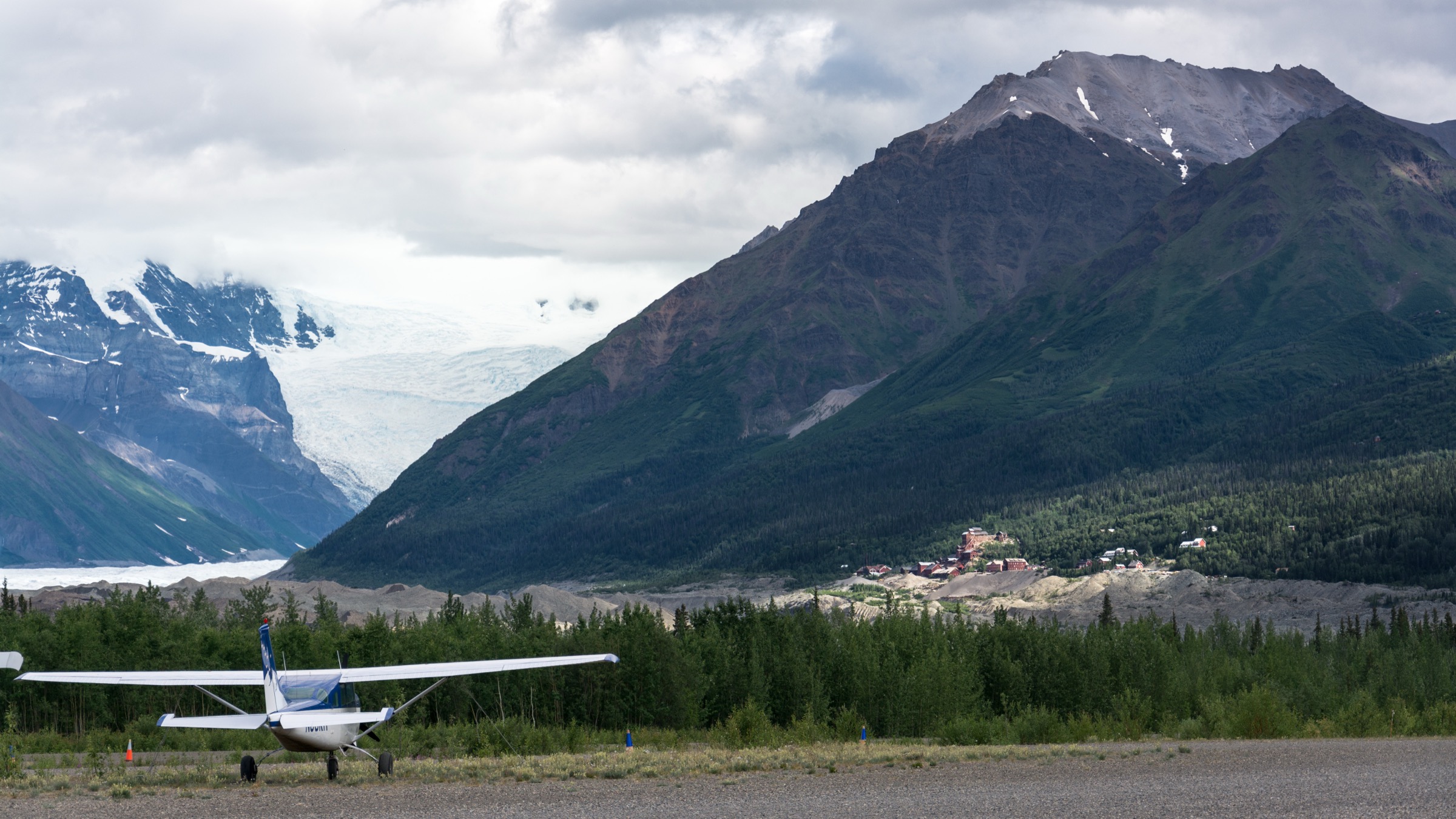
The trail leaves the Kennecott Mill Town area and follows the route north across the Bonanza and Jumbo Creek corridors, contouring above the Kennicott Glacier moraine. The Bonanza Mine junction (Hike 2) branches off after roughly 0.5 mi; the Root Glacier line continues on easy grade to a spur that descends to the toe of Root Glacier at approximately 4.8 km round-trip. The full source-route figure of 7.1 km extends the walk beyond the toe onto the moraine and glacier viewpoints. Return is on the same line. Stepping onto the ice itself requires microspikes or crampons, glacier awareness and — for most visitors — a guided trip; the NPS route ends at the ice margin.
Why it is essential
The Root Glacier walk is the signature non-technical glacier-viewing day in the Wrangell Mountains and the clearest way to pair the Kennecott historic landscape with active ice on a single afternoon. It is the walk that most cleanly delivers the range’s glacial character to a general visitor and the natural half-day complement to the strenuous Bonanza Mine climb from the same trailhead.
Equipment
- Sturdy boots
- Rain and warm layers
- Water and treatment for creek refills
- Bear spray, accessible on the pack
- Sun and wind protection at the glacier margin
- Microspikes or crampons and glacier knowledge only if stepping onto the ice
- Trekking poles for the moraine spur
Hazards and notes
- Glacier ice at the margin is unstable — do not walk onto the ice without appropriate gear and skill.
- Unstable moraine and loose rock near the ice edge.
- Creek crossings and small footbridges — flow can vary through the summer.
- Historic mining infrastructure near Kennecott is unstable; obey NPS closures and do not enter buildings or openings.
- Bears (both black and grizzly) present in the drainage.
- Weather changes rapidly; carry layers even for a short walk.
GPX / route file
| Source | URL | Format | Notes |
|---|---|---|---|
| NPS — McCarthy Road and Kennecott Trails | nps.gov | Web page | Official route listing |
| NPS — Root Glacier / Erie Mine Trail (PDF) | nps.gov | Official PDF route map | Source map only; no GPX/KML exposed |
| Alaska.org — Root Glacier Trail | alaska.org | Guide route page | Secondary distance and time reference |
Sources
- NPS — McCarthy Road and Kennecott Trails
- NPS — Root Glacier / Erie Mine Trail (PDF)
- Alaska.org — Root Glacier Trail
2. Bonanza Mine Trail
Snapshot
Itinerary
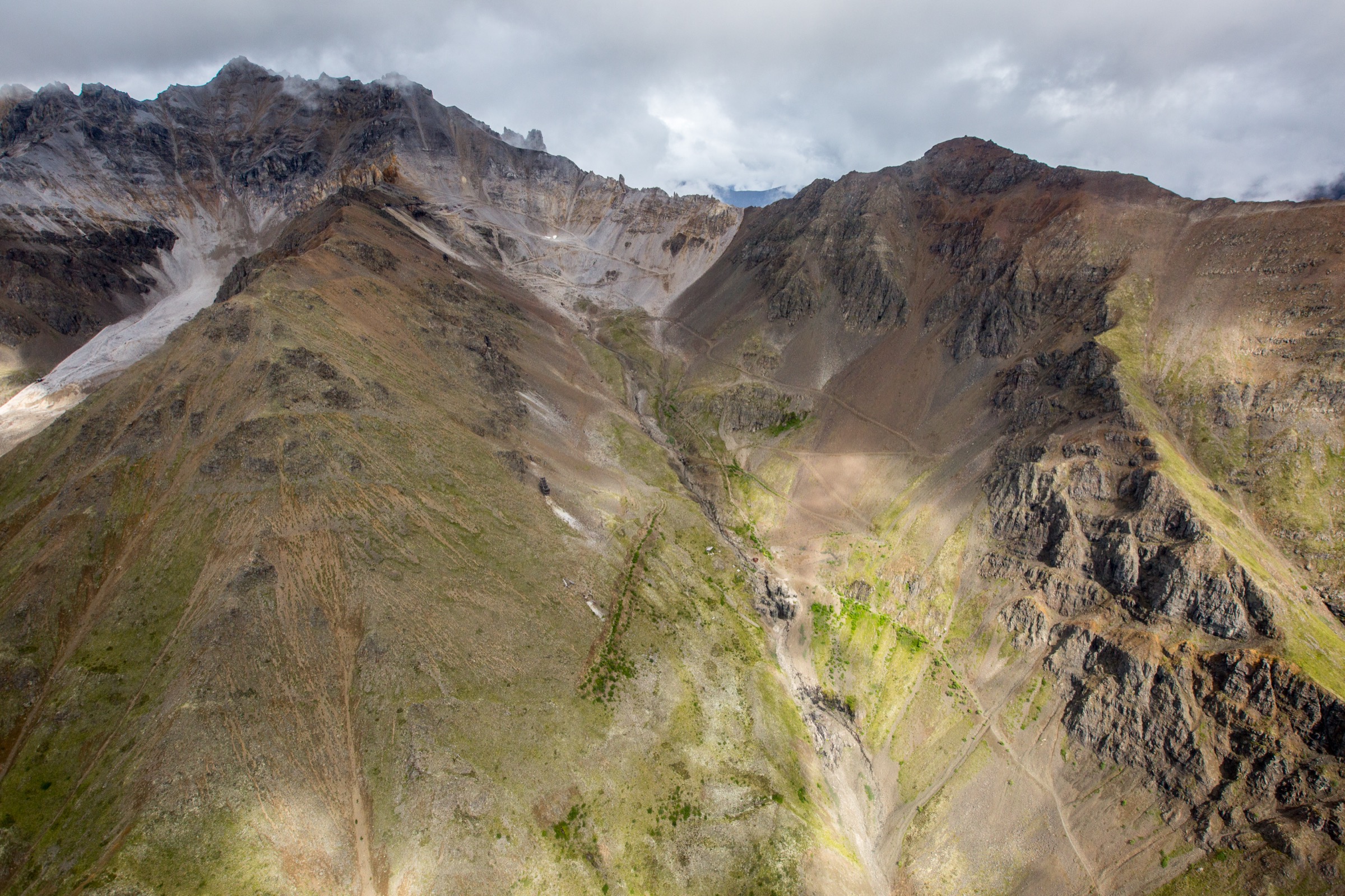
The trail branches off the Root Glacier line approximately 0.5 mi north of Kennecott and climbs steeply on old mining road and switchback tread up the ridge above the mill town. The grade is sustained — the NPS PDF gives 1,158 m (3,800 ft) of gain across roughly 4.5 mi one-way — through spruce and open sub-alpine terrain, before the trail opens onto the exposed upper ridge and the Bonanza Mine remains. The panorama at the mine is one of the classic Wrangell–St Elias views: Kennecott below, the Kennicott Glacier, the Chugach Mountains to the south, and Mount Blackburn and the neighbouring peaks of the Wrangell block to the north. Return is on the same route.
Why it is essential
Bonanza Mine is the definitive Kennecott mining day-hike and the walk that most cleanly delivers the district’s industrial and landscape history in a single climb. It is also the range’s best single summit-style day for a fit visitor working out of Kennecott — one of the most complete alpine panoramas in the Wrangell Mountains that can be reached on foot from a road-end community.
Equipment
- Mountain hiking boots
- Trekking poles for the descent
- Rain, wind and warm layers
- 3 L water and treatment for creek refills
- Bear spray, accessible on the pack
- Sun protection and sunglasses on the open upper ridge
- Offline map and GPS
- Headtorch for a long day
Hazards and notes
- Steep, sustained climb — the return descent is hard on knees; take care on loose upper tread.
- Weather exposure on the upper ridge; storms can move in quickly.
- Historic mine buildings and artifacts at Bonanza are unstable; the NPS warns against entering structures or openings, and abandoned explosives have been documented at some sites.
- Bears active in the drainage.
- No reliable water on the upper route.
- Respect NPS closures and historic-site safety rules.
GPX / route file
Sources
3. Skookum Volcano Trail
Snapshot
Itinerary
From the trailhead at Nabesna Road mile 36.8, the route climbs through open volcanic terrain toward a high pass at ~1,768 m (5,800 ft). The NPS PDF highlights the geology: eroded volcanic features including rhyolite and dacite domes, andesite flows, vents and dikes, exposed by post-glacial erosion on the north-western flank of the Wrangell volcanic field. The trail is unmaintained in its upper reaches and involves shallow creek crossings and cairn-following. Reaching the high pass is the standard turnaround; a rougher loop drops the far side of the pass and traces a steep rocky streambed back — adding roughly 3 mi and demanding careful route-finding. Return by the same route or the loop.
Why it is essential
Skookum is the strongest geology-first day-hike in the Wrangell Mountains catalogue — a route that puts the range’s volcanic character (dome-and-vent architecture, dike swarms, andesite flows) directly under a walker’s feet — and the pass gives one of the widest Nabesna panoramas available on a single day.
Equipment
- Boots with good traction for cairn-following and stream-bed sections
- Trekking poles
- Rain, wind and warm layers
- 2.5–3 L water and treatment for creek refills
- Bear spray
- Insect repellent through summer
- Offline map and GPS
- Navigation backup for the loop option
Hazards and notes
- Shallow creek crossings with fluctuating levels — flow can rise fast after rain.
- Washed-out cairns and unmaintained upper route; visibility can collapse quickly.
- Steep rocky stream-bed on the optional loop — do not attempt the loop in wet or icy conditions.
- Weather exposure at the high pass; storms move in fast in the volcanic country.
- Bears active in the drainage.
- Nabesna Road condition should be verified with the Slana Ranger Station before travel.
GPX / route file
Sources
4. Caribou Creek Trail
Snapshot
Itinerary
From the Nabesna Road mile 19.5 trailhead (parking near mile 18.9), the route follows an ATV / muddy track through open sub-alpine terrain toward the Caribou Creek drainage. The NPS PDF notes the crossing of Caribou Creek after approximately 2 mi and additional creek crossings on the way to the public-use cabin area. The upper section opens into wider mountain views before the cabin. Return is on the same route. Time and route conditions vary strongly with rainfall — the tread can be muddy and creek levels can rise fast.
Why it is essential
Caribou Creek is the moderate Nabesna valley walk in the catalogue and the natural half-day companion to the shorter Rambler Mine and the steeper Skookum Volcano days. It is the walk that most cleanly delivers the north-side valley character of the Wrangell Mountains without alpine commitment.
Equipment
- Waterproof boots — muddy tread and creek crossings
- Trekking poles for creek crossings
- Rain, wind and warm layers
- 2 L water and treatment for creek refills
- Bear spray
- Insect repellent (June–August is severe)
- Offline map and GPS
Hazards and notes
- Muddy ATV route — expect wet feet.
- Caribou Creek and additional creek crossings — check flow after rain; do not attempt in high water.
- Summer insects (mosquitoes and biting flies) are severe.
- Bears active in the drainage.
- Nabesna Road condition should be verified before travel.
GPX / route file
Sources
5. Rambler Mine Trail
Snapshot
Itinerary
The trail leaves the end of the maintained Nabesna Road at mile 42 and climbs quickly onto the ridge above, gaining most of its 122 m (400 ft) within the first 0.5 mi. The mine remains sit at the top of the climb with a panoramic view over the Nabesna Road corridor and out into the Mentasta and eastern Wrangell high country. The NPS notes the need to respect the Ellis family private property near the trailhead. Return is on the same route.
Why it is essential
Rambler Mine is the concise historic counterpoint to the longer Kennecott mining routes: a short, steep climb to a mine landscape at the end of the Nabesna Road that gives a compact taste of the remote north side of the Wrangells. It is the natural half-day pairing with a Nabesna Road drive from Slana.
Equipment
- Sturdy hiking boots — short but steep tread
- Rain and warm layer
- 1–1.5 L water — no water on route
- Bear spray
- Sun and wind protection at the mine terrace
Hazards and notes
- Mine openings, tunnels and buildings in poor condition — do not enter; the NPS warns against entering mine structures anywhere in the district.
- No reliable water on route.
- Private property boundaries near the trailhead — obey signage and stay on the trail.
- Steep tread — slippery when wet.
- Bears active in the drainage.
- Nabesna Road condition should be verified before travel.
GPX / route file
Sources
Routes excluded as out of scope
The following sit inside or adjacent to the Wrangell Mountains but fall outside a day-hike entry or are better treated in a neighbouring catalogue.
- Erie Mine Trail. The natural extension of the Root Glacier line beyond the Root Glacier toe — a much longer commitment on route rather than trail, and a common multi-day objective.
- Donoho Basin. Trailless alpine basin above the Root Glacier — a classic Wrangell backcountry destination but well outside a day-hike bracket.
- Kuskulana Bridge and Fireweed Mountain routes. Off-trail scrambles from the McCarthy Road that require substantial navigation and are treated as backcountry days.
- Nabesna Road backcountry routes (Chisana, Lost Creek, Trail Creek). Backpack corridors from the Nabesna side rather than day-hikes.
- St Elias coastal walks. Covered in the sister catalogue on the St Elias Mountains.
Further reading
| Source | URL |
|---|---|
| NPS Wrangell–St Elias — Plan Your Visit | nps.gov |
| NPS Wrangell–St Elias — McCarthy Road and Kennecott Trails | nps.gov |
| NPS Wrangell–St Elias — Nabesna Road Trails | nps.gov |
| NPS Wrangell–St Elias — Backcountry safety | nps.gov |
| NPS — Bonanza Mine Trail (PDF) | nps.gov |
| NPS — Root Glacier / Erie Mine Trail (PDF) | nps.gov |
| NPS — Skookum Volcano Trail (PDF) | nps.gov |
| NPS — Caribou Creek Trail (PDF) | nps.gov |
| NPS — Rambler Mine Trail (PDF) | nps.gov |
| Alaska.org — Root Glacier Trail | alaska.org |
| Wikipedia — Wrangell Mountains | en.wikipedia.org |
| Wikipedia — Wrangell–St. Elias National Park and Preserve | en.wikipedia.org |
| Wikipedia — Kennecott, Alaska | en.wikipedia.org |
| Wikimedia Commons — Wrangell Mountains category | commons.wikimedia.org |
Missing data / follow-up work
- No official GPX/KML files are published by NPS Wrangell–St Elias for the trail network; NPS route PDFs are the authoritative source. Route geometry for planning can be exported from OpenStreetMap, but do not reuse NPS cartography without checking terms.
- Maximum elevations for the Root Glacier, Bonanza Mine, Caribou Creek and Rambler Mine routes are not stated on the NPS route pages; the Skookum high pass at 1,768 m is the only high point called out explicitly. Verify against USGS mapping if the summit-or-mine elevation matters for a trip.
- Licence-compatible photographs have been identified on Wikimedia Commons for each hike: NPS public-domain images by Neal Herbert (Root Glacier / Nabesna Road), a public-domain / PD-self image at Bonanza Mine (User:Icewedge), a CC BY-SA 2.0 Wrangell–St Elias NPS image (Kennecott Mill Town & Bonanza Ridge), and a public-domain NPS Nabesna Road map for Rambler Mine. None have been downloaded or embedded here — resize to 2,400 px long edge before shipping and add figcaption credit blocks matching the site convention.
- McCarthy Road and Nabesna Road have distinct seasonal opening dates and can be gated or rough after storms; confirm current status with the Kennecott / McCarthy and Slana ranger stations before travel.
- Historic mining infrastructure at Kennecott, Bonanza and Rambler is unstable and the NPS documents abandoned-explosive risk at some sites; check current NPS advisories on mine-area access before travel.
- Bear-management updates for the McCarthy and Nabesna corridors are worth confirming with the Wrangell–St Elias ranger stations before any trip.