About this entry
“Southern Richardsons” is used here to describe the Queenstown-west / Ben Lomond / Moke Lake / Lake Dispute / Mount Crichton / Bob’s Cove sector of the wider Richardson Mountains — not an official DOC or QLDC visitor label. Distances, elevation gains, and times below draw on AllTrails route pages, cross-checked against encyclopedic sources for summit elevations. Several elevation maxima and official route statistics were not resolved in this pass and are flagged as such rather than guessed.
Regional overview
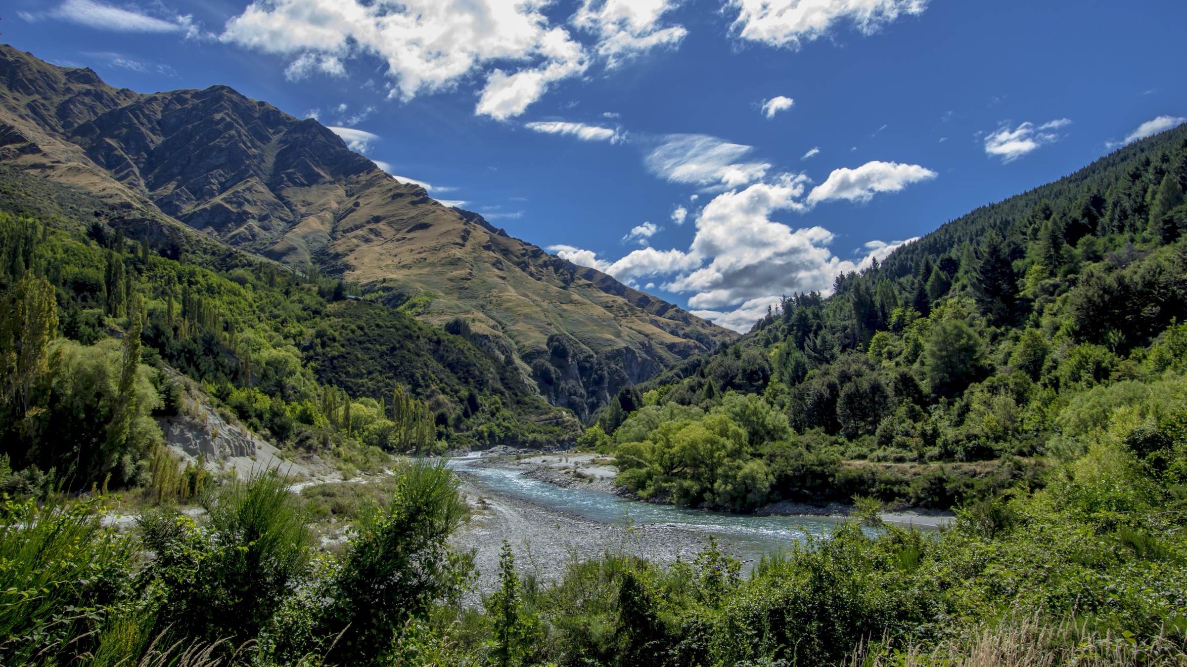
The Richardson Mountains sit on the western side of the Wakatipu Basin, separating Lake Wakatipu from the Dart–Rees catchments to the north. The southern Richardsons are the strongest sector for day walking in the range: they include the iconic Ben Lomond summit above Queenstown, the Moke Lake basin, the Lake Dispute hill lakes, the Mount Crichton gold-mining loop, and the Lake Wakatipu shoreline between Twelve Mile Delta and Bob’s Cove.
The walking character changes quickly with altitude. Ben Lomond is a serious exposed summit day with snow and ice risk outside summer; the Moke, Lake Dispute, Mount Crichton, and Bob’s Cove routes are lower but still exposed to wind, heat, wet clay, and rapid weather change. Several routes are shared with mountain bikes or cross mixed public / private access edges; check current signage before setting out.
Access is from Queenstown itself for Ben Lomond, and from the Queenstown–Glenorchy Road for the Moke Lake, Lake Dispute, Mount Crichton, Twelve Mile Delta, and Bob’s Cove trailheads.
See also: New Zealand — Northern Richardsons · New Zealand — Central Richardsons.
Selection rationale
These five hikes balance the southern Richardson essentials: Ben Lomond as the flagship summit day above Queenstown, the Moke Lake Loop as the classic lake-basin circuit, the Lake Dispute Track as the compact dry-hills-and-lake link, the Mount Crichton Loop as the sector’s forest-and-mining-history walk, and Twelve Mile Delta to Bob’s Cove as the low-level Lake Wakatipu heritage and shoreline route.
Summary table
| # | Hike | Country | Route type | Distance | Elevation gain | Max elevation | Difficulty |
|---|---|---|---|---|---|---|---|
| 1 | Ben Lomond Track via Tiki Trail | New Zealand | Out-and-back | 15.6 km | 1,443 m | 1,748 m at summit | Hard |
| 2 | Moke Lake Loop Track | New Zealand | Loop | 6.9 km | 183 m | Not resolved | Moderate |
| 3 | Lake Dispute Track | New Zealand | Out-and-back | 6.4 km | 301 m | Not resolved | Moderate |
| 4 | Mount Crichton Loop Track | New Zealand | Loop | 8.0 km | 324 m | Not resolved | Moderate |
| 5 | Twelve Mile Delta to Bob’s Cove Track | New Zealand | Out-and-back | 12.2 km | 368 m | Not resolved | Moderate |
Before you go
Permits and access
Day walking on all five routes does not require a permit. Ben Lomond, Moke Lake, Lake Dispute, Mount Crichton, and Bob’s Cove sit within reserves, scenic reserves, or QLDC / DOC-managed land accessible from public trailheads. Some sections cross private-land access edges — use the marked entries and follow current signage. The Ben Lomond Track can be shortened by using the Skyline gondola to skip the lower Tiki Trail; check gondola operating status before relying on it.
Standard southern Richardson day-hiking kit
Ben Lomond is a serious hill day; the other four are moderate lower-altitude walks. Carry:
- Sturdy boots or strong trail shoes, waterproof and windproof shell, warm insulating layer, hat and sun cover, and food.
- For Ben Lomond: 2+ litres of water, sun protection, map or GPS, headtorch, and an emergency layer.
- For the lower walks: map or downloaded track file, wind / rain layer, sun protection, and insect repellent for the Moke Lake / Bob’s Cove flats.
- Personal locator beacon (PLB) recommended for Ben Lomond; mobile coverage is patchy above the Ben Lomond Saddle and absent in parts of the western basin.
Common hazards
Ben Lomond carries snow, ice, wind, and exposure risk above the saddle, and heat and limited water on the lower climb. The Moke, Lake Dispute, Mount Crichton, and Bob’s Cove routes are subject to wet clay, slippery roots, shared mountain-bike traffic, cold water and exposure at the lake edge, and old mining relics on the Mount Crichton loop. Weather changes fast across the Whakatipu basin — check the forecast on the day of travel.
1. Ben Lomond Track via Tiki Trail
Snapshot
Itinerary
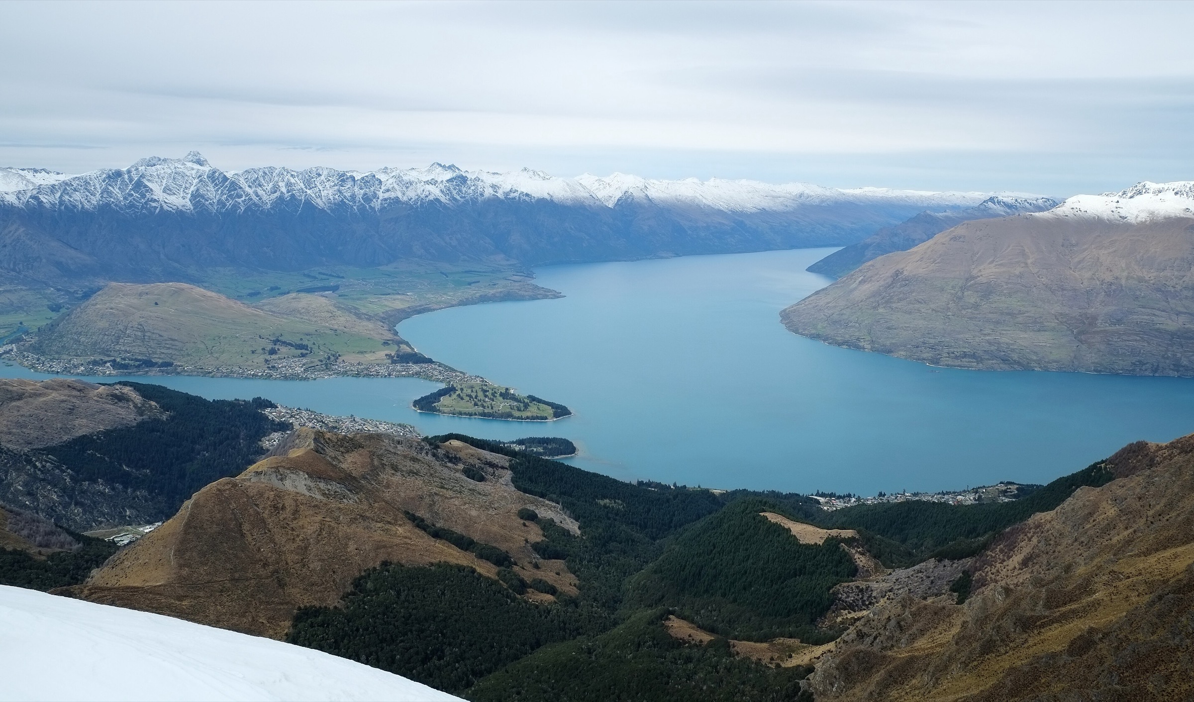
Climb from Queenstown up the Tiki Trail through the beech-and-Douglas-fir forest to the Skyline area, then continue on the graded track to Ben Lomond Saddle. From the saddle, the exposed upper track climbs to the 1,748 m summit before returning the same way.
Why it is essential
The signature Queenstown summit day and the best-known high viewpoint on the southern Richardson side of the Whakatipu basin — the essential route for hikers with the fitness for a serious alpine day.
Hazards and notes
- Snow and ice above the saddle from autumn through spring; the upper track is exposed to strong wind and rapid weather change.
- Heat and limited water on the lower Tiki Trail; carry 2+ litres.
- Mobile coverage is patchy above the saddle; carry a PLB and emergency layer.
GPX / KML links
| Source | URL | Format | Notes |
|---|---|---|---|
| AllTrails Ben Lomond Track via Tiki Trail | alltrails.com | Route page | GPX via service subject to AllTrails terms |
| AllTrails Ben Lomond via Skyline Gondola | alltrails.com | Alternate route page | GPX via service subject to AllTrails terms |
| OSM search — Ben Lomond Track | openstreetmap.org | ODbL geometry | Geometry cross-check only |
Further reading
2. Moke Lake Loop Track
Snapshot
Itinerary
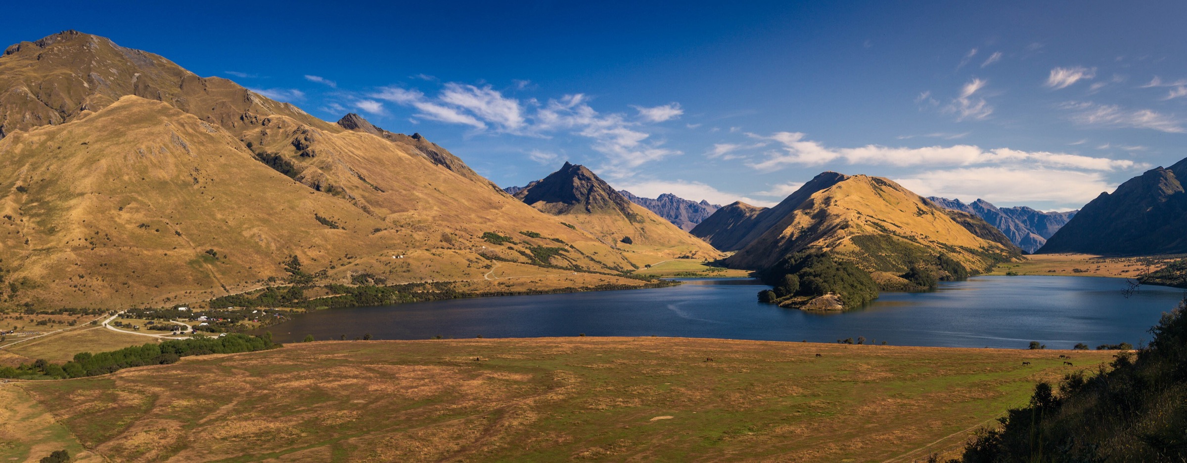
From the Moke Lake car park, follow the loop around the lake through open pasture, beech fringes, wetland edges, and surrounding dry-hill country. Optional links continue toward Lake Dispute and the Moonlight Track network.
Why it is essential
The classic easy-to-moderate lake-basin circuit west of Queenstown — the walk that reads the southern Richardson foothill landscape without committing to a summit day.
Hazards and notes
- Wind, heat, and wet grass on the exposed loop sections; winter ice is possible.
- Shared with mountain-bike traffic on the connector sections toward Lake Dispute and Moonlight.
- Campsite and picnic traffic along the lakeshore; carry insect repellent in warm weather.
GPX / KML links
| Source | URL | Format | Notes |
|---|---|---|---|
| AllTrails Moke Lake Loop Track | alltrails.com | Route page | GPX via service subject to AllTrails terms |
| OSM search — Moke Lake Loop Track | openstreetmap.org | ODbL geometry | Geometry cross-check only |
Further reading
3. Lake Dispute Track
Snapshot
Itinerary
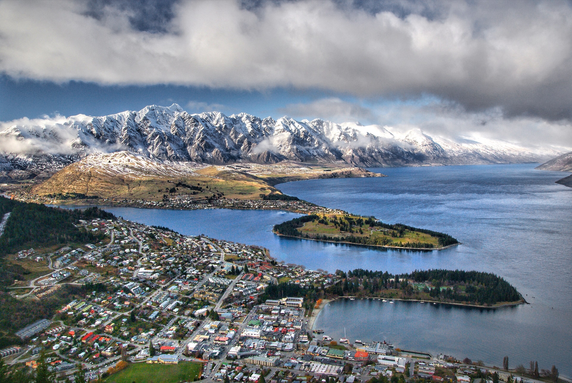
Climb from the road-side access through open dry hillside into the small Lake Dispute basin, then return by the same track. The route also connects into the Moke Lake and Moonlight networks for longer link days.
Why it is essential
A compact dry-hills-and-lake route between Lake Wakatipu and the Moke / Moonlight network — the sector’s short-day link between shoreline and hill-lake country.
Hazards and notes
- Hot, exposed slopes with limited water; carry more than the loop distance suggests.
- Wind, mud after rain, and shared-use trail sections.
- Winter ice or snow possible on the upper approach.
GPX / KML links
| Source | URL | Format | Notes |
|---|---|---|---|
| AllTrails Lake Dispute Track | alltrails.com | Route page | GPX via service subject to AllTrails terms |
| OSM search — Lake Dispute Track | openstreetmap.org | ODbL geometry | Geometry cross-check only |
Further reading
4. Mount Crichton Loop Track
Snapshot
Itinerary
Follow the loop through forest, creek gullies, waterfall features, and old gold-mining ground before returning to the car park. The loop crosses several bridges and passes historic mining relics in the reserve.
Why it is essential
The southern sector’s best compact forest, creek, and mining-history loop — a moderate half-day walk that reads the Mount Crichton scenic reserve without demanding a full alpine day.
Hazards and notes
- Slippery roots and rocks, wet-forest sections, and creek edges — take care on the bridges.
- Old mining relics along the loop; treat as heritage features, not entry points.
- Cold, shaded ground and possible ice in winter.
- No licence-compatible route-specific image was located for this entry above the resolution floor.
GPX / KML links
| Source | URL | Format | Notes |
|---|---|---|---|
| AllTrails Mount Crichton Loop Track | alltrails.com | Route page | GPX via service subject to AllTrails terms |
| OSM search — Mount Crichton Loop Track | openstreetmap.org | ODbL geometry | Geometry cross-check only |
Further reading
5. Twelve Mile Delta to Bob’s Cove Track
Snapshot
Itinerary
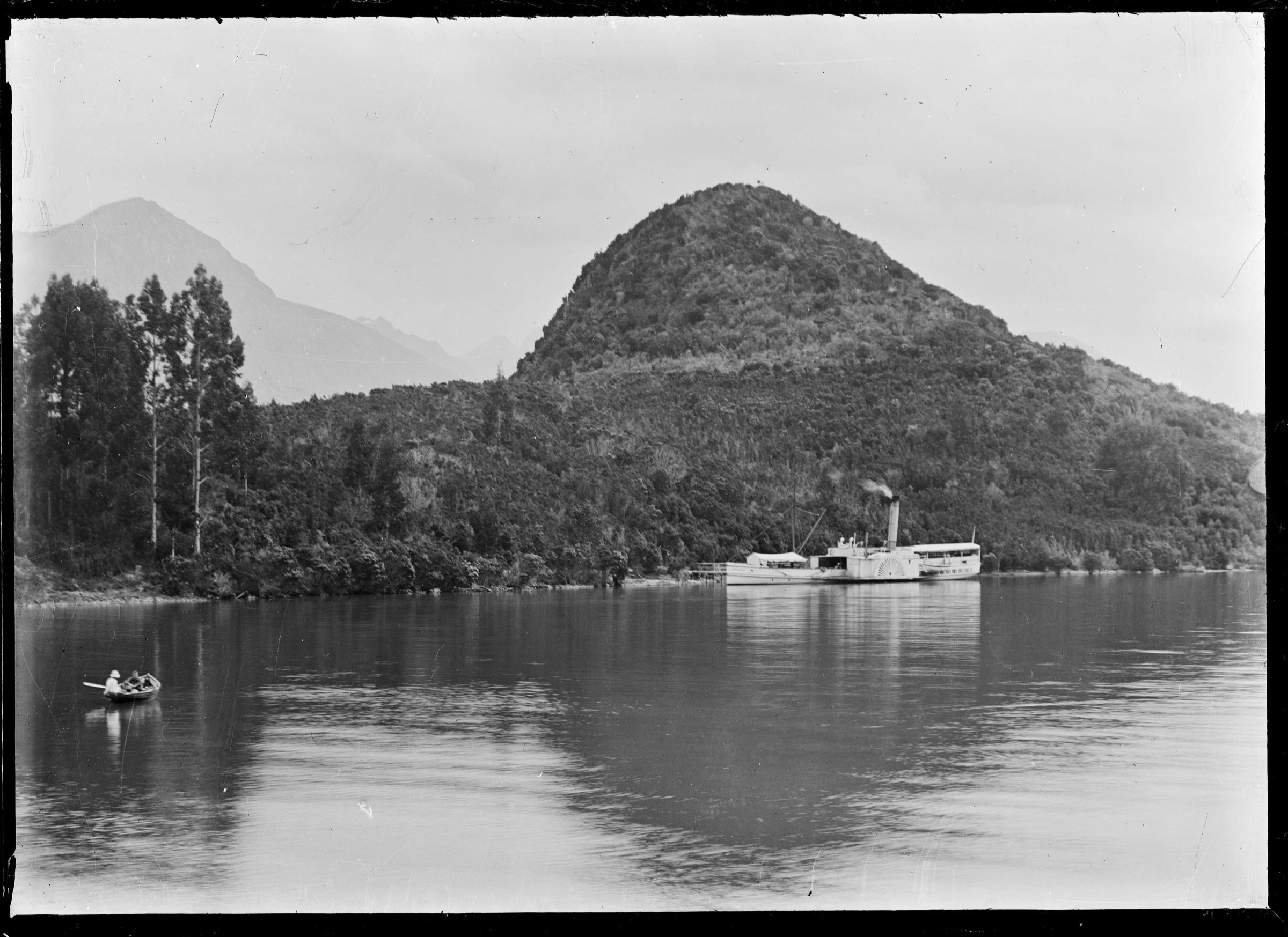
Follow the Lake Wakatipu shoreline track between Twelve Mile Delta and Bob’s Cove through beech forest, small beaches, and lake-view rises. The route passes historic lime-burning and jetty features near Bob’s Cove, where the paddle steamer Mountaineer once served the western Wakatipu settlements.
Why it is essential
Completes the southern set with the classic low-level Lake Wakatipu heritage and shoreline walk — the sector’s best route for reading the lake’s 19th-century transport history alongside the western Wakatipu forest.
Hazards and notes
- Lakeshore wind and wet roots; short steep sections above the shore.
- Shared with mountain-bike traffic on connector sections.
- Cold water and steep-edge exposure near the lakeshore.
GPX / KML links
| Source | URL | Format | Notes |
|---|---|---|---|
| AllTrails Twelve Mile Delta to Bob’s Cove Track | alltrails.com | Route page | GPX via service subject to AllTrails terms |
| AllTrails Bob’s Cove Track | alltrails.com | Related route page | GPX via service subject to AllTrails terms |
| OSM search — Twelve Mile Delta to Bob’s Cove | openstreetmap.org | ODbL geometry | Geometry cross-check only |
Further reading
Verification notes
- “Southern Richardsons” is a regional grouping used in this catalogue, not an official DOC or QLDC visitor label.
- AllTrails route pages are used as the primary source for distances and elevation gains; several maximum elevations were not resolved from published sources and are flagged as such rather than guessed. AllTrails route-file reuse permissions are not open by default — the links serve as route references.
- Ben Lomond’s 1,748 m summit elevation is cross-checked against the Ben Lomond (Otago) encyclopedic entry.
- OpenStreetMap searches are listed as geometry cross-checks only (ODbL); they are not treated as authoritative route statistics.
- Trailhead public-transport options were not confirmed for any of the five routes; treat all five as private-vehicle or walk-in access.
Further reading
| Source | URL |
|---|---|
| AllTrails Ben Lomond Track via Tiki Trail | alltrails.com |
| AllTrails Moke Lake Loop Track | alltrails.com |
| AllTrails Lake Dispute Track | alltrails.com |
| AllTrails Mount Crichton Loop Track | alltrails.com |
| AllTrails Twelve Mile Delta to Bob’s Cove Track | alltrails.com |
| Wikipedia — Ben Lomond (Otago) | en.wikipedia.org |
| Wikipedia — Richardson Mountains | en.wikipedia.org |
| Wikipedia — Moke Lake | en.wikipedia.org |
| Wikipedia — Bob’s Cove | en.wikipedia.org |