Regional overview
The Cantabrian Mountains form the great Atlantic mountain chain of northern Spain. Within them, the Picos de Europa are the sharpest and most dramatic limestone massif: steep gorges, karst plateaux, glacial hollows, high mountain passes, beech woods, pastoral vegas, and exposed rock paths are all compressed into a compact area spanning Asturias, Cantabria, and León.
The main hiking centres for these five walks are Poncebos, Caín, Covadonga, Sotres, Fuente Dé, and Alto de la Farrapona. Picos routes are often short in distance but serious in terrain: fog, limestone rockfall, steep slopes, scarce water in the high mountains, and lingering snow can make moderate routes much more demanding.
The normal hiking season is late spring to autumn. Lower gorge routes may be possible for much of the year, but high routes such as Vega de Urriellu and Horcados Rojos should be treated as summer mountain hikes unless walkers have winter equipment and experience. Access can also be regulated: the Lagos de Covadonga sector is subject to seasonal public-transport control, with private vehicles excluded during regulated periods.
Selection rationale
The five hikes below give a balanced regional set: the iconic Cares gorge, the classic Covadonga lakes circuit, the approach to Picu Urriellu / Naranjo de Bulnes, a high-mountain Fuente Dé balcony route, and a Somiedo glacial-lakes circuit representing the broader Cantabrian range beyond Picos de Europa.
Summary table
| # | Hike | Country | Route type | Distance | Gain | Max elevation | Difficulty |
|---|---|---|---|---|---|---|---|
| 1 | Ruta del Cares: Poncebos–Caín–Poncebos | Spain | Out-and-back; one-way possible with arranged transport | 22.1 km | +831 m | 532 m | Very hard / exposed path |
| 2 | Lagos de Covadonga circular | Spain | Loop | 5 km long circuit; 3 km short circuit | +50 m | Not stated by the official route source | Low, but fog-prone |
| 3 | Vega de Urriellu from Sotres | Spain | Out-and-back | 24 km full return; 12 km one way | +1,070 m | Approximately 1,953–1,960 m at Refugio/Vega de Urriellu | Medium, but long; high difficulty in winter |
| 4 | Horcados Rojos from El Cable / Fuente Dé | Spain | Out-and-back; lift-assisted | 11.4 km | +772 m | Approximately 2,344 m at Collado de los Horcados Rojos | Medium high-mountain route |
| 5 | Lagos de Saliencia circular | Spain | Loop | 7.6 km | +318 m | 1,738 m | Medium |
1. Ruta del Cares — Poncebos to Caín and back

Snapshot
Itinerary
The route starts at Poncebos near the Bulnes funicular area, crosses the lower access section, and climbs during the first kilometres above the Cares gorge. It then follows the historic service path cut into the limestone walls above the river. The path passes tunnels, rock galleries, bridges, and narrow balcony sections before reaching Caín de Valdeón. The standard full day-hike returns by the same route to Poncebos. A shorter one-way version between Poncebos and Caín is possible only with planned transport, taxi, 4x4 transfer, or seasonal bus arrangements.
Why it is essential
The Ruta del Cares is one of the signature walks of Picos de Europa: a dramatic gorge route created from hydraulic infrastructure, now following a rock-cut path high above the Cares river. It is representative of the region’s limestone, engineering history, and exposed gorge walking.
Equipment
- Sturdy hiking shoes or boots
- Weatherproof layer
- Warm layer
- Water and food
- Map/GPS
- Sun protection
- Headtorch as a reserve
- Trekking poles useful, but should be stowed on narrow sections where hands may be needed for balance
Hazards and notes
The route is not a climbing route, but the path is exposed and narrow in places. Sections are carved into the rock and may be approximately 1.5 m wide. Rockfall risk is permanent and increases after heavy rain or strong wind. Dogs must be on a lead; on the Cares route, extendable leads are prohibited and fixed leads must not exceed 1.20 m. Bicycles are not permitted.
GPX / KML links
Route files will be replaced later with rebuilt GPX/KML files.
| Source | URL | Format | Notes |
|---|---|---|---|
| Turismo Asturias route page | turismoasturias.es | GPX | Publicly linked route file; reuse terms unresolved. Use as source link for now; replace later with rebuilt GPX |
| Turismo Asturias route page | turismoasturias.es | KML | Publicly linked route file; reuse terms unresolved. Use as source link for now; replace later with rebuilt KML |
| Picos de Europa National Park cartography page | parquenacionalpicoseuropa.es | KML | Official KML listed by the park; explicit route-file licence not found. Use as source link for now; replace later |
Sources
2. Lagos de Covadonga circular
Snapshot
Itinerary
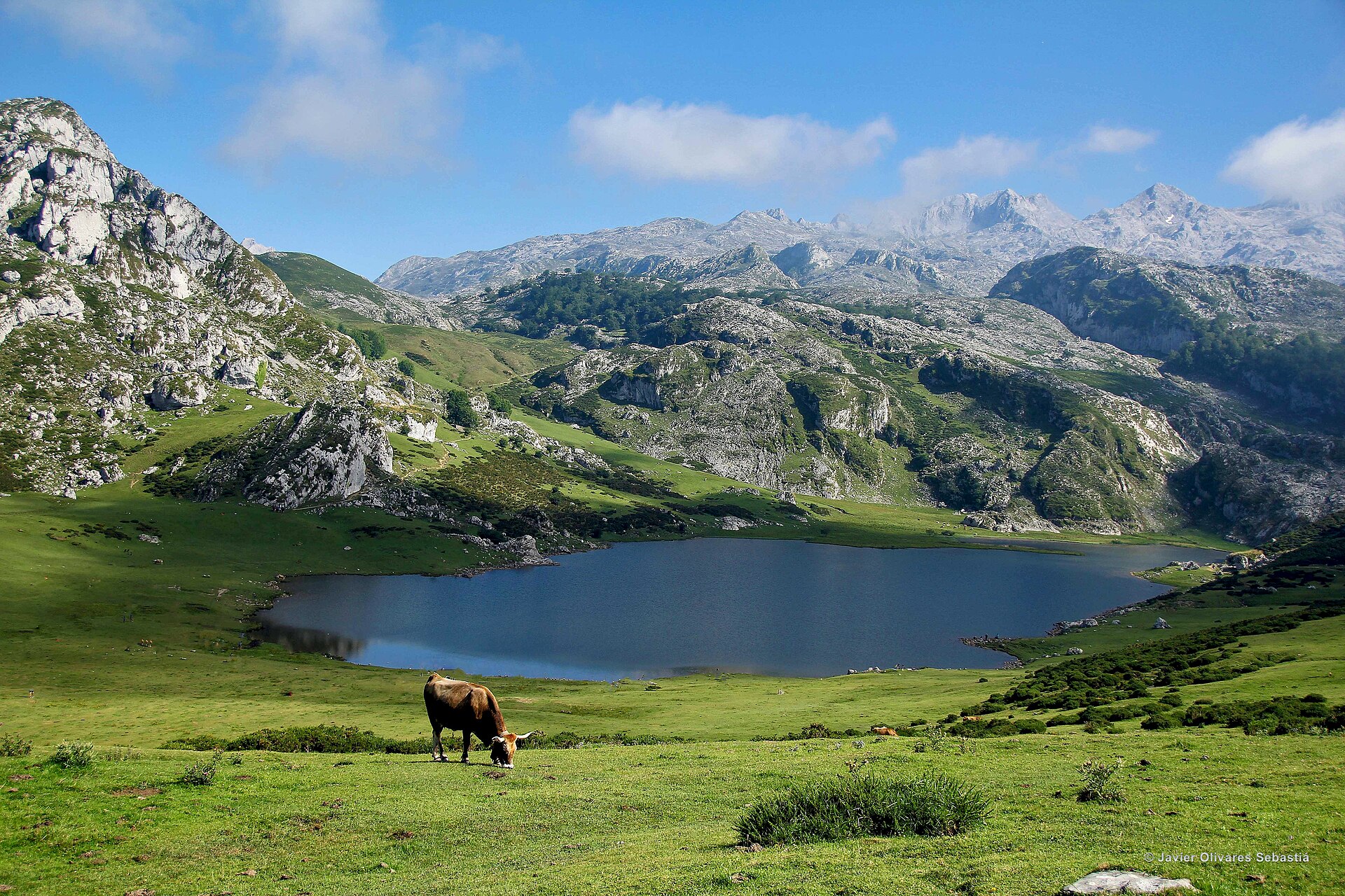
The long circular route starts at Buferrera and first reaches the Pedro Pidal visitor-centre area and the Mirador del Príncipe. It then returns towards the old Buferrera mines and continues towards Lago Ercina. The longer variant passes behind Monte Mosquital, crosses Vega del Bricial and the Palomberu beech wood, and returns via Vega de Enol to Buferrera.
Why it is essential
This is the classic introductory walk to the Covadonga lakes, combining glacial lake scenery, mining heritage, beech woodland, open pasture, and viewpoints over the western massif of Picos de Europa.
Equipment
- Hiking shoes or boots
- Weatherproof layer
- Warm layer
- Water and food
- Map/GPS
- Sun protection
- Navigation backup recommended because fog is a specific hazard
Hazards and notes
Fog is the main route-specific hazard, especially on the long circuit. Seasonal access controls apply to the Lagos de Covadonga road; during regulated periods, access is by public transport and private vehicles are excluded except authorised vehicles. Dogs must be kept on a lead in the national park.
GPX / KML links
Route files will be replaced later with rebuilt GPX/KML files.
| Source | URL | Format | Notes |
|---|---|---|---|
| Picos de Europa National Park cartography page | parquenacionalpicoseuropa.es | KML | Official KML listed by the park; explicit route-file licence not found. Use as source link for now; replace later |
| Picos de Europa National Park cartography page | parquenacionalpicoseuropa.es | KML | Official KML listed by the park; explicit route-file licence not found. Use as source link for now; replace later |
Sources
3. Vega de Urriellu from Sotres
Snapshot
Itinerary
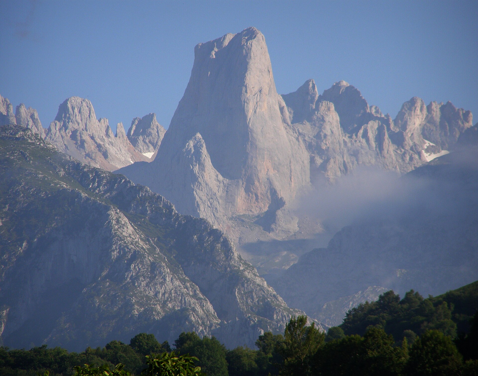
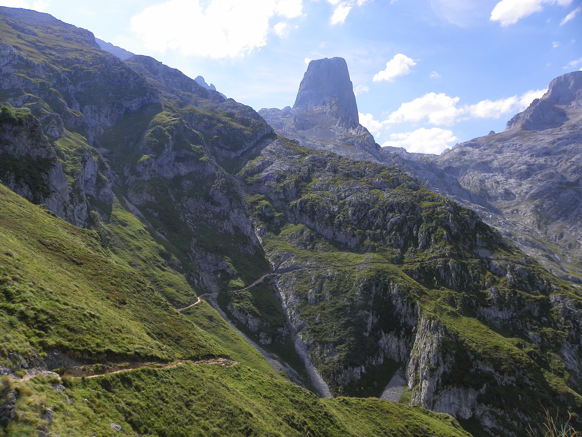
The official PR-PNPE 21 route links Sotres with Vega de Urriellu via Collado de Pandébano and Collado Vallejo. From the meadows and invernales around Sotres, the path climbs into the limestone terrain of the central massif. After Collado Vallejo, the Picu Urriellu / Naranjo de Bulnes dominates the approach to the refuge area. The route is linear and must be returned the same way for a day walk. A shorter day variant from Collado Pandébano is widely used, but official statistics for that shortened trailhead were not verified.
Why it is essential
Vega de Urriellu is the classic walking approach to the foot of Picu Urriellu, the most recognisable summit of Picos de Europa. The route gives a complete progression from inhabited pastoral valleys to the limestone heart of the central massif.
Equipment
- Sturdy boots
- Weatherproof layer
- Warm layer
- Trekking poles recommended
- Navigation backup
- Headtorch
- Water and food
- Sun protection
- Hat and gloves outside midsummer
- Microspikes or crampons only if snow or ice remains and the party has suitable experience
Hazards and notes
The full return can be very long. Snow or ice can make the Collado Vallejo area dangerous. Routes beyond the refuge into the central massif are not waymarked and require strong terrain knowledge, fitness, and suitable equipment.
GPX / KML links
Route files will be replaced later with rebuilt GPX/KML files.
| Source | URL | Format | Notes |
|---|---|---|---|
| Picos de Europa National Park cartography page | parquenacionalpicoseuropa.es | KML | Official KML listed by the park; explicit route-file licence not found. Use as source link for now; replace later |
Sources
- MITECO / OAPN — Vega de Urriellu route
- Picos de Europa National Park — Cartography and tracks
- Turismo Asturias — Refugio de la Vega de Urriellu
4. Horcados Rojos from El Cable / Fuente Dé
Snapshot
Itinerary
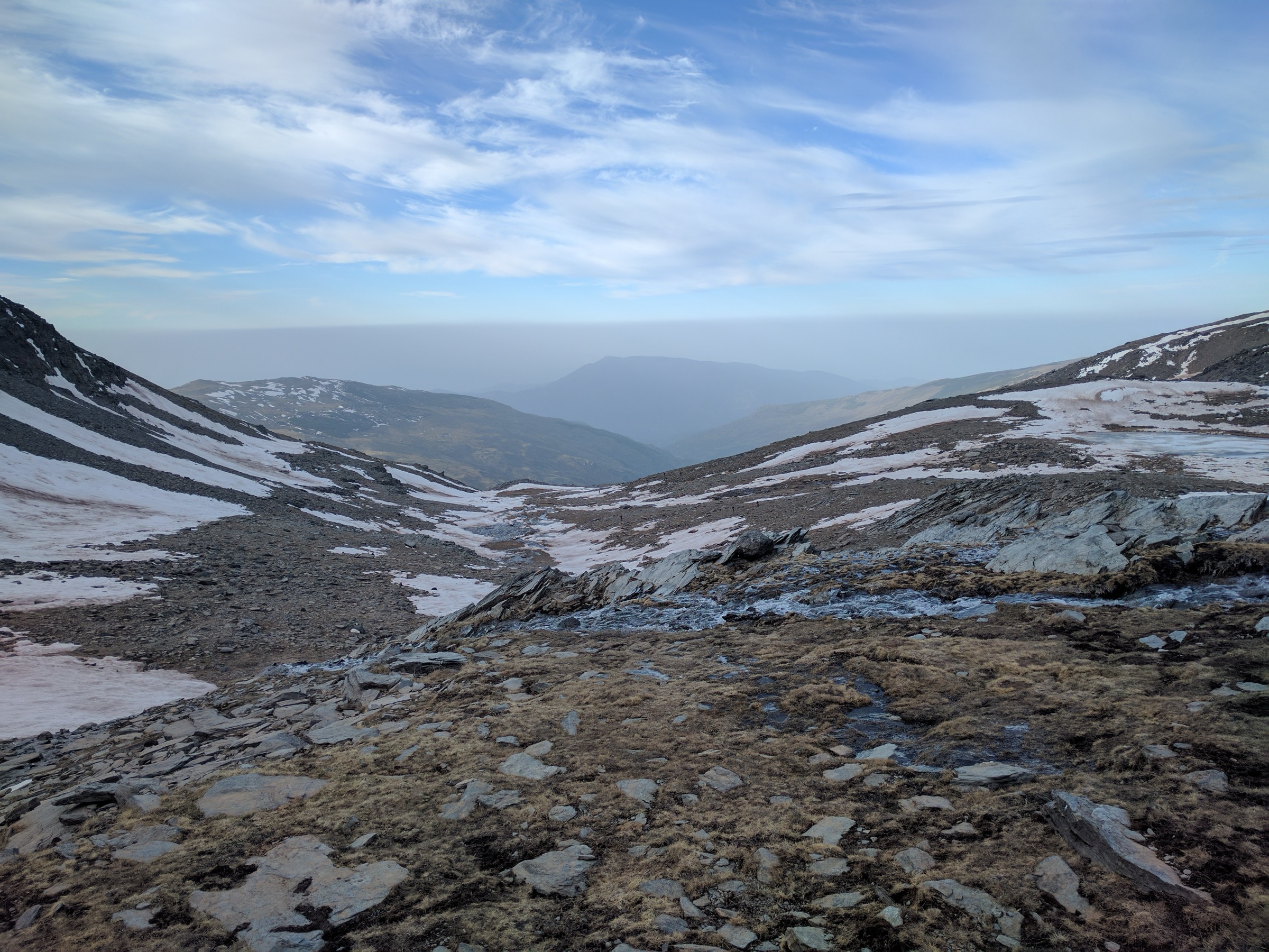
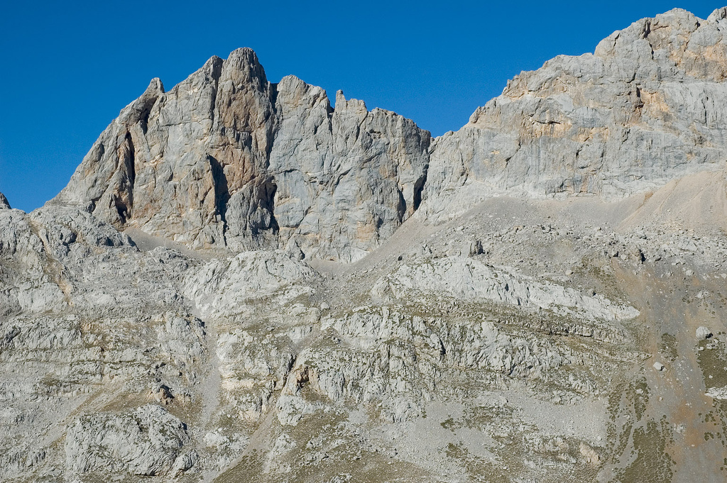
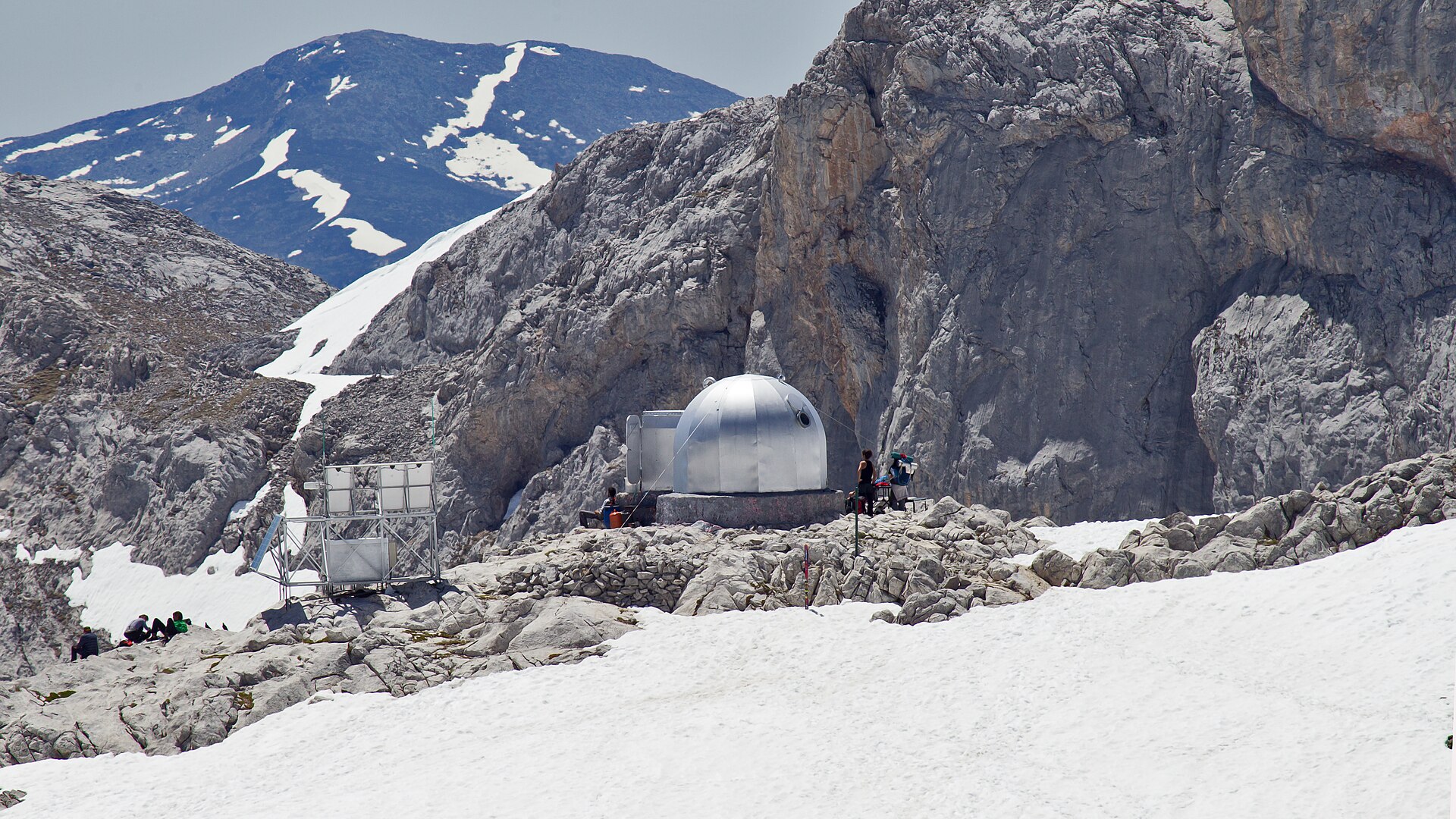
The route starts from El Cable, the upper station of the Fuente Dé cable car, and traverses into the high limestone terrain of the central massif. It follows the waymarked high-mountain path towards Horcados Rojos, with a steeper stony final section to the collado. The recommended hiking objective is the collado; the continuation to the summit is reserved for well-prepared mountaineers.
Why it is essential
This is the most accessible high-mountain balcony walk in the Fuente Dé sector. It gives a direct view into the central massif without requiring a technical climb, provided the route is walked only to the collado under good conditions.
Equipment
- Sturdy boots
- Weatherproof layer
- Warm layer
- Trekking poles
- Navigation backup
- Food and water
- Sun protection
- Headtorch
- Microspikes, crampons, and ice axe only for competent winter users; under normal catalogue assumptions the route should be avoided in snow or ice
Hazards and notes
This is a high-mountain limestone route. The last section to the collado is steep and stony. The summit continuation is for prepared mountaineers. The route should not be attempted in snow, ice, or fog by normal summer hikers.
GPX / KML links
Route files will be replaced later with rebuilt GPX/KML files.
| Source | URL | Format | Notes |
|---|---|---|---|
| Picos de Europa National Park cartography page | parquenacionalpicoseuropa.es | KML | Official KML listed by the park; explicit route-file licence not found. Use as source link for now; replace later |
Sources
- MITECO / OAPN — Horcados Rojos route
- Picos de Europa National Park — Cartography and tracks
- Hiking Iberia — Horcados Rojos
5. Lagos de Saliencia circular
Snapshot
Itinerary
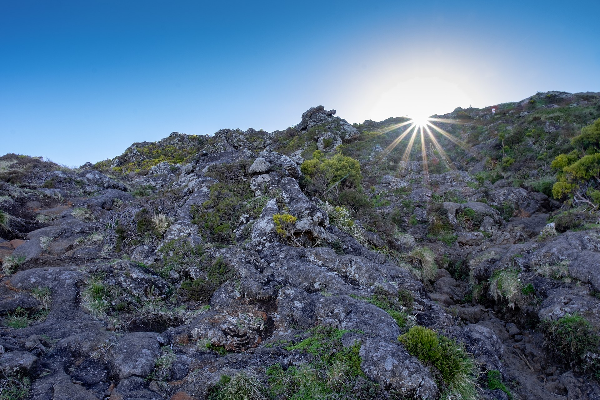
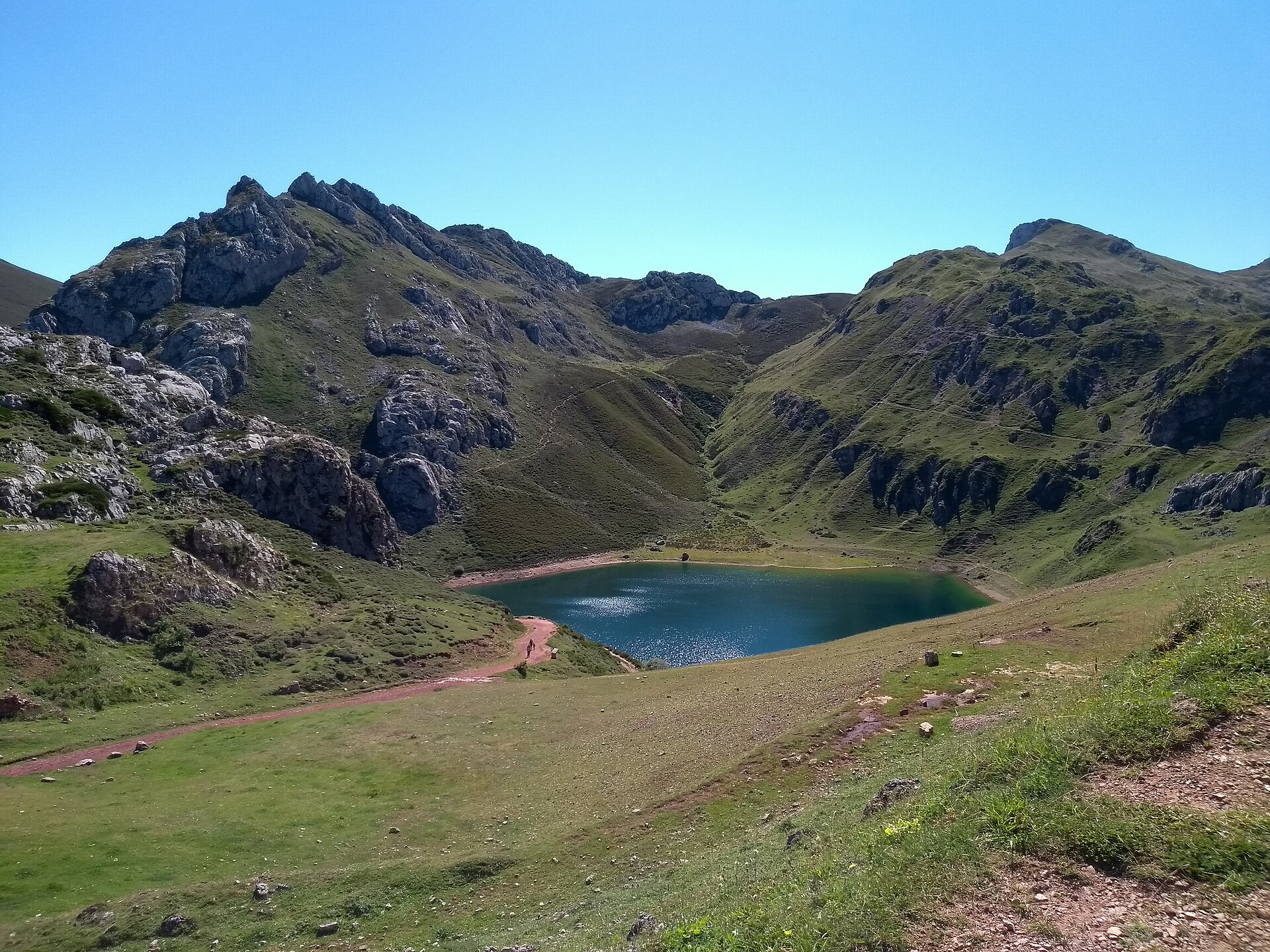
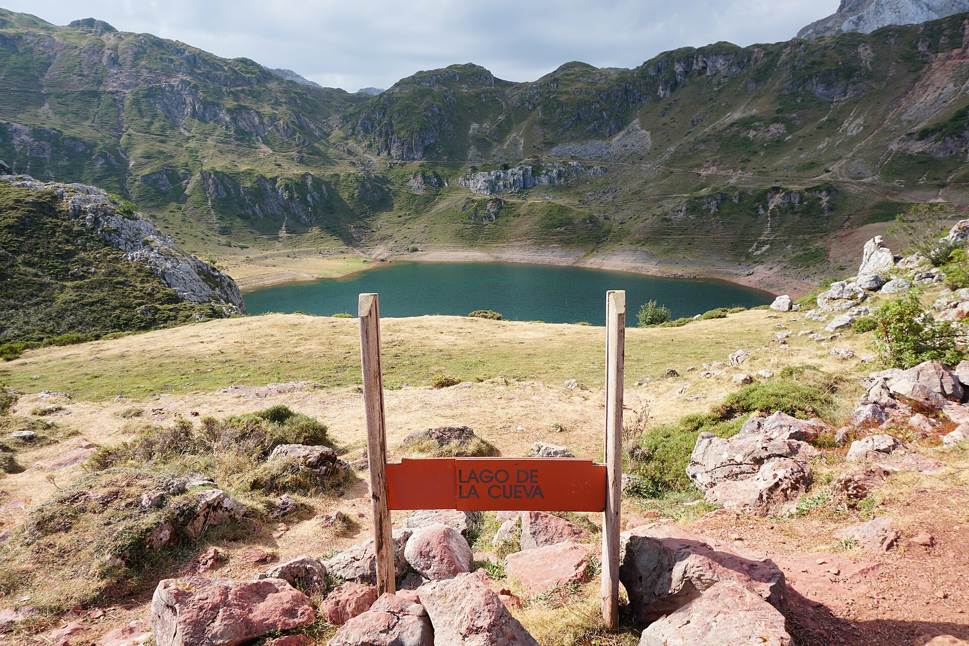
The route starts at Alto de la Farrapona, at about 1,708 m, and follows PR-AS 15 towards the glacial lakes of Saliencia. It first reaches Lago de la Cueva, then climbs on a former mining track towards Lago Almagrera and the area of Lago Cerveriz. The circuit continues towards Lago Calabazosa, also called Lago Negro, before returning by a marked path that closes the loop back towards Lago de la Cueva and Alto de la Farrapona.
Why it is essential
This hike represents the Cantabrian Mountains beyond the Picos core: glacial lakes, high pastures, old mining traces, broad views, and protected Somiedo landscapes. It is short enough for a moderate day hike but distinctive enough to stand beside the more famous Picos routes.
Equipment
- Hiking shoes or boots
- Weatherproof layer
- Warm layer
- Water and food
- Map/GPS
- Sun protection
- Trekking poles if preferred
- Extra warm clothing in shoulder season
- Winter equipment only if snow or ice remains
Hazards and notes
This is open mountain terrain and can be exposed to fog, wind, and sudden weather changes. Keep dogs on a lead, avoid cattle, do not approach mastiffs, carry suitable equipment, and leave no trace.
GPX / KML links
Route files will be replaced later with rebuilt GPX/KML files.
| Source | URL | Format | Notes |
|---|---|---|---|
| Turismo Asturias route page | turismoasturias.es | GPX | Publicly linked route file; reuse terms unresolved. Use as source link for now; replace later with rebuilt GPX |
| Turismo Asturias route page | turismoasturias.es | KML | Publicly linked route file; reuse terms unresolved. Use as source link for now; replace later with rebuilt KML |
Sources
Further reading
| Source | URL |
|---|---|
| Turismo Asturias, Ruta del Cares | turismoasturias.es |
| Turismo Asturias, Lagos de Saliencia | turismoasturias.es |
| MITECO / OAPN, Lagos de Covadonga | miteco.gob.es |
| MITECO / OAPN, Vega de Urriellu | miteco.gob.es |
| MITECO / OAPN, Horcados Rojos | miteco.gob.es |
| Picos de Europa National Park, cartography and tracks | parquenacionalpicoseuropa.es |