Regional overview
This region covers the limestone Dinaric mountain belt where Slovenia’s karst plateaux meet the Croatian Velebit range and the canyons above the Adriatic. The hiking character is strongly shaped by karst: dry ridges, dolines, caves, sharp limestone, forested plateaux, sudden cliff edges, and long views from relatively modest elevations.
The Slovenian side is represented by Nanos and Snežnik: accessible, scenic Dinaric summits with forested approaches and broad views over the Adriatic-facing karst, the Vipava Valley, and inland Slovenia. Nanos is promoted by official local tourism as one of the Vipava Valley’s classic hiking routes from Razdrto, while Veliki Snežnik is described by Slovenian route sources as the highest mountain of southern / south-western Slovenia.
The Croatian side is more rugged and remote. Northern Velebit is defined by the Premužić Trail, a historic dry-stone mountain path through the Rožanski and Hajdučki kukovi karst landscape; Paklenica adds canyon walking, cave access, mountain huts, and the most famous rock walls of the southern Velebit.
The main season is generally late spring to autumn. Velebit planning needs particular caution: official Croatian hiking guidance notes that the best period for the Velebit Hiking Trail is May to October, while winter and early spring may bring snow, ice, fog, bura winds, and difficult access roads. Water is limited on many Velebit routes and should not be assumed available.
Selection rationale
These five hikes were selected to represent the region’s main day-hiking characters: a Slovenian karst-edge summit, the highest Slovenian Dinaric summit, the historic Premužić Trail in Northern Velebit, the classic Paklenica canyon route, and the limestone towers of Tulove Grede in southern Velebit. The set avoids choosing five routes from one trailhead and balances summit, ridge, canyon, cave, and historic trail experiences.
Summary table
| # | Hike | Country | Route type | Distance | Gain | Max elevation | Difficulty |
|---|---|---|---|---|---|---|---|
| 1 | Nanos / Pleša from Razdrto | Slovenia | Loop / variant loop | 7.3 km (variants 4.8–10.6 km) | +659–671 m | 1,247–1,262 m | Moderate–hard |
| 2 | Veliki Snežnik from Sviščaki | Slovenia | Loop / out-and-back variant | ~11–13 km | +590–650 m | 1,796 m | Moderate |
| 3 | Premužić Trail: Zavižan – Rossi Shelter / Rožanski kukovi | Croatia | Loop / out-and-back variant | 16.5–18.5 km | +470–650 m | 1,630–1,678 m | Moderate–hard |
| 4 | Velika Paklenica Canyon – Manita peć – Paklenica Mountain Hut | Croatia | Out-and-back with side trip | 13.5–15.6 km | +720–742 m | ~570 m | Moderate–hard |
| 5 | Tulove Grede from Vrhprag / Majstorska cesta | Croatia | Out-and-back / short loop | 3.2–3.6 km | +240–295 m | 1,110–1,120 m | Moderate with short scrambling |
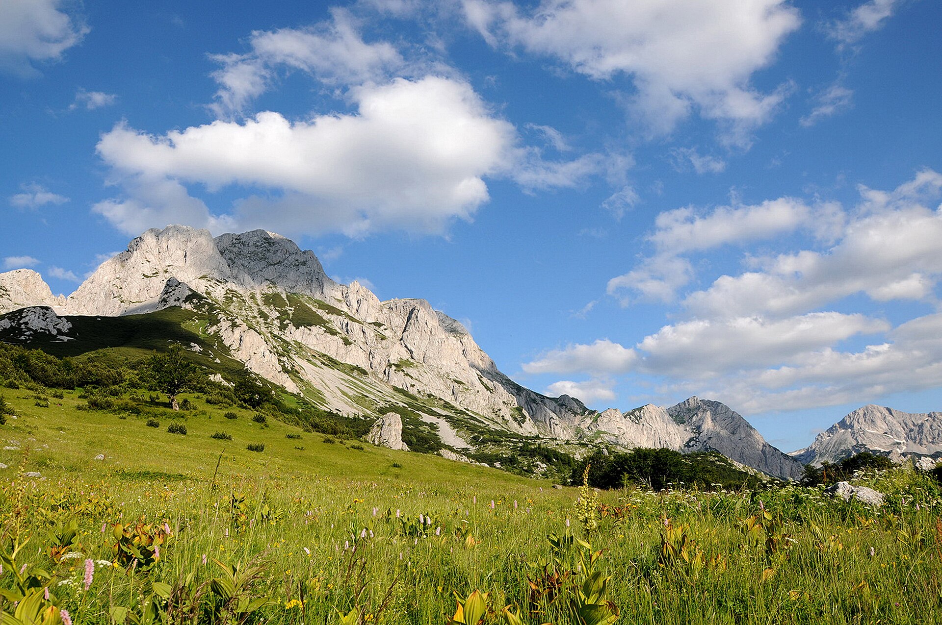
1. Nanos / Pleša from Razdrto
Snapshot
Itinerary
The route starts in Razdrto and climbs towards the western edge of the Nanos plateau. Official local sources describe two principal ascent choices: a steeper route and an easier route. The steep route climbs more directly towards the church of St Jerome and the Vojko hut area, while the easier line makes a broader approach to the plateau. The catalogue route uses the common Razdrto–St Jerome–Vojko hut / Pleša–Razdrto circuit. The upper section reaches the open karst plateau near Pleša, close to Vojkova koča. From this edge of Nanos there are wide views towards the Vipava Valley, the Adriatic-facing karst, and inland Slovenia. The descent can be made by the easier marked route to form a loop rather than repeating the steep ascent.
Why it is essential
Nanos is one of the defining Slovenian karst-edge hikes. It is short enough for a half-day mountain outing but gives a strong sense of the Dinaric limestone landscape: steep forested lower slopes, a sudden plateau edge, wind-exposed open ground, and long views.
Equipment
- Sturdy boots
- Weatherproof layer
- Warm layer
- Water
- Food
- Map/GPS
- Sun protection
- Trekking poles recommended for the descent
- Winter traction only if current local conditions justify it
Hazards and notes
The steep route is more serious than the distance suggests and includes aided or rocky sections. Weather can change quickly on the plateau edge. The official Postojna source distinguishes the steep and easy variants, so route choice should match ability and conditions.
GPX / KML links
| Source | URL | Format | Notes |
|---|---|---|---|
| Visit Postojna official Nanos route page | postojnsko.si | GPX / web map | Terms not fully checked; route file found; reuse status unresolved. |
| SloveniaHiking.Rocks Nanos from Razdrto | sloveniahiking.rocks | GPX | Site cautions that GPS tracks should not be followed blindly; route file found; reuse status unresolved. |
Further reading
- Vipava Valley official Nanos page
- Visit Postojna Nanos route page
- SloveniaHiking.Rocks Nanos route page
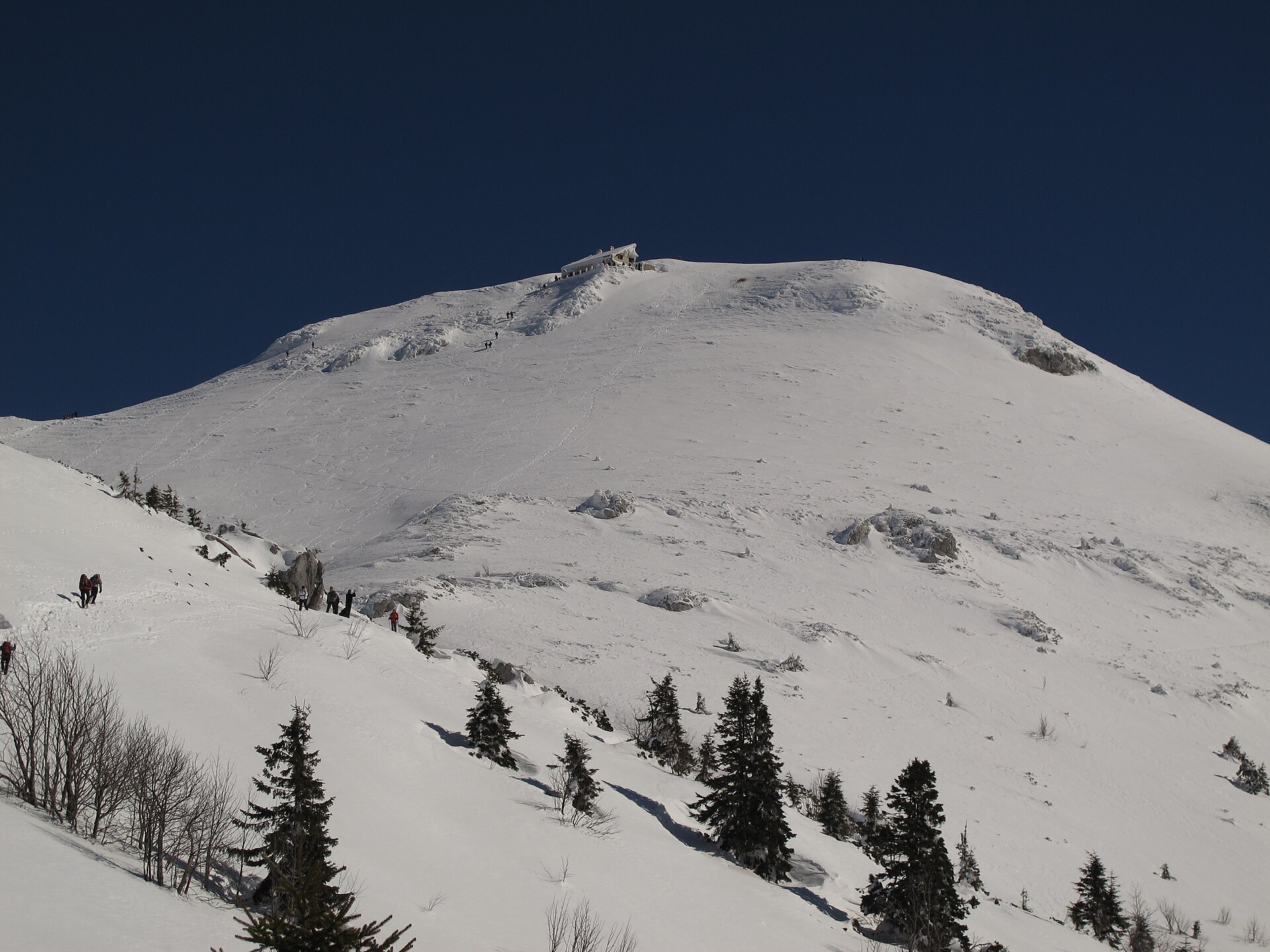
2. Veliki Snežnik from Sviščaki
Snapshot
Itinerary
The shortest standard ascent of Veliki Snežnik begins at Sviščaki. The marked route climbs from the hut / settlement area through forest and gradually reaches the open upper slopes of Snežnik. Slovenian route sources list the summit at 1,796 m and give an ascent of roughly 590–650 m from Sviščaki. A mountain hut stands just below the summit area. The return can be made by the ascent route, or as a broader circuit using the Grčovec return variant described by Slovenian hiking sources. That circular descent is reported as more difficult to navigate than the ascent route and should not be treated as an automatic choice in poor visibility.
Why it is essential
Veliki Snežnik is the highest summit of Slovenia’s southern Dinaric mountains and gives the clearest high-point experience in the Slovenian part of this catalogue region. Its combination of forest, karst, wildlife habitat, and broad summit views makes it an essential contrast to the lower Nanos plateau.
Equipment
- Sturdy boots
- Weatherproof and warm layers
- Food
- Water
- Navigation backup
- Sun protection
- Headtorch if starting late
- Trekking poles recommended
- Traction if shoulder-season snow conditions require it
Hazards and notes
Navigation is straightforward on the marked ascent in good weather, but the optional circular descent is less obvious. Sources note that the Snežnik forests are habitat for bear, wolf, and lynx; normal wildlife awareness is appropriate, especially around dawn, dusk, and in dense forest.
GPX / KML links
| Source | URL | Format | Notes |
|---|---|---|---|
| SloveniaHiking.Rocks Veliki Snežnik route | sloveniahiking.rocks | GPX | Site cautions that GPS tracks should not be followed blindly; route file found; reuse status unresolved. |
| Slotrips Veliki Snežnik from Sviščaki | slotrips.si | Web route description | Commercial site terms not fully checked; useful for verification; route-file reuse unresolved. |
Further reading
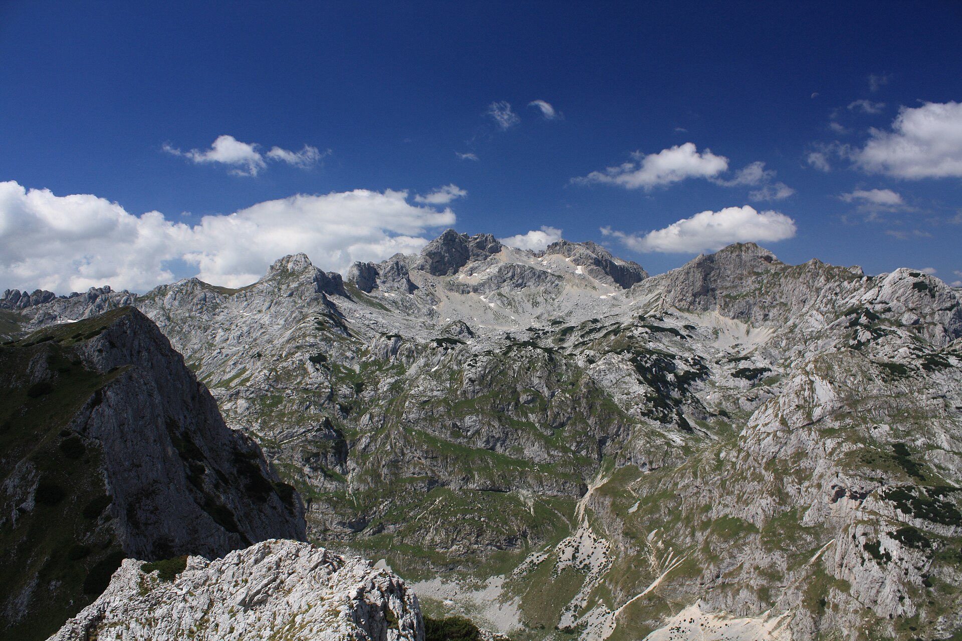
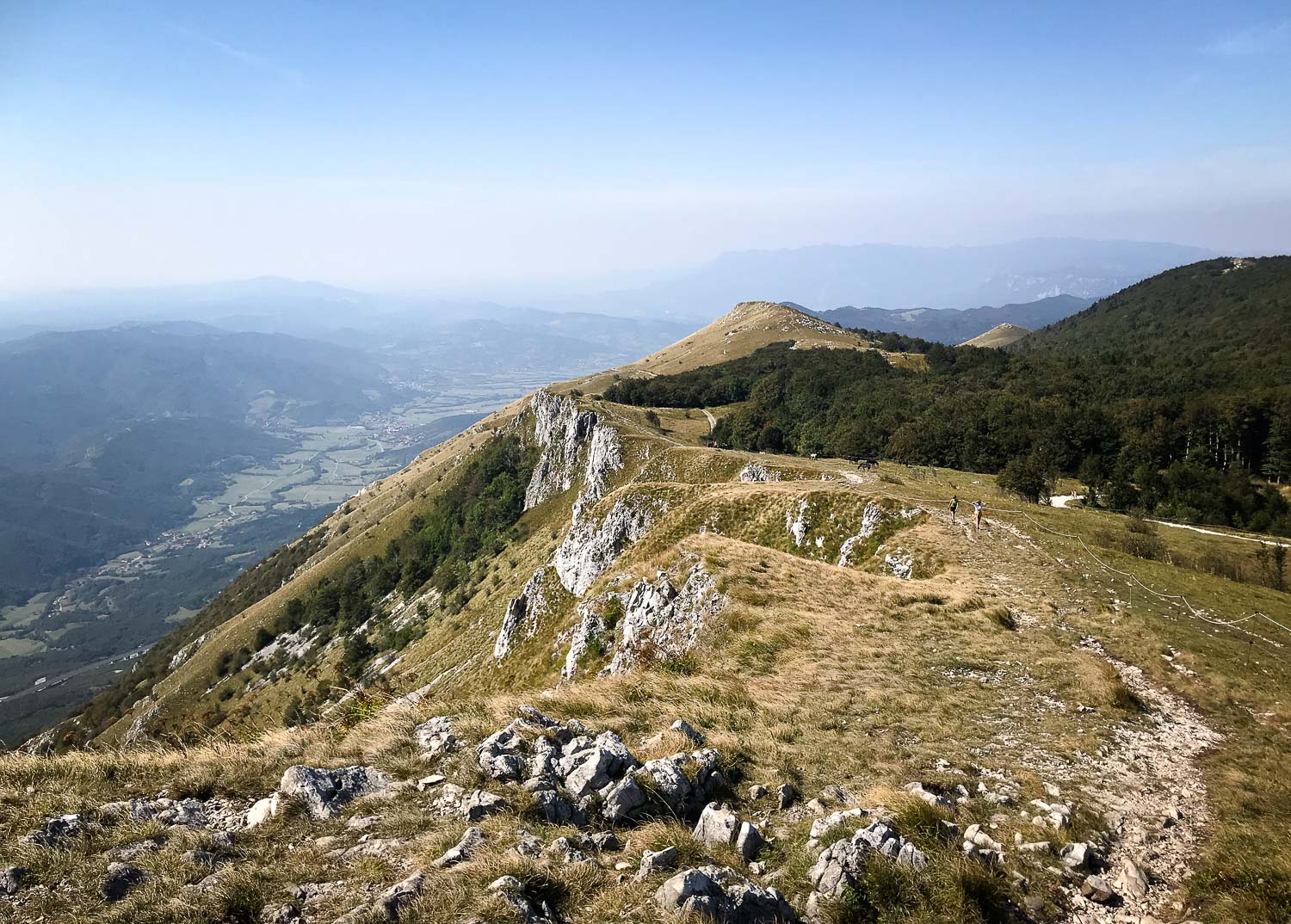
3. Premužić Trail — Zavižan to Rossi Shelter / Rožanski kukovi
Snapshot
Itinerary
The hike follows the northern section of the Premužić Trail from Zavižan into the Rožanski kukovi area. Official Northern Velebit National Park material describes the Premužić Trail as a 46 km dry-stone mountain route from Zavižan / Oltari to Baške Oštarije, with 16 km inside the national park. The trail was built between 1930 and 1933 and is protected as a cultural asset of national importance. For a day hike, the most representative section runs from Zavižan towards Rossi Shelter and the Rožanski kukovi karst formations, then returns to Zavižan by the same trail or by a longer loop variant using nearby summits such as Veliki Zavižan or Gromovača. Official park material notes that Rossi Shelter is about two hours from Zavižan, while independent GPS route sources record longer circular variants of roughly 16.5–18.5 km.
Why it is essential
The Premužić Trail is the signature hiking route of Northern Velebit. It gives access to complex limestone terrain while remaining a constructed walking trail rather than a climbing route. The Zavižan–Rossi section is the most practical day-hike expression of this historic route.
Equipment
- Sturdy boots
- Trekking poles
- Extra warm layer
- Waterproof jacket
- Map/GPS
- Navigation backup
- Headtorch
- Food
- Ample water
Hazards and notes
Fog, bura wind, sudden cold, and snow outside the main season can make this route serious. Karst terrain can make navigation difficult if leaving the main marked trail. Official Croatian hiking guidance for the wider Velebit route warns that food is not available along the route and that water sources are limited or require treatment.
GPX / KML links
| Source | URL | Format | Notes |
|---|---|---|---|
| Northern Velebit National Park Premužić Trail page | np-sjeverni-velebit.hr | Web route description | Official reuse terms not fully checked; good verification source; no direct GPX resolved. |
| Wikiloc: Premužić Zavižan–Rossi round route | wikiloc.com | GPX likely available via platform | Wikiloc terms apply; login may be required; route source found; reuse unresolved. |
| Wikiloc: Zavižan–Rossijevo–Zavižan | wikiloc.com | GPX likely available via platform | Wikiloc terms apply; route source found; reuse unresolved. |
Further reading
- Northern Velebit National Park — Premužić Trail
- Croatian Mountaineering Association — Velebit guidance
- HPS English Velebit Hiking Trail page
- Wikiloc — Premužić Zavižan–Rossi round route
- Wikiloc — Zavižan–Rossijevo–Zavižan
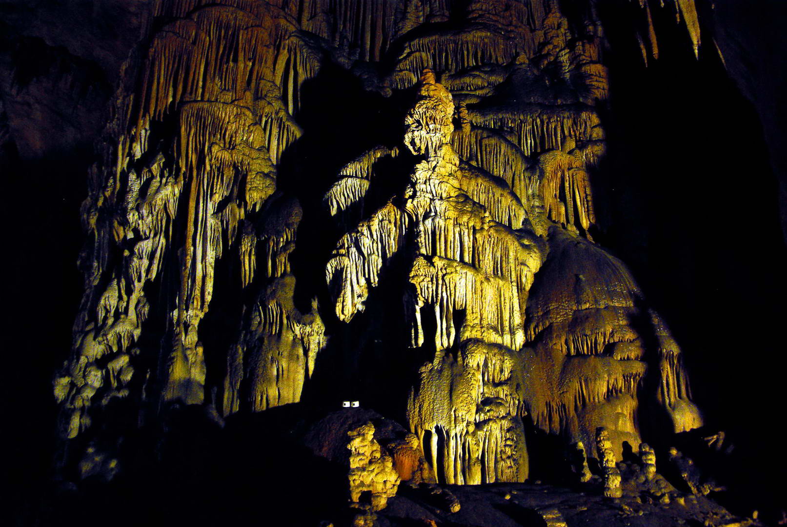
4. Velika Paklenica Canyon – Manita peć – Paklenica Mountain Hut

Snapshot
Itinerary
The route starts at the main Velika Paklenica entrance and follows the canyon path inland. Paklenica National Park describes Manita peć as the park’s only public show cave, situated at about 570 m, with an approach of roughly 1 hour 30 minutes from the Velika Paklenica parking area. After the cave side trip, the route continues along the Velika Paklenica valley towards the Paklenica Mountain Hut. The park states that the hut lies along the Velika Paklenica stream about 6 km from the main parking area, roughly two hours on foot. The return follows the same valley route, with the cave detour added either on the outward or return leg.
Why it is essential
This is the classic non-climbing way to experience Paklenica: the limestone canyon, the Anića kuk rock-wall scenery, a major cave, and the main mountain-hut approach in one day. It represents the canyon side of the Croatian Dinarides better than a summit-only route.
Equipment
- Sturdy footwear
- Sun protection
- Water
- Food
- Map/GPS
- Waterproof layer
- Warm layer outside midsummer
- Extra water in hot weather
Hazards and notes
The canyon can be hot in summer and slippery after rain. National park entry rules and fees apply. Manita peć access depends on cave opening days and hours, which must be checked close to the hike date. Paklenica’s marked trail network is extensive, and the park recommends using the Croatian Mountaineering Association interactive map, where GPX traces of marked trails can be downloaded.
GPX / KML links
| Source | URL | Format | Notes |
|---|---|---|---|
| Paklenica National Park hiking page / HPS interactive map reference | np-paklenica.hr | GPX via HPS map | HPS digital asset terms apply; GPX availability confirmed generally; direct route-specific file unresolved. |
| HPS interactive hiking map | info.hps.hr | GPX / marked-trail map source | HPS digital asset terms apply; route-file source found; exact route file unresolved. |
Further reading
- Paklenica National Park hiking page
- Paklenica Mountain Hut page
- HPS English Velebit Hiking Trail page
- HPS interactive hiking map
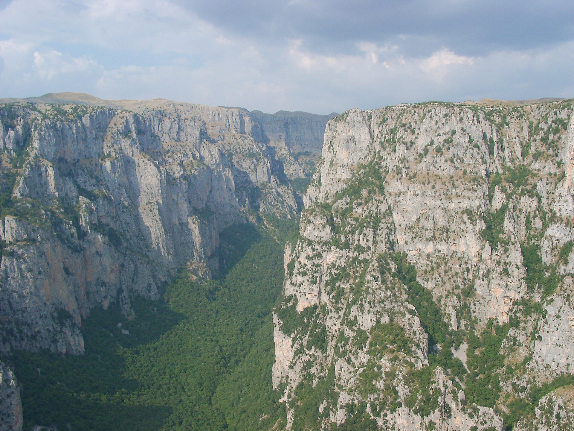
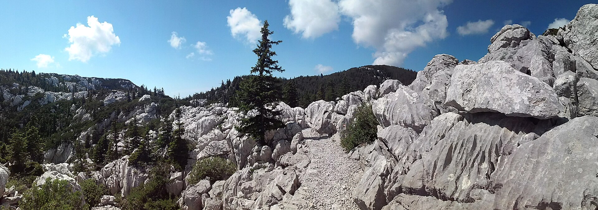
5. Tulove Grede from Vrhprag / Majstorska cesta
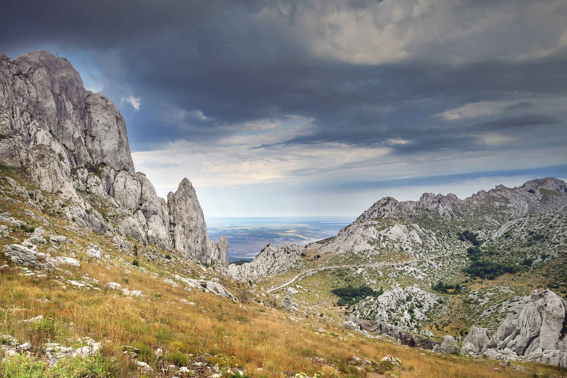
Snapshot
Itinerary
The route starts near Vrhprag on the historic Majstorska cesta road and climbs into the limestone towers of Tulove Grede. Velebit Nature Park describes Tulove Grede as a significant geomorphological locality of vertical limestone blocks, peaks, and towers, and as one of Velebit’s characteristic karst formations. Route descriptions from hiking sources describe a climb from Vrhprag across steep grassy and rocky ground into the upper massif, following red waymarks or dots. The final section includes short rocky steps or easy scrambling before reaching the summit area, then descends by the same route or a close variant.
Why it is essential
Tulove Grede is one of the most recognisable limestone landscapes in the southern Croatian Dinarides. The hike is short, but the scenery is highly distinctive: isolated towers, rough karst, open views, and a strong contrast with the forested and canyon routes elsewhere in this selection.
Equipment
- Sturdy boots
- Water
- Sun protection
- Windproof layer
- Map/GPS
- Warm layer outside summer
- Trekking poles useful on the approach but awkward on rocky sections
Hazards and notes
The route is short but not trivial. Limestone can be sharp and slippery, the upper section has short scrambling and exposure, and navigation is poor in fog. There is no confirmed water source on the route. Access by Majstorska cesta should be checked, especially after winter damage or bad weather.
GPX / KML links
| Source | URL | Format | Notes |
|---|---|---|---|
| HPS interactive hiking map, Tulove Grede track | info.hps.hr | GPX indicated by HPS map result | HPS digital asset terms apply; route source found; direct file unresolved. |
| Wikiloc Tulove Grede route variant | wikiloc.com | GPX likely platform-dependent | Wikiloc terms apply; useful for geometry comparison; reuse unresolved. |
| Outdooractive Tulove Grede route description | outdooractive.com | Web route / platform route | Platform terms apply; useful for route verification; reuse unresolved. |
Further reading
- Velebit Nature Park — Majstorska cesta / Tulove Grede
- HPS interactive hiking map
- Wikiloc — Tulove Grede route
- Outdooractive — Tulove Grede route description
Further reading
| Source | URL |
|---|---|
| Vipava Valley official Nanos hiking page | vipavskadolina.si |
| Visit Postojna official Nanos route page | postojnsko.si |
| SloveniaHiking.Rocks Nanos route page | sloveniahiking.rocks |
| SloveniaHiking.Rocks Snežnik route page | sloveniahiking.rocks |
| Slotrips Veliki Snežnik route page | slotrips.si |
| Northern Velebit National Park Premužić Trail page | np-sjeverni-velebit.hr |
| Paklenica National Park hiking page | np-paklenica.hr |
| Paklenica Mountain Hut page | np-paklenica.hr |
| Croatian Mountaineering Association / HPS Velebit Hiking Trail | hps.hr |
| HPS interactive hiking map | info.hps.hr |
| Velebit Nature Park Majstorska cesta / Tulove Grede material | pp-velebit.hr |