Regional overview
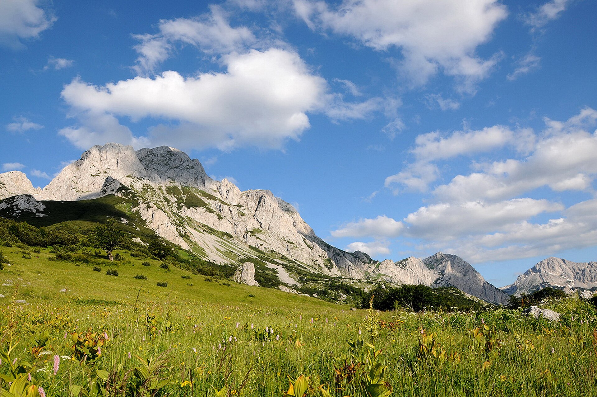
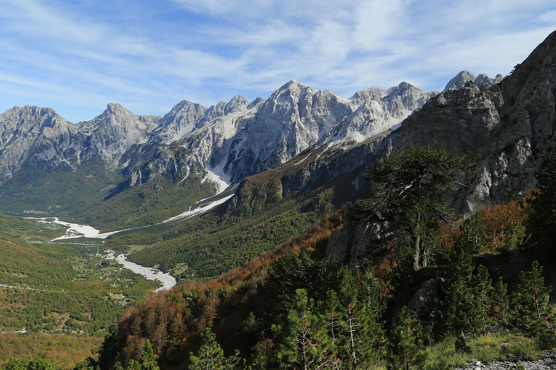
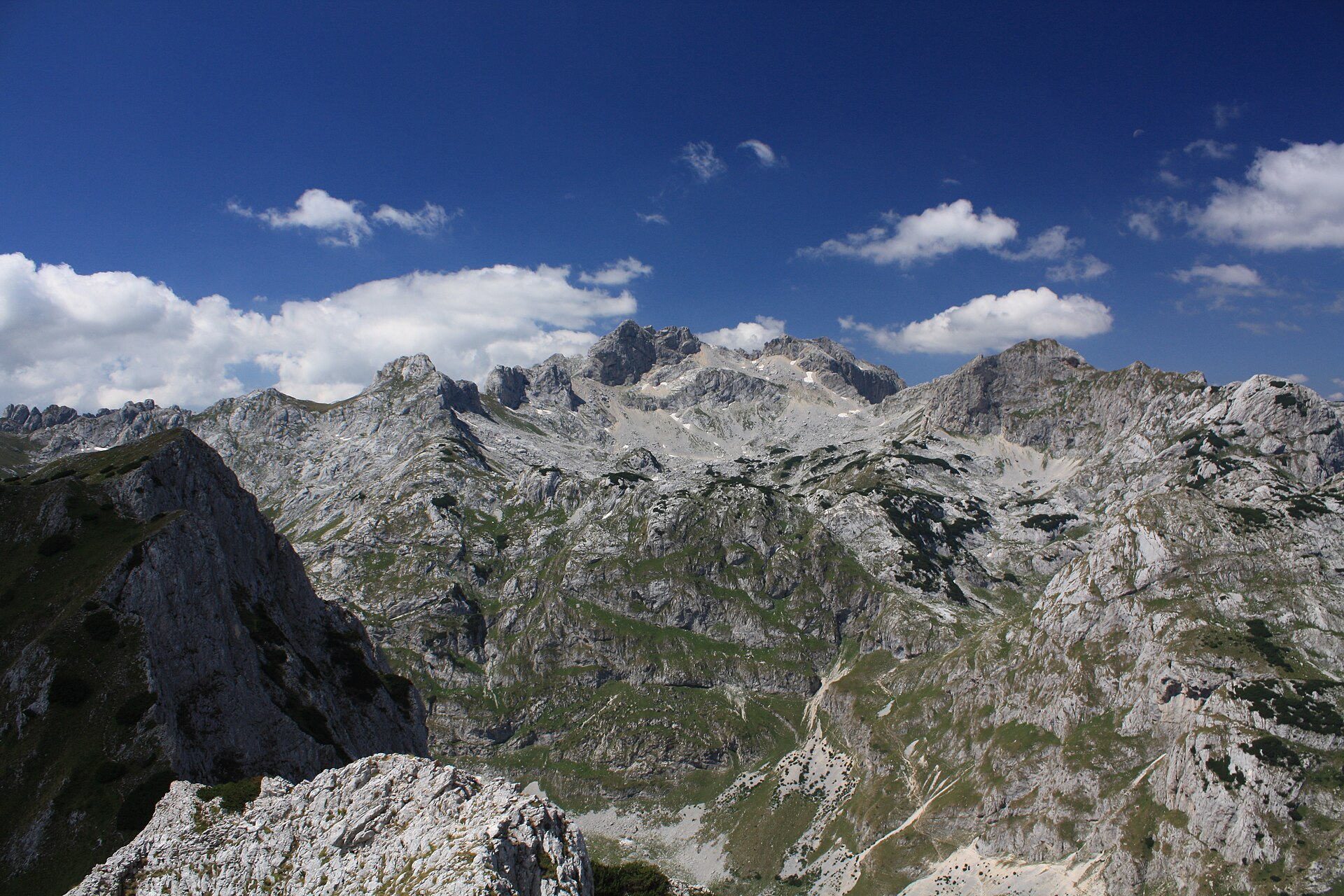
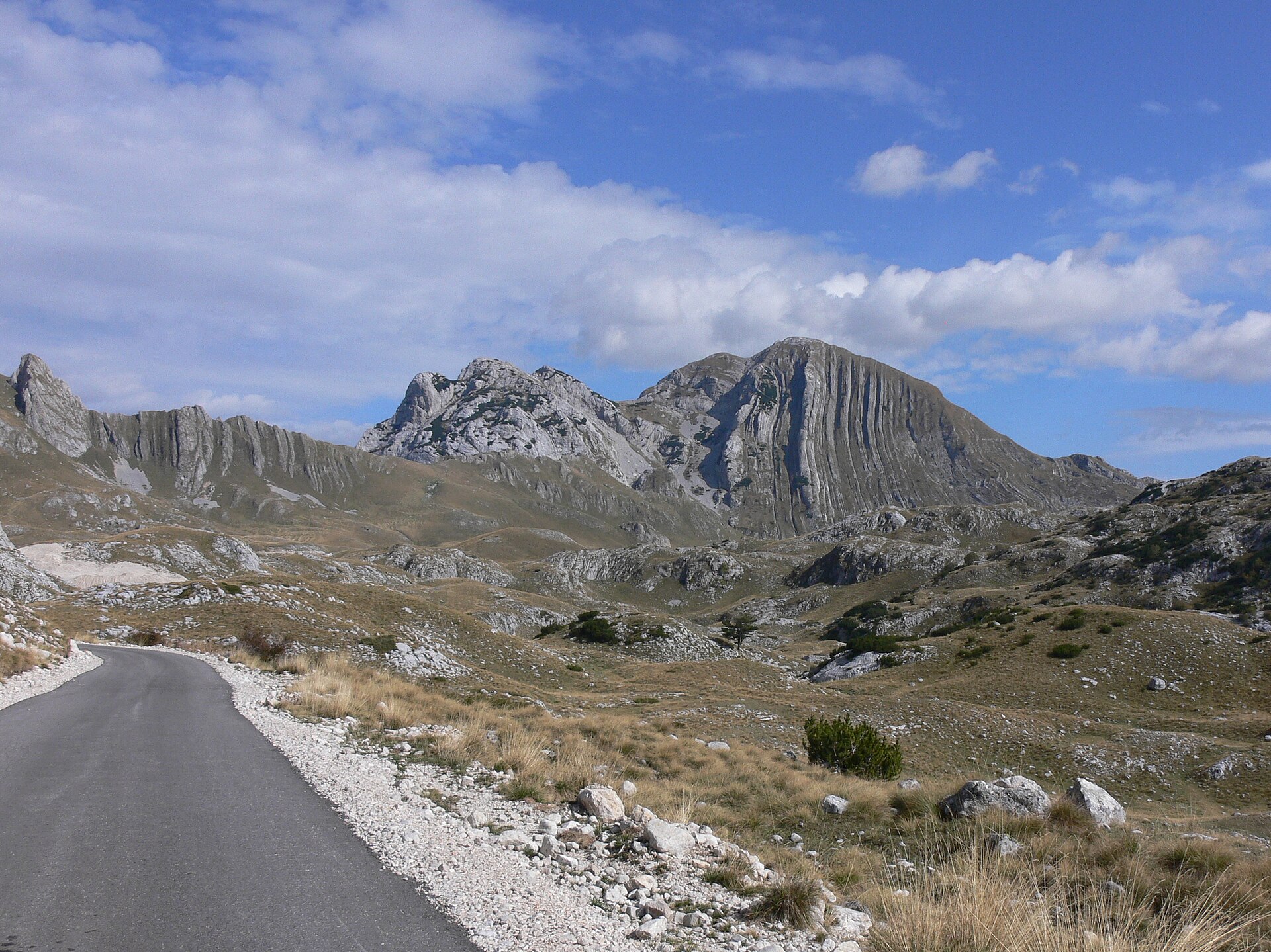
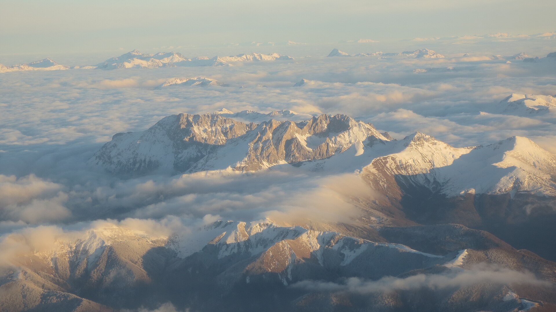
This region combines three different Montenegrin expressions of the Dinaric Alps: the high limestone massifs of Durmitor, the compact pyramidal summits of Komovi, and the coastal ridges above the Bay of Kotor and the Adriatic. Durmitor is the most alpine of the three, with high peaks, glacial lakes, forests, canyons and a marked hiking network.
Komovi is smaller but more severe, with steep grassy and rocky approaches from high katun pastures. The principal summit routes can include exposed and scrambling terrain, so they should be treated as serious mountain routes.
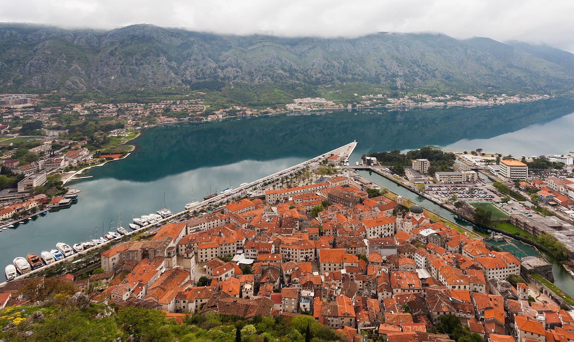
The coastal mountains are lower but distinctive. Around Kotor, Vrmac and Lovćen, old military roads, stone switchbacks and fortifications climb rapidly from sea level into karst ridges with views over the Bay of Kotor.
The main hiking season for Durmitor and Komovi is normally late June to September or early October, depending on snow. Coastal routes are usually more comfortable in spring and autumn; in summer, heat, exposed limestone and limited water become major considerations.
Selection rationale
The five hikes were selected to give a balanced regional set: Durmitor’s iconic high summit, a Durmitor lake-and-ridge circuit, one classic Komovi summit, one historic Kotor high-route, and one lower coastal ridge traverse with Austro-Hungarian fortifications.
Summary table
| # | Hike | Country | Route type | Distance | Gain | Max elevation | Difficulty |
|---|---|---|---|---|---|---|---|
| 1 | Bobotov Kuk from Sedlo Pass | Montenegro | Out-and-back | 10.1 km | +892–950 m | 2,523 m | Hard |
| 2 | Prutaš – Škrčka Lakes loop | Montenegro | Loop | 12.7 km | +1,129–1,140 m | 2,393 m | Hard |
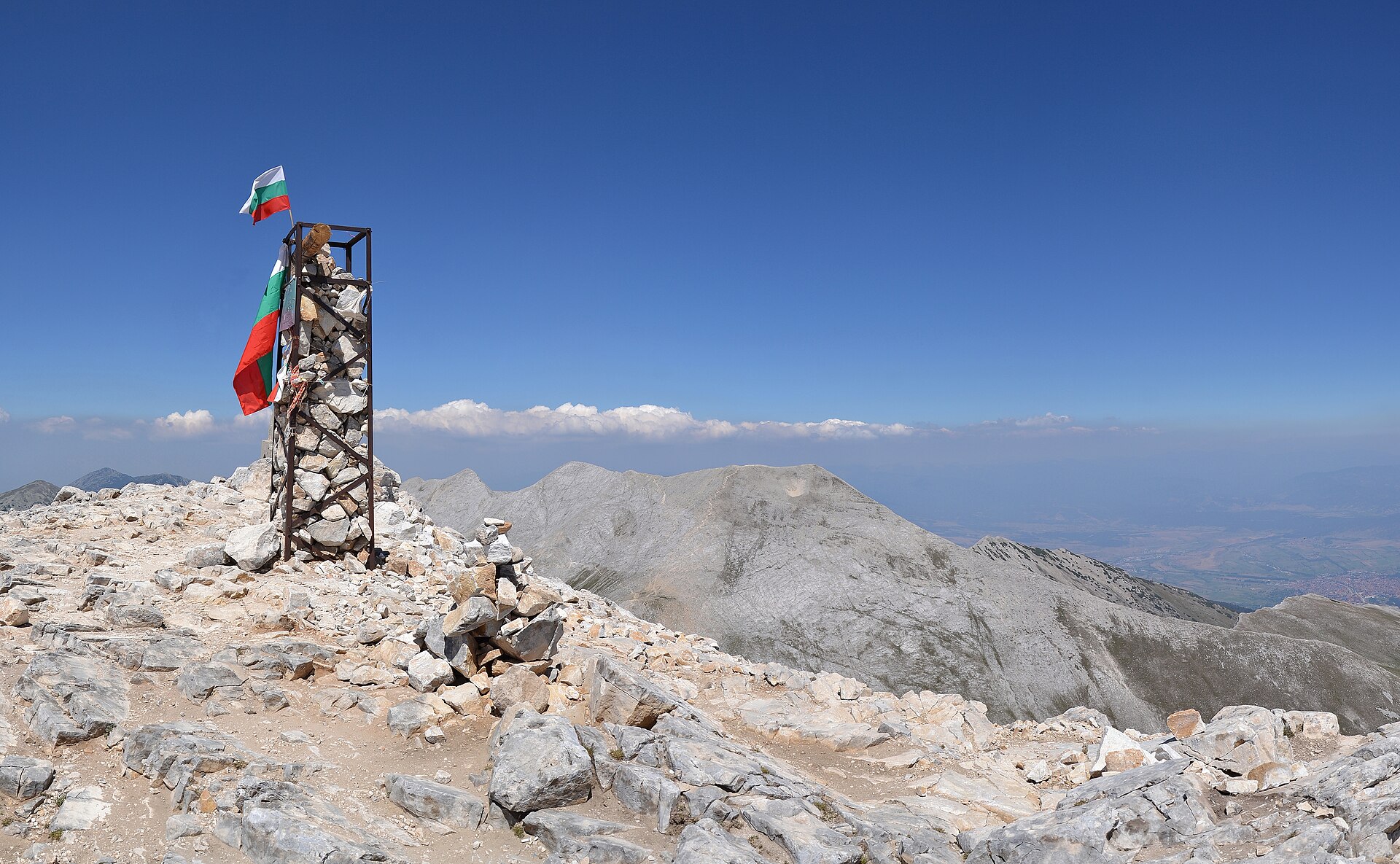
| 3 | Vasojevićki Kom from Štavna | Montenegro | Out-and-back | 8.0–8.1 km | +760–776 m | 2,461 m | Hard |
| 4 | Kotor – Krstac – Pestingrad via Ladder of Kotor | Montenegro | Out-and-back | 20.0 km | +1,180 m | Approx. 1,000–1,098 m (unresolved) | Hard |
| 5 | Fort Vrmac – Sveti Ilija – Donja Lastva | Montenegro | Point-to-point | 13.4 km | +303 m | 785 m | Moderate |
1. Bobotov Kuk from Sedlo Pass
Snapshot
Itinerary
The route starts at Sedlo Pass and follows marked mountain paths through open limestone and high alpine pasture below Sedlena Greda. It continues towards the Zeleni Vir basin, then climbs more steeply towards the Velika Previja area before the final ascent to Bobotov Kuk.
The upper section is rocky, steeper and more exposed than the approach. Fixed cables or handline-style aids may be present on the final section, but the route remains a mountain hike rather than a via ferrata. The return follows the same line to Sedlo Pass.
AllTrails records this as a 10.1 km out-and-back route with 891.8 m of elevation gain, hard difficulty and a Durmitor National Park location. The official Montenegro hiking map lists Bobotov Kuk as a Durmitor top tour with 5 h 30 min and 950 m of ascent.
Why it is essential
Bobotov Kuk is the classic Durmitor summit hike and the most recognisable high objective in the massif. Official tourism material identifies Bobotov Kuk as Durmitor’s highest peak and places it within the park’s UNESCO-listed high mountain landscape.
Equipment
- Sturdy boots
- Warm layer
- Waterproof layer
- Map/GPS
- Food
- Water
- Sun protection
- Trekking poles
- Headtorch
- Microspikes or crampons may be needed in early season if snow remains on the upper route
Hazards and notes
- Loose rock
- Steep scree
- Exposed limestone
- Abrupt cloud
- Lingering snow
- Avoid in thunderstorms, poor visibility or hard snow without suitable equipment and experience
- Water availability is limited; spring information should be checked locally before departure
GPX / KML links
| Source | URL | Format | Notes |
|---|---|---|---|
| AllTrails — Bobotov Kuk | alltrails.com | Source map / app route | GPX export availability not verified; AllTrails terms apply; reuse of route geometry not confirmed. |
| Montenegro official hiking map | montenegro.travel PDF | Map / listed route proposal, not GPX | Official publication; route-file reuse not applicable; useful for verification only. |
Further reading
- AllTrails — Bobotov Kuk
- Montenegro official hiking map PDF
- Montenegro official tourism — Durmitor National Park
2. Prutaš – Škrčka Lakes loop
Snapshot
Itinerary
The route climbs from the Dobri Do / Šarban side of the Durmitor Ring road towards Prutaš, one of Durmitor’s most distinctive viewpoint summits. From the summit area the route descends towards the Škrčka Lakes basin, where the terrain becomes steeper and more remote. The return completes a loop back towards the road.
AllTrails records the Prutaš – Škrka route as a 12.7 km loop with 1,129 m of gain, hard difficulty and lake/view features. Secondary guide-style material describes the full Prutaš–Škrčka Lakes circuit as around 12.7 km, about 7 h and roughly 1,140 m of ascent.
Why it is essential
This route combines one of Durmitor’s finest summit viewpoints with the Škrčka Lakes, one of the massif’s classic glacial lake basins. It adds variety to the Durmitor selection by including a full mountain circuit rather than only a summit out-and-back.
Equipment
- Sturdy boots
- Trekking poles
- Weatherproof layer
- Warm layer
- Map/GPS
- Headtorch
- Food
- Ample water
- Microspikes or crampons may be needed in early season depending on snow conditions
Hazards and notes
- Steep descent towards Škrčka Lakes
- Scrambling reported on some sections
- Rope-assisted sections reported
- Boulder terrain
- Some route-finding uncertainty reported
- Avoid in thunderstorms, poor visibility or unstable snow
GPX / KML links
| Source | URL | Format | Notes |
|---|---|---|---|
| AllTrails — Prutaš – Škrka | alltrails.com | Source map / app route | GPX export availability not verified; AllTrails terms apply; reuse of route geometry not confirmed. |
| Montenegro official hiking map | montenegro.travel PDF | Regional route context, not GPX | Official publication; direct geometry reuse not applicable; useful for verification only. |
Further reading
3. Vasojevićki Kom from Štavna
Snapshot
Itinerary
The route begins on the high Štavna pasture and climbs towards the Komovi massif. It follows marked mountain terrain towards the slopes of Vasojevićki Kom, with increasingly open views over the surrounding ridges. The upper part becomes steeper and more exposed as it approaches the summit.
AllTrails records the Vasojevićki Kom Trail as an 8.0 km out-and-back route with 775.7 m of elevation gain, hard difficulty and an Andrijevica location. Outdooractive, via a Rother Bergverlag verified-partner route, gives a very similar distance of 8.1 km, 772 m of ascent/descent and a high point of 2,432 m.
Why it is essential
Komovi is one of Montenegro’s most dramatic compact mountain groups, and Vasojevićki Kom is the most practical classic day-summit from the Štavna side. The official Montenegro hiking map lists the Komovi summits among the region’s top tours and specifically notes Vasojevićki Kom at 2,461 m.
Equipment
- Sturdy boots
- Trekking poles
- Warm layer
- Waterproof layer
- Map/GPS
- Headtorch
- Food
- Water
- Traction equipment may be needed in early summer or after fresh snow
- Helmet may be prudent where parties are moving above on loose rock, but no official helmet requirement was verified
Hazards and notes
- Steep upper terrain
- Exposed mountain ground
- Possible scrambling or climbing passages
- Wet rock and poor visibility increase seriousness
- Dog and protected-area rules were not verified
GPX / KML links
| Source | URL | Format | Notes |
|---|---|---|---|
| AllTrails — Vasojevićki Kom Trail | alltrails.com | Source map / app route | GPX export availability not verified; AllTrails terms apply; reuse of route geometry not confirmed. |
| Outdooractive / Rother Bergverlag route | outdooractive.com | Source map | GPX availability/licence not verified; Outdooractive terms; secondary verification only. |
| Montenegro official hiking map | montenegro.travel PDF | Regional route context, not GPX | Official publication; route-file reuse not applicable; useful for verification only. |
Further reading
- AllTrails — Vasojevićki Kom Trail
- Outdooractive / Rother Bergverlag — Kom Vasojevićki
- Montenegro official hiking map PDF
4. Kotor – Krstac – Pestingrad via Ladder of Kotor
Snapshot
Itinerary
The route climbs from Kotor into the old stone switchback network above the bay, commonly known as the Ladder of Kotor. It ascends towards Krstac, then continues towards the Pestingrad high viewpoint before returning by the same route. The line links the historic lower bay path network with the higher Lovćen-facing limestone terrain.
AllTrails records Kotor – Pestingrad via Krstac as a 20.0 km out-and-back route with 1,179.9 m of elevation gain. It is classified as hard and includes cave, forest, river, views and historic-site features.
Why it is essential
This is the strongest coastal-mountain counterpoint to Durmitor and Komovi: a long ascent directly from the Bay of Kotor into old military and trade-route terrain. It represents the cultural and historic side of Montenegro’s Dinaric hiking, with a dramatic sea-to-mountain profile.
Equipment
- Sturdy shoes or boots
- Map/GPS
- Sun hat
- High-capacity water supply
- Food
- Waterproof layer
- Warm layer outside summer
- Headtorch
Hazards and notes
- Heat
- Dehydration
- Loose limestone
- Long descent
- Navigation at junctions
- Little or no reliable water on the route
- Avoid in high summer heat or thunderstorms
- Access restrictions or fees around Kotor’s fortification paths were not fully verified for this full Pestingrad variant
GPX / KML links
| Source | URL | Format | Notes |
|---|---|---|---|
| AllTrails — Kotor – Pestingrad via Krstac | alltrails.com | Source map / app route | GPX export availability not verified; AllTrails terms apply; reuse of route geometry not confirmed. |
| Montenegro official hiking map | montenegro.travel PDF | Regional route context, not GPX | Official publication; route-file reuse not applicable; useful for verification only. |
Further reading
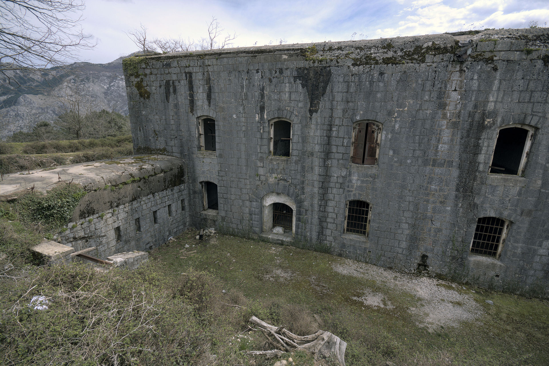
5. Fort Vrmac – Sveti Ilija – Donja Lastva
Snapshot
Itinerary
This traverse follows the Vrmac ridge between the inner Bay of Kotor and the Tivat side. From the Fort Vrmac area, the route follows ridge tracks and paths towards Sveti Ilija, the high point of the Vrmac ridge, then descends towards Donja Lastva above Tivat.
AllTrails records the Fort Vrmac – Sveti Ilija – Donja Lastva route as a 13.4 km point-to-point hike with 303 m of elevation gain, moderate difficulty, forest, view and historic-site features. Vrmac itself is described as the limestone ridge dividing the inner and outer Bay of Kotor, with Sveti Ilija as its highest point at 785 m.
Why it is essential
Vrmac gives a lower, historically rich coastal-mountain day with views over both Kotor and Tivat. Fort Vrmac adds a strong cultural element: the current structure was built by the Austro-Hungarian Empire in 1894–1897 and remains one of the notable fortifications on the ridge.
Equipment
- Sturdy hiking shoes
- Water
- Food
- Sun protection
- Weatherproof layer
- Map/GPS
- Headtorch
- Extra water in warm weather
Hazards and notes
- Abandoned fort structures may contain holes, pits or unstable surfaces
- Limestone footing
- Exposed sun
- Route-finding junctions
- Point-to-point transport should be planned before departure
- Summer heat can make this moderate-height route more demanding than the elevation suggests
GPX / KML links
| Source | URL | Format | Notes |
|---|---|---|---|
| AllTrails — Fort Vrmac – Sveti Ilija – Donja Lastva | alltrails.com | Source map / app route | GPX export availability not verified; AllTrails terms apply; reuse of route geometry not confirmed. |
| OpenStreetMap / Waymarked Trails | URL not identified | Possible manual cross-check source | ODbL if using OSM data; attribution required; OSM relation not identified. |
Further reading
- AllTrails — Fort Vrmac – Sveti Ilija – Donja Lastva
- Vrmac geography and summit height
- Fort Vrmac historical context
Further reading
- Montenegro official tourism — Durmitor National Park overview
- Montenegro official tourism — hiking and trekking overview
- Montenegro official hiking map PDF
- Montenegro official tourism — sea-to-mountains / Lovćen context
- AllTrails — Bobotov Kuk
- AllTrails — Prutaš – Škrka
- AllTrails — Vasojevićki Kom Trail
- AllTrails — Kotor – Pestingrad via Krstac
- AllTrails — Fort Vrmac – Sveti Ilija – Donja Lastva
- Outdooractive / Rother Bergverlag — Kom Vasojevićki