Regional overview
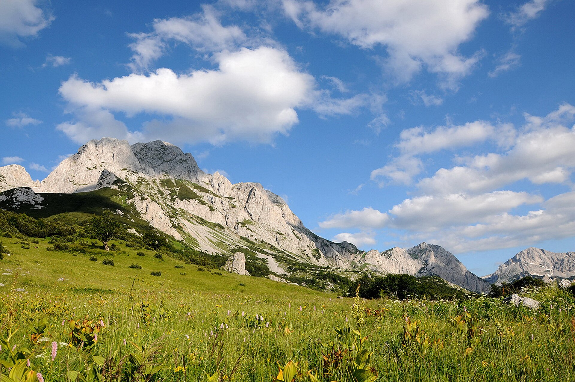
This region combines three distinct mountain characters: the limestone gorges and alpine basins of the Greek Pindus, the high sacred massif of Mount Olympus, and the steep Albanian ranges rising above the Ionian coast and the Berat–Skrapar interior. In the Pindus, the Zagori and Tymfi area is defined by stone villages, deep ravines, the Vikos Gorge, and high glacial-style basins such as Drakolimni.
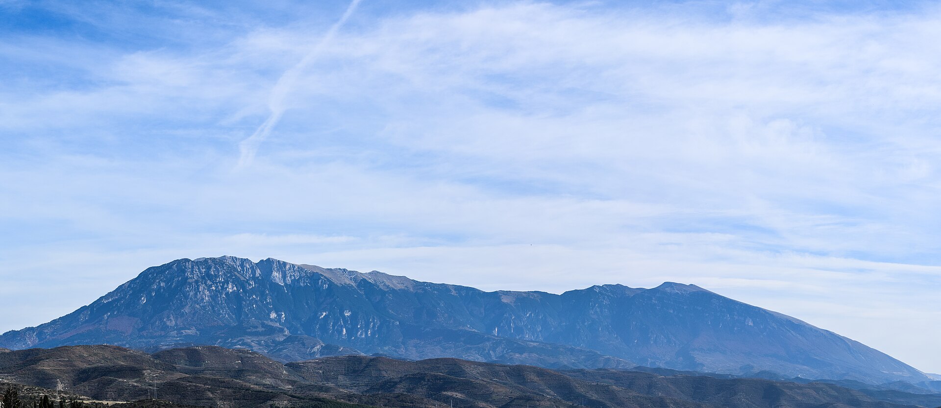
Mount Olympus adds the region’s most famous high-mountain day objective. The safest catalogue choice is not the exposed Mytikas scramble, but the long non-glacial mountain route from Prionia to Refuge A and Skala, with Mytikas as the view and not the required objective.
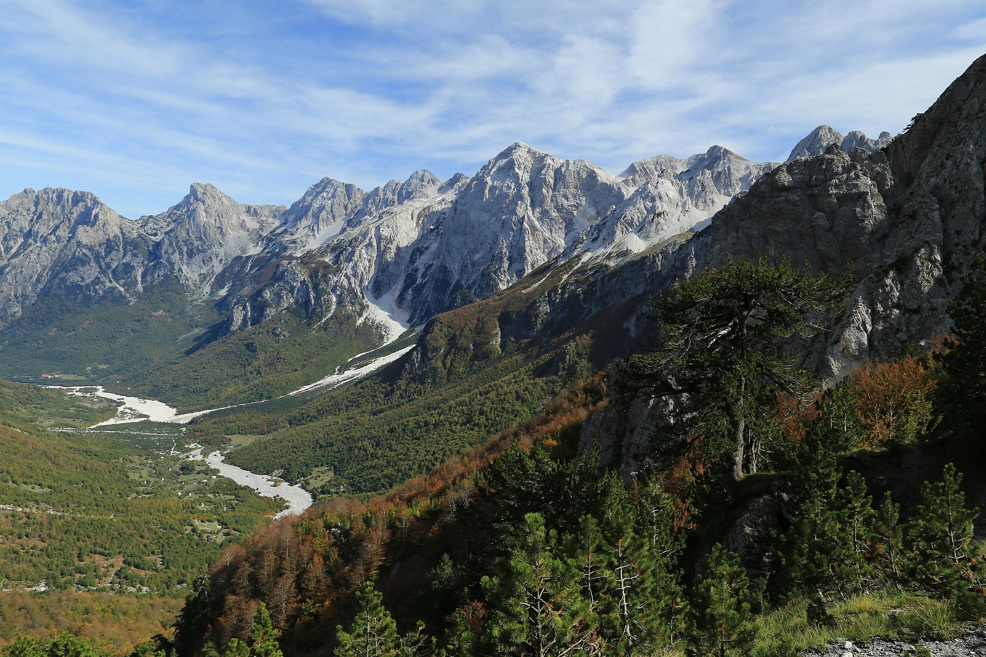
In Albania, the southern ranges are more rugged, drier, and less consistently waymarked. Mount Çika rises directly above Llogara National Park and the Ionian coast. Mount Tomorr is a high isolated massif and national park with strong cultural and religious importance as well as hiking value.
The usual season is late spring to autumn, but snow can persist much later on Tymfi, Olympus, and Tomorr. Summer thunderstorms, heat, fog, sparse water, and remote access are recurring issues. Current public transport, road access, refuge operation, and weather conditions should be checked locally before departure.
Selection rationale
These five hikes were selected to give a balanced catalogue entry: one classic gorge crossing, one Pindus alpine lake route, one Mount Olympus high-mountain route, one sea-facing Albanian summit, and one culturally significant Albanian massif. The selection avoids the most technical variants, especially the exposed Mytikas scramble, while still representing the essential landscapes of the region.
Summary table
| # | Hike | Country | Route type | Distance | Gain | Max elevation | Difficulty |
|---|---|---|---|---|---|---|---|
| 1 | Vikos Gorge: Monodendri to Vikos | Greece | Point-to-point | 12–13.2 km | c. 410–680 m | c. 1,070–1,100 m | Moderate, long |
| 2 | Tymfi Dragon Lake from Mikro Papingo | Greece | Out-and-back / variant loop | 14.9–17.1 km | c. 1,020–1,390 m | c. 2,040–2,050 m | Hard |
| 3 | Mount Olympus: Prionia to Skala | Greece | Out-and-back | c. 14.5 km | c. 1,715 m | 2,843–2,866 m | Hard mountain hike |
| 4 | Maja e Çikës from Llogara Pass | Albania | Out-and-back | c. 14.4 km | c. 1,442 m | c. 2,045 m | Difficult |
| 5 | Mount Tomorr: Çuka e Partizanit | Albania | Out-and-back | c. 16.1 km | c. 1,449 m | 2,416 m | Difficult |
Note on route files. Route links are source references and may be replaced with project-owned GPX/KML files later. Route-file reuse is not legally cleared.
1. Vikos Gorge — Monodendri to Vikos
Snapshot
Itinerary
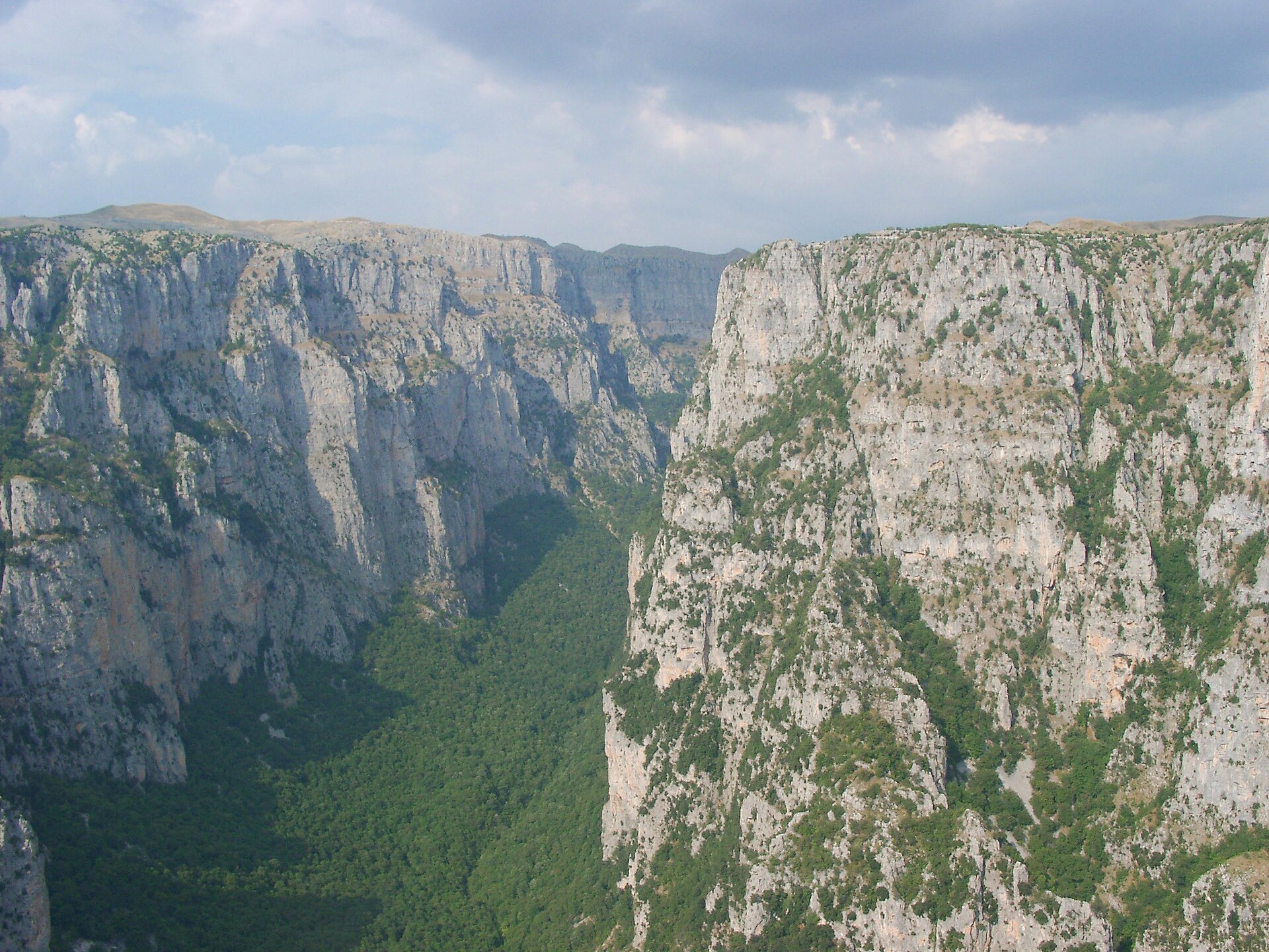
The classic crossing starts in Monodendri and descends from the village into the Vikos Gorge. The path follows the gorge floor through limestone scenery, riverbeds, woodland, and boulder sections before reaching the Voidomatis springs area and climbing out towards Vikos village. Regional route guidance describes the standard direction as Monodendri to Vikos, starting around 1,100 m, descending towards roughly 500 m, then climbing back towards about 1,000 m.
Why it is essential
Vikos Gorge is the defining low-to-mid-altitude hike of the Greek Pindus: a long limestone ravine crossing linking Zagori villages, river springs, forest, cliffs, and traditional stone settlement landscapes. It gives the catalogue a classic valley-and-gorge route rather than only summit objectives.
Equipment
- Standard hiking equipment
- Sturdy footwear for rocky gorge terrain
- Trekking poles if preferred
- Weatherproof layer
- Sun protection
- Map or GPS
- Sufficient water
Hazards and notes
- Rain can make the gorge slippery and increase rockfall or landslide risk.
- Spring snowmelt can make passages more difficult.
- Waymarking is present but navigation can still be awkward in the gorge floor, especially around boulders or dry river sections.
- The route is point-to-point, so return transport should be arranged in advance.
- Water availability should not be assumed throughout the gorge.
GPX / KML links
| Source | URL | Format | Notes |
|---|---|---|---|
| Wikiloc — Vikos Gorge Monodendri to Vikos | wikiloc.com | GPX / KML download source | Wikiloc / user-contributed terms not checked. Source route only until replaced. |
Further reading
- Visit Greece — Vikos Gorge
- Epirus for All Seasons — Hiking at Vikos–Aoos National Park
- Wikiloc — Vikos Gorge Monodendri to Vikos
2. Tymfi Dragon Lake — Mikro Papingo to Drakolimni
Snapshot
Itinerary
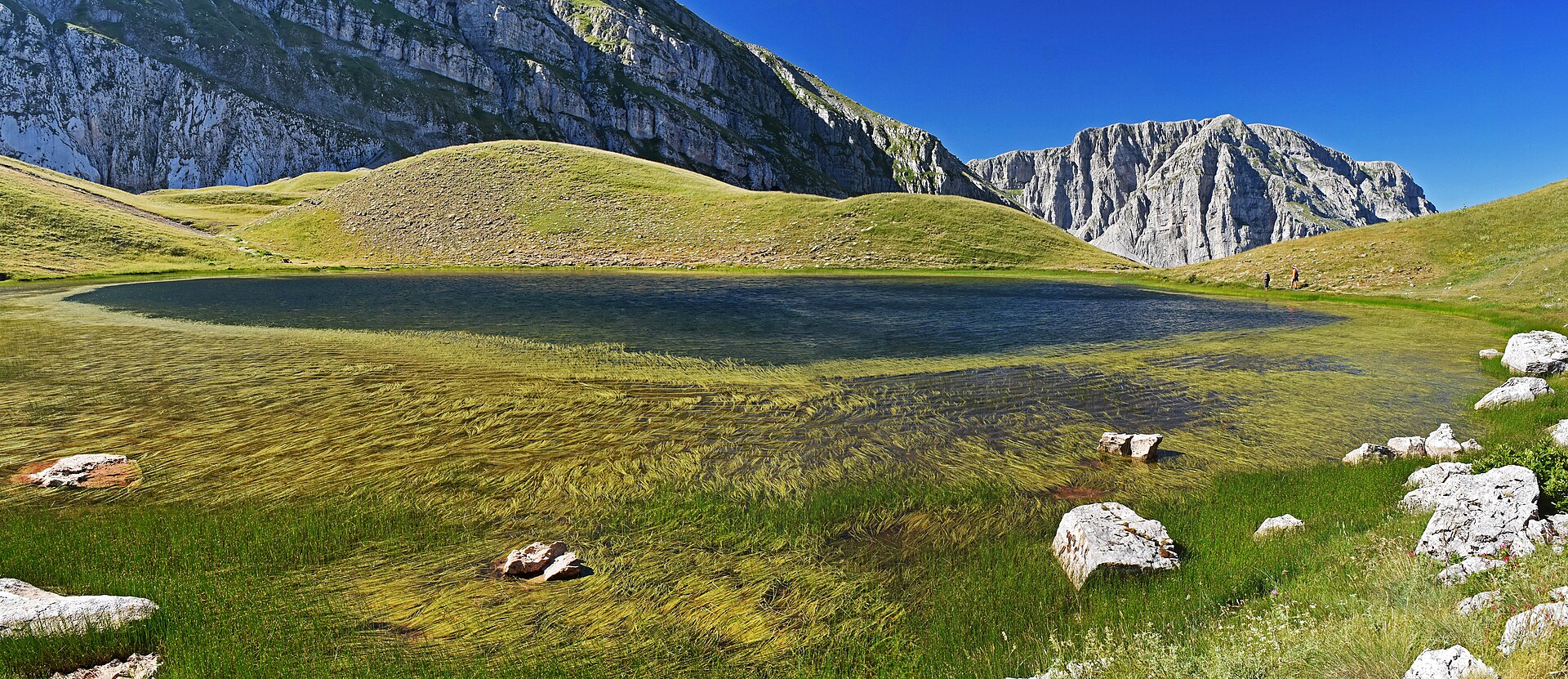
The route starts in Mikro Papingo and climbs steadily towards the Astraka mountain refuge, passing beneath the rock towers of Tymfi. From the refuge area, the route continues across high alpine terrain to Drakolimni, the Dragon Lake of Tymfi, before returning by the same general line or a nearby variant. Visit Greece places the lake at about 2,050 m and describes Mikro Papingo as the normal starting point, with the lake also reachable in about one hour from the Astraka shelter.
Why it is essential
Drakolimni is the classic high Pindus lake objective. It combines Zagori village architecture, the Astraka towers, open alpine terrain, and one of the most recognisable mountain lakes in Greece. It represents the Pindus as a high-mountain landscape rather than only a gorge-and-village region.
Equipment
- Mountain hiking equipment
- Sturdy boots
- Trekking poles recommended
- Warm layer
- Weatherproof shell
- Navigation backup
- Headtorch for delays
- Food
- Water
- Sun protection
- Microspikes or crampons if snow remains on the upper route
Hazards and notes
- The route is long and exposed to mountain weather.
- Fog can complicate navigation above the refuge.
- Snow can linger into the early season.
- The lake area is ecologically sensitive; wildlife and amphibians should not be disturbed.
GPX / KML links
| Source | URL | Format | Notes |
|---|---|---|---|
| Wikiloc — Mikro Papigko – Astraka Refuge – Dragon Lake | wikiloc.com | GPX / KML download source | Wikiloc / user-contributed terms not checked. Source route only until replaced. |
| Komoot — Astraka Hut – Drakolimni loop from Papingo | komoot.com | Source map / navigation route | Komoot terms not checked. Secondary geometry source only. |
Further reading
- Visit Greece — Tymfi Dragon Lake
- Trekking Hellas — Dragon Lake Hike, Zagori
- Wikiloc — Mikro Papigko – Astraka Refuge – Dragon Lake
- Komoot — Astraka Hut – Drakolimni
3. Mount Olympus — Prionia to Skala
Snapshot
Itinerary
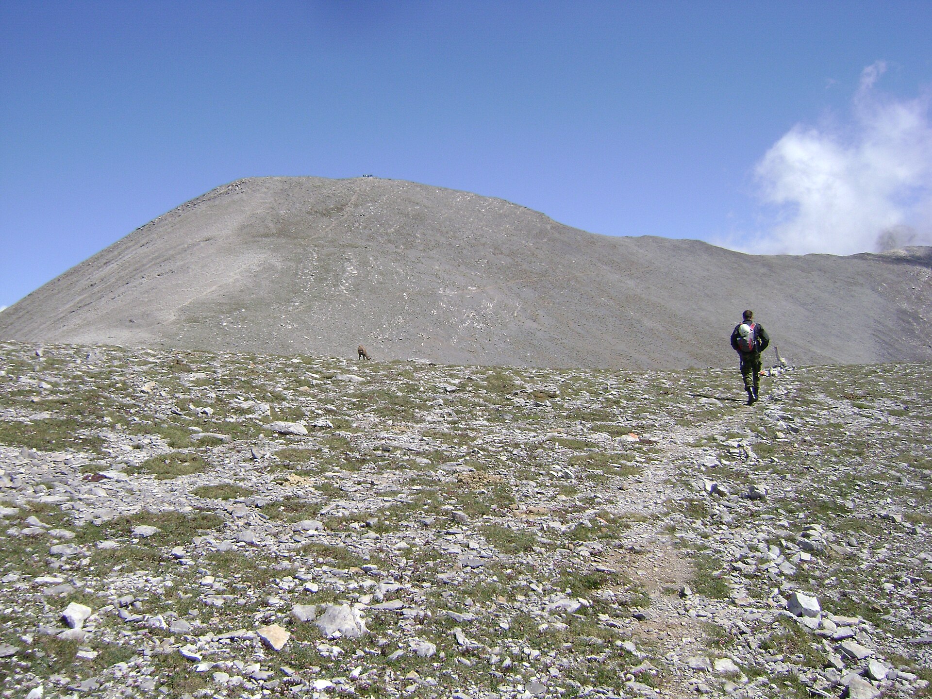
The route begins at Prionia and follows the main E4 mountain path through forest to Spilios Agapitos Refuge A. The official refuge information identifies the Prionia–Spilios Agapitos approach as the most frequented hiking path on Olympus and part of the E4. From the refuge, the route climbs above the tree line towards Skala, where the path becomes steeper and looser near the upper mountain. The catalogue route stops at Skala. The continuation towards Mytikas is not included because it involves exposed scrambling and is a different level of undertaking.
Why it is essential
This is the safest non-glacial way to include Mount Olympus as an essential day hike while avoiding the most exposed summit scramble. It gives a complete high-mountain experience: forest approach, refuge culture, alpine terrain, and close views of the upper Olympus summits.
Equipment
- Mountain hiking equipment
- Sturdy boots
- Trekking poles
- Warm layer
- Waterproof and windproof shell
- Hat and gloves outside midsummer
- Map or GPS
- Headtorch
- Food
- Ample water
- Microspikes or crampons if snow remains
Hazards and notes
- This is a very long day with more than 1,700 m of ascent.
- Weather changes quickly on Olympus.
- The upper path can be loose.
- Early-season snow can make the route significantly more serious.
- The Mytikas continuation is excluded from this catalogue route; continuing beyond Skala enters exposed scrambling terrain.
GPX / KML links
| Source | URL | Format | Notes |
|---|---|---|---|
| Mount Olympus — official downloads | mountolympus.gr | GPX | Official page lists GPX downloads; reuse terms not checked. Skala-only geometry should be trimmed from longer GPX if necessary. |
| Mount Olympus — route page: Prionia – Refuge – Skala – Mytikas | mountolympus.gr | Official source route / GPX reference | Terms not checked. Use as official source reference; replace with own Skala-only geometry later. |
| Wikiloc — Prionia – Refuge A – Skala – Prionia | wikiloc.com | GPX / KML download source | Wikiloc / user-contributed terms not checked. Secondary route source. |
Further reading
- Mount Olympus — official route page
- Mount Olympus — official downloads
- Wikiloc — Prionia – Refuge A – Skala – Prionia
4. Maja e Çikës from Llogara Pass
Snapshot
Itinerary
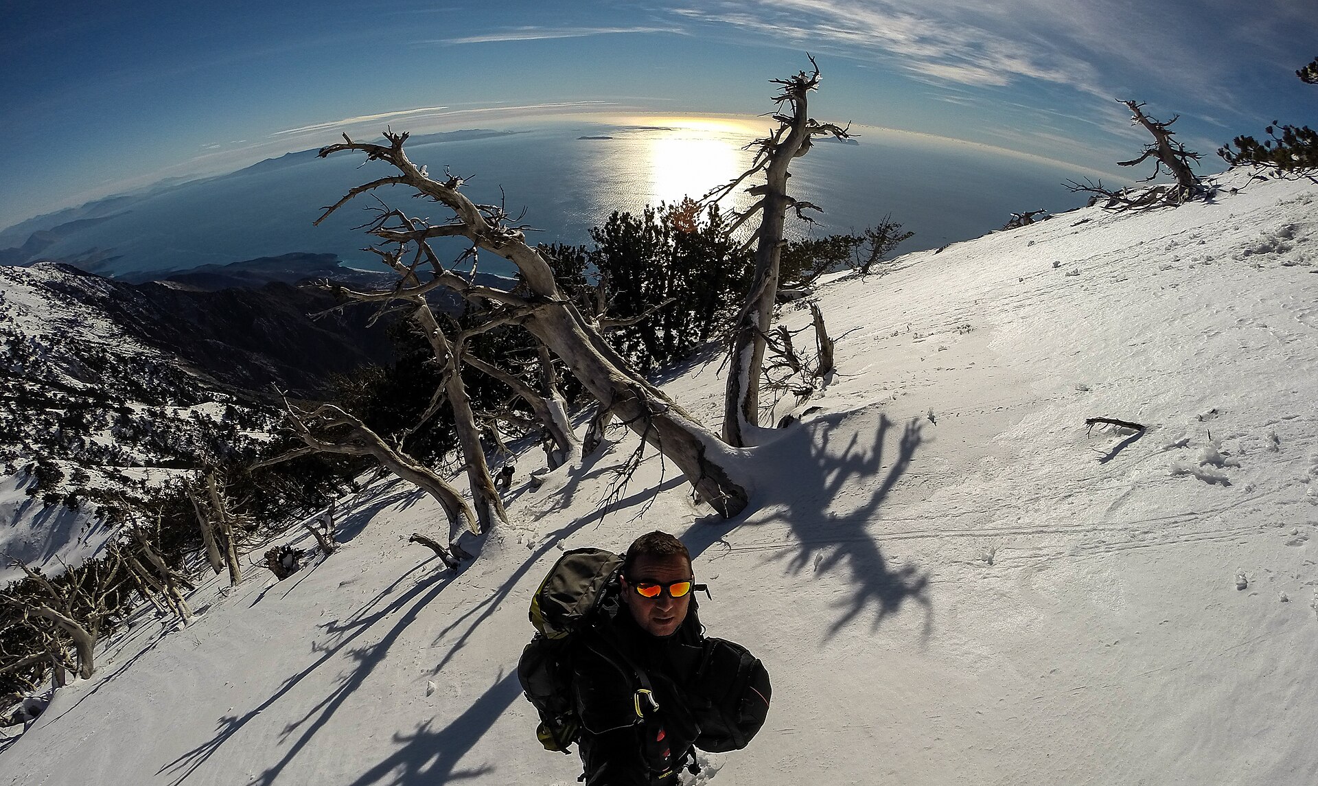
The route starts from Llogara Pass and climbs inland from the pass towards the high Ceraunian ridge. Official Albanian tourism information describes Mount Çika as a 2,044 m peak above Llogara National Park, the highest peak on the Albanian coast, with marked trails beginning at Llogara Pass. Outdooractive route data gives a difficult mountain hike of 14.4 km, 1,442 m ascent and descent, and a high point of 2,045 m.
Why it is essential
Maja e Çikës is the defining sea-to-summit landscape of southern Albania. Few Balkan day hikes combine a 2,000 m mountain objective with such direct views over the Ionian coast, Karaburun Peninsula, and Albanian Riviera.
Equipment
- Mountain hiking equipment
- Sturdy boots
- Trekking poles
- Sun protection
- Windproof layer
- Warm layer
- Map or GPS
- Navigation backup
- Food
- Generous water
- Headtorch
Hazards and notes
- Fog and cloud can arrive from the coast and make orientation difficult.
- The path may be only sporadically marked.
- GPS is recommended.
- The ridge is exposed to sun, wind, and weather.
- Water availability on the upper route was not verified.
GPX / KML links
| Source | URL | Format | Notes |
|---|---|---|---|
| Outdooractive — Maja e Çikës from/to Llogara Pass | outdooractive.com | Source map / possible export | Outdooractive terms not checked. Source route only until replaced. |
| Wikiloc — Mount Çika day hike | wikiloc.com | GPX / KML download source | Wikiloc / user-contributed terms not checked. Secondary route source; variant is longer and should be checked before use. |
Further reading
- Albania official tourism — Mount Çika
- Outdooractive — Maja e Çikës from/to Llogara Pass
- Wikiloc — Mount Çika day hike
5. Mount Tomorr — Çuka e Partizanit
Snapshot
Itinerary
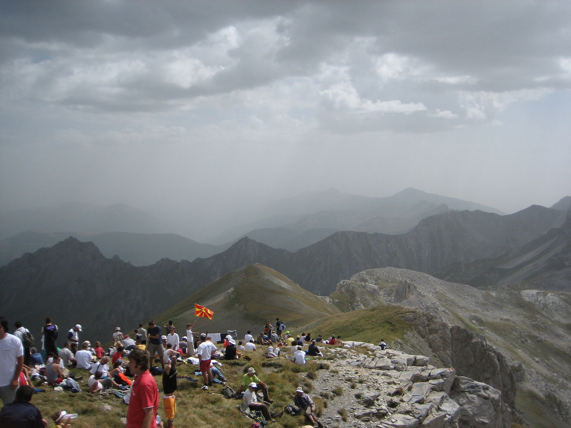
The selected day route climbs the north side of Mount Tomorr towards Çuka e Partizanit, the massif’s high point. Albania’s official tourism agency gives Mount Tomorr’s highest point as 2,416 m at Çuka e Partizanit and describes the massif as a national park and culturally important mountain above Berat and Skrapar. Berat City Tours gives the hiking route as difficult, with a maximum altitude of 2,416 m, minimum altitude around 1,007 m, 1,449 m of cumulative height gain, and 8.07 km one way.
Why it is essential
Tomorr is one of southern Albania’s most important mountains, combining height, isolation, protected-area status, and major cultural significance. It adds an interior Albanian massif to the catalogue, contrasting with the coastal Ceraunian landscape of Çika.
Equipment
- Mountain hiking equipment
- Sturdy boots
- Trekking poles
- Weatherproof and windproof layers
- Warm layer
- Sun protection
- Map or GPS
- Navigation backup
- Food
- Headtorch
- Substantial water
- Local guide or local transport arrangement if access or route condition is uncertain
Hazards and notes
- The route is steep and physically demanding.
- Loose gravel and talus are described in route-source notes.
- The summit is remote.
- Current road and trailhead access were not fully verified.
- Tomorr has major pilgrimage significance, especially around the Bektashi pilgrimage period, so access, traffic, and local restrictions should be checked before departure.
- Snow and wind can make the upper mountain serious outside the settled summer season.
GPX / KML links
| Source | URL | Format | Notes |
|---|---|---|---|
| Wikiloc — Çuka Partizan / Tomorri Summit | wikiloc.com | GPX / KML download source | Wikiloc / user-contributed terms not checked. Source route only until replaced. |
| Berat City Tours — route note | beratcitytours.com | Route description with GPS link | Site terms not checked. Useful secondary confirmation; not a standalone reusable route file. |
Further reading
- Albania official tourism — Mount Tomorr
- Berat City Tours — Hiking in Tomorr Mountain North Summit
- Wikiloc — Çuka Partizan / Tomorri Summit
Further reading
| Source | URL |
|---|---|
| Visit Greece — Vikos Gorge | visitgreece.gr |
| Visit Greece — Tymfi Dragon Lake | visitgreece.gr |
| Mount Olympus — official route page | mountolympus.gr |
| Mount Olympus — official downloads | mountolympus.gr |
| Albania official tourism — Mount Çika | akt.gov.al |
| Albania official tourism — Mount Tomorr | akt.gov.al |
| Epirus for All Seasons — Vikos–Aoos National Park hiking | epirusforallseasons.gr |
| Trekking Hellas — Dragon Lake Hike, Zagori | trekking.gr |
| Outdooractive — Maja e Çikës from/to Llogara Pass | outdooractive.com |
| Berat City Tours — Hiking in Tomorr Mountain North Summit | beratcitytours.com |
| Wikiloc — Vikos Gorge Monodendri to Vikos | wikiloc.com |
| Wikiloc — Mikro Papigko – Astraka Refuge – Dragon Lake | wikiloc.com |
| Komoot — Astraka Hut – Drakolimni | komoot.com |
| Wikiloc — Prionia – Refuge A – Skala – Prionia | wikiloc.com |
| Wikiloc — Mount Çika day hike | wikiloc.com |
| Wikiloc — Çuka Partizan / Tomorri Summit | wikiloc.com |