Regional overview
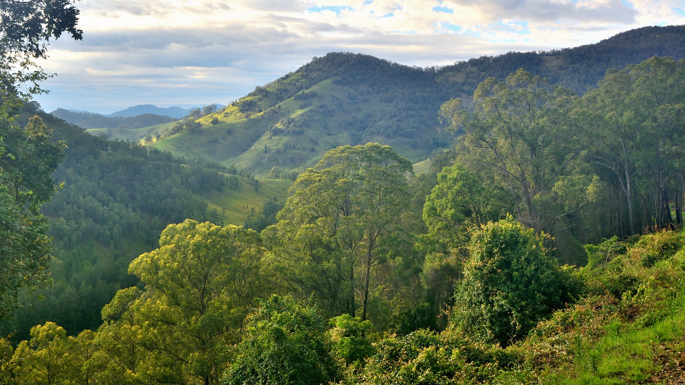
The Victorian Alps form the southern end of the Great Dividing Range and hold Victoria’s highest ground: Mount Bogong at 1,986 m, Mount Feathertop at 1,922 m and the granite plateau of Mount Buffalo. Alpine National Park is the state’s largest national park, managed by Parks Victoria, and links a chain of high plains, ridgelines and snow-gum forests from central Gippsland to the New South Wales border, where it joins Kosciuszko National Park. Adjoining reserves — Mount Buffalo National Park, Baw Baw National Park and the Mount Buller / Mount Stirling area — carry the same alpine character on separate massifs.
The main walking centres are Harrietville, Bright, Mount Beauty, Falls Creek, Mount Hotham, Dinner Plain, Mansfield and Mount Buller. The five walks in this selection sit on the four best-known massifs — the Razorback ridge between Hotham and Feathertop, Mount Bogong above Mountain Creek, Mount Buffalo above Bright, the Bogong High Plains at Falls Creek and Mount Stirling above Mansfield. Alpine National Park is Country of the Gunaikurnai and Taungurung Peoples, with Dhudhuroa, Jaitmatang and Ngarigo connections across the wider Alps.
The dominant hazards are weather and exposure. Sudden fronts, whiteout, snow flurries in any month and severe wind chill are all common above the treeline. The 2019–20 Black Summer fires burned large areas of Alpine National Park and left extensive snow-gum dieback; some tracks, huts and access roads have been rebuilt in stages and a Wonnangatta Complex Fire closure list remains in force. High-country roads at Hotham, Mount Buffalo, Mount Stirling and above Falls Creek carry a defined snow-season closure that typically runs from the Thursday after the Kings Birthday long weekend to late spring, and winter travel on the plateau requires snow experience.
Summary table
| # | Hike | Route type | Distance | Estimated time | Difficulty | Verification |
|---|---|---|---|---|---|---|
| 1 | The Razorback to Mount Feathertop | Out-and-back | 22 km return | 7–10 h | Grade 4 / hard | Route verified; Parks Vic + Trail Hiking Australia |
| 2 | Mount Bogong via Staircase Spur | Out-and-back / circuit | 16 km one-way per Parks Vic; 21.5 km circuit with Eskdale Spur per Trail Hiking Australia | 9–10 h | Grade 4 / hard | Route verified; Parks Vic + Trail Hiking Australia |
| 3 | The Horn walk, Mount Buffalo | Out-and-back | 0.8–1.5 km return depending on source | 30–45 min | Grade 3 / short but steep summit walk | Route verified; Parks Vic + Visit Mount Buffalo |
| 4 | Wallace’s Heritage Trail, Bogong High Plains | Loop | 6–6.7 km circuit depending on source | ~2 h | Grade 2 / easy | Route verified; Falls Creek + Bushwalking Victoria |
| 5 | Craig’s Hut from Circuit Road, Mount Stirling | Out-and-back | 3 km return | ~1 h | Grade 3 / short but with steep sections | Route verified; Visit Victoria’s High Country + Explore Outdoors |
Before you go
Access
The trailheads are spread across the northern half of the range. The Razorback starts at Diamantina Hut on the Great Alpine Road about 2.5 km on the Harrietville side of Mount Hotham Village. Mount Bogong’s Staircase Spur begins at the Mountain Creek Picnic and Camping Area, reached from Tawonga South. The Horn is at the end of the Horn Road above Cresta Valley in Mount Buffalo National Park, 25 km up from Porepunkah. Wallace Hut starts from a signposted car park on the Bogong High Plains Road, 7.7 km south of the Rocky Valley dam wall at Falls Creek. Craig’s Hut is reached from the Circuit Road picnic area on Mount Stirling, north-east of Mansfield. All access is by private vehicle; there is no scheduled public transport to any of the five trailheads. A Victorian national parks pass is not required for day walks, but standard Parks Victoria closure and fire-danger rules apply.
Standard kit
- Sturdy walking shoes or light hiking boots for The Horn and Wallace’s Heritage Trail; full boots for Feathertop, Bogong and Craig’s Hut.
- Full waterproof shell and warm mid-layer on every walk above the treeline, plus hat and gloves outside midsummer.
- Water: 1 litre for The Horn and Wallace’s, 2 litres for Craig’s Hut, 3+ litres for Feathertop and Bogong.
- Sun hat, sunglasses and high-SPF sunscreen — the plateau is exposed even on cool days.
- Offline map (Rooftop Maps Bogong Alpine, Buffalo or Buller/Stirling; or 1:25,000 Vicmap sheets), compass, headtorch, first aid.
- Personal Locator Beacon (PLB) is standard practice on the Razorback and Bogong; Parks Victoria emphasises that both routes should be treated as full alpine outings.
Common hazards
- Weather change: fronts can drop temperatures 15 °C in an hour and bring snow in any month above 1,500 m.
- Whiteout on the Bogong summit plateau and the Razorback ridge; the cairn line is easy to lose off-track.
- Cornices, ice and hidden creek crossings on Bogong’s summit dome and cirques from May to October.
- Snow-gum dieback and burnt-out sections of the 2019–20 fire scar in Alpine National Park — some huts have been rebuilt and some replacement tracks re-routed; check current Parks Victoria closure notices.
- Snow-season road closures at Hotham, Buffalo, Falls Creek high plains and Mount Stirling from around the Kings Birthday long weekend to late spring.
- Snakes on lower approaches (Mountain Creek and Buffalo Plateau) in warm weather.
1. The Razorback to Mount Feathertop
Snapshot
Itinerary
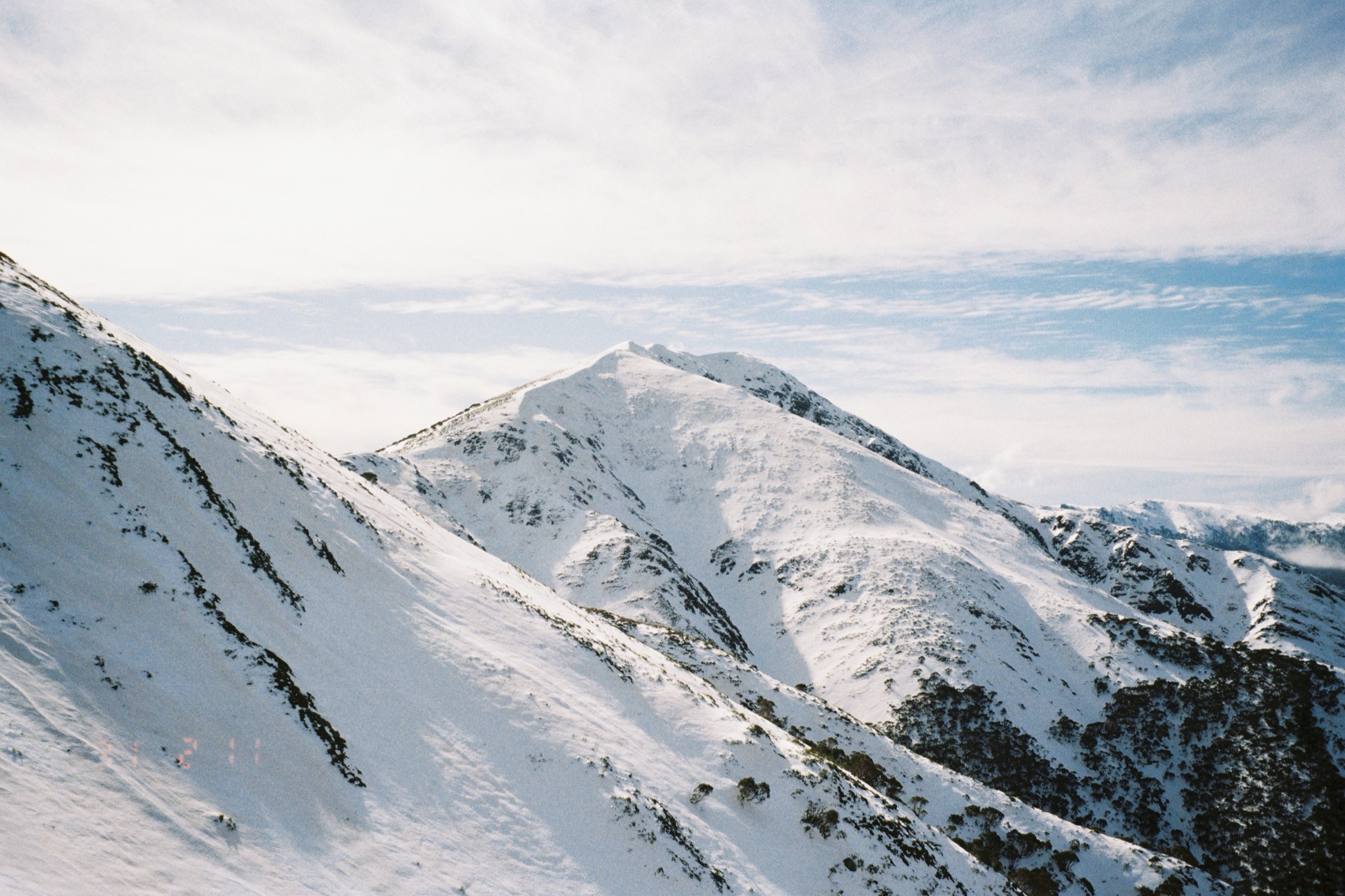
The route leaves Diamantina Hut on the Great Alpine Road and traces the Razorback — the narrow ridge running north-north-west between Mount Hotham and Mount Feathertop — through open snow-grass and stunted snow-gum woodland. The first few kilometres roll along the ridge crest with sustained views west across the Kiewa Valley and east towards the Bogong High Plains. Twin Knobs and Big Dipper add small climbs and descents before the track drops slightly to the Federation Hut / Bungalow Spur junction. From there the last stretch climbs onto the summit shoulder and then up the steep, rocky final cone to Mount Feathertop at 1,922 m. Return by the same route; there is no water on the ridge and no shelter between Diamantina Hut and Federation Hut.
Why it is essential
The Razorback is the marquee ridge walk of the Victorian Alps and the classic day objective on Victoria’s second-highest and most instantly recognisable peak. Parks Victoria itself flags it as one of the state’s most iconic walks, and it is the walk that most fully expresses the character of the Alpine National Park’s high country.
Hazards and notes
- Weather is the dominant risk: the ridge is exposed for its full length and fronts can arrive without warning.
- Cornices and rapidly changing conditions have caused fatalities on the summit block; the route should not be attempted in unsettled or bad weather.
- Route-finding above Federation Hut depends on cairns and boot-track; fog can obscure both.
- Snow persists on the summit block into November in some years.
- No water on the ridge; carry all supplies.
- Federation Hut is a shelter, not a bail-out — camping requires the designated Federation Hut campsite.
GPX / KML links
| Source | URL | Format | Notes |
|---|---|---|---|
| Parks Victoria — The Razorback Walk | parks.vic.gov.au | Official park page | No GPX published on the official page in this pass |
| Trail Hiking Australia — Mt Feathertop: The Razorback | trailhiking.com.au | Third-party route page with stats | GPX is copyright and not reusable per site notice |
| AllTrails — Mount Feathertop via The Razorback | alltrails.com | Third-party route page | Secondary reference |
Further reading
2. Mount Bogong via Staircase Spur
Snapshot
Itinerary
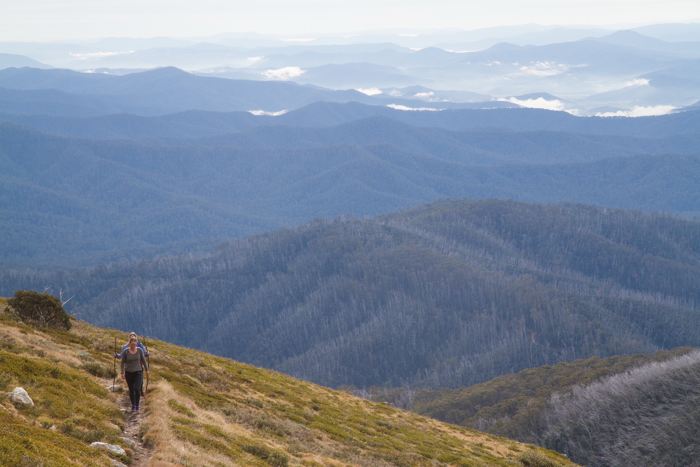
From Mountain Creek, the track follows an old vehicle line up the valley to Bivouac Hut at the foot of the spur, then climbs the Staircase — a long, steep boot-track that gains the treeline in a single sustained push. The spur emerges onto open alpine grassland at Castor and Pollux, passes the Michell Refuge Hut and continues over the summit dome to the summit cairn at 1,986 m. The Parks Victoria page describes the Staircase Spur climb as 16 km with about 1,400 m of vertical, and the standard fit-walker day treats it as an out-and-back. A more popular circuit descends the Eskdale Spur on the return and re-enters the Mountain Creek valley from the north-east, giving a 21.5 km round trip per Trail Hiking Australia.
Why it is essential
Mount Bogong is Victoria’s highest peak and the definitive summit day-hike of the state. The Staircase Spur is the shortest sustained line to the top and the historic access route from the Kiewa Valley; combined with the Eskdale Spur it forms the range’s classic summit circuit.
Hazards and notes
- Poor weather with snow, high winds and fog can occur any time of year; Parks Victoria explicitly flags this for the Bogong Remote and Natural Area.
- Above the treeline both Staircase and Eskdale spurs are very exposed and can “ice up” in the late afternoon after cold fronts.
- Snow can persist on the summit dome into December, and cornices form on the Eskdale side of the ridge in winter.
- Falling limbs and snakes are documented hazards on the lower track.
- No water on the summit plateau; the last reliable source is at Bivouac Hut on the way up.
- Sign the trailhead intentions book at Mountain Creek and carry a PLB.
GPX / KML links
| Source | URL | Format | Notes |
|---|---|---|---|
| Parks Victoria — Mt Bogong via Staircase Spur | parks.vic.gov.au | Official park page | No GPX published on the official page in this pass |
| Parks Victoria — Mount Bogong overview | parks.vic.gov.au | Official overview page | DOC-style official reference |
| Trail Hiking Australia — Mt Bogong Staircase Spur | trailhiking.com.au | Third-party route page with stats | GPX is copyright and not reusable per site notice |
| AllTrails — Mount Bogong Loop via Staircase and Eskdale | alltrails.com | Third-party route page | Secondary reference |
Further reading
- Parks Victoria — Mount Bogong
- Parks Victoria — Mt Bogong via The Staircase Spur Walking Track
- Trail Hiking Australia — Mt Bogong Staircase Spur
3. The Horn walk, Mount Buffalo
Snapshot
Itinerary
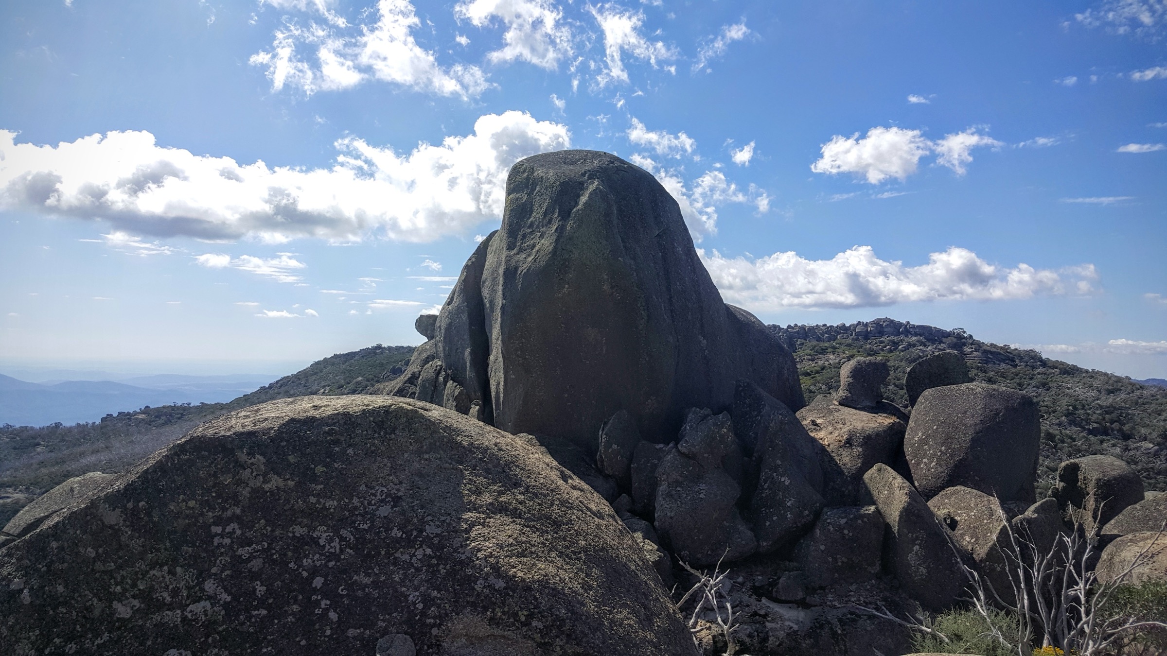
The track leaves the Horn Picnic Area and climbs the ridge onto the granite summit block of The Horn through low snow-gum, stone steps and short rock scrambles. The top gives a full 360° panorama across the Mount Buffalo plateau to Mount Feathertop, Mount Bogong and the folded Great Dividing Range to the south. Return by the same track. Sources describe the walk as either 800 m return (Visit Mount Buffalo) or 1.5 km return (Victoria’s High Country); the discrepancy is between the summit push from the picnic area and the longer variant that includes the plateau approach.
Why it is essential
The Horn is the high point of Mount Buffalo at 1,723 m and the natural summit walk of the plateau. It complements the alpine ridges of Feathertop and Bogong with a granite-plateau summit — the defining landscape of the western Victorian Alps — reached on a short, high-value walk.
Hazards and notes
- The final section is steep with exposed rock steps; care in wet or icy conditions.
- The plateau catches Southern Ocean fronts and can be markedly colder and windier than the valleys — carry a shell even for the short walk.
- Horn Road is closed to vehicles past Cresta Valley in the snow season; check current road status before travel.
- Dogs are not allowed in Mount Buffalo National Park.
GPX / KML links
| Source | URL | Format | Notes |
|---|---|---|---|
| Parks Victoria — The Horn | parks.vic.gov.au | Official park page | No GPX published on the official page in this pass |
| Parks Victoria — The Horn Walk site page | parks.vic.gov.au | Official site page | DOC-style reference |
| Trail Hiking Australia — The Horn | trailhiking.com.au | Third-party route page | Secondary statistics |
Further reading
4. Wallace’s Heritage Trail, Bogong High Plains
Snapshot
Itinerary
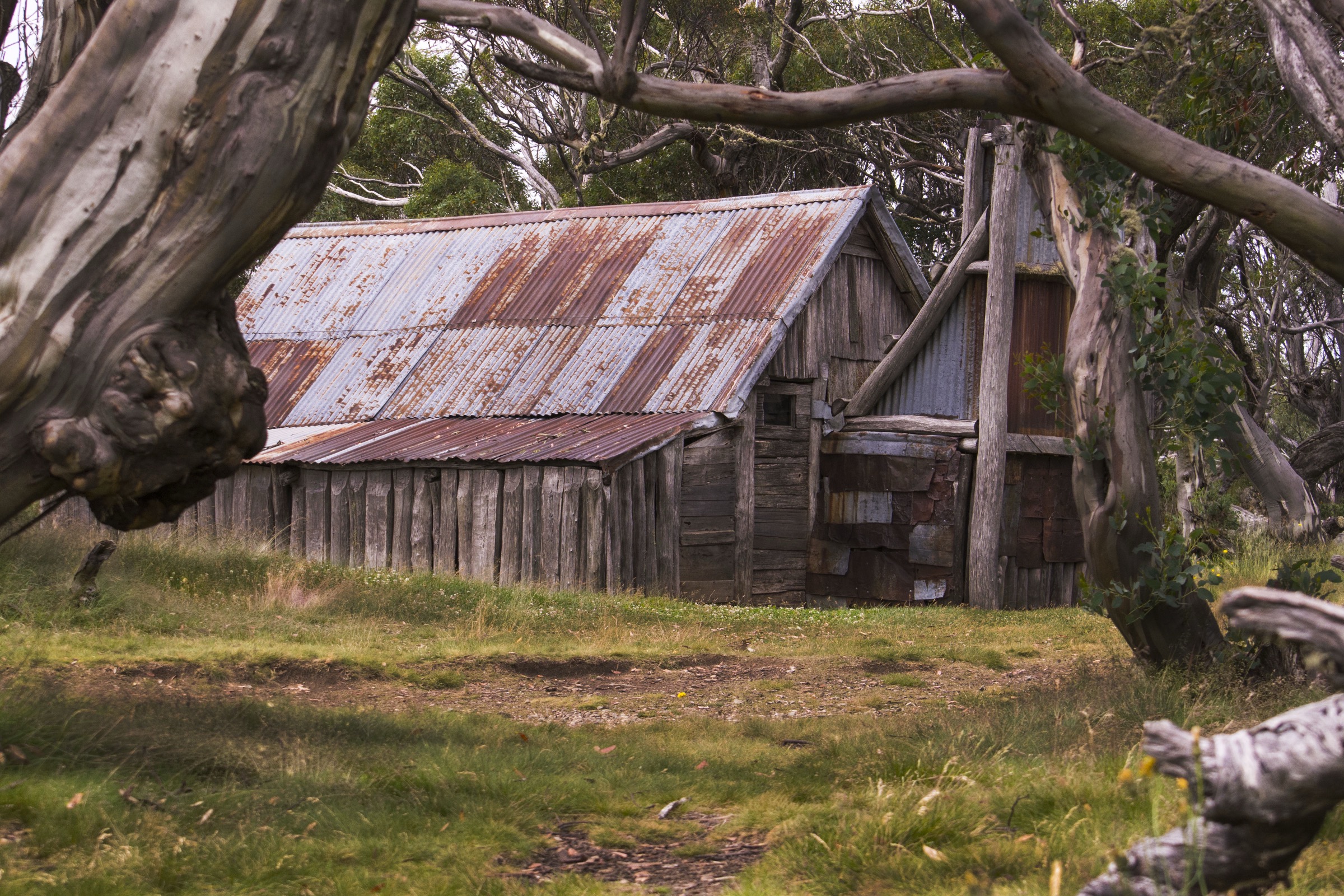
From the Wallace Hut car park, a 700 m gravel path drops gently to Wallace’s Hut itself, built in 1889 by the Wallace brothers and the oldest surviving hut in the Victorian Alps. The Heritage Trail continues past the hut and across the SEC aqueduct, then turns right past the Rover Chalet — a 1940s ski lodge still in use — and joins the Australian Alps Walking Track south to Cope Hut. From Cope Hut the loop returns north across open snow-grass and snow-gum flats to the car park. The whole circuit is signposted, formed and easy underfoot, and gives a comprehensive introduction to the cattlemen’s-hut heritage of the Bogong High Plains.
Why it is essential
Wallace’s Heritage Trail is the cultural core of the Bogong High Plains: the oldest hut in the Alps, a working ski chalet from the 1940s, and Cope Hut all on a short, non-technical loop. It sits deliberately at the easy end of the selection to represent the plains landscape and the heritage layer that the higher summit walks do not carry.
Hazards and notes
- Weather change on the plains can be as sudden as on the summit ridges — carry a shell and warm layer.
- Snow patches can linger into December on shaded aspects.
- The huts are shelters, not accommodation; camping is not permitted at Wallace or Cope Hut sites, and fires are not allowed.
- Dogs are prohibited.
- The Bogong High Plains Road is closed in the snow season and the trail then becomes a ski or snowshoe route.
GPX / KML links
| Source | URL | Format | Notes |
|---|---|---|---|
| Parks Victoria — Wallace Hut | parks.vic.gov.au | Official site page | No GPX published on the official page in this pass |
| Falls Creek Alpine Resort — Wallaces Heritage Trail | fallscreek.com.au | Official resort route page | Route description |
| Bushwalking Victoria — Wallace Heritage Trail, Falls Creek | bushwalkingvictoria.org.au | Peak-body route page | Secondary statistics |
Further reading
- Parks Victoria — Wallace Hut
- Falls Creek — Wallaces Heritage Trail
- Bushwalking Victoria — Wallace Heritage Trail
5. Craig’s Hut from Circuit Road, Mount Stirling
Snapshot
Itinerary
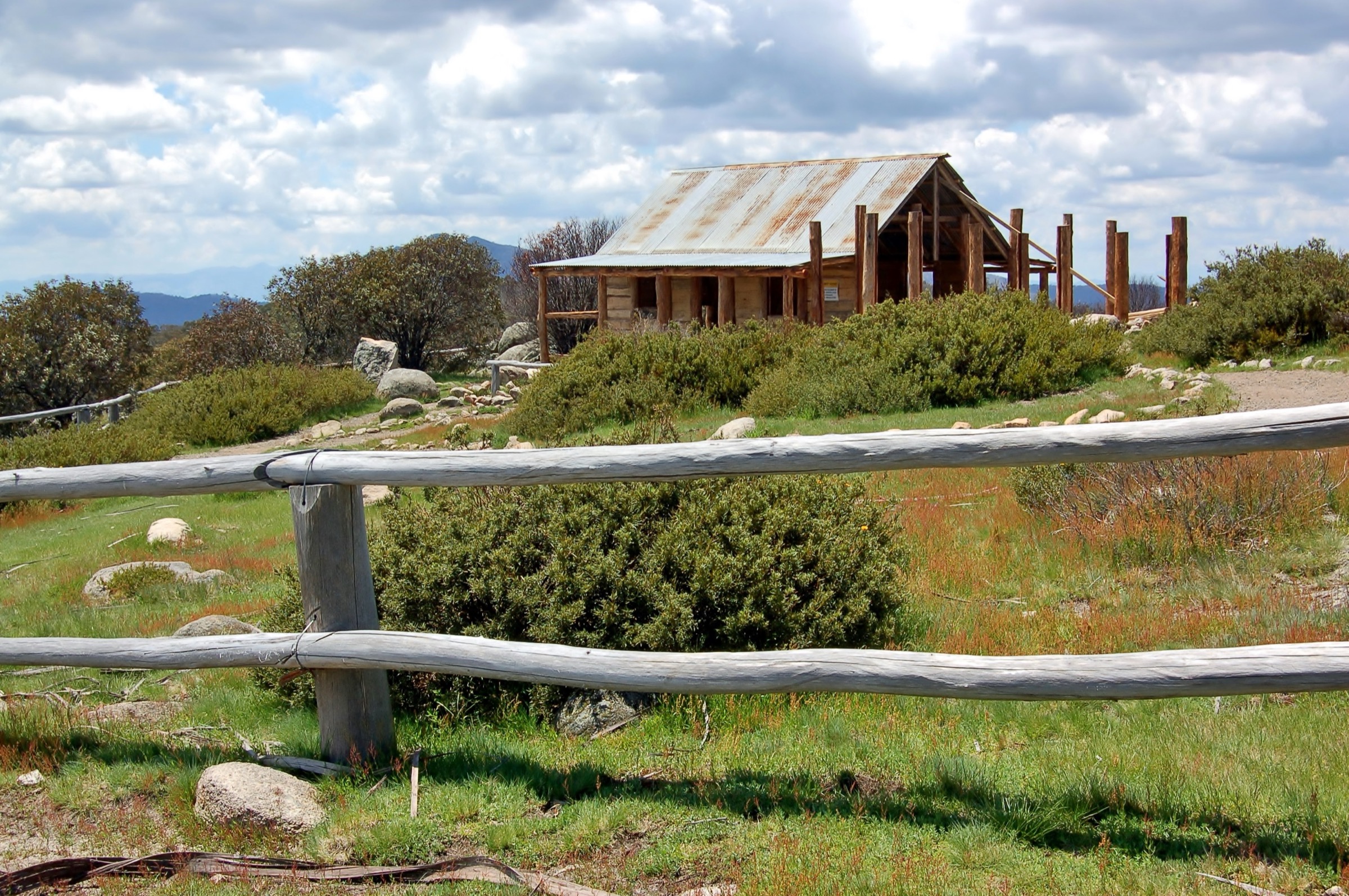
From the Circuit Road picnic area on Mount Stirling, the track leaves the road on a signposted, well-formed line and climbs through low snow-gum with intermittent views across the alpine valleys to Mount Buller and the Howqua headwaters. The track ends at Craig’s Hut on the western shoulder of Mount Stirling, a slab stockman’s hut built as a film set for the 1982 adaptation of The Man from Snowy River, burned in the 2006 alpine fires, and rebuilt as a heritage-listed shelter. Return by the same track.
Why it is essential
Craig’s Hut is the most photographed cattlemen’s hut in Australia and one of the enduring cultural landmarks of the Victorian Alps. The short Circuit Road walk gives the hut and the Mount Stirling shoulder as a compact, family-friendly day out that complements the long summit walks on Bogong and Feathertop.
Hazards and notes
- The road and walk are subject to a defined snow-season closure and the hut is not accessible by road in winter.
- Some steep sections in wet or icy conditions; sturdy shoes recommended.
- Fires and camping are not permitted at the hut itself; Sheepyard Flat and Bindaree Flat are the nearest camping areas.
- The hut sits on Taungurung Country; treat it as a heritage and cultural site.
GPX / KML links
| Source | URL | Format | Notes |
|---|---|---|---|
| Mt Buller Resort — Mt Stirling / Craig’s Hut | mtbuller.com.au | Resort route page | Official for the Mount Stirling resort area |
| Victoria’s High Country — Craig’s Hut Walk | victoriashighcountry.com.au | Regional tourism page | Route description |
| Explore Outdoors Victoria — Craig’s Hut and Walk | exploreoutdoors.vic.gov.au | Victorian Government outdoor recreation page | Access notes |
Further reading
Verification notes
- Route stats for Feathertop and Bogong are cross-referenced between Parks Victoria overview pages and Trail Hiking Australia; Parks Victoria does not publish full distance / time / elevation-gain tables on its site pages in this pass, so aggregated third-party statistics are used where marked.
- The Horn distance is quoted at both 800 m return (Visit Mount Buffalo) and 1.5 km return (Victoria’s High Country); the discrepancy is retained rather than resolved because it appears to reflect two different measurement start points.
- Wallace’s Heritage Trail distance is quoted at 6 km (Victoria’s High Country / Falls Creek Alpine Resort) and 6.7 km (Bushwalking Victoria); both figures are official-adjacent and are retained together.
- No open-licence GPX or KML files were located for any of the five walks on the official Parks Victoria pages in this pass. Third-party GPX files exist on Trail Hiking Australia, AllTrails and Bushwalking Victoria but are copyright and not reusable here.
- Snow-season closure dates for Horn Road, Bogong High Plains Road and Mount Stirling / Craig’s Hut roads should be re-confirmed against current Parks Victoria and resort notices before travel; Wonnangatta Complex Fire closures across Alpine National Park should be checked against the current Parks Victoria closure list.
Verification status
- The Razorback to Mount Feathertop — Route verified against Parks Victoria and Trail Hiking Australia; media verified via Wikimedia Commons.
- Mount Bogong via Staircase Spur — Route verified against Parks Victoria and Trail Hiking Australia; media verified via Wikimedia Commons.
- The Horn, Mount Buffalo — Route verified against Parks Victoria and Visit Mount Buffalo; media verified via Wikimedia Commons.
- Wallace’s Heritage Trail — Route verified against Falls Creek Alpine Resort and Bushwalking Victoria; media verified via Wikimedia Commons.
- Craig’s Hut from Circuit Road — Route verified against Mt Buller Resort and Victoria’s High Country; media verified via Wikimedia Commons.