Regional overview
The Scenic Rim is a horseshoe of forested peaks and escarpments arcing around the Fassifern and Numinbah valleys south-west of Brisbane, straddling the Queensland/New South Wales border along the southern end of the Great Dividing Range. The mountains are the eroded remnants of the Tweed shield volcano and the older Focal Peak volcano, both of which erupted roughly 23 million years ago as the Australian plate drifted north over a mantle hotspot. The high summits — Mount Barney, Mount Lindesay, Mount Warning across the border, and the Main Range ridgeline including Mount Cordeaux and Mount Mitchell — are the harder plugs and dyke systems left behind after millions of years of erosion stripped away the surrounding lava flows. The Scenic Rim country is home to the Yugambeh, Ugarapul, Githabul, Mununjali and Bundjalung peoples, whose songlines and cultural sites cross the escarpment from Main Range south through Mount Barney to Lamington and Springbrook.
Four national parks carry the bulk of the walking. Main Range NP protects the western wall of the horseshoe along the Great Dividing Range, with Cunninghams Gap on the Cunningham Highway giving the main walker access. Mount Barney NP protects the central massif around the 1,359 m summit of Mount Barney, Queensland’s second-highest peak and by consensus the state’s most serious unmarked day-walk. Lamington NP, split into the Green Mountains section at O’Reilly’s and the Binna Burra section above the Numinbah Valley, protects the highest and best-preserved subtropical rainforest on the horseshoe. Springbrook NP, further east on its own plateau above the Gold Coast, protects a shorter but visually spectacular section of the McPherson Range rim. Together with Border Ranges NP on the New South Wales side, Main Range, Lamington and Springbrook are inscribed as the Queensland/NSW component of the Gondwana Rainforests of Australia World Heritage Area, listed for the largest surviving stands of subtropical, cool-temperate and warm-temperate rainforest in the world.
Queensland Parks and Wildlife Service (QPWS) uses the Australian Walking Track Grading System (AWTGS), a six-class scale from Class 1 (accessible) to Class 6 (unmarked wilderness). Walks in the Scenic Rim range from Class 2 promenades (Best of All Lookout) through Class 3–4 rainforest circuits (Box Forest, Coomera, Warrie, Ships Stern) to Class 5 unmarked mountain routes (Mount Barney). The dominant environmental hazards are subtropical heat and humidity in summer, sudden thunderstorms and flash flooding on rainforest creeks, and leeches almost year-round in the wetter Lamington and Springbrook sections. Post-cyclone and heavy-rain track closures are common; walkers should confirm access with QPWS before travelling.
The five walks below give a balanced sample of the horseshoe: one from each of the four main parks, plus a second Lamington circuit to reflect the size of that park’s walking network.
Selection rationale
The five hikes are selected to give one flagship walk from each of the four main Scenic Rim parks, with Lamington represented twice because it holds two distinct walking hubs (Green Mountains and Binna Burra) with a full circuit at each. Mount Cordeaux and Bare Rock is chosen for Main Range NP as the iconic escarpment day-walk from Cunninghams Gap. Mount Barney via South East Ridge and South (Peasants) Ridge is chosen as the flagship summit of the region, despite being Class 5 and unmarked, because no honest picture of the Scenic Rim is complete without it. Box Forest Circuit is chosen at Green Mountains for its combination of rainforest, brush box stands and four waterfalls in a manageable 10.9 km loop. Ships Stern Circuit is chosen at Binna Burra as the long “view walk” of the eastern rim, taking in the Ships Stern ridge above the Numinbah Valley. Best of All Lookout is chosen at Springbrook as the standard short viewpoint walk through Antarctic beech to the McPherson Range rim above Wollumbin / Mount Warning. The Coomera Circuit at Binna Burra, the Warrie Circuit at Springbrook and the shorter Mount Cordeaux-only variant are noted as strong alternates in the follow-up section.
Summary table
| # | Hike | Country | Route type | Distance | Gain | Max elevation | Difficulty |
|---|---|---|---|---|---|---|---|
| 1 | Mount Cordeaux and Bare Rock | Australia | Out-and-back | ~12.4 km | ~500 m | ~1,135 m | Class 4 (AWTGS) |
| 2 | Mount Barney — South East Ridge and Peasants Ridge | Australia | Loop | ~14–16 km | ~1,100 m | 1,359 m | Class 5 (AWTGS) |
| 3 | Box Forest Circuit (Green Mountains) | Australia | Loop | ~10.9 km | ~350 m | ~950 m | Class 4 (AWTGS) |
| 4 | Ships Stern Circuit (Binna Burra) | Australia | Loop | ~19 km | ~700 m | ~890 m | Class 4 (AWTGS) |
| 5 | Best of All Lookout (Springbrook) | Australia | Out-and-back | ~800 m | ~20 m | ~1,000 m | Class 2 (AWTGS) |
1. Mount Cordeaux and Bare Rock
Snapshot
Itinerary
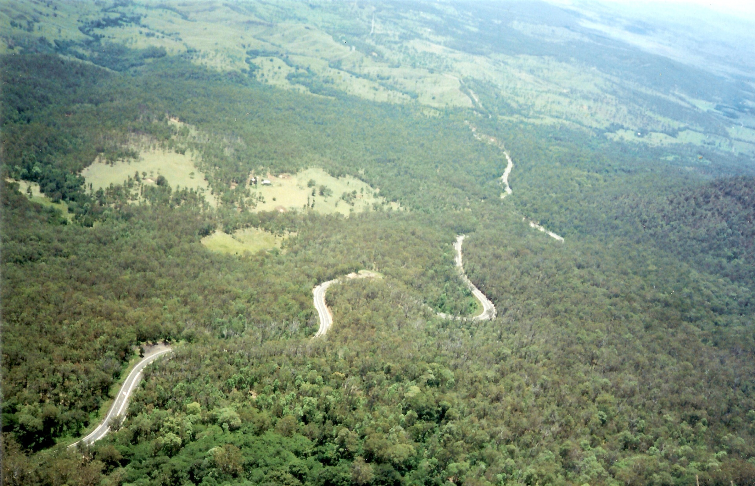
The trailhead sits at the crest of Cunninghams Gap on the Cunningham Highway, roughly 120 km south-west of Brisbane, at the low point where the highway crosses the Great Dividing Range between Aratula and Warwick. From the northern side of the car park the graded track climbs steadily through subtropical rainforest along the western flank of Mount Cordeaux, passing the ruins of a small abandoned gold-prospecting shaft carved into the eastern face. At approximately 3.4 km the track reaches a signposted spur leading to the Mount Cordeaux lookout, a rocky outcrop just below the 1,135 m summit that gives an open view south-west across the Fassifern Valley and north along the Main Range ridge to Mount Mitchell.
Beyond the Mount Cordeaux junction the graded track continues north along the ridge toward Bare Rock, crossing a saddle of montane heath and dipping briefly back into rainforest. The Morgans Walk spur (350 m one-way) branches off approximately 680 m before Bare Rock and ends in a small grove of montane heath. The main track finishes at Bare Rock with a short scramble onto an exposed rocky outcrop overlooking the Fassifern Valley to the east and the Great Dividing Range ridgeline to the north. Return is on the same line back down the ridge to the Cunninghams Gap car park.
Why it is essential
Mount Cordeaux and Bare Rock is the flagship escarpment walk of the northern Scenic Rim and the standard introduction to Main Range NP. It combines a full traverse of the Cunninghams Gap rainforest, a signature ridge-line view from Mount Cordeaux and the wider panorama from Bare Rock at the northern end of the ridge, all on a graded and marked track that stays within the Class 4 envelope. The shorter Mount Cordeaux-only variant is the natural fallback for a half-day.
Equipment
- Sturdy walking shoes or light boots
- Broad-brimmed hat and sun protection
- 2–3 L of water (no reliable water on route)
- Warm and weatherproof layer for the exposed sections
- Map and GPS
- First-aid kit including snake-bite bandage
- Leech socks or gaiters in wet months
- No drones
Hazards and notes
- The final scramble onto Bare Rock is exposed and slippery when wet.
- Weather changes rapidly on the escarpment; the ridge can be cold and windy year-round.
- Snake activity from spring through autumn.
- Leeches after rain, particularly on the lower rainforest sections.
- No mobile coverage on much of the ridge.
- Cunninghams Gap and the Cunningham Highway are subject to landslip closures after heavy rain — check QPWS alerts and Transport and Main Roads before travelling.
GPX / route file
| Source | URL | Format | Notes |
|---|---|---|---|
| QPWS — Bare Rock track and Morgans walk | parks.qld.gov.au | Web page | Official route source; no direct GPX download published |
| QPWS — Mount Cordeaux track | parks.qld.gov.au | Web page | Shorter variant reference |
| AllTrails — Bare Rock and Mount Cordeaux Track | alltrails.com | Web page | Distance and time cross-check |
Sources
- QPWS — Bare Rock track and Morgans walk
- QPWS — Mount Cordeaux track
- Wikipedia — Mount Cordeaux
- Wikimedia Commons — Cunningham Highway from Mount Mitchell
2. Mount Barney — South East Ridge and Peasants Ridge
Snapshot
Itinerary
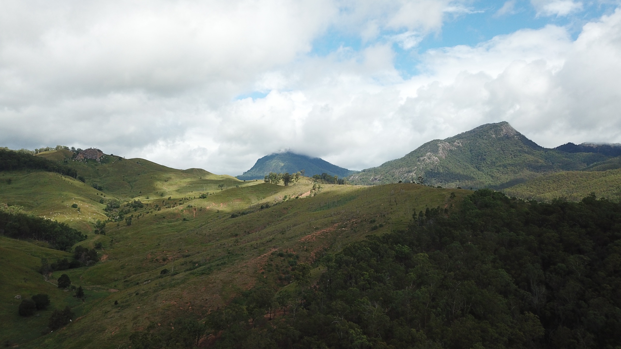
Mount Barney rises 1,359 m above the Fassifern Valley south of Rathdowney and is the second-highest peak in south-east Queensland and the eroded core of the Focal Peak shield volcano. The standard walker line for the East Peak is a loop from the Yellow Pinch car park at the eastern end of Mount Barney Road: ascent by the exposed South East Ridge, descent by the more sheltered South (Peasants) Ridge. Neither ridge is signposted or track-marked in the way Main Range or Lamington walks are; both are unmarked scrambling routes on rough foot pads with route-finding required throughout, and QPWS grades the summit routes at Class 5.
From Yellow Pinch the loop follows a rough vehicle track and then a foot pad west along the base of the range before turning north up the South East Ridge. The ridge climbs steeply on a narrow razorback of exposed rock slabs, with several airy scrambling sections and a short rock-slab crux near the summit. From the East Peak (1,359 m) the route drops west into the shallow saddle of Rum Jungle between East and West Peaks — a small pocket of rainforest — then descends south down the broader, more sheltered Peasants Ridge to rejoin the approach track and return to Yellow Pinch. QPWS publishes a Mount Barney summit routes information sheet and strongly recommends parties carry a Personal Locator Beacon and register their walk before departing.
Why it is essential
Mount Barney is the flagship summit of the Scenic Rim and the standard “hard day” of the region — an unmarked Class 5 scramble with genuine mountain exposure, sustained gain and long rescue times. It is the highest and most technically committing of the walks in this article and gives the summit view that defines the horseshoe from Main Range in the north to the McPherson Range in the south. Any credible day-walking picture of the Scenic Rim has to include it, even though the route sits at the very upper end of what “day-walk” describes.
Equipment
- Sturdy boots with good grip
- Broad-brimmed hat and sun protection
- 4 L of water minimum (no water on route above Rum Jungle in dry weather)
- Warm and weatherproof layers — the summit is often 10 °C colder than the valley
- Map, GPS with pre-loaded track, and compass
- Personal Locator Beacon (PLB) — considered mandatory local practice
- Headtorch for a long day
- First-aid kit including snake-bite bandage
- Trip intention lodged with a responsible party at Yellow Pinch
- No drones
Hazards and notes
- Unmarked Class 5 route — strong navigation skills are required.
- Exposed razorback ridge and rock-slab crux on the South East Ridge; slippery when wet.
- The route is not safe in rain, storm or low cloud.
- Route-finding on descent has historically caused most Mount Barney incidents.
- Rescue is slow — expect an overnight bivvy if benighted.
- Snake activity from spring through autumn.
- Register with QPWS at the trailhead sign-in box before departing.
GPX / route file
| Source | URL | Format | Notes |
|---|---|---|---|
| QPWS — Mount Barney walking track and summit routes (PDF) | parks.des.qld.gov.au | Official route summary | |
| QPWS — Mount Barney NP things to do | parks.qld.gov.au | Web page | Park-level information |
| Trail Hiking Australia — Mount Barney Summit | trailhiking.com.au | Web page | Distance and grade cross-check |
Sources
- QPWS — Mount Barney summit routes (PDF)
- QPWS — Mount Barney NP nature, culture and history
- Wikipedia — Mount Barney National Park
- Wikimedia Commons — Mt Barney National Park
3. Box Forest Circuit (Green Mountains, Lamington NP)
Snapshot
Itinerary
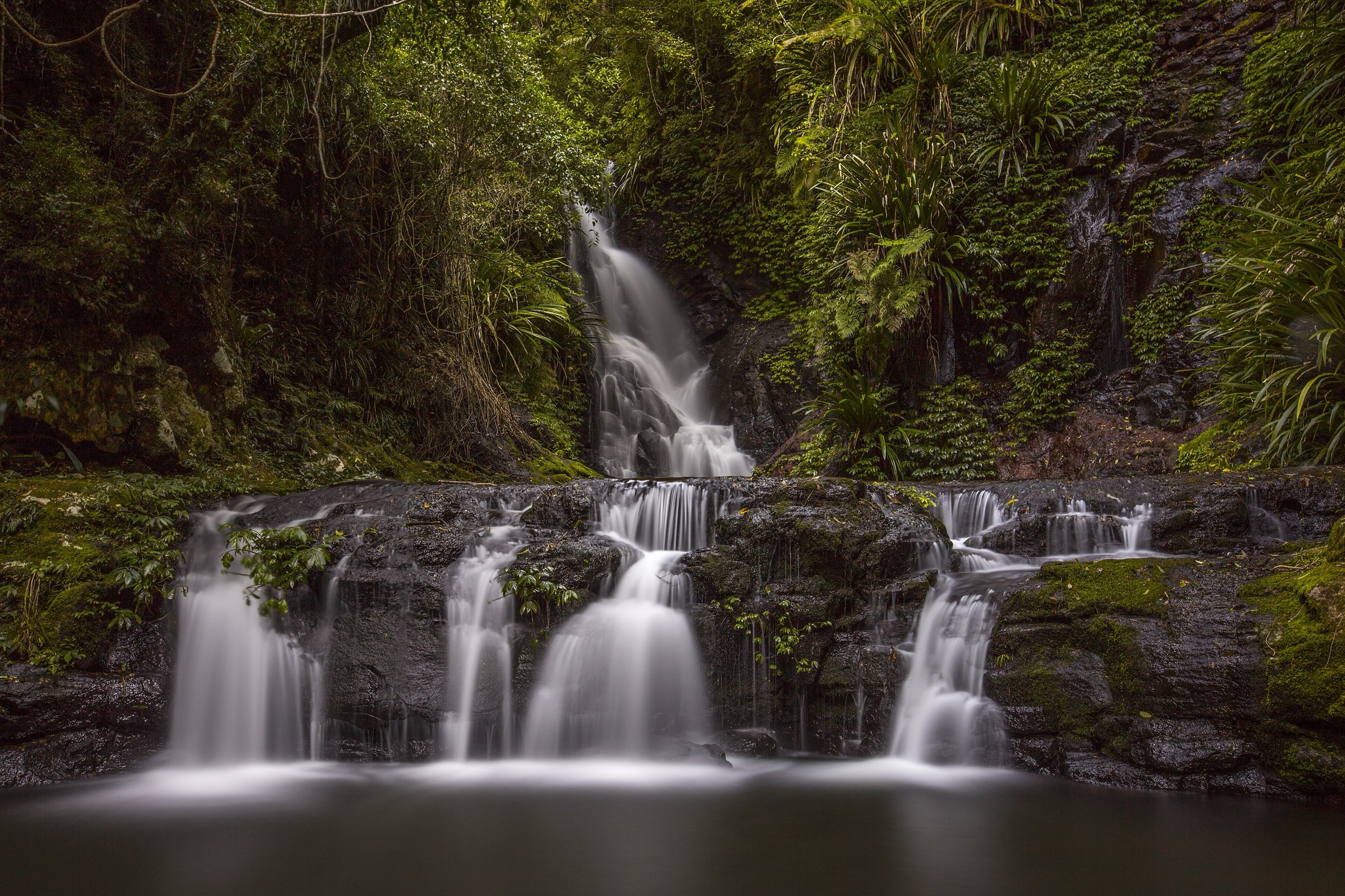
The circuit starts at the Green Mountains day-use area at the end of Lamington National Park Road, above the historic O’Reilly’s Rainforest Retreat. The signed trailhead leads onto the Border Track — Lamington’s spine trail along the McPherson Range — which is followed south for approximately 3.2 km through mature subtropical rainforest to the Box Forest Circuit junction. Turning off the Border Track, the circuit drops into the Nixon Creek catchment and follows the creek downstream through the box forest that gives the walk its name: a stand of smooth, pink-barked brush box (Lophostemon confertus) with scattered Antarctic beech higher up.
Working clockwise or anticlockwise, walkers pass a sequence of four named waterfalls — Darragumai, Tullerigumai (Box Log), Nugurin and Elabana Falls — with Elabana widely considered the standout. The trail is a mixture of graded rainforest tread, rock steps, small creek crossings and sections of exposed root and rock; it can be very slippery after rain. The loop closes back onto the Border Track and returns north to the Green Mountains trailhead.
Why it is essential
Box Forest is the standard 10 km rainforest circuit at Green Mountains and the natural single-day introduction to Lamington. It combines mature brush box and Antarctic beech, four accessible waterfalls and a graded loop that stays on marked Class 4 tread, giving a full sample of the World Heritage subtropical rainforest without either the length of the Coomera circuit or the exposure of the Ships Stern ridge. It is the most photographed rainforest circuit in the park.
Equipment
- Sturdy walking shoes with grip (wet, muddy tread)
- Leech socks or gaiters — essential in warmer months
- 2 L of water
- Waterproof jacket (rainforest showers year-round)
- Warm layer for the plateau
- Map and GPS
- First-aid kit including snake-bite bandage
- Insect repellent
- No drones
Hazards and notes
- Leeches active almost year-round on this circuit; long trousers and leech socks strongly recommended.
- Track is slippery on wet rock and roots — trekking poles help.
- Flash flooding possible on Nixon Creek and its tributaries after heavy rain.
- No mobile coverage in the rainforest.
- Track can be closed by falling trees and post-storm damage — check QPWS alerts.
GPX / route file
| Source | URL | Format | Notes |
|---|---|---|---|
| QPWS — Box Forest circuit | parks.qld.gov.au | Web page | Official route source; no direct GPX download published |
| Trail Hiking Australia — Box Forest Circuit | trailhiking.com.au | Web page | Distance and grade cross-check |
Sources
- QPWS — Box Forest circuit
- Trail Hiking Australia — Box Forest Circuit
- Wikimedia Commons — Elebana Falls, Lamington National Park
4. Ships Stern Circuit (Binna Burra, Lamington NP)
Snapshot
Itinerary
The Ships Stern Circuit is the long “view walk” of the Binna Burra section and the counterpart to the Green Mountains rainforest circuits. It starts at the Saddle trailhead directly opposite the entrance to Binna Burra Lodge. From the trailhead the route drops east along the Daves Creek Circuit, traversing an unusual open heath community perched on the McPherson Range rim before descending south through rainforest to a lower plateau. The middle section follows the base of the Ships Stern ridge above the Numinbah Valley, giving open views east across the valley to Egg Rock and Turtle Rock and, in clear weather, further east toward the Gold Coast hinterland.
The route then climbs the eastern side of the Ships Stern ridge on a rocky, moderately steep line and follows the ridge crest west back toward Binna Burra, passing several signposted lookouts along the way. It rejoins the Border Track close to the Saddle and returns to the trailhead. QPWS lists the total loop at approximately 19 km with about 700 m of cumulative gain; a longer 21 km variant is quoted where walkers add the full Daves Creek loop or a return via the Coomera lookout.
Why it is essential
Ships Stern is the standard long day at Binna Burra and gives the archetypal Lamington ridge-country experience — heath, rainforest and open ridge lookouts over the Numinbah Valley — in a single loop. It is the eastern counterpart to Box Forest at Green Mountains and gives a completely different visual character (view walk rather than waterfall walk) inside the same national park.
Equipment
- Sturdy walking shoes or light boots
- Leech socks or gaiters — essential in warmer months
- 2.5–3 L of water (limited reliable water on route)
- Waterproof jacket and warm layer
- Map and GPS
- First-aid kit including snake-bite bandage
- Headtorch (long day; early start recommended in winter)
- No drones
Hazards and notes
- Long day — the loop takes most parties 7–8 hours and there are no shortcuts once past the Ships Stern ridge.
- Leeches active in the rainforest sections almost year-round.
- Exposed sections on the ridge are hot in summer and cold in winter.
- Rockfall and post-storm trail damage — parts of the Binna Burra network have been rebuilt since the 2019 bushfires.
- Snake activity from spring through autumn.
- No reliable mobile coverage on the loop.
GPX / route file
| Source | URL | Format | Notes |
|---|---|---|---|
| QPWS — Ships Stern circuit | parks.qld.gov.au | Web page | Official route source; no direct GPX download published |
| Trail Hiking Australia — Ships Stern Circuit | trailhiking.com.au | Web page | Distance and grade cross-check |
Sources
- QPWS — Ships Stern circuit
- Trail Hiking Australia — Ships Stern Circuit
- Wikimedia Commons — Binna Burra, Lamington N-P QLD
5. Best of All Lookout (Springbrook NP)
Snapshot
Itinerary
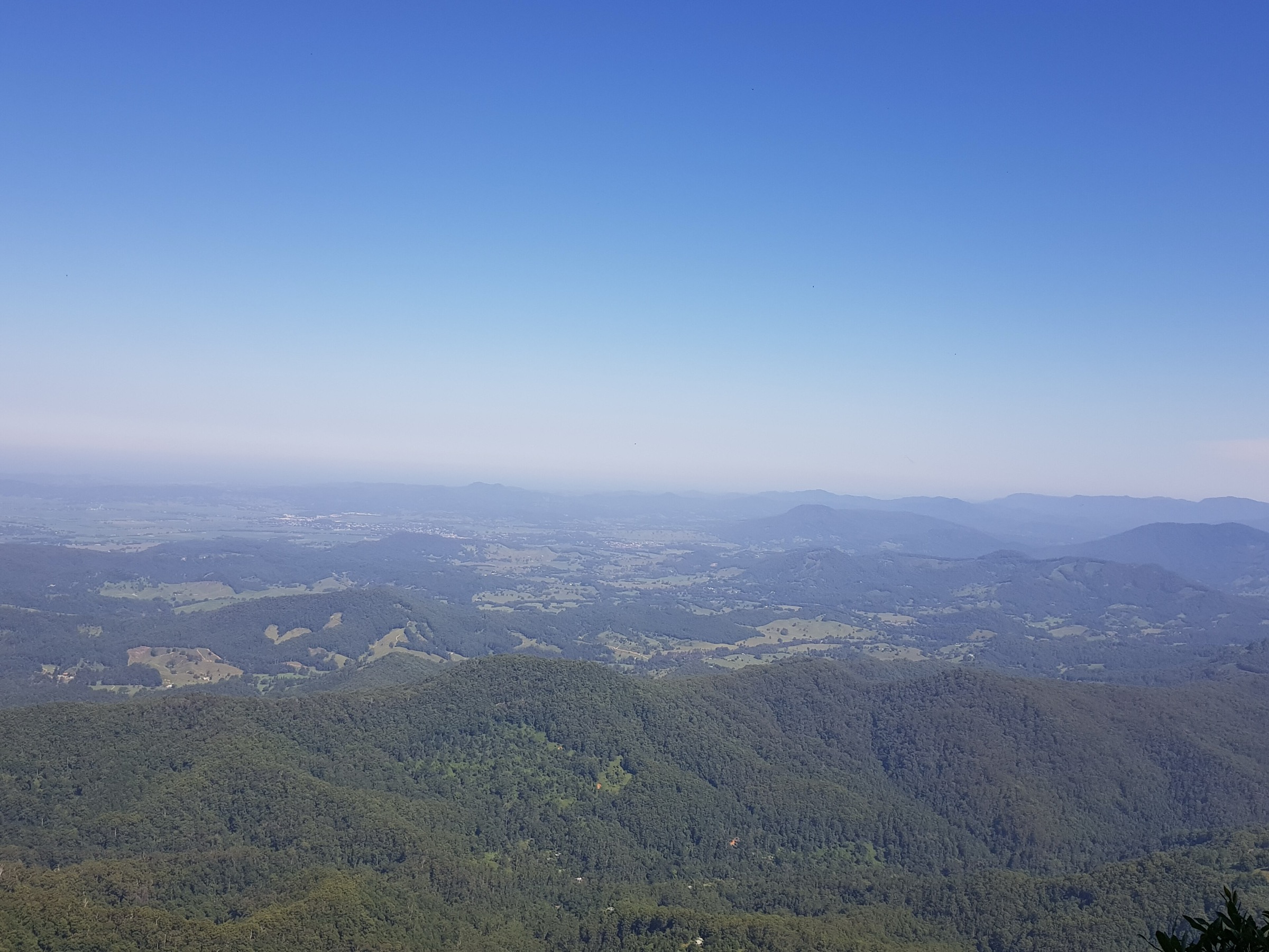
Best of All Lookout is the short signature walk at the southern end of the Springbrook plateau. A formed, largely level path leaves the small car park at the end of Repeater Station Road and winds through a stand of ancient Antarctic beech (Nothofagus moorei), some of the oldest individuals on the Springbrook plateau, before ending at a fenced lookout platform on the rim of the McPherson Range. The view drops directly south into the eroded interior of the Tweed shield volcano — the largest erosion caldera in the southern hemisphere — with Wollumbin / Mount Warning, the central volcanic plug, rising as the sharp peak in the middle of the basin. On a clear day the Tweed coast and the Byron hinterland are visible beyond.
Why it is essential
Best of All Lookout gives the definitive south-facing view of the Tweed caldera and Wollumbin, and is the walk that explains the geology of the whole Scenic Rim horseshoe in a single 800 m loop. The Antarctic beech grove on the approach is a living reminder of the Gondwanan lineage that gives the region its World Heritage listing, and the path is short enough to combine with the longer Warrie or Twin Falls circuits on the same visit.
Equipment
- Walking shoes
- Sun protection
- 500 mL–1 L of water
- Warm layer (the plateau is cool and can be windy)
- No drones
Hazards and notes
- Cool and often misty on the plateau; visibility can drop to nothing on cloudy days.
- Fenced platform but children should be supervised.
- Very short walk — main hazard is expectation of the view being clear.
- Leeches on the beech track after rain.
GPX / route file
| Source | URL | Format | Notes |
|---|---|---|---|
| QPWS — Springbrook NP journeys | parks.qld.gov.au | Web page | Official park journey list |
| Trail Hiking Australia — Best of All Lookout Walk | trailhiking.com.au | Web page | Distance and grade cross-check |
Sources
- QPWS — Springbrook NP journeys
- Trail Hiking Australia — Best of All Lookout Walk
- Wikimedia Commons — Best of All Lookout, Springbrook NP
Region-level sources
| Source | URL |
|---|---|
| QPWS — Main Range National Park | parks.qld.gov.au |
| QPWS — Mount Barney National Park | parks.qld.gov.au |
| QPWS — Lamington National Park | parks.qld.gov.au |
| QPWS — Springbrook National Park | parks.qld.gov.au |
| Queensland Environment — Gondwana Rainforests of Australia World Heritage Area | environment.qld.gov.au |
| Wikipedia — Scenic Rim | en.wikipedia.org |
| Wikipedia — Mount Barney National Park | en.wikipedia.org |
| Wikipedia — Yugambeh people | en.wikipedia.org |
Further reading
Nearby Great Dividing Range guides on Storm
- ACT, Namadgi and the Brindabella Ranges
- Atherton Tablelands / Cairns Highlands
- Barrington Tops
- Blue Mountains
- QPWS — Mount Barney summit routes (PDF)
- QPWS — Lamington National Park journeys
- QPWS — Springbrook National Park journeys
- Queensland Environment — Gondwana Rainforests of Australia
- Yugambeh Museum
Missing data / follow-up work
- The Coomera Circuit (~17.4 km, Class 4) at Binna Burra is a strong alternate to Ships Stern for a Lamington ridge day; it is not covered separately here to keep the article to five walks and one Lamington entry per hub.
- The Warrie Circuit (~17 km, Class 4) at Springbrook — a longer waterfall loop below the plateau rim — is the natural pairing for a full Springbrook day beyond Best of All Lookout and could be substituted for parties seeking a full circuit.
- QPWS does not publish direct GPX or KML downloads for any of the walks listed above; all official route sources are HTML pages or PDFs.
- Distance and time for the Ships Stern Circuit vary between sources (QPWS ~19 km; other sources up to 21 km depending on variant); use the longer figure for planning.
- Cumulative elevation gain figures for Mount Cordeaux/Bare Rock and Ships Stern are estimates from third-party sources rather than QPWS; refine against a GPS track if available.
- Mount Barney summit routes are unmarked and QPWS strongly recommends parties either walk with an experienced leader or engage a licensed guide; confirm current access and any temporary route advisories before travel.
- Post-heavy-rain closures on Cunninghams Gap, at Green Mountains and at Binna Burra are frequent — confirm current status with QPWS alerts before travelling.