Regional overview
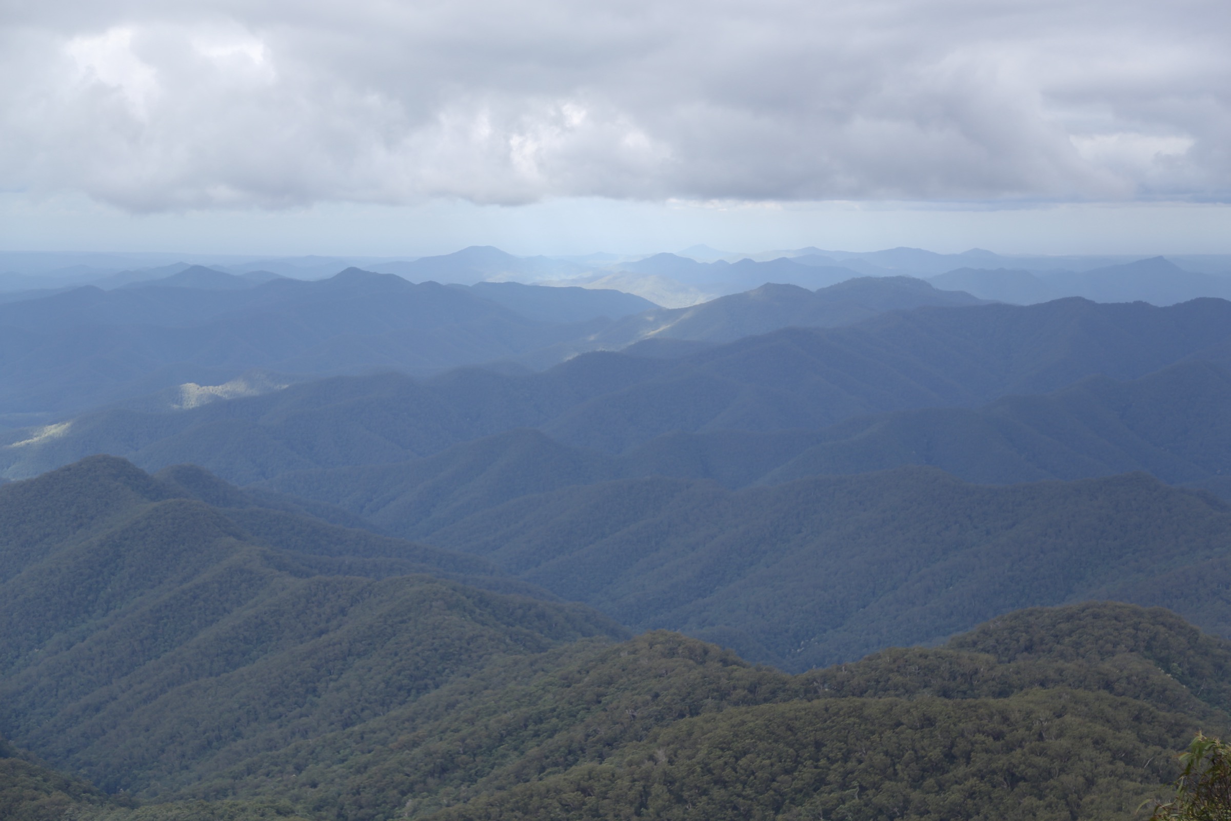
The New England Tablelands sit on the Great Dividing Range in northern New South Wales, an elevated basalt-and-granite plateau that averages 1,000–1,500 m between the Northern Rivers coast and the western slopes. Armidale is the main service centre, with Ebor, Dorrigo, Guyra and Walcha the closest gateways to the walking country. The plateau falls away sharply at the Great Escarpment: the eastern rim drops through Gondwana rainforest to the Bellinger, Nambucca and Macleay valleys, and the interior is cut by the deep gorge country of the Apsley–Macleay river system.
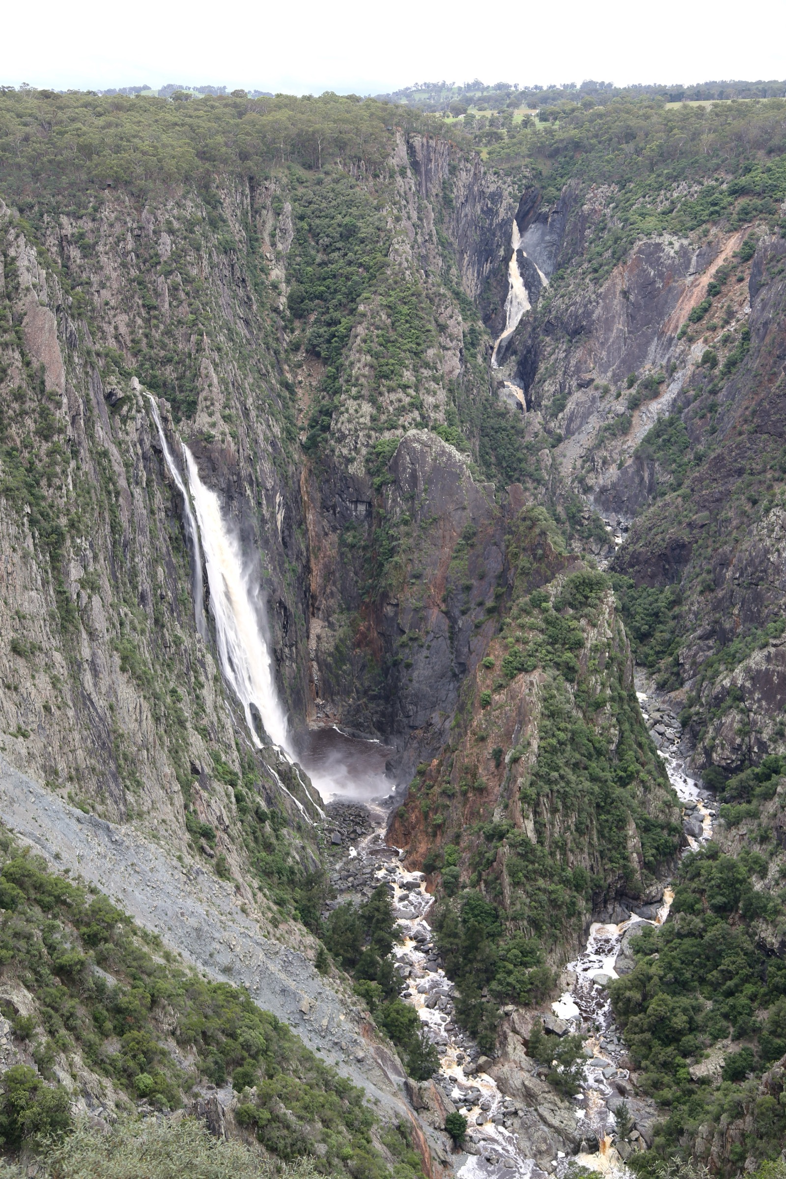
Three national parks carry most of the essential day-walks. New England National Park protects the escarpment edge above Bellingen and is part of the Gondwana Rainforests of Australia World Heritage inscription; its plateau rim gives some of the widest views on the range from Point Lookout at 1,564 m. Cathedral Rock National Park, on the plateau proper between Ebor and Guyra, is granite tor country — Cathedral Rock and Woolpack Rocks are the two headline stacks. Oxley Wild Rivers National Park, east and south-east of Armidale, holds the gorge and waterfall walks, including Wollomombi Falls, one of Australia’s tallest single drops at around 100 m.
The country is on Anaiwan / Nganyaywana and Dhungutti (Dunghutti) Country, with adjoining Gumbaynggirr and Biripi Country to the east and south. Managing agency for all three parks is the NSW National Parks and Wildlife Service (NPWS).
The dominant hazards are weather change, exposure on granite slabs, and gorge-edge drops. Fronts from the Tasman coast can bring rapid temperature swings, driving rain and, above 1,300 m, occasional winter snow. Summer wildfire regularly closes tracks and access roads across all three parks — the range was heavily burnt in 2019/20 and closures still recur. Leeches are common on the rainforest sections after rain, and rock-hopping on the granite tors is genuinely slippery when wet.
Summary table
| # | Hike | Route type | Distance | Estimated time | Difficulty | Verification |
|---|---|---|---|---|---|---|
| 1 | Point Lookout Walking Track | Loop | NPWS: 0.5 km | NPWS: 15–30 min | NPWS Grade 1 / easy | Route verified via NPWS |
| 2 | Lyrebird Walking Track | Loop | NPWS: 5.1 km; Trail Hiking Australia: 5.5 km | NPWS: 2 h 30 – 3 h 30 | NPWS Grade 3 / moderate | Route verified via NPWS + Trail Hiking Australia |
| 3 | Cathedral Rock Track | Loop | NPWS: 6 km; Trail Hiking Australia: 6 km; Aussie Bushwalking: 5.6 km | NPWS: 1 h 30 – 2 h 30 | NPWS Grade 5 / hard with scramble | Route verified via NPWS + Trail Hiking Australia + Aussie Bushwalking |
| 4 | Woolpack Rocks Track | Out-and-back | NPWS: 8 km return; Trail Hiking Australia: 7.7 km | NPWS: 2 h 30 – 3 h 30 | NPWS Grade 4 / hard | Route verified via NPWS + Trail Hiking Australia; no compliant Commons image |
| 5 | Wollomombi Walking Track | Loop | NPWS: 4 km; Trail Hiking Australia: 4 km | NPWS: 1 h 30 – 2 h | NPWS Grade 3 / moderate | Route verified via NPWS + Trail Hiking Australia |
Before you go
Access
The three parks share a common approach through Armidale on the New England Highway. New England National Park is reached from Waterfall Way (SR78) between Armidale and Dorrigo: turn onto Point Lookout Road, sealed to the Point Lookout precinct. Cathedral Rock National Park is reached from Round Mountain Road between Ebor and Guyra — Barokee campground for Cathedral Rock, Native Dog campground for Woolpack Rocks; final access is unsealed. Oxley Wild Rivers National Park’s Wollomombi precinct is signed off Waterfall Way about 39 km east of Armidale, on a short sealed spur. There is no scheduled public transport to any of the trailheads.
Standard kit
- Sturdy walking shoes or light hiking boots — granite slab and boulder work on Cathedral Rock and Woolpack Rocks is genuinely rough underfoot.
- Waterproof shell plus a warm mid-layer — carry these year-round on the higher tracks; the plateau is markedly cooler than Armidale.
- Water: 1 litre for Point Lookout and Wollomombi rim; 2 litres for Lyrebird, Cathedral Rock and Woolpack Rocks.
- Sun hat, sunglasses and high-SPF sunscreen — the plateau is exposed and UV is high in summer.
- Offline map or GPS, a compass, headtorch and a small first-aid kit.
- Insect repellent and a leech shield for Lyrebird and other rainforest sections after wet weather.
Common hazards
- Weather change: Tasman fronts can drop plateau temperatures 10–15 °C in an hour; winter frost and occasional snow on the higher granite.
- Cliff edges: unfenced or lightly fenced drops at Point Lookout, Wollomombi and along the plateau rim — stay on formed paths.
- Slippery rock: granite slabs and dolerite steps become dangerous when wet or frost-affected.
- Wildfire: the range was heavily burnt in 2019/20 and summer closures still recur; check NPWS local alerts before travel.
- Leeches after rain on Lyrebird, Point Lookout rainforest sections and Wollomombi’s damper corners.
- Cultural landscape: the tablelands are Anaiwan / Nganyaywana and Dhungutti Country; treat the granite tors and gorge country as living cultural landscape and stay on formed tracks.
- Current closures (July 2026): the Eagles Nest Walking Track and Weeping Rock access in New England National Park are closed for rockfall assessment; the West End Trail is permanently closed; Dangars Gorge precinct in Oxley Wild Rivers is closed for facilities upgrade until 5 June 2026 — check NPWS before travel. Barokee campground closes for maintenance from 13 April to 31 August 2026, but the Barokee day-use area and walking tracks remain accessible.
1. Point Lookout Walking Track
Snapshot
Itinerary
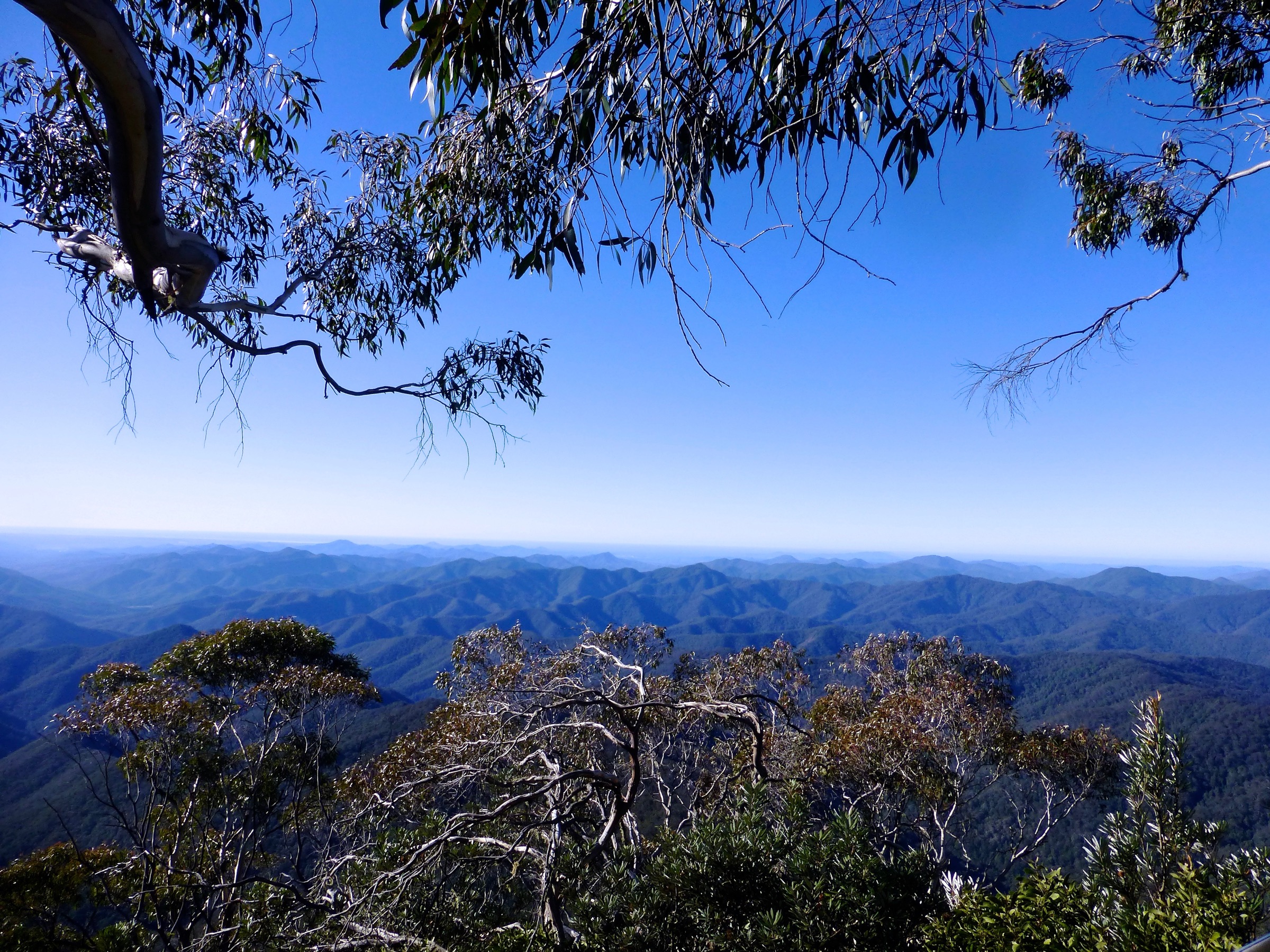
The sealed track leaves the Point Lookout car park and branches to a series of platforms on the plateau edge, at about 1,500 m above the Bellinger Valley. On a clear day the outlook runs across World Heritage Gondwana rainforest to the Pacific about 70 km east, with Dorrigo Plateau and Ebor Falls forming the middle distance. The first 100 m section from the car park is flat, sealed and rated wheelchair-accessible by NPWS; short optional branches on rougher path reach further lookouts along the rim. Return by the same track.
Why it is essential
Point Lookout is the range’s headline view — the widest and most dramatic outlook on the New England Tablelands, and the walk that NPWS itself flags as the flagship short outing in New England National Park. It anchors the escarpment section of the catalogue and, at 0.5 km, sits well below the usual 5 km catalogue floor but is retained because it is the defining public walk for the eastern rim.
Hazards and notes
- Weather changes rapidly on the escarpment — carry a shell even for the short walk.
- Unfenced drops beyond the platforms; keep children close and stay behind railings.
- Adjacent Eagles Nest Walking Track and Weeping Rock access are closed for rockfall assessment; do not attempt to link the loops in this pass.
- Winter frost and occasional snow can ice the platforms.
GPX / KML links
| Source | URL | Format | Notes |
|---|---|---|---|
| NPWS — Point Lookout Walking Track | nationalparks.nsw.gov.au | Official park page | No GPX published on the official page in this pass |
| NPWS — Point Lookout precinct | nationalparks.nsw.gov.au | Official lookout page | NPWS website terms |
| AllTrails cross-check | alltrails.com | Third-party route page | Secondary statistics only |
Further reading
2. Lyrebird Walking Track
Snapshot
Itinerary
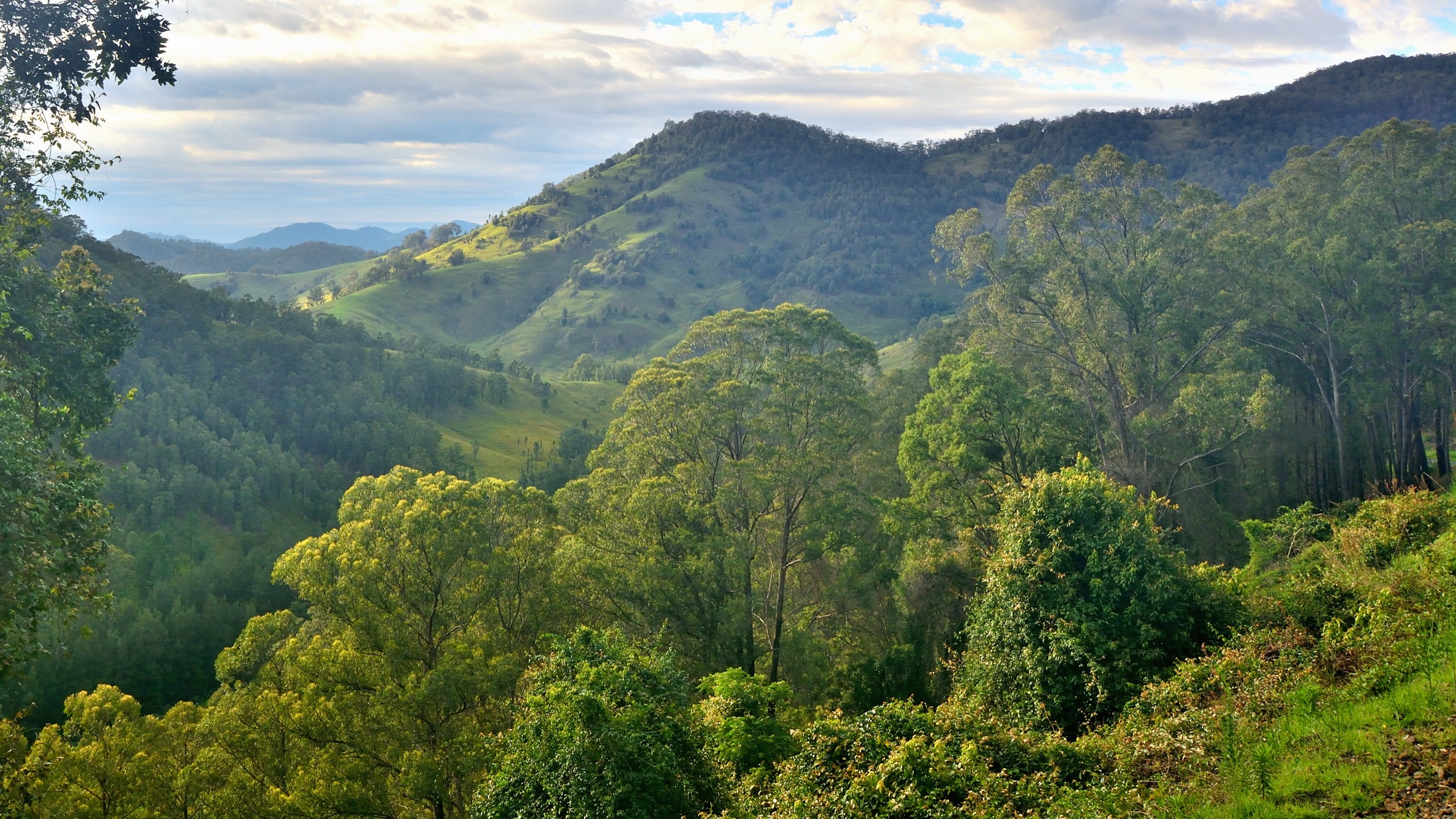
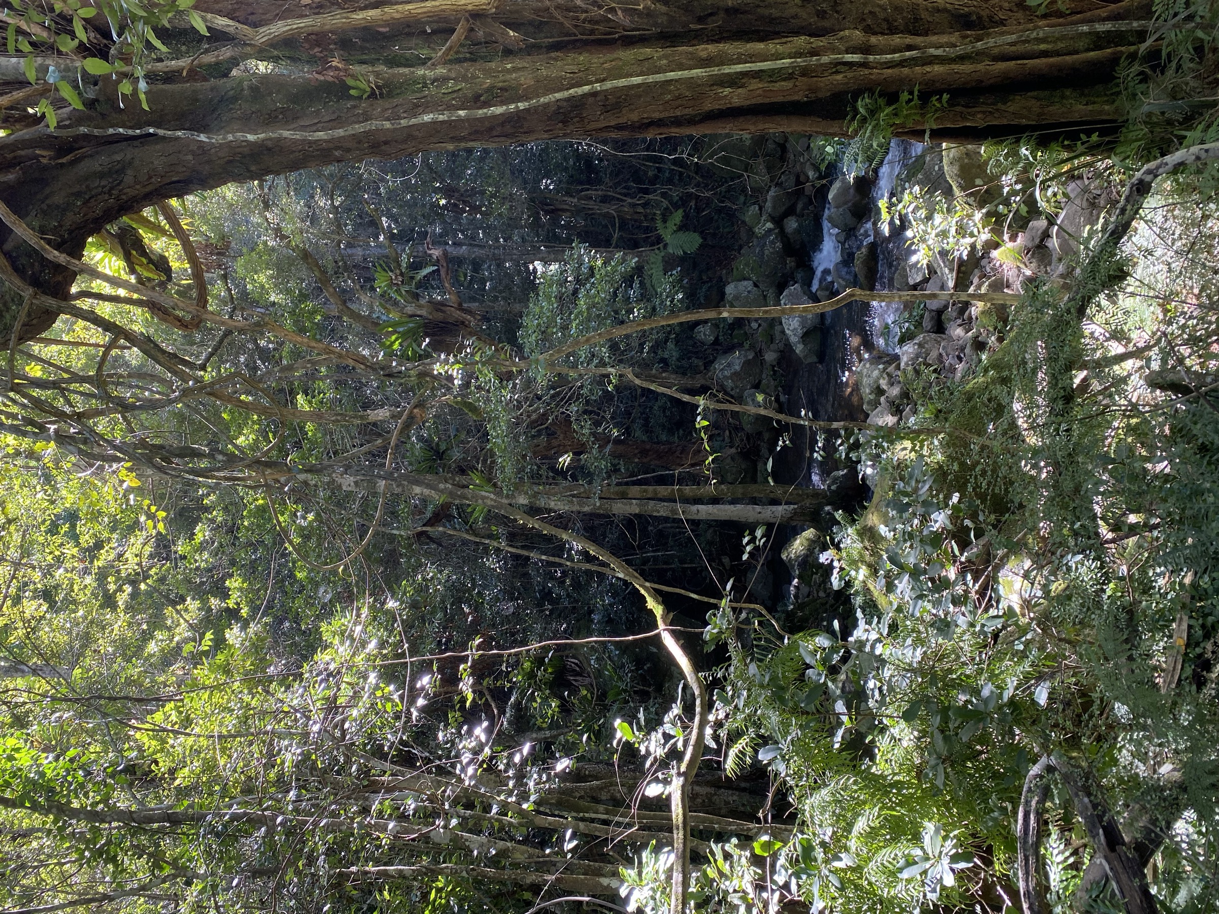
From Banksia Point car park (about 1 km before Point Lookout on the same road), the track drops off the plateau rim into a run of cool temperate rainforest, passes small waterfalls and basalt cliff bands, and follows the Fivedays Creek headwaters through eucalypt forest and colourful heath before climbing back to Banksia Point. A shorter 1.5 km cut-off returns via Tree Fern Valley. The track passes historic signposts marking the older park network, and superb lyrebirds are commonly heard through the loop.
Why it is essential
Lyrebird is the range’s marquee Gondwana rainforest loop — the walk that gives a full half-day of eucalypt-and-rainforest habitat within the World Heritage inscription without committing to a summit or escarpment route. It is the natural companion walk to the short Point Lookout circuit.
Hazards and notes
- Leeches after rain — carry insect repellent and check ankles at the finish.
- Rainforest tread is slippery when wet or frosted.
- The wider Point Lookout precinct has active closures (Eagles Nest, Weeping Rock) — do not follow signage toward those routes.
- Cold snaps and fog can obscure the rim viewpoints; carry a warm layer even in summer.
GPX / KML links
| Source | URL | Format | Notes |
|---|---|---|---|
| NPWS — Lyrebird Walking Track | nationalparks.nsw.gov.au | Official park page | No GPX published on the official page in this pass |
| Trail Hiking Australia — Lyrebird Walking Track | trailhiking.com.au | Third-party route page with stats | GPX is copyright and not reusable per site notice |
| AllTrails cross-check | alltrails.com | Third-party route page | Secondary statistics only |
Further reading
3. Cathedral Rock Track
Snapshot
Itinerary
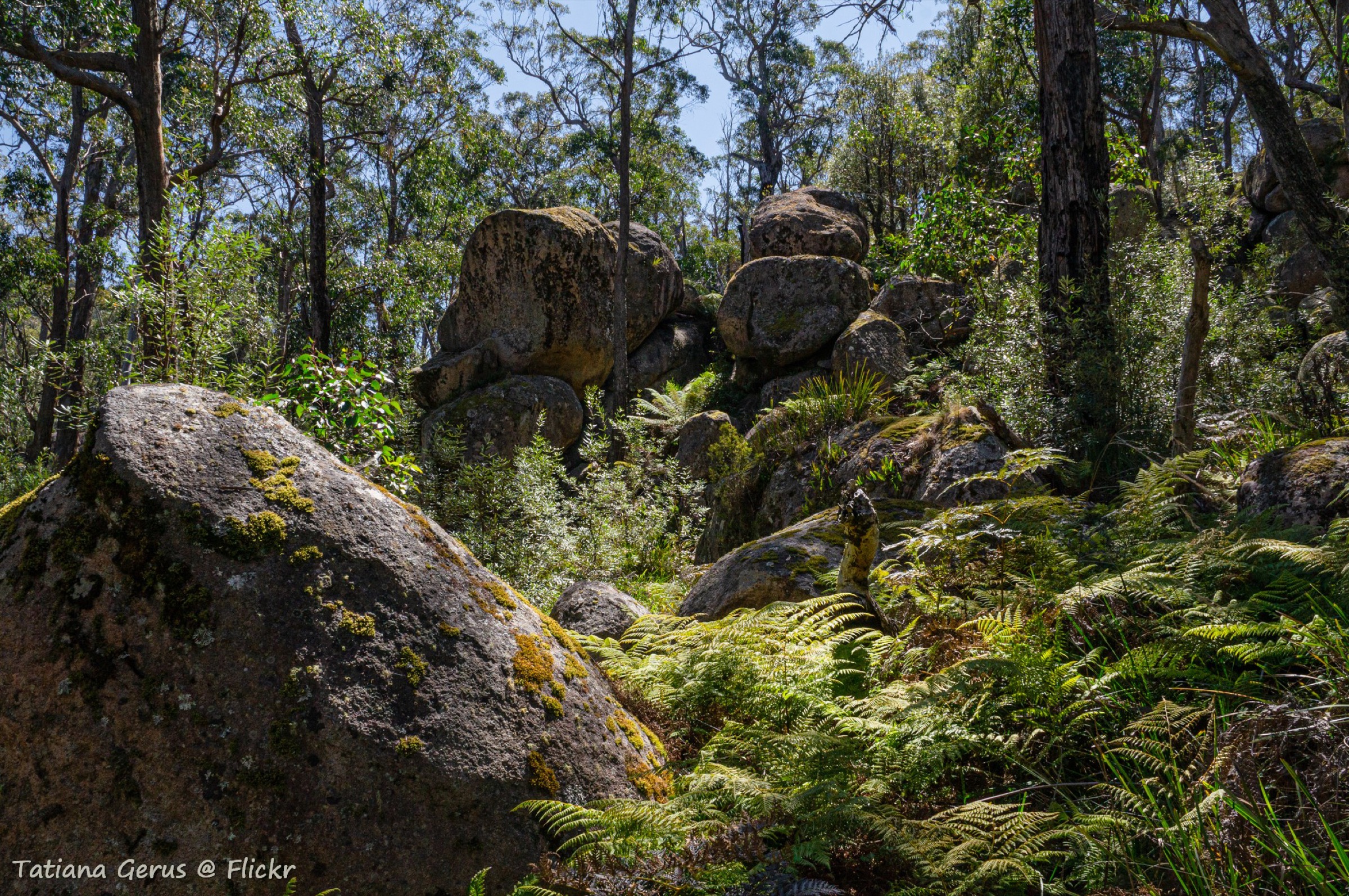
From the Barokee day-use area, the loop track heads clockwise through sub-alpine woodland and manna gum forest to the base of the Cathedral Rock granite tor. The summit spur is the crux — around 600 m of rock-hopping across stacked boulders, a squeeze between two rocks and a fixed chain up the final slab to the summit cairn at about 1,563 m. From the top the view runs across the New England Tablelands and, on a clear day, to the escarpment above the Bellinger Valley. The loop returns through the sheltered valley of manna gums on the west side of the peak back to Barokee.
Why it is essential
Cathedral Rock is the range’s iconic granite tor and the archetypal New England Tablelands summit walk. The scramble to the top is the defining Cathedral Rock National Park experience and the walk that NPWS itself flags as the flagship outing in the park.
Hazards and notes
- Granite boulders are extremely slippery when wet or frosted — the summit scramble should be avoided in wet conditions.
- The summit chain assists on the final slab; a fall from the block would be serious.
- Route-finding through the boulder field depends on painted markers; fog can obscure them.
- Barokee campground is closed for maintenance from 13 April to 31 August 2026, but the day-use area and walking tracks remain accessible.
- The park was heavily burnt in the 2019/20 fires; sign of regrowth is widespread and closures still recur in fire seasons.
GPX / KML links
| Source | URL | Format | Notes |
|---|---|---|---|
| NPWS — Cathedral Rock Track | nationalparks.nsw.gov.au | Official park page | No GPX published on the official page in this pass |
| Trail Hiking Australia — Cathedral Rock Track | trailhiking.com.au | Third-party route page with stats | GPX is copyright and not reusable per site notice |
| Aussie Bushwalking — Cathedral Rock | aussiebushwalking.com | Third-party route page | Secondary statistics only |
Further reading
- NPWS — Cathedral Rock Track
- Trail Hiking Australia — Cathedral Rock Track
- Aussie Bushwalking — Cathedral Rock
4. Woolpack Rocks Track
Snapshot
Itinerary
From Native Dog campground, the track climbs gently through sub-alpine eucalypt woodland to the foot of the Woolpack Rocks — a group of granite tors around 270 million years old that form the second headline stack in the park. The scramble to the summit is shorter and less exposed than Cathedral Rock, using natural clefts and boulder ledges. The view from the top runs across the northern tablelands to Mount Duval and the Guy Fawkes headwaters. Return by the same track. The Barokee to Native Dog Creek through-walk is not currently completable, so the walk finishes back at the Native Dog trailhead.
Why it is essential
Woolpack Rocks is the natural companion to Cathedral Rock — the same granite tor character, a longer approach on quieter tread, and a scramble that gives most walkers a summit without the chain-and-squeeze of the Cathedral block. It rounds out the tablelands catalogue with a second granite tor summit that is more forgiving than the marquee peak.
Hazards and notes
- Granite is slippery when wet or frosted; the scramble should be avoided in wet weather.
- The final section is boulder-and-cleft — sound footwork and a head for exposure are required.
- Route-finding depends on painted markers and cairns; fog can obscure them.
- The Barokee to Native Dog Creek through-walk is closed at the West End Trail; walkers must return to Native Dog.
GPX / KML links
| Source | URL | Format | Notes |
|---|---|---|---|
| NPWS — Woolpack Rocks | nationalparks.nsw.gov.au | Official park page | No GPX published on the official page in this pass |
| Trail Hiking Australia — Woolpack Rocks | trailhiking.com.au | Third-party route page with stats | GPX is copyright and not reusable per site notice |
| BeyondTracks — Woolpack Rocks | beyondtracks.com | Third-party route page | Secondary statistics only |
Further reading
5. Wollomombi Walking Track
Snapshot
Itinerary
From the Wollomombi Gorge picnic area, the track follows the northern gorge rim through low eucalypt and heath, taking in Gorge Lookout at about 0.7 km, Wollomombi Falls lookout at about 1.6 km — the head-on view of Australia’s roughly 100 m single-drop falls, with a total gorge descent of about 220 m — and Chandler Falls lookout at about 2.1 km, which frames the Chandler River drop across the gorge. The loop returns via inland heath and forest to the picnic area. At the height of dry summers the falls can slow to a thread; after heavy rain the double-drop character of the Chandler / Wollomombi confluence is at its most striking.
Why it is essential
Wollomombi is the range’s flagship gorge-country walk and the one route in this catalogue that anchors the Oxley Wild Rivers side of the tablelands. The falls are one of Australia’s tallest single drops and the walk gives head-on and side-on views of both the Wollomombi and Chandler cascades in a compact half-day loop. With Dangars Gorge closed to visitors through mid-2026, Wollomombi is the essential gorge circuit on the plateau in this pass.
Hazards and notes
- Cliff edges: the gorge rim drops sheer to the river bed — stay on formed tracks and behind railings.
- Slippery rock at lookouts in wet or frosted conditions.
- Summer flow can be very low; the falls are strongest after rain, not in mid-drought.
- Dangars Gorge precinct is closed for facilities upgrade until 5 June 2026 — plan Wollomombi as the primary gorge walk in the meantime.
- Vehicle day-use permits may apply to some Oxley Wild Rivers precincts; confirm with NPWS before travel.
GPX / KML links
| Source | URL | Format | Notes |
|---|---|---|---|
| NPWS — Wollomombi Walking Track | nationalparks.nsw.gov.au | Official park page | No GPX published on the official page in this pass |
| Trail Hiking Australia — Wollomombi Walking Track | trailhiking.com.au | Third-party route page with stats | GPX is copyright and not reusable per site notice |
| AllTrails — Chandler Lookout | alltrails.com | Third-party route page | Secondary statistics only |
Further reading
Missing data
- Elevation profiles, gain figures and maximum elevations are not systematically published by NPWS for any of the five walks. Values quoted come from Trail Hiking Australia, Aussie Bushwalking or BeyondTracks as secondary estimates and should be treated as approximate.
- No open-licence GPX or KML files were located for any of the five walks on official NPWS pages in this pass. Third-party GPX files on Trail Hiking Australia and AllTrails are copyright and not reusable here.
- No Wikimedia Commons image at or above the source floor was located for Woolpack Rocks in this pass; the figure block is intentionally omitted from that section rather than shipping a below-floor image or a generic Cathedral Rock NP shot.
- Point Lookout is retained at 0.5 km despite sitting well below the 5 km catalogue floor because it is the defining public walk for the eastern escarpment and the widest publicly accessible view on the range.
- Public-transport suitability to individual trailheads was not verified; all five walks require private vehicles from Armidale, Ebor or Dorrigo.
Verification status
- Point Lookout Walking Track — Route verified against NPWS; media verified via Wikimedia Commons.
- Lyrebird Walking Track — Route verified against NPWS and Trail Hiking Australia; media verified via Wikimedia Commons.
- Cathedral Rock Track — Route verified against NPWS, Trail Hiking Australia and Aussie Bushwalking; media verified via Wikimedia Commons.
- Woolpack Rocks Track — Route verified against NPWS and Trail Hiking Australia; no compliant Commons image located, media pending.
- Wollomombi Walking Track — Route verified against NPWS and Trail Hiking Australia; media verified via Wikimedia Commons.
Further reading
Nearby Great Dividing Range guides on Storm
- ACT, Namadgi and the Brindabella Ranges
- Atherton Tablelands / Cairns Highlands
- Barrington Tops
- Blue Mountains
- NPWS — Cathedral Rock National Park
- NPWS — Oxley Wild Rivers National Park
- Gondwana Rainforests of Australia World Heritage listing
- Wikipedia — Oxley Wild Rivers National Park
- Wikipedia — New England National Park