Regional overview
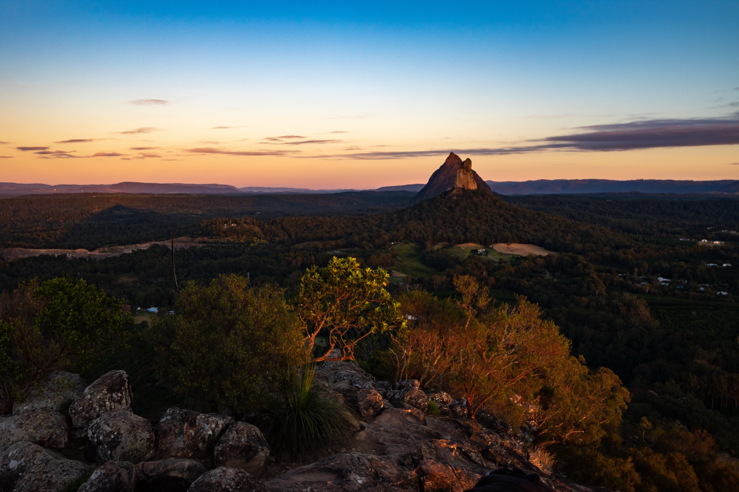
The Glass House Mountains are a scattered group of volcanic plugs rising abruptly from the coastal plain roughly 70 km north of Brisbane, on the south-eastern flank of Queensland’s Great Dividing Range. The peaks are the eroded cores of late-Oligocene to early-Miocene intrusions (~26–27 million years old) of trachyte and rhyolite that cooled inside softer surrounding rock; long weathering has stripped the country around them, leaving the harder plugs exposed as steep-sided domes and spires above cane fields, pine plantations and the Bruce Highway. James Cook named the group in 1770 because the peaks reminded him of the glass furnaces of his Yorkshire childhood.
The mountains and the wider Sunshine Coast hinterland are the ancestral country of the Jinibara and Kabi Kabi (Gubbi Gubbi) peoples, and the peaks are central to their creation stories. Beerwah is the mother, Tibrogargan the father, and Coonowrin (Crookneck) the eldest son; the surrounding smaller peaks are their other children. The Traditional Owners have long asked that visitors consider not climbing the sacred summits of Beerwah and Tibrogargan out of respect for cultural values, and Coonowrin has been closed to public climbing since 1999 for a combination of Traditional Owner concerns and severe rockfall risk on its near-vertical rhyolite walls.
Access is from the Steve Irwin Way (the old Bruce Highway) and the small township of Glass House Mountains, where sealed side roads reach signposted Queensland Parks and Wildlife Service (QPWS) trailheads for Ngungun, Beerwah, Tibrogargan and the Trachyte Circuit. QPWS grades tracks using the six-class Australian Walking Track Grading System (AWTGS), where Class 1–3 are standard walking tracks, Class 4 requires moderate bushwalking experience and Class 5 is unmarked or difficult terrain that may include exposed scrambling. Two of the five walks selected here — Beerwah and the Tibrogargan summit — are Class 5 and involve sustained, exposed rock scrambling on trachyte slabs where a slip has serious consequences. The remaining three are within reach of any reasonably fit walker.
The region is warm-temperate to subtropical. The reliable dry-weather window is roughly April to October; summer (December to February) is hot, humid and prone to short but violent thunderstorms that leave the trachyte slabs dangerously slick for one or two days afterwards. QPWS advises walkers not to attempt the Class 5 summit routes if rain has fallen recently or is forecast. Mobile-phone coverage is generally good across the Glass House Mountains proper but patchy in the Sunshine Coast hinterland.
Selection rationale
The five walks are chosen to give a balanced day-walking picture of the volcanic-plug landscape and the adjoining Sunshine Coast hinterland. Mount Ngungun is included as the standard mid-difficulty summit of the group — the only summit in the Glass House Mountains that a fit walker without scrambling experience can safely reach. Mount Beerwah and the Mount Tibrogargan summit are the two Class 5 scrambles that define the technical hiking character of the range, and are included with clear cultural and safety notes. Wild Horse Mountain gives the standard lookout view over the whole group from a short paved climb and is the natural short walk of the region. Mount Tinbeerwah is added as the Sunshine Coast hinterland representative — a short, accessible summit in Tewantin National Park with a coastal-hinterland panorama that complements the volcanic-plug country to the south. The Trachyte Circuit around the base of Tibrogargan is discussed within the Tibrogargan entry as the Class 3 alternative to the summit route for parties who do not intend to scramble.
Summary table
| # | Hike | Country | Route type | Distance | Gain | Max elevation | Difficulty |
|---|---|---|---|---|---|---|---|
| 1 | Mount Ngungun Summit Track | Australia | Out-and-back | ~2.8 km | ~180 m | 253 m | Class 4 (AWTGS) |
| 2 | Mount Beerwah Summit Track | Australia | Out-and-back | ~2.6 km | ~400 m | 556 m | Class 5 (AWTGS) |
| 3 | Mount Tibrogargan Summit / Trachyte Circuit | Australia | Out-and-back / loop | ~3.3 km / ~6.4 km | ~300 m / ~120 m | 364 m | Class 5 / Class 3 (AWTGS) |
| 4 | Wild Horse Mountain Lookout | Australia | Out-and-back | ~1.4 km | ~85 m | 123 m | Class 3 (AWTGS) |
| 5 | Mount Tinbeerwah Lookout Walk | Australia | Out-and-back | ~1 km | ~50 m | 265 m | Class 3 (AWTGS) |
1. Mount Ngungun Summit Track
Snapshot
Itinerary
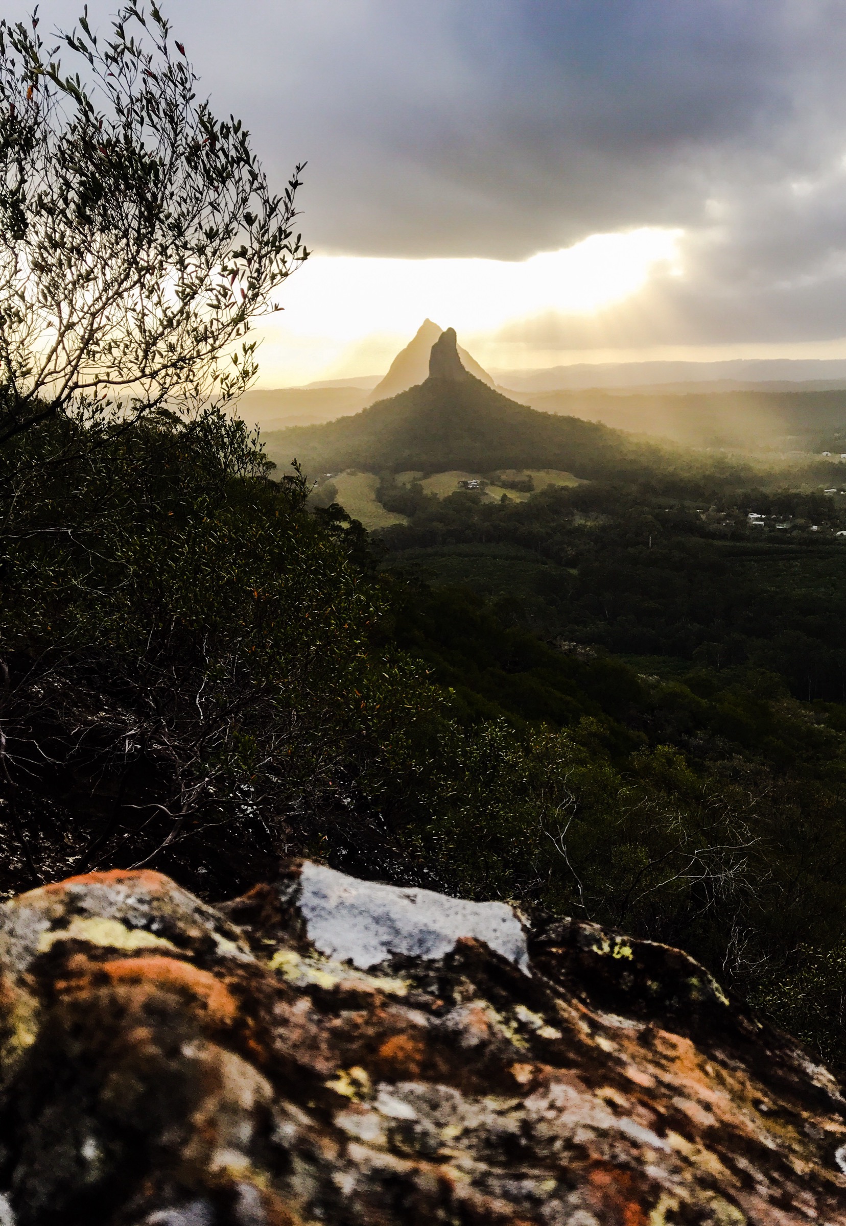
The track leaves the sealed Fullertons Road car park on the western side of Ngungun and climbs immediately into open eucalypt forest. After about 300 m the gradient eases briefly across a bench and the tread turns onto the trachyte flank of the mountain, weaving between grass-trees and small overhangs. Roughly half way up the route passes a signposted rock shelter often called “Lovers Cave”, associated with a local Aboriginal story. Above the cave the tread steepens and follows a series of stepped ledges up the north-western ridge, with several unfenced sections where the cliff drops sharply into the valley. The summit is a bare trachyte platform at 253 m giving an open 360° view over Tibrogargan and Coonowrin to the east, Beerwah’s steep south face to the south, and the Sunshine Coast beaches on a clear day. Return is on the same line.
Why it is essential
Ngungun is the only summit in the Glass House Mountains that is realistically open to the general walking public — the higher peaks of Beerwah and Tibrogargan are Class 5 scrambles, and Coonowrin is closed to climbing. It is the standard “must do” of the group and gives the classic panoramic view over the other plugs used in most published photographs of the region.
Equipment
- Sturdy walking shoes with grippy soles
- Broad-brimmed hat and high-SPF sun protection
- 1.5–2 L of water minimum
- Light rain shell in unsettled weather
- Basic first-aid kit including snake-bite bandage
- Head torch if starting for a sunrise or sunset
Hazards and notes
- Unfenced cliff edges near the summit — supervise children closely and stay on the marked track.
- Trachyte becomes very slippery when wet; do not attempt in or after rain.
- Snake activity from spring through autumn.
- Very busy car park at weekends — arrive early.
- No water on route; no shade above the mid-mountain bench.
GPX / route file
| Source | URL | Format | Notes |
|---|---|---|---|
| QPWS — Glass House Mountains National Park | parks.desi.qld.gov.au | Web page | Official route source; no direct GPX download published |
| Trail Hiking Australia — Mount Ngungun Summit Track | trailhiking.com.au | Web page | Distance and grade cross-check |
Sources
- QPWS — Glass House Mountains National Park
- Trail Hiking Australia — Mount Ngungun Summit Track
- Queensland.com — Mount Ngungun summit walking track
- Wikimedia Commons — View from Mt Ngun Ngun
2. Mount Beerwah Summit Track
Snapshot
Itinerary
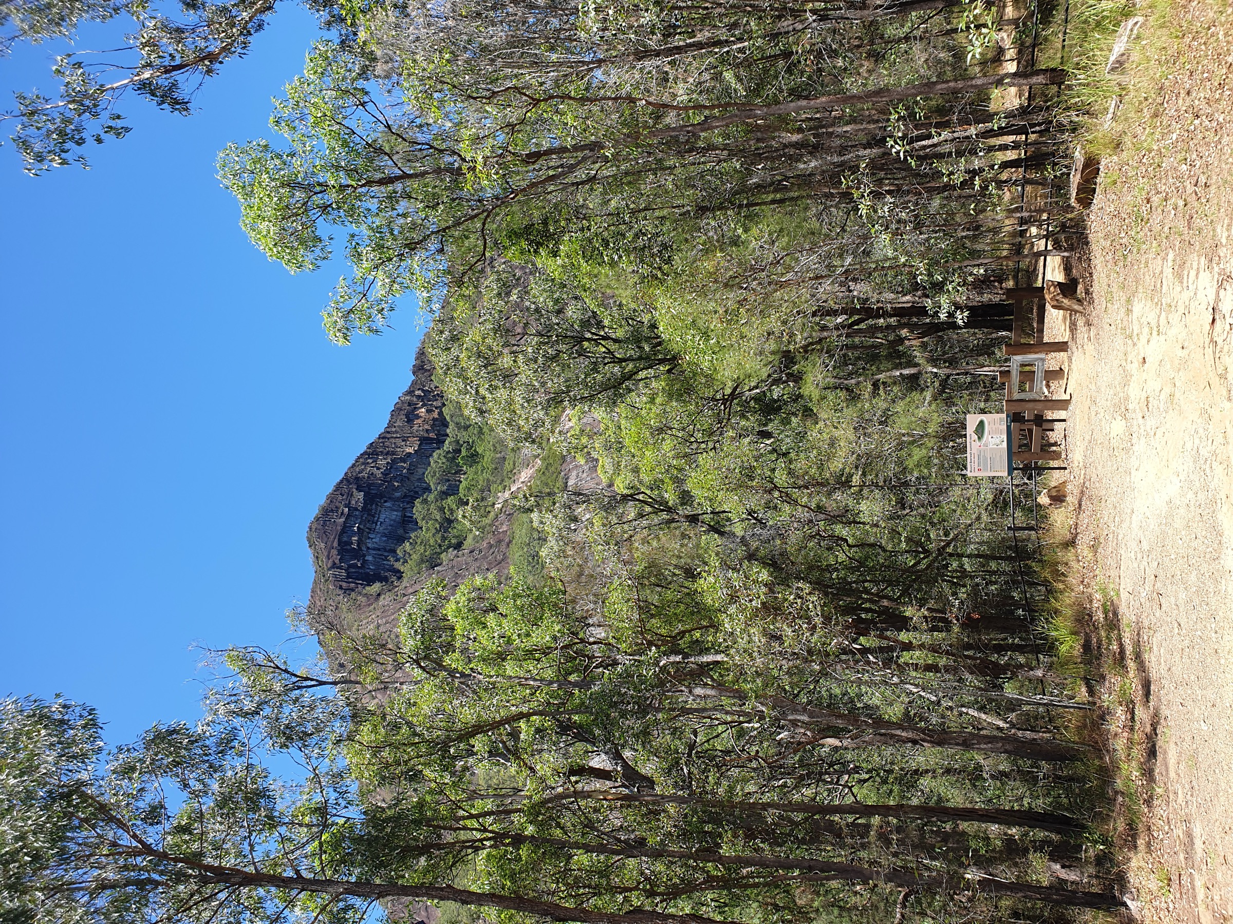
The track leaves the sealed Mount Beerwah car park on the northern flank of the mountain and climbs a short forested approach to the base of the exposed south face. After about 200 m the route reaches “The Chimney” or “First Crux” — a steep, near-vertical trachyte slab where hands must be used continuously and where most parties without scrambling experience turn back. Above the chimney the route continues up open slabs of coarse trachyte at a sustained 30–45° angle, following painted markers and worn tread lines through low heath. The upper mountain eases into a series of ledges and short walls to the summit at 556 m — the highest of the Glass House Mountains — with an open panorama across the entire group, the coastal plain and the Great Dividing Range escarpment inland. Return is by the same route; the descent of the upper slabs is often more difficult than the ascent.
Why it is essential
Beerwah is the “mother” peak of the group in Jinibara and Kabi Kabi tradition and the highest point in the Glass House Mountains. The summit route is the flagship serious scramble of south-east Queensland — a compact but genuinely committing Class 5 climb on smooth volcanic rock. The Traditional Owners request that visitors consider not climbing the sacred summit; walkers who choose to proceed should do so with full awareness of the technical, safety and cultural context.
Equipment
- Sturdy boots or approach shoes with sticky rubber
- Broad-brimmed hat and high-SPF sun protection
- 2–3 L of water minimum
- Long-sleeved layer for slab abrasion
- Helmet is worth considering for parties of two or more (loose rock, dropped objects)
- Basic first-aid kit including snake-bite bandage
- No trekking poles (need hands free for the slabs)
- Do not attempt with dogs or young children
Hazards and notes
- Class 5 exposed scramble — a slip on the upper slabs has severe consequences and rescue is complex.
- Trachyte is dangerously slippery when wet or damp; QPWS advises not attempting in or after rain.
- The Jinibara and Kabi Kabi peoples request that visitors consider not climbing sacred Beerwah.
- Fatalities and serious injuries have occurred; QPWS classes the route as a rock climb, not a bushwalk.
- Descend the same line — do not attempt an alternative route on the upper mountain.
- No shade or water above the base; full exposure to sun on the slabs.
GPX / route file
| Source | URL | Format | Notes |
|---|---|---|---|
| QPWS — Glass House Mountains National Park | parks.desi.qld.gov.au | Web page | Official route source; no direct GPX download published |
| QPWS — Glass House Mountains summit routes map (PDF) | parks.des.qld.gov.au | PDF map | Official summit-routes reference |
| Trail Hiking Australia — Mount Beerwah Summit | trailhiking.com.au | Web page | Distance and grade cross-check |
Sources
- QPWS — Glass House Mountains National Park
- QPWS — Summit routes map (PDF)
- Trail Hiking Australia — Mount Beerwah Summit
- Wikipedia — Mount Beerwah
- Wikimedia Commons — Mount Beerwah Glass House Mountains
3. Mount Tibrogargan Summit / Trachyte Circuit
Snapshot
Itinerary
The Marshs Road car park sits below the western flank of Tibrogargan and gives access to two separate walks that share the same start. The Trachyte Circuit turns south-west from the trailhead and follows a well-formed track through open woodland and heath around the base of the mountain, passing the Jack Ferris Lookout on the Trachyte Ridge saddle and returning through mixed forest for a total loop of roughly 6.4 km at Class 3. This is the standard walking option for parties who do not intend to scramble.
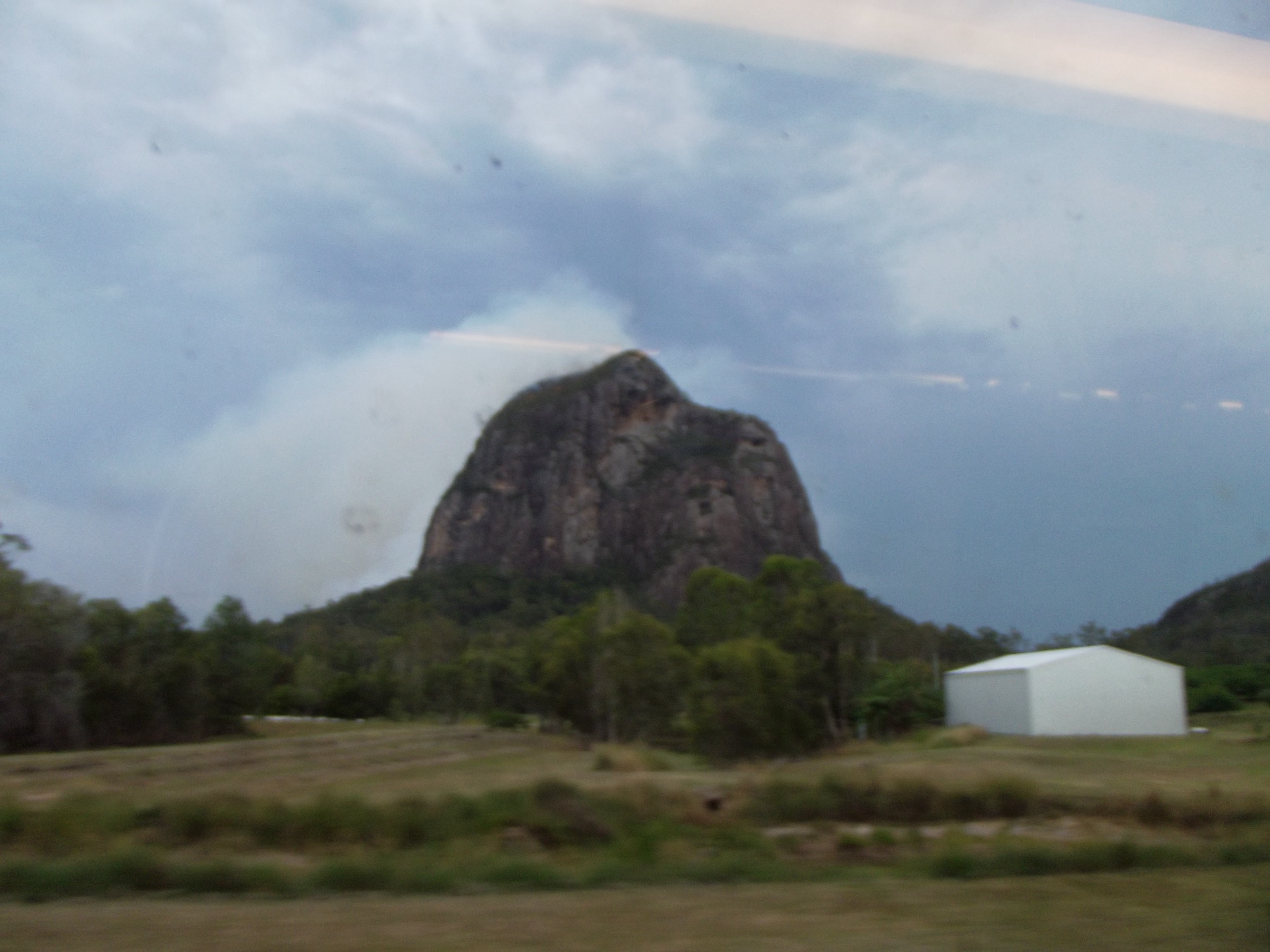
The summit route branches north-east from the same trailhead, contours briefly through forest and then rises steeply onto the exposed west face. Roughly a third of the way up the tread ends and the route becomes a sustained Class 5 scramble on trachyte slabs, gaining the last ~150 m by climbing directly up a series of ledges and shallow chimneys. Hands are required continuously and a slip has serious consequences. The route exits onto a short summit ridge at 364 m with views east to the coast and back across the whole group. Return is on the same line; downclimbing the upper face is often harder than the ascent.
Why it is essential
Tibrogargan — the “father” peak in Jinibara and Kabi Kabi tradition — is the second Class 5 scramble of the range and, along with Beerwah, defines the technical hiking character of the Glass House Mountains. The Trachyte Circuit is the natural short walk of the same trailhead and gives the standard base-of-mountain woodland experience and lookout view without the exposure of the summit route. Together the two lines cover the full spread of what the mountain offers a day walker. As with Beerwah, the Traditional Owners request that visitors consider not climbing to the summit.
Equipment
- Sturdy boots or approach shoes with sticky rubber (for the summit)
- Standard walking shoes acceptable for the Trachyte Circuit only
- Sun protection and 2 L of water minimum
- Long-sleeved layer for slab abrasion
- Helmet is worth considering on the summit route
- Basic first-aid kit including snake-bite bandage
- No trekking poles on the summit route
Hazards and notes
- Summit route is Class 5 — QPWS classes it as a rock climb, not a bushwalk; fatalities have occurred.
- Trachyte becomes dangerously slippery when wet; do not attempt the summit in or after rain.
- The Jinibara and Kabi Kabi peoples request that visitors consider not climbing sacred Tibrogargan.
- The Trachyte Circuit passes close to cliff edges in places — stay on the track.
- Snake activity through the warmer months.
- Do not confuse the two routes at the trailhead junction; check signage.
GPX / route file
| Source | URL | Format | Notes |
|---|---|---|---|
| QPWS — Glass House Mountains National Park | parks.desi.qld.gov.au | Web page | Official route source; no direct GPX download published |
| QPWS — Glass House Mountains walks and shared trail map (PDF) | parks.des.qld.gov.au | PDF map | Official walks map |
| Trail Hiking Australia — Trachyte Circuit | trailhiking.com.au | Web page | Circuit distance and grade cross-check |
| Trail Hiking Australia — Mount Tibrogargan Summit Walk | trailhiking.com.au | Web page | Summit distance and grade cross-check |
Sources
- QPWS — Glass House Mountains National Park
- QPWS — Walks and shared trail map (PDF)
- Trail Hiking Australia — Trachyte Circuit
- Trail Hiking Australia — Mount Tibrogargan Summit Walk
- Wikipedia — Mount Tibrogargan
- Wikimedia Commons — Mt Tibrogargan
4. Wild Horse Mountain Lookout
Snapshot
Itinerary
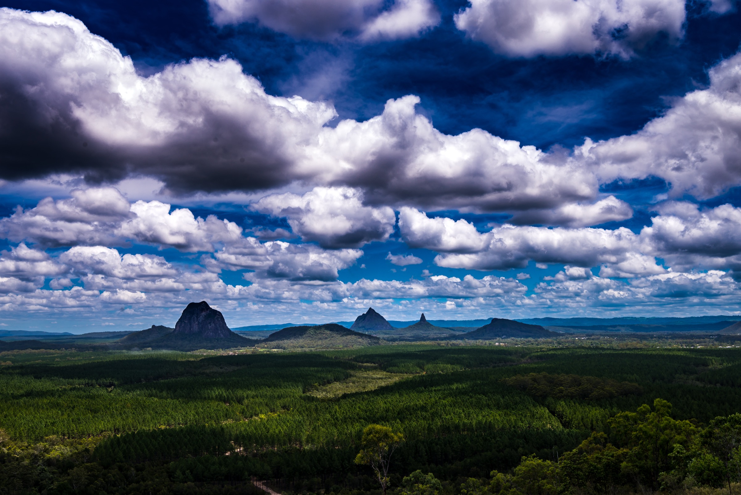
The car park sits on the eastern side of the Bruce Highway just south of the Glass House Mountains township. A sealed concrete service road climbs directly from the car park up the northern flank of Wild Horse Mountain for approximately 700 m, gaining ~85 m at a steady grade of about 12%. The path is short but sustained; there is no shade and the concrete surface radiates heat in summer. At the top a fire-lookout tower and a fenced viewing area give a broad 180° panorama west and north-west over the whole Glass House Mountains group — Tibrogargan, Ngungun, Coonowrin, Beerwah, Tibberoowuccum and the outlying peaks — with the coastal plain, Pumicestone Passage and Bribie Island visible to the east. Return is on the same line.
Why it is essential
Wild Horse Mountain is the standard “overview” viewpoint of the Glass House Mountains group and gives the classic panoramic photograph of the whole set of plugs from a single elevated point. It is the natural short walk of the region and the sensible first or last stop on a Glass House Mountains day trip — a compact climb that gives the whole map before or after a longer summit hike.
Equipment
- Walking shoes
- Sun protection (no shade on the concrete path)
- 1 L of water
- Light layer in cooler months
Hazards and notes
- Sustained ~12% concrete gradient — deceptively tiring in summer heat.
- No shade on the climb; surface radiates heat.
- Fenced platform at the top but the surrounding fire-tower area is a working QPWS asset.
- Cell coverage is present.
GPX / route file
| Source | URL | Format | Notes |
|---|---|---|---|
| QPWS — Beerburrum and Beerwah State Forests | parks.des.qld.gov.au | Web page | Official route source; no direct GPX download published |
| Sunshine Coast Council — Wild Horse Mountain Lookout | adventure.sunshinecoast.qld.gov.au | Web page | Council trail listing |
Sources
- QPWS — Beerburrum and Beerwah State Forests
- Sunshine Coast Council — Wild Horse Mountain Lookout
- Wikimedia Commons — Glass House Mountains National Park
5. Mount Tinbeerwah Lookout Walk
Snapshot
Itinerary
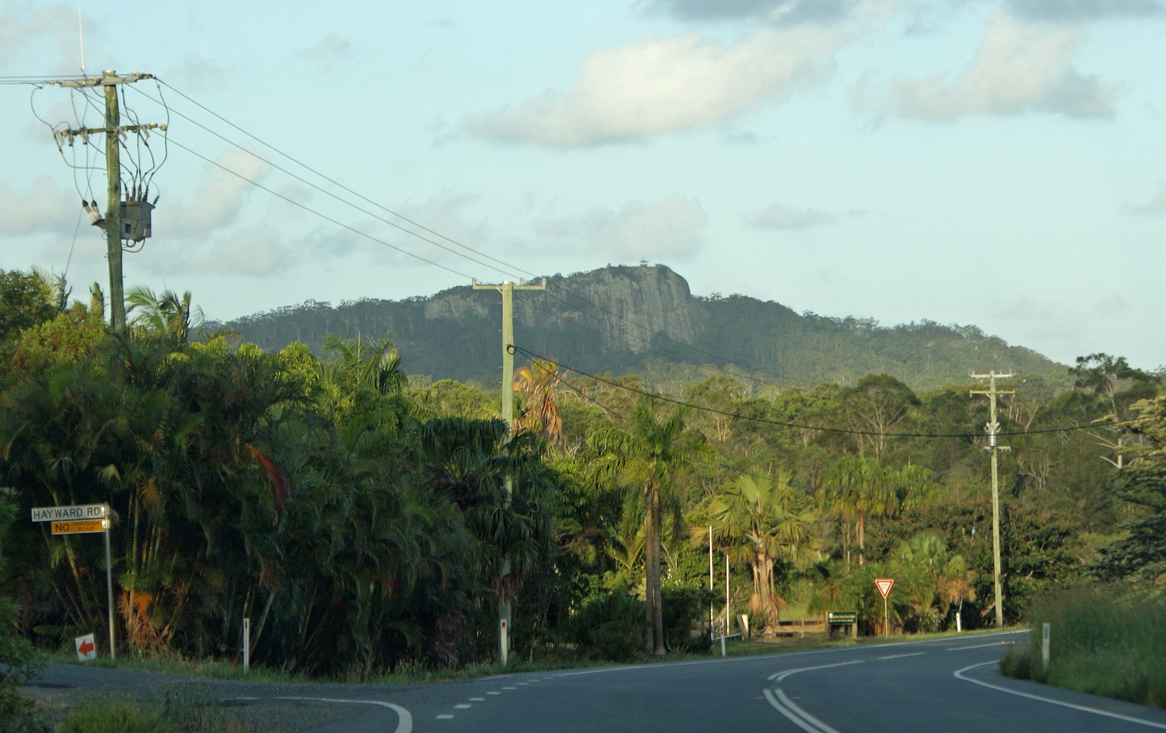
The sealed car park sits below the summit ridge on the western flank of Mount Tinbeerwah, off Mount Tinbeerwah Road. A short formed path of about 130 m gives wheelchair and pram access to the first lookout on the ridge, with an open view east across the Noosa hinterland to the coast. From the first lookout the track continues for a further ~300 m along the ridge on rocky steps and stone-set tread to the fire-tower lookout at 265 m, the summit of the mountain. The upper platform gives a 360° view over Lake Cootharaba and the Noosa Everglades to the north, the Blackall Range and Sunshine Coast hinterland to the south-west, and the coast at Noosa Heads to the east. Return is on the same line.
Why it is essential
Tinbeerwah is the standard short-walk summit of the Noosa hinterland and the natural Sunshine Coast counterpart to the Glass House Mountains summits farther south. It is one of the very few summits in the region reachable by a formed walking track, and the first-lookout section is one of only a handful of wheelchair-accessible summit views in south-east Queensland. Together with a Glass House Mountains day, it gives a complete north-and-south picture of the volcanic-plug country of the region.
Equipment
- Walking shoes
- Sun protection
- 1 L of water
- Light layer in cooler months
Hazards and notes
- Rocky steps on the upper section can be slippery when wet.
- Fenced platform at the top but small unfenced sections along the ridge.
- Cell coverage generally present.
- Popular sunrise and sunset spot — arrive early on public holidays.
GPX / route file
| Source | URL | Format | Notes |
|---|---|---|---|
| QPWS — Tewantin National Park map (PDF) | parks.des.qld.gov.au | PDF map | Official route source |
| Visit Noosa — Mt Tinbeerwah | visitnoosa.com.au | Web page | Local tourism authority cross-check |
Sources
- QPWS — Tewantin National Park map (PDF)
- Visit Noosa — Mt Tinbeerwah
- Noosa.com — Mount Tinbeerwah Lookout Walk
- Wikimedia Commons — Mount Tinbeerwah
Region-level sources
| Source | URL |
|---|---|
| QPWS — Glass House Mountains National Park | parks.desi.qld.gov.au |
| QPWS — Glass House Mountains walks map (PDF) | parks.des.qld.gov.au |
| QPWS — Glass House Mountains summit routes map (PDF) | parks.des.qld.gov.au |
| QPWS — Beerburrum and Beerwah State Forests | parks.des.qld.gov.au |
| QPWS — Tewantin National Park map (PDF) | parks.des.qld.gov.au |
| Trail Hiking Australia — Glass House Mountains hikes | trailhiking.com.au |
| Wikipedia — Glass House Mountains | en.wikipedia.org |
| Wikipedia — Mount Beerwah | en.wikipedia.org |
| Wikipedia — Mount Tibrogargan | en.wikipedia.org |
| Wikipedia — Jinibara people | en.wikipedia.org |
| Wikipedia — Kabi Kabi people | en.wikipedia.org |
Further reading
Nearby Great Dividing Range guides on Storm
- ACT, Namadgi and the Brindabella Ranges
- Atherton Tablelands / Cairns Highlands
- Barrington Tops
- Blue Mountains
- QPWS — Glass House Mountains summit routes map (PDF)
- Wikipedia — Glass House Mountains
- Wikipedia — Jinibara people
- Wikipedia — Kabi Kabi people
Missing data / follow-up work
- Mount Coonowrin (Crookneck, 377 m) is the third of the “big three” Glass House Mountains peaks and has been closed to public climbing since 1999 following Traditional Owner concerns and severe rockfall risk on its near-vertical rhyolite walls. It is intentionally excluded from the walking selection above and cannot be lawfully climbed by the general public.
- Reported distances for Mount Beerwah vary between sources (~2.6 km to ~4.3 km return) depending on how the approach track and summit slabs are measured. The QPWS grade of Class 5 is consistent across sources.
- QPWS does not publish direct GPX or KML downloads for any of the walks listed above. All route files are official web-page or PDF sources.
- Mount Beerburrum (a very short Class 4 summit walk in Beerburrum State Forest) is a further candidate for a follow-up entry; it was excluded here to keep the selection to five and to include the hinterland representative at Mount Tinbeerwah instead.
- Kondalilla Falls and Mapleton Falls in the Blackall Range are hinterland waterfall alternatives that were considered for slot 5; Mount Tinbeerwah was chosen for its summit character and its position closer to the Noosa hinterland. Either falls walk would suit a follow-up hinterland-focused article.
- Traditional Owner cultural values for Mount Beerwah and Mount Tibrogargan are respected by many walkers by choosing the Trachyte Circuit or Ngungun rather than the sacred summits; parties should make an informed choice.