Regional overview
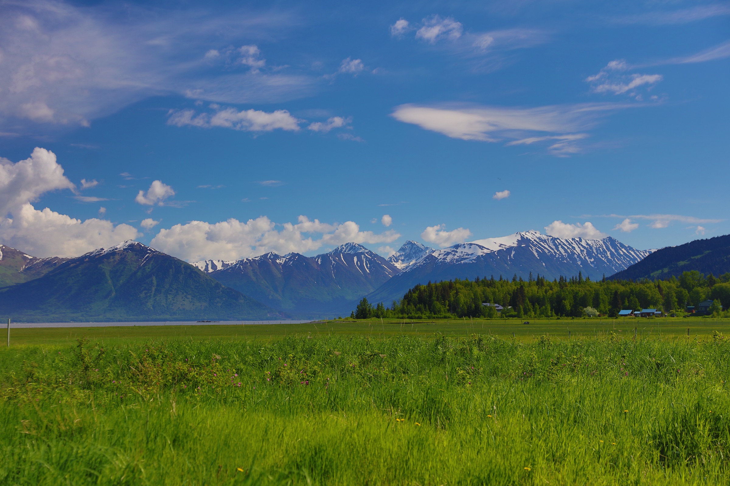
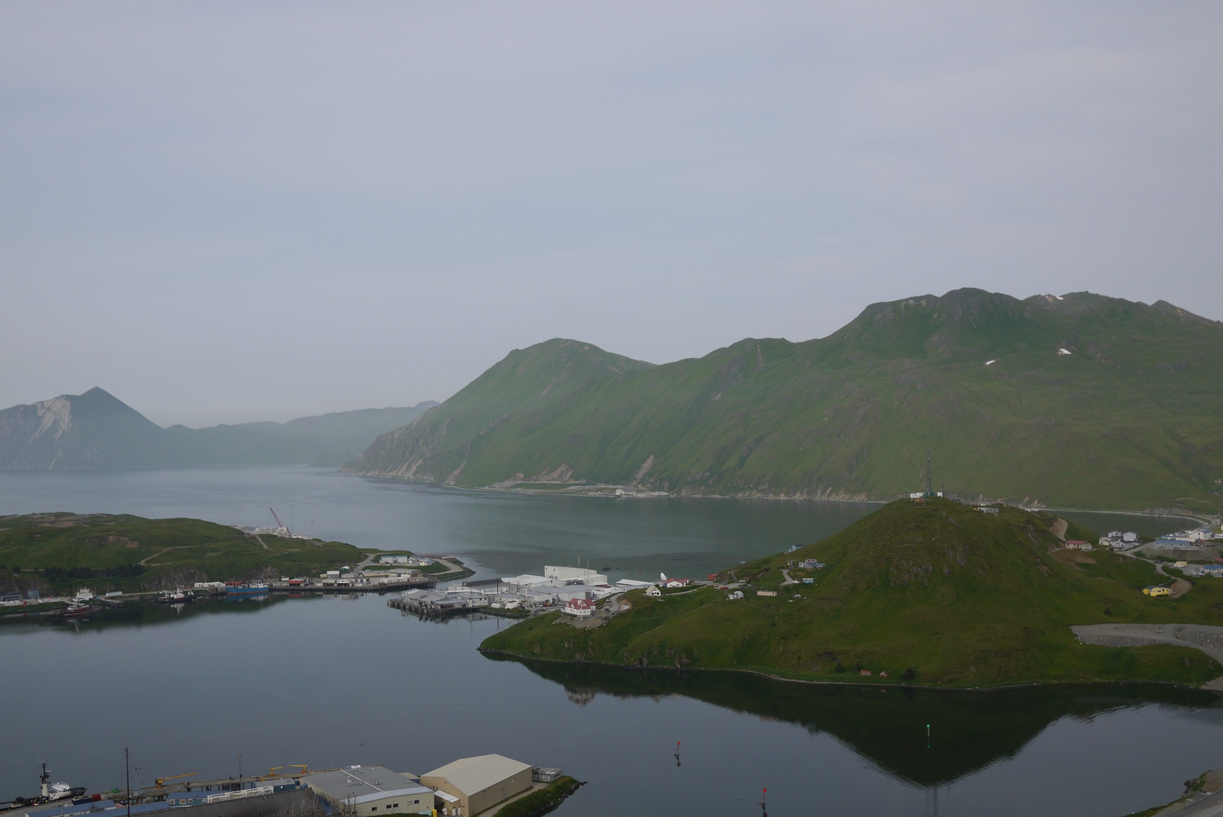
The Aleutian Islands volcanic ranges are maritime, wind-scoured, and logistically difficult. The most practical hiking centre is Unalaska / Dutch Harbor, where treeless volcanic hills, World War II relics, bays, and short steep ridges can be reached from town. Farther west, islands such as Adak add major historic and volcanic landscapes but require much more planning, flights or boats, and local permissions.
The terrain is generally low in absolute elevation but serious in feel: wet tundra, faint tracks, fog, strong wind, rapidly changing weather, and limited signage are normal. Many routes cross lands where local permission or permits may be required — AllTrails notes Ounalashka Corporation land-access permits on the Unalaska hikes — and historic military areas can contain unstable structures and other hazards. The most reliable hiking season is late spring through early autumn, with June to September the conservative window for remoter objectives. Public transport between trailheads was not verified; Unalaska routes are typically reached by local road access, while other islands require flights, boats, and local permissions. North-east along the same volcanic arc, the Alaska Peninsula volcanoes day-hike catalogue and the Katmai and Aniakchak region day-hike catalogue cover the mainland Alaska Peninsula continuation.
Selection rationale
This catalogue prioritises the best-sourced day-hikes in the accessible Unalaska / Amaknak area, then opens a placeholder for the wider arc. Mount Ballyhoo gives the major volcanic hill and Fort Schwatka setting above Dutch Harbor; Bunker Hill is the short WWII-viewpoint walk that complements it; Mount Newhall is a steeper treeless ridge objective; Goose Lake is a longer lake-and-waterfall outing; and Adak is included candidate-only because the Aleutian volcanic ranges are not fully represented by Unalaska alone.
Summary table
| # | Hike | Country | Route type | Distance | Gain | Max elevation | Difficulty |
|---|---|---|---|---|---|---|---|
| 1 | Mount Ballyhoo / Fort Schwatka | USA | Out-and-back | 5.0 km | 503 m | 508 m | Hard |
| 2 | Bunker Hill Trail | USA | Out-and-back | 3.4 km | 120 m | 125 m | Easy |
| 3 | Mount Newhall | USA | Out-and-back | 3.4 km | 342 m | 371 m | Hard |
| 4 | Goose Lake Trail | USA | Out-and-back | 9.3 km | 325 m | 217 m | Moderate |
| 5 | Adak Army and Naval Operating Bases tundra walk | USA | Candidate loop / out-and-back | Unresolved | Unresolved | Unresolved | Remote / variable |
1. Mount Ballyhoo / Fort Schwatka

Snapshot
Itinerary
The route climbs the treeless slopes of Mount Ballyhoo on Amaknak Island to a broad summit and the Fort Schwatka historic area above Dutch Harbor. AllTrails notes more than one possible starting point, with a southern access on the airport side and another on the northern side of Ballyhoo; choose the variant locally based on current access.
Why it is essential
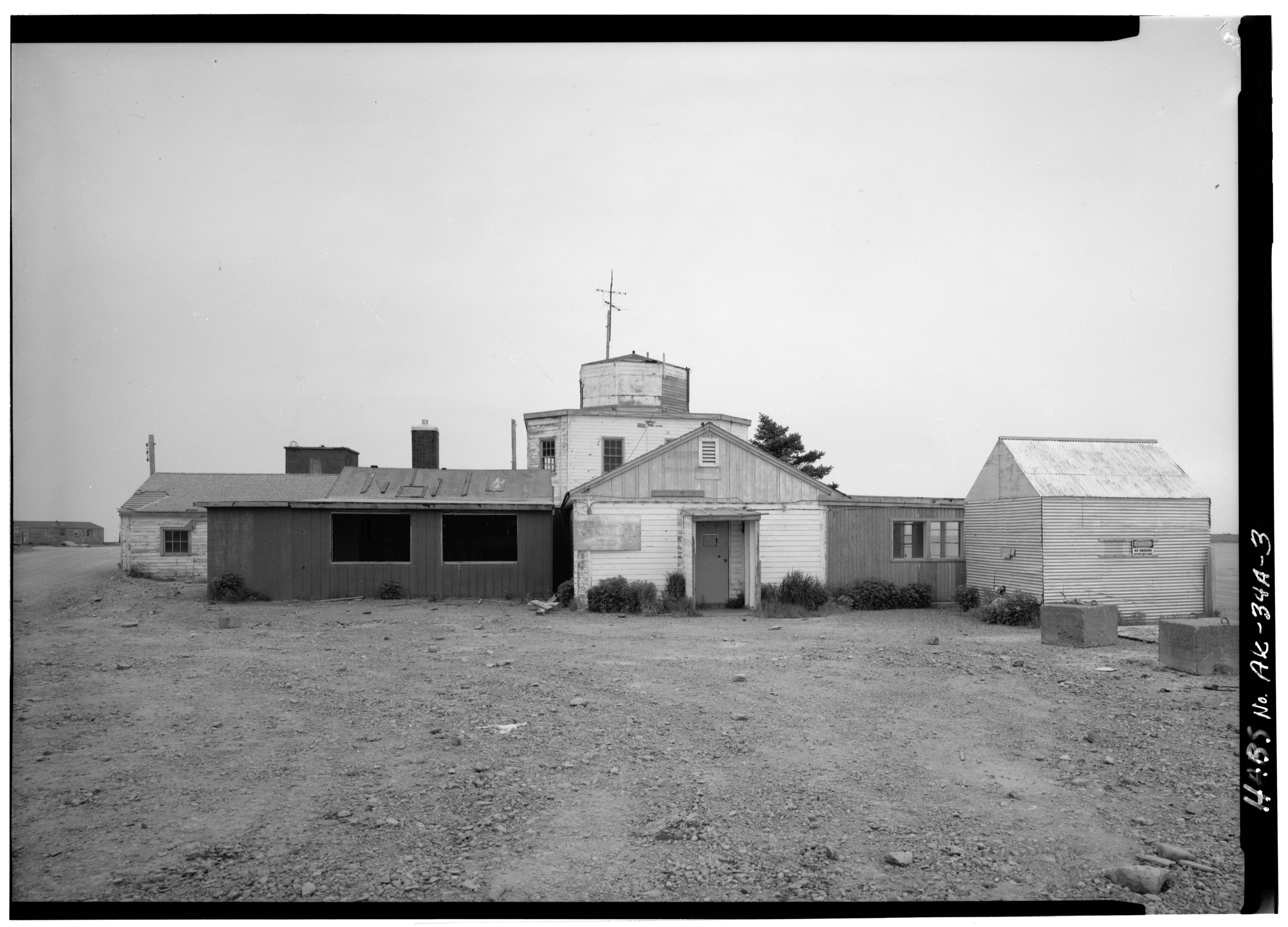
Mount Ballyhoo is the signature day-hike of Dutch Harbor: a compact volcanic hill with big harbour views and a direct line into the Aleutian Islands World War II National Historic Area landscape.
Equipment
Mountain hiking equipment: waterproof boots, rain shell, warm layer, hat and gloves outside settled weather, navigation backup, water, food, and trekking poles for wet tundra.
Hazards and notes
Fog, high wind, wet grass, and steep tundra can make the route more serious than its distance suggests. AllTrails reports that an Ounalashka Corporation land-access permit may be required; confirm locally. Do not climb on or enter historic structures unless clearly allowed and safe.
GPX / KML links
| Source | URL | Format / access | Reuse status |
|---|---|---|---|
| AllTrails: Mount Ballyhoo | alltrails.com | Interactive source map | AllTrails terms apply; route-file reuse not confirmed |
| NPS: Aleutian Islands WWII maps | nps.gov | Official area maps | NPS terms; context only, no route file |
Further reading
- AllTrails — Mount Ballyhoo
- NPS — Aleutian Islands WWII maps
- NPS — Things to Do, Aleutian Islands WWII
2. Bunker Hill Trail
Snapshot
Itinerary
The trail climbs a small hill above Dutch Harbor to the concrete WWII bunker on the summit. AllTrails describes a shorter, steeper Airport Beach Road approach and a more gradual Henry Swanson Drive approach. Views extend over Captains Bay, Iliuliuk Bay, Nateekin Bay, and the surrounding volcanic hills.
Why it is essential
Bunker Hill is the short, accessible historic-viewpoint hike that complements the harder Mount Ballyhoo climb and anchors the WWII landscape in an easy walking route.
Equipment
Standard hiking equipment: waterproof shoes or boots, rain shell, warm layer, water, and map or GPS. In wet or windy weather, dress as for a mountain walk despite the low elevation.
Hazards and notes
AllTrails reports that an Ounalashka Corporation land-access permit may be required for local hiking lands; verify before departure. Avoid unstable concrete edges, historic structures, and any restricted areas.
GPX / KML links
| Source | URL | Format / access | Reuse status |
|---|---|---|---|
| AllTrails: Bunker Hill Trail | alltrails.com | Interactive source map | AllTrails terms apply; route-file reuse not confirmed |
| NPS: Aleutian Islands WWII Things to Do | nps.gov | Official area / history context | NPS terms; context only, no route file |
Further reading
3. Mount Newhall
Snapshot
Itinerary
The route follows a faint trail north-east toward Mount Newhall. AllTrails notes that the trail fades after about half a mile and that the mapped route ends before the summit, with a short off-trail continuation needed to reach the top.
Why it is essential
Mount Newhall adds a compact, steeper volcanic-ridge objective on Unalaska and shows the exposed, treeless terrain that defines Aleutian hillwalking.
Equipment
Mountain hiking equipment: waterproof boots, rain shell, warm layer, navigation backup, water, food, and trekking poles. Carry offline mapping because the trail is faint.
Hazards and notes
The route is exposed to wind and fog, and the trail may disappear. Treat the summit continuation as off-trail navigation. Current land-access requirements should be checked locally.
GPX / KML links
| Source | URL | Format / access | Reuse status |
|---|---|---|---|
| AllTrails: Mount Newhall | alltrails.com | Interactive source map | AllTrails terms apply; route-file reuse not confirmed |
Further reading
4. Goose Lake Trail
Snapshot
Itinerary
The route heads from the Unalaska access area toward Goose Lake. AllTrails identifies forest, kid-friendly terrain, and waterfall features. It is longer and less steep than the summit routes, giving a different valley-and-water objective within the Unalaska hiking set.
Why it is essential
Goose Lake broadens the Aleutian catalogue beyond short bunkers and steep hills, adding a longer lake-and-waterfall day route that remains feasible from Unalaska.
Equipment
Standard to mountain hiking equipment: waterproof footwear, rain shell, warm layer, water, food, navigation backup, and trekking poles if wet.
Hazards and notes
Route detail is less robust than for Ballyhoo or Bunker Hill because no official route description was found in this pass. Verify current land-access requirements, trailhead, and underfoot conditions locally.
GPX / KML links
| Source | URL | Format / access | Reuse status |
|---|---|---|---|
| AllTrails: Goose Lake Trail | alltrails.com | Interactive source map | AllTrails terms apply; route-file reuse not confirmed |
Further reading
5. Adak Army and Naval Operating Bases tundra walk
Snapshot
Itinerary
This candidate would use legal public or local access around the Adak Army Base and Naval Operating Base National Historic Landmark to create a low tundra walk linking historic structures, harbour views, and volcanic island terrain. The NPS place page verifies the significance of the Adak base landscape but does not provide a hiking route.
Why it is essential
The Aleutian volcanic ranges extend far beyond Unalaska. Adak is an important wider-arc candidate because it combines volcanic island terrain with one of the major WWII landscapes of the chain.
Equipment
Remote coastal hiking equipment: waterproof boots, rain gear, warm layers, navigation backup, food, water, emergency communication, and respect for historic-site and wildlife-refuge restrictions.
Hazards and notes
This is not publication-ready. Access permissions, unexploded-ordnance risk, unstable structures, wildlife-refuge restrictions, and exact route legality must be checked with local and federal land managers. NPS notes that many Aleutian sites are remote and may require special transportation.
GPX / KML links
Further reading
Outstanding verification
- Official local trail descriptions or land-manager route pages were not found for Mount Newhall or Goose Lake.
- Ounalashka Corporation land-access permit requirements should be checked directly before any Unalaska / Amaknak walk.
- No official GPX/KML files were located; AllTrails links are source maps only, with route-file reuse terms unconfirmed.
- Mount Newhall and Goose Lake need licence-compatible route-specific photos.
- Adak remains candidate-only until a legal route, route statistics, current access restrictions, and safety hazards are verified.