Regional overview
The Bvumba (often written “Vumba”) Mountains form the central section of Zimbabwe’s Eastern Highlands, straddling the Zimbabwe–Mozambique border roughly 10 km south-east of Mutare. The name comes from the Shona word for “mist”, and the range earns it: low cloud rolls in off the Mozambique plain most mornings and clings to the upper ridges before clearing through the middle of the day. Castle Beacon, the high point, reaches 1,911 m — modest compared with Nyanga’s Inyangani (2,592 m) to the north and the Chimanimani quartzite peaks to the south, but the Bvumba’s character is different and intentional: it is a softer, cooler, deeply forested range of rolling granite hills, mist-belt evergreen forest, sub-montane grassland and fern-filled ravines, rather than open high mountain.
This character shapes what an “essential” Bvumba day-hike looks like. There are few classic summit days; instead the signature walks are short to medium forest loops, ridge viewpoints over the Burma Valley and Mozambique plain, and botanical and birding circuits through the Bunga Forest Botanical Reserve and the adjoining Bvumba (Vumba) Botanical Garden. The main hiking centres are the Bvumba Botanical Garden (a ZimParks-managed recreational park of roughly 159 ha of landscaped gardens and 42 ha of botanical reserve), Bunga Forest Botanical Reserve on the southern slopes, the Leopard Rock Hotel area below Chinyakwaremba, and the Seldomseen cottages, base for the long-distance Vumba Trail and for many birding paths. Mutare itself provides the Cecil Kop Nature Reserve and Murahwa’s Hill as a lower-altitude warm-up. Several routes — particularly on Chinyakwaremba and the Vumba Trail network — are maintained by the Friends of the Vumba (FOTV) trust, which charges a small access/maintenance fee.
Access is mostly via Mutare on the A3 from Harare, then the tarred Bvumba Road which climbs south-east into the range. Public transport is limited to combis (minibuses) to Mutare and informal lifts up to the Botanical Garden area; in practice almost all hikers self-drive or arrange a transfer through an Eastern Highlands operator. The walking season is essentially year-round, but the dry, cool months from May to early October offer the clearest views and the easiest underfoot conditions; the November-to-March wet season brings persistent mist, very greasy paths on granite and forest floors, and a higher risk of bilharzia exposure in standing water. Specific safety concerns are unusual for an African mountain region: there are no glaciers, no altitude issues, and large predators are absent, but mist navigation, slippery wet rock, ticks, and (on more remote sections) limited mobile coverage are real. Cross-border tracks should not be used as informal entry points to Mozambique.
Selection rationale
The five hikes below were chosen to reflect the actual hiking character of the Bvumba rather than forcing big-mountain templates onto a forest range. Castle Beacon is the natural “summit” pick — the highest point in the Bvumba and the one objective with a clear top-of-the-range feel. The Bvumba Botanical Garden circuit is the most accessible representative walk and the entry point most visitors actually use, combining gardens, indigenous reserve and a viewpoint over the Mozambique plain. Chinyakwaremba (the hill behind Leopard Rock Hotel) is the iconic ridge/viewpoint day, with the range’s best long views into Burma Valley and Mozambique. Bunga Forest / Bunga Views is the essential mist-forest walk, representing the botanically important inner core of the reserve. Murahwa’s Hill / Cecil Kop is included as the Mutare-side day — a lower granite kopje with rock art, archaeological features and montane forest that pairs naturally with a Bvumba trip and is the most reliably accessible walk in the area. Seldomseen’s birding footpaths were considered, but on inspection they function as short specialist birding circuits and as the launch point of the multi-day Vumba Trail rather than as a stand-alone “essential” day-hike, and are folded into the regional notes instead.
Summary table
| # | Hike | Country | Route type | Distance | Gain | Max elevation | Difficulty | GPX status | Photo status |
|---|---|---|---|---|---|---|---|---|---|
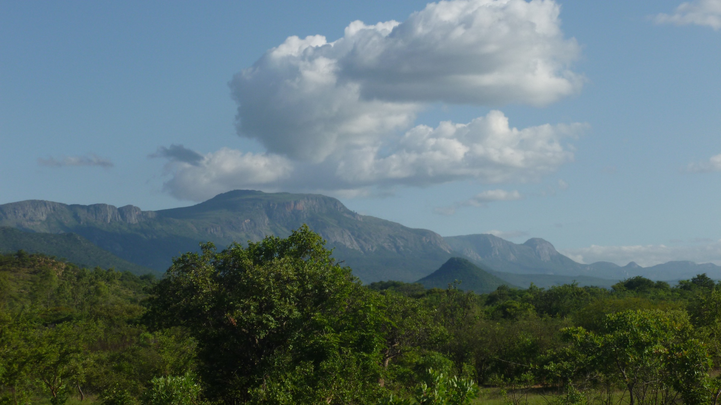
| 1 | Castle Beacon from Bunga Forest / Botanical Garden | Zimbabwe | Out-and-back | ~5–7 km | ~250–350 m | 1,911 m | Easy–moderate | Not located; OSM trace possible | Indirect Wikimedia Commons photo of Bvumba/Castle Beacon area |
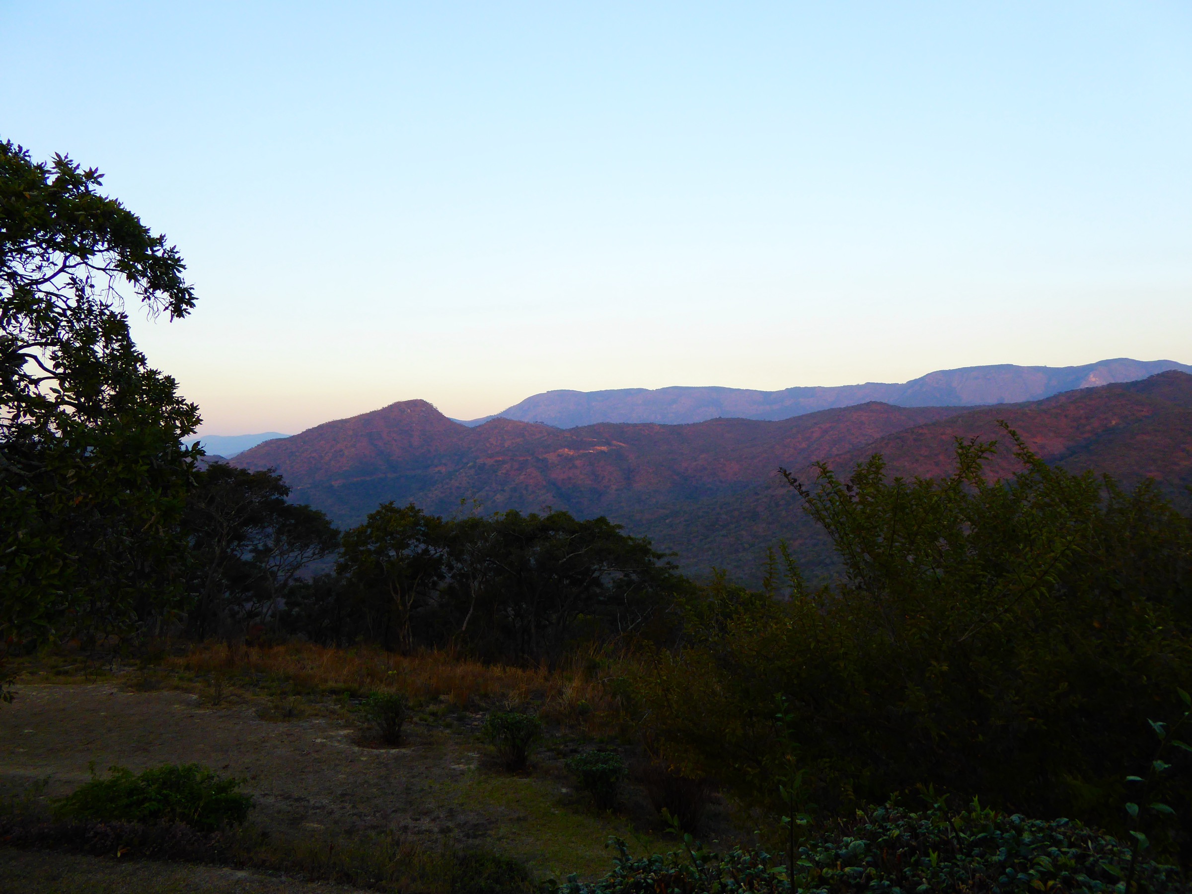
| 2 | Bvumba (Vumba) Botanical Garden and Reserve circuit | Zimbabwe | Loop | ~4–6 km | ~150–250 m | ~1,650 m | Easy | Not located | Indirect Wikimedia Commons photo (Bvumba landscape) |
| 3 | Chinyakwaremba (Leopard Rock) ridge | Zimbabwe | Out-and-back | ~6–8 km | ~400–500 m | ~1,650 m | Moderate | Not located; FOTV-maintained route | Indirect Wikimedia Commons / archive photo |
| 4 | Bunga Forest and Bunga Views | Zimbabwe | Loop | ~5–8 km | ~200–300 m | ~1,700 m | Easy–moderate | Not located | No licence-compatible image found in this pass |
| 5 | Murahwa’s Hill (Cecil Kop area, Mutare) | Zimbabwe | Out-and-back / loop | ~4–6 km | ~250–350 m | ~1,308 m | Easy–moderate | Not located | No licence-compatible image found in this pass |
All distance, gain and time figures should be treated as approximate ranges drawn from secondary sources; no official ZimParks distance sheet for individual Bvumba trails was located during research.
1. Castle Beacon


Snapshot
Itinerary
The route follows the Bvumba Road up onto the central ridge of the range and then leaves the road on a forest track that climbs through Bunga Forest Botanical Reserve to the open granite dome of Castle Beacon. The lower section threads through mist-belt evergreen forest dominated by Syzygium guineense with Dracaena fragrans in the understorey; mosses, ferns and epiphytic orchids are abundant. Above the forest the path emerges onto sub-montane grassland with scattered proteas and aloes, then climbs the final granite shoulder to the beacon and trig point at 1,911 m. The summit is a low rounded granite top with views east into Mozambique’s Manica plain, north over Mutare, and south across the Bunga and Burma Valley.
Why it is essential
Castle Beacon is the highest point in the Bvumba and the closest the range offers to a true summit day. It compresses the Bvumba’s signature landscape sequence — mist forest, fern gully, sub-montane grassland, granite dome — into a short half-day walk, and the summit panorama is the standard “top of the Bvumba” view referenced by Zimbabwe Field Guide, Birdlife Zimbabwe (IBA Z011) and most regional guides.
Equipment
- Standard hiking equipment (shoes/boots, weatherproof layer, warm layer, water, food, sun protection)
- Map/GPS — the upper section can be confusing in mist
- Tick protection in the grassland section
- No technical equipment required in normal dry-season conditions
Hazards and notes
Mist can drop visibility on the open summit very quickly even in the dry season; the granite slabs become genuinely slippery when wet. Exposure is low overall but the final dome has some sloping rock that is best avoided after rain. The reserve is part of the Bunga Forest Botanical Reserve and falls under ZimParks management; standard protected-area rules apply (no fires, no plant collection). There are no large predators, but blue duiker, samango monkey and bushpig are present. No formal permit is required for the summit itself but access through some private surrounds (e.g. the Seldomseen area) may attract a Friends of the Vumba maintenance fee of around US$10 per hiker.
GPX / route file
| Source | URL | Format | Licence / terms | Reuse status |
|---|---|---|---|---|
| OpenStreetMap base data (manual trace required) | openstreetmap.org | OSM (vector) | ODbL | Geometry derivable; attribution required |
| Wikidata coordinates for Castle Beacon | 19°06′00″S 32°47′00″E | Point | CC0 | Reusable |
No official ZimParks, FOTV or Wikiloc GPX track for Castle Beacon was located in this pass.
External links
- en.wikipedia.org — Wikipedia: Bvumba Mountains
- zimfieldguide.com — Zimbabwe Field Guide: Bunga Forest Botanical Reserve
- birdlifezimbabwe.org — Birdlife Zimbabwe IBA Z011 Bvumba Highlands
- en.wikipedia.org — Wikipedia: Bunga Forest Botanical Reserve
2. Bvumba (Vumba) Botanical Garden and Reserve circuit

Snapshot
Itinerary
The route starts at the main ZimParks gate of the Vumba Recreational Park, which combines roughly 159 ha of landscaped gardens with a 42 ha indigenous Botanical Reserve. From the car park, paths drop through banked terraces of azaleas, fuchsias, hydrangeas, proteas, begonias, lilies, aloes and a notable cycad collection (the site holds 59 of approximately 189 known cycad species), then cross a small lake fed by perennial streams. A network of footpaths leaves the cultivated section and enters the 42 ha Botanical Reserve, a fragment of indigenous mist-belt evergreen forest with tree ferns, mosses and orchids. The reserve paths climb a low ridge with a viewpoint east over the Mozambique plain — almost 1,000 m below — before looping back through the upper garden section to the gate.
Why it is essential
This is the most representative short walk in the range: it contains the Bvumba’s signature mist-belt forest, the sub-montane grassland ecotone and one of the classic east-facing Mozambique-plain viewpoints, all within a managed protected area. It is also the only walk in the range with formal ZimParks-managed access, a recognised opening regime (broadly 9am–6pm), and explicit on-site staff, which makes it the safest fallback for hikers travelling without a guide.
Equipment
- Standard hiking equipment (shoes/boots, light weatherproof, water, sun protection)
- Insect repellent and tick protection
- Camera/binoculars for birds (sunbirds, batises, robin-chats, samango monkeys overhead)
Hazards and notes
Hazards are minimal: paths are well defined, exposure is negligible, and the gardens are gated. Wet weather makes the forest sections slippery. Samango monkeys are habituated and should not be fed. A ZimParks entrance fee applies; rates change periodically and should be confirmed at the gate. Dogs are not permitted. The site is open daily; sources cite 9am–6pm but hours can change with season and staffing.
GPX / route file
| Source | URL | Format | Licence / terms | Reuse status |
|---|---|---|---|---|
| OpenStreetMap base data (paths within Vumba Botanical Garden) | openstreetmap.org | OSM (vector) | ODbL | Geometry derivable; attribution required |
| ZimParks site page (no downloadable GPX, but lists trails and access) | zimparks.org | HTML | All rights reserved | Reference only |
No official ZimParks GPX/KML was located in this pass.
External links
- zimparks.org — ZimParks: Vumba Recreational Park
- zimbabwetourism.net — Zimbabwe Tourism Authority: Vumba Botanical Garden
- zimfieldguide.com — Zimbabwe Field Guide: Bvumba National Botanical Gardens (formerly Manchester Gardens)
- en.wikipedia.org — Wikipedia: Bvumba Mountains (cycad collection figure)
3. Chinyakwaremba (Leopard Rock) ridge

Snapshot
Itinerary
Chinyakwaremba is the Shona name for the hill rising directly behind Leopard Rock Hotel; the popular but inaccurate shorthand “Leopard Rock” properly refers only to a large granite boulder lower on the slope, near Castle Guesthouse. The route leaves the hotel/guesthouse area and climbs steadily up scree slopes and through grassland and msasa (Brachystegia) woodland to the upper ridge. From the ridge crest the path follows the spine northwards with widening views across the Burma Valley, the Bunga Forest and into Mozambique. The classic turnaround is a viewpoint on the upper ridge looking down onto the Leopard Rock golf course and east across the international frontier; a longer point-to-point variant continues along the old Pioneer Road, descending via the Witchwood (Wichwood) stream and Butterfly Falls into the Burma Valley.
Why it is essential
This is the Bvumba’s signature ridge-and-viewpoint walk. The east-facing aspect gives the most expansive panorama in the range — Burma Valley directly below, Mozambique’s Manica plain unrolling east, and on clear winter mornings the Chimanimani range visible far to the south. The route is also part of the network maintained by the Friends of the Vumba trust, which underwrites trail clearing and anti-poaching scout patrols.
Equipment
- Standard hiking equipment plus sturdier boots for the scree section
- Trekking poles useful on the descent
- Sun protection — the upper ridge is largely unshaded
- Tick protection in grassland
- Small cash float for the FOTV maintenance fee (around US$10 per hiker, typically paid at Seldomseen Reception)
Hazards and notes
Slippery wet rock on the scree section after rain. Navigation on the upper ridge can be confusing in mist; carry a GPS track. The route crosses a mosaic of private land, ZimParks-managed reserve and FOTV-supported footpath corridors. Cross-border tracks dropping east must not be used as informal entry points to Mozambique. Mobile coverage on the ridge is patchy.
GPX / route file
| Source | URL | Format | Licence / terms | Reuse status |
|---|---|---|---|---|
| OpenStreetMap base data (Chinyakwaremba slopes) | openstreetmap.org | OSM (vector) | ODbL | Geometry derivable; attribution required |
| Friends of the Vumba (route information via FOTV office at HiVu) | facebook.com | Reference only | Not specified | Contact for current track |
No official downloadable GPX was located in this pass.
External links
- zimfieldguide.com — Zimbabwe Field Guide: Leopard Rock Hotel (Chinyakwaremba clarification and Pioneer Road descent)
- pindula.co.zw — Pindula: Leopard Rock Hotel (location at the foot of Chinyakwaremba)
- thevumbatrail.com — The Vumba Trail official page (FOTV-maintained network, fee)
- facebook.com — Friends of the Vumba (FOTV) public page
4. Bunga Forest and Bunga Views
Snapshot
Itinerary
The walk enters the Bunga Forest Botanical Reserve — the largest single protected block in the Bvumba, conserving mist-belt evergreen forest on the southern slopes of the range — and follows footpaths through dense indigenous canopy where the understorey is rich in tree ferns, mosses and orchids and the lower forest is dominated by Syzygium guineense. Streams cross the path at intervals and small fern gullies open off the main track. The route climbs gently onto Bunga Views, an area of sloping sub-montane grassland between Castle Beacon and the main forest block, ending at a sheer south-east-facing Brachystegia-covered cliff that drops away towards the Burma Valley. The grassland section adds the option of continuing towards Castle Beacon for a longer day.
Why it is essential
Bunga Forest is the botanically most important hike in the Bvumba — it is the inner core of the Botanical Reserve, the most extensive remaining tract of indigenous mist-belt forest in the range, and a Birdlife Zimbabwe Important Bird Area. The Bunga Views grassland gives one of the few wide views from inside the forest belt itself, and the ecological transition from closed forest to grassland to cliff edge is unique to this walk.
Equipment
- Standard hiking equipment
- Waterproof footwear; the forest floor is often wet even in the dry season
- Insect repellent and tick protection
- Binoculars for forest birds (Roberts’ Warbler, Stripe-cheeked Greenbul, Chirinda Apalis, Swynnerton’s Robin)
Hazards and notes
Paths are intermittently overgrown; route-finding requires care, especially where forest paths braid. Mist can close in suddenly. The reserve is part of the ZimParks-managed estate; standard protected-area rules apply. The Bunga Views cliff is a genuine drop and should be approached with care, particularly in wet conditions.
GPX / route file
| Source | URL | Format | Licence / terms | Reuse status |
|---|---|---|---|---|
| OpenStreetMap base data (Bunga Forest paths) | openstreetmap.org | OSM (vector) | ODbL | Geometry derivable; attribution required |
No official ZimParks or FOTV GPX was located in this pass.
External links
- zimfieldguide.com — Zimbabwe Field Guide: Bunga Forest Botanical Reserve
- en.wikipedia.org — Wikipedia: Bunga Forest Botanical Reserve
- zimbabweflora.co.zw — Flora of Zimbabwe: Castle Beacon and Bunga Views location records
- birdlifezimbabwe.org — Birdlife Zimbabwe IBA Z011 Bvumba Highlands
5. Murahwa’s Hill (Cecil Kop area, Mutare)
Snapshot
Itinerary
The route starts from the National Trust of Zimbabwe gate at Murahwa’s Hill, signposted off Magamba Drive about 1.6 km from the A3/Christmas Pass junction in Mutare. The marked path climbs through dry deciduous miombo and msasa woodland on the western slopes, then crosses onto wetter eastern slopes where canopy evergreen forest takes over. Granite outcrops, watercourses and small ravines punctuate the climb. The summit area, around 1,308 m, contains an archaeological complex including a rock gong, a granary cave and grinding querns. From the high points there are views over the Mutare basin, the Christmas Pass to the north and the Bvumba ridge to the south-east.
Why it is essential
Murahwa’s Hill complements the higher Bvumba walks rather than competing with them: it is the most accessible and reliably waymarked nature walk in the immediate Mutare area, it sits in a National Trust of Zimbabwe property that has had recent path-clearing and signage investment, and it pairs an ecological transect (deciduous woodland to montane forest) with a culturally significant precolonial site. For visitors approaching Bvumba from Harare, it is the natural acclimatisation/orientation day.
Equipment
- Standard hiking equipment
- Sturdy shoes for granite steps
- Sun protection on the lower deciduous section
- Tick protection
- Small cash for the entrance/National Trust contribution at the gate
Hazards and notes
The trail is generally well used and waymarked but path braiding is possible near the summit; the National Trust caretaker maintains the main route. Snakes are present in summer; standard precautions apply. The reserve is open daylight hours only. Cecil Kop proper (the larger adjoining 1,500-ha reserve) historically hosted introduced game and separate game-fenced areas; access conditions there can change and should be confirmed locally.
GPX / route file
| Source | URL | Format | Licence / terms | Reuse status |
|---|---|---|---|---|
| OpenStreetMap base data (Murahwa’s Hill paths) | openstreetmap.org | OSM (vector) | ODbL | Geometry derivable; attribution required |
| National Trust of Zimbabwe property page | ntoz.org | HTML | All rights reserved | Reference only |
No official GPX/KML was located in this pass.
External links
- ntoz.org — National Trust of Zimbabwe: Murahwa’s Hill property page
- ntoz.org — National Trust of Zimbabwe: Exciting developments for Murahwa’s Hill
- zimfieldguide.com — Zimbabwe Field Guide: Murahwa’s Hill Nature Reserve
- lonelyplanet.com — Lonely Planet: Cecil Kop Wildlife & Nature Reserve
Missing data / follow-up work
- No official ZimParks, FOTV, Wikiloc or Komoot GPX/KML was located in this pass for any of the five Bvumba day-hikes; route geometry will need to be drawn from OpenStreetMap path data and on-the-ground tracks.
- Distance, elevation gain and time figures are approximate ranges derived from secondary sources; official trail-statistics sheets do not appear to be published by ZimParks or FOTV.
- Photo coverage is thin: only general Bvumba landscape images are available on Wikimedia Commons under reusable licences. Specific photos of Castle Beacon summit, Chinyakwaremba ridge, Bunga Forest interior, Bunga Views cliff, the Botanical Garden interior, and Murahwa’s Hill summit remain to be sourced; Wikimedia Commons Category:Bvumba Mountains currently contains only 7 files plus subcategories.
- Friends of the Vumba access/maintenance fee (around US$10) and Seldomseen reception arrangement should be confirmed locally before each trip; figures and procedures change.
- ZimParks entrance fees and opening hours (Vumba Botanical Garden cited as 9am–6pm) should be confirmed at the gate; both vary by season and currency regime.
- Cross-border footpaths on the Mozambique side of the watershed (Mount Vumba / Manica) were not assessed; they should not be used as informal frontier crossings.
- All five hikes are currently marked Candidate only or Route verified, media pending. Field verification — ideally via a partner in Mutare or via FOTV — is required before any can be upgraded to Verified.
External links
| Source | URL |
|---|---|
| ZimParks — Vumba Recreational Park | zimparks.org |
| ZimParks main site | zimparks.org |
| Zimbabwe Tourism Authority — Vumba Botanical Garden | zimbabwetourism.net |
| National Trust of Zimbabwe — Murahwa’s Hill | ntoz.org |
| Birdlife Zimbabwe IBA Z011 Bvumba Highlands | birdlifezimbabwe.org |
| Wikipedia — Bvumba Mountains | en.wikipedia.org |
| Wikipedia — Bunga Forest Botanical Reserve | en.wikipedia.org |
| Zimbabwe Field Guide — Bvumba Mountains | zimfieldguide.com |
| Zimbabwe Field Guide — Bunga Forest Botanical Reserve | zimfieldguide.com |
| Zimbabwe Field Guide — Leopard Rock Hotel (Chinyakwaremba) | zimfieldguide.com |
| Zimbabwe Field Guide — Bvumba National Botanical Gardens | zimfieldguide.com |
| Zimbabwe Field Guide — Murahwa’s Hill Nature Reserve | zimfieldguide.com |
| The Vumba Trail (FOTV-supported long-distance route) | thevumbatrail.com |
| Friends of the Vumba public page | facebook.com |
| Flora of Zimbabwe — Castle Beacon and Bunga Views records | zimbabweflora.co.zw |
| Flora of Mozambique — Bunga Views record | mozambiqueflora.com |
| Tracks4Africa Padkos — Vumba Botanical Gardens listing | tracks4africa.co.za |
| SummitPost — Vumba | summitpost.org |
| Wikimedia Commons — Category: Bvumba Mountains | commons.wikimedia.org |
| OpenStreetMap | openstreetmap.org |