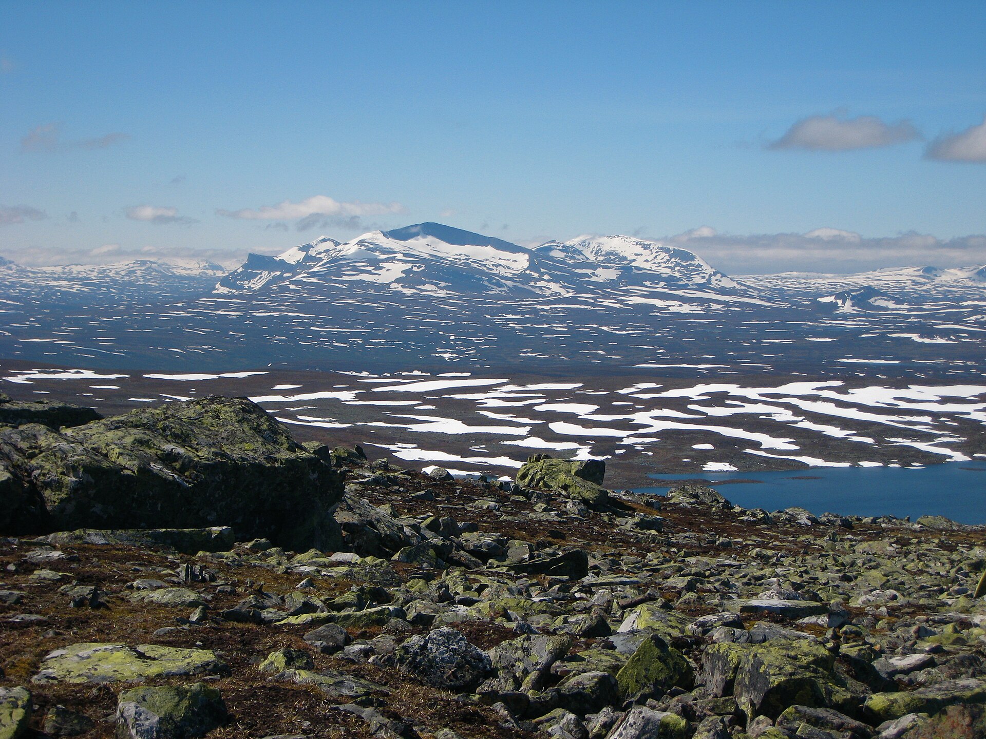
Regional overview
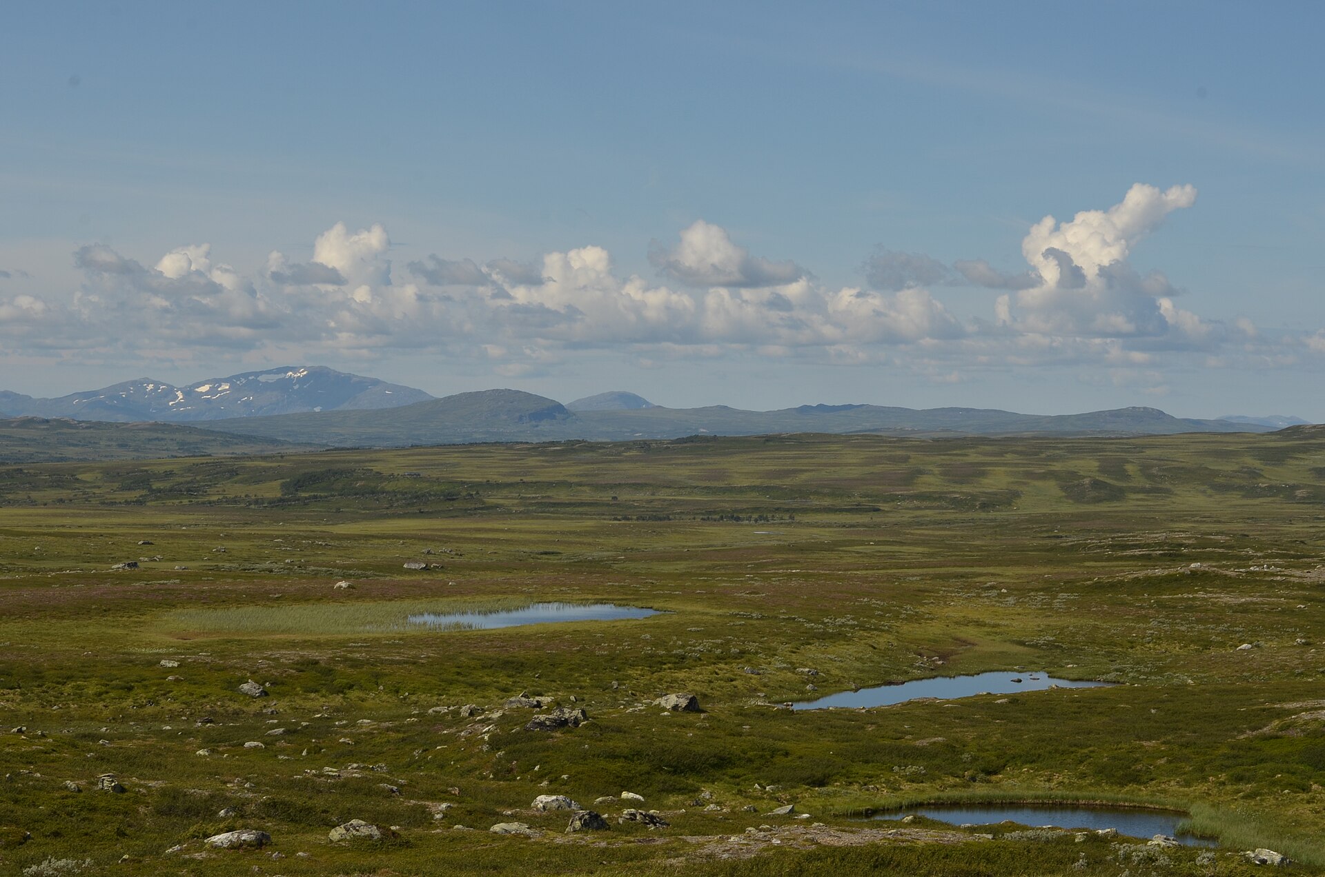
This region covers the classic northern Scandinavian hiking belt: Abisko and Kungsleden in Swedish Lapland, the edge of Sarek, the Kebnekaise massif, and the Jämtland mountains around Helags and Sylarna. The terrain ranges from birch forest, river canyons and boardwalked valley paths to high tundra, boulder fields, glacier views and long roadless approaches.
Abisko National Park is one of the most accessible mountain areas, with Kungsleden starting at Abisko Turiststation and crossing the park via Abiskojåkka and Abiskojaure.
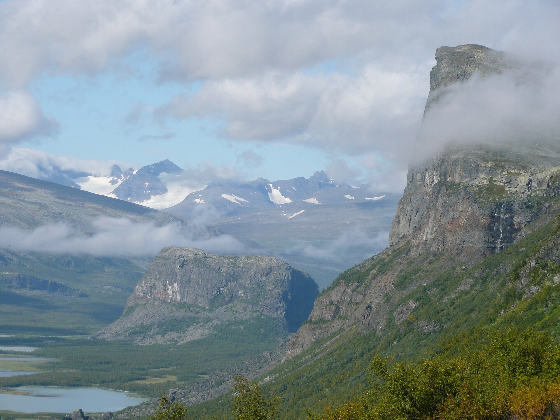
Sarek is wilder and less serviced. It is known for high mountains, glaciers, Rapadalen and the Rapa River delta, with Skierfe offering one of the most famous accessible viewpoints from the Kungsleden/Aktse side.
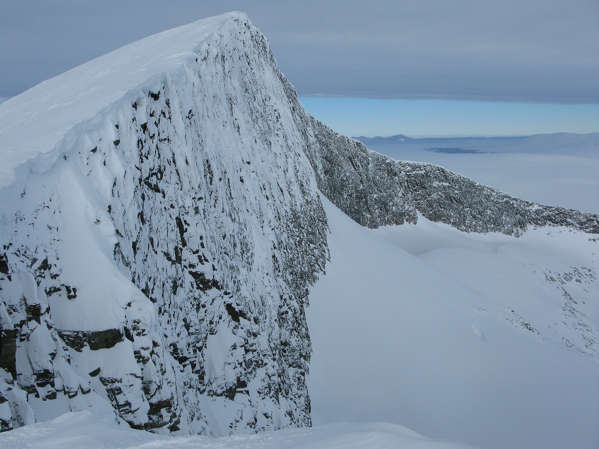
Jämtland is more rounded and hut-based, but still serious in poor weather. Helags and Sylarna provide alpine-style day objectives from STF mountain stations, with Helags notable for Sweden’s southernmost glacier and Sylarna for the cross-border Sweden–Norway massif centred on Storsylen.
The main walking season is usually July to September for the higher objectives, with June sometimes possible on lower valley routes and lingering snow on summits. Weather can change quickly, visibility can collapse on bare upland terrain, and transport may depend on seasonal buses, boats, taxis or hut opening periods.
Selection rationale
These five hikes were selected to balance the region’s essential hiking character: one historic Kungsleden stage, one national high mountain objective, one Sarek/Rapadalen viewpoint, one Helags glacier-and-summit route, and one Sweden–Norway border massif route in Sylarna. They are all feasible as demanding day hikes for fit walkers in normal summer conditions, although some require a hut-based overnight before the day hike.
Summary table
| # | Hike | Country | Route type | Distance | Gain | Max elevation | Difficulty |
|---|---|---|---|---|---|---|---|
| 1 | Kungsleden — Abisko Turiststation to Abiskojaure | Sweden | Point-to-point | 14.2 km | c. 450 m | c. 526 m | Moderate |
| 2 | Kebnekaise South Peak via Västra leden | Sweden | Out-and-back | 18–20 km | c. 1,775–1,800 m | c. 2,086 m | Hard |
| 3 | Skierfe from Aktse | Sweden | Out-and-back | 15.9 km | c. 843 m | 1,159–1,179 m | Hard |
| 4 | Helags Summit from STF Helags Mountain Station | Sweden | Loop | 9.0 km | c. 906 m | 1,797 m | Hard |
| 5 | Storsylen from STF Sylarna Mountain Station | Sweden / Norway border | Out-and-back | 11.6 km | c. 795 m | 1,762 m | Hard |
1. Kungsleden — Abisko Turiststation to Abiskojaure
Snapshot
Itinerary
The route starts at Abisko Turiststation, the northern gateway of Kungsleden. It follows the Abiskojåkka valley southwards through Abisko National Park, initially close to the river and canyon before entering birch forest and open valley terrain. Boardwalks cross wetter ground, and the route continues past lake and river scenery towards Abiskojaure. AllTrails lists the stage as 14.2 km, 450 m ascent and a point-to-point route.
Why it is essential
This is the classic opening stage of Kungsleden and one of the most accessible ways to experience Swedish Lapland’s mountain valleys, birch forest, river canyon terrain and hut-based hiking culture.
Equipment
- Hiking shoes or boots
- Waterproof layer
- Warm layer
- Food and water
- Map/GPS
- Sun protection
- Navigation backup
Hazards and notes
- Camping and access rules in Abisko National Park should be checked before departure.
- Mosquitoes can be significant in summer.
- The route is not technically difficult, but the finish has no public road, so onward hut booking or a planned return is needed.
- Dogs are listed as allowed on leash in the secondary route source.
GPX / KML links
| Source | URL | Format | Notes |
|---|---|---|---|
| AllTrails route map | alltrails.com | Web route map; possible GPX export depending on account/product | Source route link only; no official reusable GPX/KML located |
Sources
- AllTrails — Kungsleden Segment 1: Abisko to Abiskojaure
- Sweden’s National Parks — Abisko National Park
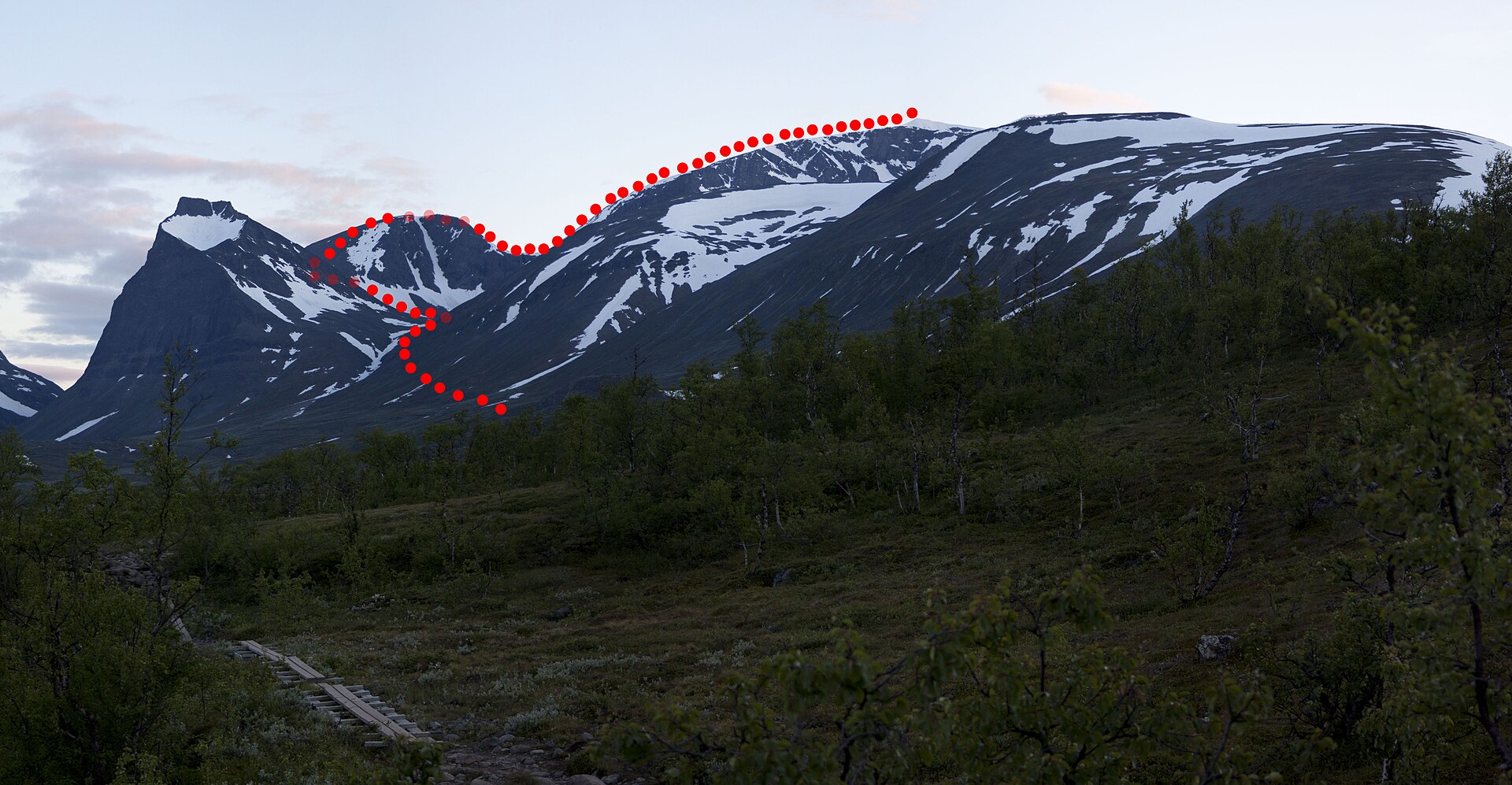
2. Kebnekaise South Peak via Västra leden
Snapshot
Itinerary
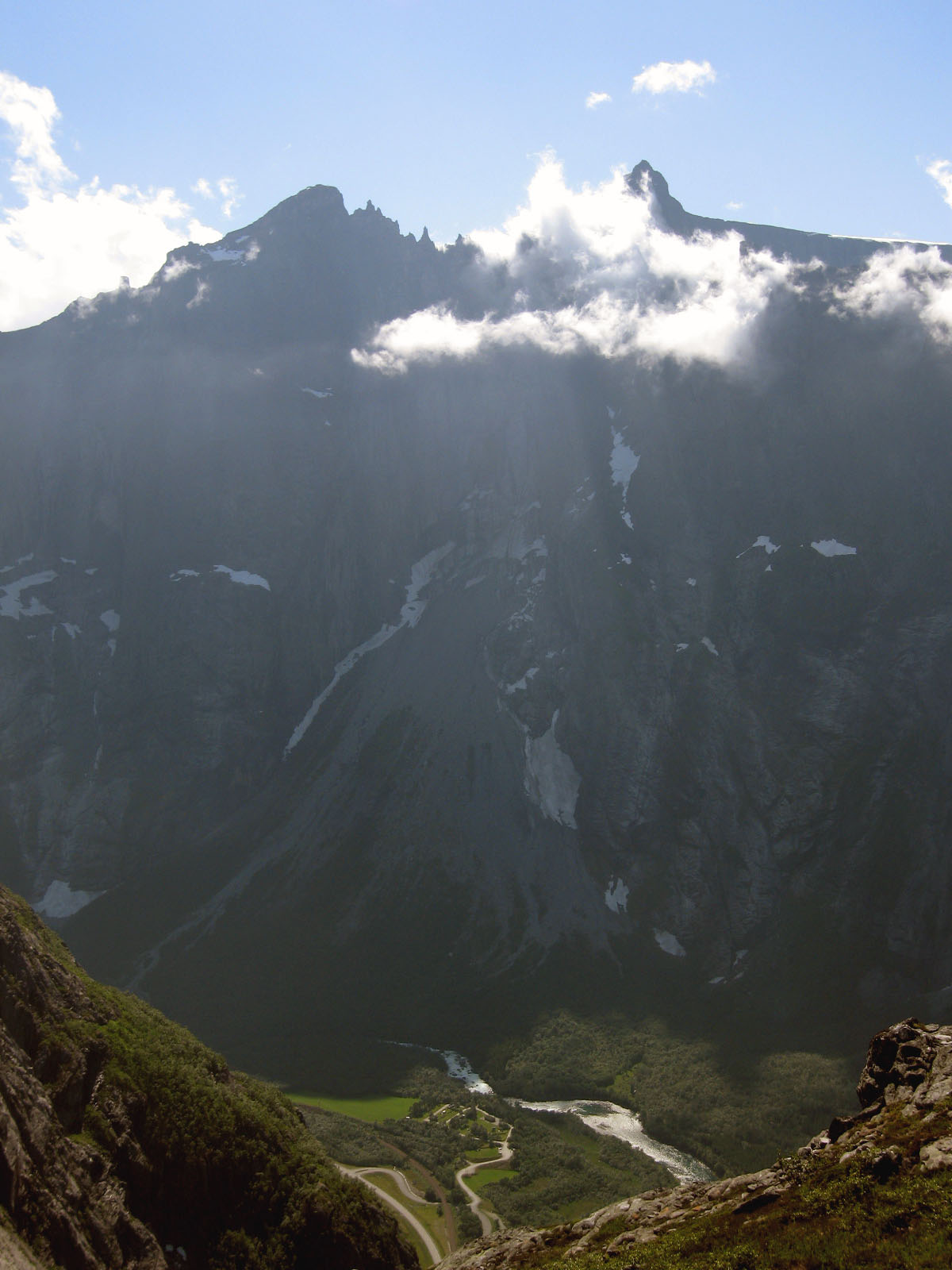
The Western Route starts at STF Kebnekaise Mountain Station and climbs westwards through Kitteldalen, following marked stones and cairns. It passes the Kittel stream area, climbs towards Vierranvárri, descends into Kaffedalen, then climbs steeply towards the summit area. STF describes the Western Route as the common non-glacier route to the South Peak, about 18 km round trip with around 1,800 m of ascent; the AllTrails entry gives 18.7 km and 1,775 m ascent.
Why it is essential
Kebnekaise is Sweden’s highest mountain area, and the Western Route is the classic strenuous walking ascent from the mountain station. It gives a full-value alpine day without the glacier and via ferrata sections of the Eastern Route.
Equipment
- Sturdy boots
- Waterproof and windproof clothing
- Warm layers
- Hat and gloves
- Food for a long day
- Headtorch
- First-aid kit
- Map/GPS and compass
- Trekking poles strongly recommended
- Crampons may be required near the South Peak when the summit snow cover has melted; check current STF advice
Hazards and notes
- This is a long, exposed alpine walk with steep, rocky and uneven ground.
- STF notes high or difficult water levels in the Kittel and Jökel streams, especially with rain, snowmelt or glacier melt.
- Poor visibility can make waymarking hard to follow.
- Mobile coverage should not be relied on.
- The Eastern Route is not included here because it crosses glacier terrain and includes via ferrata equipment requirements.
GPX / KML links
| Source | URL | Format | Notes |
|---|---|---|---|
| AllTrails route map | alltrails.com | Web route map; possible GPX export depending on account/product | Source route link only; no official reusable GPX/KML located |
| STF route guidance | swedishtouristassociation.com | Official route description, not a GPX | Use for factual description and safety only |
Sources
3. Skierfe from Aktse
Snapshot
Itinerary
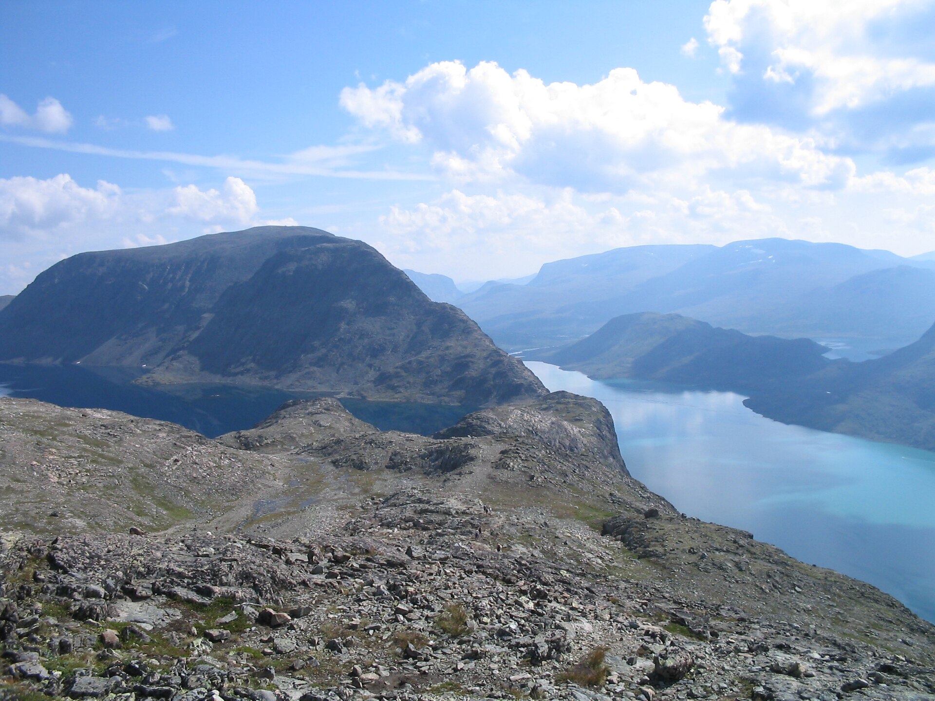
From STF Aktse, the route climbs towards Skierfe, passing Aktsekallio before continuing onto open mountain terrain above Laitaure. The objective is the Skierfe viewpoint above the Rapa River delta, Lake Laitaure and the Sarek interior. AllTrails lists Aktse–Skierfe as a 15.9 km out-and-back route with 843 m ascent.
Why it is essential
Skierfe is the classic accessible Sarek viewpoint. It gives a dramatic view into Rapadalen and over the Rapa River delta without committing to a deeper Sarek traverse.
Equipment
- Sturdy boots
- Waterproof layer
- Warm layer
- Map/GPS
- Food and water
- Trekking poles
- Insect protection in summer
- Hut booking or tent plan
Hazards and notes
- The upper section is exposed to weather and visibility changes.
- The viewpoint edge is serious and should be treated cautiously.
- STF notes Aktse access may require boat travel on Laitaure, and the lake is weather-sensitive.
- Reindeer husbandry and protected-area considerations require keeping distance from animals and following local rules.
GPX / KML links
| Source | URL | Format | Notes |
|---|---|---|---|
| AllTrails route map | alltrails.com | Web route map; possible GPX export depending on account/product | Source route link only; no official reusable GPX/KML located |
| STF Aktse page | swedishtouristassociation.com | Official place/access guidance, not GPX | Use for access and factual context only |
Sources
4. Helags Summit from STF Helags Mountain Station
Snapshot
Itinerary
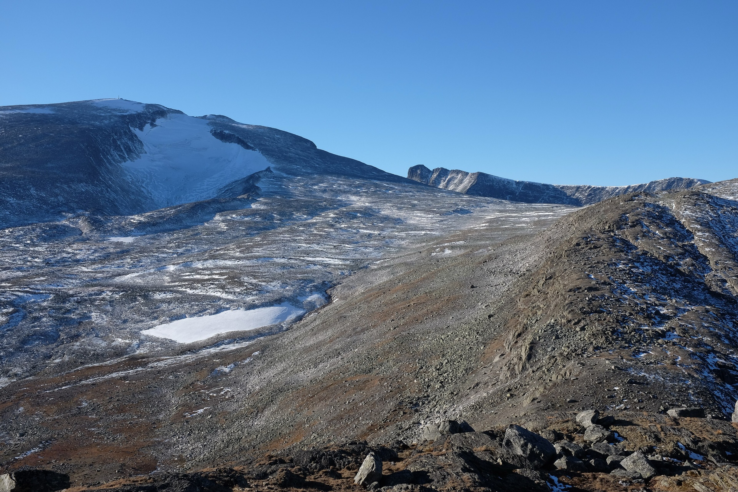
The day route starts from STF Helags Mountain Station and climbs the mountain above the station. STF describes Helags as a 1,797 m peak with Sweden’s southernmost glacier and notes that the original hut was built in 1897 to make the 750 m ascent of the peak easier. The AllTrails summit entry gives a 9.0 km route with 906 m ascent.
Why it is essential
Helags is the defining summit of the southern Swedish mountain world: high, glacier-backed, hut-based and less technical than many alpine objectives, while still being a serious mountain day in poor weather.
Equipment
- Sturdy boots
- Waterproofs
- Warm layers
- Gloves and hat outside stable midsummer weather
- Map/GPS
- Compass
- Food and water
- Trekking poles
- Headtorch
- Microspikes may be useful if snow remains on the upper route
Hazards and notes
- The route is exposed to wind, cloud and rapid weather changes.
- Snowfields can persist and make navigation more serious.
- STF Helags is in roadless terrain; the nearest normal starting point is Kläppen, 12 km away, so this summit is usually done after reaching the mountain station.
- STF lists summer opening in 2026 from 1 July to 27 September.
GPX / KML links
| Source | URL | Format | Notes |
|---|---|---|---|
| AllTrails route map | alltrails.com | Web route map; possible GPX export depending on account/product | Source route link only; no official reusable GPX/KML located |
| STF Helags page | swedishtouristassociation.com | Official access and mountain-station guidance, not GPX | Use for access, season and factual context only |
Sources
5. Storsylen from STF Sylarna Mountain Station
Snapshot
Itinerary
From STF Sylarna Mountain Station, the route heads towards the Storsylen massif and climbs into increasingly rocky, alpine terrain. The final part is a mountain summit route rather than a simple valley path, and the secondary route source notes rock and some scrambling near the top. AllTrails lists the route as 11.6 km out-and-back with 795 m ascent.
Why it is essential
Storsylen is the highest point of the Sylarna/Sylan massif and a long-standing objective from the Swedish mountain-station network. STF describes Sylarna as a dramatic alpine centre for hiking, skiing and climbing, with Storsylen at 1,762 m drawing hikers and skiers since the first ascent in 1886.
Equipment
- Sturdy boots
- Waterproof and windproof clothing
- Warm layers
- Gloves and hat outside stable midsummer weather
- Map/GPS and compass
- Food and water
- Trekking poles
- Headtorch
Hazards and notes
- The upper route has rocky ground and some scrambling.
- Cloud, wind or wet rock can make the final section more serious.
- Snow can remain into summer.
- The route is in a Sweden–Norway border massif, and access normally depends on hut-to-hut logistics rather than a road trailhead.
- Reindeer husbandry and dog restrictions/accommodation rules should be checked locally.
GPX / KML links
| Source | URL | Format | Notes |
|---|---|---|---|
| AllTrails route map | alltrails.com | Web route map; possible GPX export depending on account/product | Source route link only; no official reusable GPX/KML located |
| STF Sylarna page | swedishtouristassociation.com | Official area and access guidance, not GPX | Use for factual context only |
Sources
Region-level sources
| Source | Use | URL |
|---|---|---|
| Sweden’s National Parks — Abisko National Park | Regional terrain and Kungsleden/Abisko context | sverigesnationalparker.se |
| Sweden’s National Parks — Sarek National Park | Sarek landscape and Rapadalen context | sverigesnationalparker.se |
| Swedish Tourist Association — Climbing Kebnekaise | Official Kebnekaise route, safety, access and equipment guidance | swedishtouristassociation.com |
| Swedish Tourist Association — STF Kebnekaise Mountain Station | Access and mountain-station context | swedishtouristassociation.com |
| Swedish Tourist Association — STF Aktse Mountain Cabin | Aktse, Skierfe, Laitaure and access logistics | swedishtouristassociation.com |
| Swedish Tourist Association — STF Helags Mountain Station | Helags summit context, access, opening periods and services | swedishtouristassociation.com |
| Swedish Tourist Association — STF Sylarna Mountain Station | Sylarna/Storsylen context and hut-network access | swedishtouristassociation.com |
| AllTrails route pages | Secondary route statistics and route-map sources | alltrails.com |
| Wikimedia Commons | Licence-compatible image candidates and verified reuse licences | commons.wikimedia.org |