Regional overview
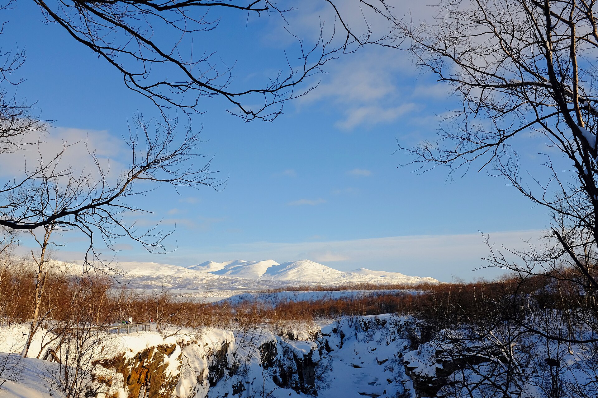
Jotunheimen is Norway’s classic high-mountain hiking region: a compact landscape of glaciated peaks, broad valleys, lakes, ridges and historic mountain lodges. The national park protects a large alpine area with more than 250 high peaks, including Galdhøpiggen and Glittertind, the two highest summits in Norway.
The main hiking centres for these routes are Gjendesheim / Memurubu on Lake Gjende, Spiterstulen and Glitterheim in the central high mountains, Valdresflye for the eastern ridges, and Hjelle / Vetti Gard in Utladalen. Access often depends on seasonal roads, buses, boats, hut openings and local shuttle services, especially around Gjende and the high-road approaches.
The normal hiking season is short. Most high routes are summer objectives, generally from late June or July to September, with snow possible earlier and later. Weather changes quickly, visibility can deteriorate on broad stony plateaux, and several walking routes include steep scrambling, airy ridge sections, snowfields or glacier-edge terrain.
Selection rationale
These five hikes were selected to represent the essential Jotunheimen range rather than one single trailhead: Besseggen for the iconic Gjende ridge, Galdhøpiggen for Norway’s highest summit, Glittertind for the second-highest mountain and high plateau terrain, Knutshøe for a sharper and quieter ridge alternative, and Utladalen–Vettisfossen for the protected valley and waterfall landscape.
Summary table
| # | Hike | Route type | Distance | Gain | Max elevation | Difficulty |
|---|---|---|---|---|---|---|
| 1 | Besseggen Ridge: Memurubu to Gjendesheim | Point-to-point / boat-assisted | 13.7–14.8 km | 1,020–1,100 m | 1,743 m | Demanding / strenuous |
| 2 | Galdhøpiggen from Spiterstulen | Out-and-back | 12.5–13.0 km | 1,350–1,455 m | 2,469 m | Hard mountain hike |
| 3 | Glittertind from Glitterheim | Out-and-back | 12.2–15.0 km | c. 1,075 m | 2,452 m | Hard mountain hike |
| 4 | Knutshøe Loop from Vargebakken | Loop | 12.0–13.4 km | 556–741 m | c. 1,517 m | Hard / exposed ridge hike |
| 5 | Utladalen: Hjelle / Vetti Gard to Vettisfossen | Out-and-back | 12.2–13.7 km | c. 600–780 m | Variant-dependent | Moderate to hard |
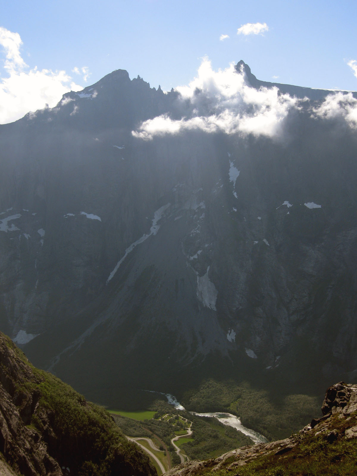
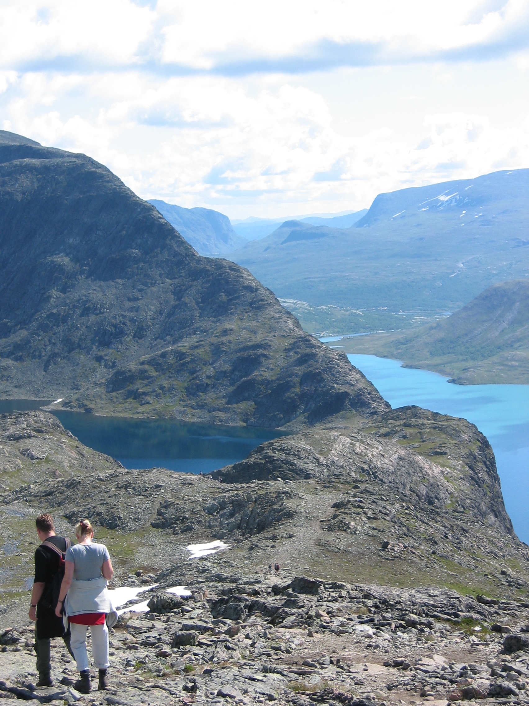
1. Besseggen Ridge — Memurubu to Gjendesheim
Snapshot
Itinerary
The standard day hike starts with the Gjende boat from Gjendesheim to Memurubu, then climbs steeply from the lakeshore into high ground above Gjende. The route traverses the Besseggen ridge system and continues across Veslfjellet, the highest point of the walk, before descending to Gjendesheim.
DNT lists the route as a very demanding 13.7 km point-to-point hike with 1,020 m of total ascent and an estimated time of 8 hours. The route description also notes the 14 km distance, the 1,743 m high point and the common boat-first strategy from Gjendesheim to Memurubu.
AllTrails records a comparable Besseggen Ridge route at 14.8 km with about 1,073 m of ascent, classified as strenuous and point-to-point.
Why it is essential
Besseggen is Jotunheimen’s most famous ridge walk and one of Norway’s signature day hikes. Its essential character comes from the high-level traverse between the blue-green waters of Gjende and the higher lake of Bessvatnet, the narrow ridge section and the direct connection between Gjendesheim and Memurubu.
Equipment
Mountain hiking equipment is appropriate:
- Sturdy boots
- Waterproof and warm layers
- Food and water
- Map/GPS
- Navigation backup
- Gloves and hat outside stable midsummer weather
- Headtorch for long days
DNT specifically recommends a hiking pack, warm and waterproof clothing, map and compass, first-aid kit, charged phone and headlamp.
Hazards and notes
The ridge has exposed and steep sections, and rain, wind or poor visibility can make the route significantly more serious. Early or late season snow may remain. Boat tickets should be checked and booked in advance where possible, as DNT specifically advises planning the Gjende boat connection.
Dogs are marked as not allowed on some trail databases, but local legal access and transport rules should be checked before travel.
GPX / KML links
| Source | URL | Format | Notes |
|---|---|---|---|
| DNT UT route page | ut.no | Route page / map | Primary route source |
| DNT UT map | ut.no | Source map | Geometry source-map link |
| AllTrails route page | alltrails.com | Route page / possible platform GPX | Secondary route source |
Sources
2. Galdhøpiggen from Spiterstulen
Snapshot
Itinerary
The route leaves Spiterstulen and climbs westwards from the valley, gaining height steadily towards Svellnose and Keilhaus topp before reaching the summit area of Galdhøpiggen.
DNT describes the Spiterstulen route as a demanding 12.5 km out-and-back hike with 1,455 m of ascent and an estimated time of 9 hours. The route is a long summit walk rather than a short excursion, despite avoiding the glacier crossing used on the Juvasshytta route.
Visit Norway states that the Spiterstulen route does not require a guide because the normal path avoids glacier travel. It gives about 13 km return, about 1,350 m of ascent and a normal walking time of 7–9 hours.
Why it is essential
Galdhøpiggen is Norway’s highest mountain at 2,469 m, making this the essential summit day in Jotunheimen. The Spiterstulen route is the classic non-glacier normal route for strong walkers who want to reach the highest point without joining a roped glacier party.
Equipment
Mountain hiking equipment is required:
- Sturdy boots
- Waterproof and warm layers
- Gloves and hat
- Food and water
- Map/GPS
- Navigation backup
- Headtorch
- Trekking poles recommended for the long descent
- Microspikes may be useful if snow or frozen surfaces remain
Hazards and notes
This route has substantial ascent and reaches very high Norwegian mountain terrain. Snow, wind, low cloud and cold temperatures can occur even in summer.
The Spiterstulen normal route avoids glacier crossing, but variants involving Styggebreen or descent towards Juvasshytta require glacier competence, a guide or roped travel as applicable.
GPX / KML links
| Source | URL | Format | Notes |
|---|---|---|---|
| DNT UT route page | ut.no | Route page / map | Primary route source |
| DNT UT map | ut.no | Source map | Geometry source-map link |
| AllTrails route page | alltrails.com | Route page / possible platform GPX | Secondary route source |
Sources
- DNT UT — Galdhøpiggen fra Spiterstulen
- DNT UT map
- Visit Norway — Galdhøpiggen from Spiterstulen
- AllTrails — Spiterstulen–Galdhøpiggen
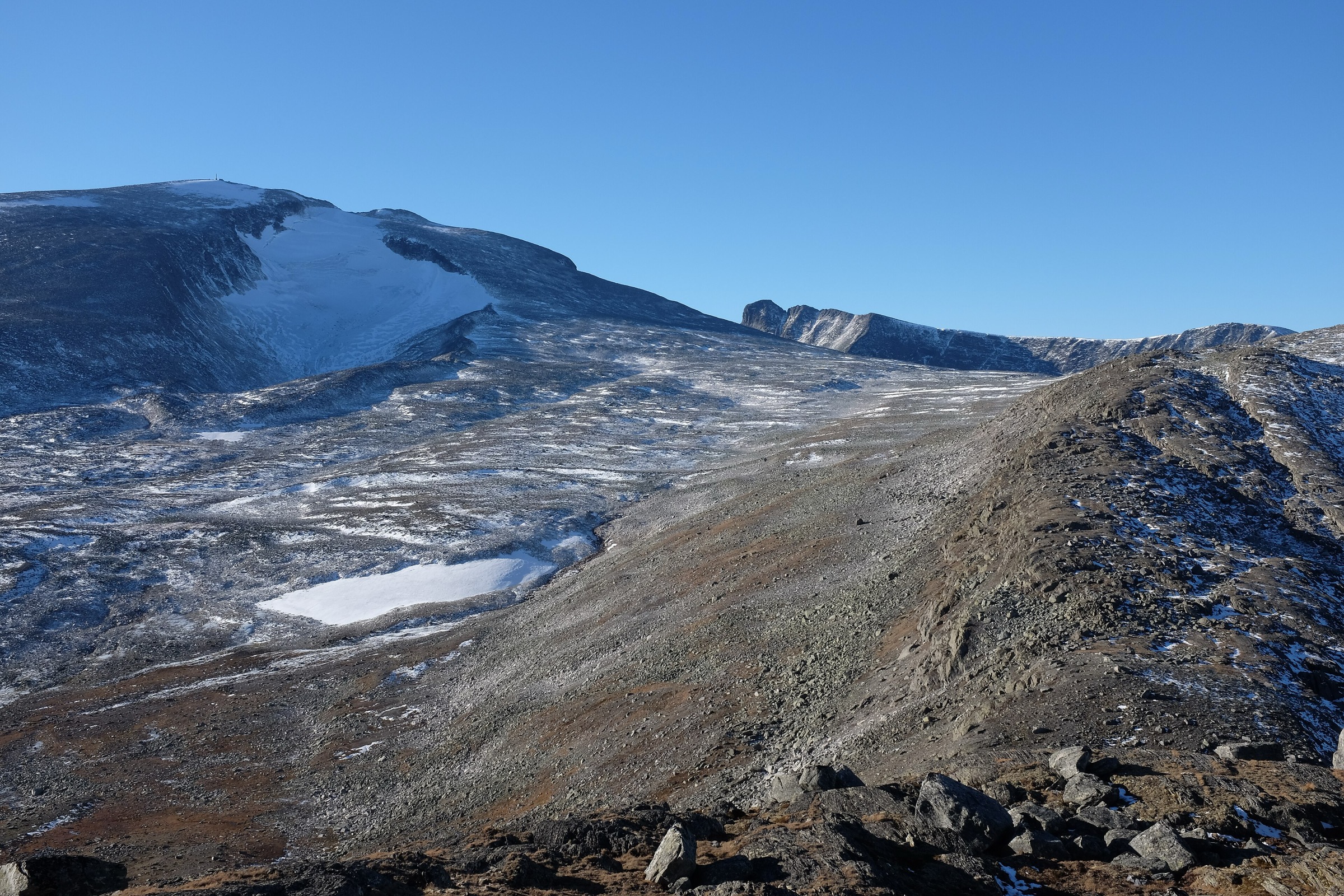
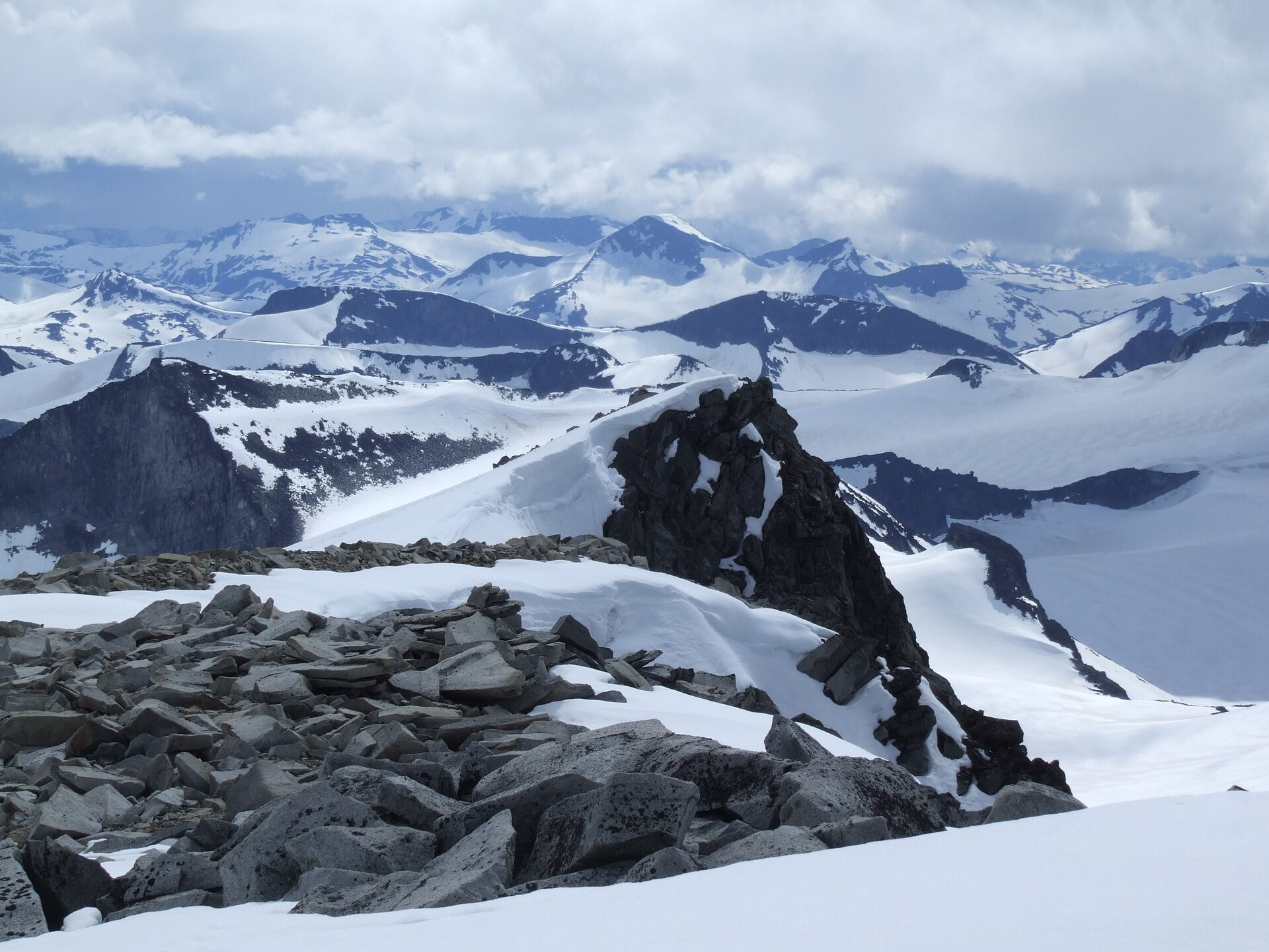
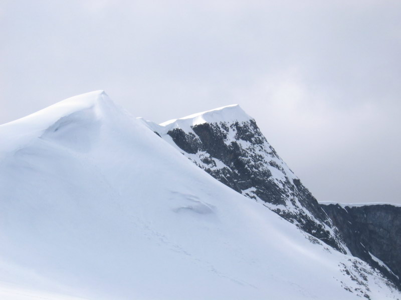
3. Glittertind from Glitterheim
Snapshot
Itinerary
From Glitterheim, the marked route climbs north-west from the lodge through grass and gradually into stony high-mountain terrain. Around 2,250 m the route turns west and crosses the summit snow/ice area of Glitterbrean before reaching Glittertind.
DNT lists the route as a demanding 12.2 km out-and-back hike with 1,075 m of ascent, a 7-hour estimate and a June–September season.
The summit-height figure is not completely uniform between sources because Glittertind has been affected by its snow and ice cap. For guidebook use, the safest wording is: 2,452 m rock summit; some route sources list around 2,457 m including ice/snow.
Why it is essential
Glittertind is Jotunheimen’s other great high summit and provides a different experience from Galdhøpiggen: a long approach from a mountain lodge, broad stony slopes and a snow-covered summit area with wide views across the national park.
Equipment
Mountain hiking equipment is required:
- Sturdy boots
- Warm and waterproof layers
- Map/GPS
- Navigation backup
- Gloves and hat
- Food and water
- Headtorch
- Trekking poles recommended
- Microspikes or light crampons may be needed when the summit snow or ice is firm
Hazards and notes
The route crosses the upper Glitterbrean snow/ice area. DNT notes that the route normally has good tracks in the snow, but local conditions should be checked. Crampons or microspikes may be needed in some conditions, especially outside the warmest summer period.
Access itself is a consideration: Glitterheim lies inside the national-park approach zone, with about 7 km from the Veodalen parking / boundary area, and bicycles may be used where available.
GPX / KML links
Sources
- DNT UT — Glittertinden fra Glitterheim
- DNT UT map
- Jotunheimen.com — Glittertind
- Wikipedia — Glittertind
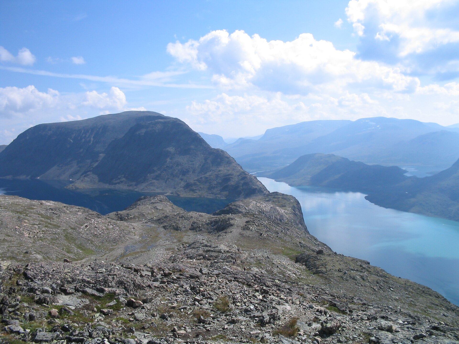
4. Knutshøe Loop from Vargebakken
Snapshot
Itinerary
The loop starts near Vargebakken on road 51 and crosses the Varga before climbing steeply onto the Knutshøe ridge. The route follows the ridge north-west with views towards Gjende and the surrounding mountains, then descends towards Leirungsåi and returns through Leirungsdalen.
DNT lists the hike as a demanding 12.7 km loop with 556 m of ascent and an estimated time of 5 hours.
AllTrails records a comparable Knutshøe Loop at 13.4 km with about 741 m of ascent, classified as hard and looped. This explains the range in the summary statistics.
Why it is essential
Knutshøe is often described as Besseggen’s harder, quieter little brother, but it is not simply a lesser substitute. It gives a sharper ridge experience, wide Gjende-area views and a more serious mountain-walking character without needing the boat logistics of Besseggen.
Equipment
Mountain hiking equipment is required:
- Sturdy boots with good grip
- Weatherproof and warm layers
- Map/GPS
- Navigation backup
- Food and water
- Headtorch
- Trekking poles may help in the valley but can be awkward on scrambling sections
Hazards and notes
This route is more serious than its moderate distance suggests. DNT states that the path is not marked, that there are airy and exposed sections, and that route-finding errors can lead towards cliffs. It should be attempted only in good visibility and dry conditions by mountain-experienced walkers.
DNT also notes golden eagle nesting sensitivity and recommends waiting until after 1 July.
Dogs are problematic on the scrambling sections, and some route databases mark the route as not suitable for dogs. Local rules should be checked before travel.
GPX / KML links
| Source | URL | Format | Notes |
|---|---|---|---|
| DNT UT route page | ut.no | Route page / map | Primary route source |
| DNT UT map | ut.no | Source map | Geometry source-map link |
| AllTrails route page | alltrails.com | Route page / possible platform GPX | Secondary route source |
Sources
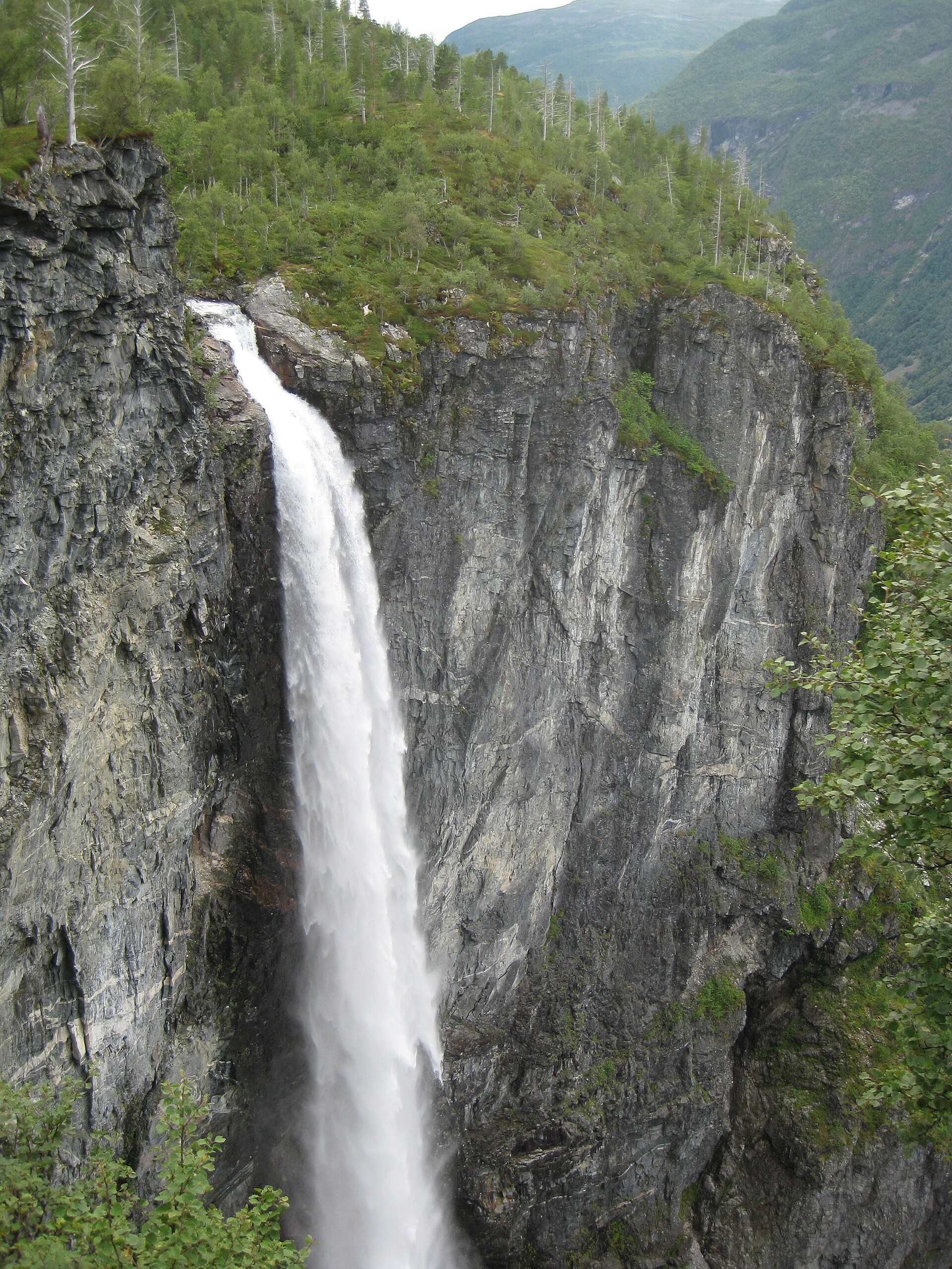
5. Utladalen — Hjelle / Vetti Gard to Vettisfossen
Snapshot
Itinerary
The route follows Utladalen from the Hjelle area towards Vetti Gard, then continues to Vettisfossen. Jotunheimen.com describes the walk from Hjelle through Utladalen to Vetti Gard and Vettisfossen, identifying Vettisfossen as Norway’s highest protected waterfall.
The final route choice matters: some walkers visit the foot of the waterfall, while other mapped routes include higher viewpoints or slightly different returns. Tyin Filefjell lists the Vettisfossen hike as a 4-hour May–October route, while Visorando gives a 12.24 km return route with about 608 m of ascent and 5 h 15 min walking time. AllTrails lists a longer Hjelle–Vettisfossen route at 13.7 km with about 781 m of ascent.
Why it is essential
This route represents the western Jotunheimen valley landscape rather than the high summits and ridges. Vettisfossen has a 275 m free fall and lies in the Utladalen protected landscape, making the walk one of the most important valley-and-waterfall day hikes in the Jotunheimen area.
Equipment
Standard to mountain hiking equipment is appropriate:
- Hiking boots or sturdy shoes
- Waterproof layer
- Warm layer
- Food and water
- Map/GPS
- Sun protection
- Trekking poles may help on steeper or rougher sections
- Waterproof layer useful near the waterfall and in the shaded valley
Hazards and notes
The valley route is less alpine than Besseggen or the summit hikes, but the final sections near the waterfall can be steep, rocky and slippery. Care is needed near riverbanks, wet rock and exposed viewpoints. Seasonal access and any protected-area restrictions should be checked before travel.
GPX / KML links
| Source | URL | Format | Notes |
|---|---|---|---|
| AllTrails route page | alltrails.com | Route page / possible platform GPX | Secondary route source |
| Visorando route page | visorando.com | Route page / possible GPX source | Secondary route source |
| Jotunheimen.com route article | jotunheimen.com | Route article | Descriptive source |
Sources
- Jotunheimen.com — Utladalen and Vetti
- Jotunheimen.com — Hike to Utladalen and Vetti
- Tyin Filefjell — Vettisfossen
- Visorando — Utladalen valley
- Visorando — Vettisfossen
- AllTrails — Hjelle–Vettisfossen
- Wikipedia — Vettisfossen
Region-level sources
| Source | Use |
|---|---|
| Jotunheimen official tourism / national park information | Regional overview, high-mountain context, protected-area context, Utladalen / Vettisfossen context |
| DNT UT | Primary route statistics and descriptions for Besseggen, Galdhøpiggen, Glittertind and Knutshøe |
| Visit Norway | Galdhøpiggen route character, glacier-avoidance note and access context |
| AllTrails | Secondary route-statistic cross-checks and route-source pages |
| Visorando | Secondary statistics for the Vettisfossen route |
| Wikimedia Commons | Licence-compatible image candidates and attribution data |