Regional overview
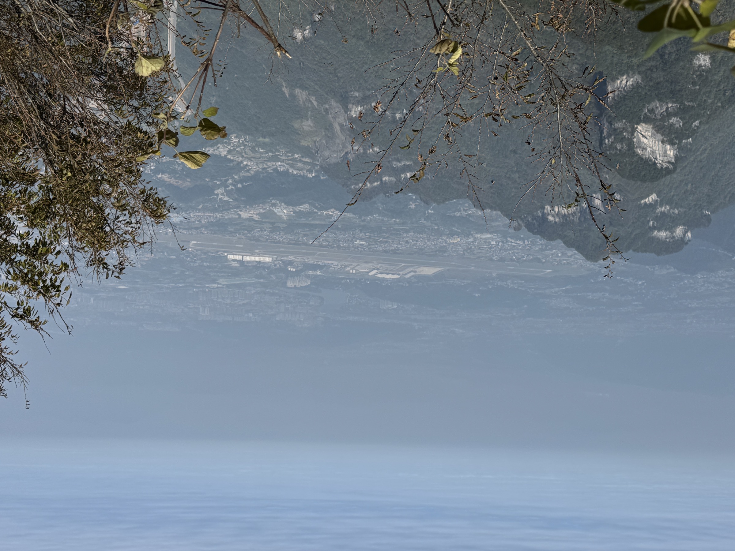
The Enshi Grand Canyon (恩施大峡谷) sits in the western Wuling Mountains, in Enshi Tujia and Miao Autonomous Prefecture, southwestern Hubei. It is a 108 km-long karst canyon system cut into Triassic limestones, with vertical sandstone–limestone cliffs, slot gorges, stone forests, sinkholes, caves and a managed scenic area of cliff plank roads, stairways, viewing platforms, cableways and shuttle buses. The signature landmark is the 150 m-high free-standing “One Stick of Incense” (一炷香, Yi Zhu Xiang) limestone pillar inside the Qixingzhai (七星寨, Seven-Star Stockade) sector. Hikes here mix managed scenic-area walking with serious vertical: every major route involves long stair sections, exposed cliff balconies, or both.
The wider Enshi region also includes the parallel Yunlong Ground Fissure (云龙地缝, Yunlong Dizhao) — a deeply incised karst slot canyon with waterfalls — and, around 100 km north-west in Lichuan, the Suobuya Stone Forest (梭布垭石林), one of China’s largest karst stone forests. These three sub-areas together cover the essential walking landscapes of the prefecture and are linked by the same regional shuttle network.
Sibling overviews in this range include Zhangjiajie / Wulingyuan, Hunan, Tianmen Mountain, Hunan, the Xiangxi karst at Hongshilin and Fanjingshan, Guizhou.

Selection rationale
The five hikes cover the essential Enshi walking experience: the Qixingzhai cliff route past the “One Stick of Incense” pillar; the Yunlong Ground Fissure slot-canyon loop; two Luyuanping (鹿院坪) variants for walkers who want the full sinkhole-village descent; and the Suobuya karst stone forest for a contrasting flat-walking day on a vast pinnacle plateau. Together they give cliff balcony, gorge slot, sinkhole basin and stone-forest hiking without relying on five near-identical viewpoint loops.
Summary table
| # | Hike | Route type | Distance | Gain | Max elevation | Difficulty |
|---|---|---|---|---|---|---|
| 1 | Qixingzhai cliff route (Seven-Star Stockade) | Point-to-point cliff balcony | 7.1 km | 510 m | 1,702 m | Hard |
| 2 | Yunlong Ground Fissure loop | Loop with stairs | 3.5 km | 185 m | 957 m | Moderate |
| 3 | Luyuanping Loop | Loop with deep descent | 7.6 km | 1,076 m | 1,641 m | Hard |
| 4 | Luyuanping point-to-point | Point-to-point traverse | 8.7 km | 716 m | 1,641 m | Hard |
| 5 | Suobuya Stone Forest | Managed loop on karst plateau | Unresolved | Modest | ~900 m | Easy–moderate |
1. Qixingzhai cliff route — Seven-Star Stockade and “One Stick of Incense”

Snapshot
Itinerary
From the Qixingzhai cableway upper station, follow the rim path north along the Seven-Star Stockade. The signed sequence runs through Liu Zi Tai (六字台) and the viewpoint balconies above the canyon’s north arm, then onto the Jue Bi Zhan Dao — a cantilevered cliff plank road bolted to the limestone wall, with continuous drops of several hundred metres. The route passes the “One Stick of Incense” overlook, where the 150 m free-standing pillar stands clear of the cliff face, then descends the long stairway to the lower scenic exit and shuttle pickup. Most walkers exit by shuttle rather than back-tracking up the rim.
Why it is essential
Qixingzhai is the single hike that defines Enshi Grand Canyon. It links the cableway rim, the cliff plank road, the “One Stick of Incense” pillar and the deep canyon overlooks in one continuous walking line, with no realistic substitute elsewhere in the park.
Equipment
- Sturdy trail shoes with good grip — limestone steps stay greasy after rain
- 1.5–2 L water and a packed lunch; only limited food carts on the rim
- Sun and rain protection; mid-summer afternoons bring sudden storms
- Trekking poles for the long stair descent
- Small daypack — large packs are awkward on the narrowest plank sections
Hazards and notes
- Cliff plank road is fully railed but exposed; not advisable for severe vertigo sufferers
- Lightning risk on the rim — turn back if storms build
- Rockfall after heavy rain occasionally closes sections; check entrance signage
- Mid-summer crowds can queue at the cableway and at the One Stick of Incense viewpoint
- Carry cash or a working WeChat / Alipay wallet — entrance and shuttle ticketing is in-app only at busy times
2. Yunlong Ground Fissure loop

Snapshot
Itinerary
From the Yunlong entrance, descend the staircase into the karst slot. The path drops through the narrow fissure on a railed plank road, passing the Bayu (巴蛇) and Long Mu (龙门) waterfalls and a chain of small bridges and pools. The loop crosses the gorge floor, climbs back out on the opposite-bank stairway, and returns along the rim to the entrance. The whole circuit is short but stair-heavy in both directions.
Why it is essential
Yunlong is the geological complement to Qixingzhai: where the Seven-Star route looks across the canyon, the Ground Fissure walk drops into a parallel slot that exposes the same limestone bedding from inside. The two routes pair naturally over a single day if you start early and skip the longer Luyuanping traverse.
Equipment
- Grippy shoes — slot floor stays wet
- Light waterproof for the waterfall spray sections
- Headlamp not required (the path is daylit and partially lit), but useful in low cloud
- Compact pack — railed sections are narrow
Hazards and notes
- Flash-flood risk after upstream rain; the route closes during heavy weather
- Stairs are steep and continuous in both directions — knee support helps
- Air is markedly colder than on the rim; add a layer at the lip
- Crowds bunch on the narrow plank sections at midday; start early or late
3. Luyuanping Loop — deep sinkhole circuit

Snapshot
Itinerary
From the rim entrance, descend the cliff stairway — around 1,500 stone steps — into the Luyuanping sinkhole, a Tujia-village basin enclosed by 300–500 m limestone walls and reached only on foot until recently. The loop crosses the basin floor past terraced fields and a chain of waterfalls (Mahuangtang and Disheng) before climbing the opposite-side stair system back to the rim. A direct cable car was installed in 2023 but is closed off-season; the all-foot loop is the classic and quietest version.
Why it is essential
Luyuanping is the most physically committing day-hike in the prefecture and the only route here that genuinely takes you into a closed karst basin on foot, rather than along a managed scenic balcony. The descent–ascent is steep but the basin floor is gentle, with old village walking and water features that contrast sharply with the canyon rim.
Equipment
- Sturdy trail shoes; the basin paths can be muddy
- 2 L water minimum; basin water sources are not reliably drinkable
- Trekking poles for the long stair descent and re-ascent
- Sun and rain protection
- Snacks and a packed meal — basin village food service is informal and not always open
Hazards and notes
- Cliff stairs are wet and slick after rain — descents are the most common slip injury here
- Once in the basin, escape on foot is a sustained climb; commit early in the day
- Phone signal is patchy at the basin floor
- The cable car is not a reliable backup — check operational status before counting on it
- Respect privacy in the Tujia village settlement at the basin floor
4. Luyuanping point-to-point traverse
Snapshot
Itinerary
This is the through-walking variant of the Luyuanping basin: instead of looping back to the same rim, the route descends one stairway, crosses the basin past the same waterfalls and terraces, and exits via the opposite rim’s stair-and-shuttle line. Distance is slightly longer than the loop because the basin section is fuller, but total ascent is lower because you only re-climb once.
Why it is essential
The point-to-point is the more pleasant variant for walkers who don’t want to repeat the climb out. It also reveals more of the basin floor — the loop short-cuts across; the traverse follows the long axis past Mahuangtang and Disheng before exiting at the far rim.
Equipment
- Sturdy trail shoes
- 2 L water minimum
- Trekking poles
- Sun and rain protection
- Pre-arranged shuttle or driver to recover you from the opposite rim — there is no scheduled public transport at that end
Hazards and notes
- Logistics fail more often than the route itself — confirm pickup before descending
- Same wet-stone, slip and signal-loss risks as the loop variant
- If the cable car is running and you are short on time, it can substitute for the final climb but it is not a year-round option
- Carry a paper sketch of the route and pickup point; the basin GPS is sometimes weak
5. Suobuya Stone Forest

Snapshot
Itinerary
The stone forest is divided into four signed sub-areas — Qinggou (青龙寺), Lianhuazhai (莲花寨), Zhiluwanzhuan (磨子沟) and the Yiteng Suoqiao (依藤索桥) bridge route. The standard visit follows the main paved loop counter-clockwise, threading through corridors between karst pinnacles, past the Lianhuazhai sub-cluster of lotus-shaped towers, the rattan suspension bridge, and the eastern Mozigou ravine. Side branches off the loop add small loops up onto individual pinnacle clusters.
Why it is essential
Suobuya is the flat-walking counterweight to the Qixingzhai and Luyuanping vertical days. It is one of China’s largest dolomitic karst stone forests by area, with a different geology and forest cover from Qixingzhai and a much gentler walking grade — useful for an arrival or rest day in the regional itinerary.
Equipment
- Trail shoes or sturdy walkers; the paths are paved but uneven in places
- 1–1.5 L water
- Sun protection — the plateau is open
- Light rain shell
Hazards and notes
- Signage is bilingual at major junctions but Chinese-only on minor branches; carry an offline map
- Easy to miss sub-loops; allow time to back-track
- Limited food on the plateau — eat before entering or carry snacks
- Avoid mid-summer afternoons; thunderstorms cross the plateau quickly
- Combine with Enshi Grand Canyon as a separate day, not the same day — the drive each way eats 2+ hours
Further reading
| Resource | Link |
|---|---|
| Wikipedia — Enshi Grand Canyon | en.wikipedia.org |
| Wikipedia — Enshi Tujia and Miao Autonomous Prefecture | en.wikipedia.org |
| AllTrails — Qixingzhai cliff route | alltrails.com |
| AllTrails — Yunlong Ground Fissure loop | alltrails.com |
| AllTrails — Luyuanping basin loop | alltrails.com |
| Wikimedia Commons — Category: Enshi Grand Canyon | commons.wikimedia.org |
| Wikimedia Commons — Category: Suobuya Stone Forest | commons.wikimedia.org |