Regional overview
This Slovak core-mountain region combines three distinct hiking characters: the broad alpine ridges of the Low Tatras, the limestone gorges and rocky summits of Malá and Veľká Fatra, and the ladder-and-waterfall canyon terrain of Slovak Paradise.
The Low Tatras are the most alpine part of this selection, with long ridge walks over Ďumbier, Chopok and Kráľova hoľa. The Chopok–Ďumbier ridge is a high-mountain route to the highest Low Tatras summit, while full-day variants of the ridge are around 14–15 km with more than 1,100 m of ascent.
Malá Fatra is represented by Veľký Rozsutec and the Jánošíkove diery gorge system, one of Slovakia’s classic combinations of ladders, waterfalls, limestone narrows and a steep summit.
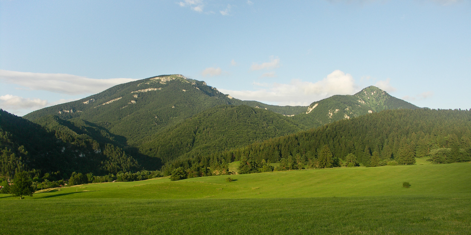
Veľká Fatra has a quieter, forested and karstic character, with long valleys, limestone outcrops and steep grassy or rocky summits. Slovak Paradise is lower but more technical in hiking terms: its essential routes follow narrow gorges equipped with ladders, footbridges and metal rungs.
Selection rationale
The five hikes were selected to represent the region’s main walking experiences: one major Low Tatras ridge, one symbolic eastern Low Tatras summit, one Malá Fatra gorge-and-summit route, one Veľká Fatra limestone summit loop, and one Slovak Paradise ladder gorge. All are feasible as summer day hikes for fit walkers, but several require sure-footedness, comfort on ladders or chains, and caution in wet, icy or snowy conditions.
Summary table
| # | Hike | Country | Route type | Distance | Gain | Max elevation | Difficulty |
|---|---|---|---|---|---|---|---|
| 1 | Ďumbier–Chopok high ridge traverse | Slovakia | Point-to-point or near-loop high-ridge traverse | 14.0–14.8 km | 1,130–1,141 m | c. 2,043–2,046 m | Hard mountain hike |
| 2 | Kráľova hoľa from Šumiac | Slovakia | Out-and-back | 11.2–13.7 km | c. 1,050 m | 1,946 m | Moderate–hard mountain hike |
| 3 | Veľký Rozsutec via Jánošíkove diery | Slovakia | Loop | 10–12 km | 985–1,050 m | 1,610 m | Hard; ladders, chains and exposed rocky sections |
| 4 | Tlstá and Ostrá from Blatnica | Slovakia | Loop | 15.6–17 km | 900–1,100 m | c. 1,414 m | Hard |
| 5 | Suchá Belá Gorge and Kláštorisko from Podlesok | Slovakia | Loop | 12.6 km | 484 m | c. 950–960 m near top of Suchá Belá; exact route maximum unresolved | Moderate distance; technically demanding gorge equipment |
1. Ďumbier–Chopok high ridge traverse
Snapshot
Itinerary
The full-day version links the southern Low Tatras access points with the main ridge between Ďumbier and Chopok. From the Trangoška or Srdiečko side, the route climbs towards the ridge and the Ďumbier summit area, then follows the open crest westwards via the Krúpova hoľa / Demänovské sedlo area to Chopok. The descent can be made towards Kosodrevina and Srdiečko, or the route can be adapted around Jasná lift access. A shorter official ridge section from Chopok to Ďumbier is listed by Visit Liptov as a 4.4 km alpine hike with 428 m of ascent and 418 m of descent, while a fuller Outdooractive route over the ridge is listed at 14.8 km, 7:14 h, 1,141 m ascent and 1,140 m descent.
Why it is essential
This is the core high-ridge walk of the Low Tatras, linking the range’s most famous western high summits. It gives sustained open-ridge walking, broad Central Slovak views, and a very different character from the limestone gorges of Fatra and Slovak Paradise.
Equipment
- Sturdy boots
- Windproof and waterproof layers
- Warm layer
- Map or GPS
- Spare food and water
- Trekking poles recommended
- Hat and gloves outside midsummer
- Microspikes may be needed if snow or ice remains
Hazards and notes
The ridge is exposed to wind, thunderstorms and sudden cloud. In poor visibility, navigation on the broad ridge and on descent variants can become more serious. Early-season snow can remain on shaded approaches. Lift-assisted variants depend on current Jasná cable-car operation and should not be assumed without checking schedules.
GPX / KML links
| Source | URL | Format | Notes |
|---|---|---|---|
| Outdooractive — On the ridge of the Low Tatras from Dumbier to Chopok | outdooractive.com | Route page; GPX/KML/FIT export indicated | Outdooractive terms not checked. Route source found; reuse unresolved |
| Visit Liptov — Ďumbier from Chopok | visitliptov.sk | Official route page / PDF | Reuse terms not checked. Official verification source; no GPX confirmed |
Sources
2. Kráľova hoľa from Šumiac
Snapshot
Itinerary
The standard Šumiac route climbs from the village towards Skalička and Predné sedlo before reaching the broad summit of Kráľova hoľa. Hikemates records the route as Šumiac – Skalička – Predné sedlo – Kráľova hoľa and back, with 11.2 km distance, 5:21 h walking time, 1,050 m ascent and 1,050 m descent. Slovakia.travel describes Kráľova hoľa as a 1,946 m summit in the Low Tatras and notes that, in bad weather, a return to Šumiac by the asphalt road is possible.
Why it is essential
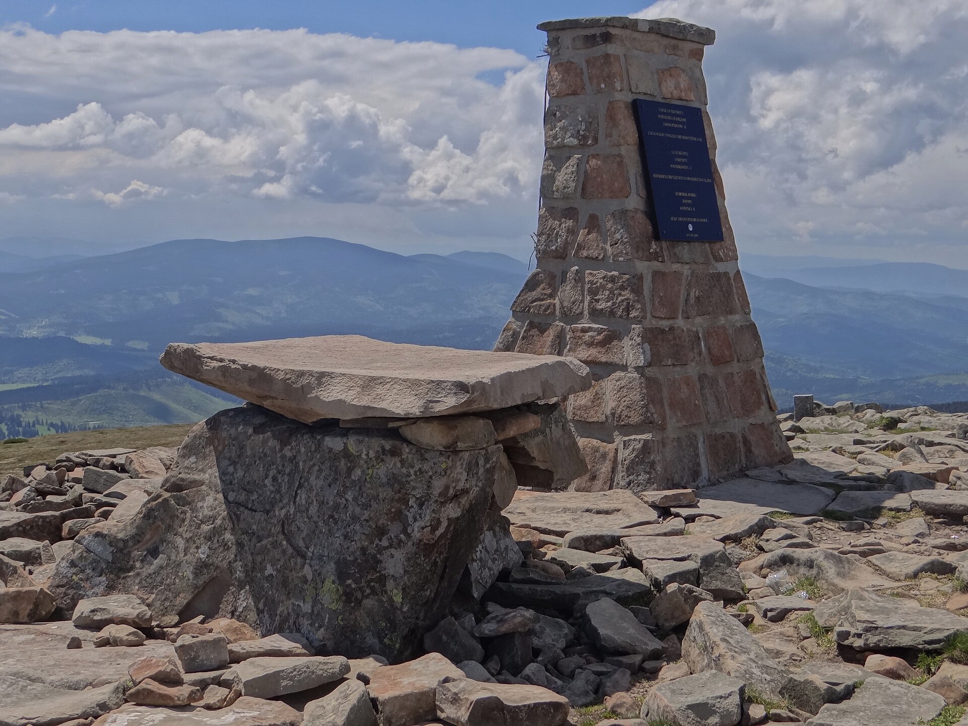
Kráľova hoľa is the symbolic eastern summit of the Low Tatras and one of Slovakia’s most recognisable mountains. It is also a major watershed summit, associated with the sources of important Slovak rivers and with the eastern end of the Low Tatras ridge-traverse tradition.
Equipment
- Sturdy boots
- Waterproof and windproof layers
- Warm layer
- Map or GPS
- Food and water
- Trekking poles useful for the long descent
- Hat, gloves and microspikes in shoulder seasons if snow or ice is possible
Hazards and notes
The summit area is broad and exposed, with strong wind possible. The ascent is long and sustained rather than technical. In cloud, the upper mountain and descent choices require careful navigation. Snow, ice or frozen ruts on the service-road option can make the route more serious.
GPX / KML links
| Source | URL | Format | Notes |
|---|---|---|---|
| Hikemates — Kráľova hoľa zo Šumiaca a späť | hikemates.com | GPX indicated on route page | Hikemates terms not checked. GPX/source route found; reuse unresolved |
| Slovakia.travel — Kráľova hoľa | slovakia.travel | Official route description / summit source | Reuse terms not checked. Official verification source; no downloadable GPX confirmed |
Sources
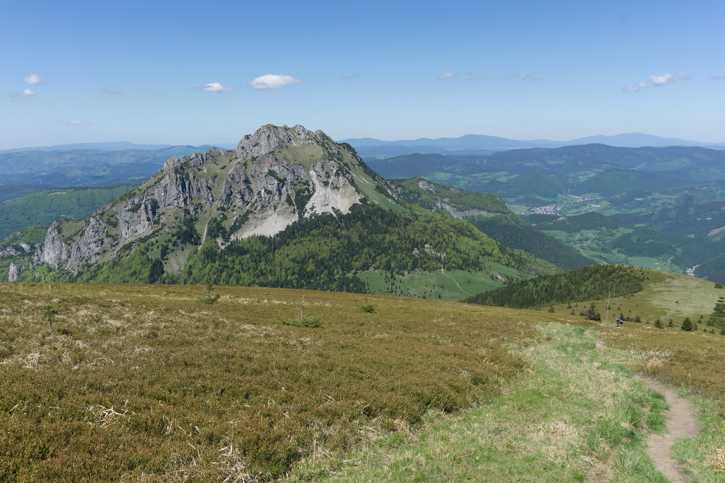
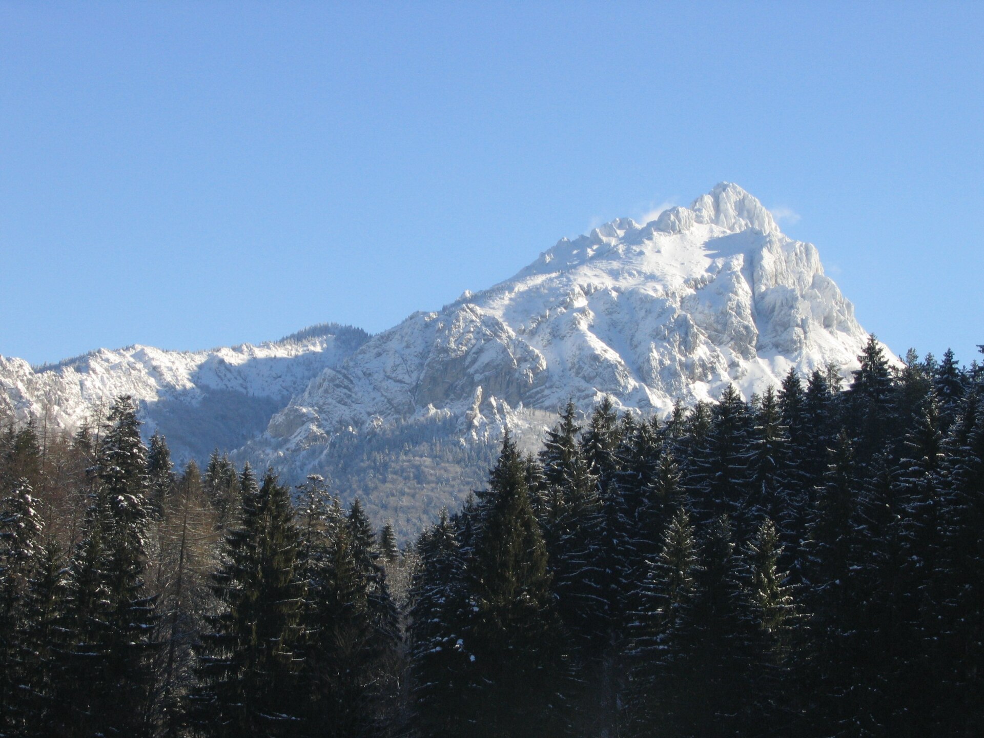
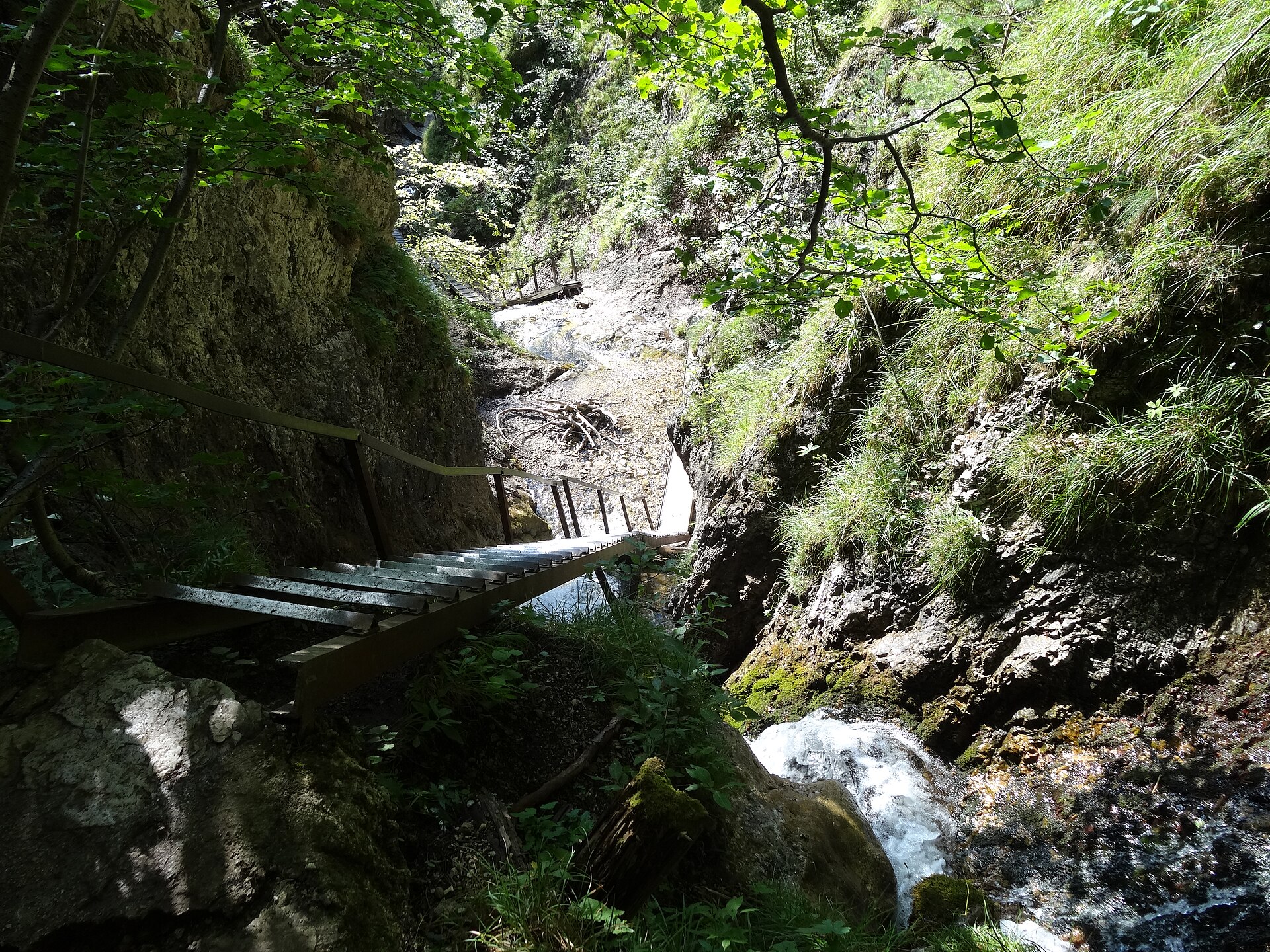
3. Veľký Rozsutec via Jánošíkove diery
Snapshot
Itinerary
The classic loop starts in Štefanová and climbs through Podžiar and Horné diery towards Medzirozsutce. From there, the path climbs steeply to the limestone summit of Veľký Rozsutec, then descends by Medziholie back to Štefanová. Slovakia.travel lists the official route as Štefanová – Podžiar – Horné diery – Medzirozsutce – Veľký Rozsutec – Medziholie – Štefanová, with a total time of 5½ hours. Hikeria records a closely matching version at 12 km, 6:00 h and 1,050 m ascent, starting from the Štefanová parking/bus area and using the gorge system before the summit.
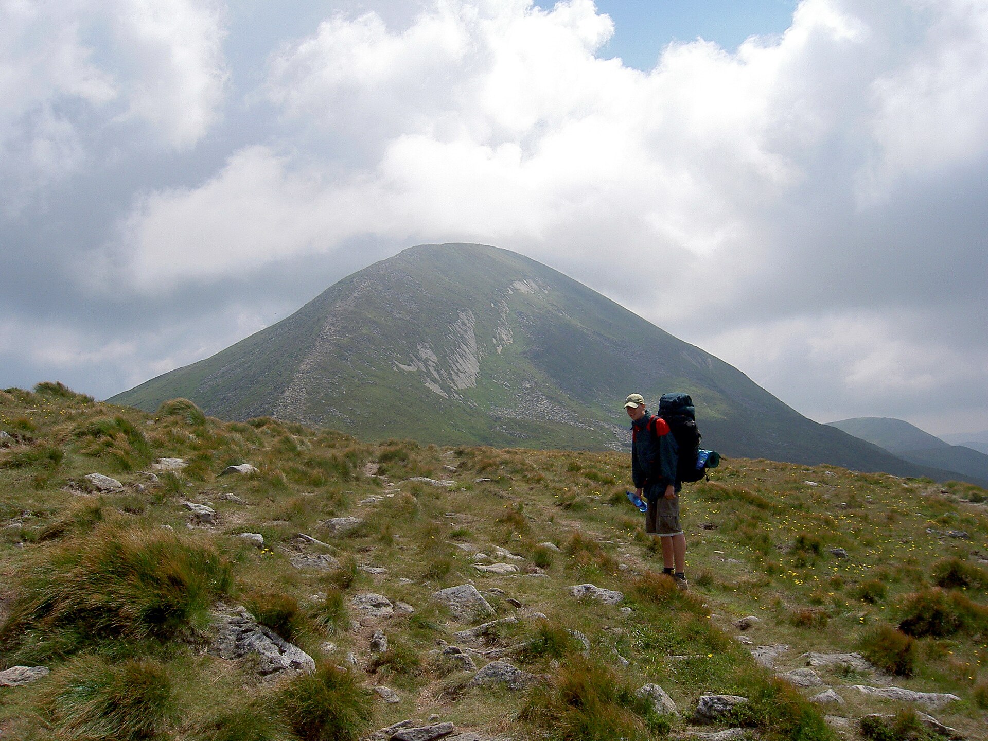
Why it is essential
This hike combines two of Malá Fatra’s defining features in one day: the ladder-and-waterfall passages of Jánošíkove diery and the rocky, isolated summit of Veľký Rozsutec. It is more varied and more technical than a simple ridge walk, and is one of the region’s most recognisable routes.
Equipment
- Sturdy boots with good grip
- Weatherproof layer
- Warm layer
- Water and food
- Map or GPS
- Gloves useful on cold metal ladders and chains
- Microspikes may be needed outside the normal dry summer season
- Via ferrata equipment is not normally required for the standard hiking route
Hazards and notes
The route includes ladders, footbridges, chains, steep limestone and exposed sections. Wet limestone, mud, frost or early snow can make the route significantly more serious. The Medziholie–Veľký Rozsutec–Medzirozsutce trail is subject to seasonal closure from 1 March to 15 June for nature protection.
GPX / KML links
| Source | URL | Format | Notes |
|---|---|---|---|
| Hikeria — Veľký Rozsutec: ascent via Jánošíkove diery | hikeria.cz | GPX download indicated | Hikeria terms not checked. GPX/source route found; reuse unresolved |
| Slovakia.travel — Veľký Rozsutec | slovakia.travel | Official route description | Reuse terms not checked. Official route verification; no GPX confirmed |
Sources
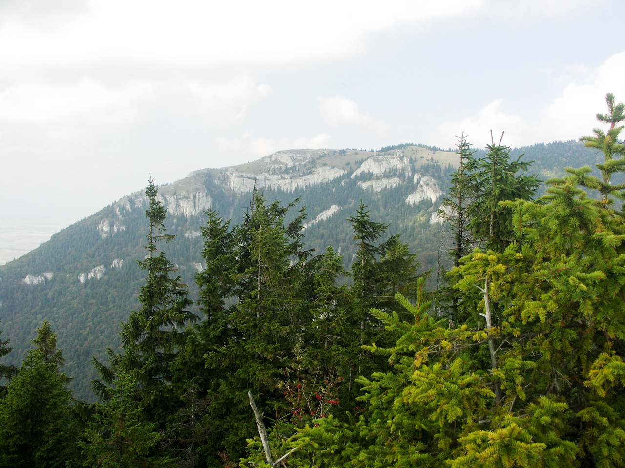
4. Tlstá and Ostrá from Blatnica
Snapshot
Itinerary
The Slovakia.travel route starts and finishes in Blatnica and follows Blatnica – Vápenná dolina – Tlstá – Ostrá – Juriášovo – Blatnica, with a total time of 7½ hours. The same source lists the start and finish as Blatnica bus stop / parking. A Bergfex route for Blatnica – Ostrá – Lúbená – Tlstá records 15.74 km, 6:59 h, a 505–1,396 m elevation range, and downloadable GPX/KML. Hikeria’s related Veľká Fatra listings show “The Great Fatra Double: Tlstá and Ostrá” at 17 km, 6:25 h and 1,100 m ascent.
Why it is essential
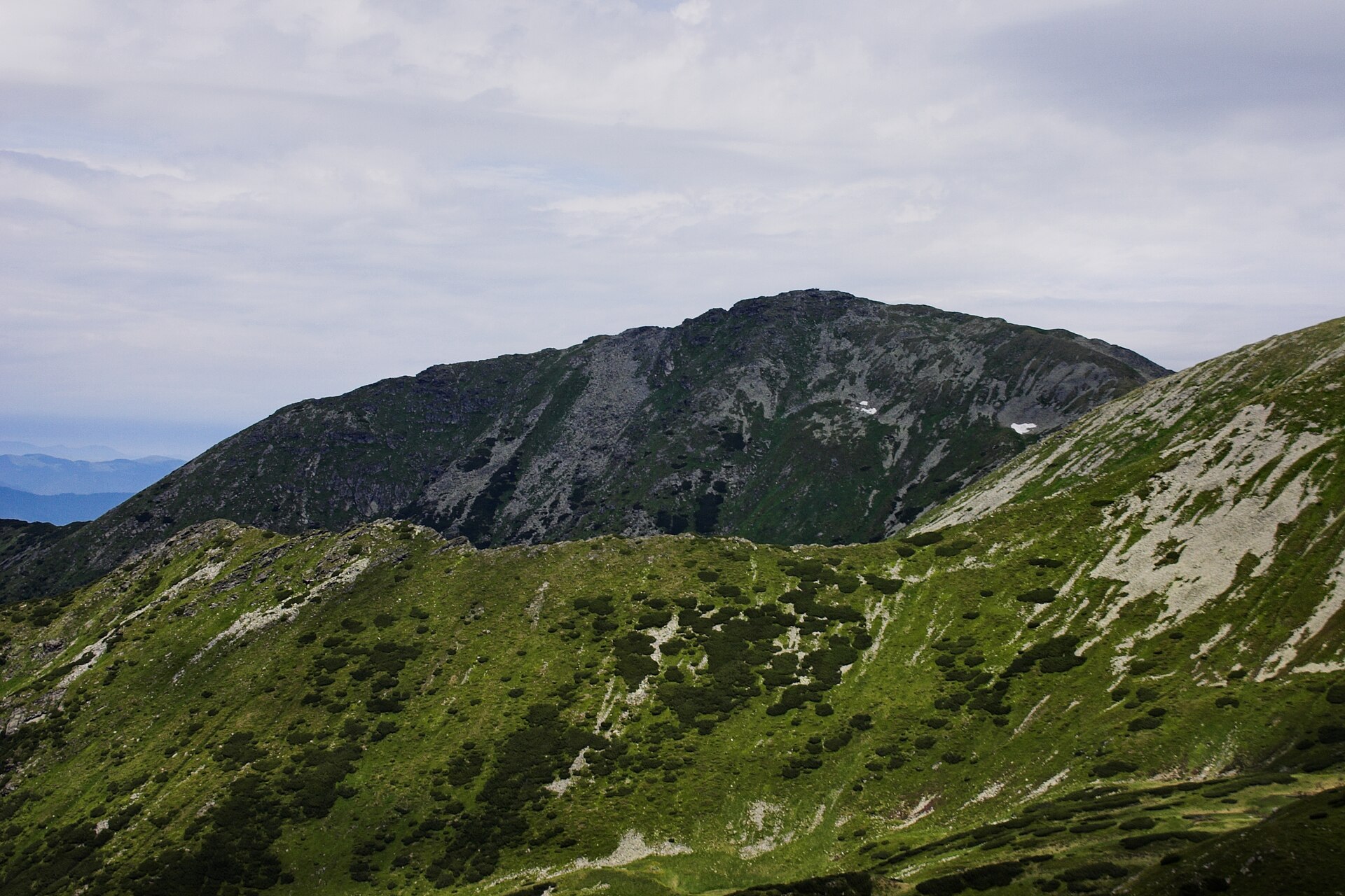
Tlstá and Ostrá form one of Veľká Fatra’s most distinctive limestone summit pairs. The route gives a concentrated sample of the range’s forested valleys, karst terrain, caves, rock windows, steep summits and views over Turiec.
Equipment
- Sturdy boots
- Waterproof layer
- Warm layer
- Water and food
- Map or GPS
- Trekking poles
- Gloves useful on cold rock or chains
- Extra water in hot weather
Hazards and notes
The official route is described as difficult and demanding because of the steep ascent and overall length. Wet grass, mud and limestone can be slippery, and some variants near Ostrá include chains and exposed rocky ground. The Mažarná Cave is noted in Slovakia.travel route material but cave access should not be assumed; published descriptions identify it as closed to the public.
GPX / KML links
| Source | URL | Format | Notes |
|---|---|---|---|
| Bergfex — Blatnica - Ostrá - Lubená - Tlstá | hu.bergfex.com | GPX and KML indicated | Bergfex terms not checked. GPX/KML source found; reuse unresolved |
| Slovakia.travel — Tlstá and Ostrá | slovakia.travel | Official route description | Reuse terms not checked. Official verification source; no GPX confirmed |
Sources
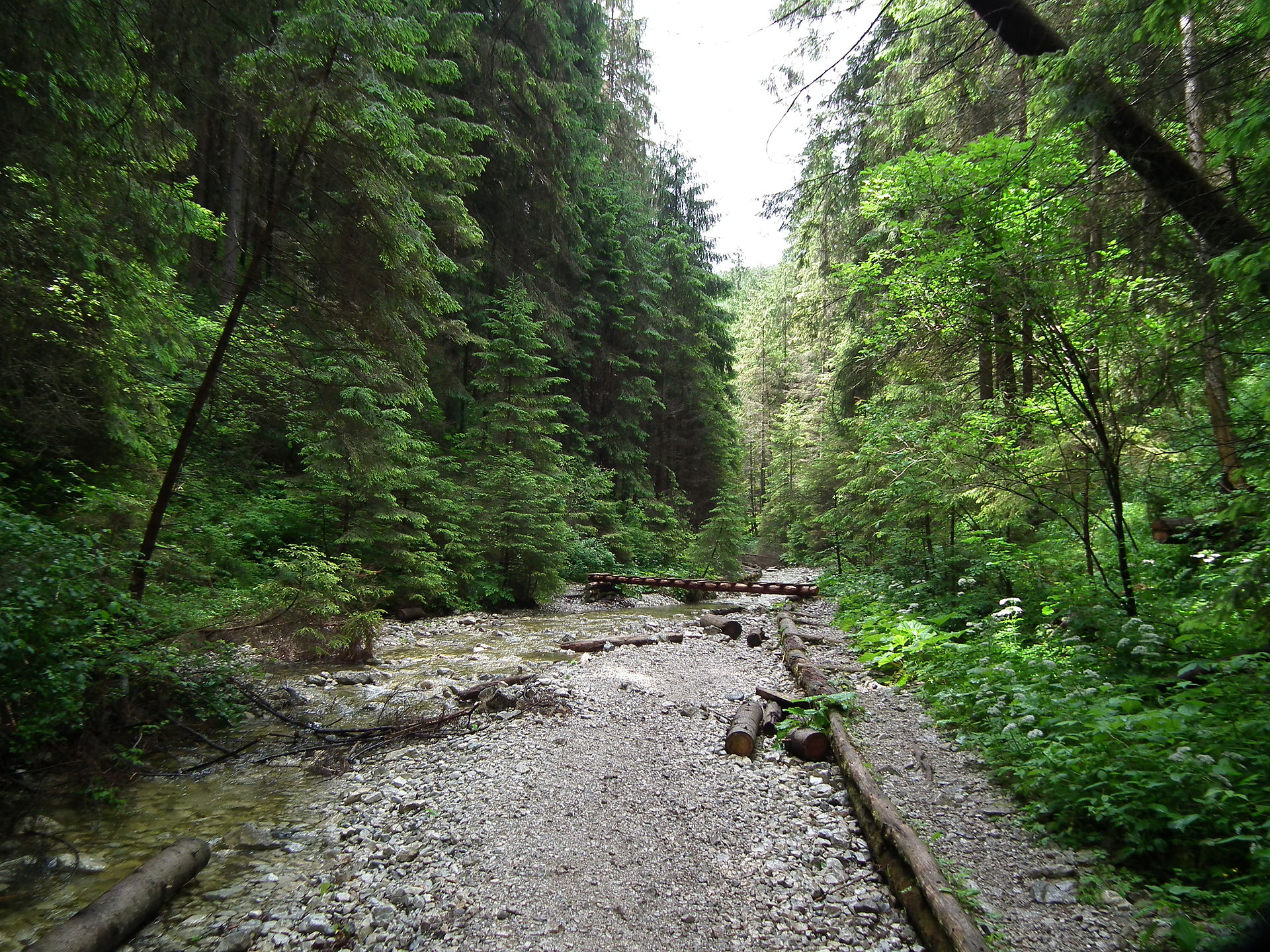
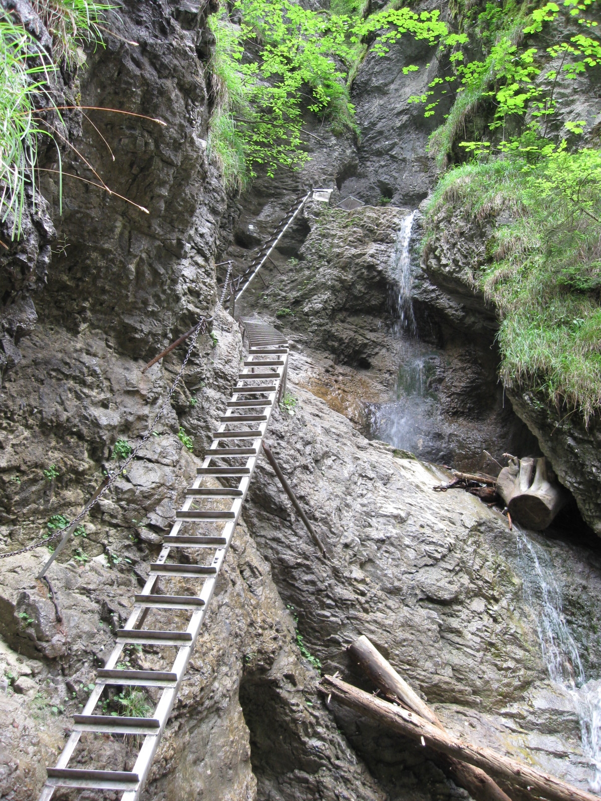
5. Suchá Belá Gorge and Kláštorisko from Podlesok
Snapshot
Itinerary
The official Slovak Paradise route starts and finishes at Podlesok. It ascends the Suchá Belá gorge, then continues via the upper gorge exit and Kláštorisko before returning to Podlesok. The official route page records 12.6 km, 4:05 h, 484 m ascent and 471 m descent, and confirms that the route includes ladders and rungs and is not suitable for dogs. Slovakia.travel gives the classic time schedule as Podlesok – Suchá Belá-vrch – Pod Vtáčím hrbom – Kláštorisko – Pod Kláštoriskom – Hrdlo Hornádu – Podlesok.
Why it is essential
Suchá Belá is one of Slovak Paradise’s defining gorge hikes. It combines a compact canyon ascent with waterfalls, ladders, metal rungs and footbridges, followed by a return through the Kláštorisko area. It provides the most representative single-day introduction to the Slovak Paradise hiking style.
Equipment
- Sturdy hiking shoes or boots with good wet-rock grip
- Weatherproof layer
- Warm layer
- Food and water
- Map or GPS
- Spare socks
- Gloves useful for ladders
- Crampons or microspikes in winter or icy conditions
Hazards and notes
The gorge is ladder-equipped and should be treated as more technical than its elevation suggests. Wet wood, metal rungs and rock can be slippery. The official park page notes that conditions change with season and weather, that a visitor fee is required, and that winter ladders can be icy. Park regulations also state that dogs must be on a lead and muzzle in the national park and cannot pass through ladders in gorges.
GPX / KML links
| Source | URL | Format | Notes |
|---|---|---|---|
| Official Slovak Paradise route — Suchá Belá loop via Kláštorisko | npsr.sk | Official route/map page; no GPX confirmed | Reuse terms not checked. Official route verification; no downloadable route file observed |
| Wikiloc — Suchá Belá Loop Trail | wikiloc.com | GPS track / GPX download indicated | Wikiloc terms not checked. Route-file source found; reuse unresolved |
Sources
- Official Slovak Paradise route — Suchá Belá loop
- NPSR — Suchá Belá information
- Slovakia.travel — Suchá Belá Gorge
- Wikiloc — Suchá Belá Loop Trail
Region-level sources
| Source | Use | URL |
|---|---|---|
| Visit Liptov — Ďumbier from Chopok | Ďumbier–Chopok official route | visitliptov.sk |
| Jasná — Mt Chopok / Mt Ďumbier | Ďumbier–Chopok lift/area context | jasna.sk |
| Outdooractive — Ďumbier to Chopok | Ďumbier–Chopok ridge source | outdooractive.com |
| Slovakia.travel — Kráľova hoľa | Kráľova hoľa context | slovakia.travel |
| Slovakia.travel — Veľký Rozsutec | Veľký Rozsutec official route | slovakia.travel |
| Slovakia.travel — Tlstá and Ostrá | Tlstá / Ostrá official route | slovakia.travel |
| Slovakia.travel — Suchá Belá Gorge | Suchá Belá context | slovakia.travel |
| Hikemates — Kráľova hoľa zo Šumiaca a späť | Kráľova hoľa GPX source | hikemates.com |
| Hikeria — Veľký Rozsutec via Jánošíkove diery | Veľký Rozsutec GPX source | hikeria.cz |
| Bergfex — Blatnica - Ostrá - Lubená - Tlstá | Veľká Fatra GPX/KML source | hu.bergfex.com |
| Official Slovak Paradise route — Suchá Belá loop | Suchá Belá official route map | npsr.sk |
| NPSR — Suchá Belá information | Suchá Belá park information | npsr.sk |
| Wikiloc — Suchá Belá Loop Trail | Suchá Belá GPX source | wikiloc.com |
| Wikimedia Commons — Low Tatras Ďumbier image | Ďumbier–Chopok photo | commons.wikimedia.org |
| Wikimedia Commons — Kráľova hoľa image | Kráľova hoľa photo | commons.wikimedia.org |
| Wikimedia Commons — Veľký Rozsutec image | Veľký Rozsutec photo | commons.wikimedia.org |
| Wikimedia Commons — Jánošíkove diery image | Jánošíkove diery photo | commons.wikimedia.org |
| Wikimedia Commons — Tlstá from Ostrá image | Tlstá / Ostrá photo | commons.wikimedia.org |
| Wikimedia Commons — Suchá Belá image | Suchá Belá photo | commons.wikimedia.org |
| Wikimedia Commons — Misové vodopády image | Misové vodopády photo | commons.wikimedia.org |