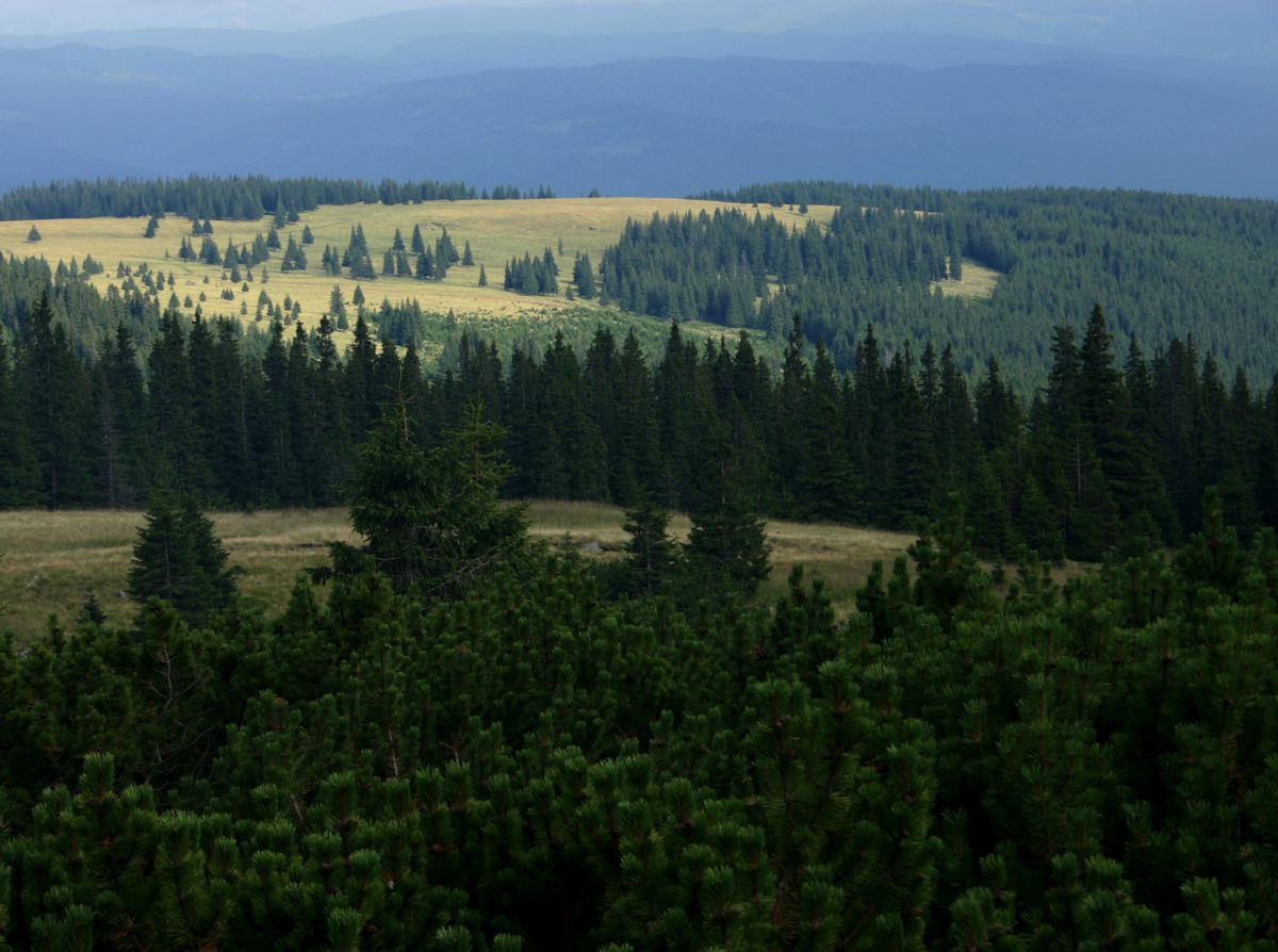
Regional overview
The Romanian Eastern Carpathians covered here combine three distinct hiking landscapes: the volcanic ridges and rocky outcrops of Maramureș/Gutâi, the higher glacial terrain of the Rodna Mountains, and the broad volcanic plateau, craters, quarry landscapes and rock formations of the Călimani Mountains. Rodna National Park is one of Romania’s major protected mountain areas, covering 47,202 ha, with notable geological, geomorphological, floral and faunal value.
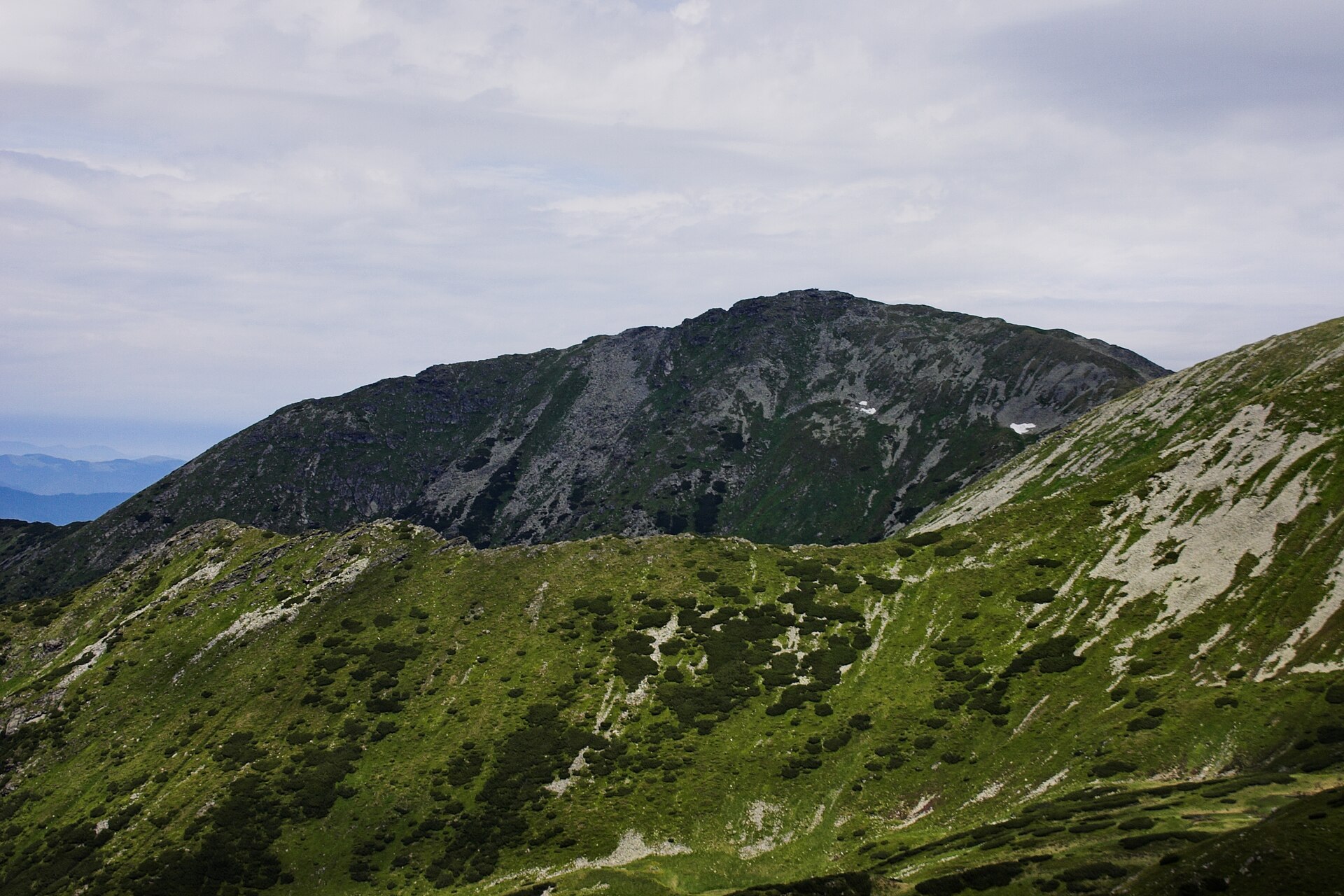
Rodna provides the highest and most alpine hiking in this selection, including Pietrosul Rodnei, Lala Mare/Lala Mică and Ineu. Călimani has a different character: long volcanic ridges, dwarf pine, former sulphur-mining terrain, wind-exposed summits and isolated forest approaches. The Călimani park route list shows that some marked routes are very long, including 16-hour and 18–21-hour traverses, so day-hike selections need careful shortening or route-variant control.
The main hiking centres and access points are Borșa and Pasul Rotunda for Rodna, Pasul Gutâi / Cavnic / Baia Mare for Gutâi, and Gura Haitii / Șaru Dornei / Vatra Dornei for Călimani. Summer to early autumn is the normal season. Early summer snow, fog, thunderstorms, strong wind on open ridges, and poor visibility above the forest line can make these routes significantly more serious.
Selection rationale
These five hikes were selected to represent the region without over-concentrating on one mountain group: one iconic high summit in western Rodna, one lake-and-summit route in eastern Rodna, one Maramureș volcanic ridge traverse, one Călimani nature/rock-formation trail, and one Călimani high volcanic summit. Routes that are valuable but either too long as official full traverses or less representative were left as follow-up candidates.
Summary table
| # | Hike | Route type | Distance | Gain | Max elevation | Difficulty |
|---|---|---|---|---|---|---|
| 1 | Pietrosul Rodnei and Iezer Lake from Borșa | Out-and-back / summit variant | 15.7–20.3 km | 1,388–1,775 m | 2,303 m | Difficult |
| 2 | Ineu, Ineuț and the Lala Lakes from Pasul Rotunda / Gura Lalei | Long loop / ridge-and-lake variant | 21.7–27.3 km | 1,000–1,270 m | 2,279 m summit; GPS tracks report up to 2,306 m | Difficult |
| 3 | Creasta Cocoșului from Pasul Gutâi to Pasul Neteda | Point-to-point ridge traverse | 12.7 km | 644 m | 1,443 m | Difficult |
| 4 | 12 Apostles Interpretation Trail from Gura Haitii | Linear / loop variant | 13.7–15.9 km | 673–723 m | c. 1,767 m | Moderate |
| 5 | Pietrosul Călimanilor from the sulphur quarry / Gura Haitii approach | Loop / out-and-back variant | 13–16.1 km | 700–900 m | 2,103 m | Difficult |
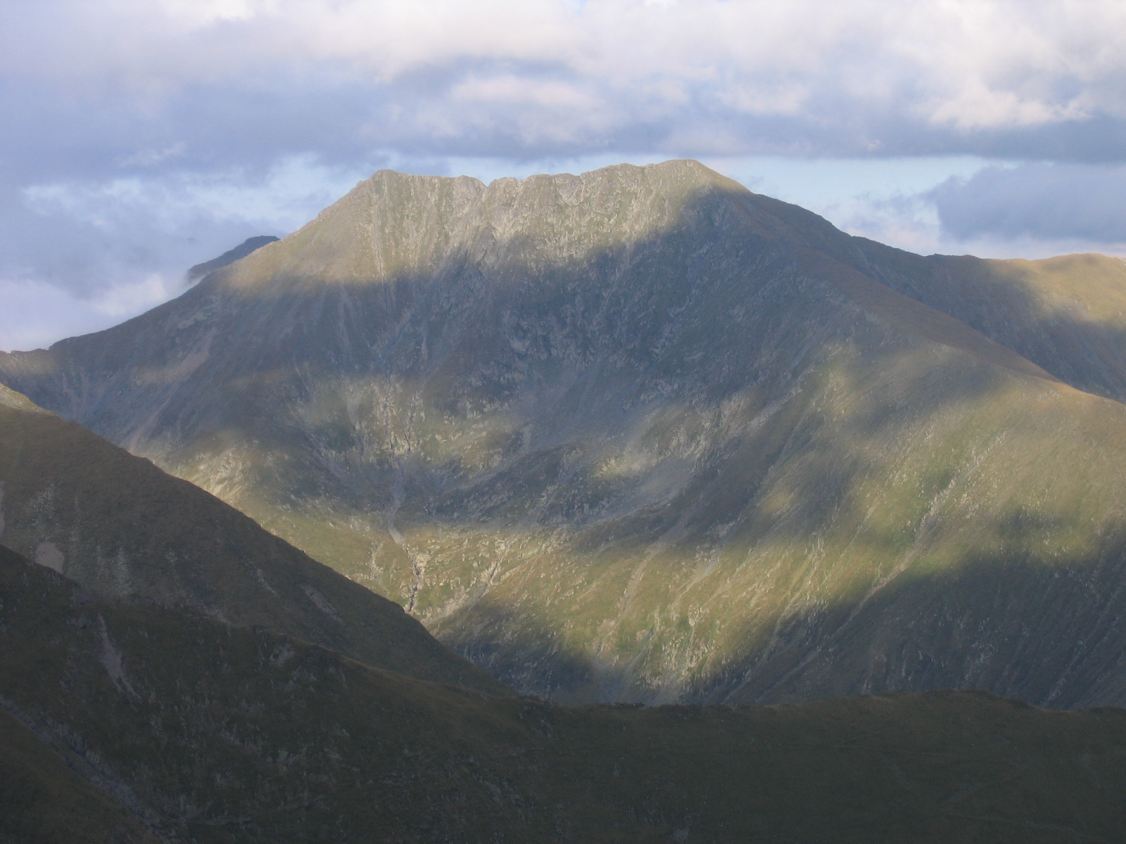
1. Pietrosul Rodnei and Iezer Lake from Borșa
Snapshot
Itinerary
The route starts from Borșa and follows the Pietroasa valley approach towards the Pietrosu Rodnei massif. The marked route climbs through forest and pastures on Piciorul Moșului, reaches the weather-station area near Iezer Lake, then ascends the upper glacial cirque by a zigzagging mountain path to the ridge and summit of Pietrosul Rodnei. Muntii Nostri describes this as one of the main routes from Borșa to the main Rodna ridge, passing the Iezer cirque and reaching Pietrosul Rodnei before continuing towards Buhăescu and Rebra. For a day-hike catalogue entry, the practical version is the Borșa–Iezer–Pietrosul Rodnei out-and-back. Bergfex records a Borșa–Salvamont–Pietrosul Rodnei route of 15.71 km, 5:50 h and 1,388 m ascent, with GPX and KML download links on the route page.
Why it is essential
Pietrosul Rodnei is the defining high summit of the Rodna Mountains and the most recognisable high-mountain objective in this part of the Eastern Carpathians. The route combines a long forest approach, glacial lake scenery, open alpine terrain and a major summit.
Equipment
- Sturdy boots
- Weatherproof layer
- Warm layer
- Map/GPS
- Headtorch
- Food
- Water
- Sun protection
- Trekking poles recommended
- Microspikes may be needed outside the main summer season if snow remains
Hazards and notes
This is a long, steep mountain ascent with major height gain. Fog and thunderstorms can make navigation and exposure on the upper mountain serious. Muntii Nostri notes that the winter ascent through the Iezer cirque is not recommended, so early-season snow should be treated cautiously.
GPX / KML links
| Source | URL | Format | Notes |
|---|---|---|---|
| Bergfex route: Borșa – Salvamont – Pietrosul Rodnei | bergfex.com | Source map; GPX/KML downloads linked on page | Bergfex terms not checked |
| Bergfex GPX direct download | bergfex.com | GPX | Terms not checked; available as source reference |
| Bergfex KML direct download | bergfex.com | KML | Terms not checked; available as source reference |
| Muntii Nostri official-style route page/PDF | muntii-nostri.ro | Source map / PDF route | Useful official-style route verification; no GPX found |
Further reading
- Muntii Nostri — Borșa – Vârful Pietrosul Rodnei – Tărnița La Cruce
- Muntii Nostri PDF atlas page
- Bergfex — Borșa – Salvamont – Pietrosul Rodnei
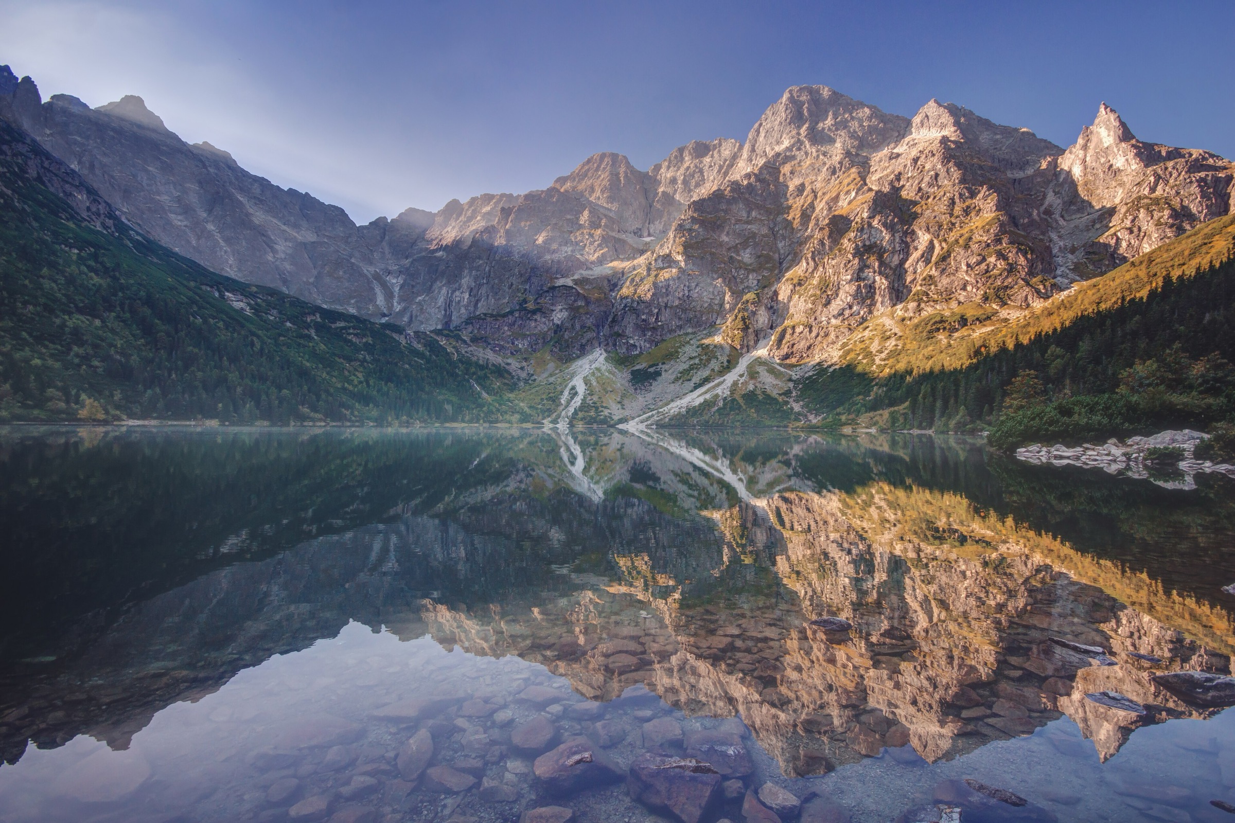
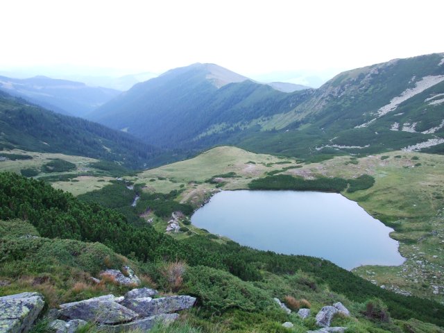
2. Ineu, Ineuț and the Lala Lakes from Pasul Rotunda / Gura Lalei
Snapshot
Itinerary
The official Gura Lalei route starts near DN18 at Gura Lalei, crosses the Bistrița Aurie, follows the Valea Lala forest road, then climbs through forest, pasture and dwarf-pine terrain towards Lacul Lala Mare, Lacul Lala Mică and Șaua Cu Lac. Muntii Nostri gives this marked lake route as 12.1 km, 4:30–5:45 h, 1,172 m ascent, 89 m descent and a maximum elevation of 2,120 m. For the fuller essential day-hike, the route can be built as a long Pasul Rotunda loop over Șaua Găgii, Ineuț, Șaua Cu Lac, the Lala lakes and, for strong parties in good conditions, Ineu. Wikiloc records a Vârful Ineu – Lacul Lala Mare – Lala Mică loop at 27.31 km, 1,270 m ascent/descent and 10:14 h total time; Komoot lists an Ineuț Peak–Lala Mic Lake loop from Pasul Rotunda at 21.7 km, 7:46 h and 1,000 m ascent/descent.
Why it is essential
This hike represents the eastern Rodna landscape: glacial lakes, high open ridges, dwarf pine and the Ineu/Ineuț high-summit area. It gives a different Rodna experience from Pietrosul Rodnei and avoids duplicating the western Rodna summit approach.
Equipment
- Sturdy boots
- Warm layer
- Waterproof shell
- Navigation backup
- Headtorch
- Food
- Enough water
- Trekking poles recommended
- Early-season snow equipment may be needed before full summer
Hazards and notes
The full Ineu/Lala circuit is a long day and should be attempted only in stable weather. In fog, the open ridge and lake-to-saddle sections require reliable navigation. Winter and spring conditions can be serious; Muntii Nostri notes winter limitations on the Lala lake/saddle section.
GPX / KML links
| Source | URL | Format | Notes |
|---|---|---|---|
| Muntii Nostri: Gura Lalei – Lacul Lala Mare – Șaua Cu Lac | muntii-nostri.ro | Source map / route page | Terms not checked; official-style lake-section verification; no GPX found |
| Muntii Nostri PDF atlas page | muntii-nostri.ro | PDF route sheet | Terms not checked; useful route-stat source; not a GPX |
| Wikiloc: Vârful Ineu, Lacul Lala Mare și Lala Mică | wikiloc.com | Route page / likely GPX via Wikiloc | Wikiloc terms not checked; source route found |
| Komoot: Ineuț Peak – Lala Mic Lake loop from Pasul Rotunda | komoot.com | Source map / route listing | Komoot terms not checked; route-file reuse not verified |
Further reading
- Muntii Nostri — Gura Lalei – Lacul Lala Mare – Șaua Cu Lac
- Muntii Nostri — Lacul Lala Mare – Șaua Găjei
- Wikiloc — Vârful Ineu, Lacul Lala Mare și Lala Mică
- Komoot — Ineuț Peak – Lala Mic Lake loop
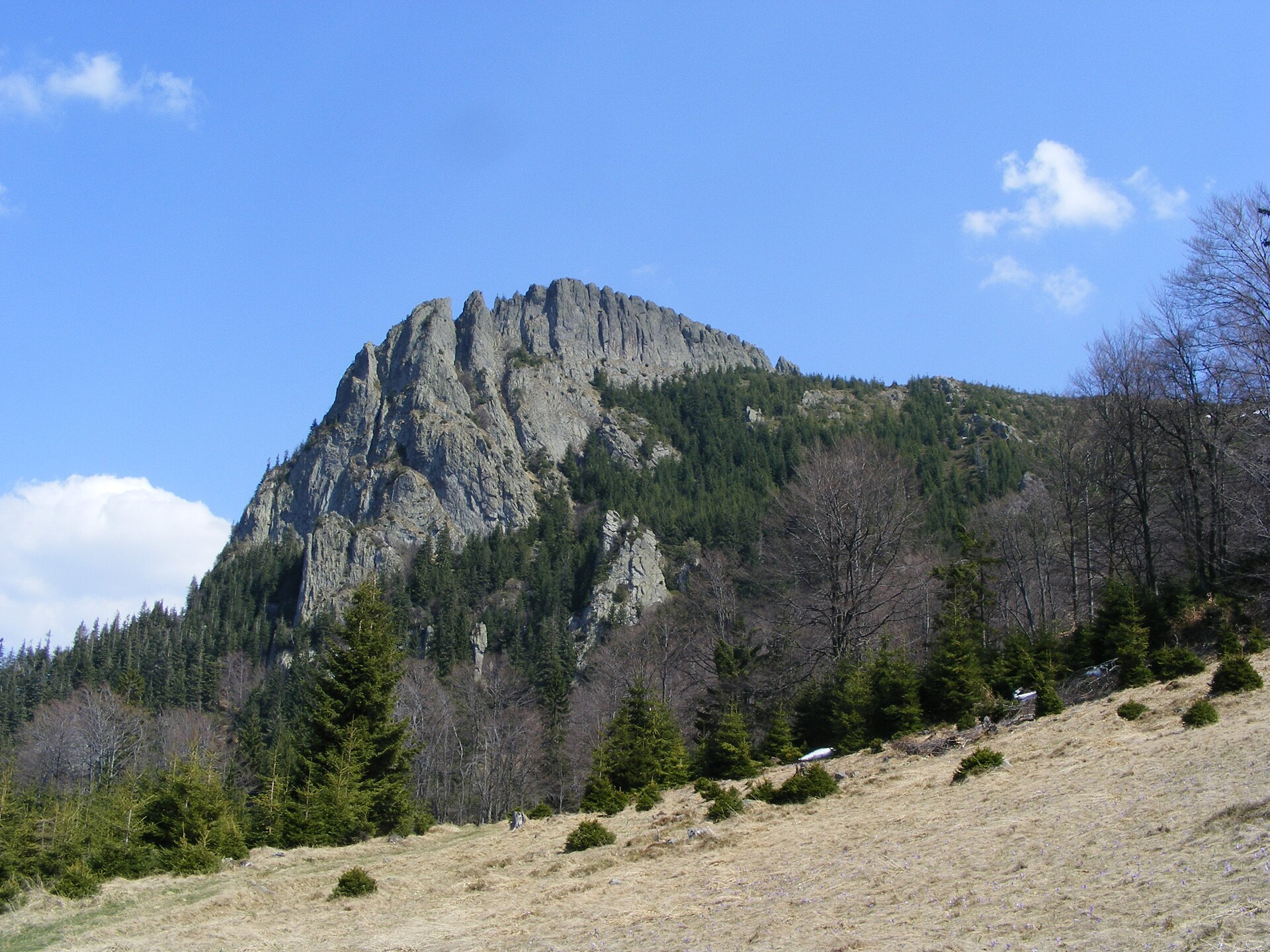
3. Creasta Cocoșului from Pasul Gutâi to Pasul Neteda
Snapshot
Itinerary
The route begins at Pasul Gutâi and climbs through forest and clearings towards Poiana Boului. It then follows historic and ridge terrain towards Secătura and Creasta Cocoșului, entering the reserve area and reaching the prominent volcanic rock crest. The traverse continues towards Vârful Gutâi, Vârful Gutâiului Mic and Pasul Neteda. Muntii Nostri gives the Pasul Gutâi–Creasta Cocoșului–Pasul Neteda route as 12.70 km, 6:30 h, 644 m ascent, 569 m descent and 1,443 m maximum elevation.
Why it is essential
Creasta Cocoșului is one of the most recognisable volcanic landforms in Maramureș and gives the catalogue an essential non-Rodna route. It adds rocky volcanic scenery, forest-and-ridge walking and a historically significant Maramureș crossing.
Equipment
- Sturdy boots
- Waterproof layer
- Warm layer
- Map/GPS
- Food
- Water
- Trekking poles useful
- Crampons or microspikes may be needed in snow
Hazards and notes
The rock crest and exposed viewpoints require care, especially in wet, icy or windy conditions. Muntii Nostri classifies the traverse as difficult and notes that winter snow requires suitable equipment.
GPX / KML links
| Source | URL | Format | Notes |
|---|---|---|---|
| Muntii Nostri: Pasul Gutâi – Creasta Cocoșului – Pasul Neteda | muntii-nostri.ro | Source map / route page | Terms not checked; route verified; GPX not found |
| Muntii Nostri route listing | muntii-nostri.ro | Route listing | Terms not checked; cross-check only |
Further reading
4. 12 Apostles Interpretation Trail from Gura Haitii
Snapshot
Itinerary
The trail starts from Gura Haitii, where the 12 Apostles Interpretation Trail is signposted from the last bus stop. The route climbs towards the volcanic rock formations known as the 12 Apostles, with interpretive panels explaining the Călimani landscape, geology and local relationships with nature. The AER / Eco-România page describes the route as a linear interpretation trail in Călimani National Park, while Outdooractive lists the thematic trail at 13.7 km, 4:35 h, 673 m ascent and 668 m descent. Wikiloc records a “Calimani - circuit 12 Apostoli” loop at 9.86 miles, 2,372 ft ascent/descent, 5,796 ft maximum elevation and 6:32 h total time.
Why it is essential
The 12 Apostles route is the most representative short-to-medium Călimani walk in this selection: volcanic forms, forest, open ridge sections and a clear interpretation-trail identity. It balances the harder summit objectives with a culturally and geologically focused hike.
Equipment
- Hiking boots or sturdy shoes
- Waterproof layer
- Warm layer
- Food
- Water
- Sun protection
- Map/GPS
- Winter conditions require snow-appropriate equipment
Hazards and notes
Navigation should be straightforward in good visibility where signs are intact, but fog or snow can obscure the open upper sections. The official park route list includes longer routes through the 12 Apostles area, so the shorter interpretation-trail variant should not be confused with 18–21-hour Călimani traverses.
GPX / KML links
| Source | URL | Format | Notes |
|---|---|---|---|
| AER / Eco-România: 12 Apostles Interpretation Trail | asociatiaaer.ro | Source page | Terms not checked; official-style route description; no GPX found |
| Outdooractive: The thematic trail “12 Apostles” | outdooractive.com | Source map / route listing | Outdooractive terms not checked; route statistics found; route-file reuse not verified |
| Wikiloc: Calimani - circuit 12 Apostoli | wikiloc.com | Route page / likely GPX via Wikiloc | Wikiloc terms not checked; source route found |
Further reading
- AER / Eco-România — The 12 Apostles Interpretation Trail
- Wikiloc — Calimani - circuit 12 Apostoli
- Călimani National Park route list
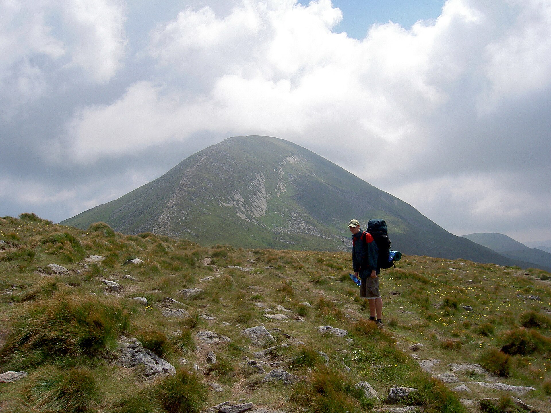
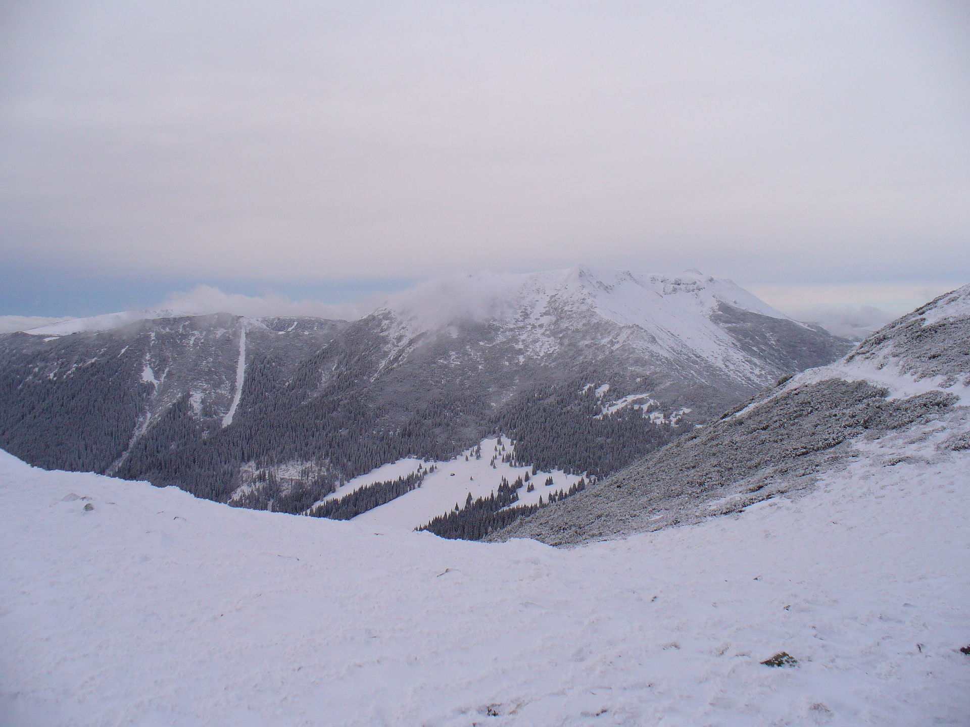
5. Pietrosul Călimanilor from the sulphur quarry / Gura Haitii approach
Snapshot
Itinerary
The official Călimani red-cross route from Gura Haitii runs through Poiana Izvoarelor, Pietrosu Călimani, Rețitiș, Iezerul Călimanilor and Pasul Păltiniș, and is listed by the park as a difficult 16-hour route, so it is not suitable as a normal single-day catalogue hike in full. The day-hike version uses the shorter upper approach from the sulphur quarry / Exploatarea Călimani area. Third-party route sources describe a climb via Șaua Negoiu / Negoiul Unguresc to Pietrosul Călimanilor and back as a 13–16 km mountain hike. Travel-Hike records a 6.5 km ascent to the summit, 5 h hiking plus breaks, about 700 m gain/loss and 13 km total distance; Komoot lists a Negoiul Unguresc–Pietrosul Călimani loop from Exploatarea Căliman at 15.9 km, 6:56 h and 900 m ascent/descent. The official park PDF confirms Pietrosul Călimani as the highest point in Călimani National Park and the highest volcanic peak in Romania, with rocky slopes, wind-exposed summit terrain and views towards the crater, Rodna, Ceahlău, Hășmaș and other ranges.
Why it is essential
Pietrosul Călimanilor is the major Călimani summit objective and represents the high volcanic side of the range: open ridges, crater views, sulphur-mining history and broad Eastern Carpathian panoramas.
Equipment
- Sturdy boots
- Warm layer
- Waterproof layer
- Navigation backup
- Food
- Water
- Sun protection
- Headtorch
- Trekking poles useful on scree and rough volcanic ground
Hazards and notes
The summit area is exposed to wind and poor weather. The official route text notes rocky slopes, scree, dwarf pine and long exposed ridge terrain; the former sulphur exploitation area operated from 1970–1992 and remains a visible disturbed landscape. Vehicle access to the upper quarry parking and any park-entry requirements need current local confirmation before travel.
GPX / KML links
| Source | URL | Format | Notes |
|---|---|---|---|
| Călimani National Park official route text/PDF | calimani.ro | PDF / route description | Park website terms not checked; confirms summit and official route context; too long as full day-hike; no GPX found |
| Travel-Hike: Pietrosul Călimanilor Peak | travel-hike.com | Route description | Blog reuse terms not checked; useful secondary route-stat check; no reusable geometry assumed |
| Komoot: Negoiul Unguresc – Pietrosul Călimani loop | komoot.com | Source map / route listing | Komoot terms not checked; route-file reuse not verified |
| Wikiloc: Pietrosul Călimani | wikiloc.com | Route page / likely GPX via Wikiloc | Wikiloc terms not checked; source route found |
Further reading
- Călimani National Park route list
- Călimani National Park official PDF route
- Travel-Hike — Pietrosul Călimanilor Peak
- Komoot — Hiking in Călimani-Gurghiu
- Wikiloc — Pietrosul Călimani
Further reading
| Source | URL |
|---|---|
| Rodna National Park official site | parcrodna.ro |
| Călimani National Park official route list | calimani.ro |
| Muntii Nostri | muntii-nostri.ro |
| Bergfex — Borșa – Salvamont – Pietrosul Rodnei | bergfex.com |
| AER / Eco-România — 12 Apostles Interpretation Trail | asociatiaaer.ro |
| Wikiloc | wikiloc.com |
| Komoot | komoot.com |