Regional overview
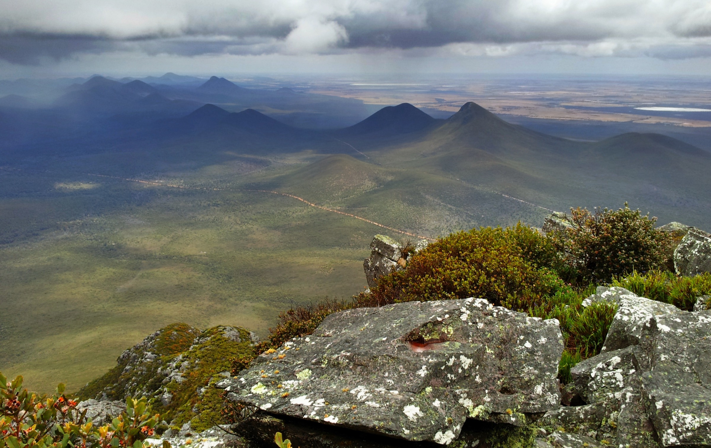
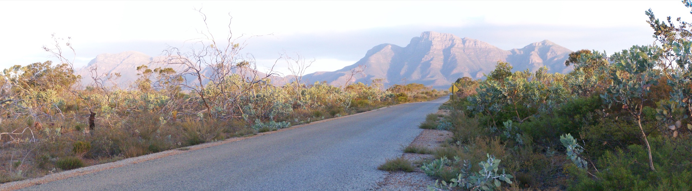
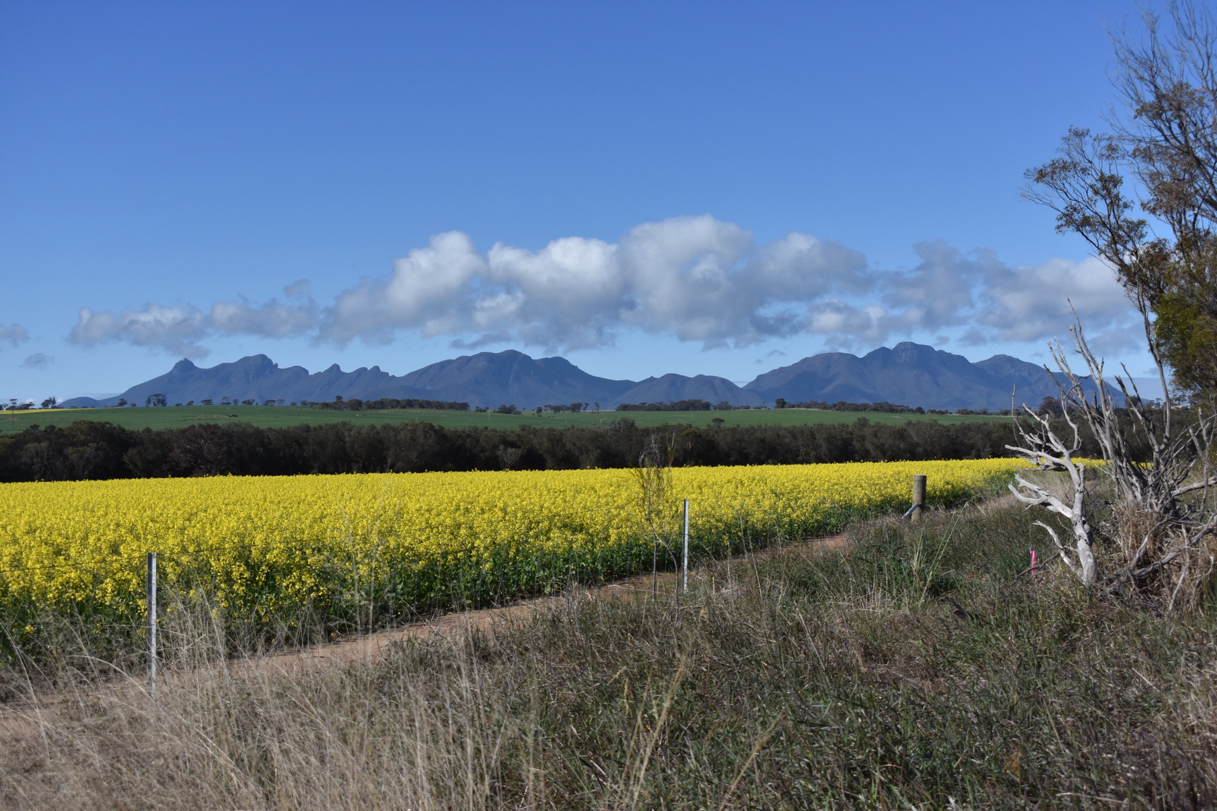
The eastern block of Stirling Range National Park runs east of Chester Pass Road and is dominated by the state’s highest peak in its south — Bluff Knoll (Pualaar Miial) at 1,099 m — and the long east-tilting ridge of the Eastern Stirlings that continues through Coyanarup, Isongerup and East Bluff to Ellen Peak at 1,013 m. This is the highest and most weather-exposed part of the range, and the only place in Western Australia where snowfalls are effectively an annual event.
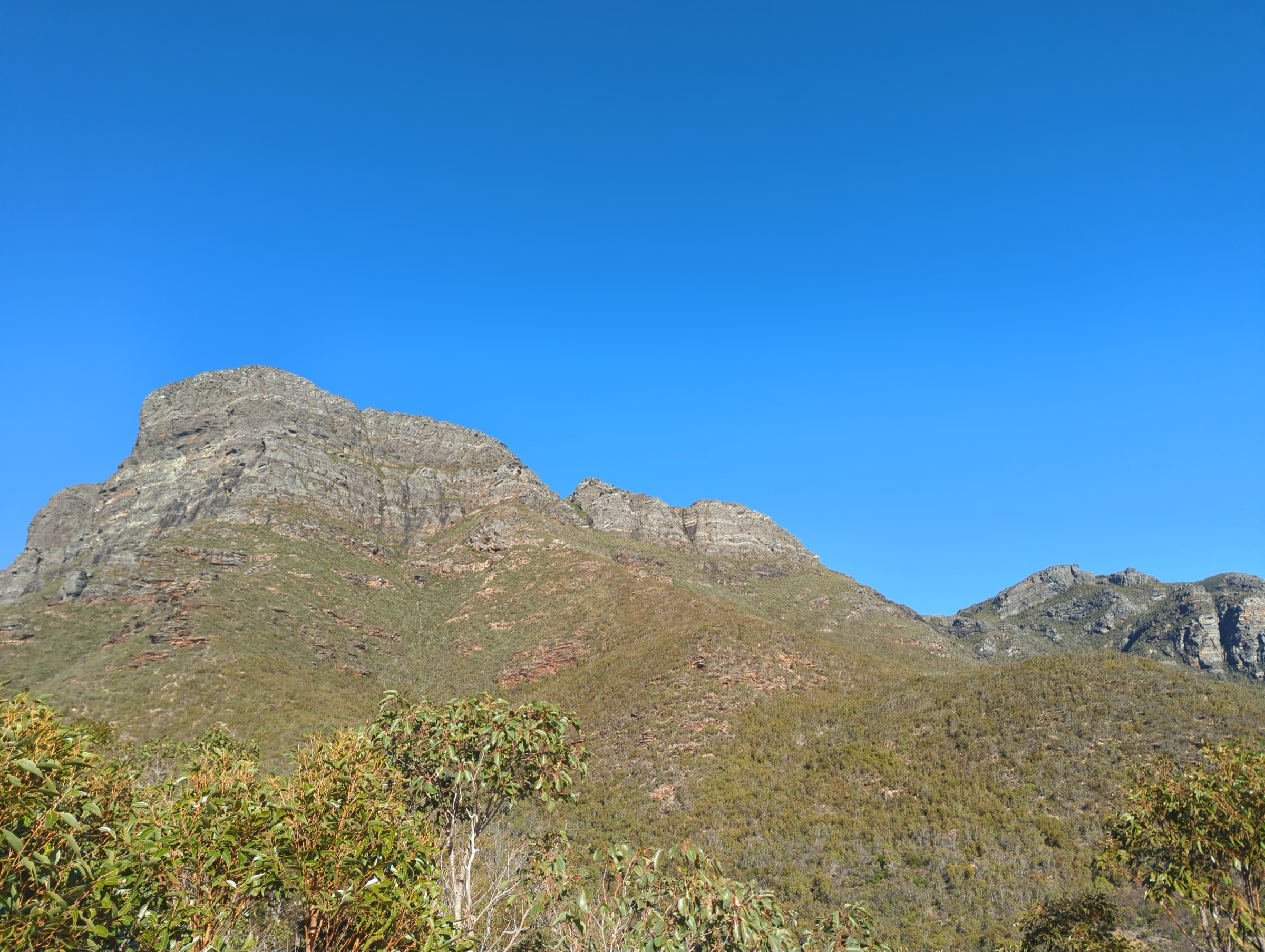
Geologically these are the same folded Proterozoic sandstones and shales as the central block, but the eastern peaks are more massive and the ridge crest holds more altitude for longer. Bluff Knoll’s south-facing bluff is a 300 m near-vertical wall that is one of the state’s landmark cliff features. The range is Menang and Goreng (Koreng) Noongar country; the peaks are places of high cultural significance and DBCA asks all visitors to treat the summits with respect. Pualaar Miial (“great many-faced hill”) is the recorded Menang name for Bluff Knoll.
Weather on the eastern peaks is genuinely dangerous. Cold fronts from the Southern Ocean can bring cloud, high winds, hail, sleet and snow to the summits with little warning; lightning has killed walkers on the range. Winter (June–August) brings the state’s only regular snow, and summit temperatures can sit below zero even in daylight. Summer (December–February) brings extreme fire risk and heat above 35 °C in the exposed lower sections. The practical walking seasons are autumn (March–May) and spring (September–November, with wildflowers peaking in October).
Access to Bluff Knoll is from a well-signposted turn-off on Chester Pass Road, 100 km north of Albany. The sealed Bluff Knoll Access Road climbs to a fee-station car park and the trailhead. Access to Ellen Peak and the far-eastern peaks is via unsealed tracks from Salt River Road and, for off-track parties, a substantial approach walk. A standard DBCA vehicle entry fee applies at the Bluff Knoll car park. Verify at exploreparks.dbca.wa.gov.au before travel.
Selection rationale
The eastern block has only two DBCA-marked day-hike summit routes — Bluff Knoll and Ellen Peak — so the five-hike selection includes two supporting choices and one advanced off-track option to give a complete picture. Bluff Knoll is the state’s landmark summit walk and the only walk on this list that is genuinely feasible for a fit walker in any weather. Ellen Peak is the eastern block’s second major summit and the classic strenuous eastern day; it is a long, hard walk with significant off-track and route-finding content near the summit. The Bluff Knoll trailhead precinct covers the short walks and viewpoints around the fee-station car park and is the essential short-walk selection for anyone unable to attempt the full summit. The Ridge Walk day sample describes a legal, sanctioned dayable section of the multi-day Ridge Walk that starts from Bluff Knoll. Isongerup Peak is an off-track summit day for experienced parties and is included with a clear caveat about its off-track nature.
Summary
| # | Hike | Country | Route type | Distance | Gain | Max elevation | Difficulty |
|---|---|---|---|---|---|---|---|
| 1 | Bluff Knoll (Pualaar Miial) | Australia | Out-and-back | 6.8 km | ~630 m | 1,099 m | Grade 4 |
| 2 | Ellen Peak | Australia | Out-and-back | ~15 km | ~800 m | 1,013 m | Grade 5 (partly off-track) |
| 3 | Bluff Knoll trailhead precinct short walks | Australia | Multiple short walks | ~2 km cumulative | Minimal | ~475 m | Grade 2 |
| 4 | Ridge Walk day sample from Bluff Knoll | Australia | Out-and-back on Ridge Walk | ~10 km return (indicative) | ~700 m cumulative | 1,099 m + ridge tops | Grade 5 (off-track) |
| 5 | Isongerup Peak (off-track) | Australia | Out-and-back off-track | ~10 km return (approx.) | ~500 m | ~845 m | Advanced (off-track) |
1. Bluff Knoll (Pualaar Miial)

Snapshot
Itinerary
From the fee-station car park the graded track descends briefly across a small gully then begins the long, steady climb up the north-western flank of Bluff Knoll. The first two kilometres switchback through low mallee heath on a well-made rock-and-gravel path, gaining height quickly and giving increasingly wide views west to the central peaks and south to the coastal plain. The middle section crosses steep open slopes with occasional rock steps and cuts across the base of the mountain’s western spur.
Above the spur the track works up onto the summit ridge on rougher rock and gains the flat summit plateau at 1,099 m. The summit itself is broad and heath-covered; a short walk east from the marked high point brings the walker to the cliff edge overlooking the range’s landmark 300 m southern bluff. Views cover the length of the range in both directions and, on very clear days, reach south to the Southern Ocean and north across the wheatbelt. Return by the same route.
Why it is essential
Bluff Knoll is the highest peak in the south of Western Australia and the state’s most-walked “big” summit. It is a DBCA-graded and well-maintained route, and is the one walk in the range that a fit but non-scrambling walker can attempt with confidence. It is the essential summit of the eastern block and the anchor walk of any Stirling Range trip.
Equipment
- Sturdy hiking boots with grippy soles
- Weatherproof shell and warm layer, even in summer
- Extra warm layer in winter — summit temperatures can be below zero
- Water: 2 litres per person
- Food for a long half-day
- Hat, sun protection, sunglasses
- Trekking poles useful for descent
- Emergency communicator recommended in winter
Hazards and notes
The summit is exposed to Southern Ocean fronts and can go from clear to storm in under an hour. Lightning has killed walkers on the summit. Snow and hail are possible June–September. Turn back at the top of the spur if wind is rising or cloud is dropping. There is no water on route. Snakes are possible in warmer months. Dogs are not permitted. A DBCA vehicle entry fee applies at the car park.
GPX / route file
| Source | URL | Format | Licence / terms | Reuse |
|---|---|---|---|---|
| DBCA — Bluff Knoll trail page | exploreparks.dbca.wa.gov.au | Web description | Copyright DBCA | Reference only |
| Trails WA — Bluff Knoll | trailswa.com.au | Web description; map view | Copyright Trails WA | Reference only |
| OpenStreetMap — Bluff Knoll track | osm.org | OSM way data | ODbL | Reusable with attribution |
| trailhiking.com.au — Bluff Knoll | trailhiking.com.au | Web + GPX | Site-specific terms | Verify before reuse |
Sources
- DBCA — Explore Parks WA, Stirling Range National Park page
- Trails WA — Bluff Knoll Hike entry
- trailhiking.com.au — Bluff Knoll Hike entry
- OpenStreetMap track data
2. Ellen Peak
Snapshot
Itinerary
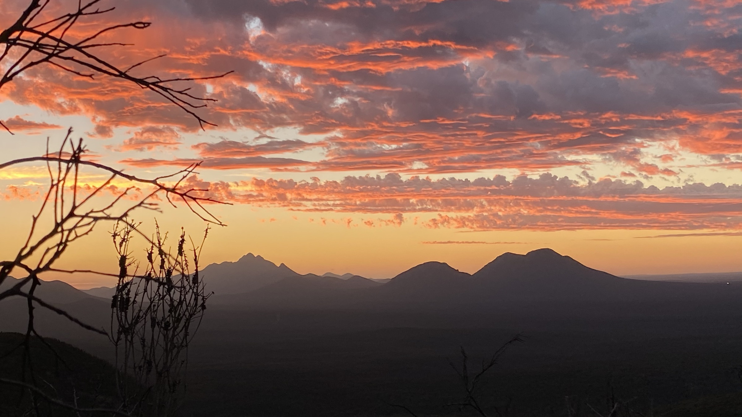
From the Salt River Road trailhead the track heads south-west across the plain toward the base of the eastern ridge. The first several kilometres are a straight walk on a rough foot-track through low mallee. The track then climbs the ridge’s north-eastern spur on a marked path that becomes progressively steeper and rockier. The upper section, above about 800 m, is partly off-track: the marked path fades into a series of cairned lines that pick a route through broken quartzite onto the summit plateau. The marked summit is at 1,013 m.
Views from the summit cover the eastern ridge back to Bluff Knoll and the coastal plain south to the Southern Ocean. Return by the same route; the descent is slow and route-finding matters as much on the return as on the way up.
Why it is essential
Ellen Peak is the eastern block’s second major summit and the definitive strenuous eastern day. It is not signposted or graded as a normal DBCA day-walk — the upper section is off-track and requires navigation skill — but it is included in every serious guide to the range as the essential eastern strenuous walk.
Equipment
- Full mountain hiking kit: sturdy boots, weatherproof shell, warm layers, gloves, hat
- Navigation: topographic map, compass, GPS with waypoints
- Emergency communicator (PLB or satellite messenger)
- Water: 3 litres per person; carry all water — no reliable water on route
- Food for a long day
- Helmet worth considering for the scrambly upper section
Hazards and notes
The upper section is off-track and route-finding is real. Cloud on the summit ridge can strand walkers. Weather is the primary hazard: fronts arrive quickly, and lightning has killed walkers on the range’s exposed summits. Do not commit to the upper section if weather is deteriorating. Salt River Road is unsealed and can close after rain. Wildflower dieback control requires walkers to remain on the marked path where one exists, and to use boot-cleaning stations at trailheads. Dogs are not permitted.
Photos
Additional licence-compatible imagery specific to the Ellen Peak summit ridge was not located in this pass.
GPX / route file
| Source | URL | Format | Licence / terms | Reuse |
|---|---|---|---|---|
| DBCA — Stirling Range NP page | exploreparks.dbca.wa.gov.au | Web description | Copyright DBCA | Reference only |
| Perth Bushwalkers Club — Ellen Peak trip reports | pbwc.org.au | Trip reports | Copyright PBWC | Reference only |
| OpenStreetMap — Ellen Peak track | osm.org | OSM way data (partial) | ODbL | Reusable with attribution |
| trailhiking.com.au — Ellen Peak | trailhiking.com.au | Web + GPX | Site-specific terms | Verify before reuse |
Sources
- DBCA — Explore Parks WA, Stirling Range National Park page
- Perth Bushwalkers Club — trip reports
- trailhiking.com.au — Ellen Peak Hike entry
3. Bluff Knoll trailhead precinct short walks
Snapshot
Itinerary
The Bluff Knoll fee-station car park is the eastern block’s main visitor precinct and has several short walks and viewpoints suitable for walkers who are not attempting the summit. Interpretive signage covers the range’s geology, Noongar cultural context and safety information. Short walks include the sealed viewing platform overlooking the bluff, a short interpretive loop through the mallee immediately west of the car park, and the first 500 m of the main summit track — which give a first view of the peak’s south-western face without commitment to the full climb.
Why it is essential
The Bluff Knoll precinct is the essential short-walk selection for the eastern block. It gives full interpretive context — cultural, geological and safety — for anyone visiting the range even if not attempting a summit walk, and it is the recommended stop for a party split by fitness or weather.
Equipment
- Standard walking shoes
- Water and sun protection
- Warm layer for early or late visits
Hazards and notes
The car park sits at ~475 m and can be cold and windy even when the plain below is warm. Snow is possible in winter. DBCA vehicle entry fee applies. Dogs are not permitted.
Photos
Photo status: No licence-compatible image specific to the trailhead precinct was found; the Bluff Knoll cover images above cover the surrounding landscape.
GPX / route file
| Source | URL | Format | Licence / terms | Reuse |
|---|---|---|---|---|
| DBCA — Bluff Knoll trail page | exploreparks.dbca.wa.gov.au | Web description | Copyright DBCA | Reference only |
| OpenStreetMap — Bluff Knoll car park paths | osm.org | OSM way data | ODbL | Reusable with attribution |
Sources
- DBCA — Explore Parks WA, Stirling Range National Park page
4. Ridge Walk day sample from Bluff Knoll (advanced)
Snapshot
Itinerary
The Ridge Walk is DBCA’s advanced multi-day off-track traverse of the eastern ridge from Bluff Knoll to Ellen Peak. As a day sample, a fit party can walk the marked Bluff Knoll track to the summit at 1,099 m, then continue east onto the unmarked ridge to the first named subsidiary top and return by the same line. The ridge is off-track and unmarked. Progress is on quartzite slab and low scrub with several drop-and-climb sections. Return to Bluff Knoll and descend the marked track.
The sample gives a sense of the range’s landmark ridge without committing to the full multi-day carry-over. It requires the same navigation, weather and communication discipline as the full Ridge Walk.
Why it is essential
The Ridge Walk is the range’s landmark long route and defines the eastern block for experienced walkers. Including a day sample here allows the article to represent the ridge experience without recommending the full traverse as a day walk. It is included with the clear caveat that it is not a signposted or graded route.
Equipment
- Full mountain hiking kit: sturdy boots, weatherproof shell, warm layers, gloves, hat
- Navigation: topographic map, compass, GPS with the full Ridge Walk waypoints
- Emergency communicator (PLB or satellite messenger)
- Water: 3 litres per person minimum
- Food for a long day
- Helmet worth considering for scrambly sections
Hazards and notes
The ridge is off-track and exposed to the full weather of the range. Cloud on the ridge makes navigation seriously difficult, and retreat off the ridge between summits is not straightforward — cliff bands make many spurs impassable. Wildflower dieback control requires walkers to avoid crossing between drainage catchments where possible. Lightning is a real risk. Dogs are not permitted.
Photos
Photo status: No licence-compatible image of the specific ridge sample was found in this pass.
GPX / route file
| Source | URL | Format | Licence / terms | Reuse |
|---|---|---|---|---|
| DBCA — Ridge Walk advisory | exploreparks.dbca.wa.gov.au | Web description | Copyright DBCA | Reference only |
| Perth Bushwalkers Club — Ridge Walk trip reports | pbwc.org.au | Trip reports | Copyright PBWC | Reference only |
| OpenStreetMap — Bluff Knoll track only | osm.org | OSM way data | ODbL | Reusable with attribution |
Sources
- DBCA — Explore Parks WA, Ridge Walk advisory
- Perth Bushwalkers Club — Ridge Walk trip reports
5. Isongerup Peak (advanced, off-track)
Snapshot
Itinerary
Isongerup Peak sits on the eastern ridge between Coyanarup and East Bluff. There is no signposted trail. Access is typically from a Salt River Road approach that crosses low farmland to the base of the ridge, followed by an off-track climb up a chosen spur onto the summit ridge. Route-finding on the summit ridge is by ridgeline, on quartzite slab and low scrub.
Why it is essential
Isongerup is the classic off-track “quiet summit” of the eastern block. It is included here as the fifth eastern hike to represent the range’s off-track walking tradition, and to give experienced parties a documented alternative to the more popular routes.
Equipment
- Full mountain hiking kit: sturdy boots, weatherproof shell, warm layers, gloves, hat
- Navigation: topographic map, compass, GPS with waypoints
- Emergency communicator (PLB or satellite messenger)
- Water: 3 litres per person
- Food for a long day
Hazards and notes
Off-track approach and summit. Route-finding is real. Cloud on the ridge makes navigation difficult. Weather is the primary hazard: fronts arrive quickly. Wildflower dieback control requires walkers to avoid mud transfer between catchments and to use boot-cleaning stations. Dogs are not permitted.
GPX / route file
| Source | URL | Format | Licence / terms | Reuse |
|---|---|---|---|---|
| Perth Bushwalkers Club — trip reports | pbwc.org.au | Trip reports | Copyright PBWC | Reference only |
| OpenStreetMap — Isongerup Peak area | osm.org | OSM way data (partial) | ODbL | Reusable with attribution |
Sources
- Perth Bushwalkers Club — trip reports
- DBCA — Explore Parks WA, Stirling Range National Park page (context only)
Region-level sources
| Source | Type | Notes |
|---|---|---|
| DBCA — Explore Parks WA, Stirling Range National Park | Official park authority | Primary source for trail listings, grading, closures and Ridge Walk advisory |
| Trails WA — trailswa.com.au | State trail portal | Bluff Knoll trail statistics and printable map |
| trailhiking.com.au — trailhiking.com.au | Independent trail database | Bluff Knoll and Ellen Peak notes and GPX |
| Perth Bushwalkers Club — pbwc.org.au | Bushwalking club | Off-track and Ridge Walk trip reports |
| OpenStreetMap — openstreetmap.org | Community map | Track geometry cross-checking |
| Bureau of Meteorology — bom.gov.au | Federal weather bureau | Frontal timing and snow/lightning risk |
Further reading
Nearby Stirling Porongurup guides on Storm
- Central Stirling Range
- Porongurup Range
-
Storm — Australia | Central Stirling Range: Essential Day-Hikes
- Storm — Australia | Western Stirling Range: Essential Day-Hikes
- Storm — Australia | Porongurup Range: Essential Day-Hikes
Missing data / follow-up work
- Bluff Knoll trailhead elevation is approximate; no DBCA-published trailhead elevation was located.
- Ellen Peak route statistics vary between sources; the figures shown are indicative and should be verified from a current trip report before departure.
- The Ridge Walk day sample is a described-not-signposted route; distance and gain figures are cumulative estimates.
- Isongerup Peak has no formal trailhead; parties should consult a current club trip report for the specific access line.
- No licence-compatible image was located specifically for Ellen Peak, the Ridge Walk sample, Isongerup Peak or the Bluff Knoll trailhead precinct in this pass.
- No official DBCA-provided GPX file was found for any eastern-block route; OpenStreetMap covers the marked Bluff Knoll track only.